MAY 27TH TEXAS: FOUR TORNADOES NEAR CANADIAN

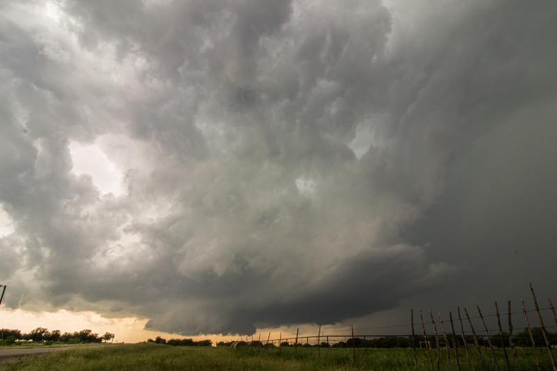
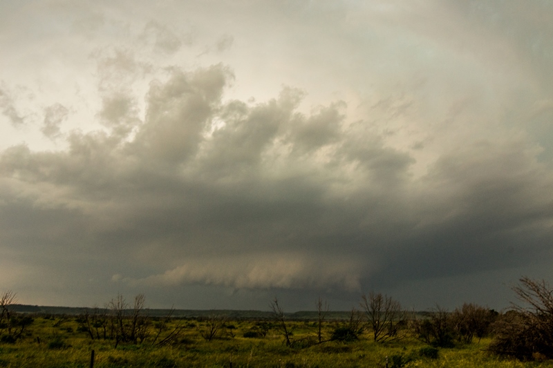
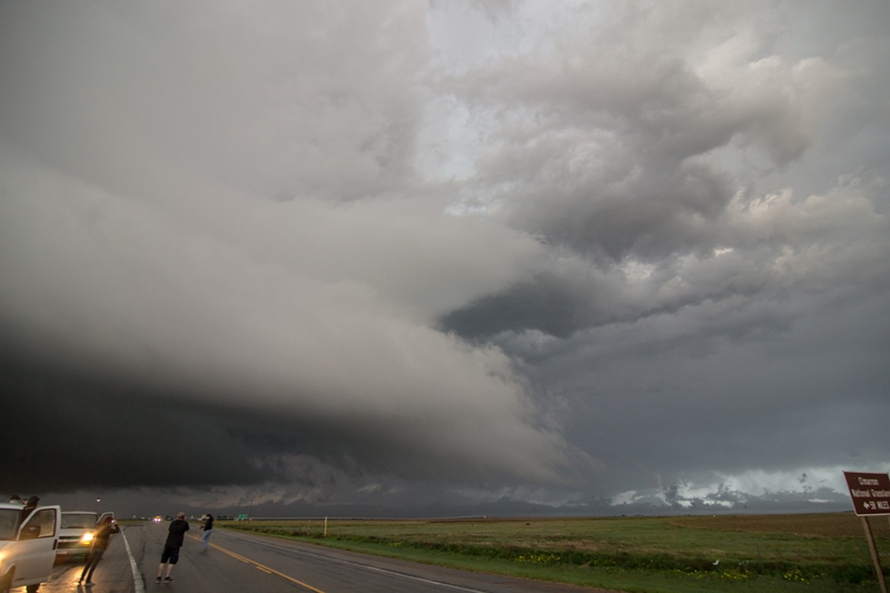
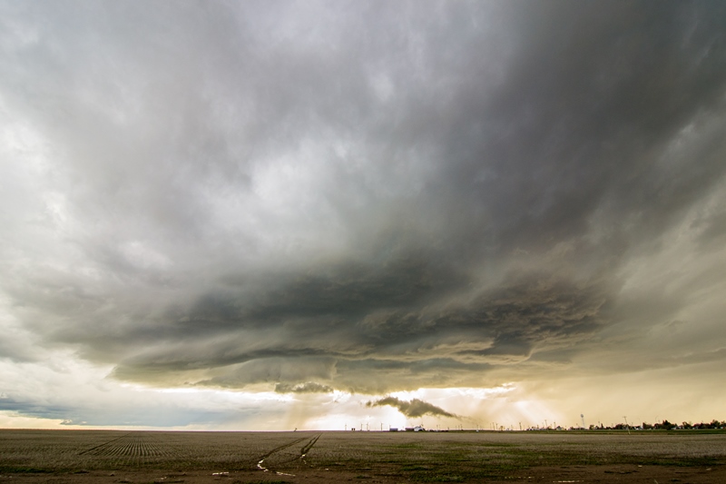
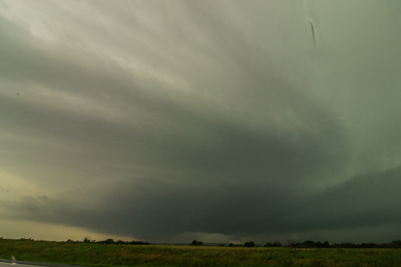
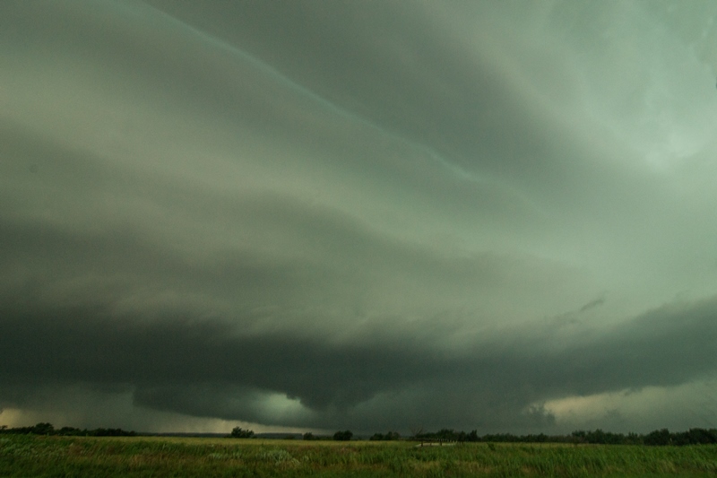
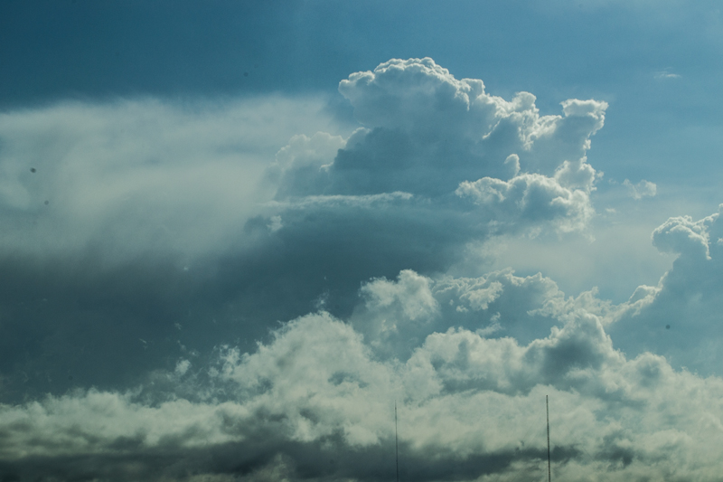
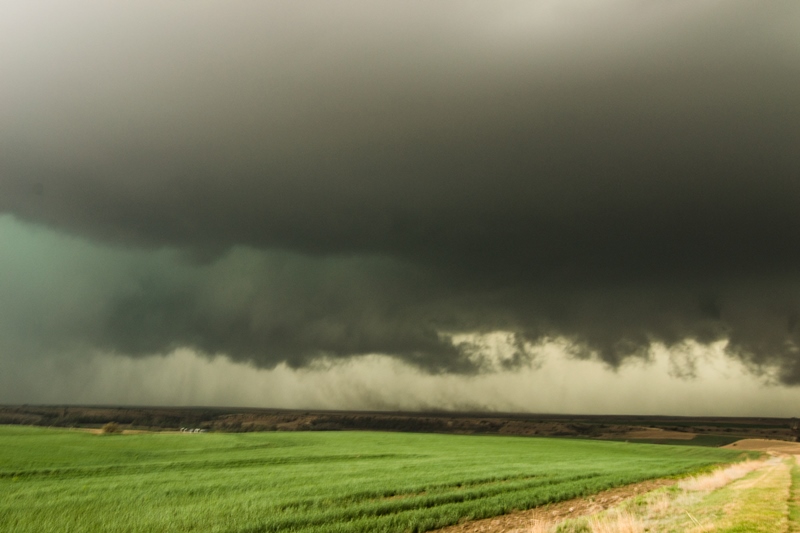
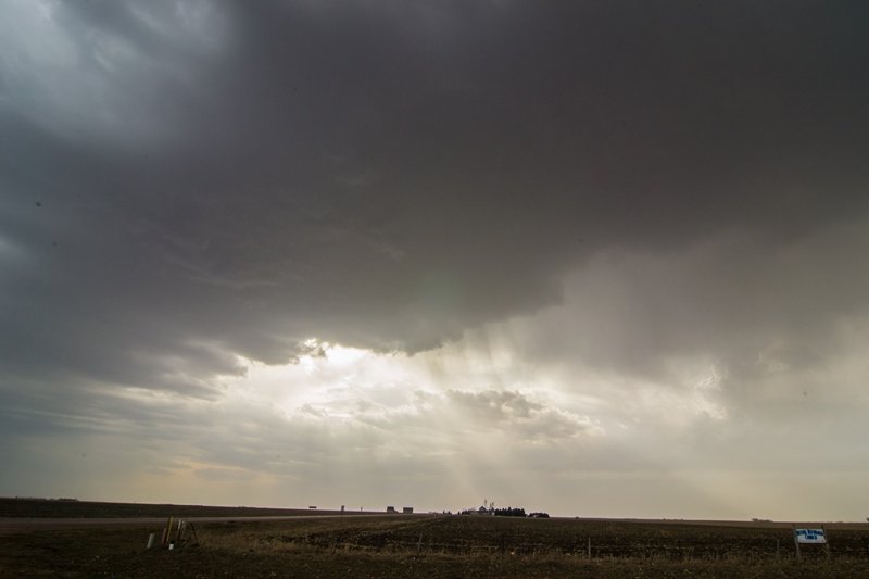
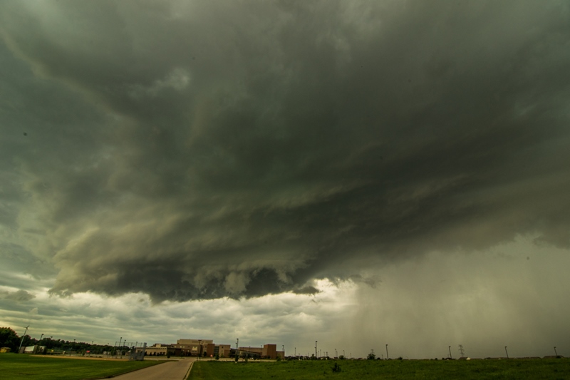
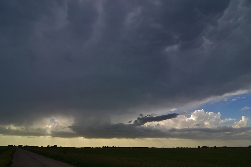
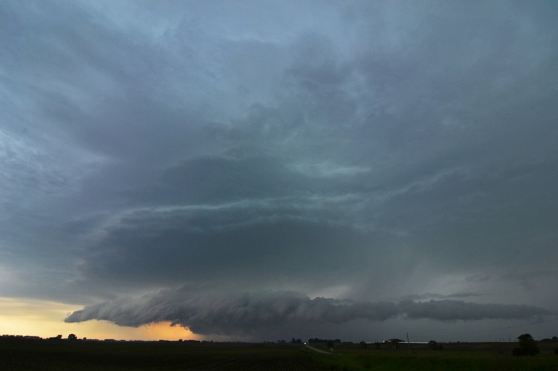
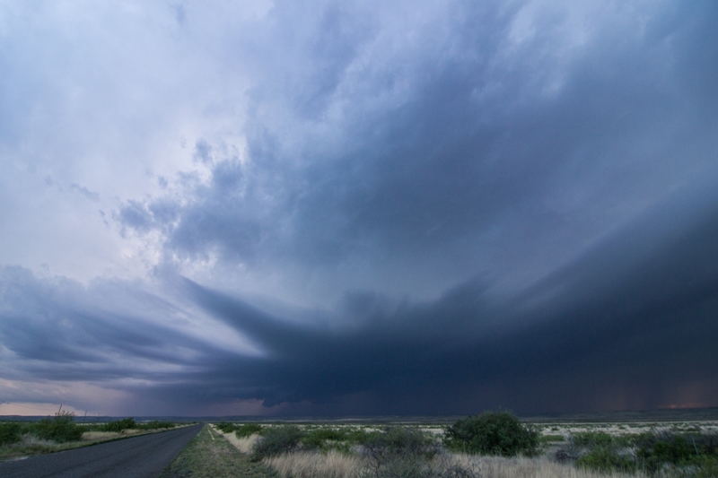
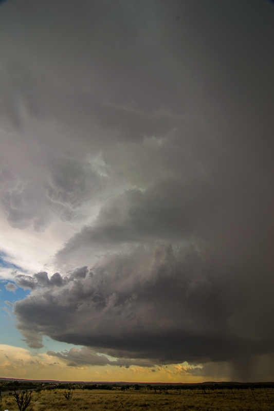
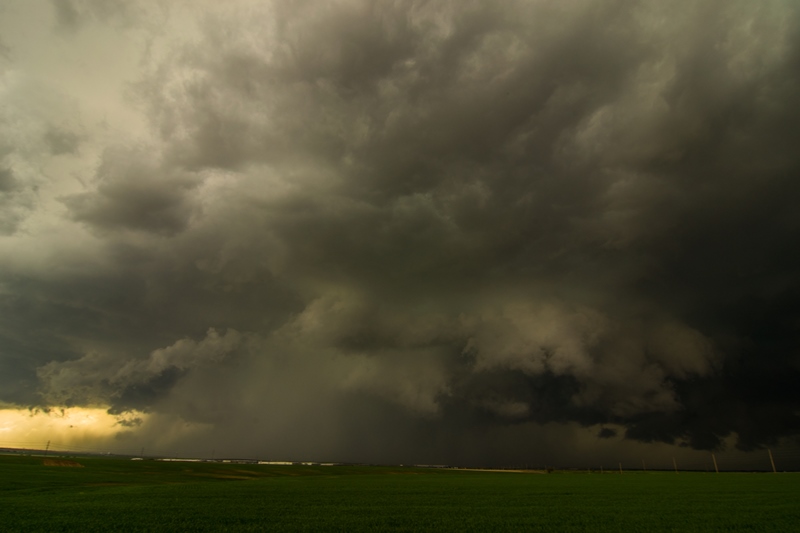
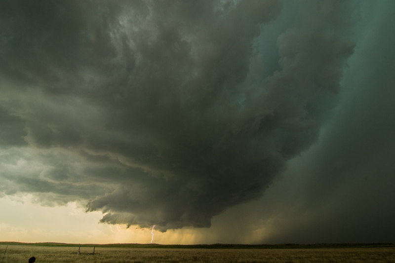
Initial supercell exploding 19 miles northwest of Canadian, Texas. Well-defined base forming to the left of the hail core.

2 thumbs up to this amazing wall cloud and funnel, northwest of Canadian, TX!

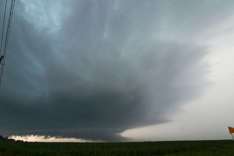
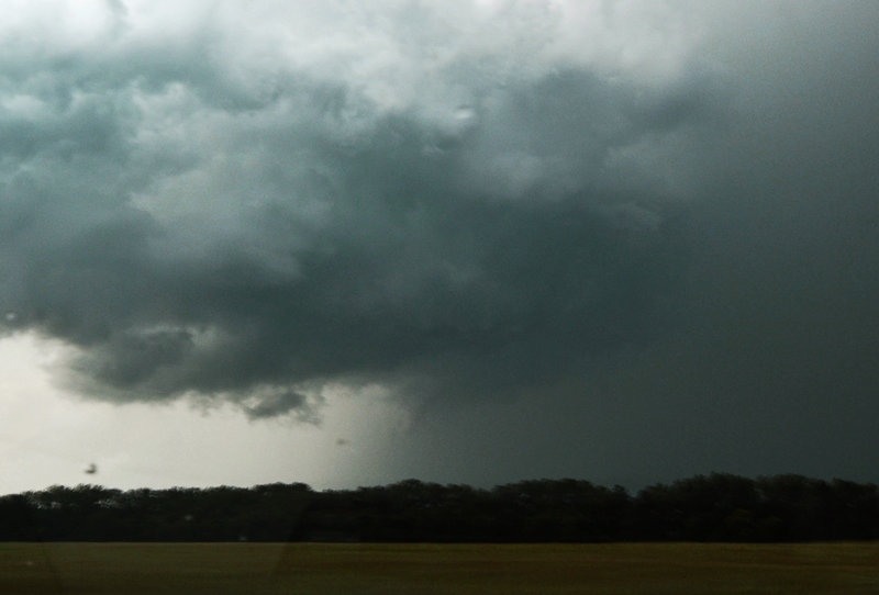
Awesome storm and well defined wall cloud with funnel extending over halfway to the ground.

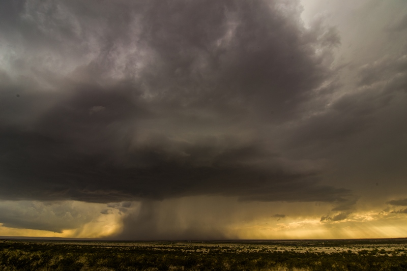
Love this shot. Roughly the time another storm chaser reported a tornado. They were closer and saw a debris cloud at the ground...hence a tornado!

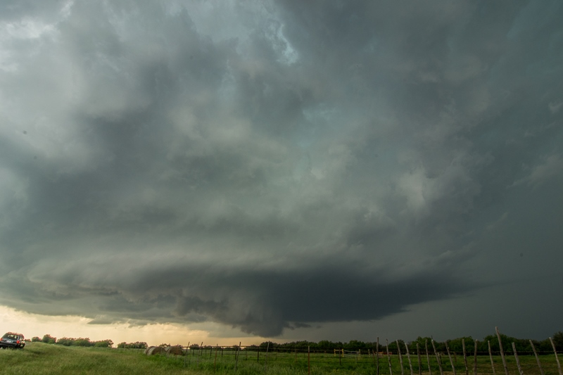
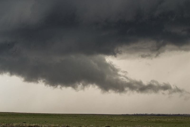
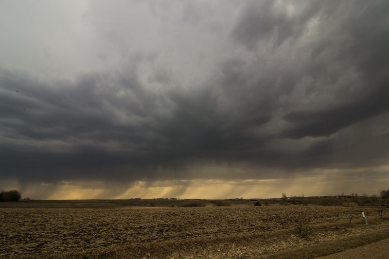
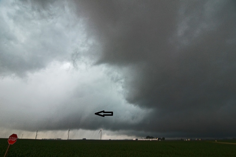
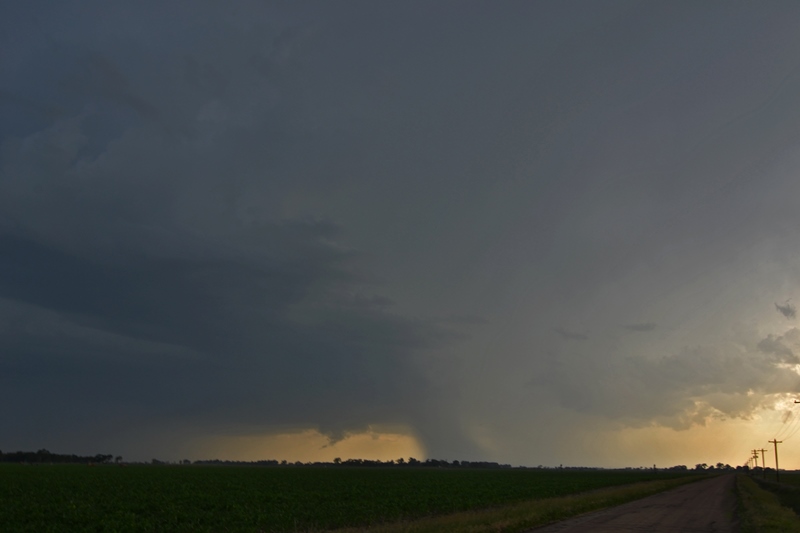
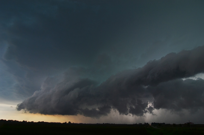
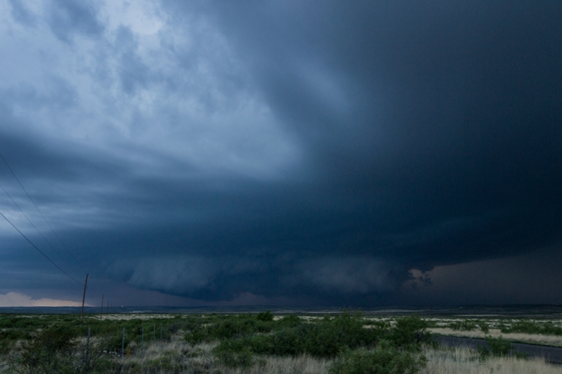
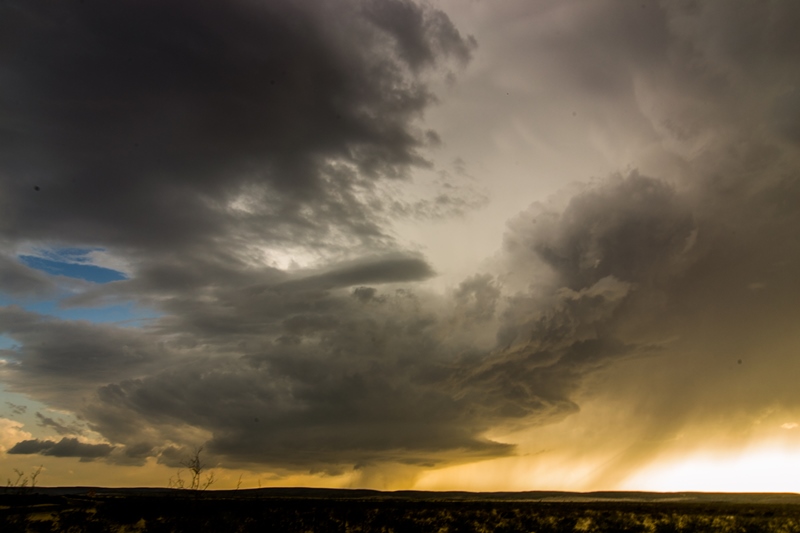
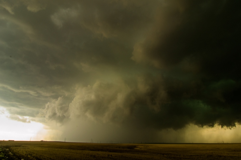
Another funnel forming northwest of Canadian a short while later as the wall cloud tightened back up.

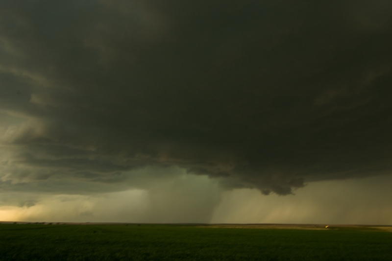
Same funnel next to a rain/hail core. This never did touch down.
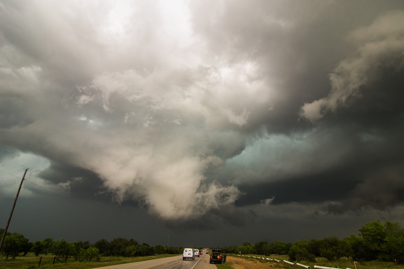
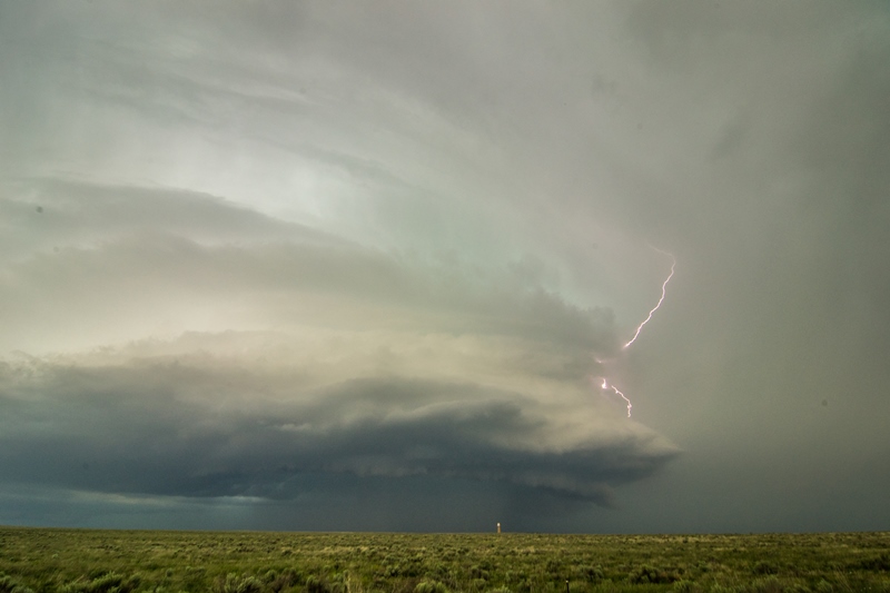
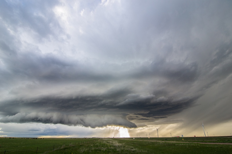
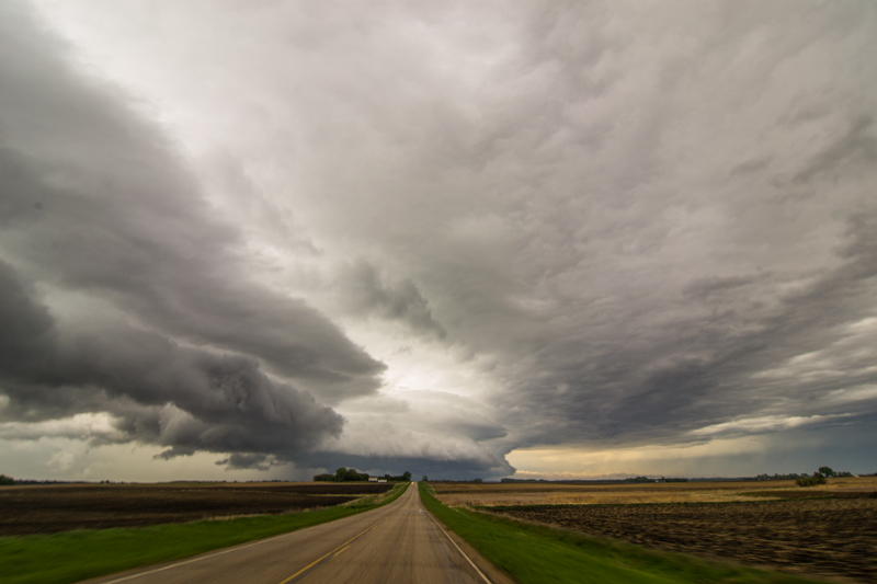
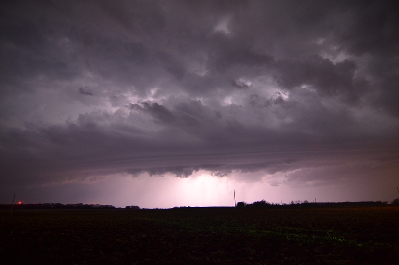
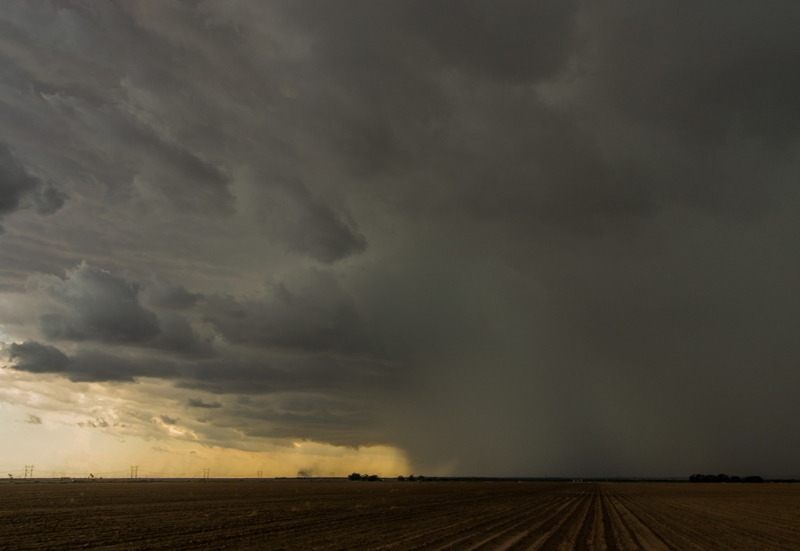
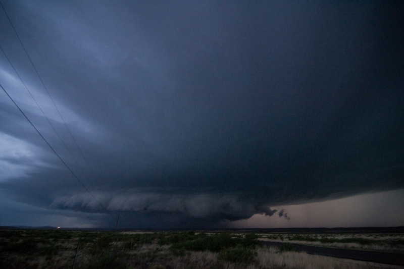
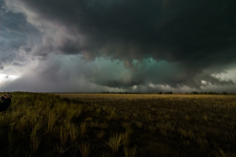
Lightning out of the base. Storm really twisting hard here with another wall cloud starting to develop as RFD punch develops clear slot on the southwest side of the storm.

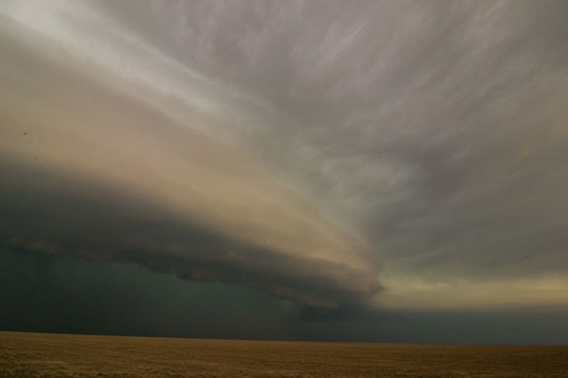
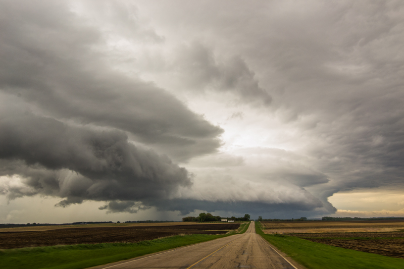
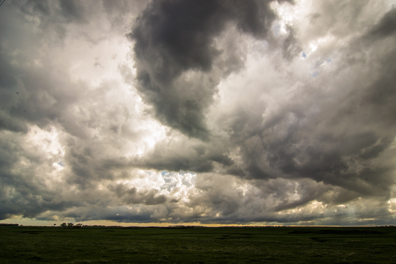
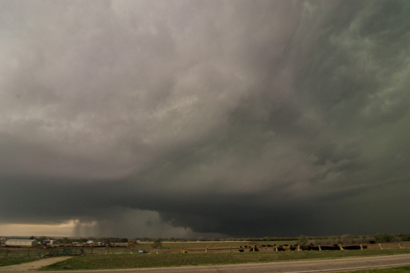
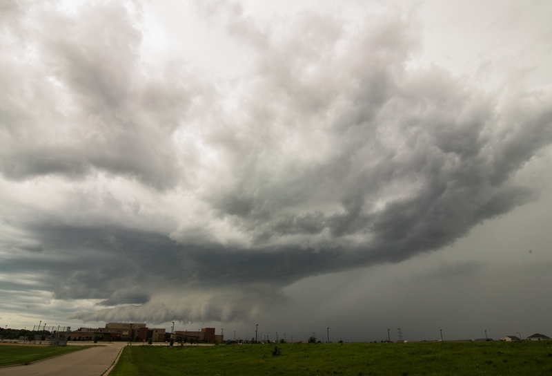
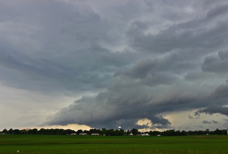
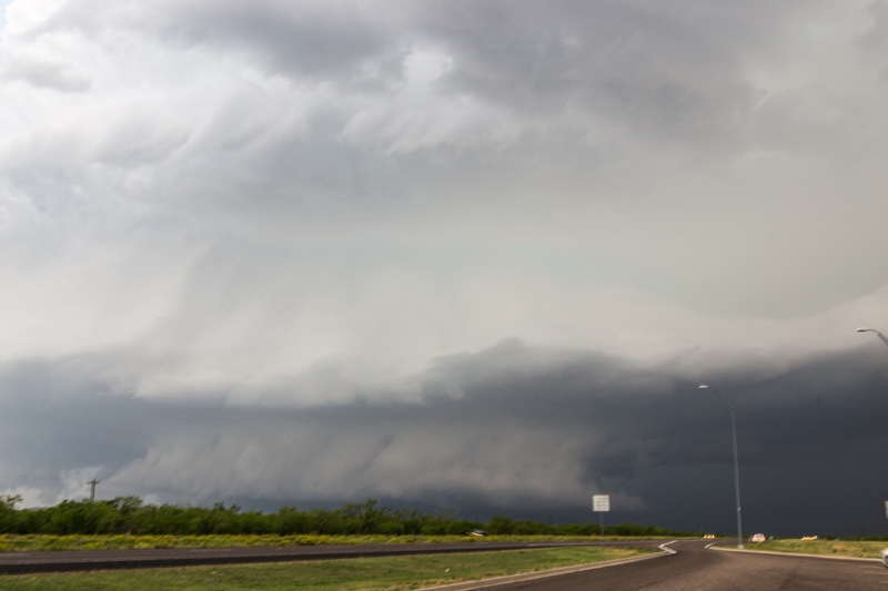
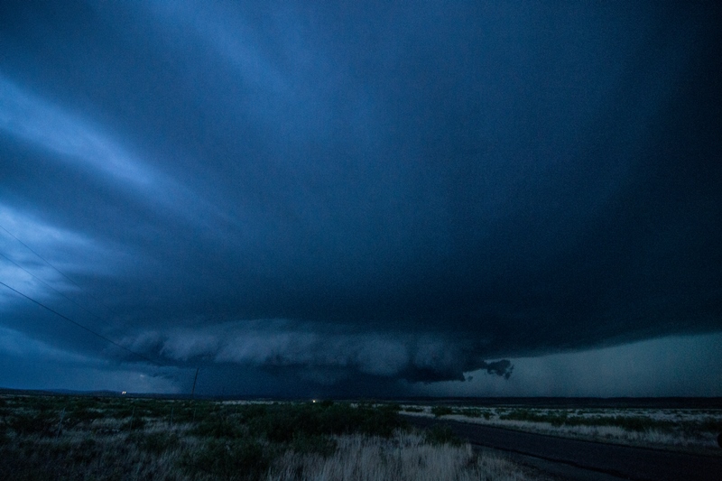
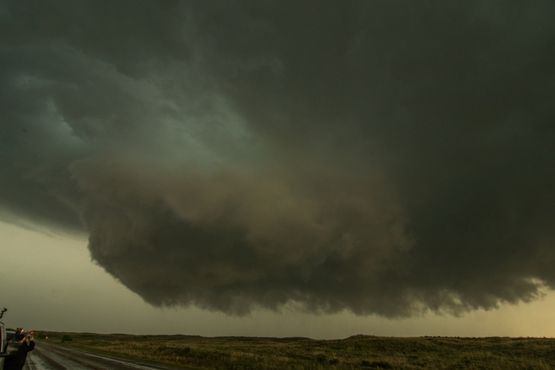
Storm taking on a mothership appearance with large, circular base. Large, ragged wall cloud underneath at this point.
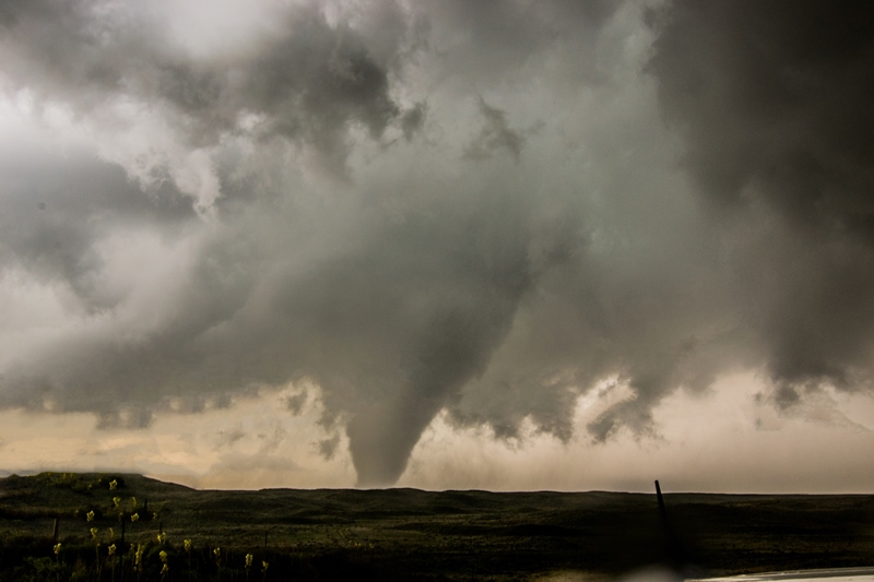
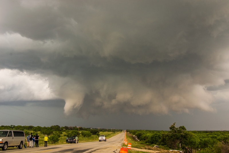
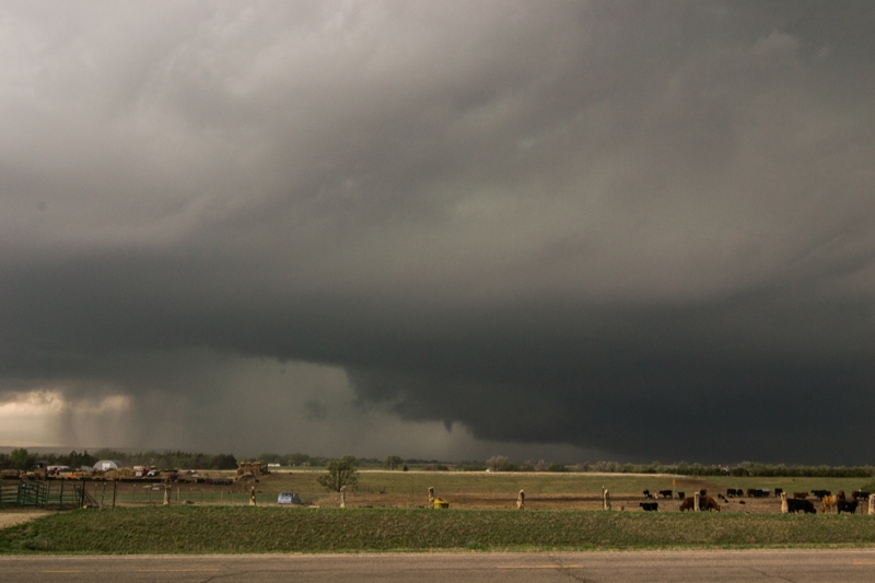
Tornado #2! Large cone/stovepipe tornado right in front of us, a few miles north of Canadian.
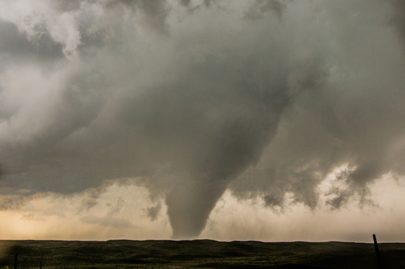
Closer shot of the tornado.


Tornado getting even larger with a big debris cloud. Clouds with the inflow were screaming into it right to left here.Tornado taking on a definite cone shape as it sits nearly stationary.

Tornado takes an elephant trunk shape as the cloud base begins to erode and the circulation starts the occlusion process.

Closer shot of the tornado from the previous image.
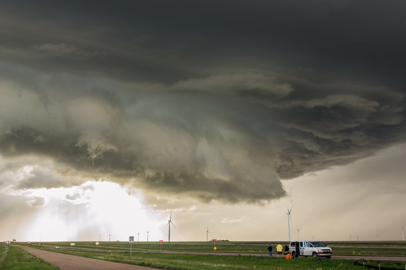
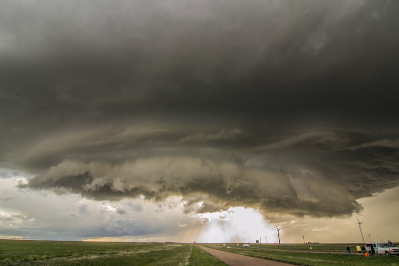
After the tornado dissipates, a new and fast rotating wall cloud develops just to the east of the occluded meso.
Wall cloud moves east to west (right to left), being pulled into the parent mesocyclone of the storm. The Silver Lining Tours crew looks on in amazement.

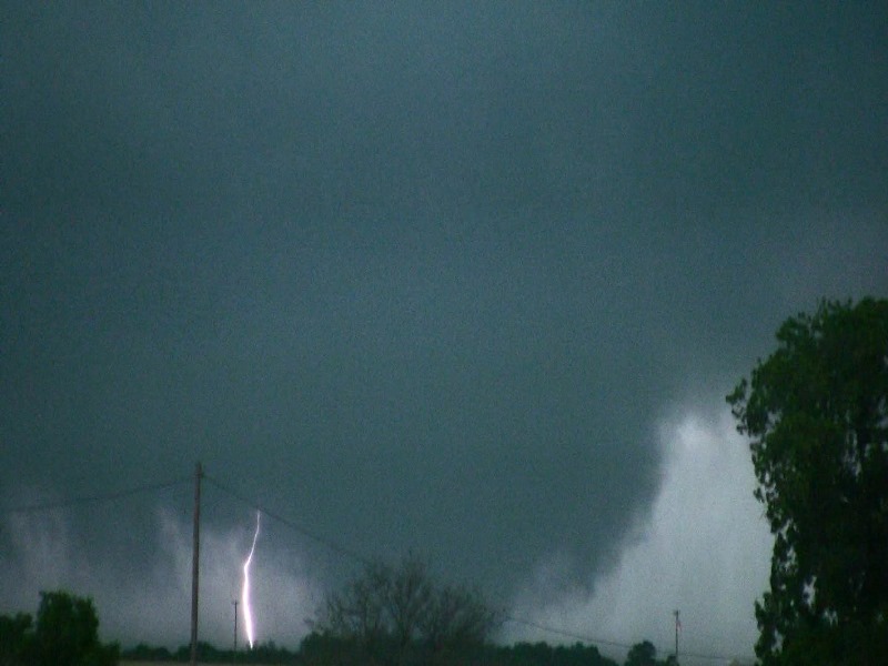
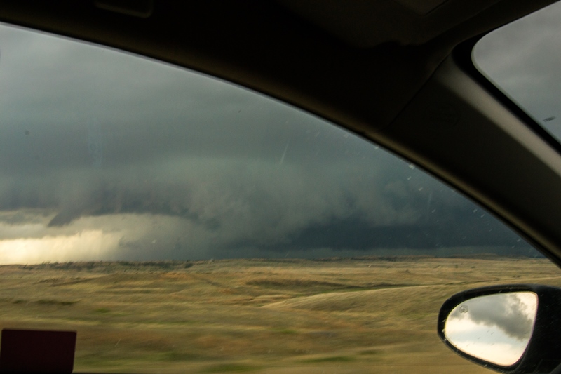
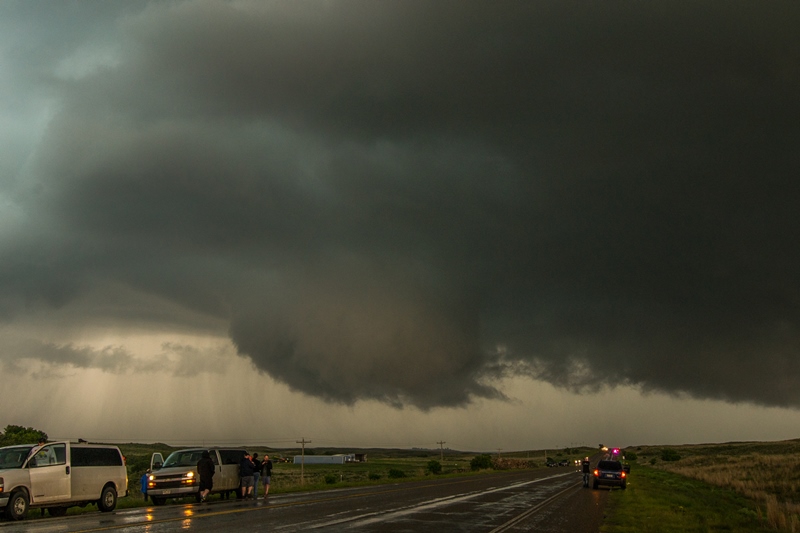
Tornado #3 just west of Canadian as we watch from the south side of town.
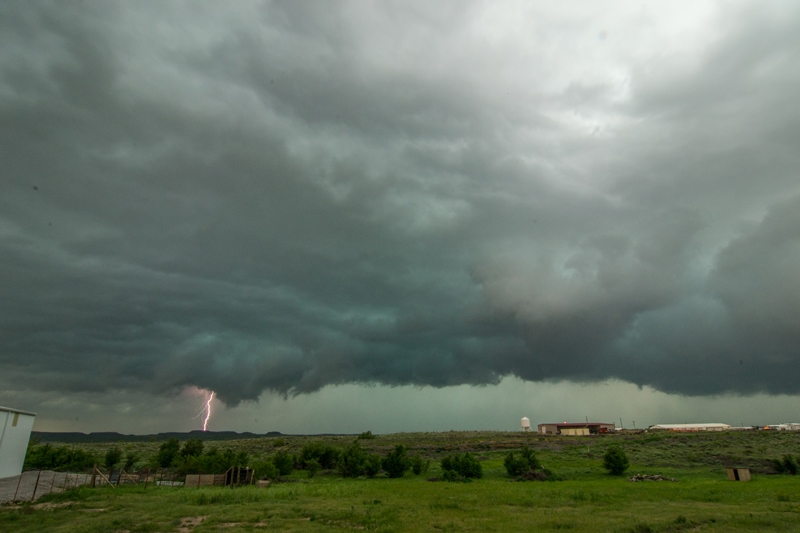
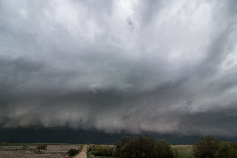
Lightning bolt out of the storm as it appears to become more outflow dominant.

Tornado #4! This circulation did condensate and touch down just northwest of town. This was the final attempt at producing a tornado. What a day and storm!
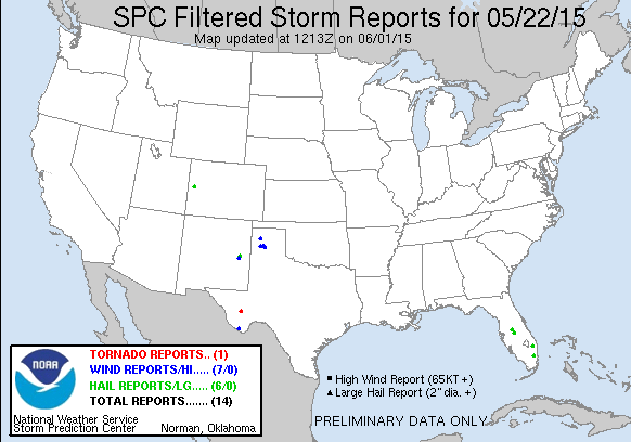
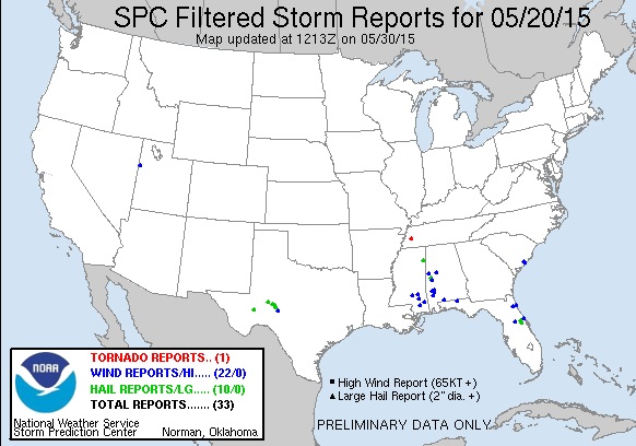
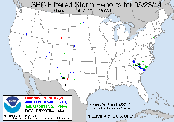
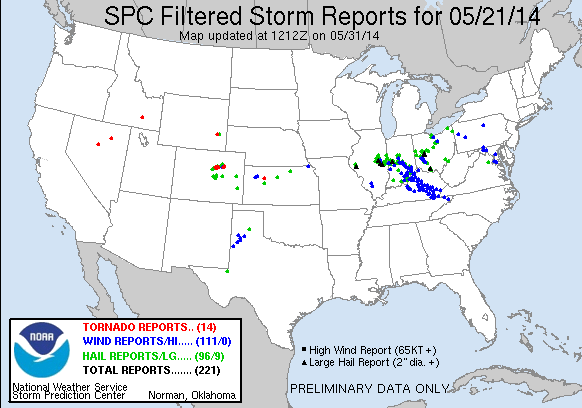
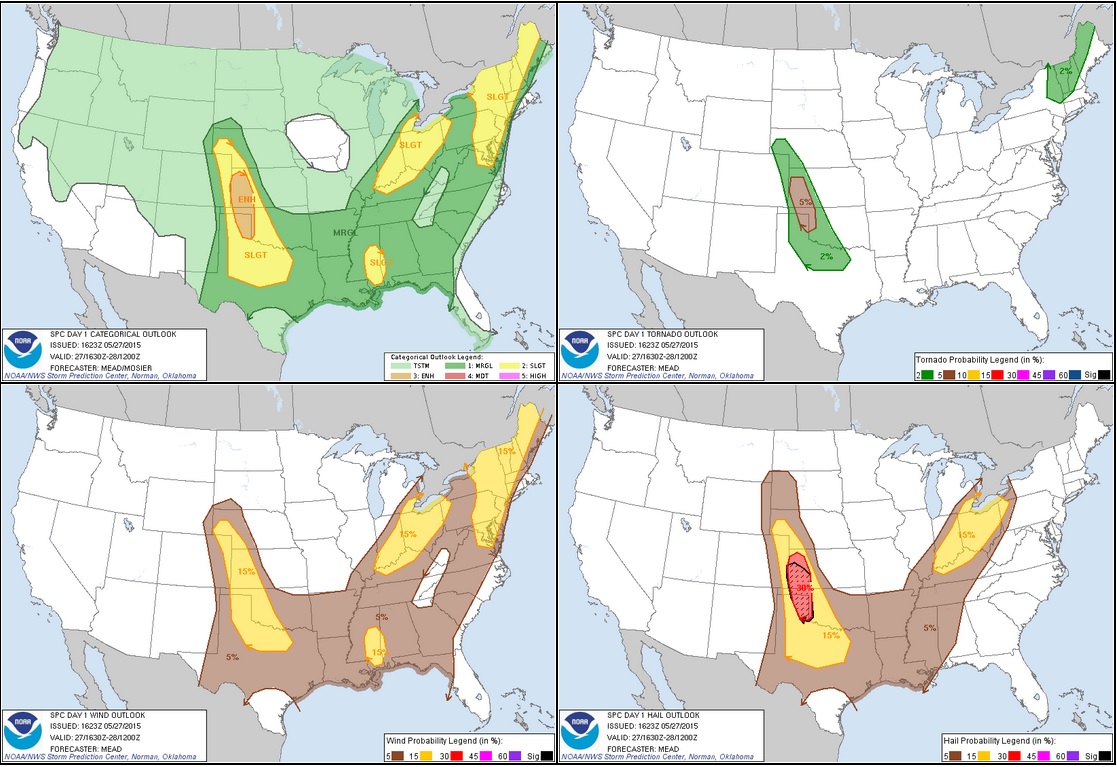
STORM REPORTS:

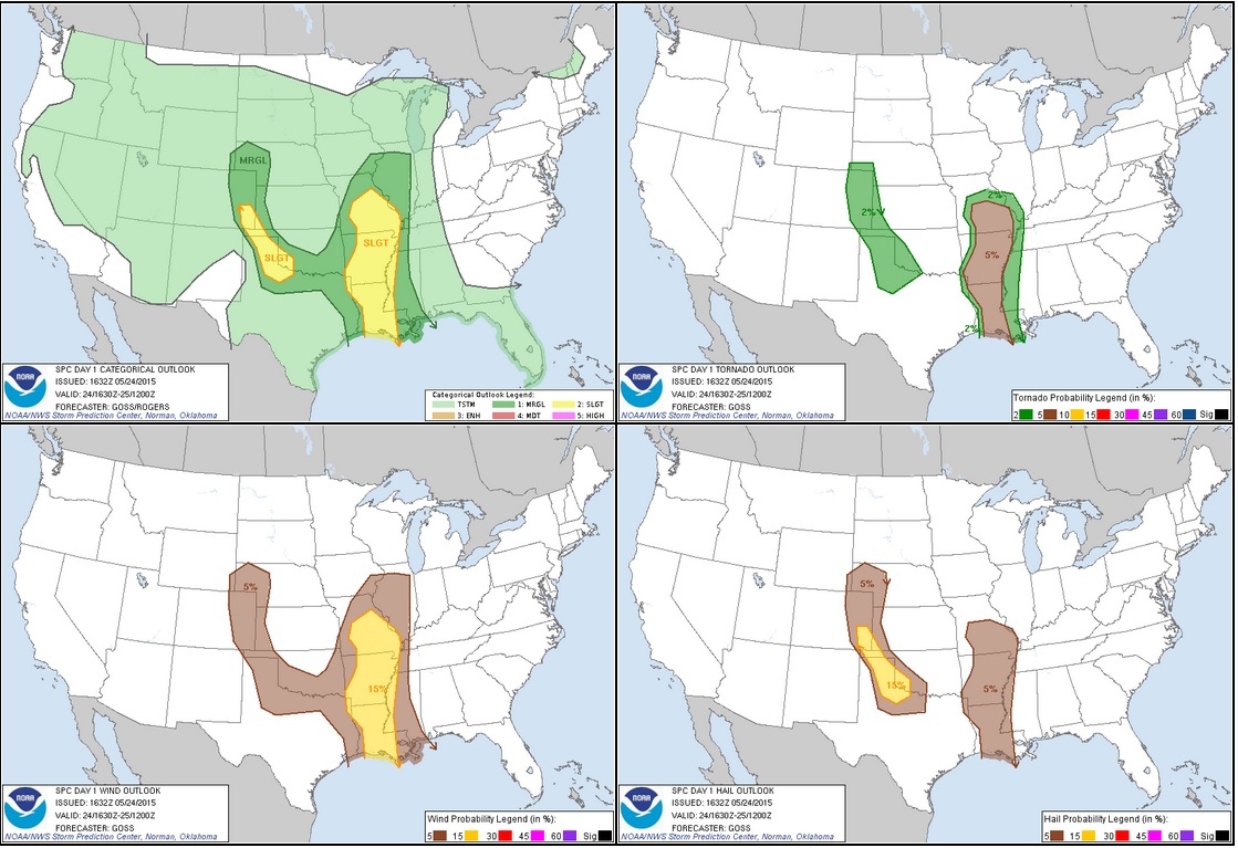
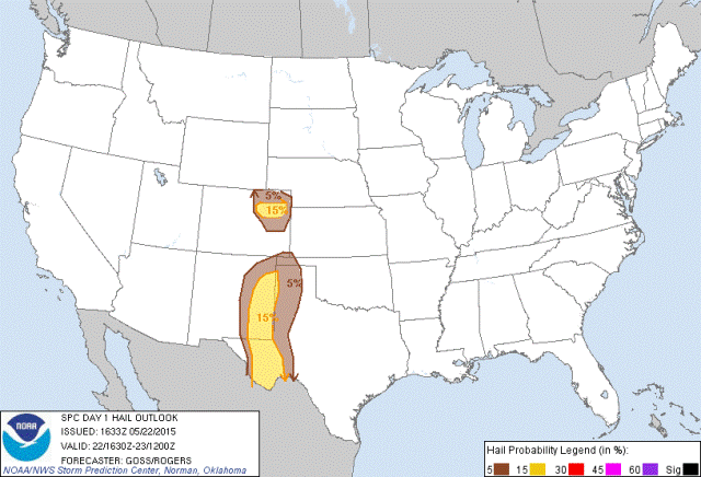
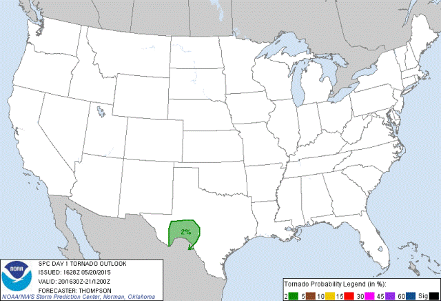
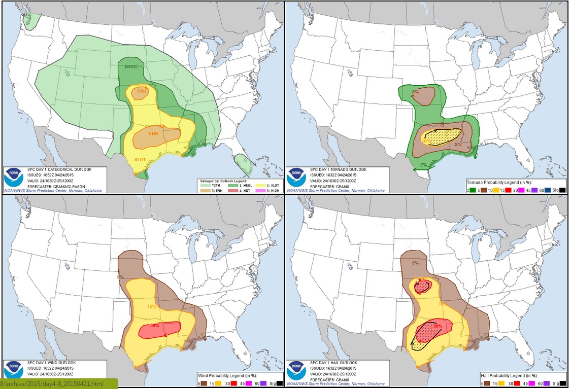
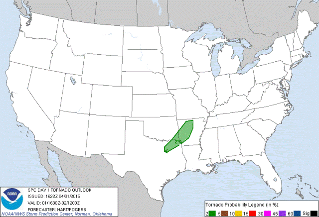
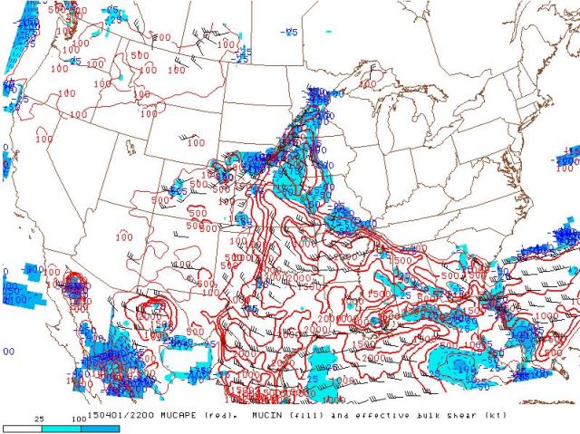
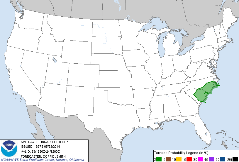
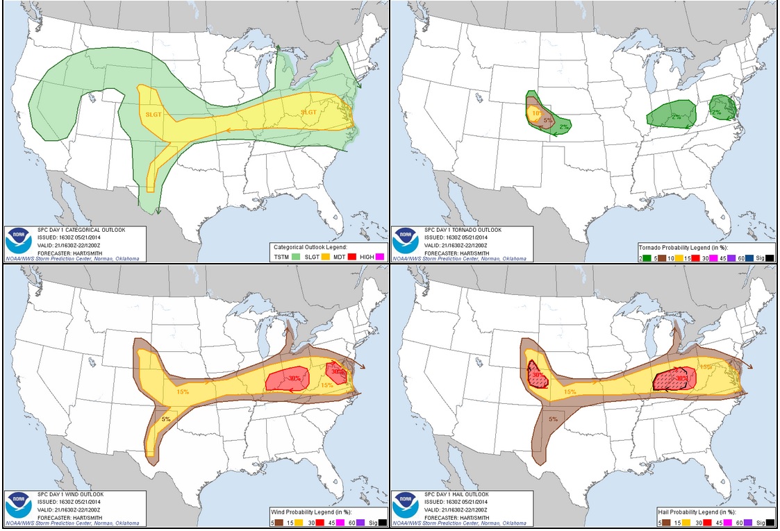
STORM PREDICTION CENTER OUTLOOKS:
MAY 27, 2015 CHASE LOG: TEXAS
Written by Rich Hamel: (www.bostonstormchaser.com/)
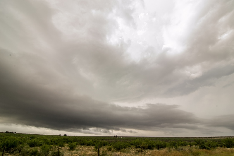
We left Abilene at about 9:30 with the intent of targeting storms at a triple point set up on the Texas Panhandle. Our target for the day was Canadian, TX as the earlier model runs which had favored Kansas backed off that play significantly and favored the Texas Panhandle. We made good time and, after a quick lunch stop in Childress, were in Canadian by about 2 PM with nothing to do but wait, so we hung out at the Dairy Queen. At this point there were towers percolating on two distinct boundaries, one on the front just west of us and the other on the dry line, forming a triple point around Spearman.
After about an hour of waiting, the HRRR predicted monster was in its early stages of development and we left to chase it, heading about 5 miles out of town on Rt. 83 and pulling off on a side road to watch the storm grow. Our vantage point was perfect and soon the storm had classic structure with a vertical updraft (though it later tilted over hard), inflow bands, and a flanking line. It wasn’t long before it developed a nice wall cloud and not long after that dropped an elephant trunk funnel more than half way to the ground! It seemed like for sure the storm was ready to tornado, but after cycling through two additional larger funnels more than half way to the ground, the wall cloud dissipated and as the storm was slowly moving east, we had to as well. It turns out that the funnel did indeed contact the ground (from our vantage we couldn’t tell), tornado #1 for the day! But why is it that when you are in a perfect spot in terms of visibility, contrast, and everything else, they never put down a nice long tornado!!?
We headed back towards Canadian, stopping once more to view the storm as it cycled and generated a new wall cloud. The storm was barely moving, slowly drifting east, and was already becoming HP, so we had to see into the inflow notch to tell what was going on. We went northeast out of town on Rt. 60 and started experiencing significant amounts of chaser convergence, as well as a lot of other trucks that were stopped waiting for the storm to clear past the road which, as it turns out, took hours. We stopped and watched as the storm developed a lowering on the nose of the updraft in typical HP fashion and decided to head north to look into the notch. We weaved through heavy traffic and drove right up to the storm with the mesocyclone just a little in front of us and wild motion almost directly above the vans! Soon the meso was spinning away wildly just to our northeast and we got blasted by heavy RFD winds. We went even further north past the meso on the end of the hook to FM1920 where we watched another larger meso to our southwest move by. It looked like it could tornado right there, and the action was intense as we were pinned up against the front flank core by the meso, and once hail started falling we moved along with the meso to stay just ahead of the hail. As we did, the rotation to the right of the vans got stronger and stronger and soon a large cone shaped funnel lowered and contacted the ground. Tornado #2! This one was a big cone tornado at first heading straight at us about a mile away, then moving southeast, paralleling our direction as the storm dive bombed southeast, then later headed away from us as it curved around the meso. The cone grew in size and started to show a decent debris fan. One cool feature at this time was that you could look right up the clear slot and see up the whole updraft to the top of the storm. The tornado continued to intensify and grown into a larger cone until, after about 10 minutes the tornado roped out and that meso occluded, but no sooner had that happened then the next meso formed on the other side of the road from us and came towards us. We beat feet to get out of the way and stay ahead of the storm.
We traveled about a mile to get ahead of the new meso and watched as it crossed the road behind us, all the while throwing out funnels part of the way to the ground. We continued on south of the town, parking near a small airport. The storm began to look a little strung out, but still had wild motion under multiple lowerings as each took turns being the focus of attention. Soon to our west, the storm generated another tornado, this one an elephant trunk that turned into a multiple vortex, #3, then another multi-vortex which lasted a bit longer and looked almost stationary before getting swallowed by the rain core.. #4!! All the while the town’s tornado sirens were blaring.
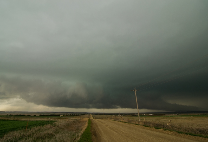
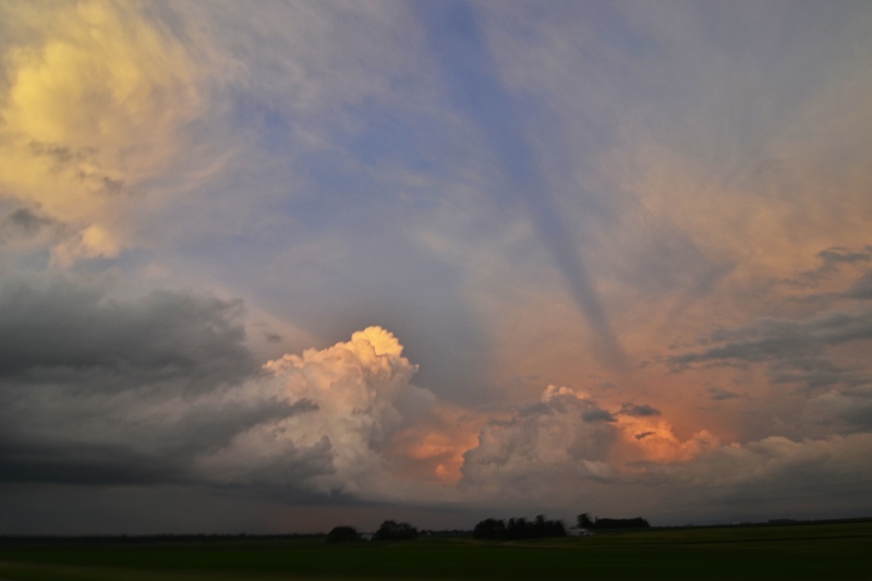
Right after the 4th tornado, the storm belched out the strong, cold winds of outflow and a big precipitation core opened up under the updraft. The show was over for this storm.
After an Allsups break in Pampa, we proceeded towards Amarillo, intending to jump south towards Claude and another storm south of there in the Caprock Country but it was barely moving in the slow upper level winds: Unfortunately there was no road to get south on it, and even if we could, the roads in the canyons were slim and at the bottom of the valleys which made it hard to see anything. So we decided we couldn’t make it and gave up for the night, heading into town for dinner at the Big Texas steakhouse.
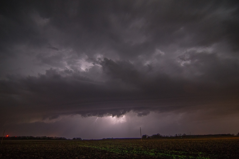
The night wasn’t quite done with us though as storms kept firing on the pinch point of a pair of boundaries south of town where our Claude storm had been, giving us quite a lightening show at the hotel.
What a great chase day! We only moved a total of about 10 miles over the course of the entire chase. Even an hour after we drove away from it, the Canadian storm, which was right over the town, was dumping water and hail amounting to over 4” of rainfall and causing flash flooding.
Mileage for the day was 399 miles.