
JULY 7TH MINNESOTA: SEVERE STORM THROUGH SOUTHERN TWIN CITIES

Severe warned storm with developing wall cloud over Chaska, MN.
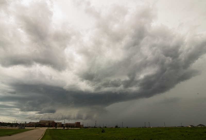
Wall cloud becoming fully mature as the storm moves closer to Shakopee High School.

Wall cloud starting to gust out a bit but still holding together.

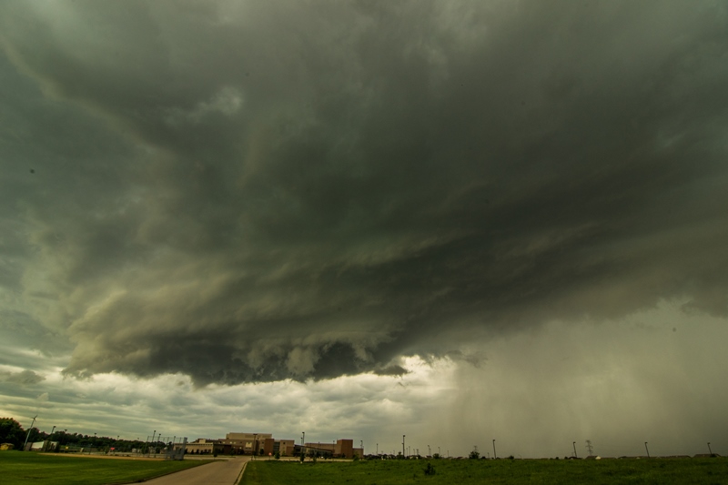
Storm about to move through Shakopee, MN. Broad lowering that is becoming outflow dominant with core to the right.

Strong core here with 1 inch hail being reported at this time near Shakopee.
Another shot of the lowering and storm core as it was approaching.

My favorite shot of the day...small but intense updraft at the back of the storm over Burnsville, MN taken from Lac Lavon Park.

Wide shot of this updraft tube and associated storm taken looking southeast from Lac Lavon Park in Burnsville. This storm produced 1.75 inch hail in Burnsville.

