
APRIL 24TH KANSAS: EMMERAM TORNADO & FUNNEL NEAR PARADISE

Sunset photo near Ames, Iowa from the night before on our drive down to Kansas City.

Arriving on the storm to the northeast of Hays, Kansas as the original wall cloud that prompted the tornado warning had dissipated.
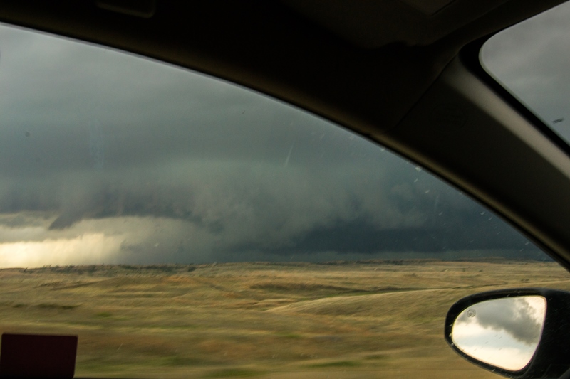
Driving north on Toulon Avenue trying to get ahead of the storm and developing wall cloud northeast of Hays, Kansas.
Looking west on Emmeram Road at a large wall cloud that was starting to rotate. Strong inflow band on the northeast side of the wall cloud feeding into this storm.

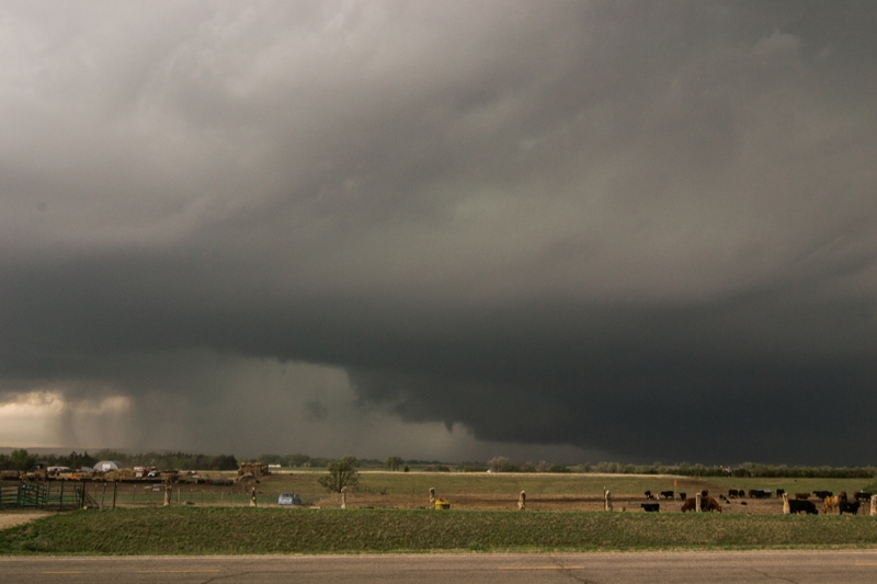
Tornado touching down near Emmeram, Kansas at 5:04 PM. This was down for around 1 minute before lifting. Wall cloud and associated mesocyclone had rapid rotation at this point as the vorticity tightened up to produce the tornado.

Another shot of the tornado.

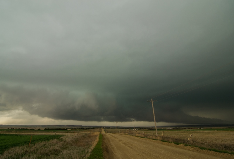
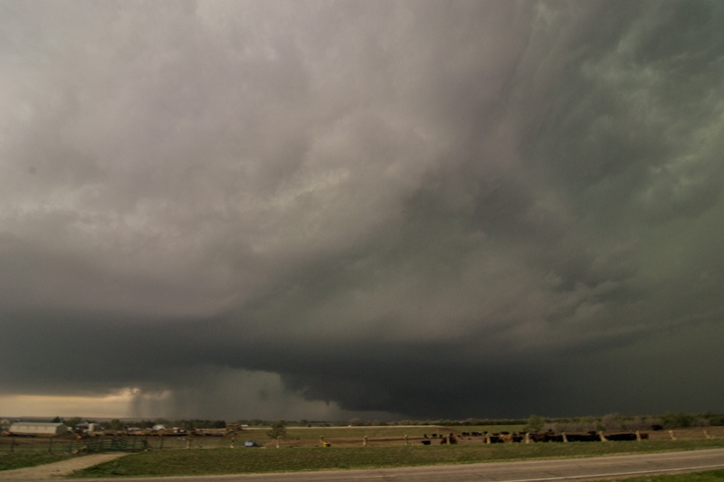
Large wall cloud reforming north of Gorham, Kansas. Bowl shaped lowering underneath with rain curtains rotating around base as storm attempted for form another tornado.

Yet another wall cloud forming on the storm near Paradise, Kansas.
This was rear flank downdraft (RFD) winds around the backside of the storm kicking up dirt behind a new wall cloud.

Another well structured wall cloud near Paradise, Kansas. Notice multiple mid-level inflow bands.
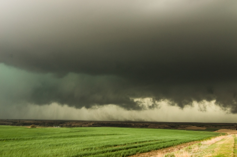
New funnel and wall cloud on the storm near Sylvan Grove, Kansas.
View of the storm structure with funnel and wall cloud underneath near Sylvan Grove.

Supercell starting to merge with other storms but still have an organized inflow band on the northeast side.

View of the entire storm about 10 miles ahead near Lincoln, Kansas.
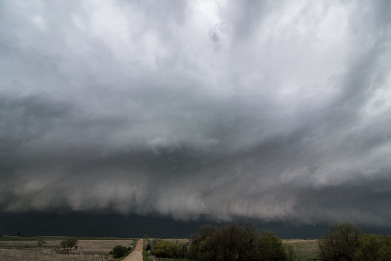
Let it approach us again near Lincoln, Kansas, but clearly starting to take on that more outflow dominant and shelf cloud look.

12Z HRRR did a good job in depicting this storm, developing on the triple point and becoming rather intense by 22Z, right at the time of the tornado.

13Z HRRR had highest forecast updraft helicity values with storm on the triple point. Nailed it!
STORM PREDICTION CENTER OUTLOOKS:
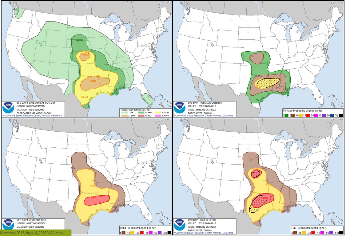
STORM REPORTS

APRIL 24, 2015 CHASE LOG: KANSAS
This was a chase that I had every intention of doing for several days leading up to it. This was the ‘next’ trough in-line to eject out of the Rockies and instability, shear and moisture appeared sufficient for severe thunderstorms and possibly tornadoes for an entire week in advance leading up to the 24th. Having the day off and no major plans, Wes Hyduke and I decided to make a run for it, staying in Overland Park, KS Thursday night and heading west on I-70 towards Russell, KS on Friday. The original intention was to chase storms off the dryline and south/southeast of the triple point near Wichita, but we awoke Friday morning to the main risk area shifting north towards the triple point in west-central KS. The models were not developing the dryline storms until later in the evening and it appeared the dewpoints would mix out with larger T/Td spreads as a result, along with some capping issues. The target shifted more towards Great Bend to Russell, just ahead of the surface low and along the warm front where the models, especially the HRRR, were blowing up a large supercell and riding it east along the front.
My concerns leading up to the day were the lack of bulk shear with a forecast 30-40 kts across this area, as well as the moisture returning out of Texas where strong convection was expected to occur throughout the day. However, bulk shear did increase to 40-50 kts for this event across central and north-central KS while dewpoints were able to creep up into the upper 50s and lower 60s. MLCAPE nosed northward to 500-1,500 j/kg near the triple point where the models continued to project the development of an intense supercell storm throughout the day. A surface low deepened to sub-998 mb as it approached southwest of Hays with surface winds backing somewhat and veering winds with height, leading to the supercell and tornado threat. Mid-level lapse rates increased to 8.0 C/km, promoting a concern for very large hail. A mesoscale discussion was issued at 2:14pm CT, highlighting these risk factors and much of western and central KS for the threats of damaging winds, large hail, and isolated tornadoes. A tornado watch then followed at 3:40pm CT for the same area.
Upon reaching Russell, we progressed south to meet up with some chaser friends in Hoisington. As soon as we got there, towers started developing to the west of La Crosse up towards just west of Hays, KS. The storm that the models had been projecting to explode on the triple point did just that right over Hays. We went back north and intercepted the storm northeast of Hays around 4:45pm. We then progressed north on Toulon Ave and then east on Emmeram Rd, parking on top of a hill to watch the developing wall cloud that was starting to spin at a good clip. Just as I was putting the video camera on a tripod, the storm produced a brief rope tornado right at 5pm a few miles west of our location. This lifted and another cone tornado formed at 5:04pm. This also was fairly brief but did last around a minute. There was a moment that I thought this would form into a larger, longer lasting tornado since the mesocyclone and associated wall cloud were spinning very fast at this point. However, the tornado could not last and wrapped up into the wall cloud. Upon moving further east, the storm continued to produce wall clouds with rising, condensation at times along with some rotation. We stair-stepped northeast on dirt roads, all the while staying in the notch of the storm and out ahead of the hook so we were able to see if anything touched down. However, it was difficult to determine if there were any rain-wrapped tornadoes as there were some additional reports. Near Paradise, the storm really tried to produce again and we witnessed a funnel shielded in the rain at that time. After the funnel occurred, new updrafts began forming out ahead and south, which led to some weakening near Lucas as we traveled east on Hwy 18. However, the storm seemed to reorganize near Sylvan Grove and produced another wall cloud and funnel. I believe there were a few reports of a rain wrapped tornado at this location as well, but we never saw this. Thereafter, we stayed out ahead of the storm until Lincoln where everything began to merge. At this point, we decided to end the chase and start heading east on I-70 towards Kansas City.