
MAY 21ST COLORADO: TORNADO NEAR DIA AND SUPERCELL TIME LAPSE

Supercell over Denver that was dropping very large hail at the time over the city.

Closer view of the storm mesocyclone as it rolled off the foothills and right over Denver.

Another shot as the storm was moving closer.
Intense hail core in this storm as it moved over the eastern suburbs of Denver. Caused a lot of damage with a noticeable hail swath even the next day.
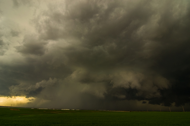
Moving up towards our position a few miles south of Denver International Airport.
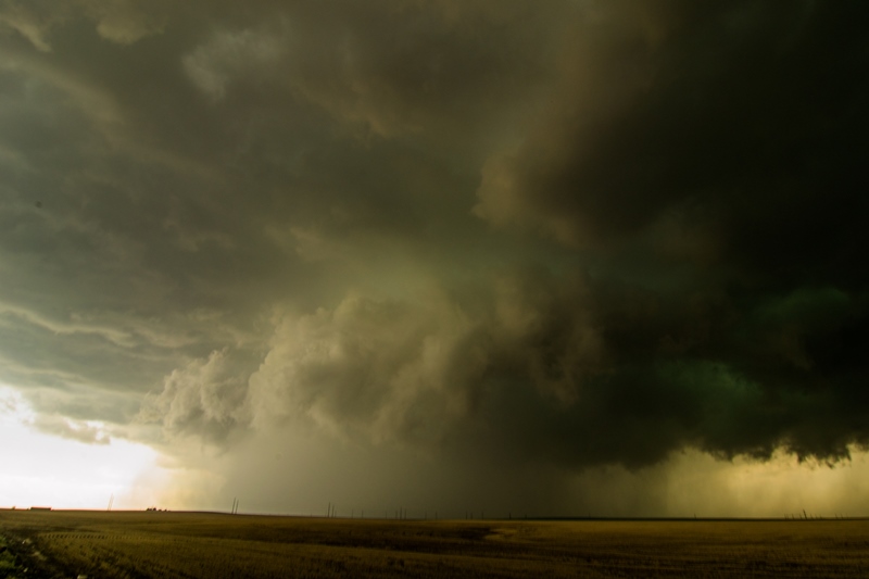
View of the entire storm, wall cloud, and the beginning of the tornado south of DIA.

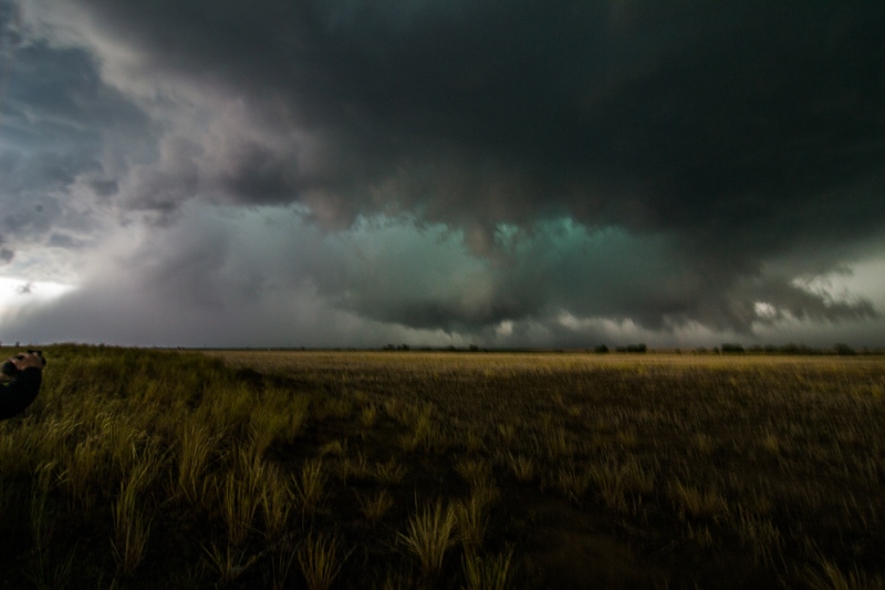
Zoomed in view of the initial touchdown of the tornado south of DIA.

Appears the tornado grew larger upon becoming rain-wrapped but cannot be completely sure it was an intense core or tornado.

Silver Lining Tours enjoying the beauty of the storm.

Terrific mothership with possible rain-wrapped tornado in the core north of Watkins and near Front Range Airport.

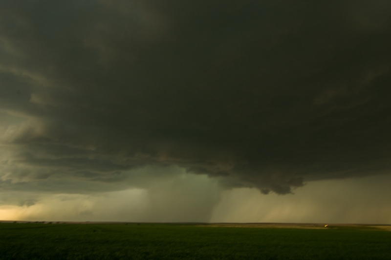
Short while later with bowl lowering on the right side of the core.
Wanted to post this storm core photo because this is NOT a tornado. Was reported as one and totally false. Intense rain/hail core.

Another wall cloud forming on the storm north of Strasburg, CO.

A zoomed out view of the wall cloud and storm north of Strasburg, CO as the day was coming to an end.
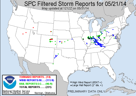
STORM REPORTS:
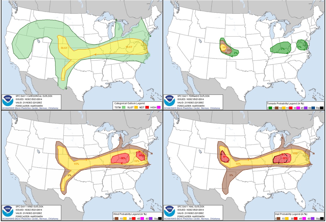
STORM PREDICTION CENTER OUTLOOKS:
MAY 21, 2014 CHASE LOG: COLORADO
Written by Rich Hamel: (http://www.bostonstormchaser.com/)
Another great chase day, and for the most part we were within 40 miles of our hotel the whole time. After sleeping in at our hotel near Denver airport, we met late and headed out for lunch as storms were already bubbling up in the foothills of the Rockies. By the time we got the group back together, one of those storms was already severe just south of Denver, so we headed towards Bennett to get set up, initially targeting a cell off to the south. We quickly elected to change targets to the storm near Denver, hopping back on I-70 towards Denver. We soon were driving directly towards a big, low hanging wall cloud and the chase was on by 2 PM local time, only a few miles from our hotel! We got off the highway just south southeast of Denver International Airport and made our first stop as the storm was already showing significant rotation and had that greenish glow of a storm with large hail. We began stair stepping on the roads to the east of the airport and soon the storm was tornado warned and had now developed a long tail cloud out of the wall cloud area. We repositioned one more time and when we stopped and set up the storm was now showing violent rotation and quickly produced a brief elephant trunk tornado! The tornado quickly changed to a multi-vortex tornado then got swallowed by the massive precipitation core. From that point we were never able to clearly see it again, but now there were several reports of a tornado along Tower Road (where our hotel was!) so we knew it was in there. The precipitation core kept getting larger and larger as we continued stair stepping northeast in front of the big high-precipitation storm. We let the core get right up to us a couple of times then pulled away to get a better view of the structure, all the while weaving in and out of the hundreds of storm chasers who were on the storm. When we got to Rt. 36 east of Byers, we were in a full blown traffic jam, mostly precipitated by the Doppler on Wheels crews crawling along the road. At this point the storm had cycled down, but by about 5 PM it was cycling back up and was again tornado warned so we headed north on county roads northwest of Last Chance to get in front of the updraft again. This unfortunately proved impossible as multiple cells were opening up all around us, turning the roads to mud and making any chance of seeing anything impossible. We aborted our chase and had a wild, muddy ride east trying to get back to the pavement, finally succeeding north of Last Chance. As we got back on Rt. 36 heading back to Byers, the fields off to our north were covered with hail. After stopping at a restaurant for dinner we returned to the hotel, curious to see if there was any damage. It turns out they had gotten EIGHT INCHES of hail! It was 6 hours after the storm, and hail was still piled everywhere. The trees were absolutely shredded and there were numerous cars pock-marked by the dime and quarter sized hail. There were rabbits everywhere loving the “instant salad” created by the hail shredding the trees, and the neon sign at the diner we stopped at for breakfast was shattered. All in all, another fun chase day, and we didn’t have to drive 962 miles to do it! The miles do rack up though, and by the time we’d finished we’d done another 213 miles, for a total of 1175 for the first two days of the trip.