
JUNE 11TH MINNESOTA: SHELF CLOUDS & GUSTNADO
Lowering on the storm over Ortonville, Minnesota. Actually was trying to form a wall cloud here!

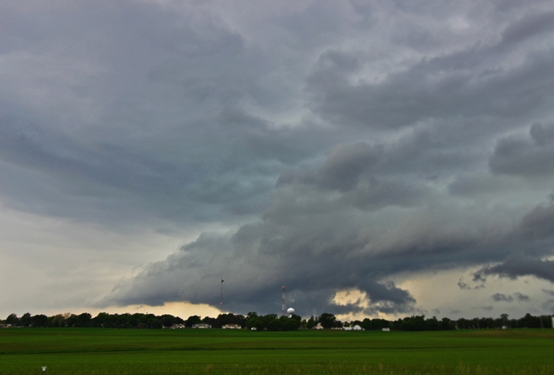
Still inflow into the storm as noted by the tail with a weak bowl shaped lowering under the storm. Starting to form a shelf cloud on the southern end.

Shelf cloud fully developed on this storm near Appleton, Minnesota.

Nice looking shelf cloud about to overtake us with some gusty winds.
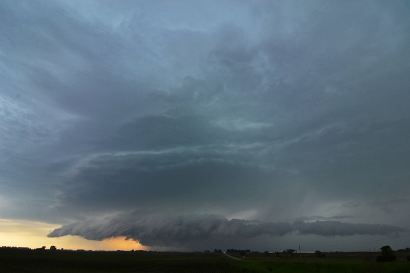
A different storm with actually some decent structure near Kerkhoven, MN! Lowering underneath that held together for a while.

Another shot of this storm as it was approaching my location. Lowering underneath is becoming more ragged.

Cool roll cloud that developed out ahead of the storm as outflow was starting to really take over.
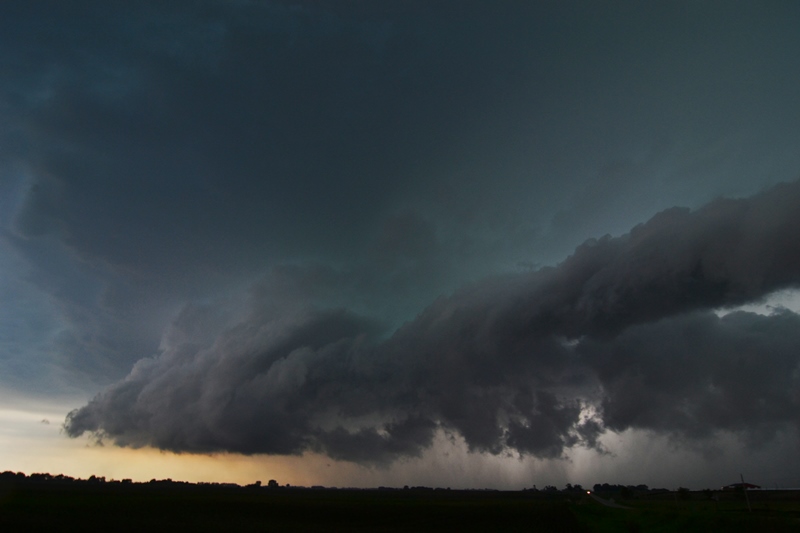
Another view as the roll cloud was moving over with the storm base to the left where it still appeared to have some inflow. This base to the left is what eventually formed the gustnado near Pennock.
STORM REPORTS:

STORM PREDICTION CENTER OUTLOOKS:

JUNE 11, 2014 CHASE LOG: MINNESOTA
Making the best out of a marginal situation is what this day was all about. I awoke in the morning to a Slight Risk for severe weather and a 5% tornado risk across west-central and northwest MN. I had been watching for this potential chase for days leading up to the event, but it never looked like a slam dunk for severe weather and especially for tornadoes. The main issues for the day were the weak low and especially mid-level lapse rates as well as dewpoints only in the upper 50s to lower 60s. MLCAPE was only expected to get into the 500-1,000 j/kg range at the most, so instability was also rather low and confined to a narrow corridor ahead of the cold front. The surface set-up included a low pressure center east of Aberdeen across northeast SD and a stationary front to the east-northeast through “The Hump” are of western MN and into north-central portions of the state. A trailing cold front slowly advanced eastward through eastern SD and into southwest MN. Bulk shear was not bad but not great, and on the order of 40 kts later in the day as the upper trough approached. The plan was to play the triple point area near and just southeast of the low in the vicinity of Hoffman, MN and hope that supercell and tornado potential would be maximized here.
I left my parent’s place in southern MN by 9am and headed northwest towards Alexandria. Here is where I met up with a few other chasers and waited for things to become clearer. This area was right on the stationary front while an area of low pressure was moving towards from northeast SD. Storms began to form near the low and along the cold front by mid-afternoon and looked very weak on radar. SPC issued a mesoscale discussion for the area at 3:36pm, basically saying that a low risk for severe weather existed and there would only be a low probability of a watch issuance. They even downgraded the 5% tornado to a 2% for the 2000Z update. Shortly thereafter, one storm caught my eye that was near Webster, SD that was intensifying and had a 40k foot echo top. This storm was near the triple point and looked to be the best of the many that were starting to fire around it. I made my way down from Alexandria through Morris and west on Hwy 28 to Graceville, MN. I then went south on Hwy 75 to intercept the storm in Ortonville. The storm did have a lowering on it as it crossed the river towards us to the north of Ortonville, but this looked non-threatening and the storm was not warned at the time. I was able to stay ahead of the storm on Cty Rd 10 for quite a while, stopping to take photos and video at times as the storm was looking interesting but with more shelf-like, outflow features as the storm started to move past maturity.
A new storm began to form to the south near Appleton and I moved south on Hwy 59 to Hwy 12 to intercept this storm. Again, this cell never was severe warned but did have several lowered areas underneath the base and had nice structure at times. Upon reaching Kerkhoven, I followed to the northeast on Hwy 6 and the road turned into Cty Hwy 13. At the intersection of 13 and Cty Hwy 7, I was able to get out ahead enough to set up the tripod and take some video as well as a number of photos. The storm had good structure for a while, while the northern end began to gust out upon reaching me. I was about to let the storm core me, when I noticed a dirt plume to the south. This was where the storm appeared to have a hook appendage on radar and still had inflow/outflow balance. There was an action area above that looked like a ragged mesocyclone with a lot of turbulent undulations. I followed south on Cty Hwy 7 back to Hwy 12 and then east through Pennock. Here is where the dirt plume really looked like a large gustnado. There was also a lot of dirt being blown back to the east on the south side of the storm where an RFD may have been in place, then curling back ahead and into the storm with the inflow. It certainly looked interesting and Melanie Metz has a nice photo of what looks like a funnel and dirt being kicked up underneath shortly before the dirt plume got larger. I followed through Willmar where dirt was still being kicked up and when it really looked like a gustnado. Another formed to the northeast of Willmar as I continued to the east on Hwy 12. It soon was too dark to see much and the storm began to weaken, so I progressed back home for the night. A nice chase considering there were no severe warnings and it was such a marginal type of day!