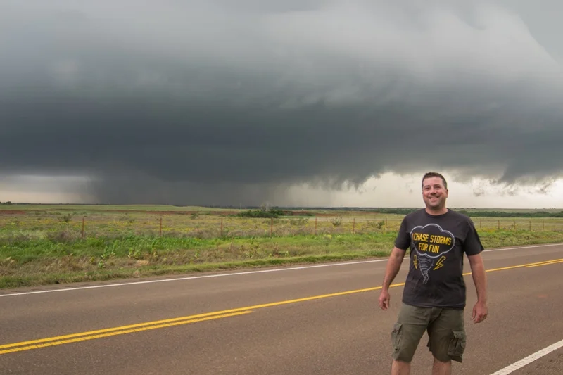
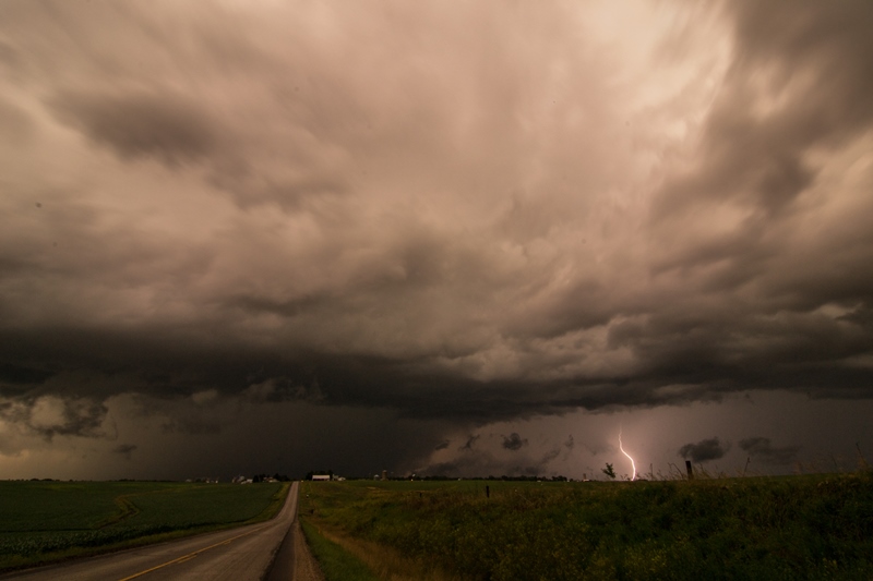
JULY 11, 2017 NORTH DAKOTA & MINNESOTA: TORNADO & INTENSE SUPERCELL
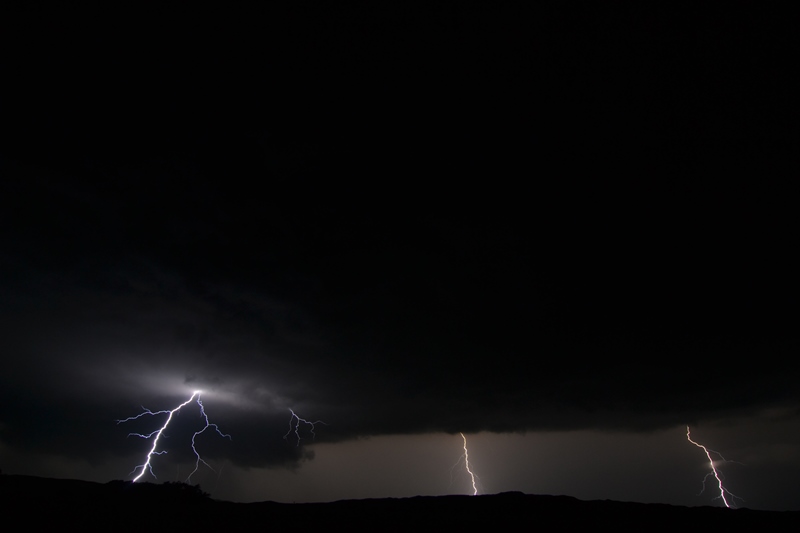
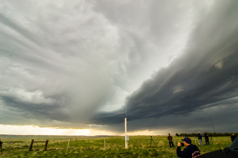
Chased a beast of a tornadic supercell out of eastern North Dakota into northwest Minnesota. Witnessed a multiple vortex tornado between Hatton and Buxton, North Dakota before it wrapped back into the core and was not in view. Thereafter, I stayed in or near the notch and thankfully had a good road network to do so as I stayed with the storm southeast into Minnesota, ending the chase near Ada. The storm exhibited terrific supercell structure throughout its entire life cycle! A textbook mothership.

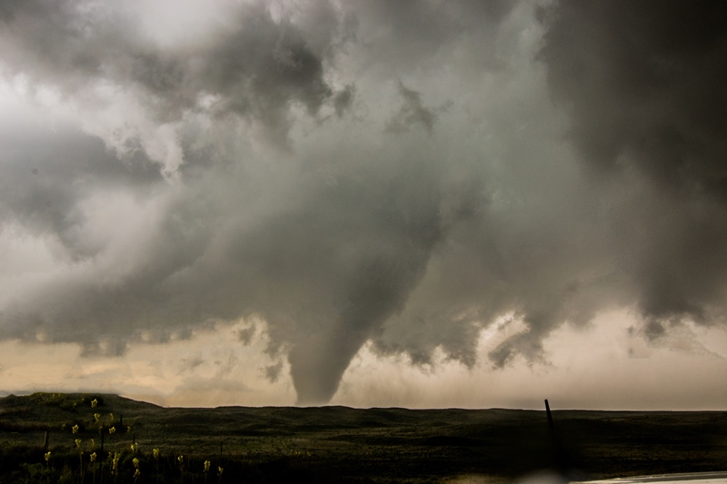
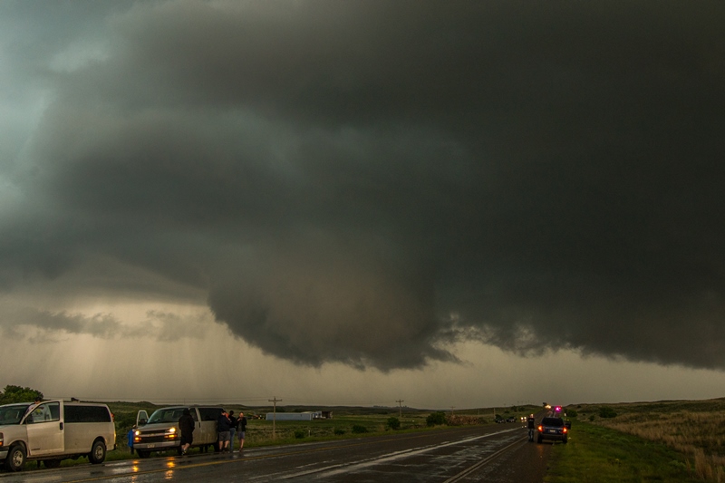
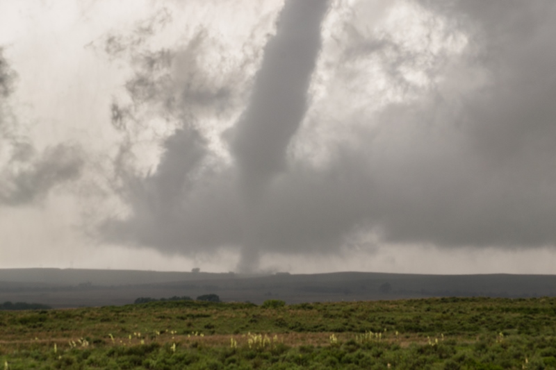
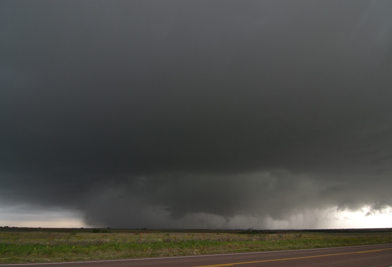
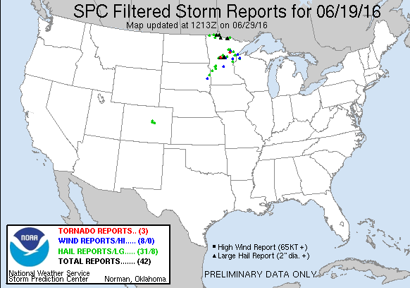
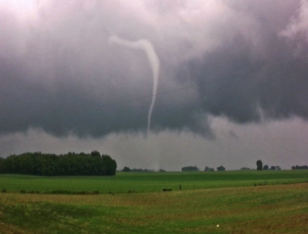
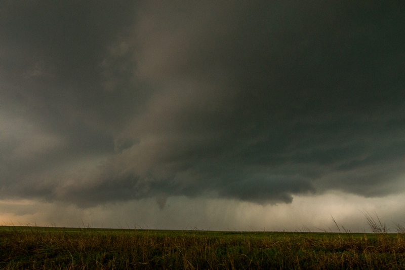
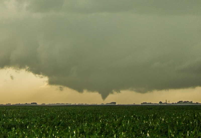
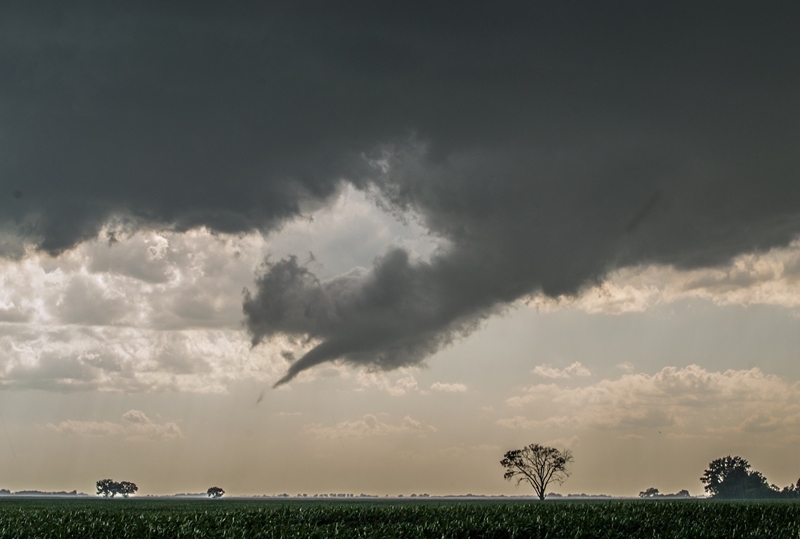
Tornado! Multiple vortex tornado between Hatton and Buxton, North Dakota. Had to be right in the notch to view this as the tornado formed on the north side of the core as the wall cloud was wrapping back in. This photo is out of sequence with the others below. Wanted to show this first.
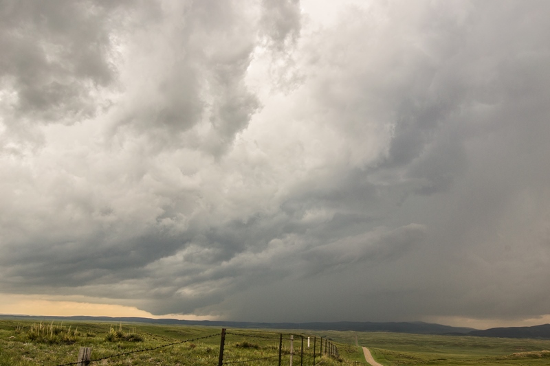
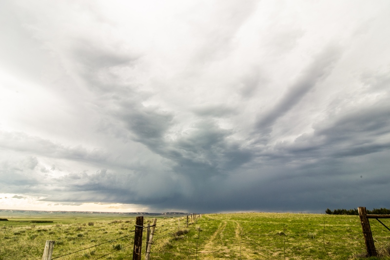
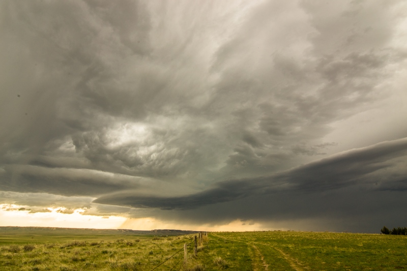
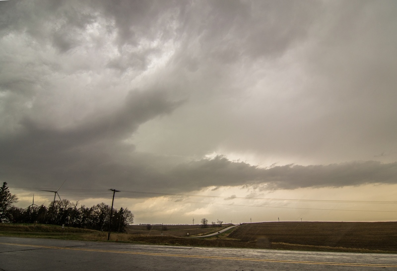
Storm starting to get organized with a lowering already forming near Northwood, North Dakota.

Supercell forming with wall cloud and inflow tail right to left into the base near Northwood, North Dakota.
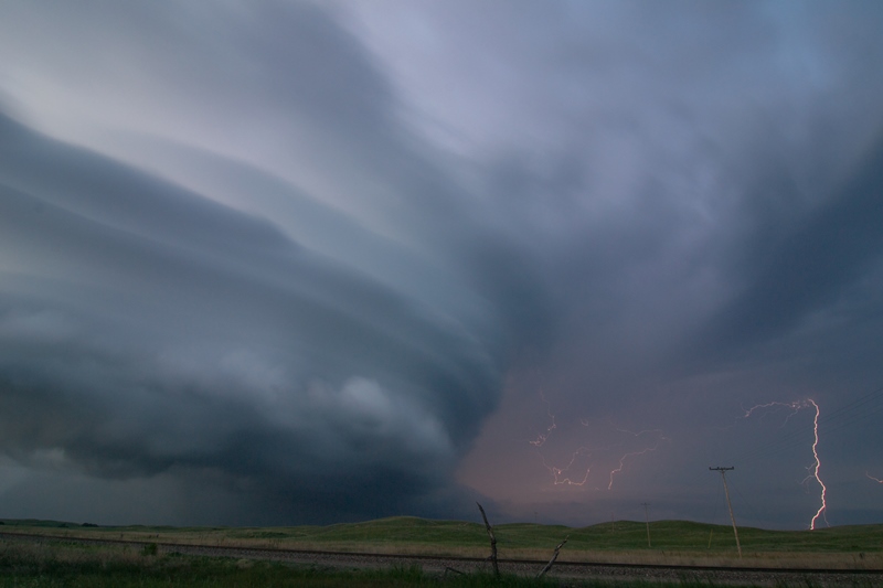
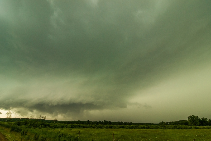
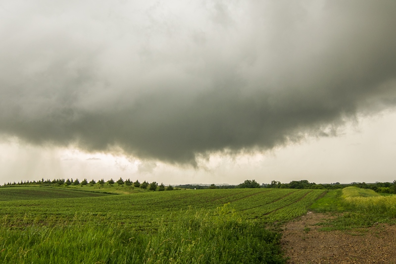
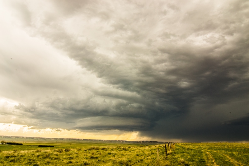
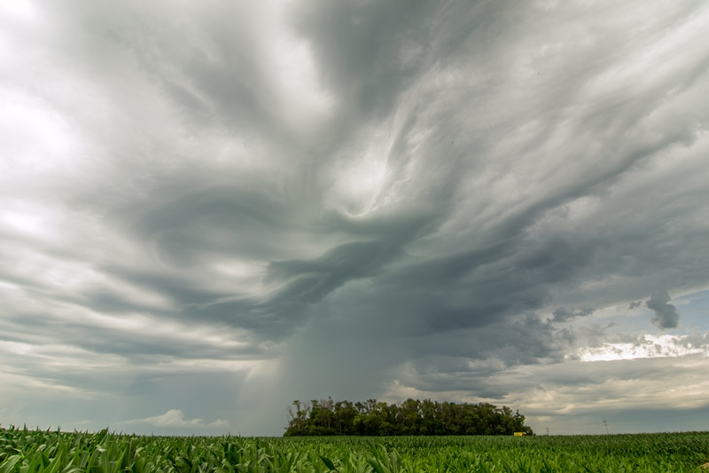
Wall cloud tightening up with structure taking mothership appearance north of Hatton, North Dakota.

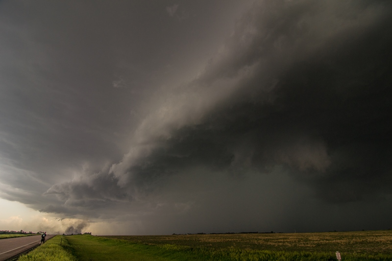
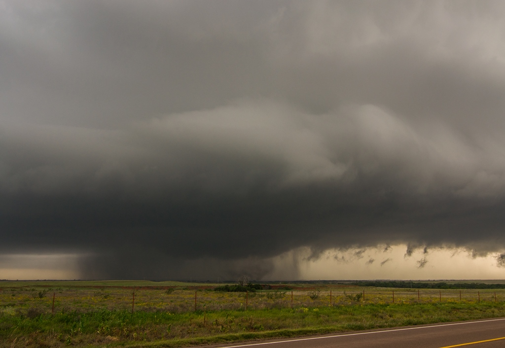
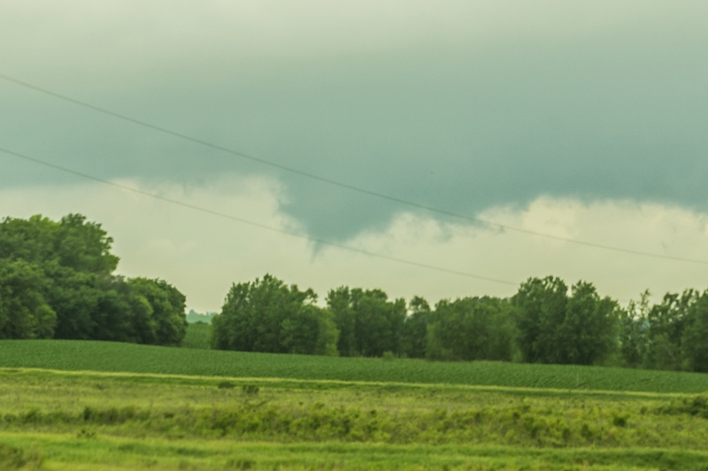
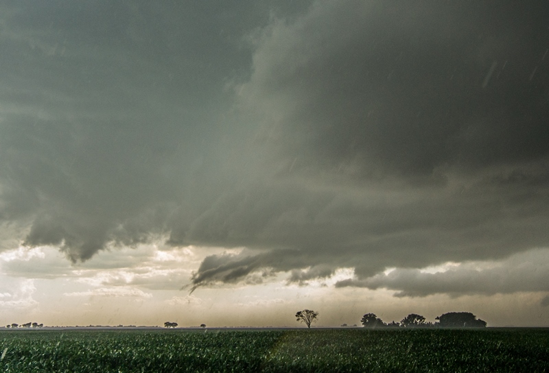
Beautiful supercell with tornado in progress on the right side of the core and terrific structure west of Buxton, North Dakota.

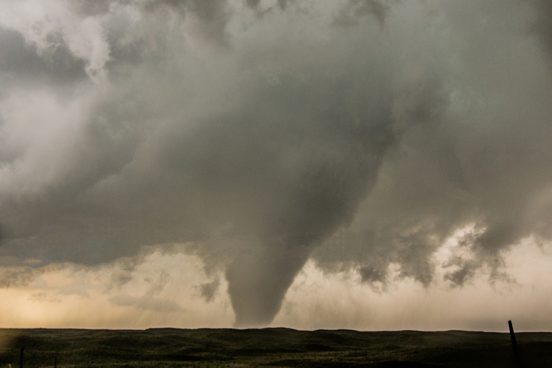
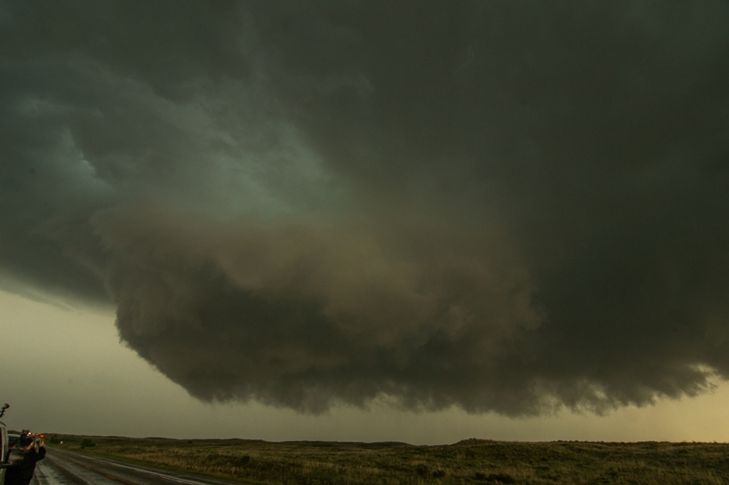
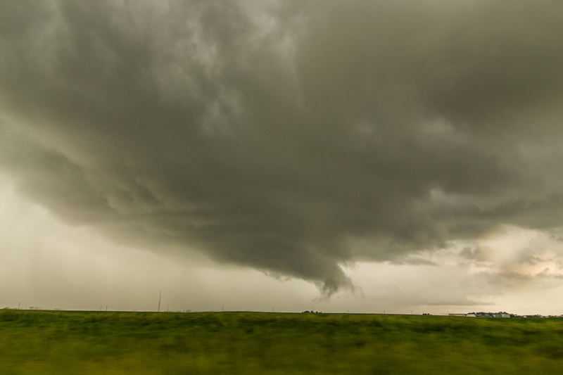
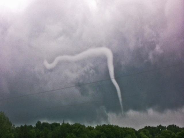
Multiple vortex tornado tucked away in there! Roughly 1.5 miles west of my location between Hatton and Buxton, North Dakota.

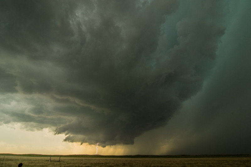
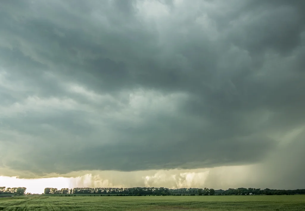
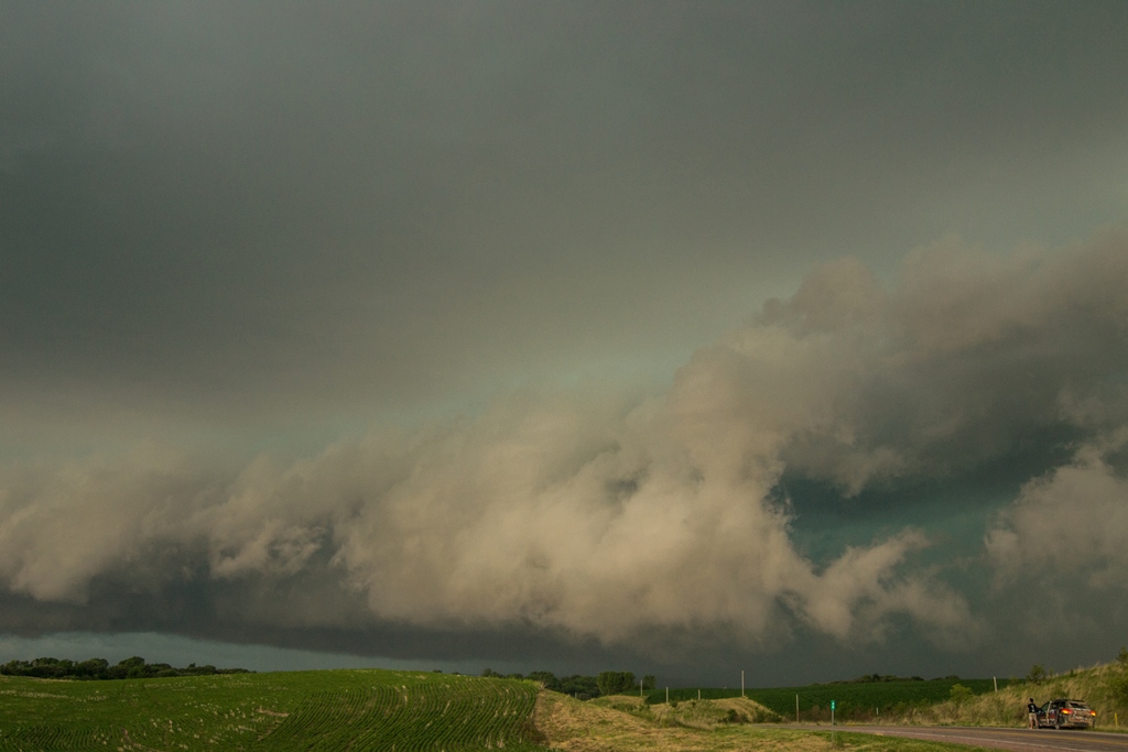
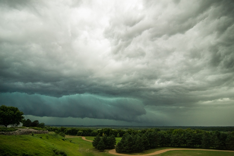
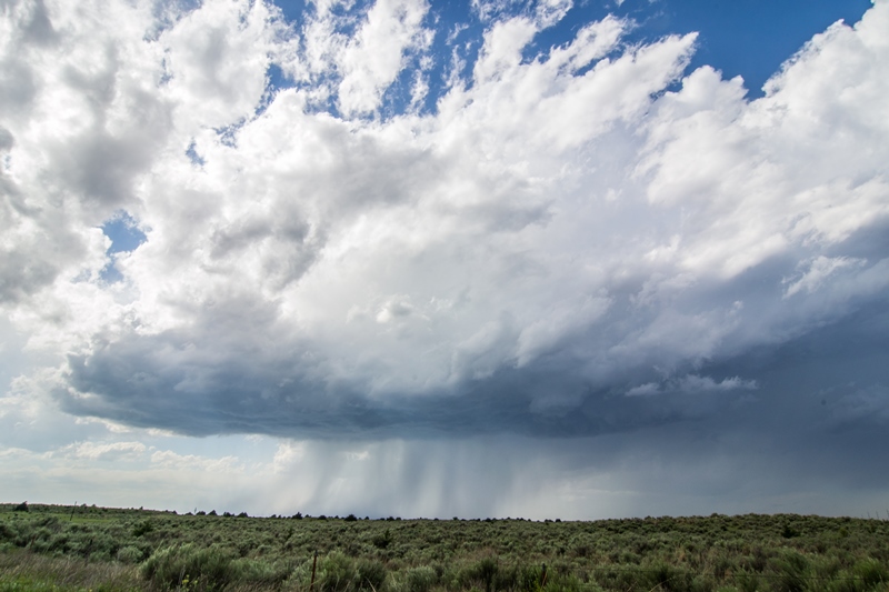
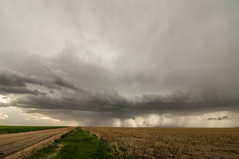
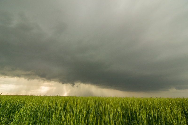
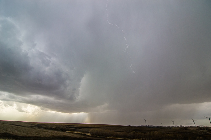
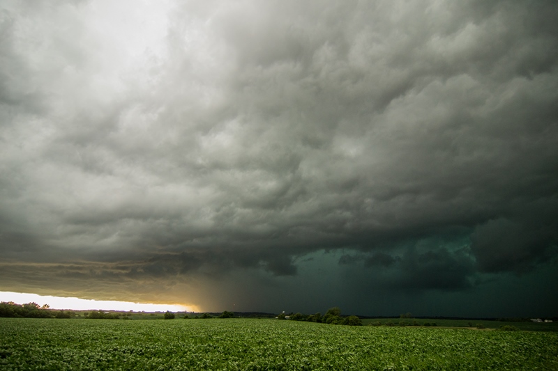
Intense core approaching me from this mothership supercell. Inflow tail present as moisture is being focused and drawn into the storm.

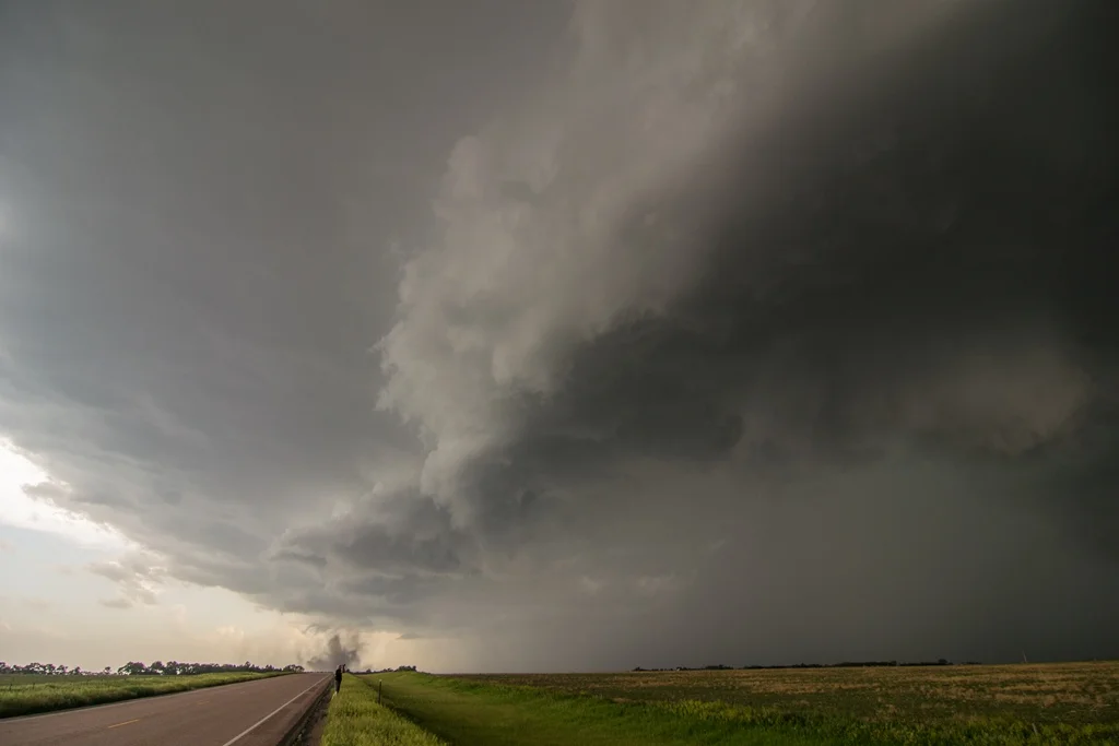
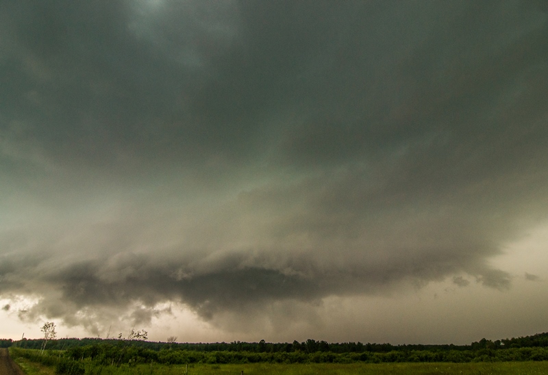
Another shot of the intense supercell approaching me near Buxton, North Dakota. Tornado is occurring at this time but cannot see it due to being shielded by the rain and hail core.

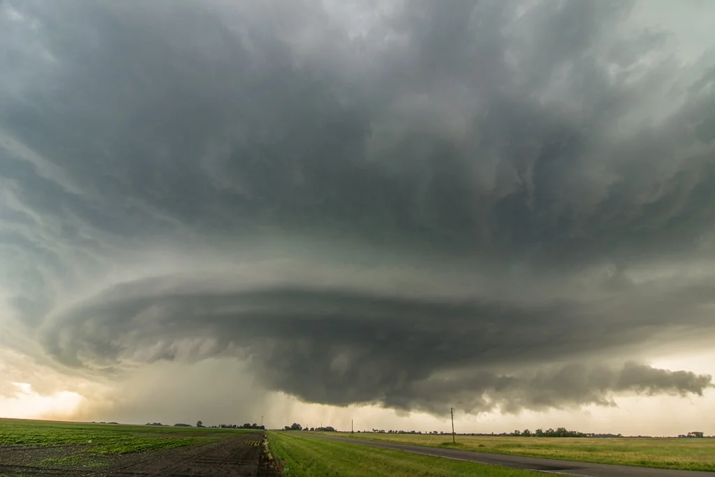
Textbook supercell here with big wall cloud on the right side of the core underneath the updraft vault.

All you can say is WOW!

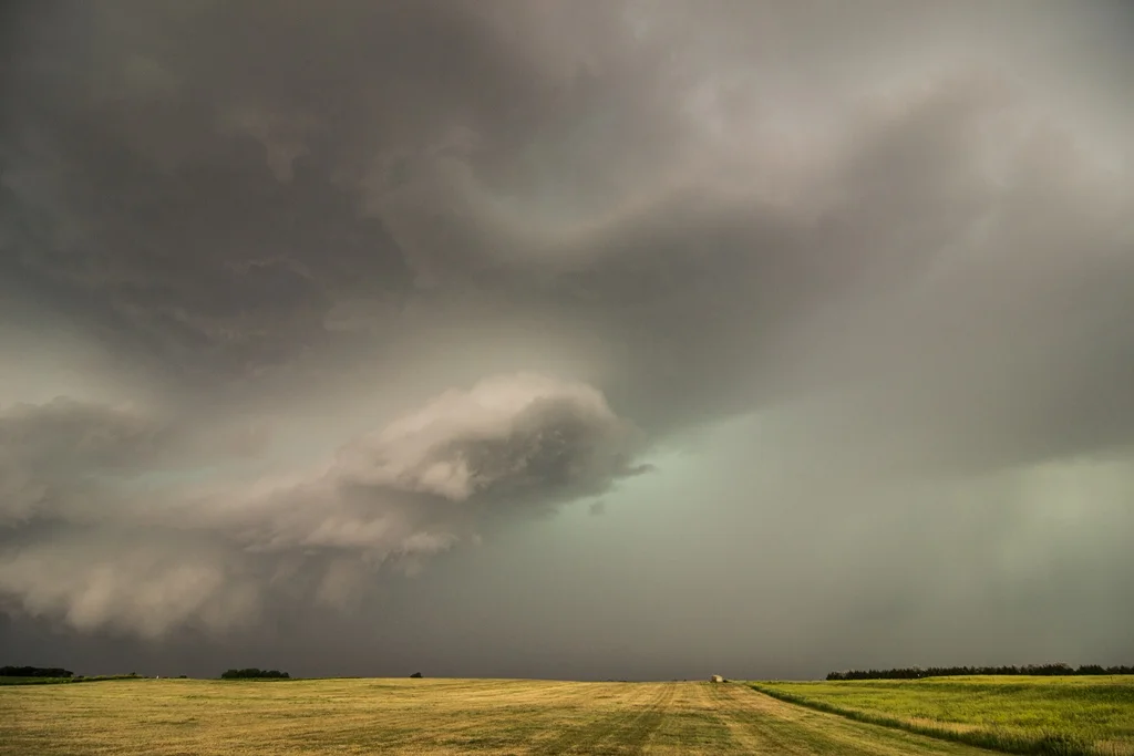
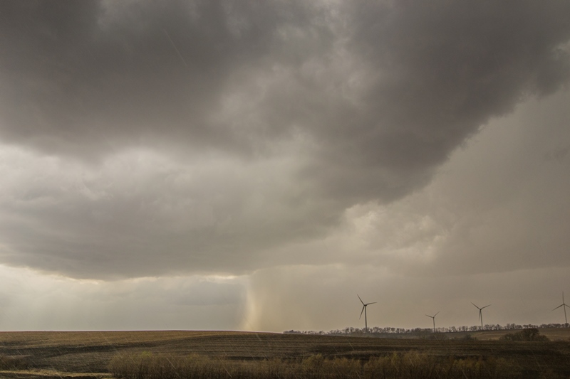
Multiple inflow bands as rich moisture in the low and mid levels is being drawn into this storm near Shelly, Minnesota.

Looks like the mothership is coming in for a landing!

Awesome storm near Shelly, Minnesota as I got 5 miles out ahead to get a better shot of the structure.

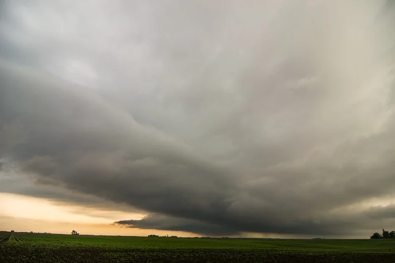
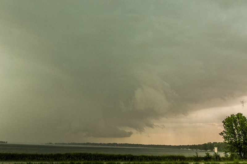
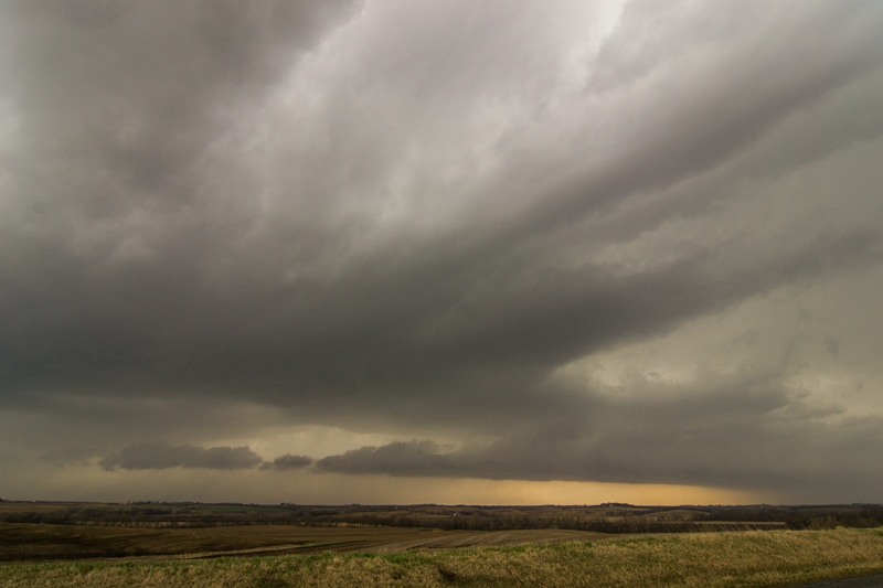
Intense mothership supercell after producing a tornado near Buxton, North Dakota. This was as the storm was nearing the river crossing into Minnesota near Shelly.

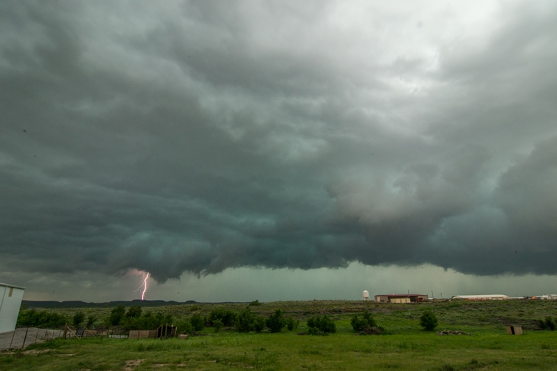
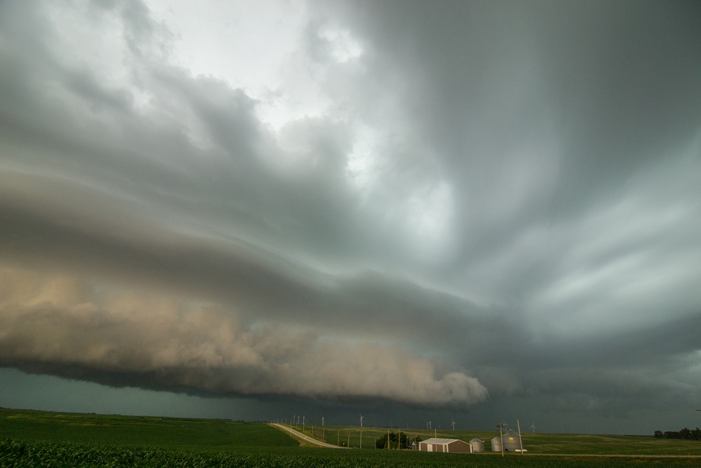
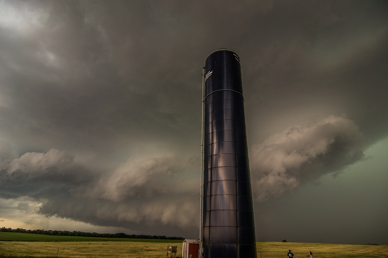
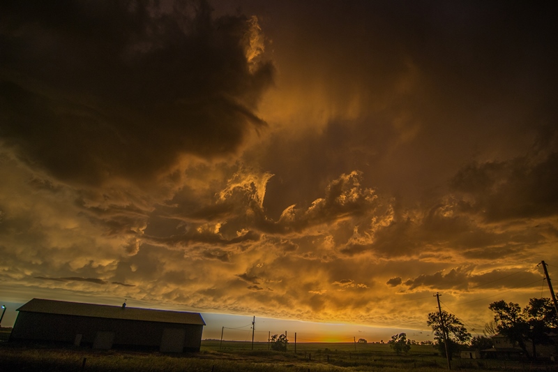
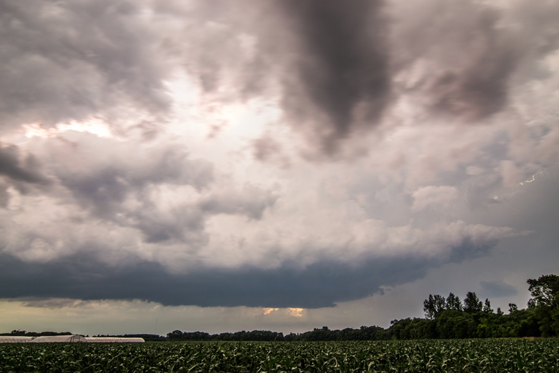
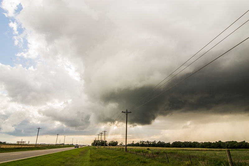
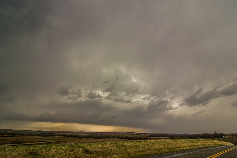
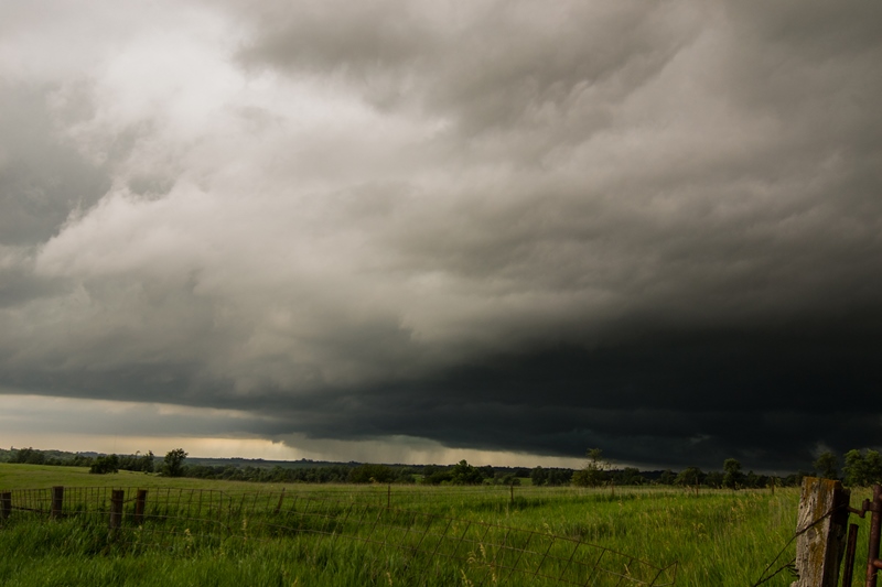
A mean looking storm, still tornado warned near Ada, Minnesota.

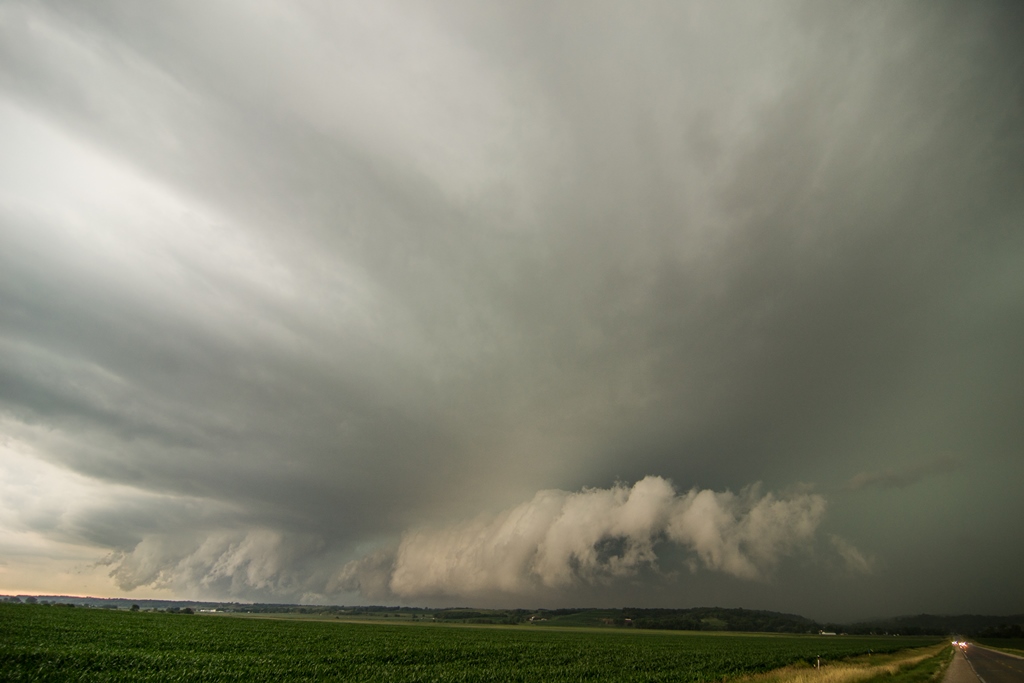
Storm starting to become more outflow dominant with wicked shelf cloud near Ada, Minnesota at the end of the chase. Chased this storm for 5 hours!
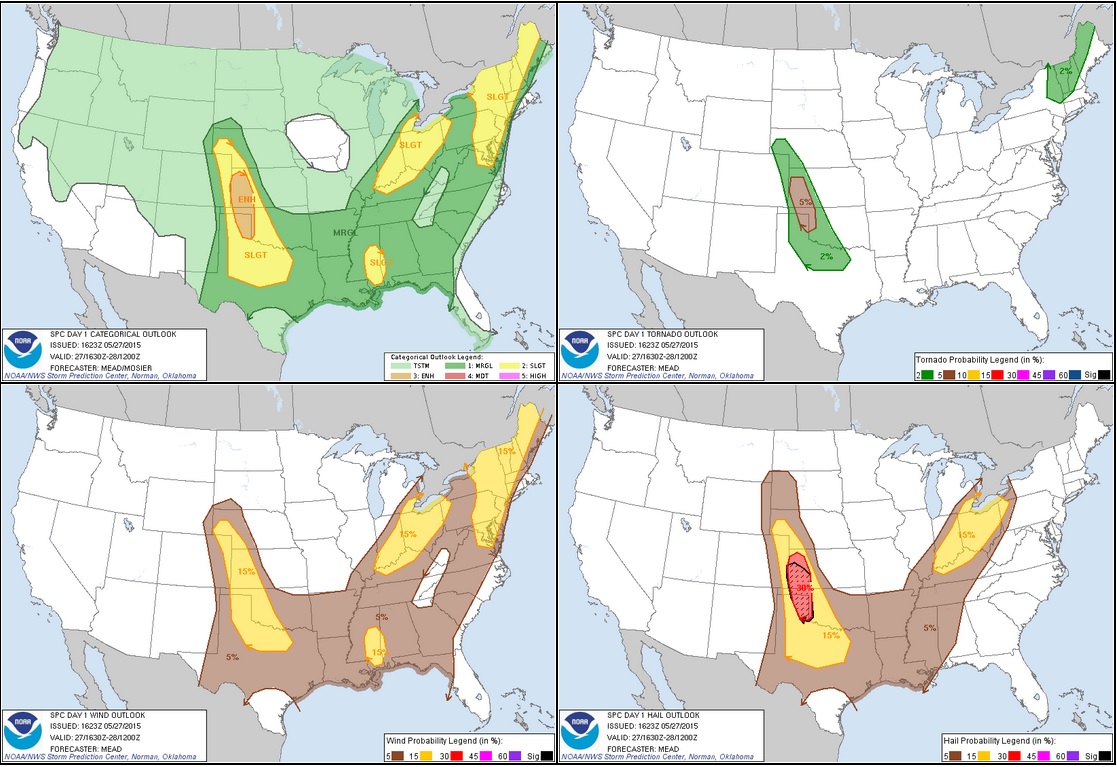
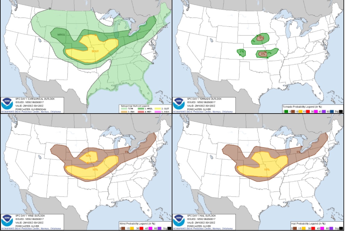
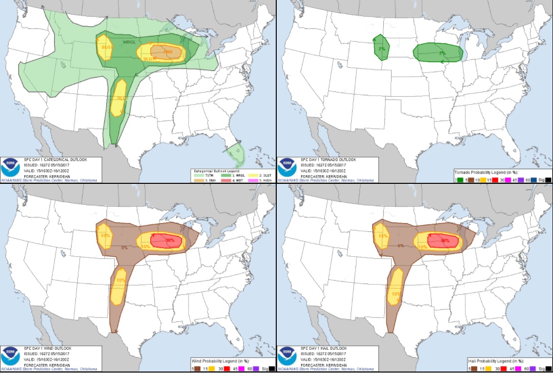
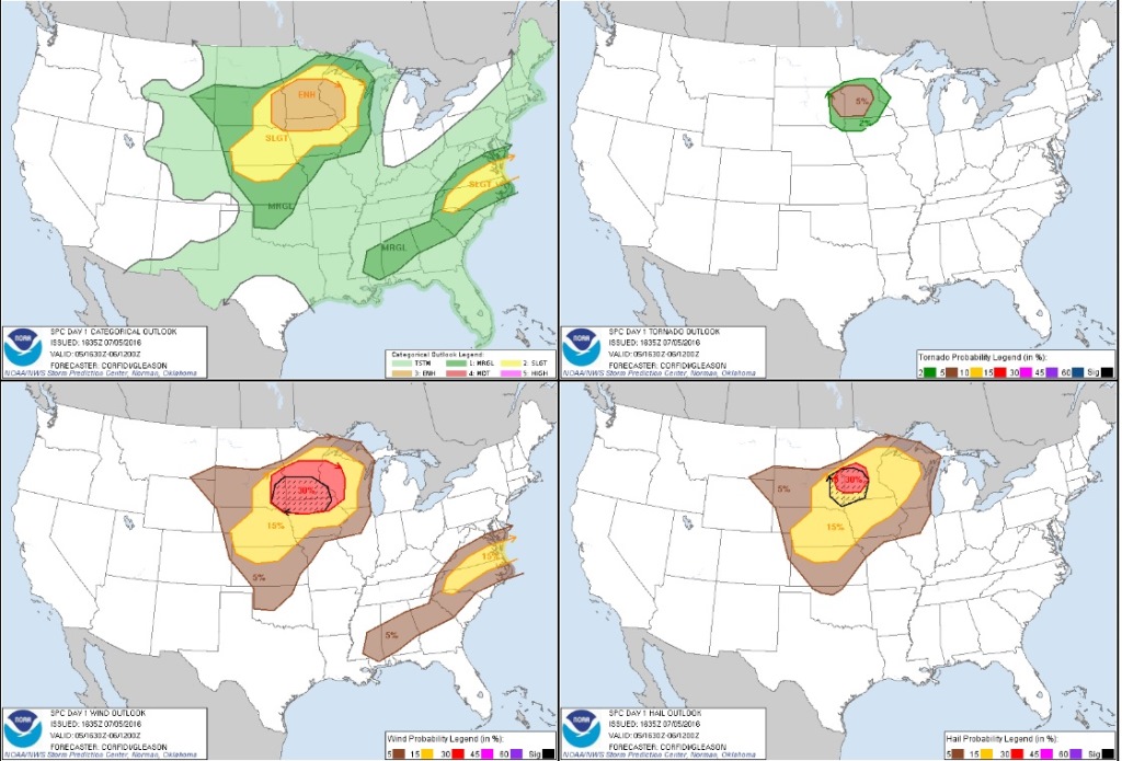
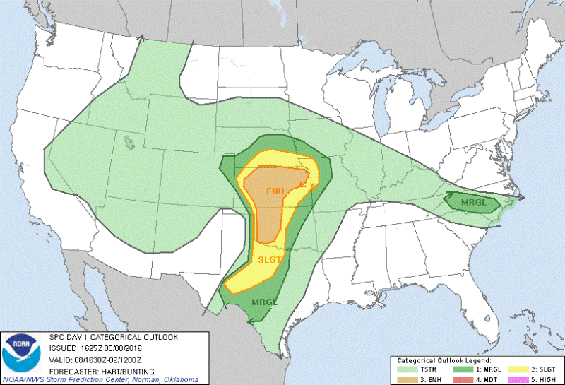
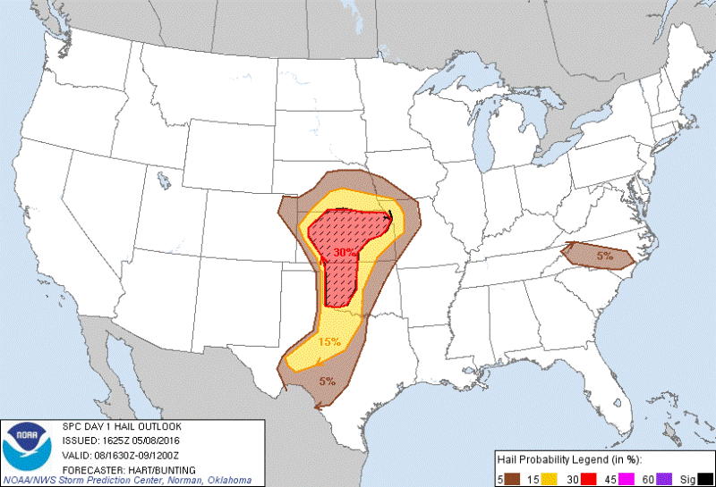
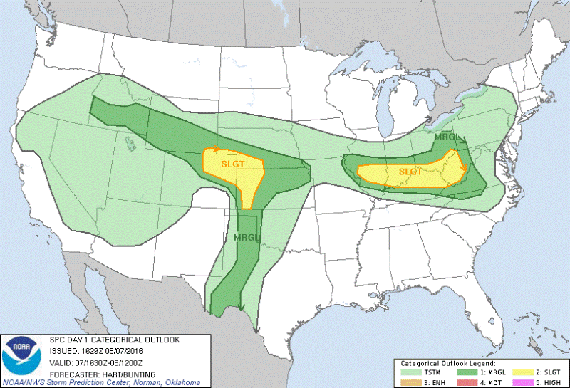
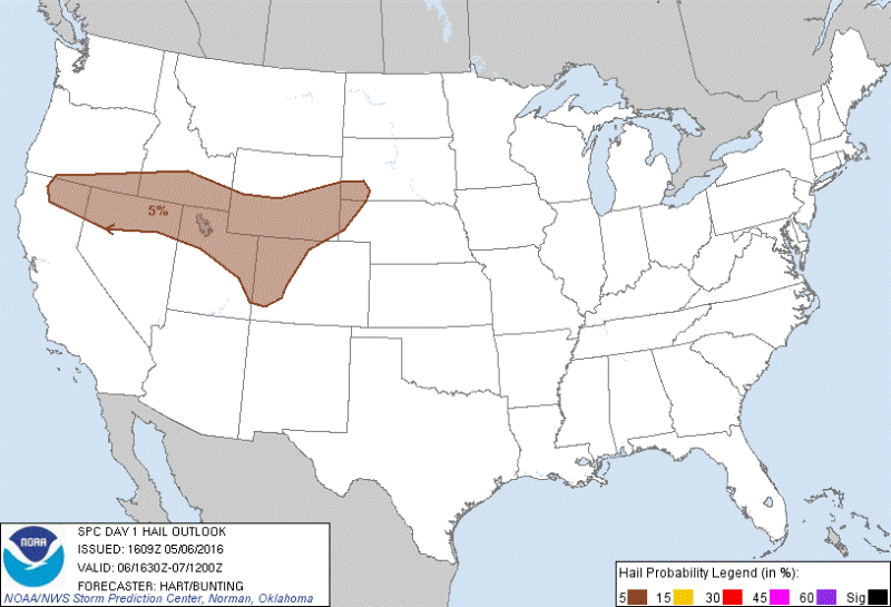
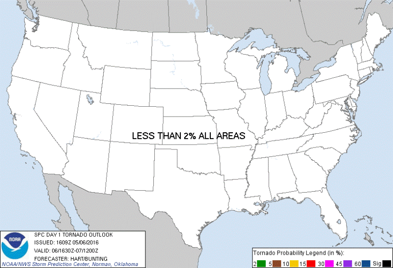
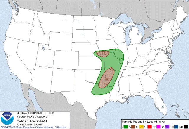
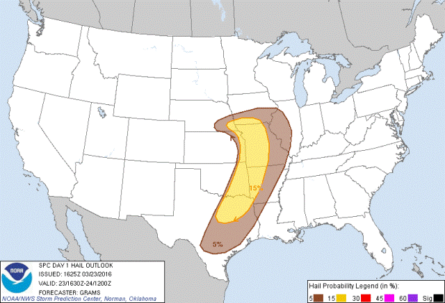
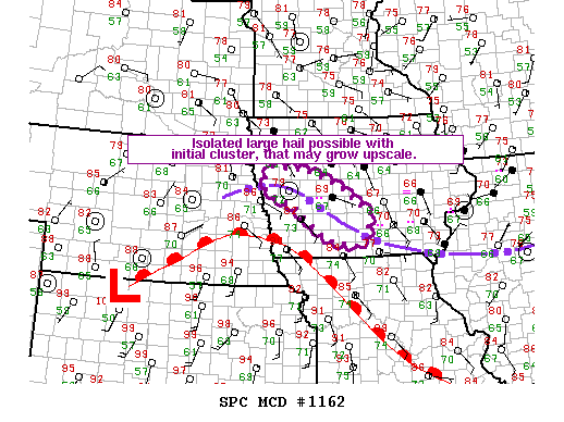
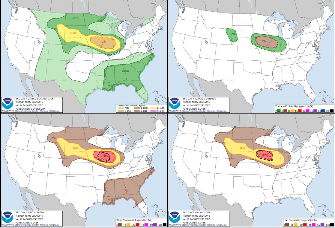
STORM PREDICTION CENTER OUTLOOKS

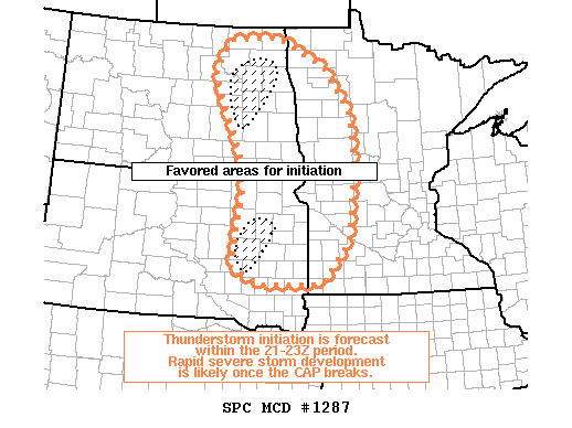
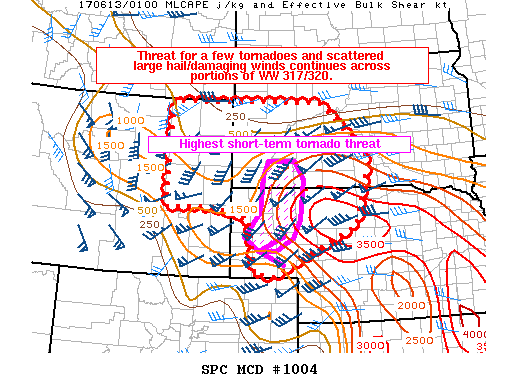
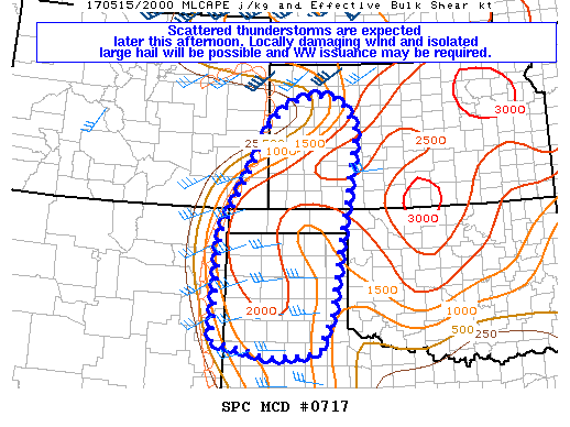
Mesoscale Discussion issued at 3:48 PM showing favored areas for initiation of thunderstorms between 21-23Z (4-6 PM).

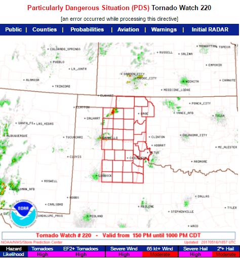
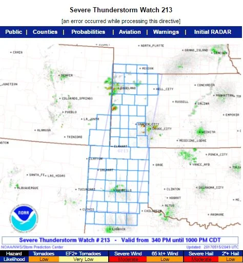
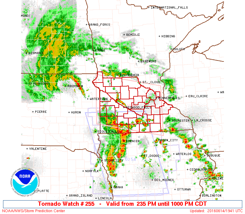
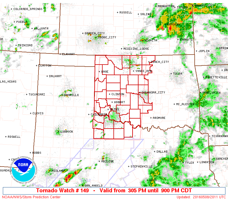
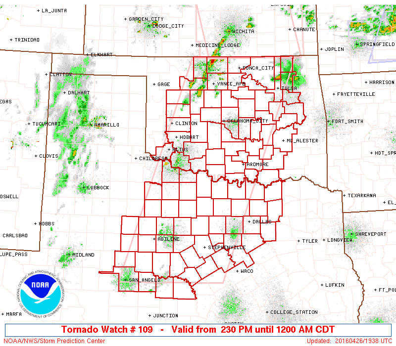
Tornado watch issued at 4:40 PM for eastern North Dakota and northwest Minnesota. Valid until 11:00 PM.

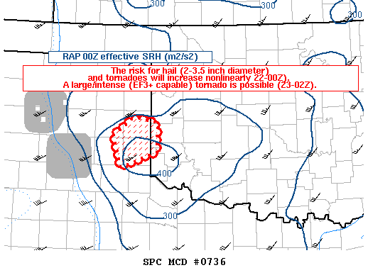
New mesoscale discussion issued at 7:09 PM showing the area of greatest tornado risk along the warm front and old stationary boundary near Grand Forks and areas south to Fargo, North Dakota, right where the supercell I was one was tracking and producing tornadoes.

Severe thunderstorm watch issued at 10:00 PM for all of central Minnesota as the thunderstorms formed an intense cluster moving southeast and producing damaging winds.

Mesoscale discussion issued at 1:49 AM as the thunderstorms continued to progress southeast and produce damaging winds, eventually reaching my house near the Twin Cities and moving east.


![FullSizeRender[1]](http://static1.squarespace.com/static/58e402b415d5db35557895e3/58e405e0c4d04b6fcb78d264/58e40612c4d04b6fcb78da9d/1491338770836/FullSizeRender1.jpg?format=original)