
JUNE 20TH IOWA: HIGH-PRECIPITATION SUPERCELL & INCREDIBLE MAMMATUS


Awesome mammatus display east of Garwin, IA, looking south off Hwy 229.


The mammatus got even better a short while later near Traer, IA.Incredible mammatus field over Iowa farmland at sunset near Buckingham, Iowa!
![FullSizeRender[1]](http://static1.squarespace.com/static/58e402b415d5db35557895e3/58e405e0c4d04b6fcb78d264/58e40612c4d04b6fcb78da9d/1491338770836/FullSizeRender1.jpg?format=original)
Panoramic cell phone shot of the entire mammatus field laid out in front of us.
MESOSCALE DISCUSSION:

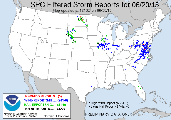
STORM REPORTS:
STORM PREDICTION CENTER OUTLOOKS:

JUNE 20th, 2015 CHASE LOG: IOWA
This was one of those chases that had a lot of potential, but didn’t quite live up to the hype. For a few days in advance, myself and others were chatting that this could be a solid tornado day. We stayed at MaryLynn’s parent’s house the night before and then left early Saturday morning to Deer Creek Speedway where my parents were going to watch Gage. Wes and Debby Hyduke met us at Deer Creek close to 10am and we quickly departed for west-central Iowa down Hwy 63 towards Waterloo.
Storm Setup: Morning convection cleared the area very fast, allowing for destabilization to occur with 3,000-4,000 j/kg of MLCAPE. A surface low developed near Des Moines, while a stationary front was positioned to the northeast and a cold front moved across south-central Iowa. Even though some of the low level shear was veered and led to lower 0-1km storm relative helicities, the 0-3km SRH values were near 250 m2/s2. This was still quite supportive for rotating supercells and tornadoes.
A mesoscale discussion was issued at 3:10pm, while a Tornado Watch followed at 3:50pm for southeast Iowa, northern Missouri, and western Illinois. We progressed south on Hwy 63 to the southern side of Waterloo to fill up for gas and grab food, then repositioned further south towards Tama. The thinking was that we were right at the crossroads of a good road network and directly ahead of the surface low/triple point and south of the stationary front. Storm initiation occurred shortly before 4pm directly to our west-northwest. We waited for this storm to approach us as it was still in the developing stages, but did head about 5 miles to the west to check things out as it got closer. The base of the storm was not very well defined and appeared rather ragged, but was low to the ground. The storm was starting to produce a lot of lightning as it moved near and appeared to be strengthening. At the same time, another storm had formed to the south and looked to be right on the triple point or just to the southeast. This was the storm we wanted to be on as it quickly became severe warned shortly after initiation.
We traveled down to I-80 and west to exit 179, south on Hwy T38, and west on Hwy 102 to Pella where we intercepted the storm. From here, we followed the severe storm that was producing big hail southeast on Hwy 163, barely escaping the hail core on the east side of Pella. We got back on Hwy 63 and were able to get out ahead enough to stop a few times as we approached Eddyville. Through the duration, the storm had some interesting lowerings and attempted a few times to produce wall clouds with decent inflow banding going on. We exited at Eddyville and got just east of town on Hwy G77. This is when the storm started to tighten up the wall cloud and the closest that it came to producing a tornado. There were indications here that it produced a funnel cloud and this was reported by other chasers, but too hard to discern from our location. After this intense moment, we had to drive through the forward flank core to get to our south option and back towards Hwy 63. This is where we encountered some very intense rain and some smaller hail with roughly 40 mph winds. Wes had a good time driving out of that! Thereafter, the storm started to gust out upon reaching Ottumwa, taking on linear characteristics, and had a nice shelf cloud before we decided to call off the chase.
On the way back home, we encountered some of the most amazing mammatus that I’ve ever seen and were able to stop a few times to take photos. The colors and visibility of the mammatus field were incredible at sunset and definitely the highlight of the whole chase!