SEPTEMBER 17, 2022 MINNESOTA: LAST CHASE DAY OF THE YEAR


The storm we were targeting in our forecast the entire time. Great to get on the storm as it was developing near Nimrod, Minnesota. Had a decent lowering underneath the updraft for a while.

A funnel look-alike here as scud was being pulled up into the base. Could have easily been mistaken for a funnel.

The storm took on some decent structure for a while! Was cool to see those inflow bands being pulled in left to right and around the updraft base.

The structure starting to degrade a little bit but overall not bad. Still maintaining although the storm itself was not overly impressive.

Caught some lightning after sunset while watching the storm near Poplar, Minnesota.

STORM REPORTS:

STORM PREDICTION CENTER OUTLOOKS:

JULY 31, 2022 MINNESOTA: FUNNEL CLOUD AT SUNSET


Wall cloud just to my west, golden in color due to the setting sun. Funnel cloud starting to form on the left side of the wall cloud.

Funnel cloud fully developed and rotating. Can notice somewhat of a clear slot just left of the funnel through the clouds.

Funnel cloud 3/4 of the way to the ground just outside of town near Conger, Minnesota. Clear slot quite evident here now. Wall cloud hanging on but can tell that it’s starting to erode.

Funnel cloud so close to touching down! I could not confirm but there was other chaser video evidence that it did touch down with debris being thrown. Made the official storm reports that you can see below.

Heading home and got off at the Glenville, Minnesota I-90 exit to take a few shots of the storms to the east.

STORM REPORTS:

STORM PREDICTION CENTER OUTLOOKS:

JUNE 12, 2022 COLORADO AND KANSAS: SUB PAR STORM BUT NICE LIGHTNING SHOW


Intercepted an initial storm in northeast Colorado near Yuma. Nothing special but the wide open landscape was beautiful. Nice to be out here viewing storms in the wide open high plains.

Another shot of the storm. Wasn’t doing too much and was struggling so I decided to leave it shortly after this shot and head to Wichita, Kansas for the night. Had to work in Wichita the next week.

Heading to Wichita, a cluster of storms developed on my drive near Grinnell, Kansas and gave me a terrific lightning show!

STORM REPORTS:

STORM PREDICTION CENTER OUTLOOKS:

JUNE 11, 2022 NEBRASKA: SOME OF THE BEST STRUCTURE OF THE YEAR


Stopped heading south on highway 75 south of Auburn, Nebraska to take a look back at the developing supercell. Decided to turn around and head northwest towards this storm after seeing this view and the explosive updraft as noted on the left side! The scud rising up and condensing into the base underneath the updraft really caught my eye.

Beautiful supercell approaching me near Cook, Nebraska. Although the wall cloud was very low on the right side, I decided to wait here and take a time lapse as the tornado potential was not all that high in this environment and the storm was not tornado warned.

Here it comes! Heading directly for my position.

Just awesome structure here. There’s a couple of inflow tails and a nice wall cloud still in place.

Favorite shot of the day. WHAT A STORM!!!

Storm really starting to gust out and become outflow dominant now, but still holding onto some great structure.

Storm about to overtake me here. Ended up bailing shortly after taking this photo.

Got south ahead of the storm as it was tornado warned, and stopped to take a shot of the wall cloud holding on near Tecumseh, Nebraska.

Tornado warned storm here. Thought this was a lowering on the bottom left, possible funnel was going to touch down but it quickly dissipated.

Shelf cloud on the northern end of the hook of the storm.

Beautiful scene at sunset as I ended the case and headed to the hotel.

STORM REPORTS:

STORM PREDICTION CENTER OUTLOOKS:

MAY 24, 2022 TEXAS: TERRIFIC STRUCTURE NEAR SAN ANGELO


Finally got in good position to get the initial view of this supercell near San Angelo, Texas.

Shot of this storm as it got closer to our location as we stayed put.

Repositioned for another quick shot between the trees of the supercell near San Angelo.

Really nice shelf cloud near Brady, Texas as the storm became outflow dominant and we raced back south to get out of the way.

STORM REPORTS:

STORM PREDICTION CENTER OUTLOOKS:

MAY 23, 2022 TEXAS: THE MORTON EF-2 TORNADO


Supercell storms starting to fire near Dora, New Mexico. Could tell right away these storms were going to be significant.

Heavy rain and hail core on the storm as it intensifies as we crossed the border back into west Texas.

Storm taking on some great structure near Morton, Texas. Intense inflow winds at 50 mph pulling in a ton of west Texas red dirt into the updraft! We saw power poles being blown over INTO the storm.

Another shot of the structure as the storm approached us. Dirt completely obscuring the base.

Wall cloud very low to the ground and twisting away as the tornado was about to drop.

Farmer casually working the field as the wall cloud approached. Very dangerous at this point and was surprised he continued to work as a tornado was imminent.

Incredible large tornado near Morton, Texas! Tornado was rated EF-2 and would have likely been stronger if it would have hit anything other than open fields.

Absolutely awesome structure with the mile wide tornado underneath.

Love this shot of the tornado and the lightning!

Obligatory tornado selfie.

After the tornado, the storm continued to exhibit great structure near Whiteface, Texas.

Likely another tornado in there on the storm between Whiteface and Levelland, Texas.

Can pick out here what would be the likely left and right side of another wedge tornado.

Incredible mothership structure as the storm was moving over Levelland, Texas!

Really enjoyed the nighttime lightning and structure as we gazed on near Levelland, Texas.

STORM REPORTS:

STORM PREDICTION CENTER OUTLOOKS:

MAY 19, 2022 MINNESOTA AND IOWA: UNDERACHIEVING BUT A COUPLE NICE SUPERCELLS


First severe storm finally developing late in the day near Alden, Minnesota on I-90.

Base of the next storm near Dexter, Minnesota. Some okay structure but not great.

Another shot of the storm near Dexter. Can see the hail streaks falling in the core straight ahead.

The vans parked and guests enjoying the storm near Dexter, Minnesota.

The storm gusting out and overtaking us and the wind farm.

Really nice updraft and base of the third storm, backlit by the sun getting low in the sky near St Ansgar, Iowa.

Beautiful storm with a rainbow cutting through the hail shaft near St Ansgar.

Really cool explosive updraft!

STORM REPORTS:

STORM PREDICTION CENTER OUTLOOKS:

MAY 18, 2022 COLORADO: HIGH BASED SUPERCELL


Decent structure with this high based storm near Kit Karson, Colorado.

Weak shelf cloud forming on the storm due to being outflow dominant. Heavy rain and hail core to the right.

Looking to the north at the northeast side of the storm and core.

Caught a decent bolt with my iPhone as we stopped at a gas station in Eads, Colorado. The storm overtook us here with some hail and strong winds.

STORM REPORTS:

STORM PREDICTION CENTER OUTLOOKS:

MAY 15, 2022 OKLAHOMA: INCREDIBLE MAMMATUS DISPLAY, LIGHTNING, AND GREAT STRUCTURE


Severe warned thunderstorm with wall cloud approaching us in Okemah, Oklahoma.

Another wall cloud on the storm just to the northwest of us at the same location.

Storm starting to gust out a little more here, taking on more of a shelf cloud appearance although there is still a lowering tucked back in there on the northern end.

Wall cloud on the storm near Wetumka, Oklahoma as we continue south on highway 27 to stay ahead.

Severe thunderstorm starting to gust out a short while later after losing the wall cloud.

Fortunate to find a good vantage point on a hill to the south of Wetumka, Oklahoma to view the supercell and capture some CG lightning!

Caught this bolt on my iPhone as we watched the severe storm approach us near Horntown, Oklahoma.

Great structure with this supercell near Horntown, Oklahoma. Wall cloud forming on the right side of the base.

Just… WOW! Wall cloud tightening up here as and condensation occurring quickly on the right side.

Wall cloud still there as we repositioned to get back ahead of the storm.

Severe thunderstorm near Atwood, Oklahoma starting to become more outflow dominant and form shelf cloud.

Incredible mammatus display as we got back around the hail core of the storm on the north side in Holdenville, Oklahoma.

One of my favorite shots that I’ve ever taken! Lightning going through the mammatus and illuminating the clouds from above. Looks like something out of this world like an alien spaceship coming in from War of the Worlds or something.

Lightning coming out the back of the storm, this time underneath the mammatus.

STORM REPORTS:

STORM PREDICTION CENTER OUTLOOKS:

MAY 14, 2022 KANSAS: HIGH BASED SUPERCELL AND LIGHTNING


Driving north on highway 283 to intercept the storm near Fowler, Kansas. Was surprised to see a small lowering on the storm at this time. Can see this right under the base to the left.

Love chasing the wide open prairies of southwest Kansas! Wide open country spaces.

Rain and hail core of the severe warned storm passing to our north.

The storm took on the best structure of the day as it approached Englewood, Kansas. Large slowly rotating soda barrel updraft.

Looking right up the storm updraft in Englewood, Kansas. This storm had numerous CG lightning strikes cause fires to fields and grass northwest of town.

Mammatus clouds near Laverne, Oklahoma.

The red rock terrain and hills in the foreground of this storm really make the shot for me. Severe thunderstorm still cranking along near Laverne, Oklahoma.

Interesting lowering at the action area tucked away on the northeast side of the meso near the forward flank core. Impressive inflow tail feeding the storm on the right side of the image.

Catching the storm one last time and some bolts near Fort Supply, Oklahoma.

STORM REPORTS:

STORM PREDICTION CENTER OUTLOOKS:

MAY 13, 2022 OKLAHOMA: EXTREMELY PHOTOGENIC STORM


First storm of the day developing north of Wakita, Oklahoma. We stopped here to visit the great Twister Museum!

The Twister Museum! Lots of good stuff in here to see and so much history about the film. Need to play the pinball machine when you visit.

Concentrated inflow bands into the intensifying storm as we first got in position near Manchester, Oklahoma.

Rock hard updraft vault with this storm!

Absolutely stunning structure with this storm near Manchester, Oklahoma.

Cigar shaped roll cloud on the southern end of the forward flank core looking to our north-northwest. Had a really cool shape for a while.

Such a beauty of a storm! Skinny, twisting, near vertical updraft and terrific colors at sunset.

Vertical view of the entire updraft and circular base.

Rich Hamel in the foreground as we all admire the storm at sunset. Base taking on a mothership appearance at this point.

Second severe warned storm to our northeast really started cranking up the lightning! Actually had a decent lowering under this storm for a while.

Looking back south at our original storm that also started sparking away like crazy.

Stopped near Garber, Oklahoma as we were heading back to the hotel to get a view of the storm that continued to put on a lightning show to our northwest.

STORM REPORTS:

STORM PREDICTION CENTER OUTLOOKS:

MAY 9, 2022 MINNESOTA: TORNADO WARNED STORM


Wall cloud on tornado warned storm near Wyoming, Minnesota.

Scud rising into the base underneath what was the wall cloud as it approached south of Chisago City, Minnesota.

Wall cloud becoming better organized on the tornado warned storm as we progressed southeast of Chisago City looking west.

Another shot of the wall cloud from the previous image a very short time later with possible funnel cloud on the right side next to the core.

Our position on the storm as we progressed east on Hwy 8 near Shafer, Minnesota.

Wall cloud getting closer as we stayed ahead on the northeast side of the storm.

Wall cloud a bit more disorganized with scud roll cloud due to outflow from the core as we approached Taylors Falls, Minnesota to get across the St Croix River.

STORM REPORTS:

STORM PREDICTION CENTER OUTLOOKS:

APRIL 12, 2022 IOWA: CLOSE RANGE TORNADO CHASE NEAR GILMORE CITY


Severe warned storm to the south of Fonda, Iowa. Already getting that look to it with a broad, rotating wall cloud at this point.

Storm still looking good and intensifying as it approaches us.

Here it comes! Had to bail shortly after this photo was taken due to the proximity of the wall cloud moving overhead and hail starting to fall.

Mothership structure to this storm as it became tornado warned and soon dropped a tornado. Big blocky lowering in there on the left that was rotating hard.

TORNADO!! No condensation funnel making contact yet but the tornado is definitely down as it began churning up dirt over the field ahead of us. This is looking to the northwest near Palmer, Iowa.

Tornado starting to fully condensate to the ground. Nice and clear mesocyclone rotating above the tornado.

Tornado taking on the shape of a thick elephant trunk at this point.

After the initial touchdown in the previous photos, we drove up at it and got closer as the tornado planted once again and became stronger. Now between Palmer and Gilmore City.

Damage to a farmstead. Lots of tree and grain bin damage but appeared to be fairly minor damage to the house.

Grain bin destroyed with corn spilling out. Sheet metal from the grain bin was strewn downwind throughout the field for miles.

Tornado occluding and starting to weaken near Gilmore City, Iowa. This storm went on later to product another tornado that we could not get a view of.

Got back ahead of the tornado warned storm Kanawha, Iowa. Very dark at this point but could make out what appeared to be a base embedded in there.

The path of the tornado in yellow and the path we took with our vehicle in red, coming up at it from the south.

WATCHES AND MESOSCALE DISCUSSIONS:

   SUMMARY...Convective initiation is expected by around 21-23z. A
   tornado watch will likely be needed in the next hour or so. Severe
   thunderstorms capable of large hail, damaging gusts and a few
   tornadoes are possible.

   DISCUSSION...A surface low is located near the central NE/SD border
   as of 19z. A warm front was noted in surface analysis arcing from
   the low across northeast NE into southern IA. Meanwhile, the surface
   cold front was located across central NE and rapidly approaching the
   surface dryline just a few counties to the east. Increasing cumulus
   has been noted in visible satellite imagery along the dryline and
   across the warm sector to the east across northeast NE. The cumulus
   along the dryline has shown modest vertical development where
   capping is likely less than further east. As the warm front
   continues to lift northward and better quality boundary-layer
   moisture works northward in conjunction with strong large-scale
   ascent, convection is expected to develop near the triple point by
   21-23z. 

   Initial convection across southeast SD into southwest MN to near the
   NE/IA border may be elevated near/just to the cold side of the warm
   front, with a better-quality warm sector remaining quite narrow from
   near the MO River into northwest IA. Fast storm motion toward the
   northeast could result in these storms rapidly moving away from the
   better warm sector as they mature. Nevertheless, strong vertical
   shear, steepening midlevel lapse rates and sufficient instability
   should support organized supercells capable of large hail and
   perhaps strong gusts. Any storm that develops in the better warm
   sector or that can anchor to the warm front will access better
   low-level shear and see an increased risk for tornado development.
   Furthermore, any storm that develops further south along the cold
   front/dryline in NE may be higher-based, posing a threat for large
   hail and damaging gusts. If any dryline convection persists eastward
   into better moisture, these cells also could become surface-based
   within the better-quality warm sector with a corresponding increase
   in tornado potential. With time into the evening, more linear
   convective development is expected near/east of the MO River as the
   cold front surges east.
   SUMMARY...Supercell development will be possible in the next couple
   of hours, near and east of a surface cyclone along the
   Nebraska/South Dakota border.  The storm environment will continue
   to become more favorable for a few tornadoes (a couple of which
   could be strong) and very large hail, if storms can mature quickly
   enough in the relatively narrow, unstable warm sector near the warm
   front.  Damaging winds will also be possible, especially late this
   evening when storms could grow upscale into a squall line along the
   cold front approaching from the west.

   The tornado watch area is approximately along and 60 statute miles
   east and west of a line from 50 miles northeast of Yankton SD to 45
   miles south of Sioux City IA. For a complete depiction of the watch
   see the associated watch outline update (WOUS64 KWNS WOU1).
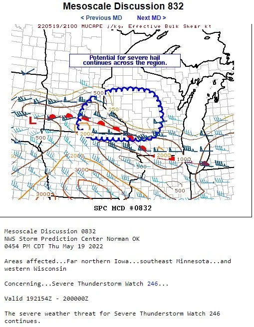
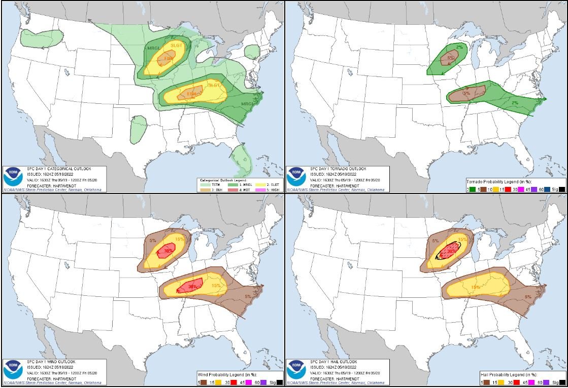
   SUMMARY...Sustained strong supercells appear increasingly likely
   through early evening.  Some probably will pose a risk for producing
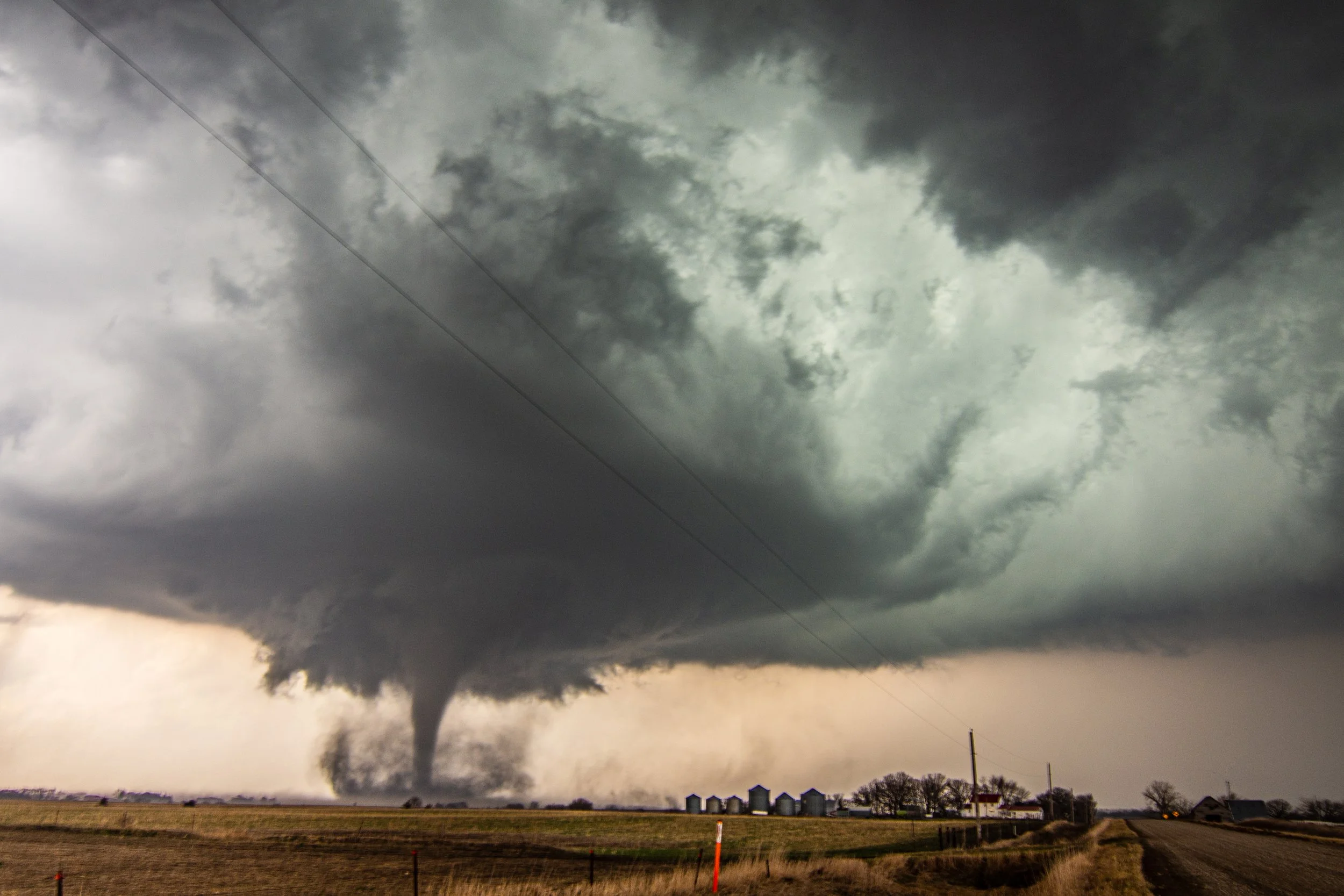
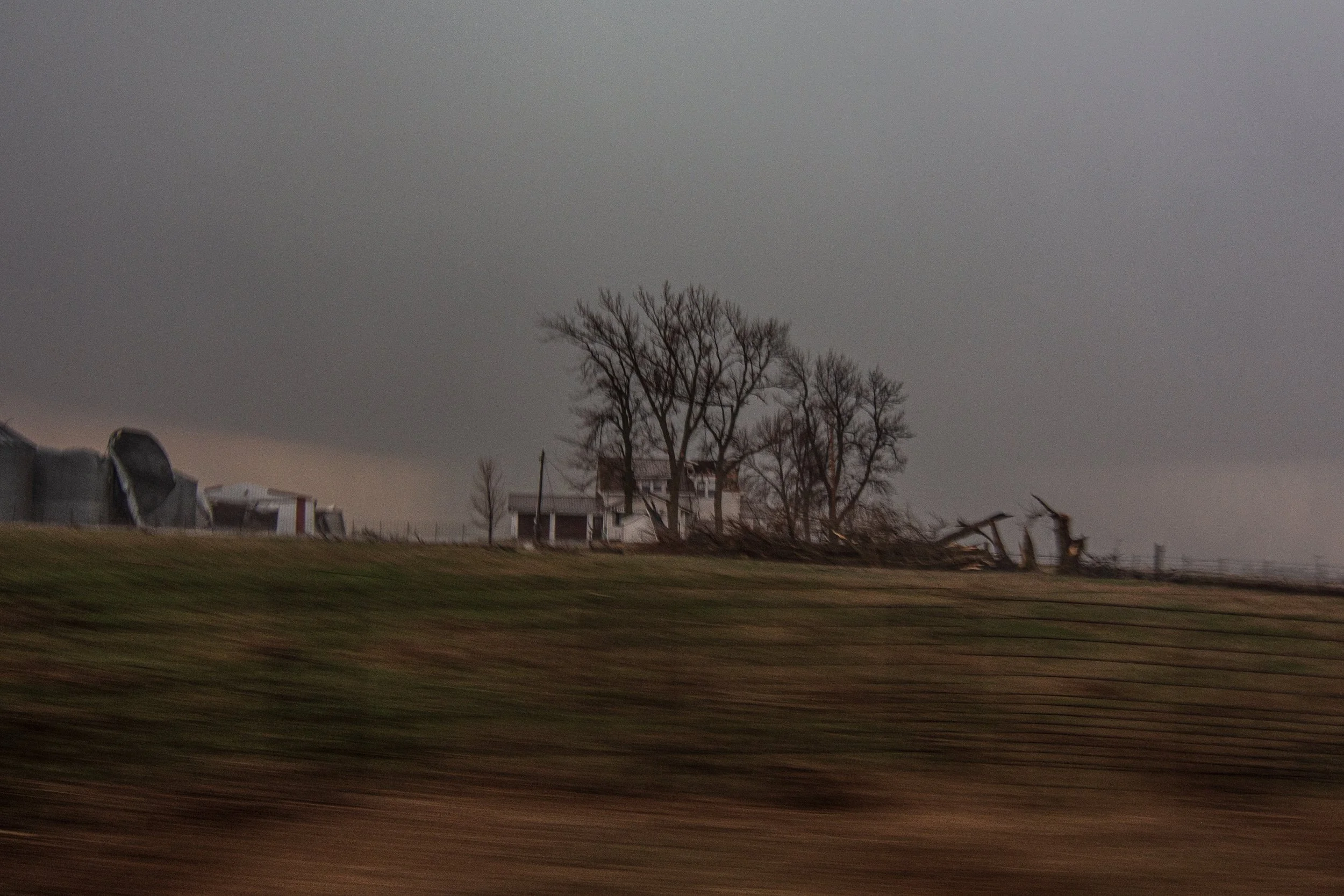
   tornadoes, particularly around the Storm Lake and Fort Dodge IA
   areas by 7-9 PM CDT, where a strong tornado or two is possible. 
   Additional, a severe thunderstorm watch will probably be issued soon
   to the north of the current watch, where severe hail may become an
   increasing concern this evening.

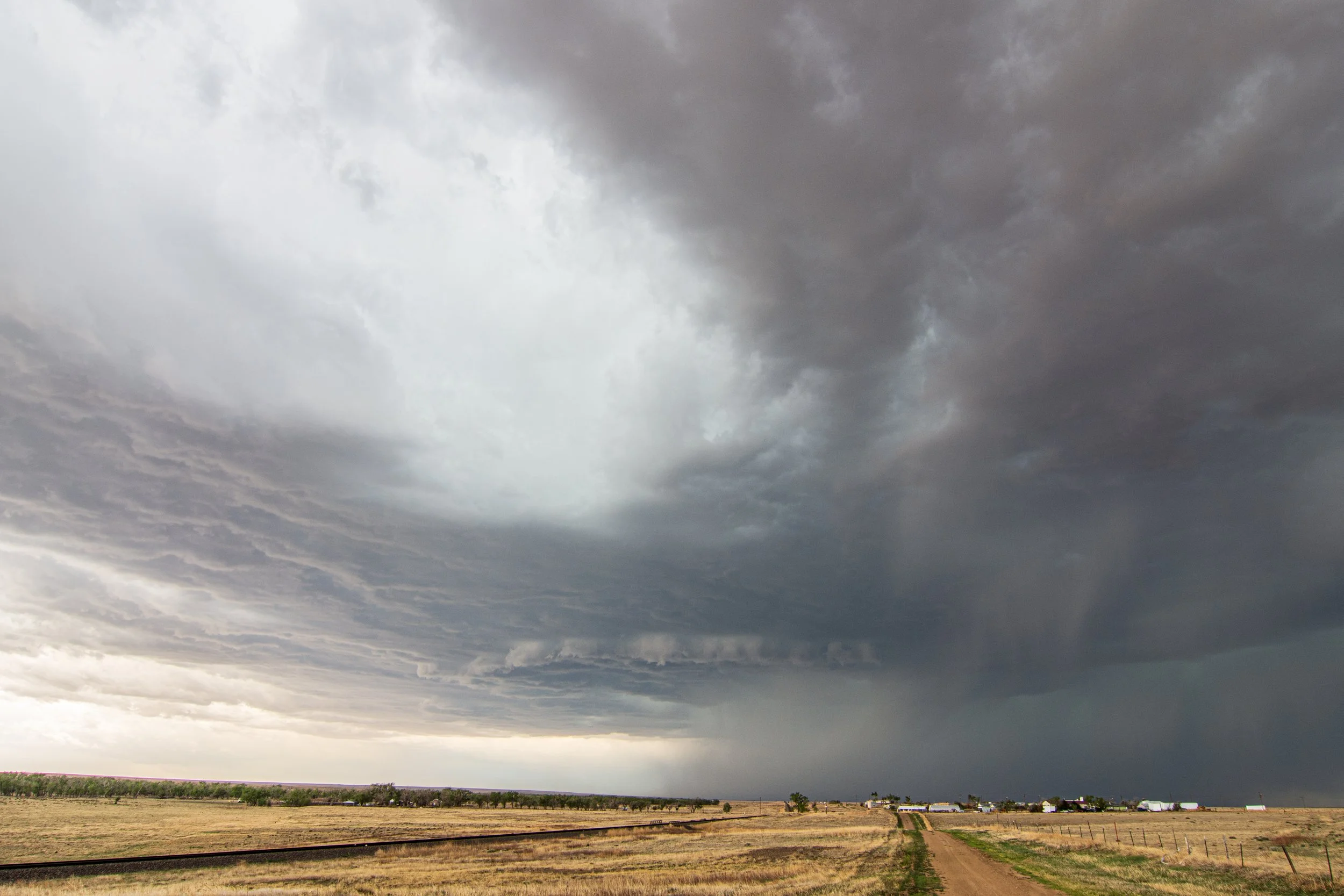
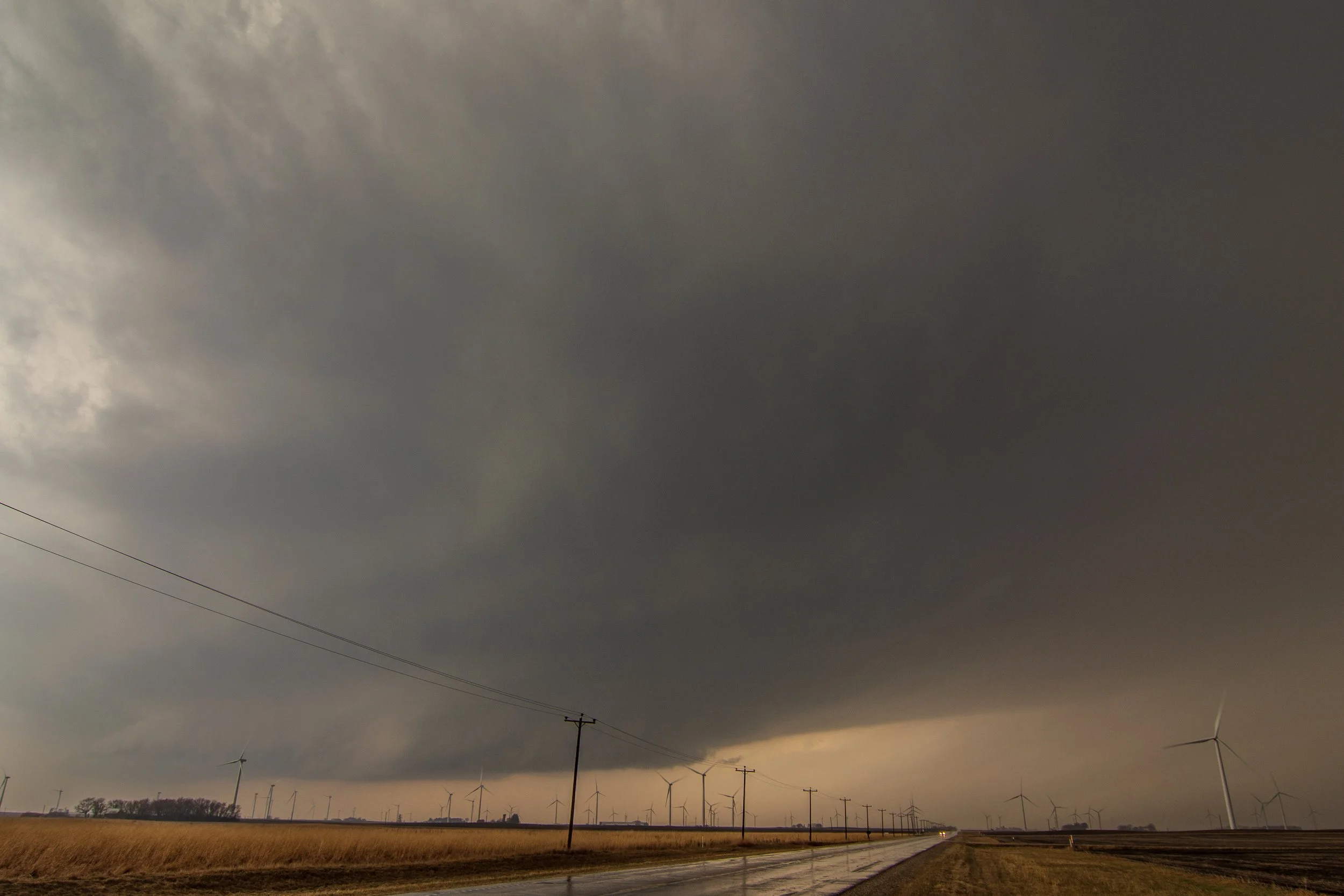
   DISCUSSION...Thunderstorms are now initiating along the warm frontal
   zone, north through east of a deep surface cyclone slowly migrating
   east-northeast of the Sioux City area.  This is being supported by
   lift driven by low-level warm advection, and perhaps a subtle
   mid-level perturbation forecast to migrate north-northeastward
   across the mid Missouri Valley around Sioux City through early
   evening.

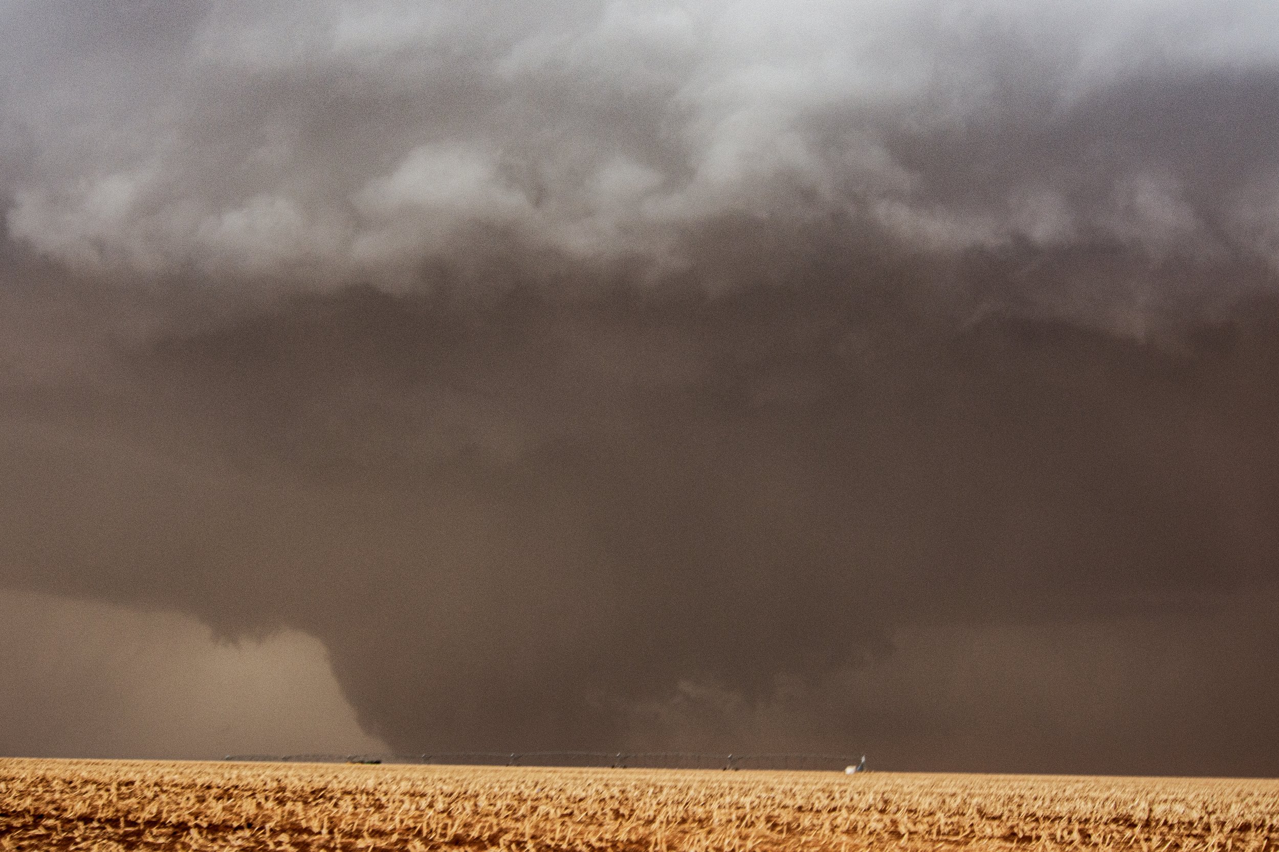
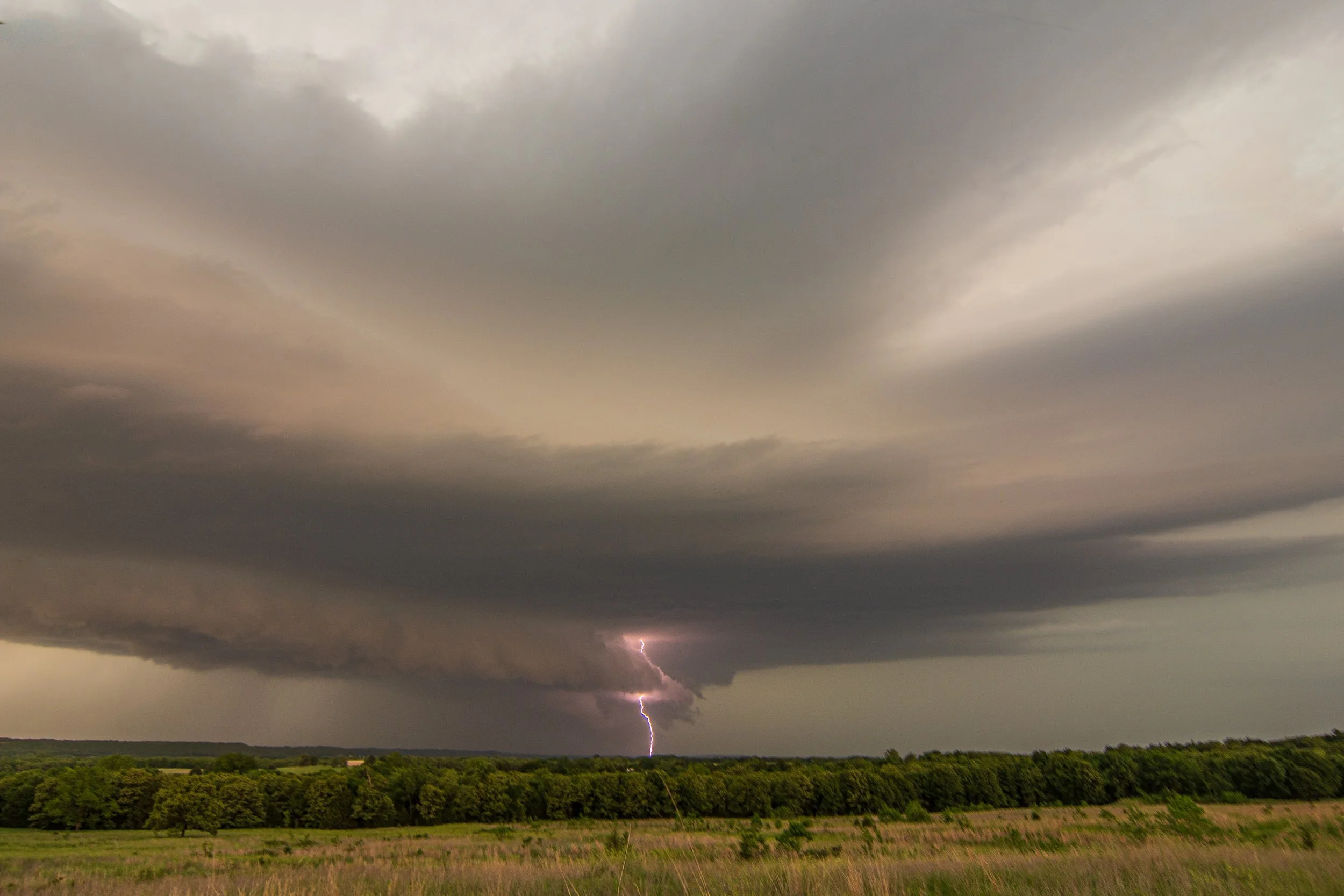
   The strongest thunderstorms probably will tend to evolve along the
   front to the east-southeast of the warm front/dryline intersection,
   now generally east of the Missouri River, where a narrow tongue of
   modest boundary-layer moistening wrapping toward the surface low
   center may be contributing to mixed-layer CAPE as high as 3000 J/kg
   to the southwest of Fort Dodge.  Into the the 00-02Z time frame,
   southerly 850 mb flow across the narrow warm sector, into and across
   the warm frontal zone is forecast to strengthen to 50-60+ kt,
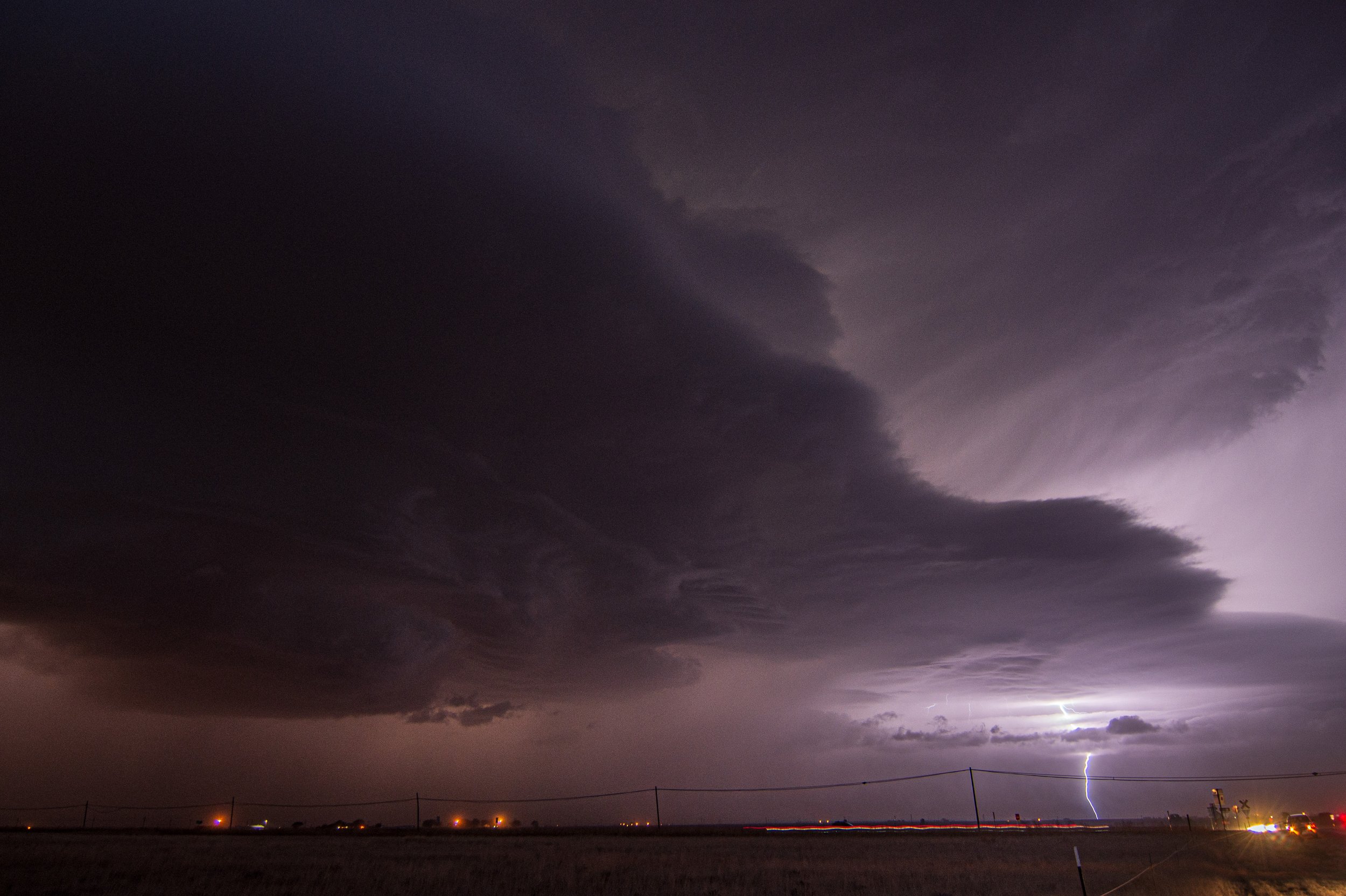
   contributing to very large, clockwise curved low-level hodographs.

   As this occurs, the warm frontal zone is expected to become the
   focus for intensifying supercells, including the evolution of strong
   low-level mesocyclones, potentially capable of producing tornadoes. 
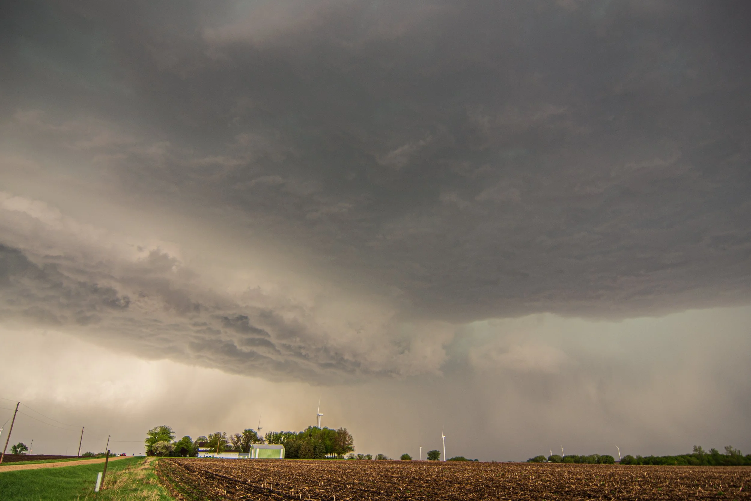
   The warm front is rather sharp, and the air to the north of the
   front rather cool and stable.  However, the front is slowly
   advancing northward, and model forecast soundings indicate low-level
   thermodynamic profiles will destabilize across much of northwestern
   through north central Iowa into early evening.  It appears possible
   that this will become sufficient for tornado development, with  
   highest probabilities for sustained/longer track tornadic supercell
   development around the Storm Lake/Fort Dodge Iowa vicinities.

   As storms progress north of the warm frontal zone, into the colder
   air, stronger cells could continue to pose a risk for severe hail
   while the tornado threat diminishes.
   SUMMARY...The evolution of an increasingly organized cluster of
   storms seems probable this evening, before overspreading the region
   through 10 PM-Midnight, accompanied by a risk for damaging wind
   gusts and tornadoes.

   DISCUSSION...Strong thunderstorm development continues to increase
   in coverage in association with large-scale ascent downstream of a
   deep northeastward migrating surface cyclone.  This is being aided
   by forcing associated with a subtle lead short wave perturbation,
   and includes an evolving cluster of supercells near the Fort Dodge
   IA area.  

   As the mid-level perturbation migrates northeast of the mid Missouri
   Valley toward the Upper Midwest through mid to late evening,
   considerable further upscale convective growth will continue to
   ensue.  The evolution of an increasingly organized mesoscale
   convective system seems probable as the environment destabilizes
   coincident with increasing forcing for ascent overspreading the
   region. 

   Embedded within strengthening deep-layer ambient mean flow (in
   excess of 50 kt), increasingly widespread damaging wind gusts are
   possible.  A coinciding larger-scale bow structure may evolve in
   radar reflectivities, with embedded supercell structures posing a
   risk for tornadoes, mainly where the apex of the bow intersects a
   northeastward advancing warm front ahead of the surface cyclone.

STORM REPORTS:

STORM PREDICTION CENTER OUTLOOKS:

MARCH 5, 2022 IOWA: MY EARLIEST TORNADO OF ANY SEASON AND MY SON'S FIRST!


First severe storm of the day just west of Shenandoah, Iowa. We got on this one right away.

Tornado warned storm south of Red Oak, Iowa. This is looking to the southwest as the base was coming right at us.

Beautiful flanking towers going up on the southern end of what would become the tornado producing supercell that traveled over 100 miles to Des Moines and points east-northeast of there.

The contrast here around the rainbow was fantastic. Like a clear boundary of light and dark.

This was before our tornado and could have produced here well ahead of us as we were traveling east on Highway 34 near Corning.

Short lived funnel cloud right there in the middle shortly before producing the tornado near Prescott, Iowa.

Tornado! Near Prescott, IA at 4:06 pm. Unfortunately tearing up a barn and other farm structures.

Another shot of the tornado. Notice the condensation funnel overhead.

Funnel cloud, possible tornado, north of Macksburg, Iowa. Might be the start of the killer tornado that impacted Winterset.

Another shot of the persistent funnel cloud, possible tornado.

Ping pong ball size hail as we approach the town of Orient, Iowa.

BIG hail covering the ground everywhere in Orient, Iowa. Lots of windows busted out and tree damage.

You can see the car window busted out here due to the massive hail.

The car was sliding all over the road here due to all of the hail.

Tornado damage in Winterset, Iowa. There was so much more that was way worse than this even. Very sad.

Tornado damage to a hour to the northeast of Winterset, Iowa.

Trying to get ahead of the storm! Was really hard to keep up with since it was moving 50+ mph and we kept running into debris and small towns. Nice updraft and inflow tail here.

Coming across more tornado damage in Norwalk, Iowa. Hwy 28 impassable due to debris so we were forced to turn around and find another route.

Major damage to a shed in Norwalk.

More damage to homes and a church in Norwalk.

Tornado debris across the road in Pleasant Hill, Iowa on the eastern side of Des Moines. This was off highway 65 in the eastern metro.

Mammatus from the storm to the south as we were about to get around the east side of Des Moines and into I-80.

Spooky scene as we were blasting east to still try and get ahead of the tornado warned storm approaching Newton, Iowa. Storm still had a tornado at this point. Soon after had to call off the chase as I-80 slowed down to a crawl due to an accident.

MESOSCALE DISCUSSIONS AND WATCHES:

   SUMMARY...Storms are expected to gradually increase in coverage and
   intensity this afternoon. A few tornadoes, damaging winds, and large
   hail all appear possible. Watch issuance is likely in the next
   couple of hours.

   DISCUSSION...An area of precipitation with embedded storms is
   ongoing early this afternoon across parts of western/central IA and
   vicinity. This activity is being aided by strong low-level warm and
   moist advection occurring with a 40-50+ kt south-southwesterly
   low-level jet. As pronounced ascent associated with a shortwave
   trough ejecting across the central Plains overspreads the warm
   sector across IA and northern MO, additional convection is forecast
   to develop over the next couple of hours. The airmass across this
   region is gradually destabilizing, with surface temperatures
   generally in the mid 50s to upper 60s, and dewpoints in the low to
   mid 50s. Around 500-1000 J/kg of MLCAPE may ultimately develop as
   modest diurnal heating through cloud breaks occurs, as mid-level
   temperatures are expected to rapidly cool with the approach of the
   shortwave trough. Deep-layer shear of 50+ kt will favor supercells
   with a threat for both large hail and damaging winds.

   There is still some uncertainty in the coverage and intensity of
   severe storms later this afternoon owing to the modest instability
   and leading band of ongoing storms, which may hamper additional
   diurnal heating. Potential does exist for this leading band to
   strengthen as it moves across central/eastern IA while posing a
   threat for mainly hail and strong/gusty winds. Current expectations
   are for a greater severe threat to develop with supercells that
   should form near the NE/IA/MO border, in close proximity to the
   surface low over northeastern KS. This activity should have access
   to slightly greater instability and low-level moisture, with a
   better chance for these storms to become surface based and produce
   isolated large hail. Strong low-level wind fields and 200-300 m2/s2
   of effective SRH should prove favorable for updraft rotation, and a
   few tornadoes appear possible with any storms that can remain at
   least semi-discrete. Scattered damaging winds should also occur as
   convection attempts to grow upscale later this afternoon/early
   evening while moving quickly eastward across IA and northern MO. A
   watch will likely be needed within the next couple of hours as the
   severe threat gradually increases.
   SUMMARY...Thunderstorms are expected to develop this afternoon along
   a cold front moving into western Iowa/Missouri.  These storms will
   track across the watch area, posing a risk of damaging winds, hail,
   and a few tornadoes.

   The tornado watch area is approximately along and 85 statute miles
   east and west of a line from 60 miles north northwest of Des Moines
   IA to 40 miles south of Lamoni IA. For a complete depiction of the
   watch see the associated watch outline update (WOUS64 KWNS WOU7).
   SUMMARY...Ongoing severe storms should continue to track east
   northeast over the next several hours across IA and northern MO.
   Damaging wind gusts, large hail and a few tornadoes will be
   possible. Some upscale growth is expected as storms track farther
   east into central and eastern Iowa later this evening.

   DISCUSSION...As of 21:45 UTC, a semi-discrete band of supercells
   were ongoing across far southwestern IA and northwestern MO. In the
   wake of early-day storms, clearing ahead of a strong surface cyclone
   and upper trough have allowed weak destabilization (500-1000 J/kg)
   of MLCAPE to propagate ahead of the cells ongoing across central IA
   and northern MO. These storms should continue to keep pace with the
   rapidly recovering warm sector posing a risk for all hazards over
   the next few hours.

   Initial storm mode has been messy with multiple updrafts in close
   proximity across western IA. This is likely a result of
   relatively-long straight-line hodographs above weekly veered surface
   flow. Additional upscale growth appears likely with these storms as
   they track northeastward. All hazards, including damaging wind
   gusts, and a few tornadoes will however remain possible given strong
   low-level shear (0-1km srh 150-200 m2/s2) supporting small
   mesocyclones. 

   Farther south, more discrete convection across northern MO were
   tracking toward southern IA. Greater residence time within the
   expanding warm sector and resulting stronger low-level mesocyclones
   may result in a locally greater risk of tornadoes over the next
   several hours. Upscale growth into more linear segments with a risk
   of damaging gusts appears possible into portions of eastern Iowa
   where an additional watch may be needed later this
   afternoon/evening.
   SUMMARY...The tornado threat will be focused in parts of central and
   southeast Iowa this evening. This threat may extend beyond the WW 27
   and an additional downstream tornado watch will likely be considered
   this evening.

   DISCUSSION...A strong supercell continues to move through southern
   suburbs of Des Moines. This storm has had consistent rotational
   velocities in the 55-70 kt range over the past hour. Other discrete
   storms are moving out of north-central Missouri into south-central
   Iowa. At least one tornado was reported in Wayne County, IA, with
   this activity. These storms are moving into a similar environment
   and will continue to pose a threat for tornadoes over the next 1-2
   hours. To the west of these discrete storms, a more broken line of
   convection has developed along the cold front. This activity will
   pose greater threats for large hail and damaging winds than
   tornadoes.

   Farther to the north and east, earlier cloud cover and precipitation
   has limited destabilization. For parts of eastern Iowa and perhaps
   far northeastern Missouri, an additional downstream tornado watch
   will need to be considered this evening.
   SUMMARY...Storm mode has trended more linear in WW 29. Low-level
   wind fields will still support damaging wind gusts and brief
   tornadoes.

   DISCUSSION...Modest destabilization continues ahead of a broken line
   of quasi-linear storms in eastern Iowa and far northeastern
   Missouri. Though storm mode has trended less discrete, regional
   radar velocity data has shown periodic embedded circulations
   developing within the line segments. A couple of measured severe
   gusts were reported within the last hour in eastern Iowa. Given the
   strong low-level shear and veering seen on the KDVN VWP, there will
   be continued potential for this sort of activity. Damaging winds and
   brief tornadoes will be the primary threats. The observed DVN 00Z
   sounding showed an 8 C/km mid-level lapse rate which would also
   support marginally severe hail, despite the less favorable storm
   mode.

STORM REPORTS:

STORM PREDICTION CENTER OUTLOOKS: