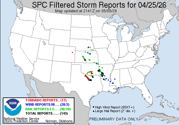
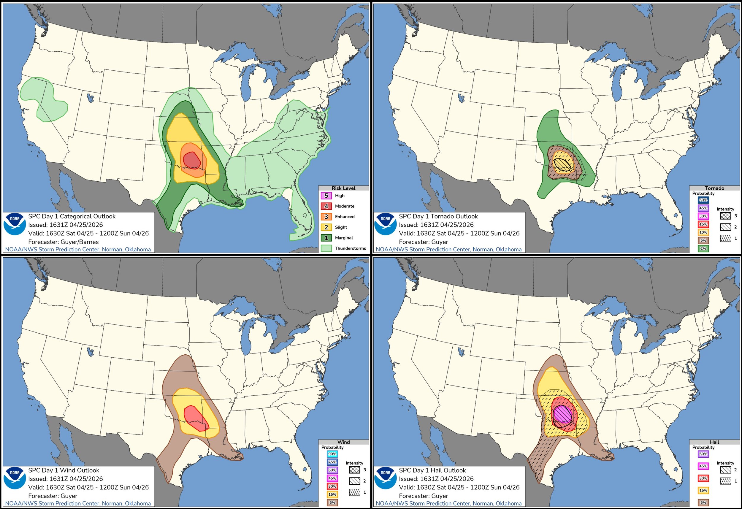
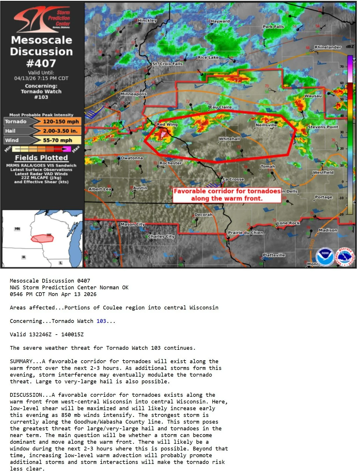
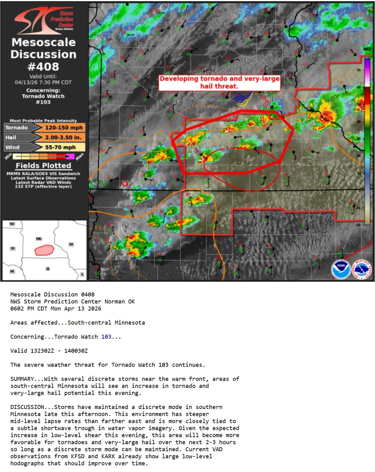
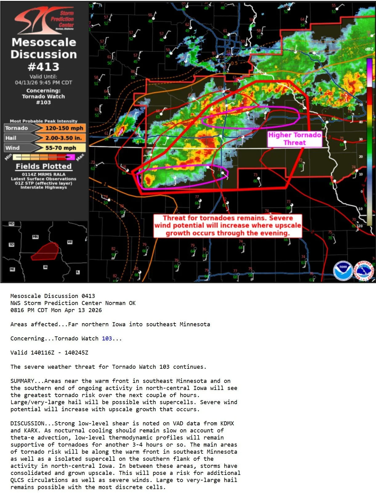
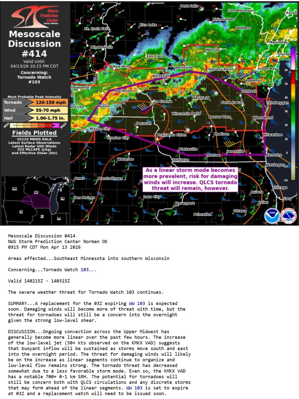
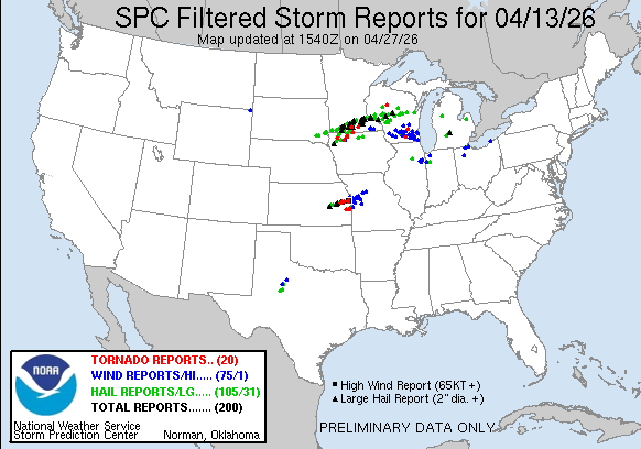
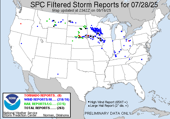
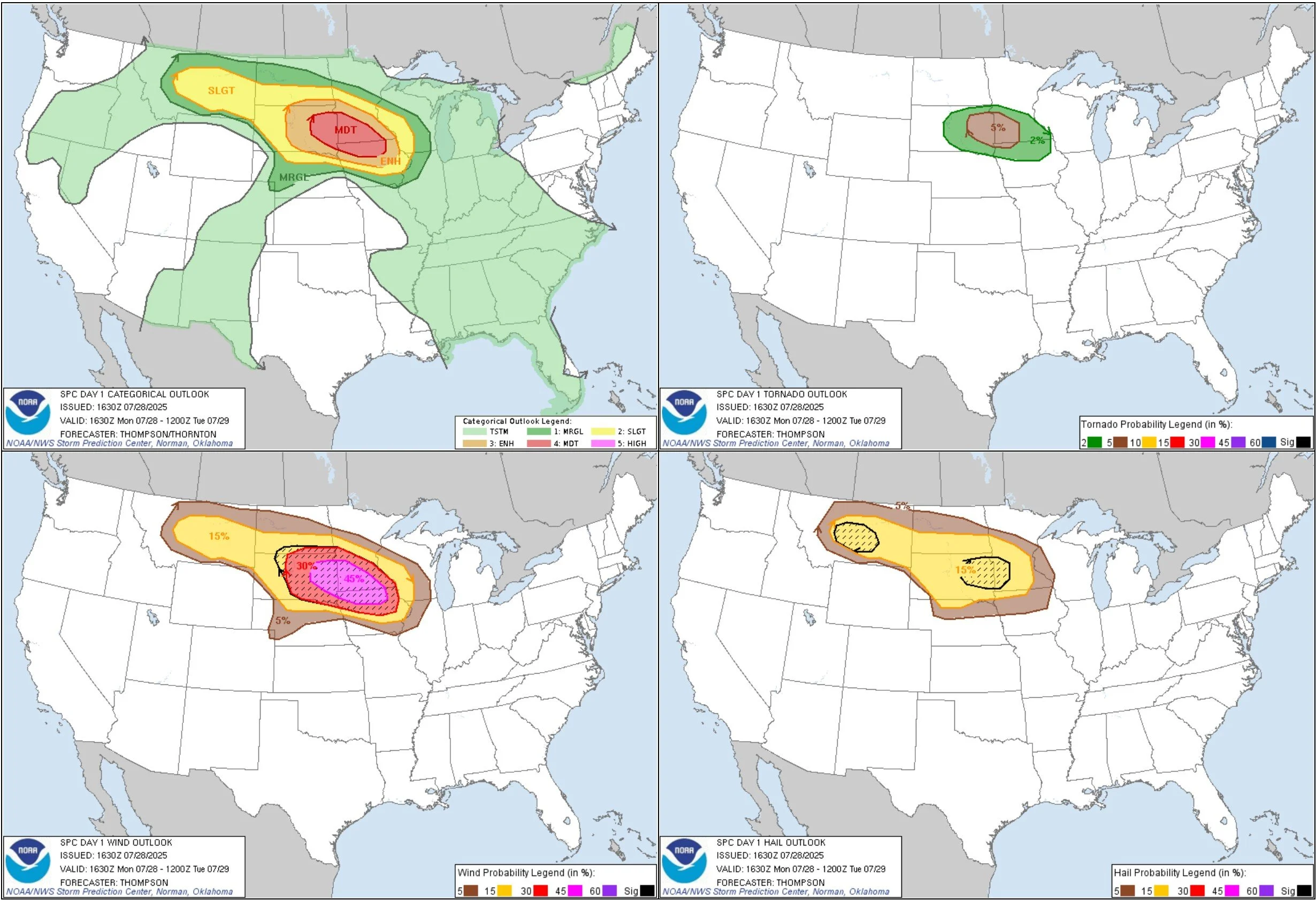
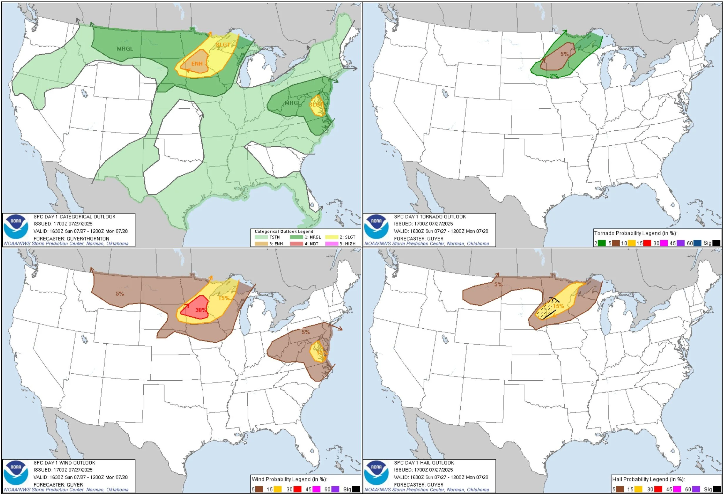
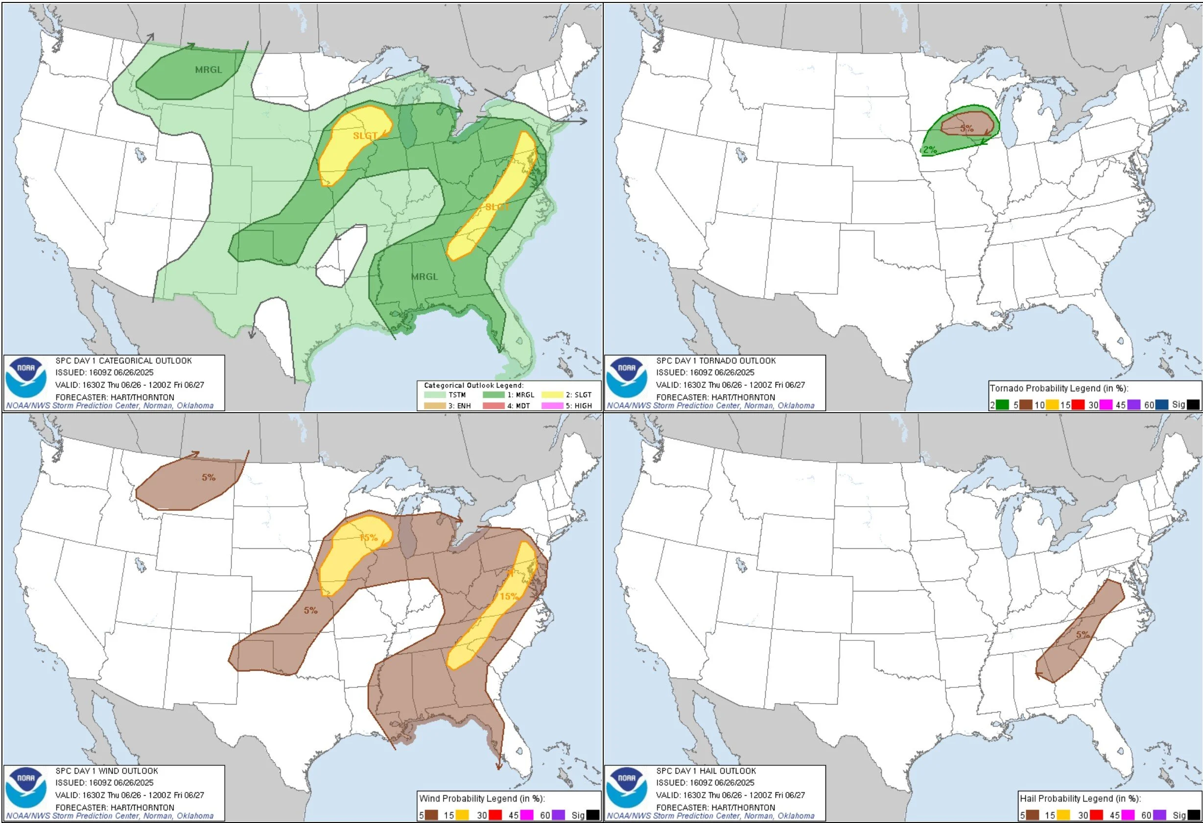
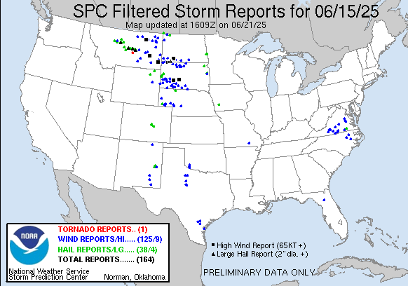
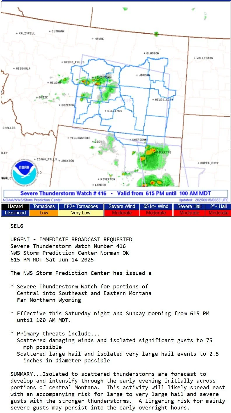
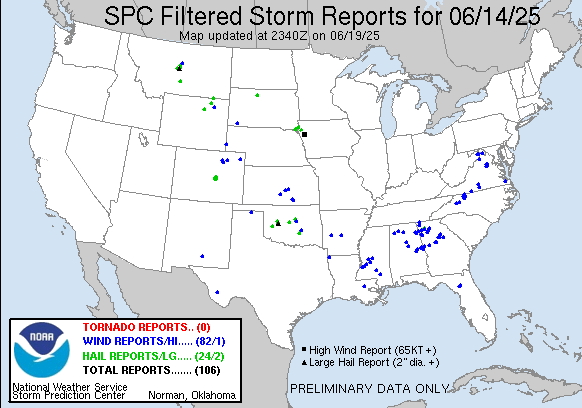
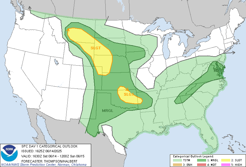
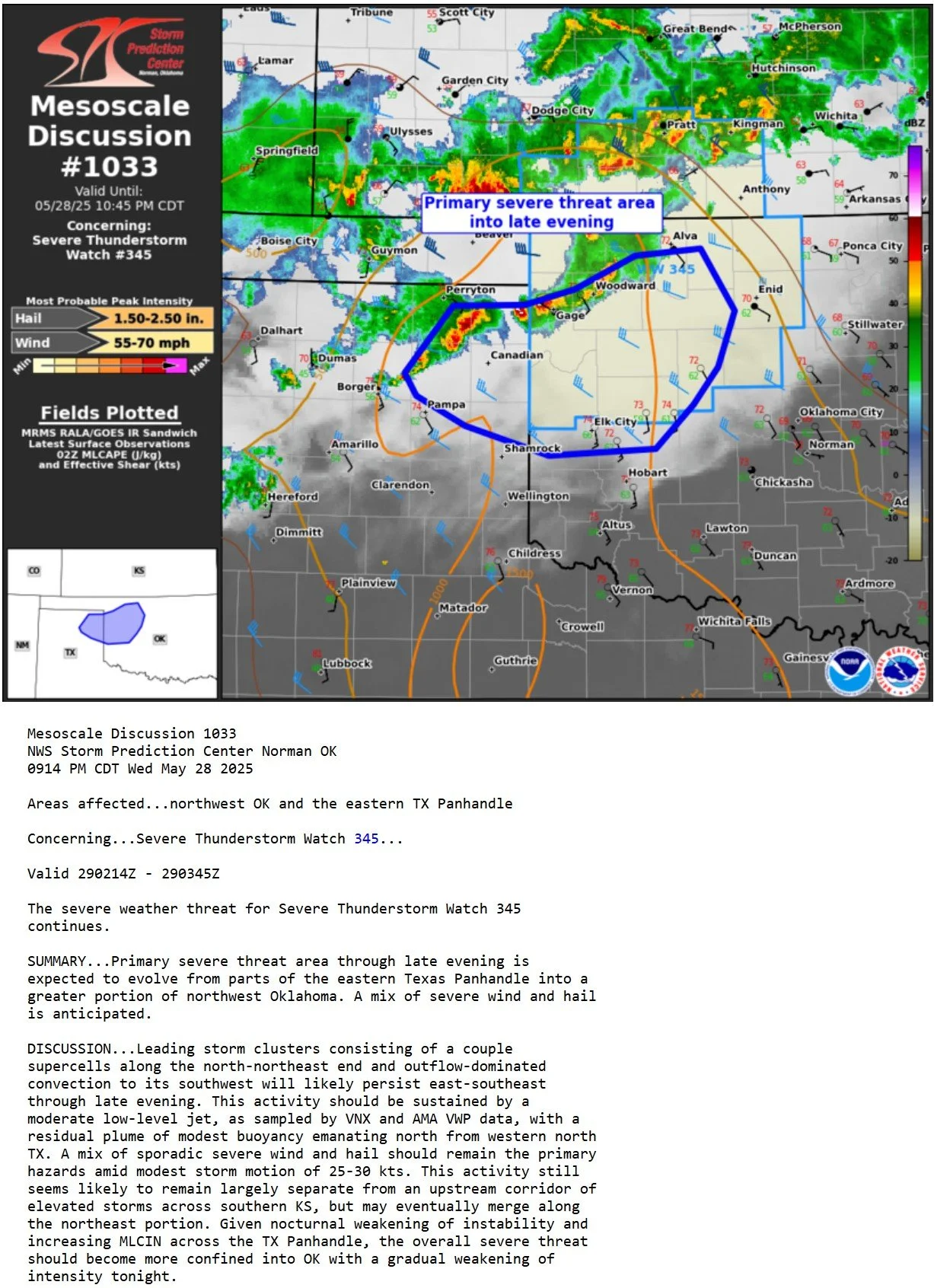
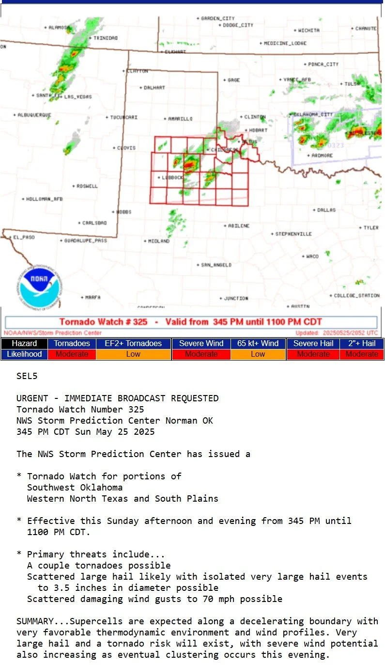
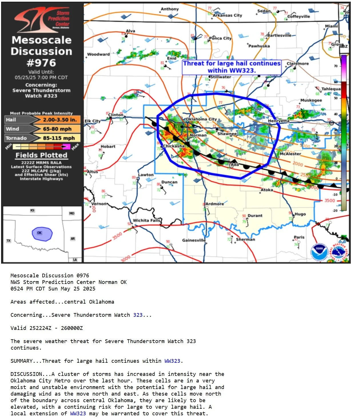
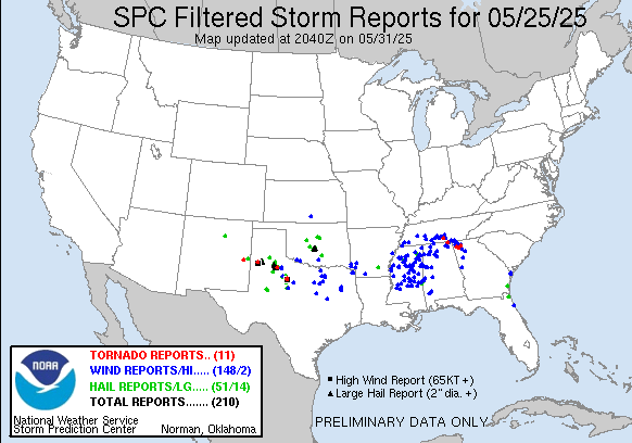
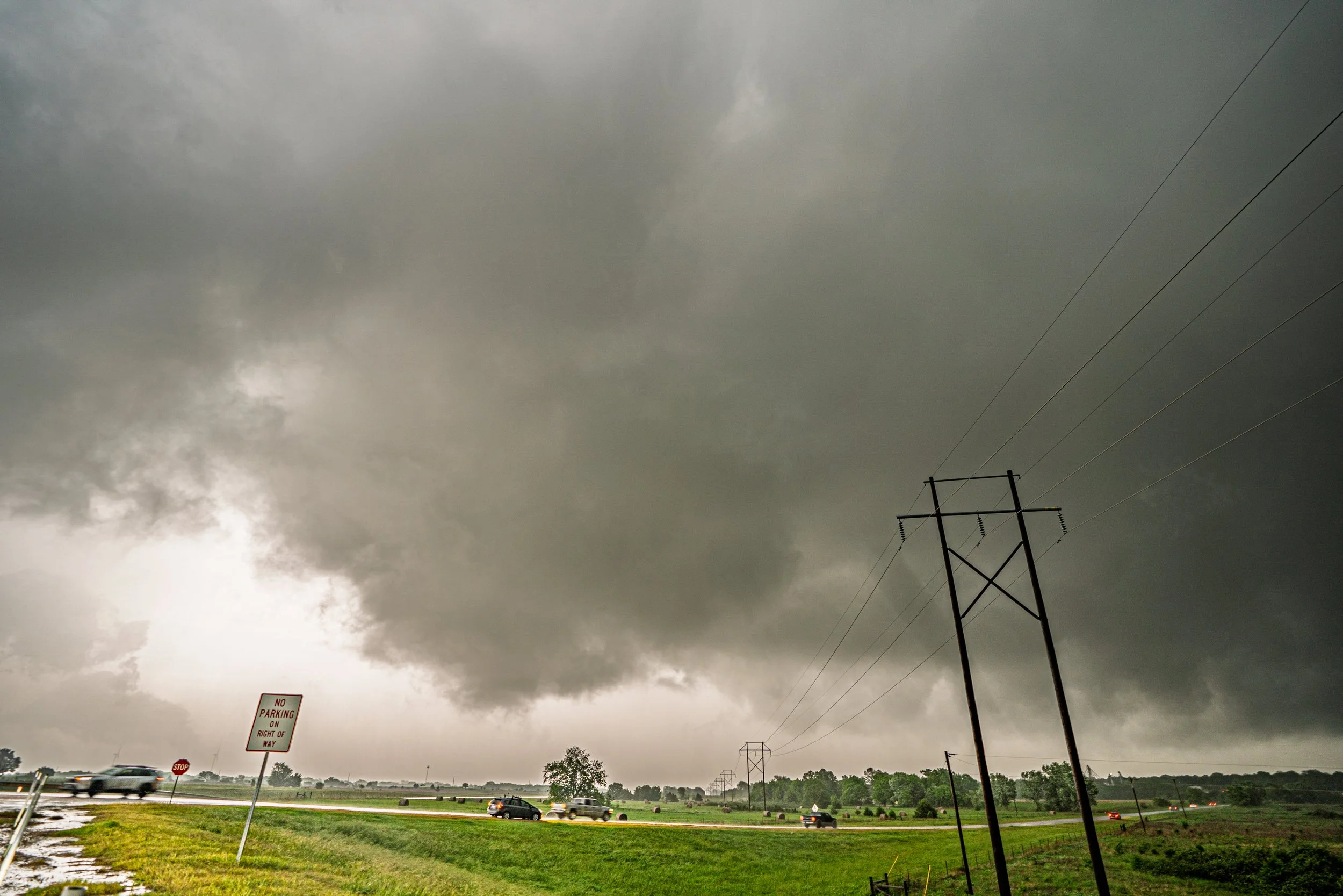
APRIL 25, 2026 OKLAHOMA: SUPERCELLS AND A FEW BRIEF FUNNELS
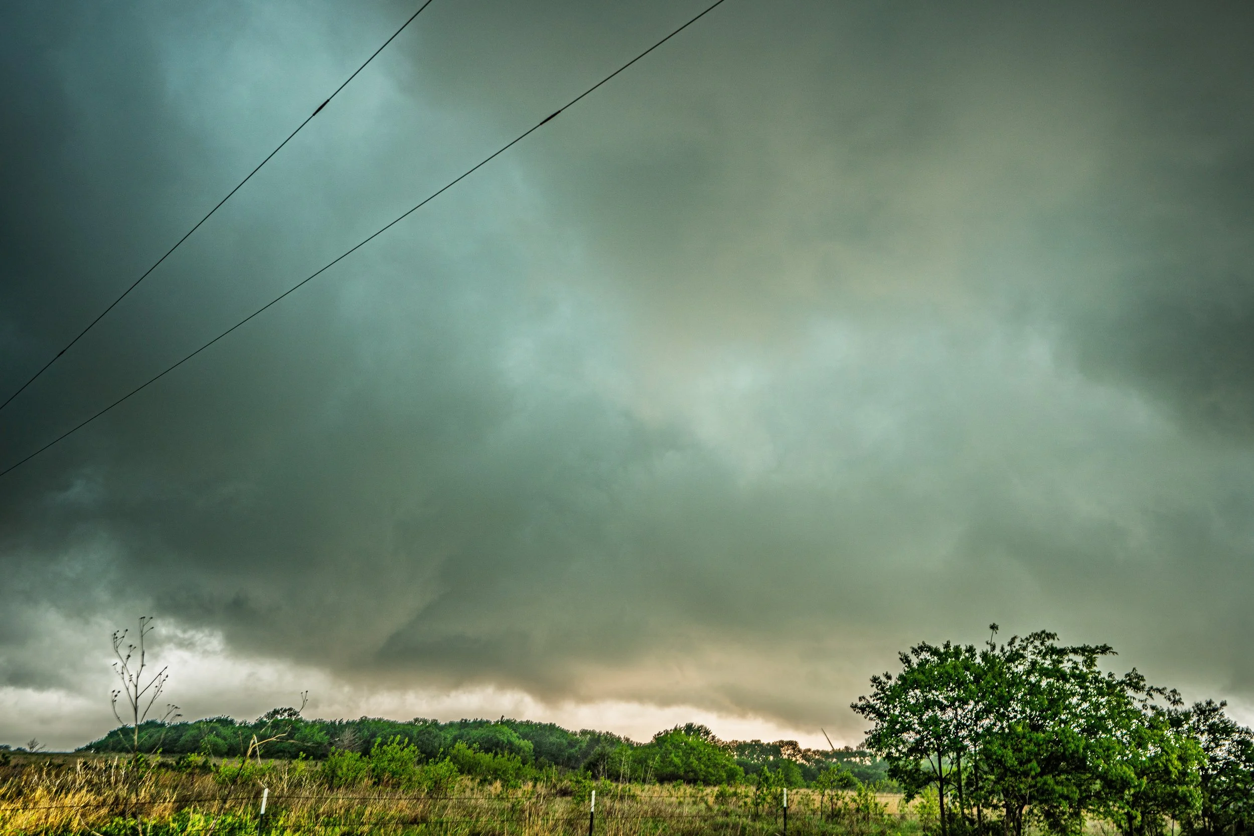
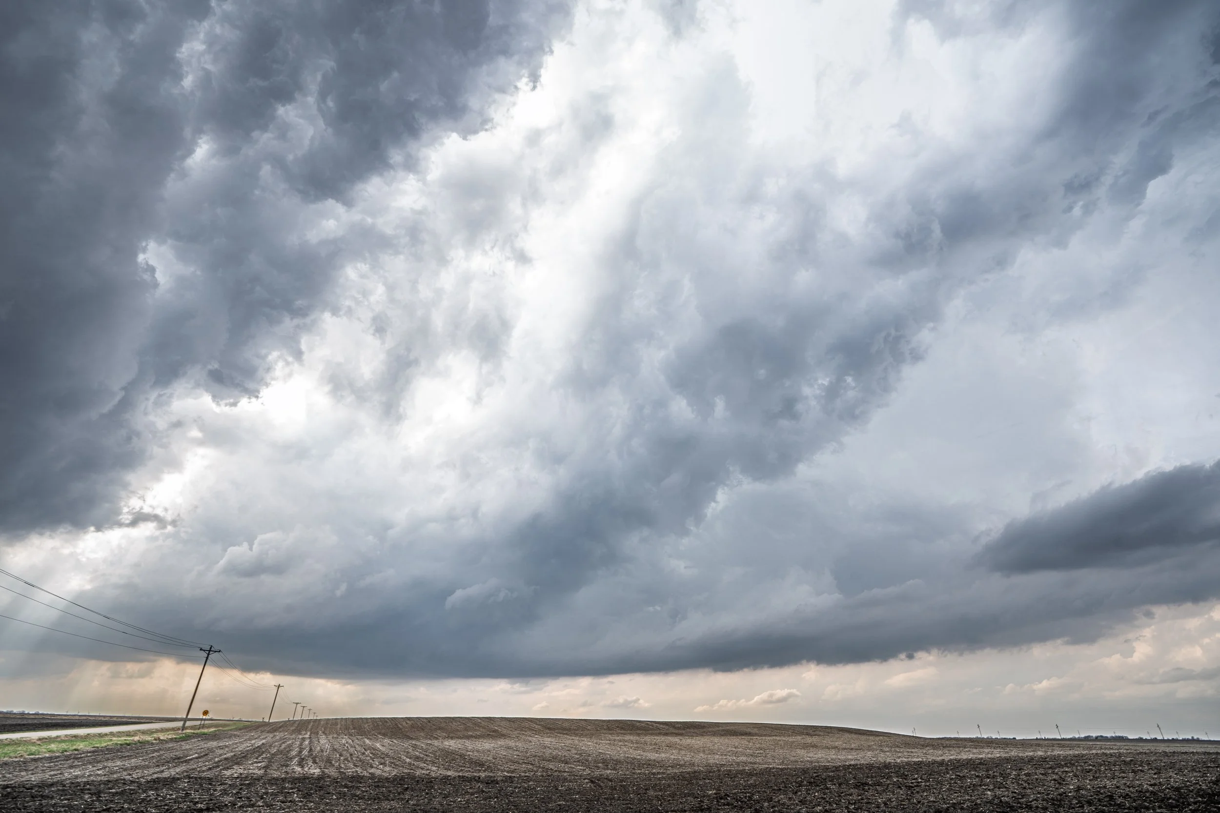
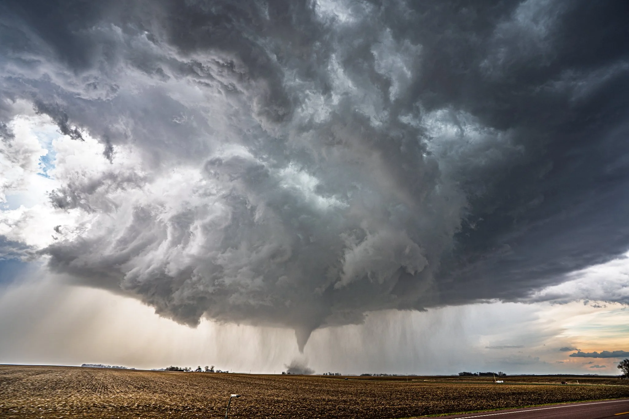
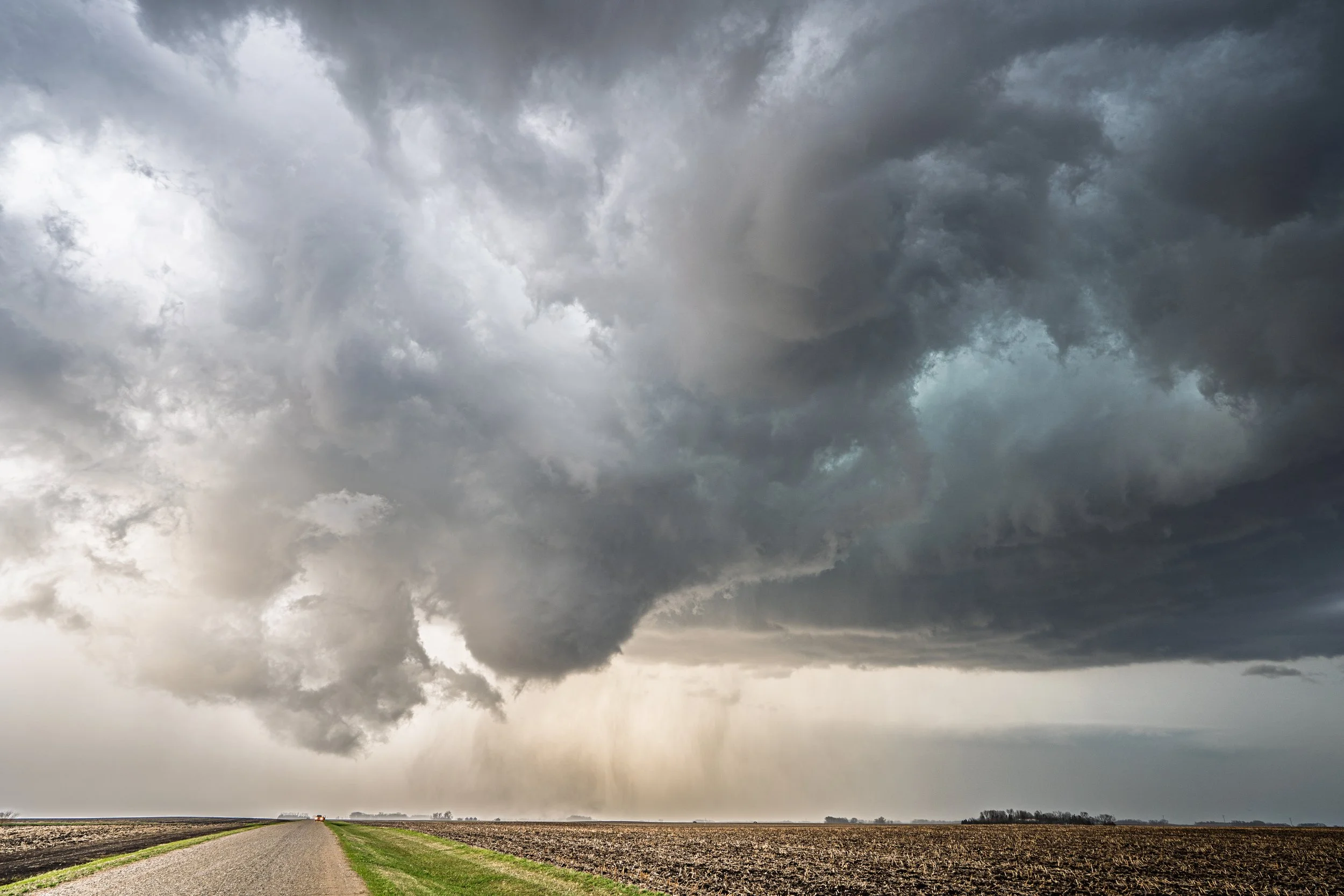
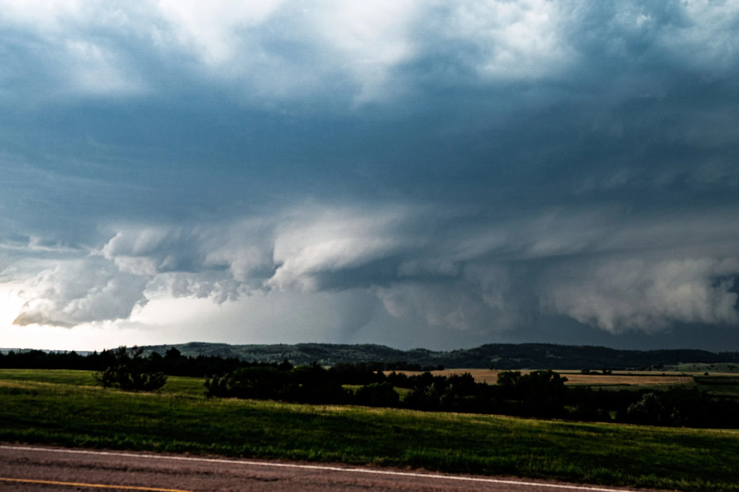
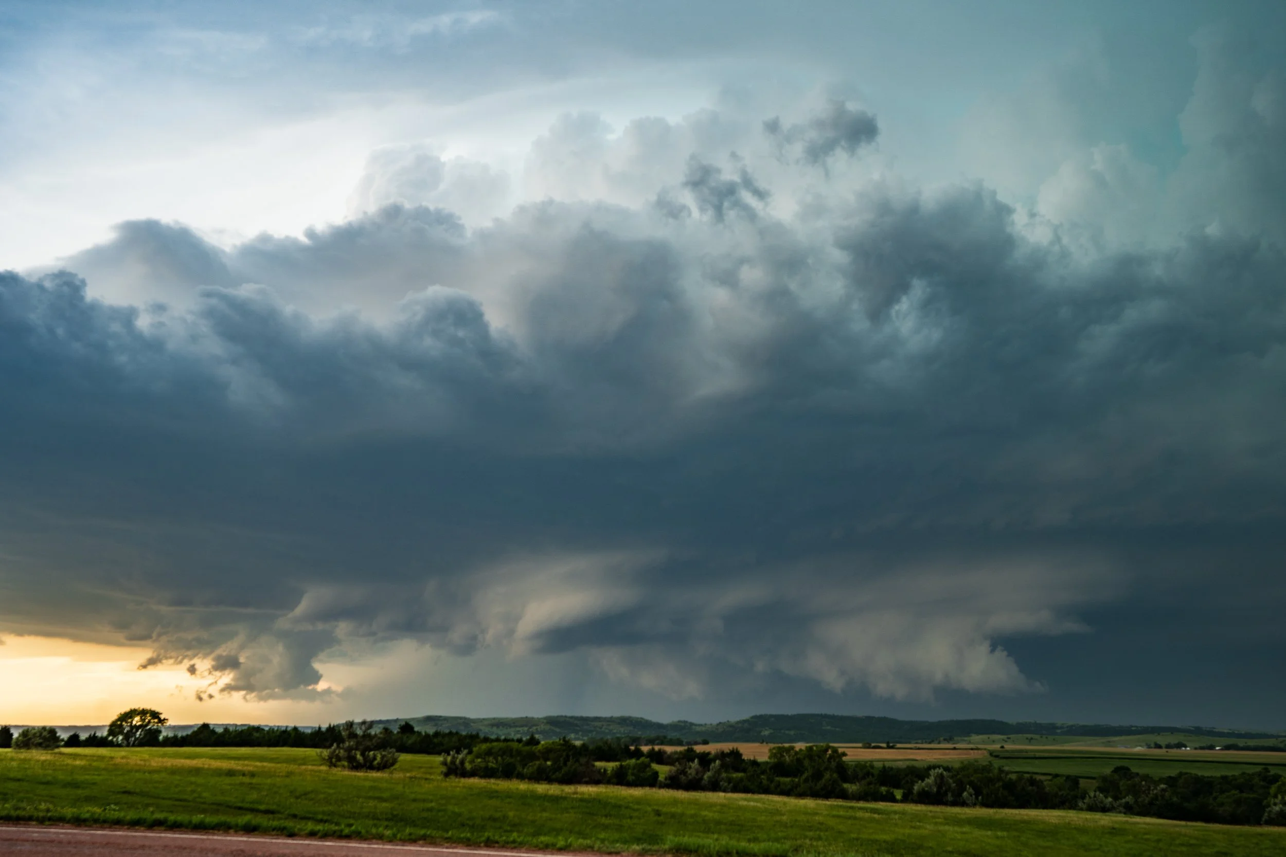
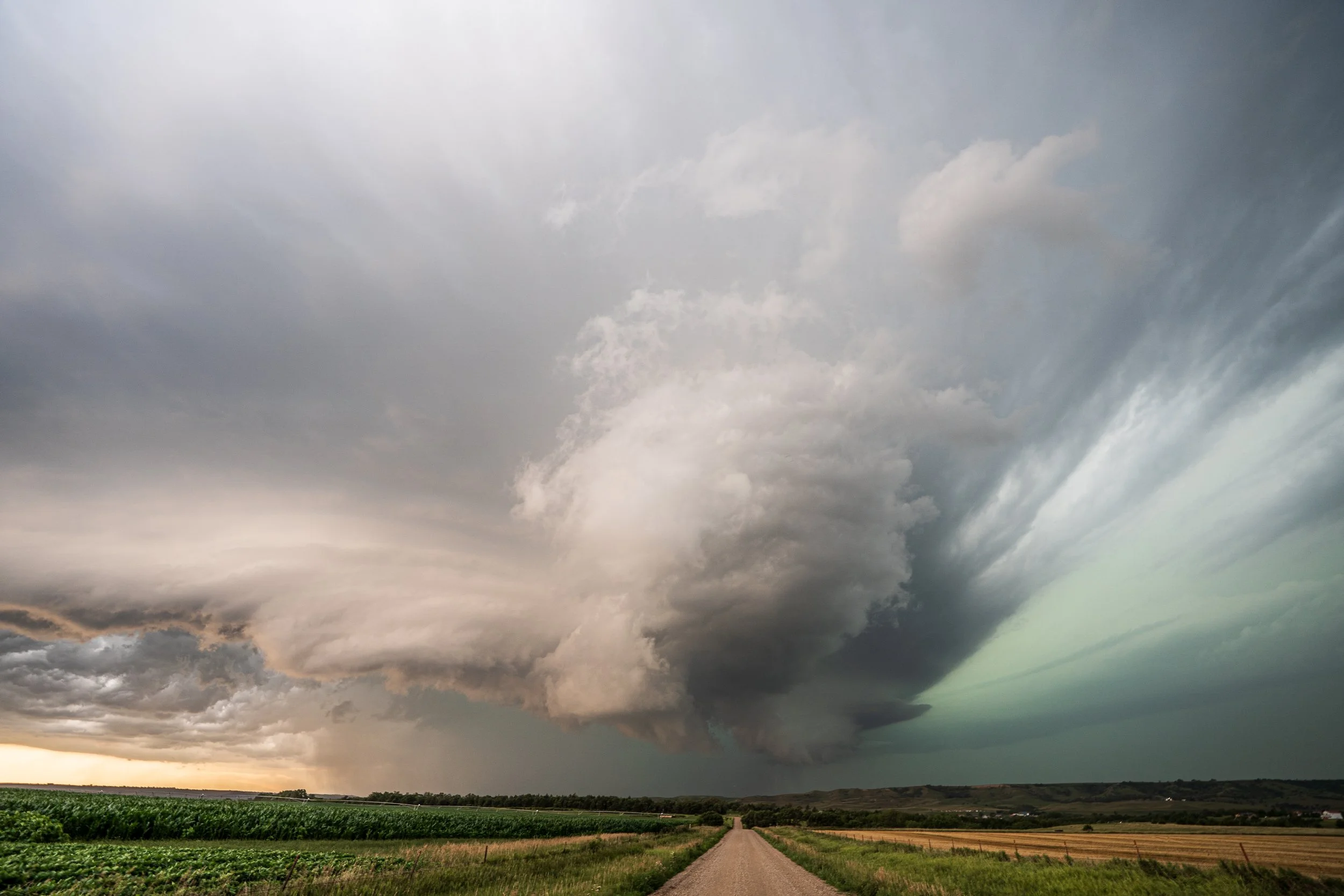
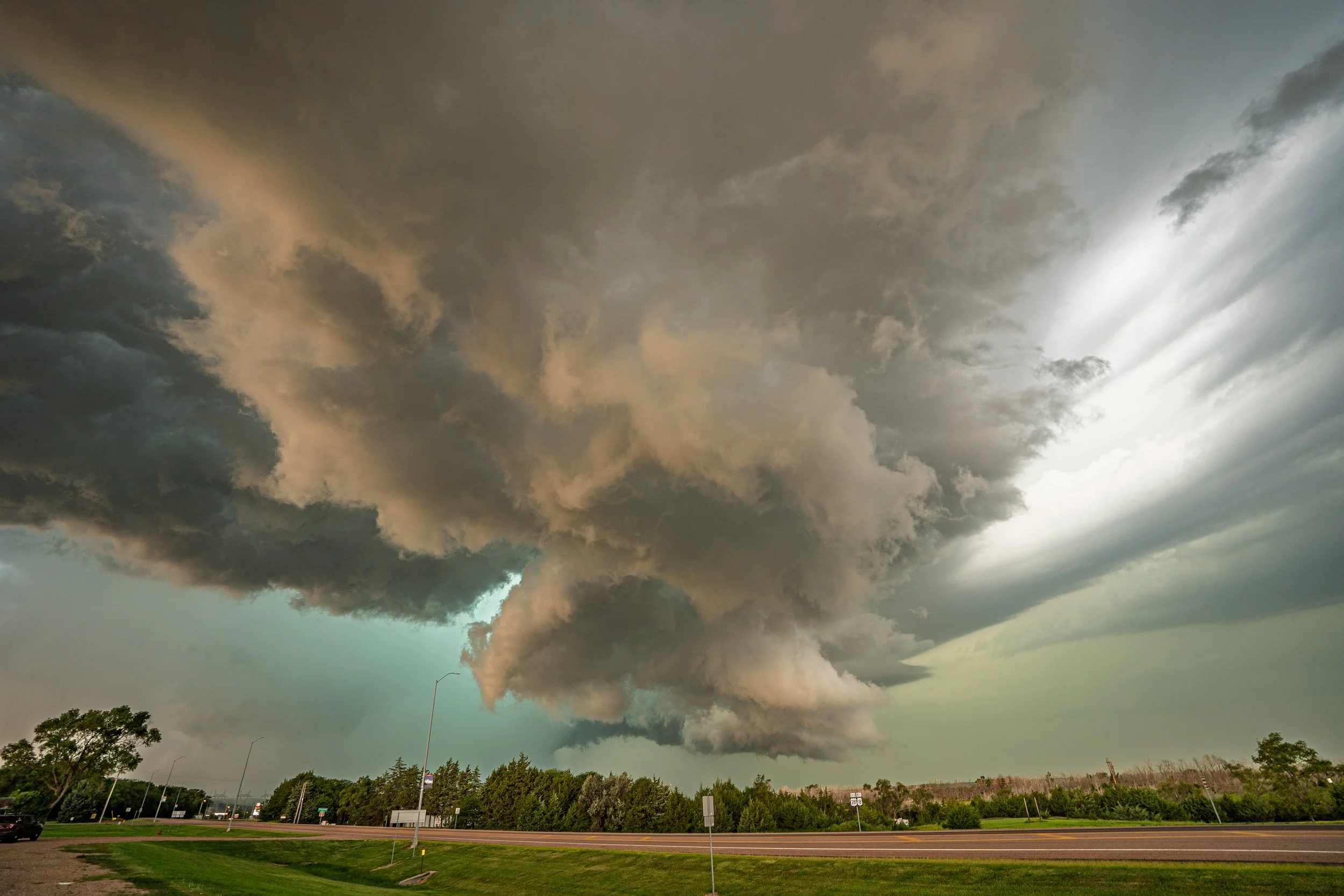
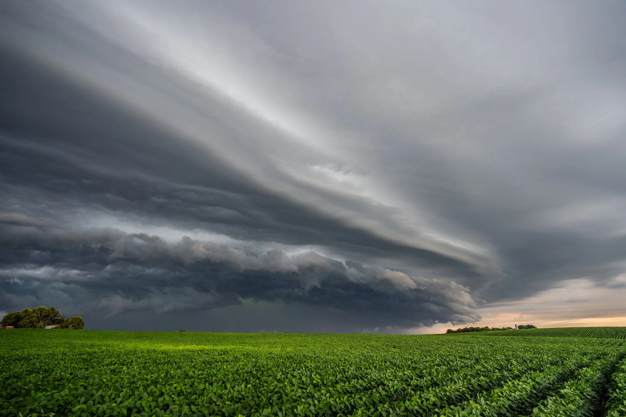
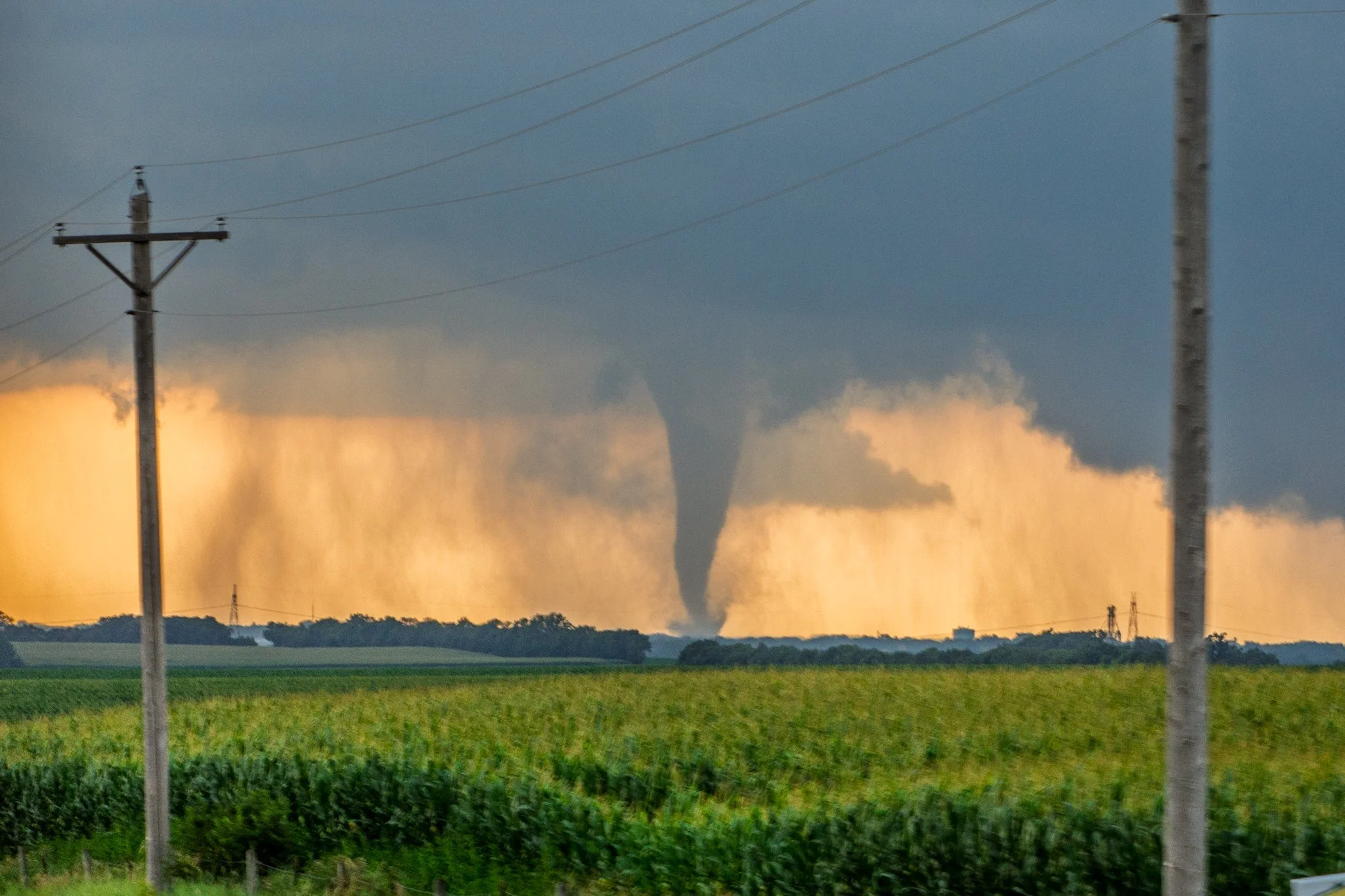
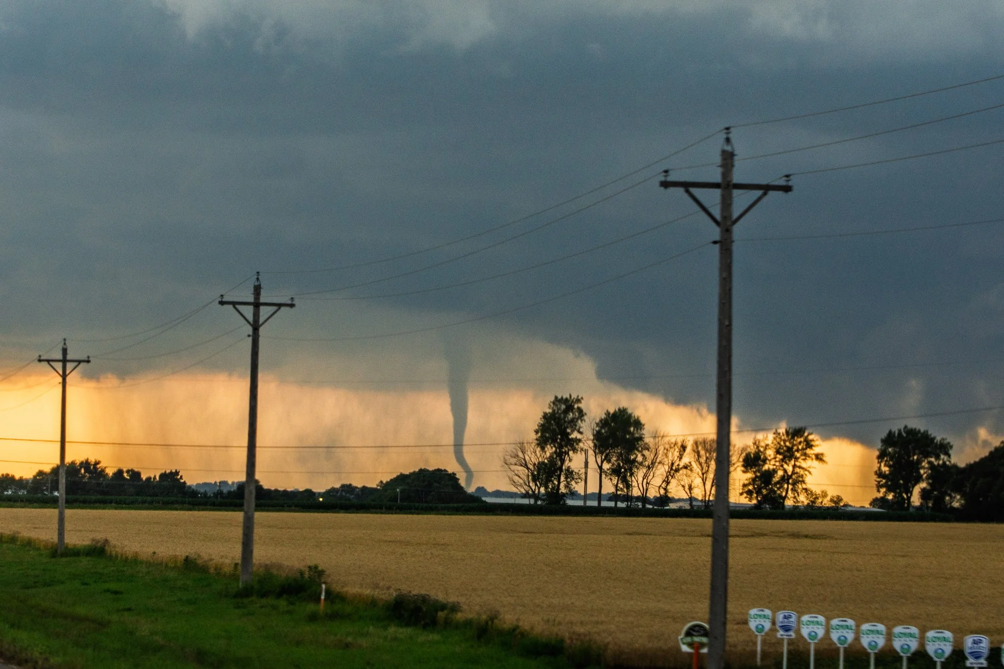
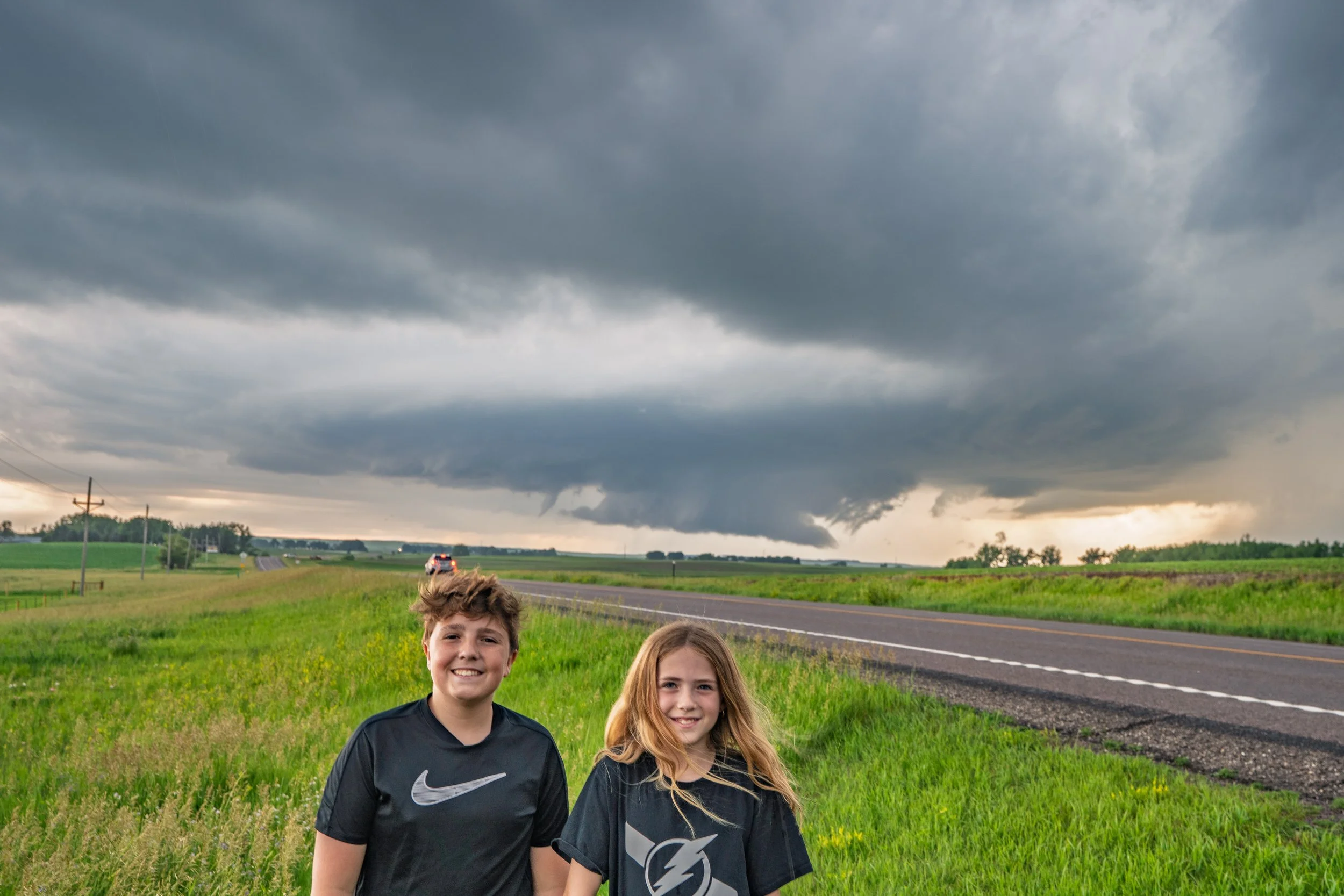
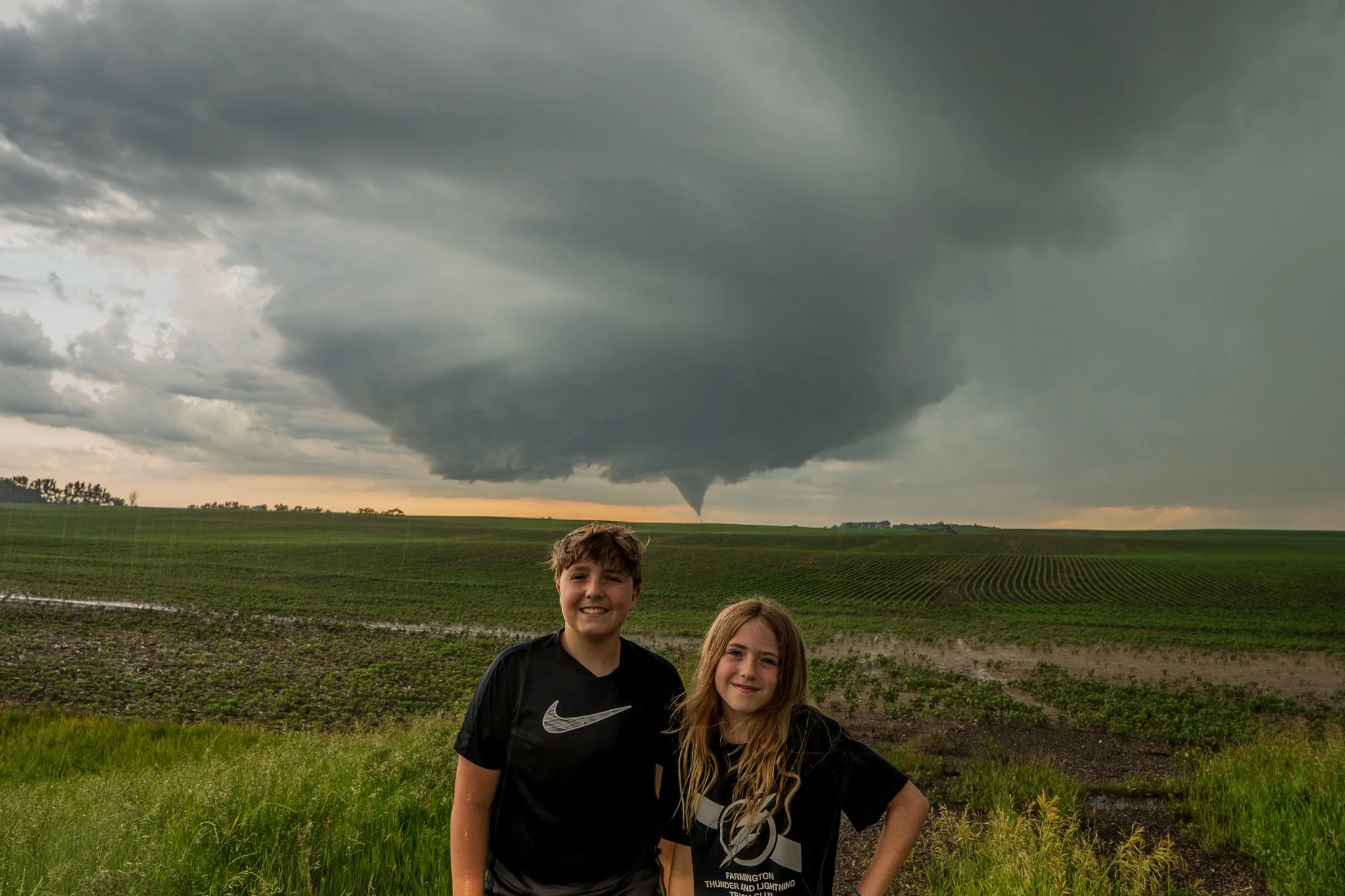
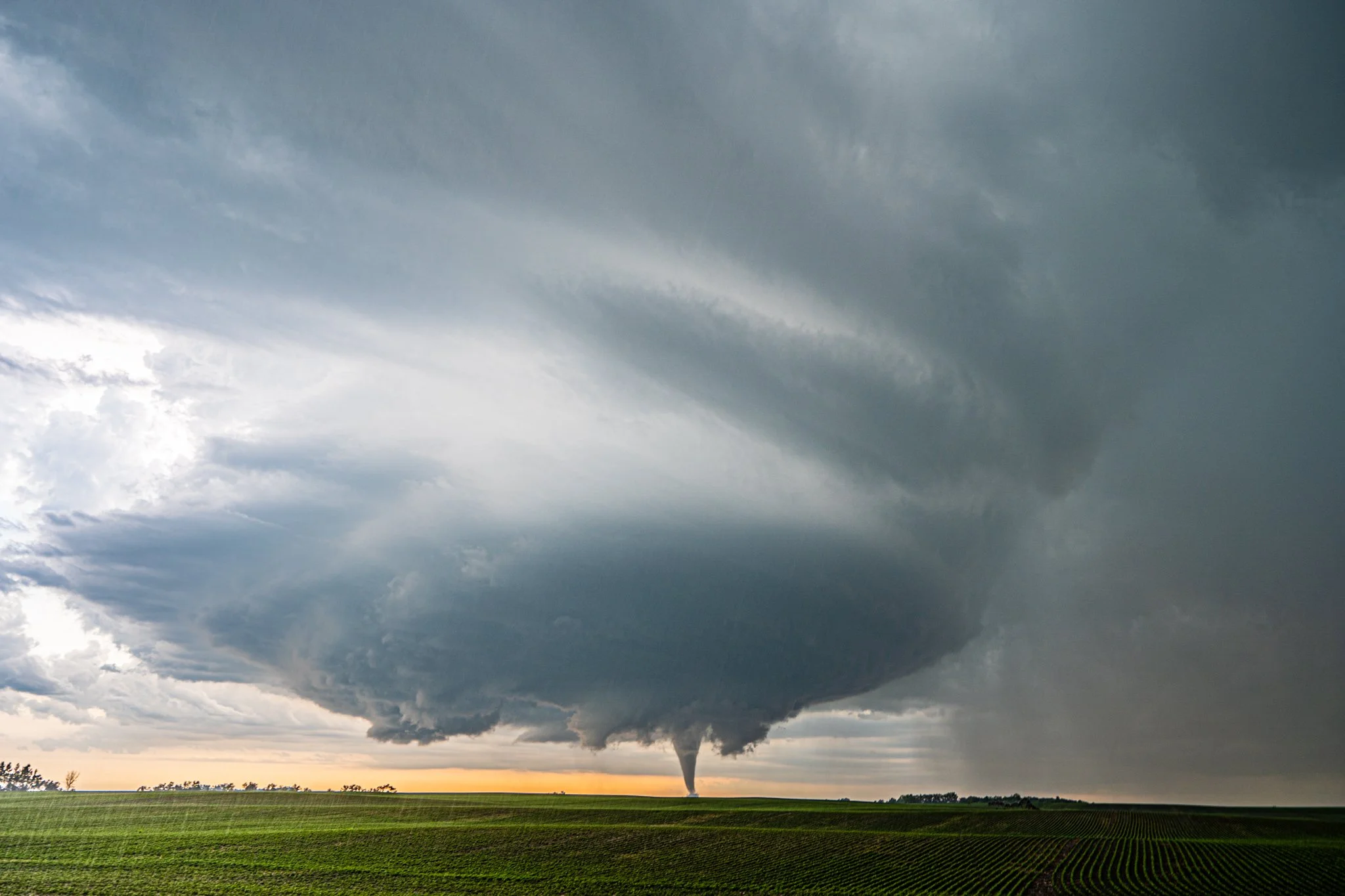
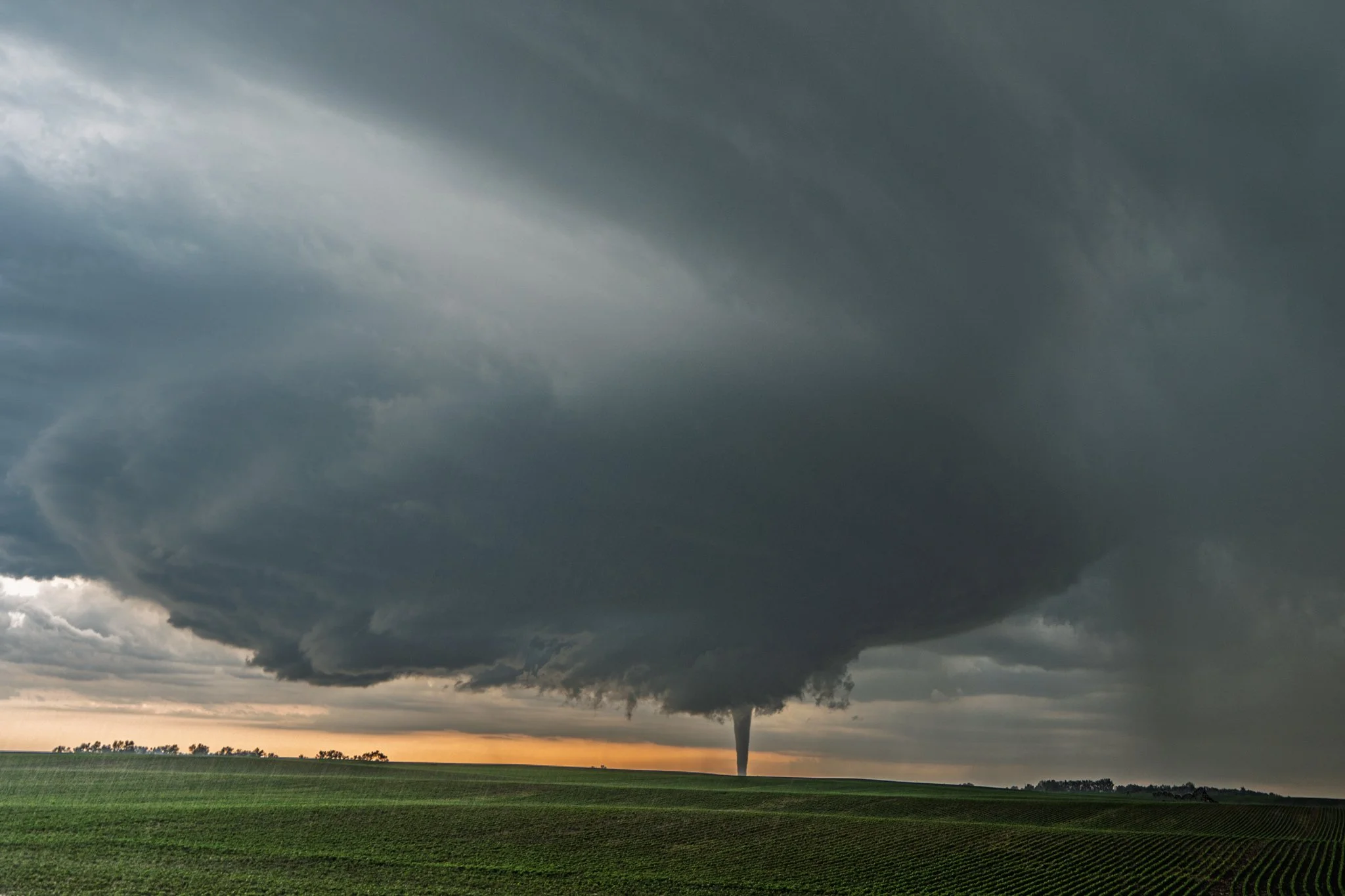
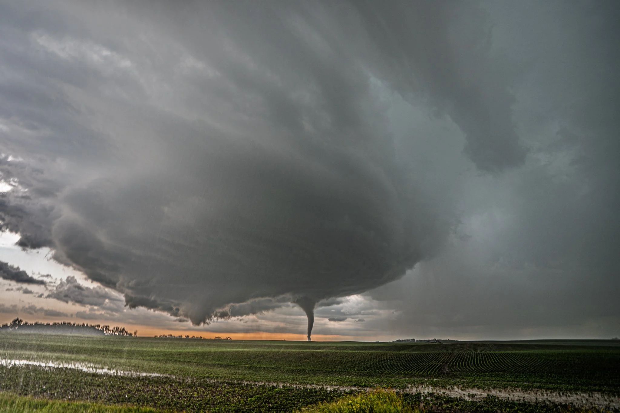
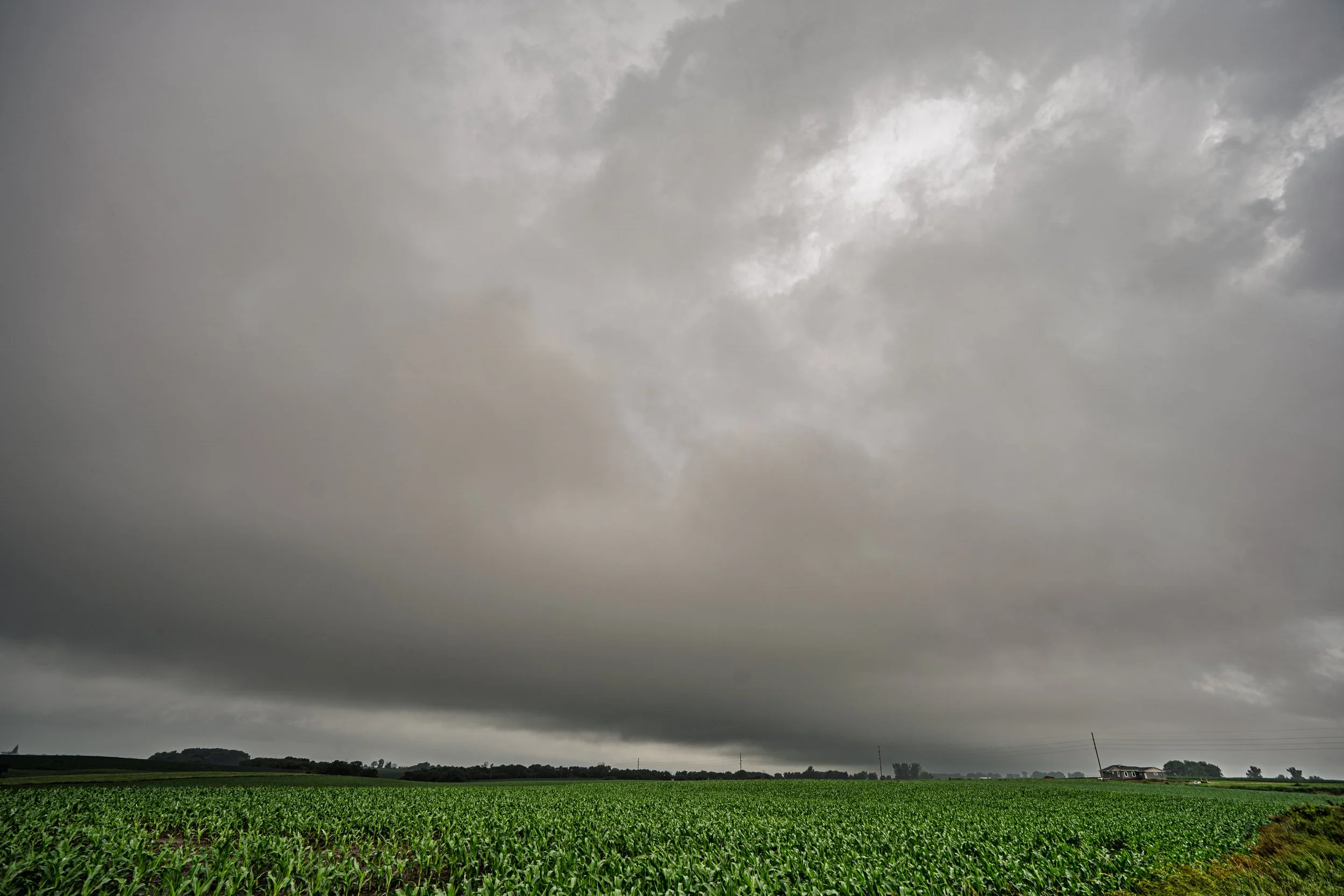
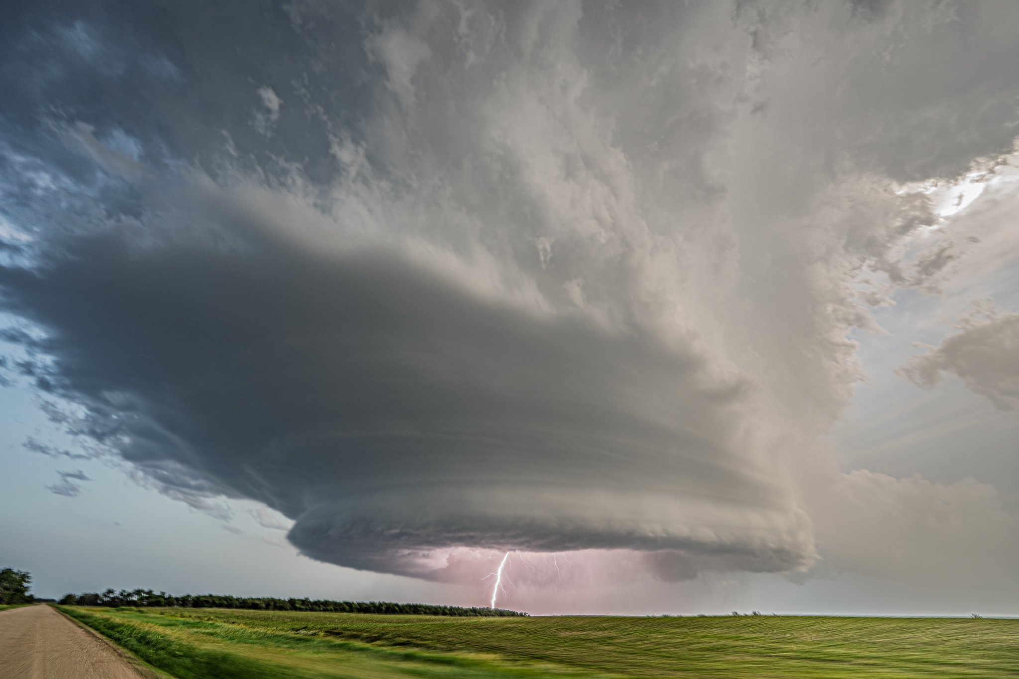
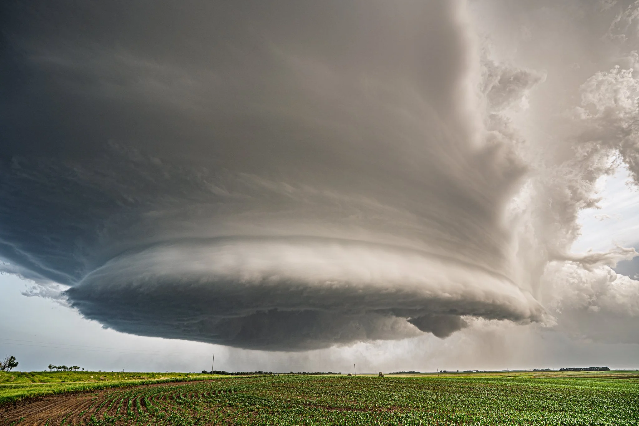
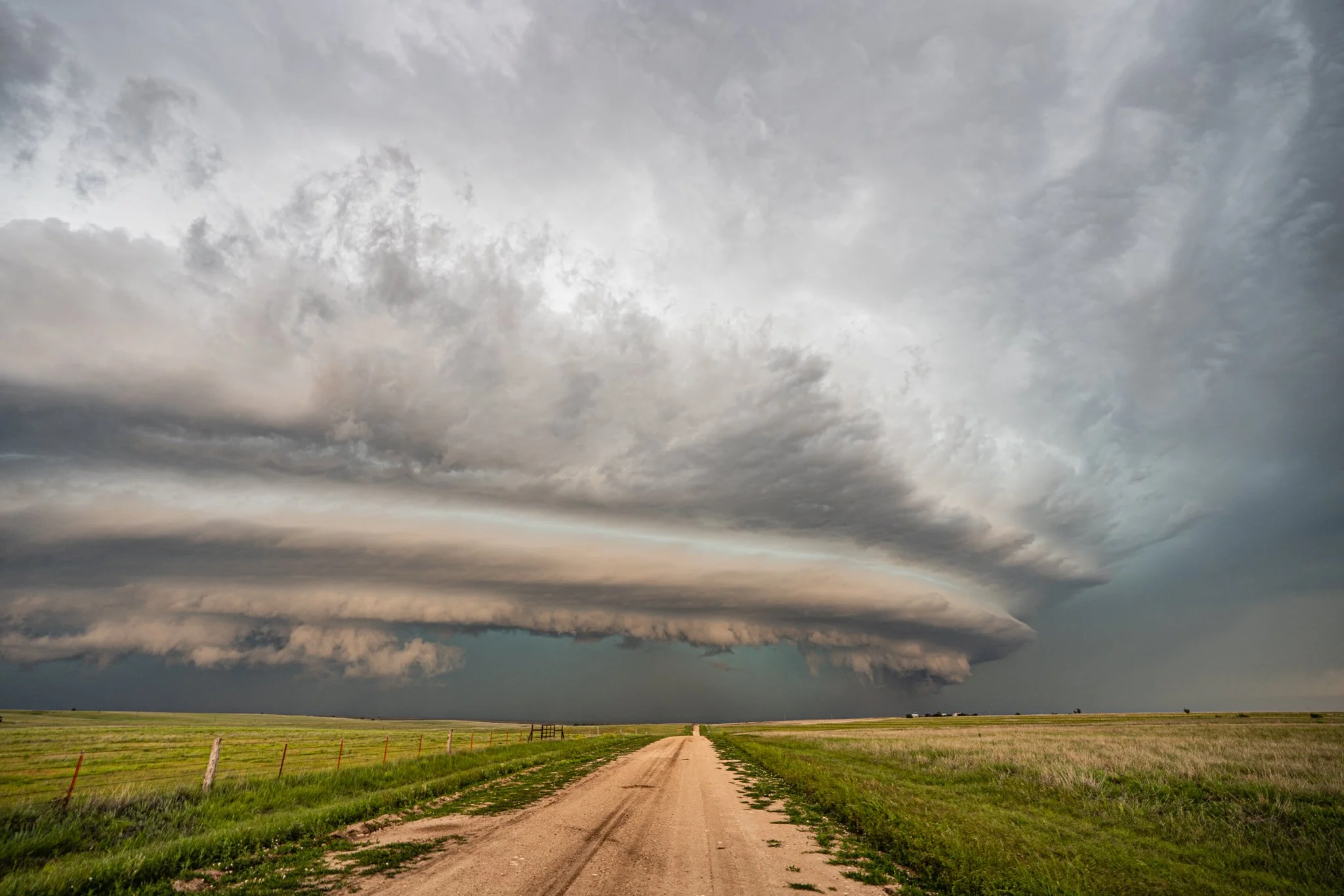
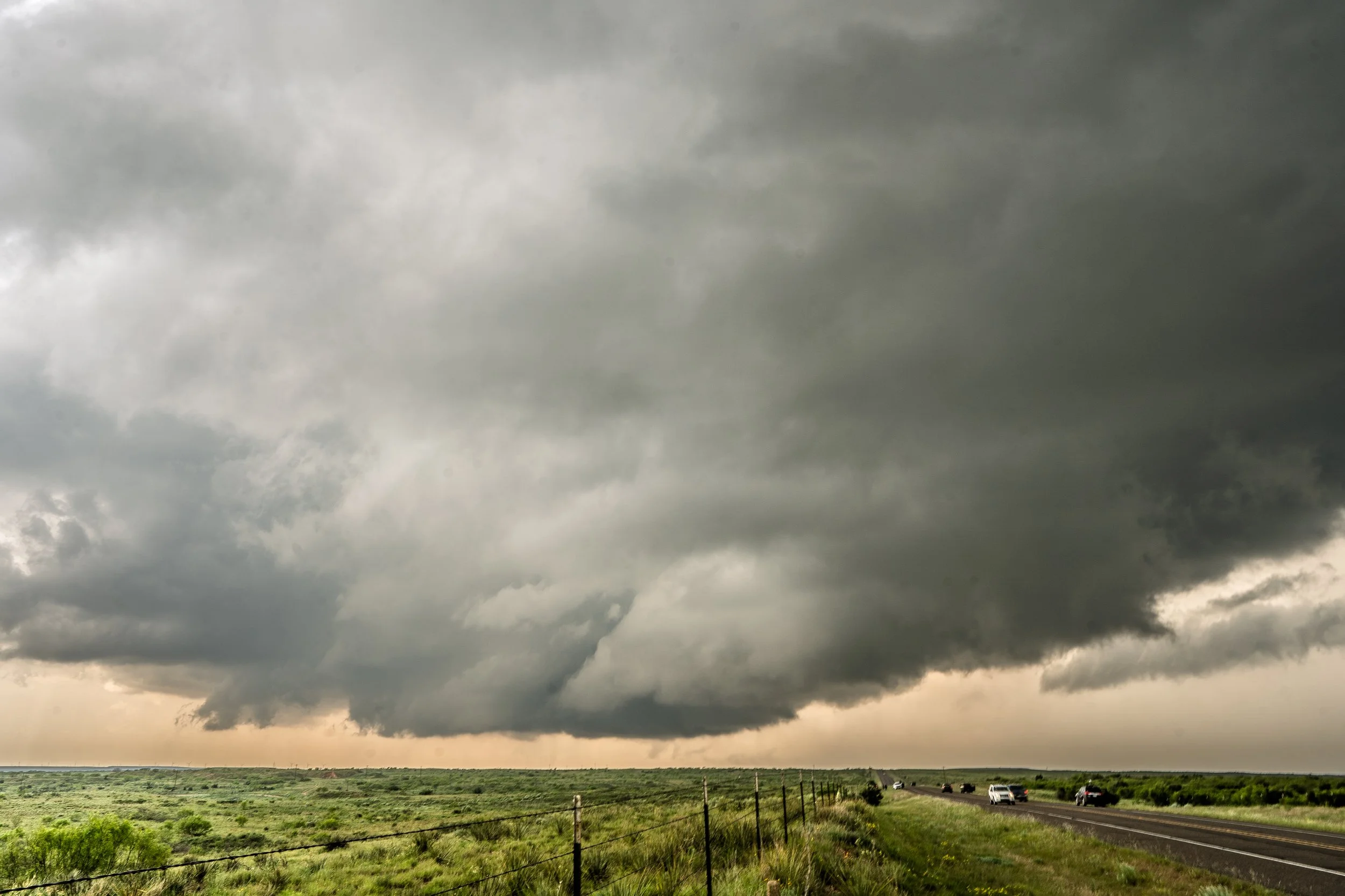
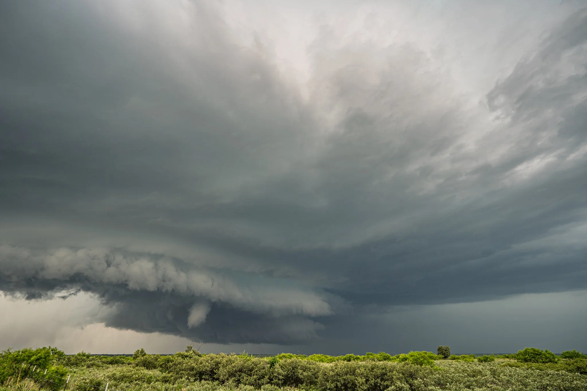
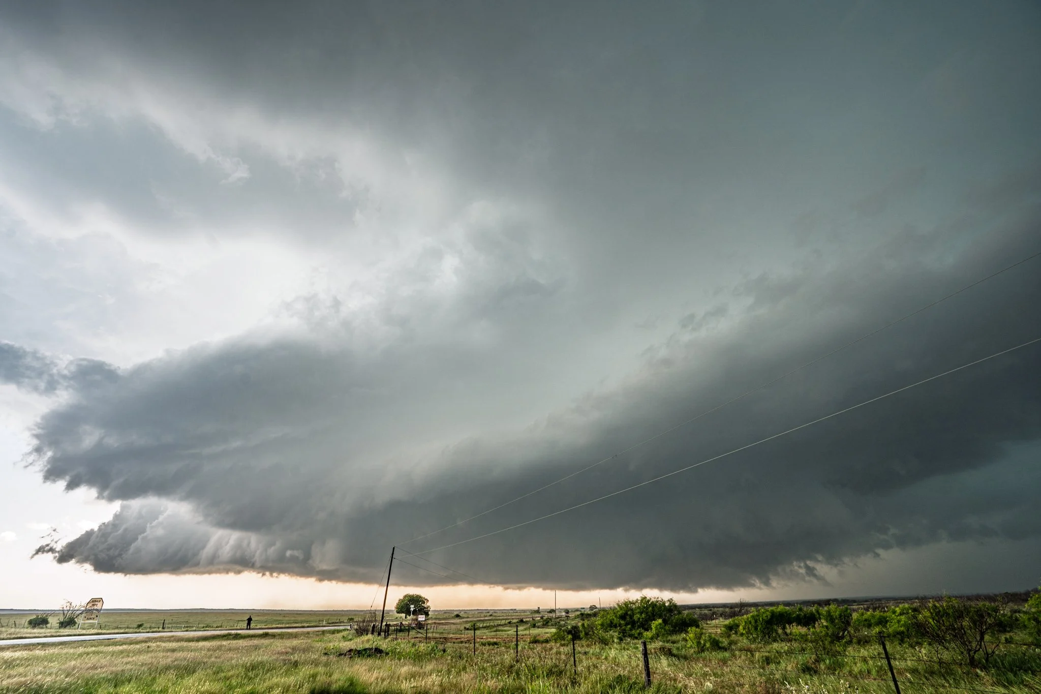
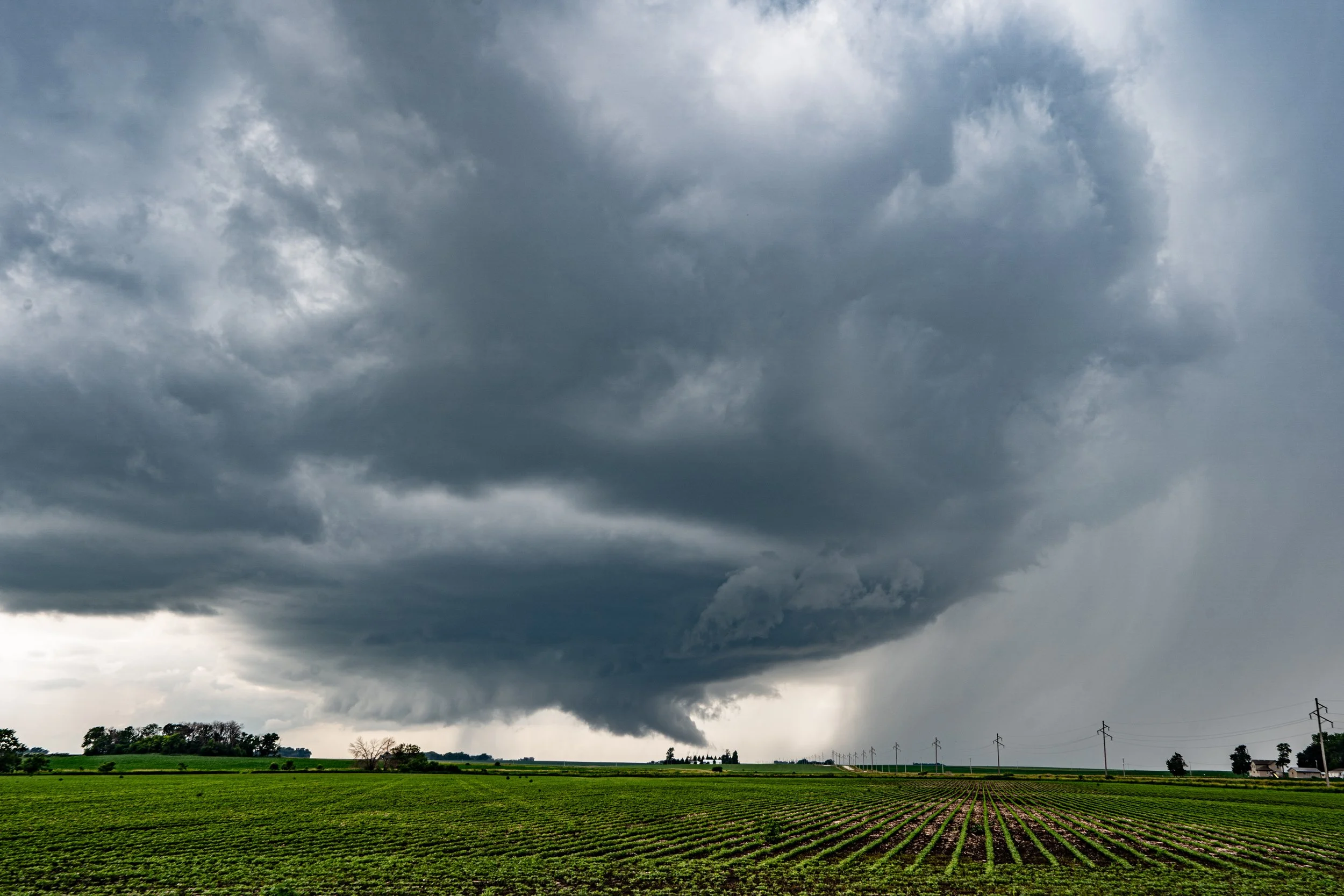
Initial storm and rotating, producing a brief funnel just over the trees near Roff, Oklahoma.
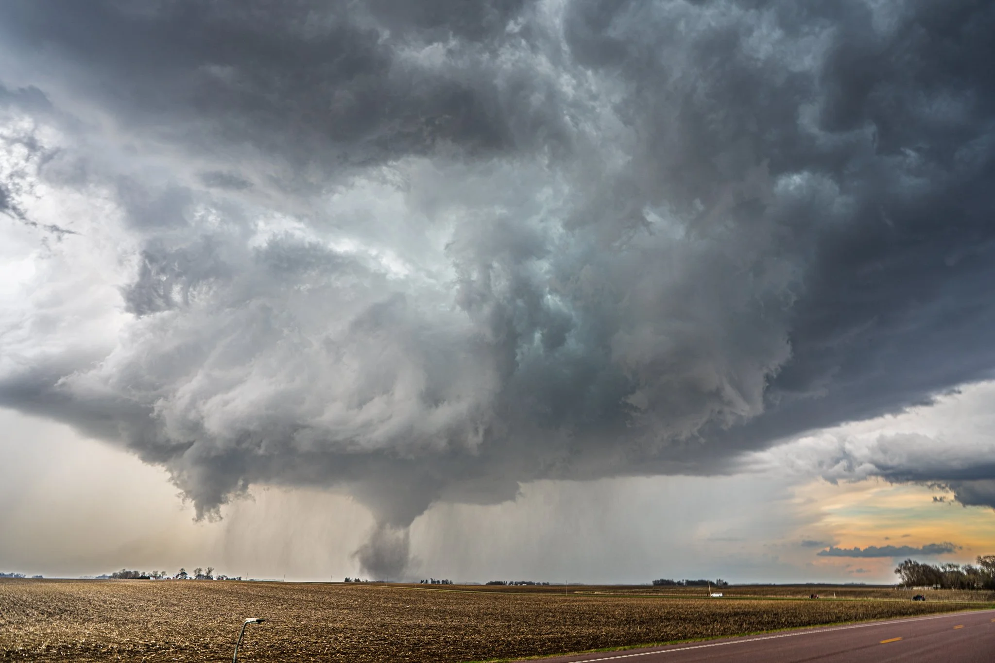
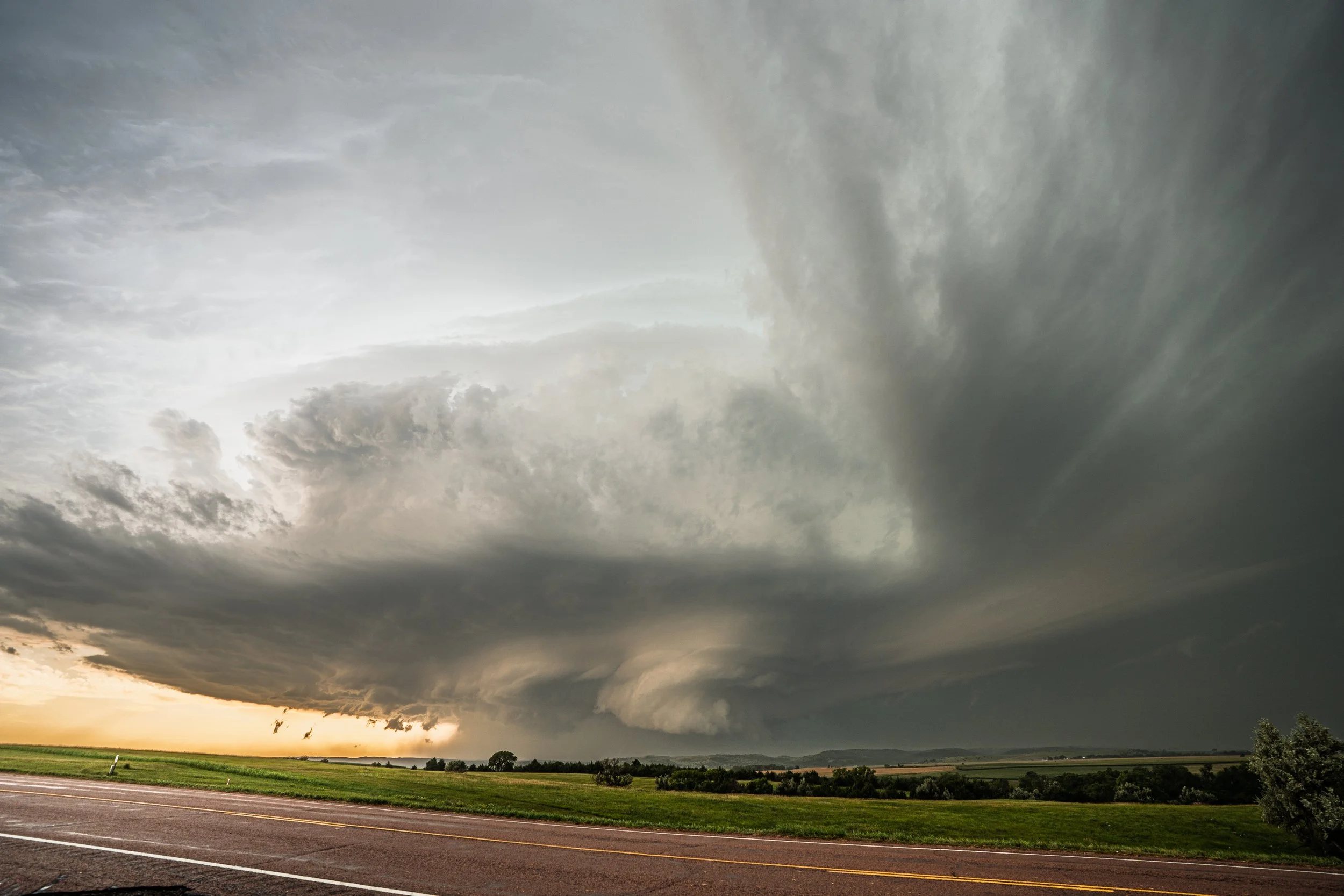
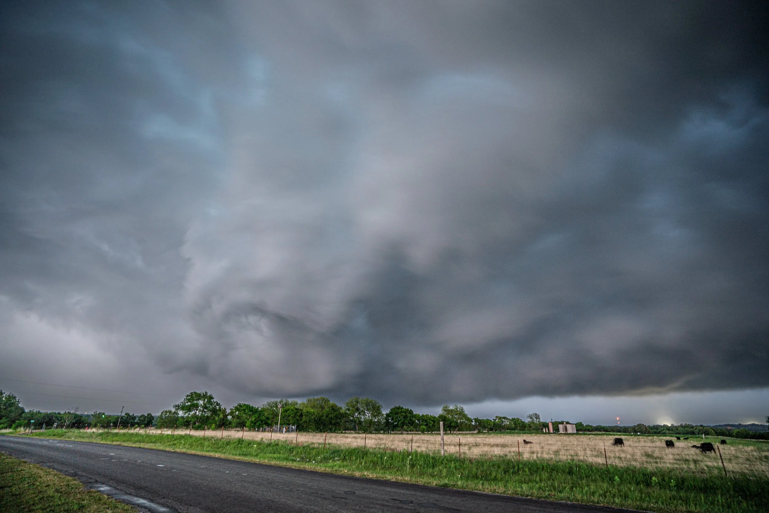
Another funnel cloud just above the tree straight ahead near Roff, Oklahoma.
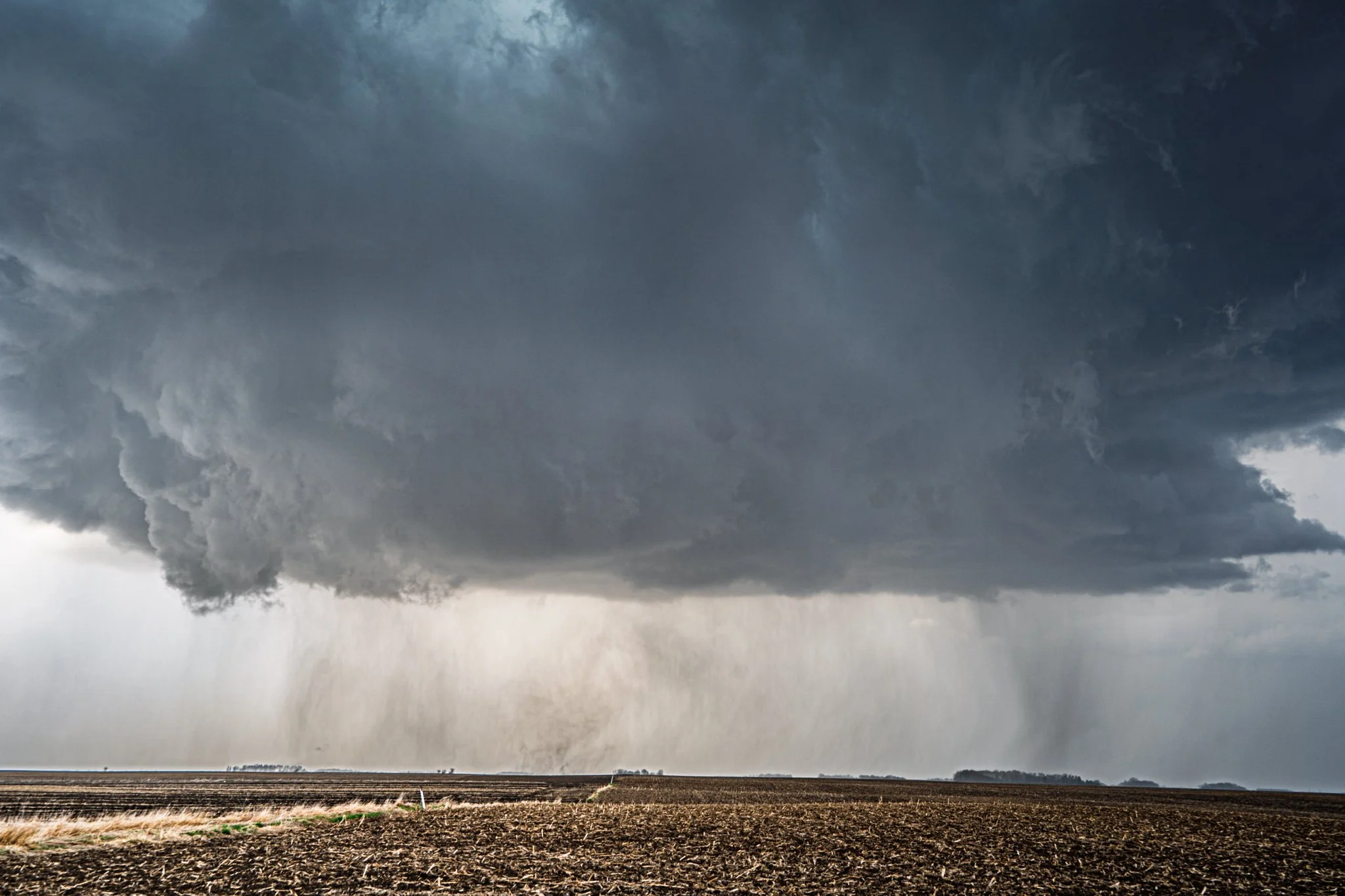
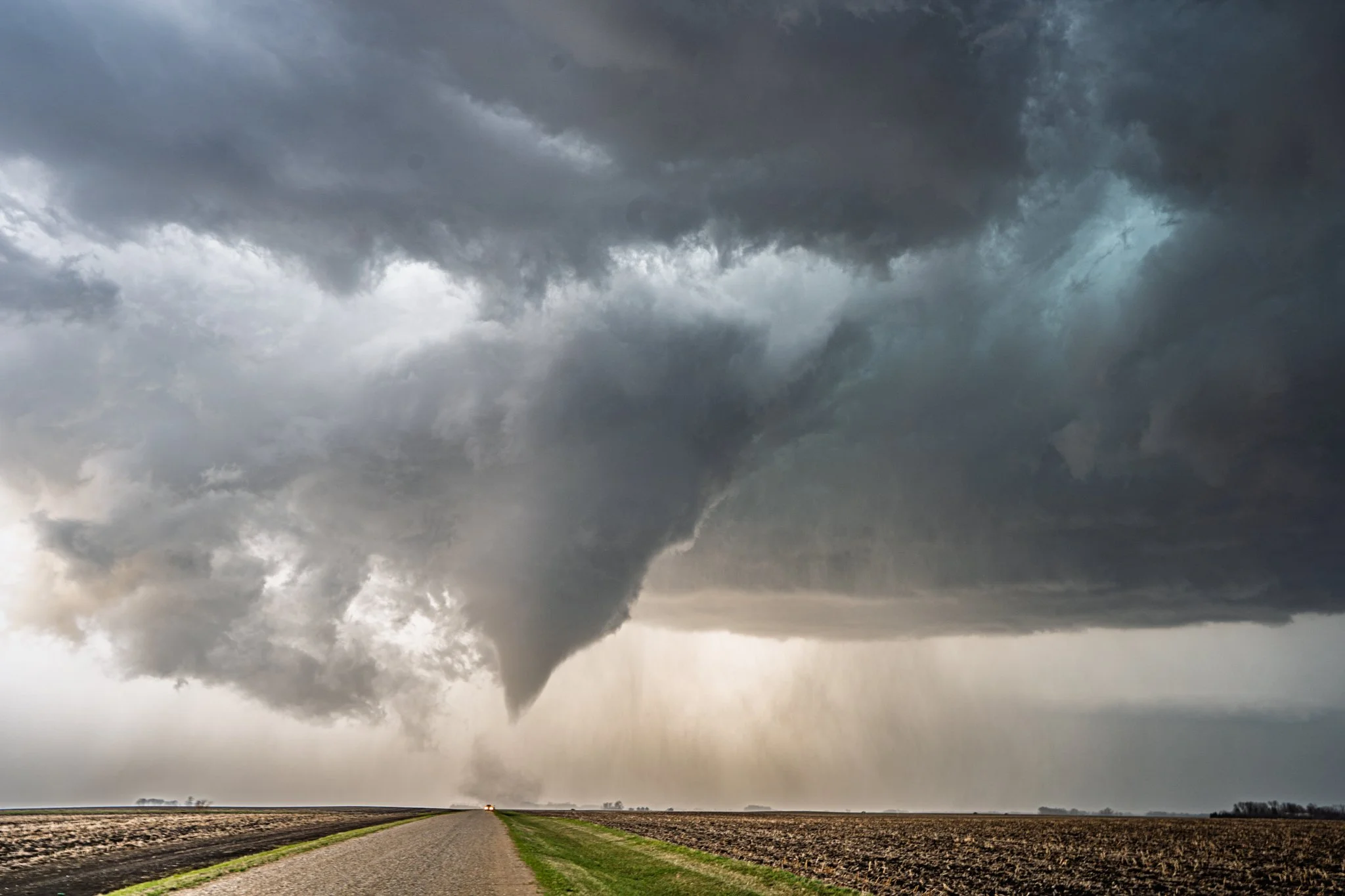
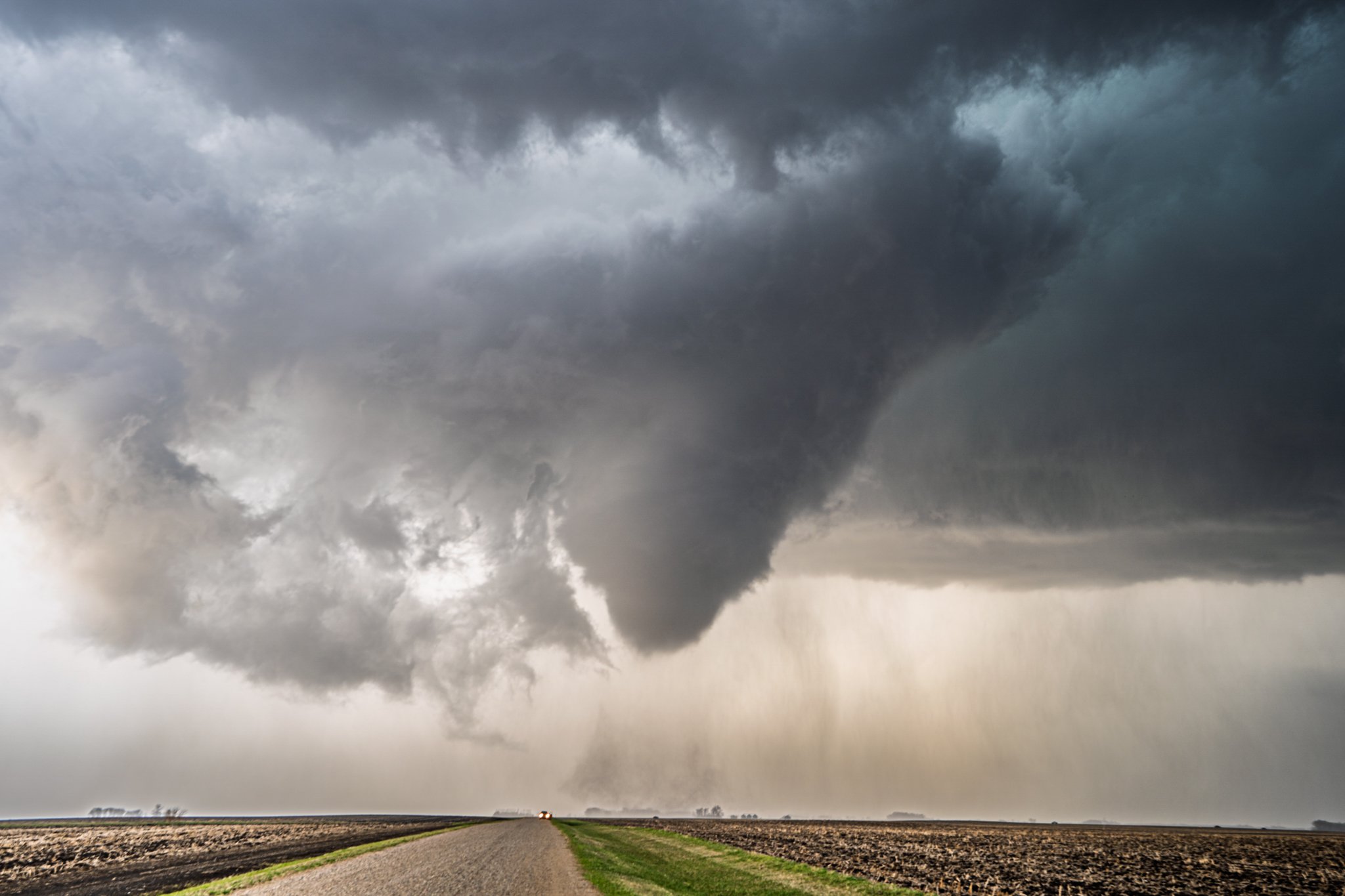
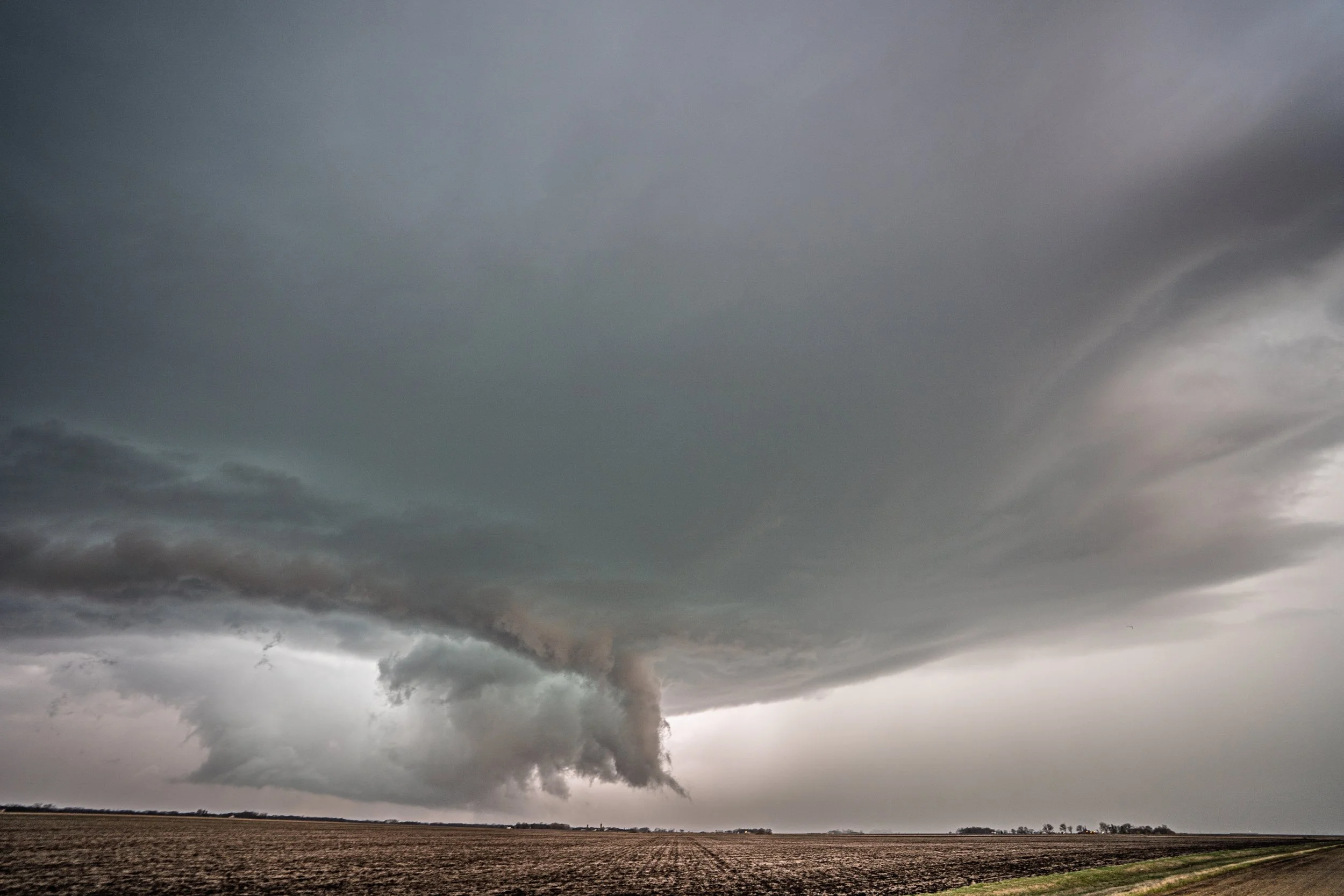
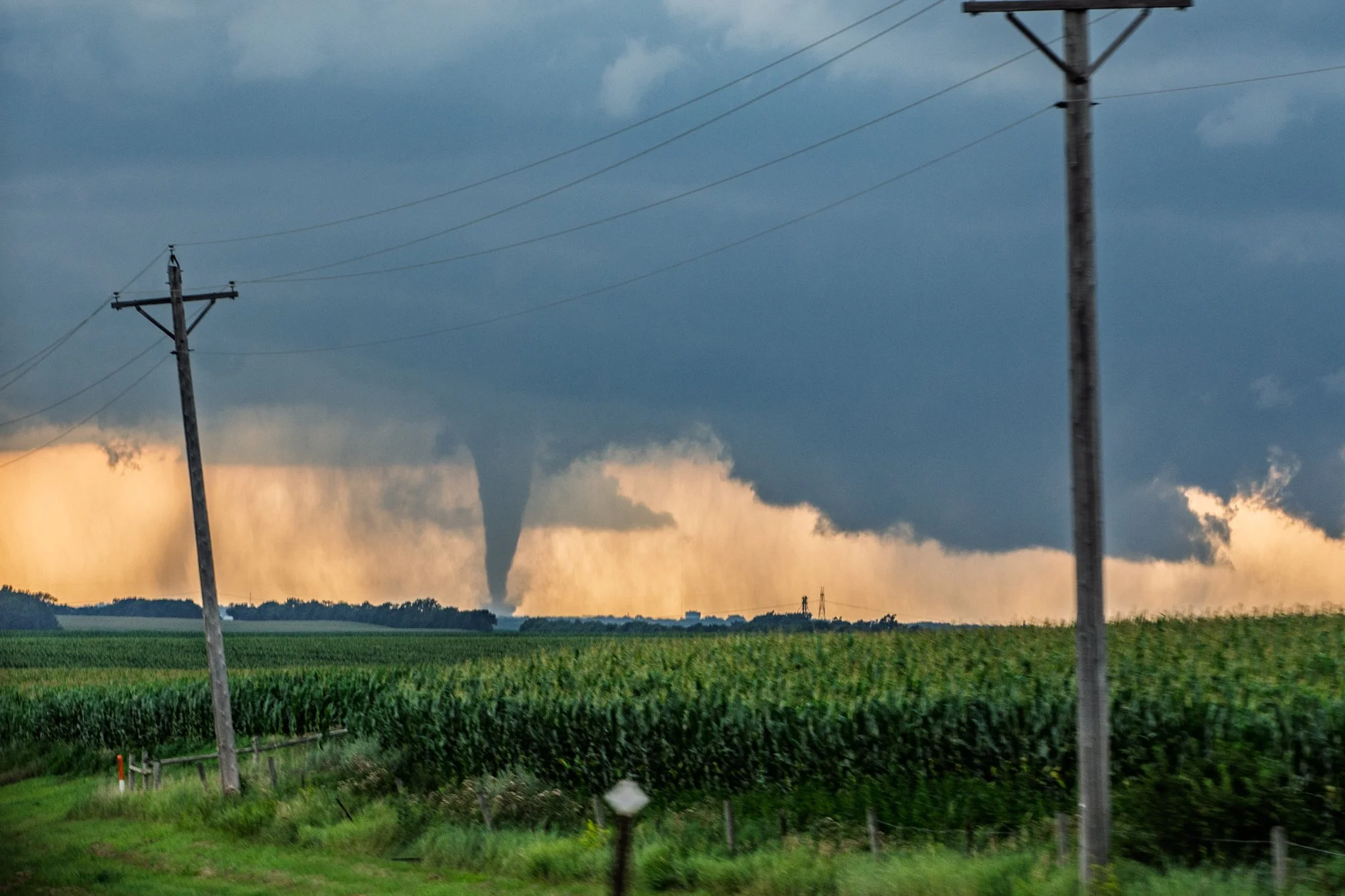
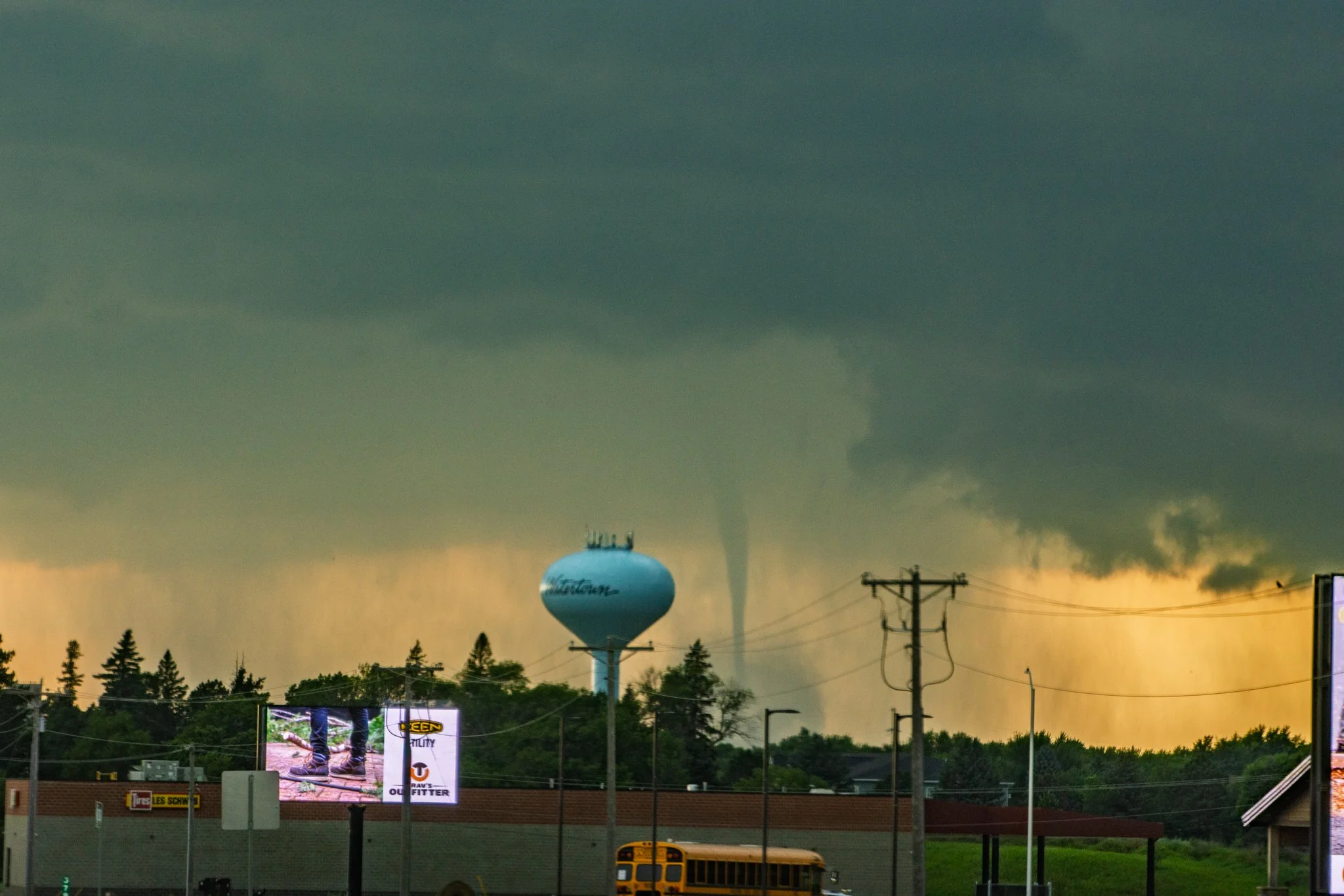
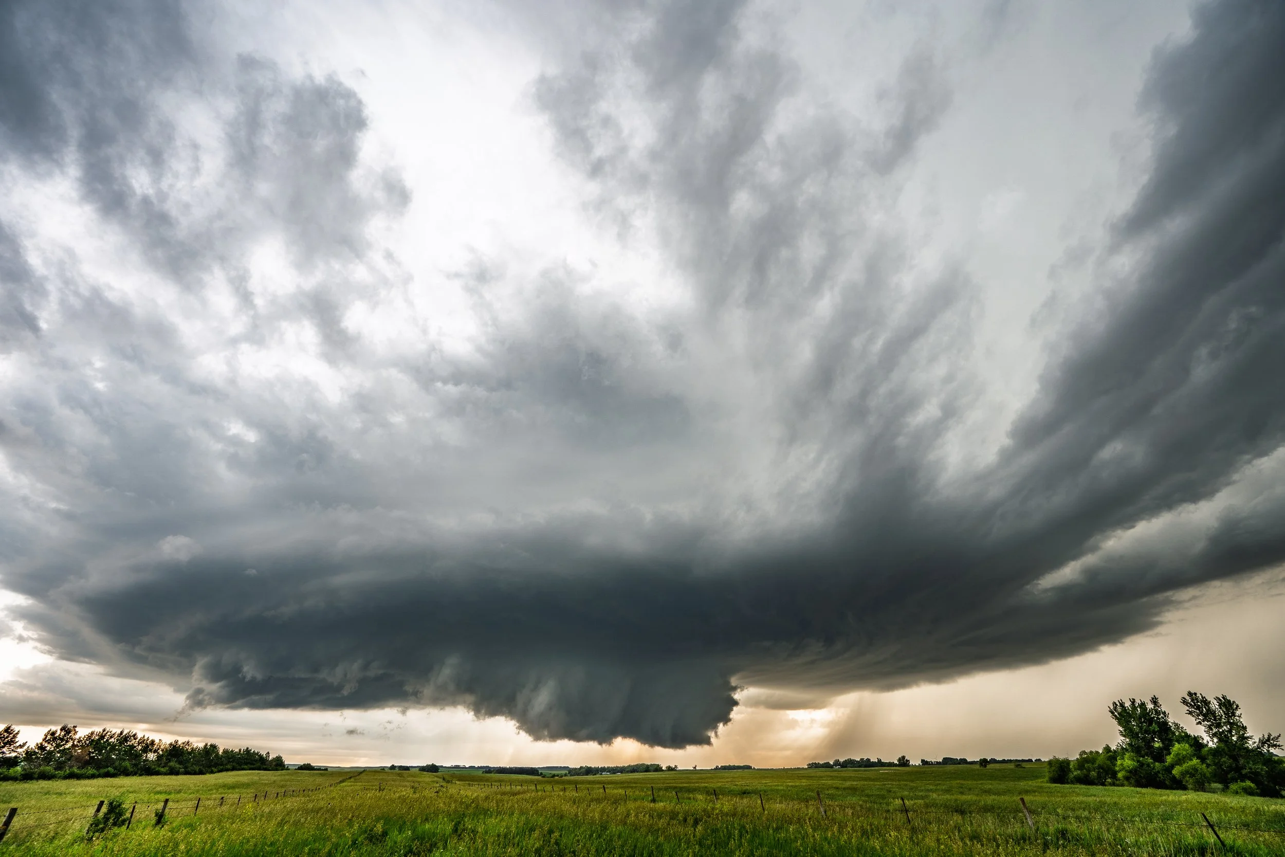
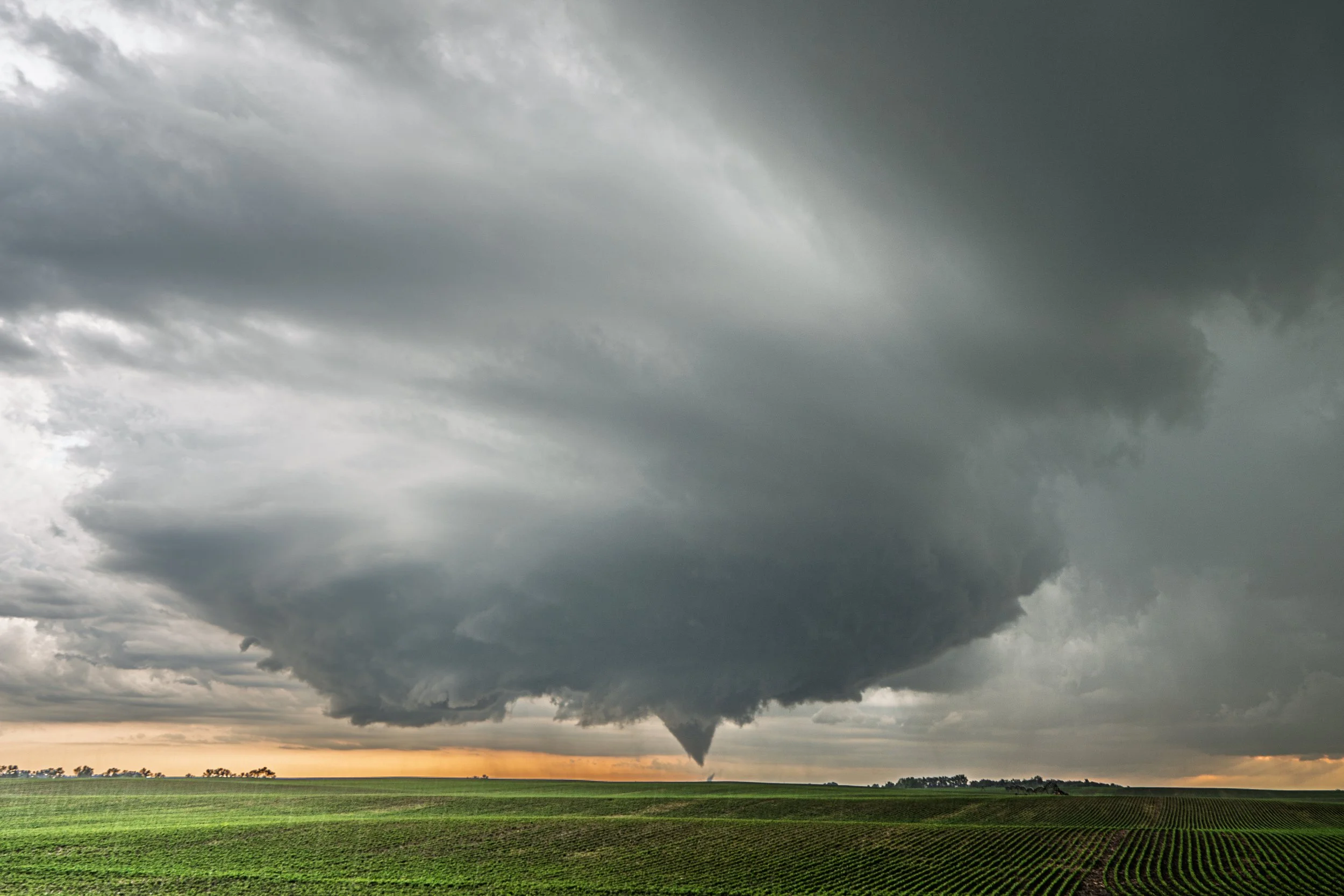
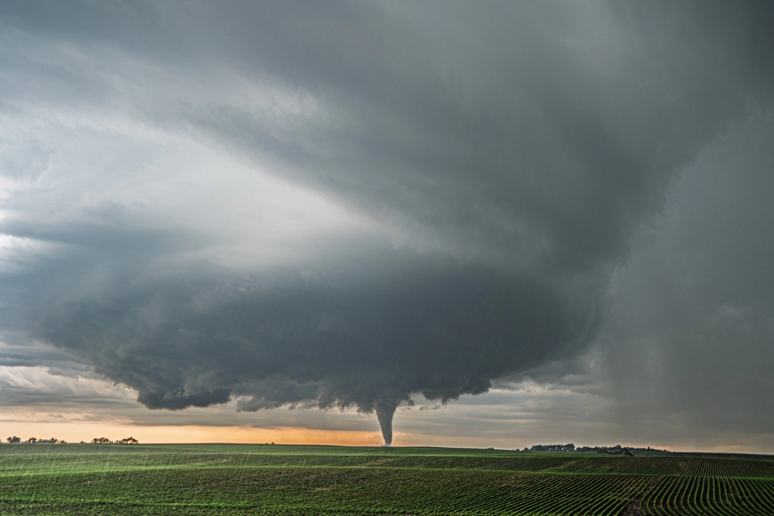
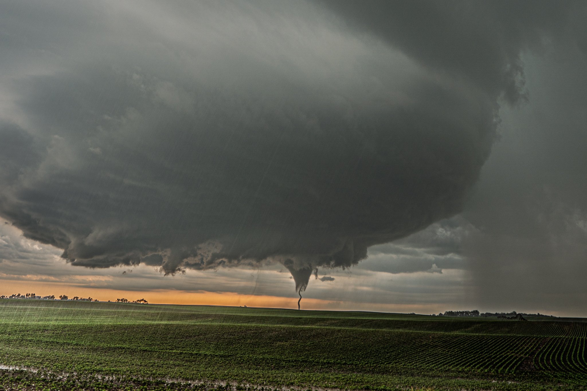
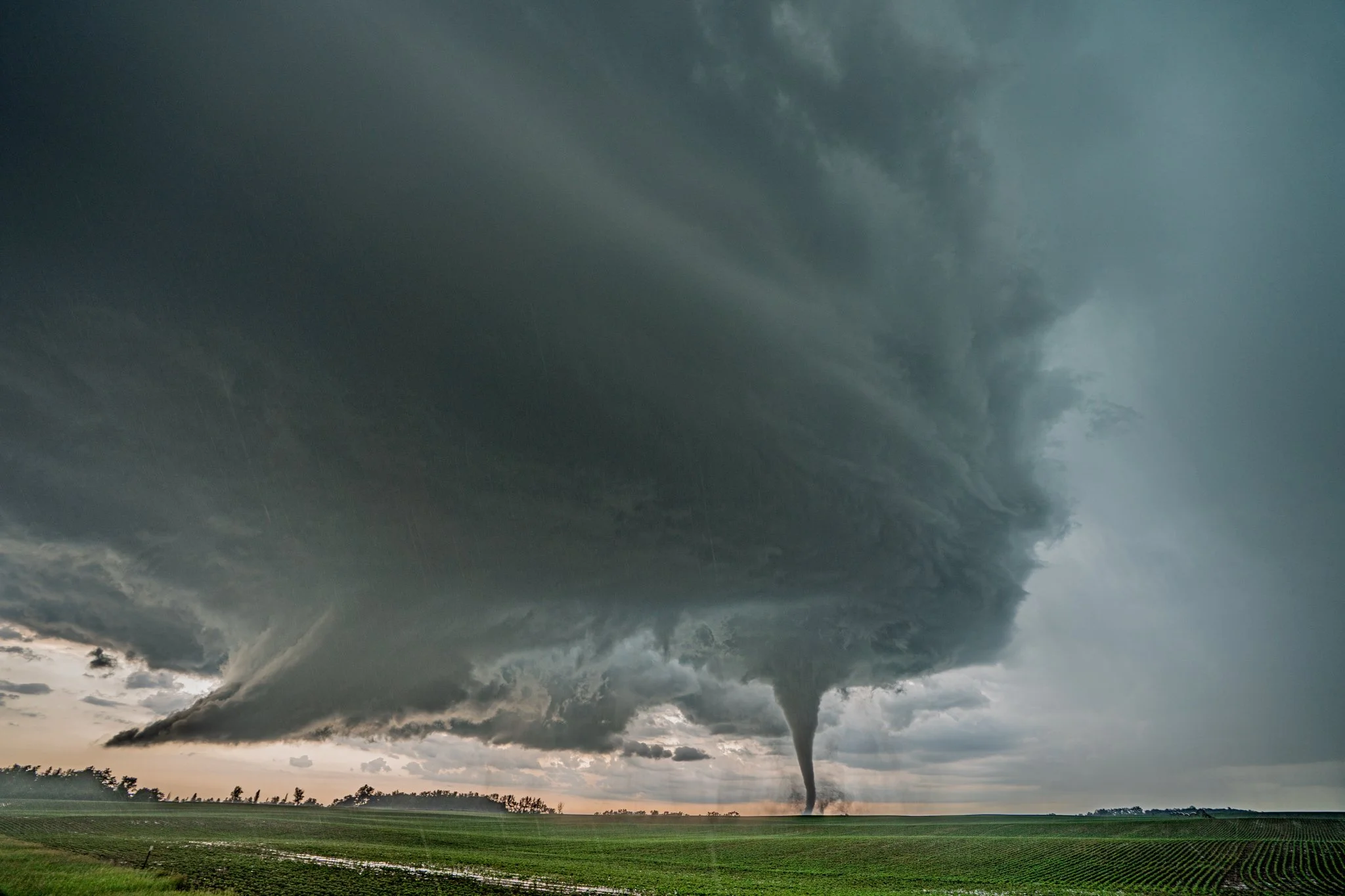
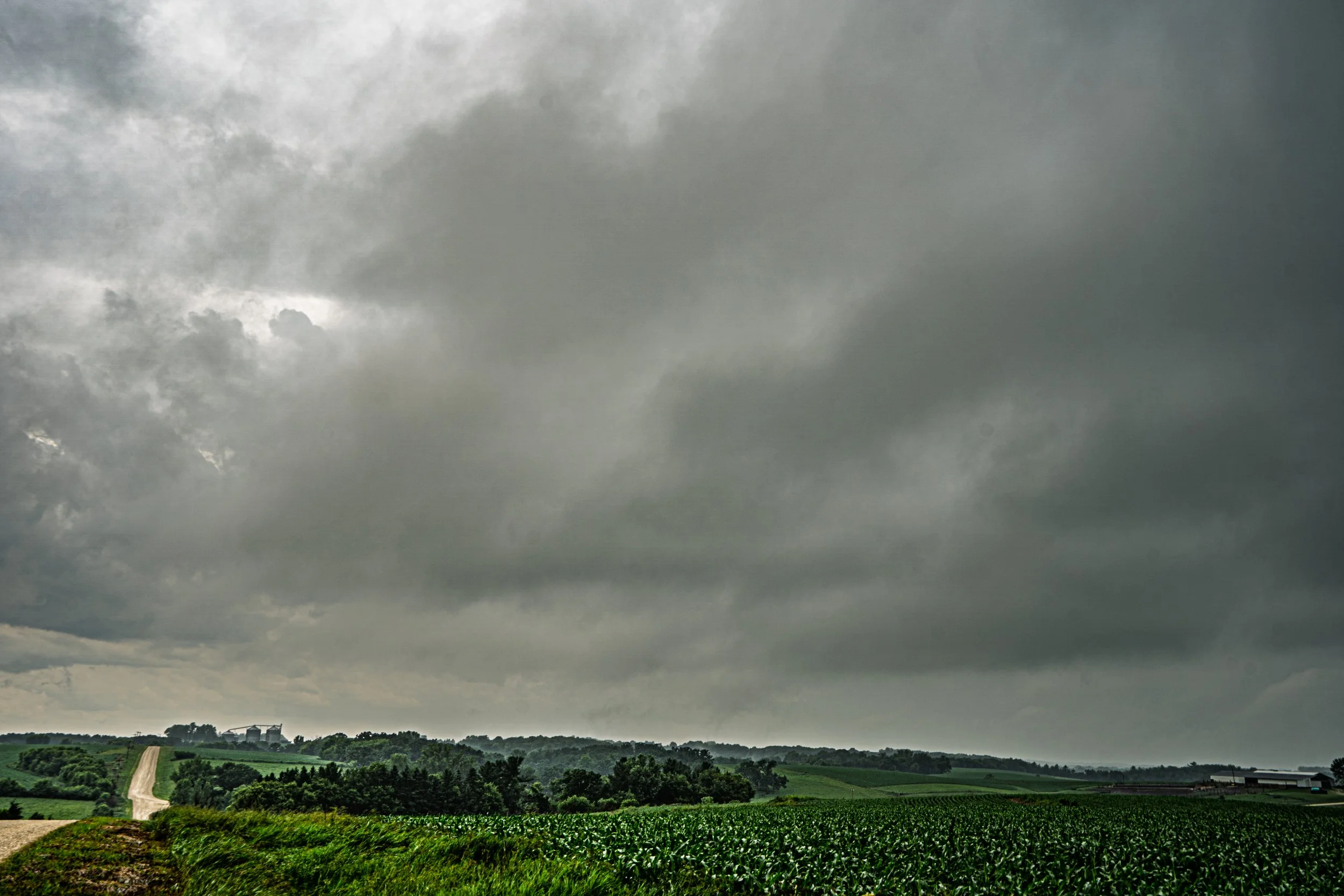
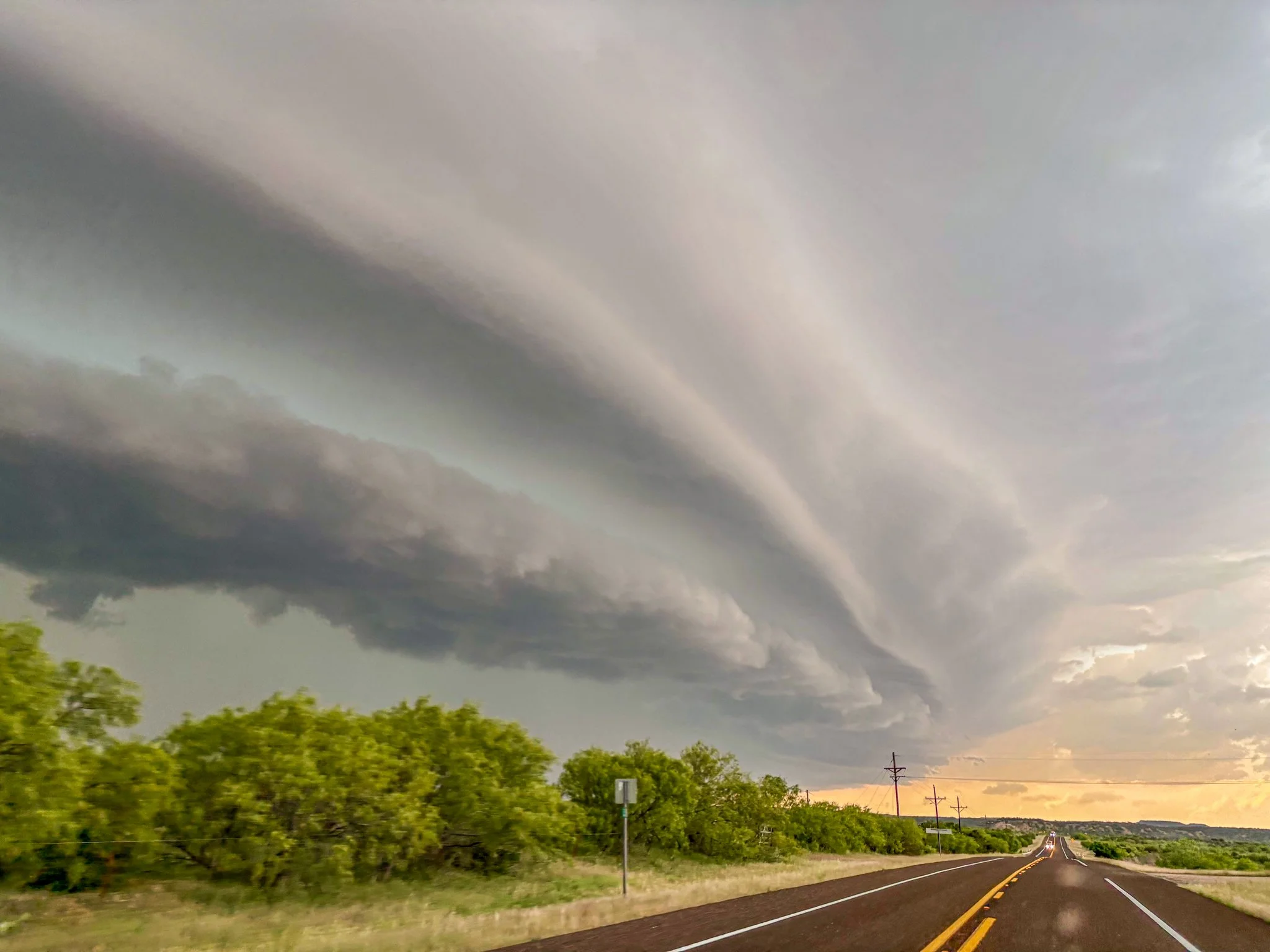
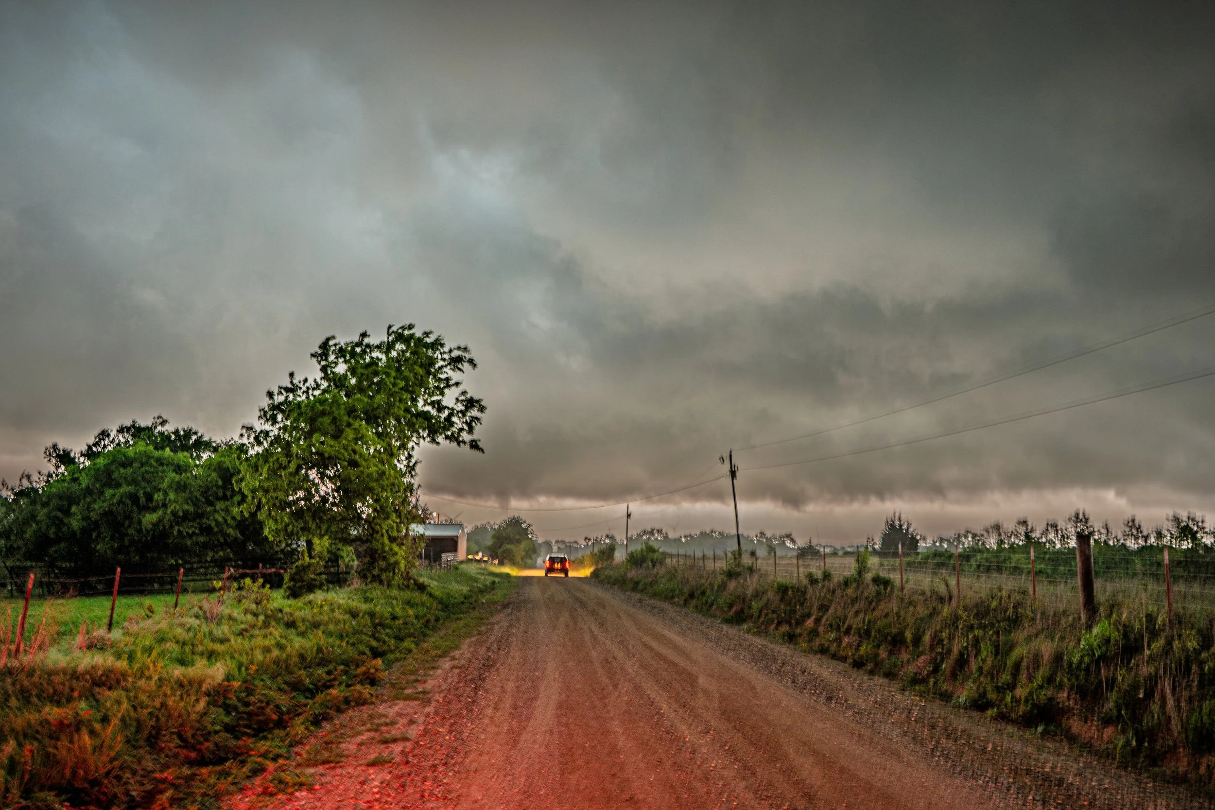
Another shot of the funnel that was condensating a bit more towards the ground as we were racing up the road to get closer.
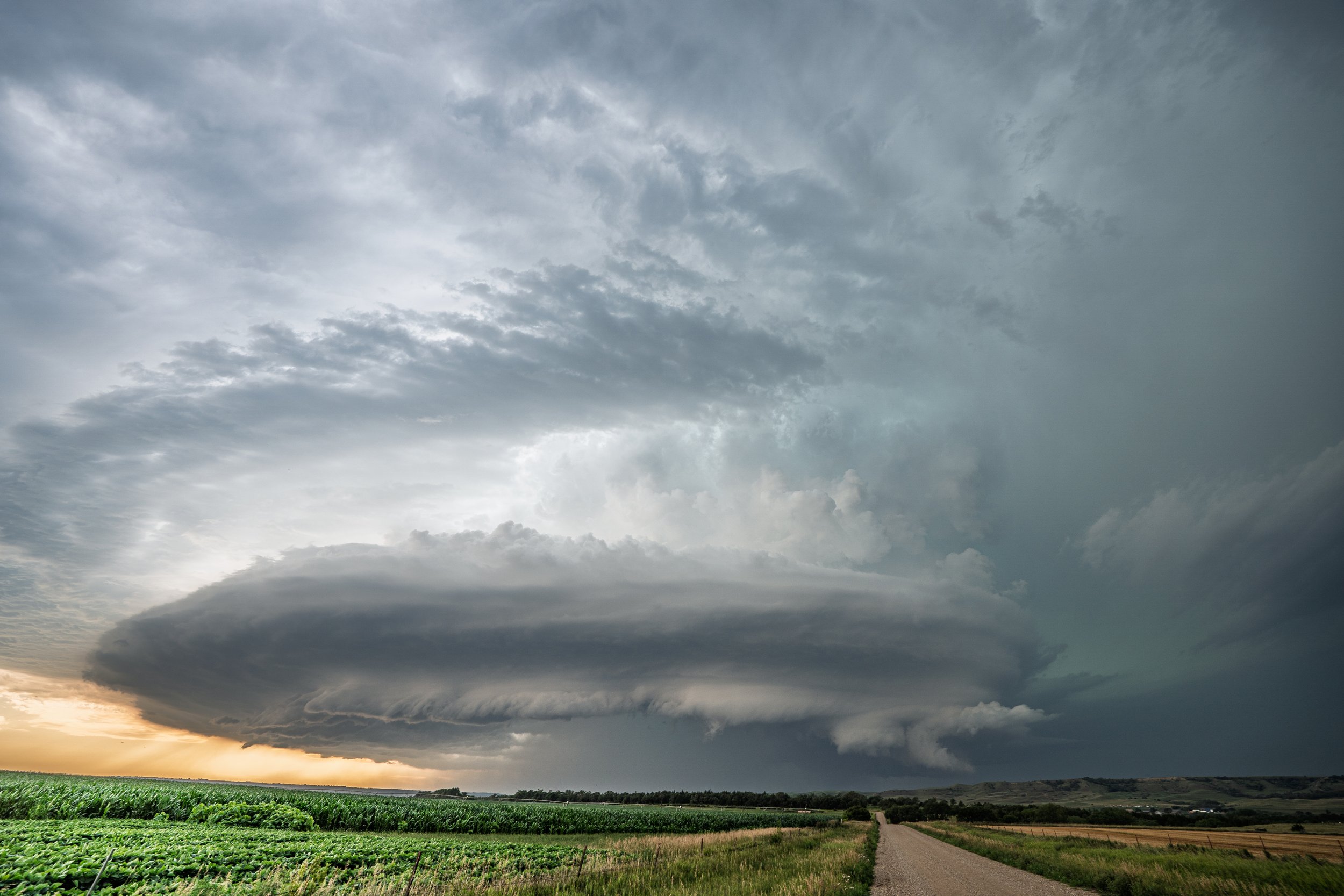
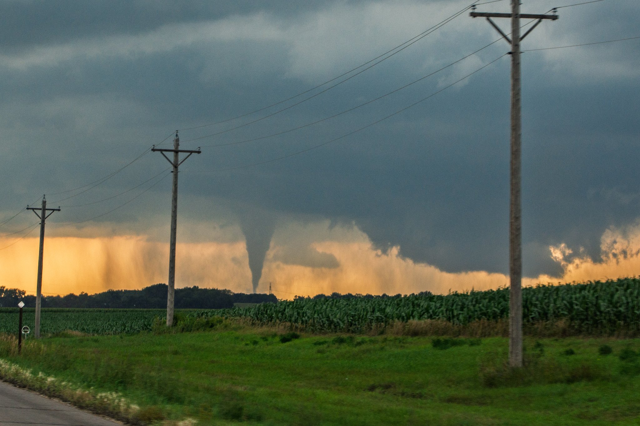
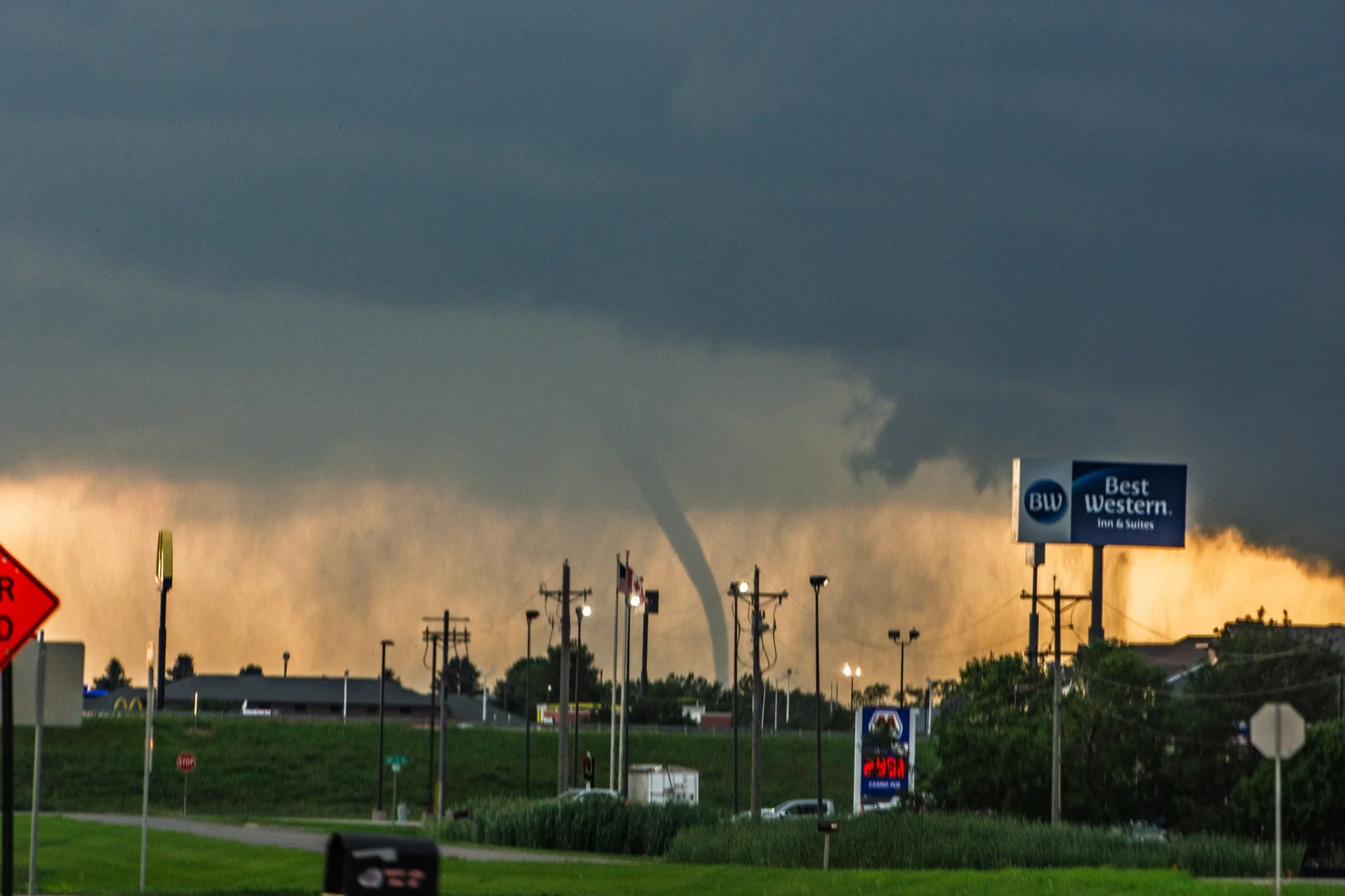
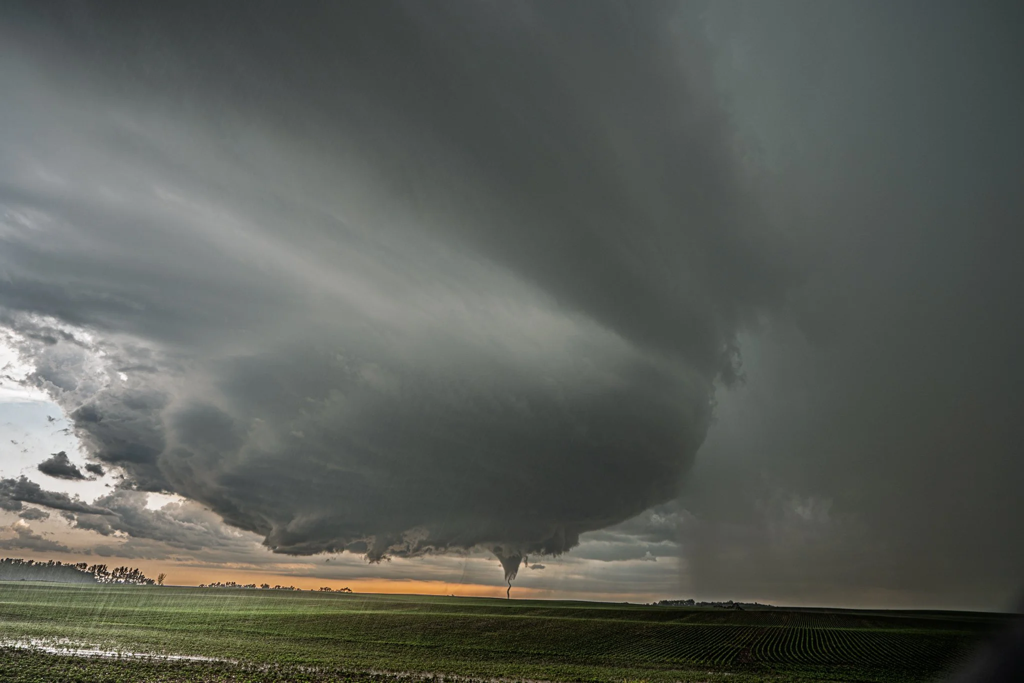
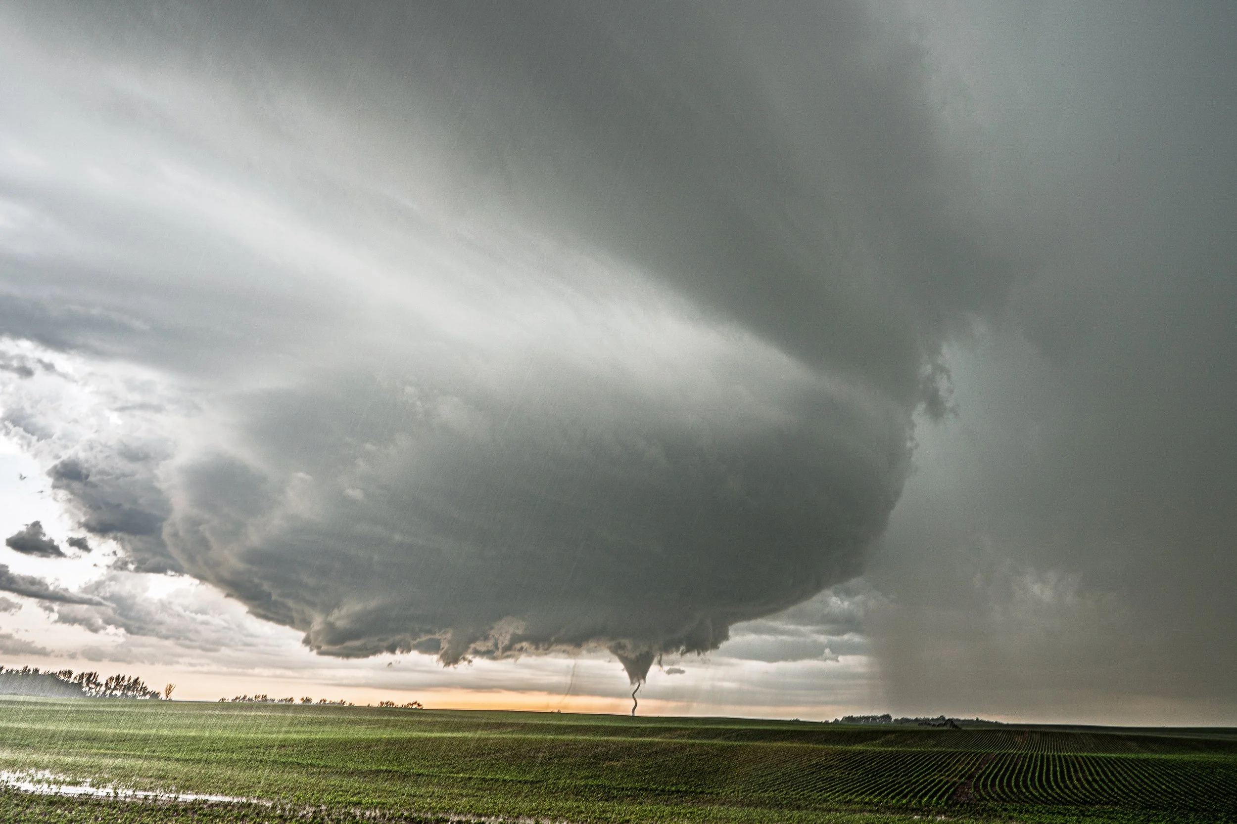
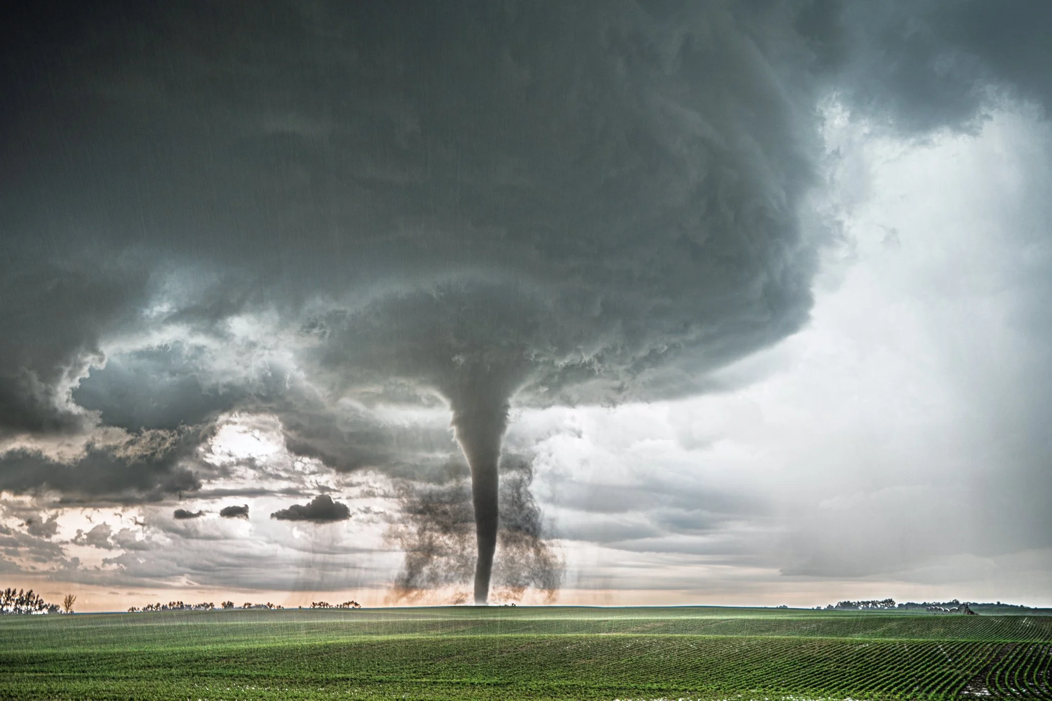
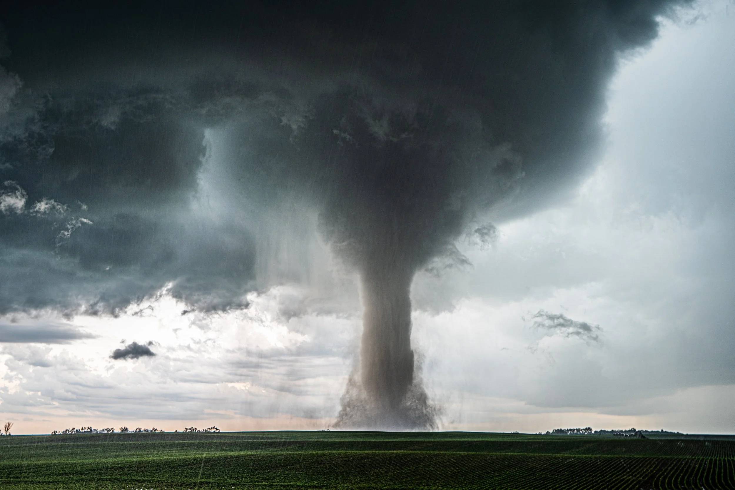
The funnel lifted as we get closer, only 1 mile west of Roff at this point. Action area and rotating lowering was still present.
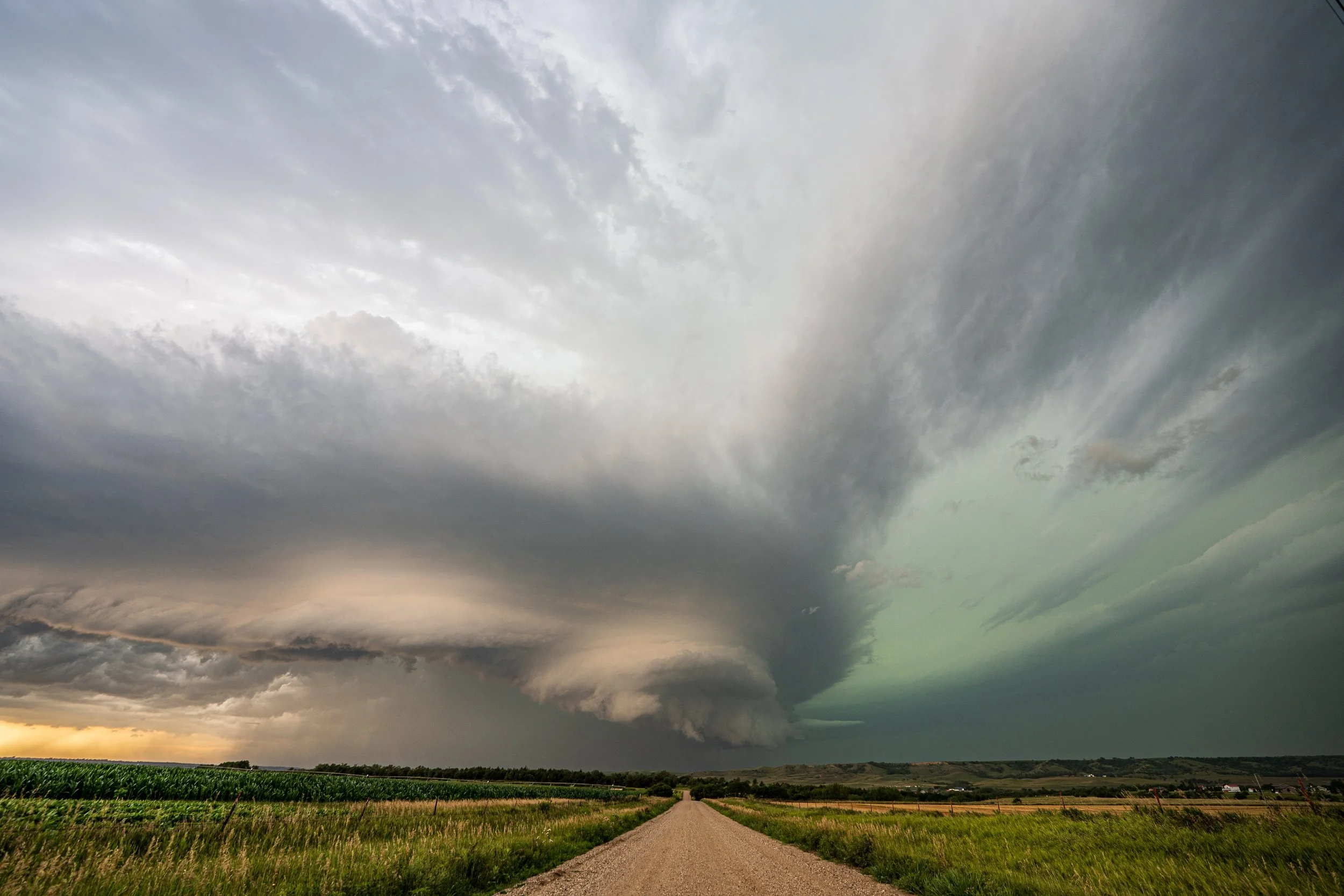
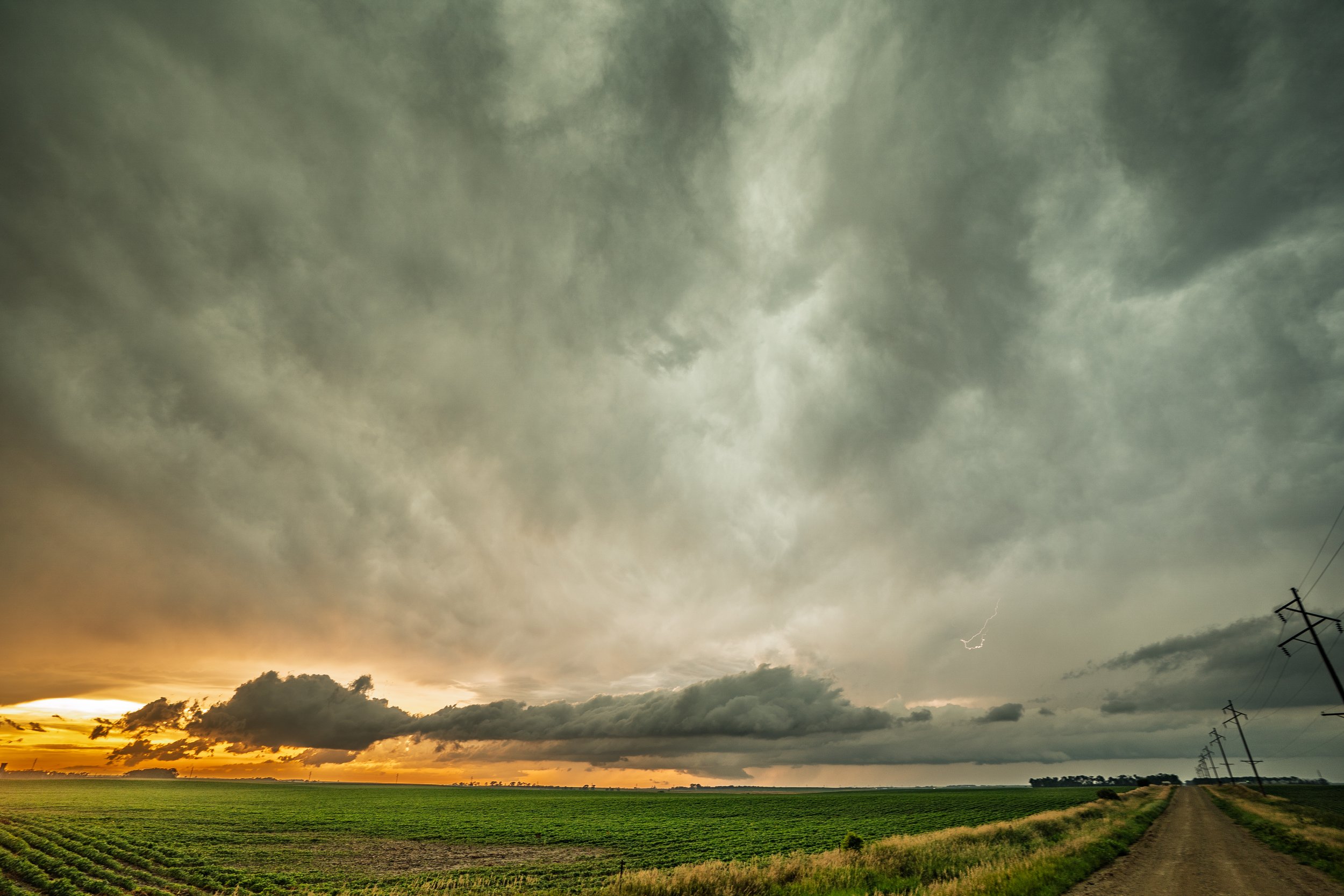
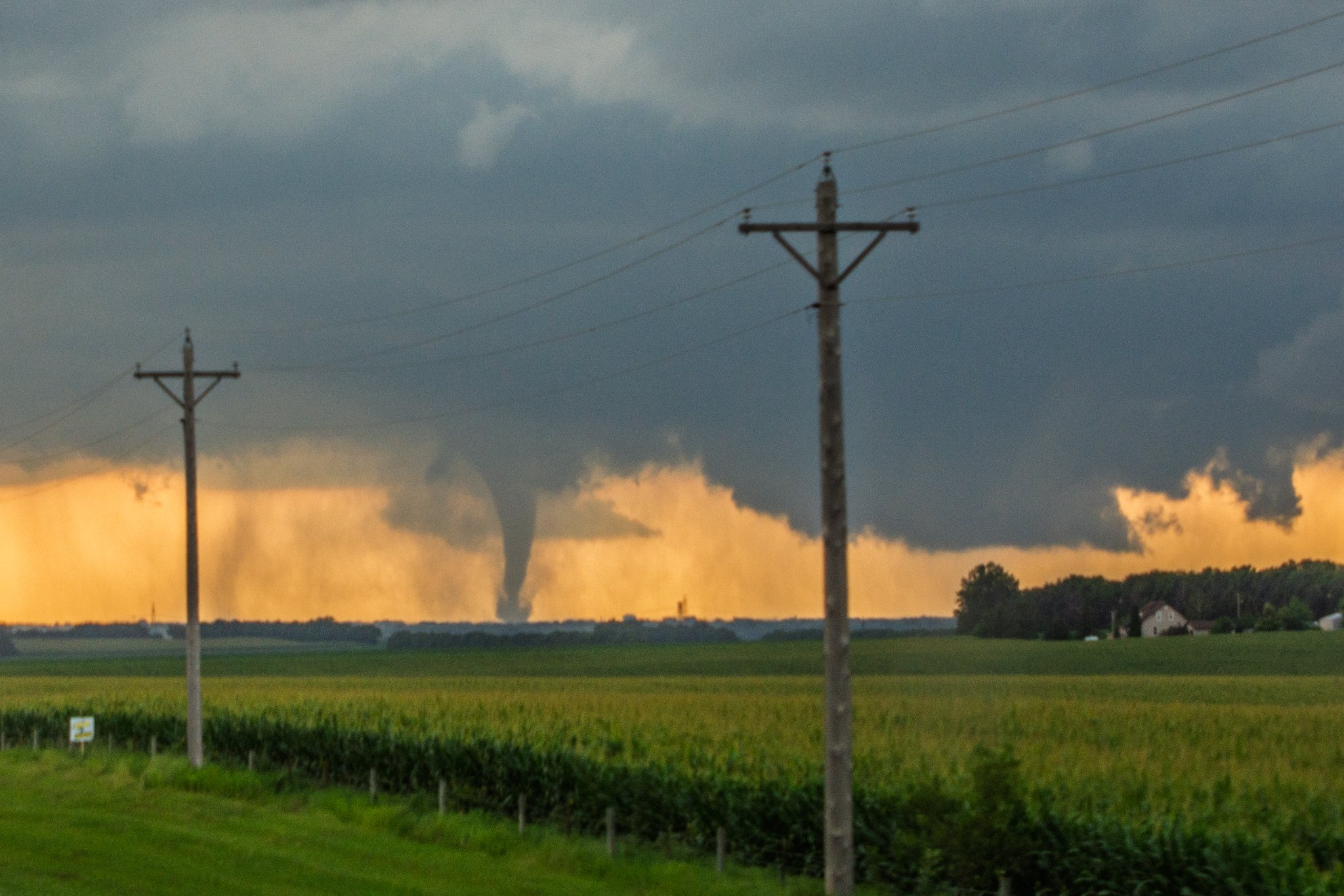
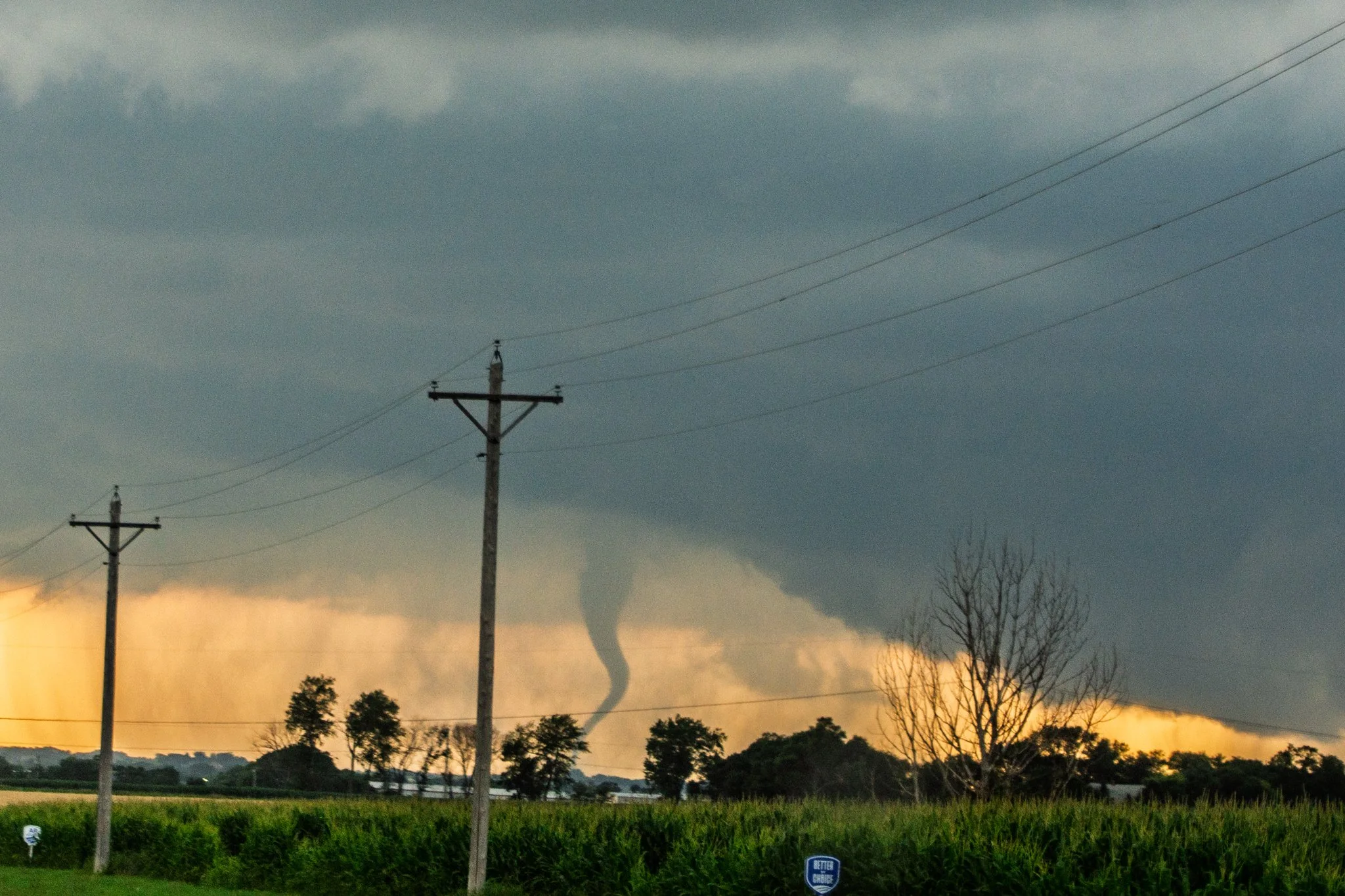
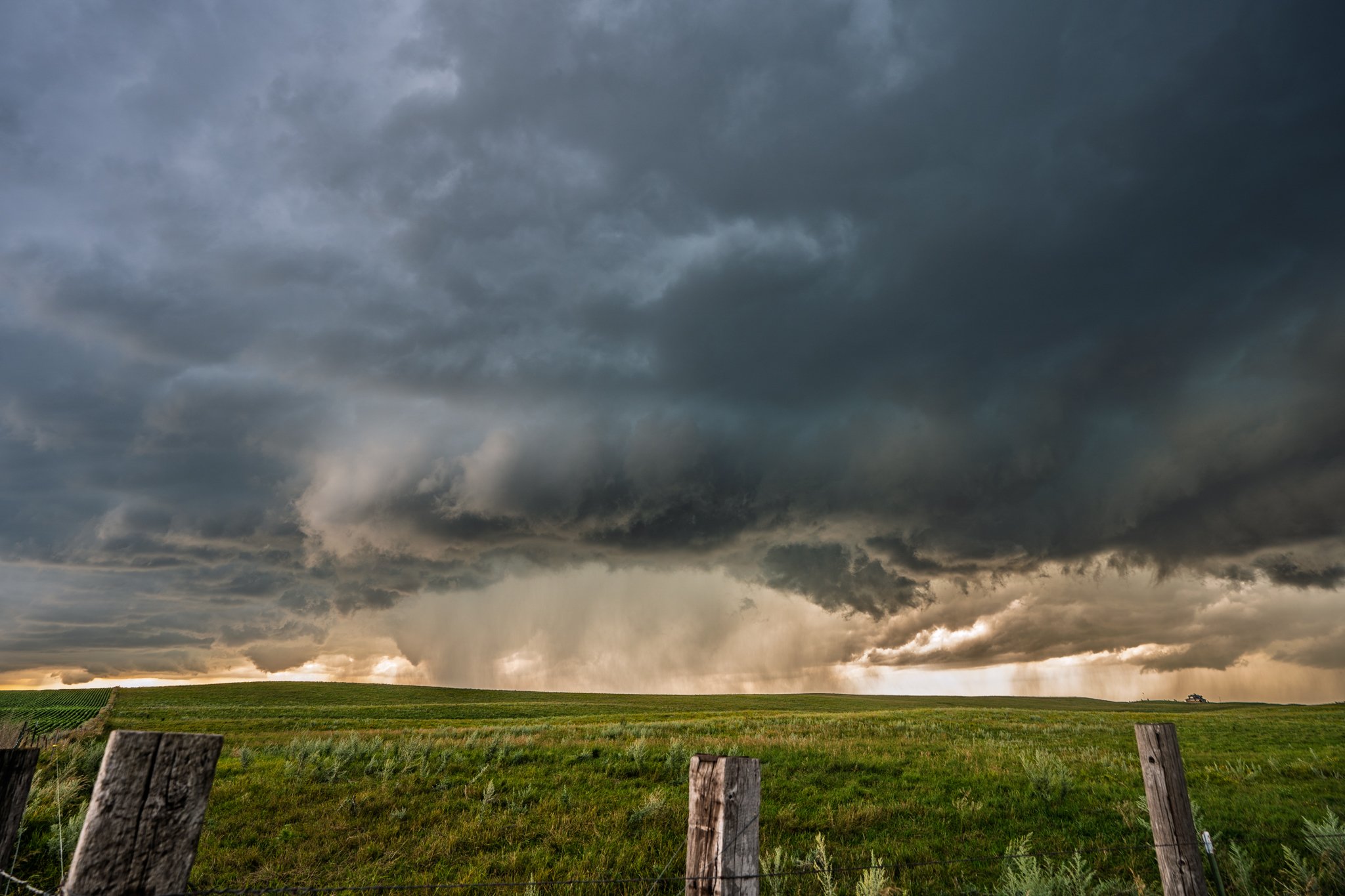
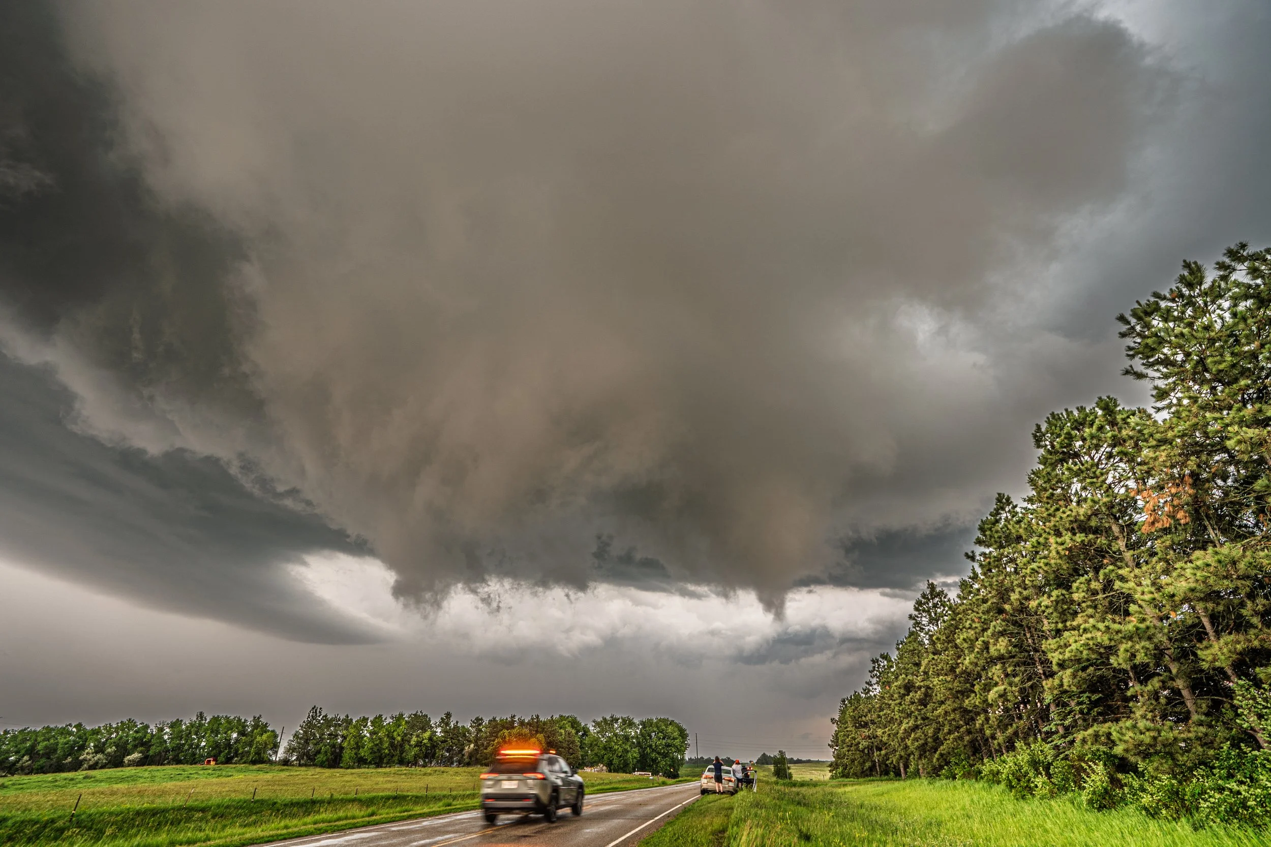
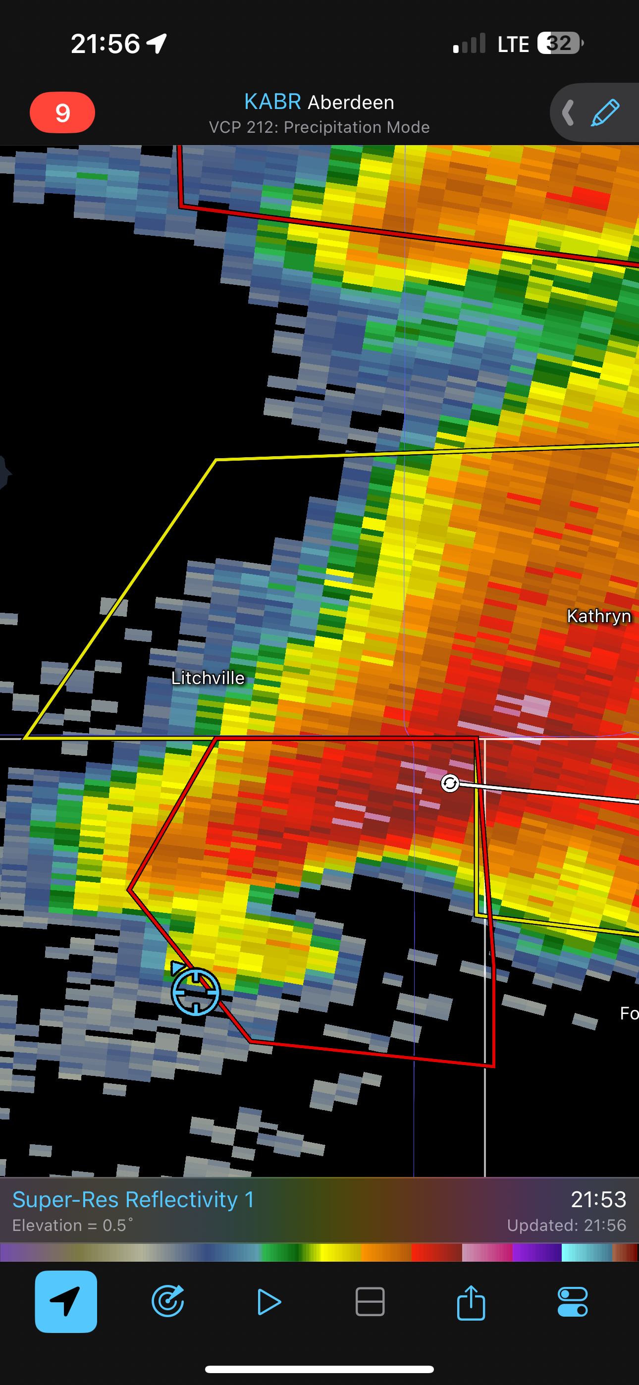
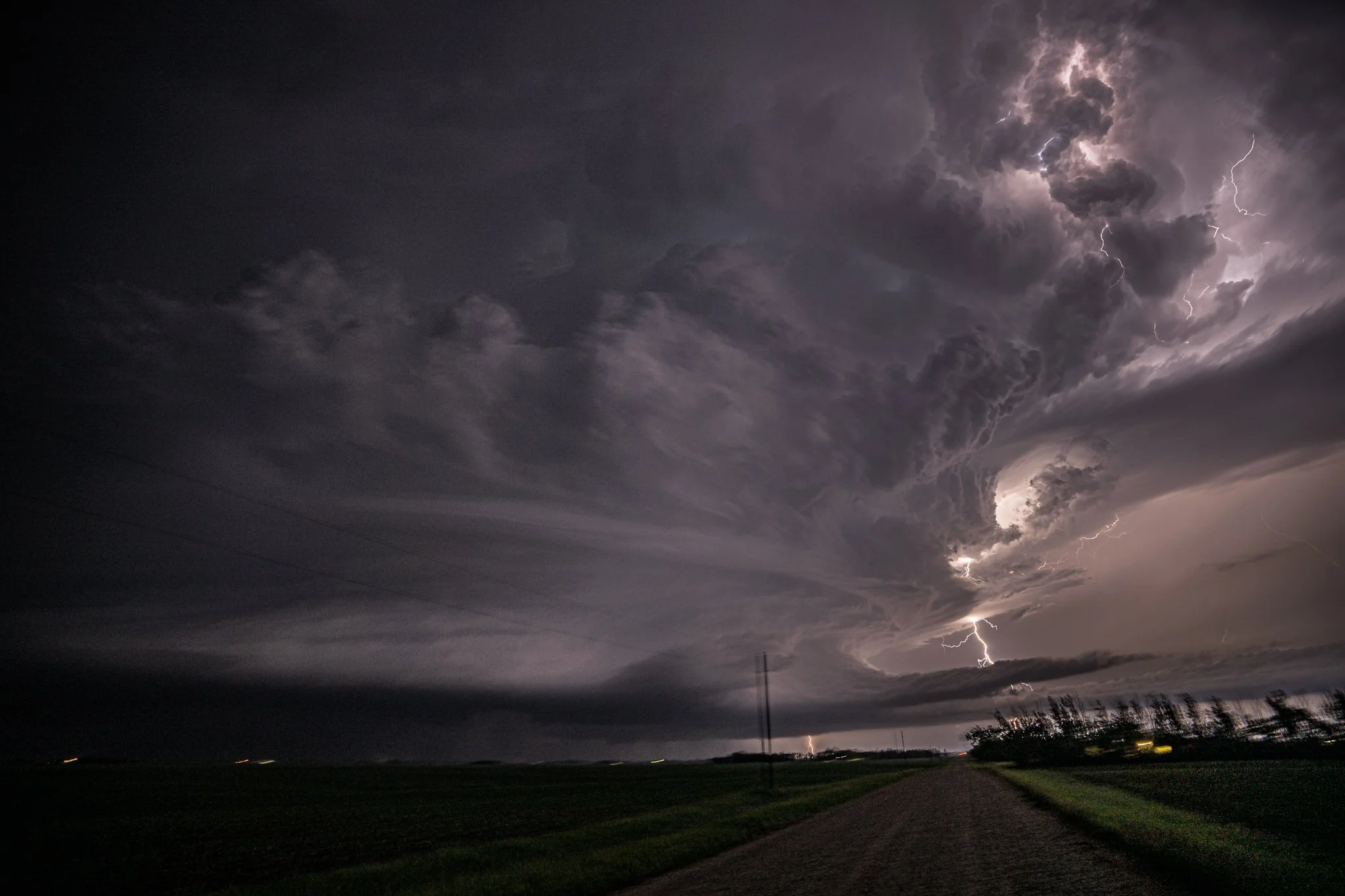
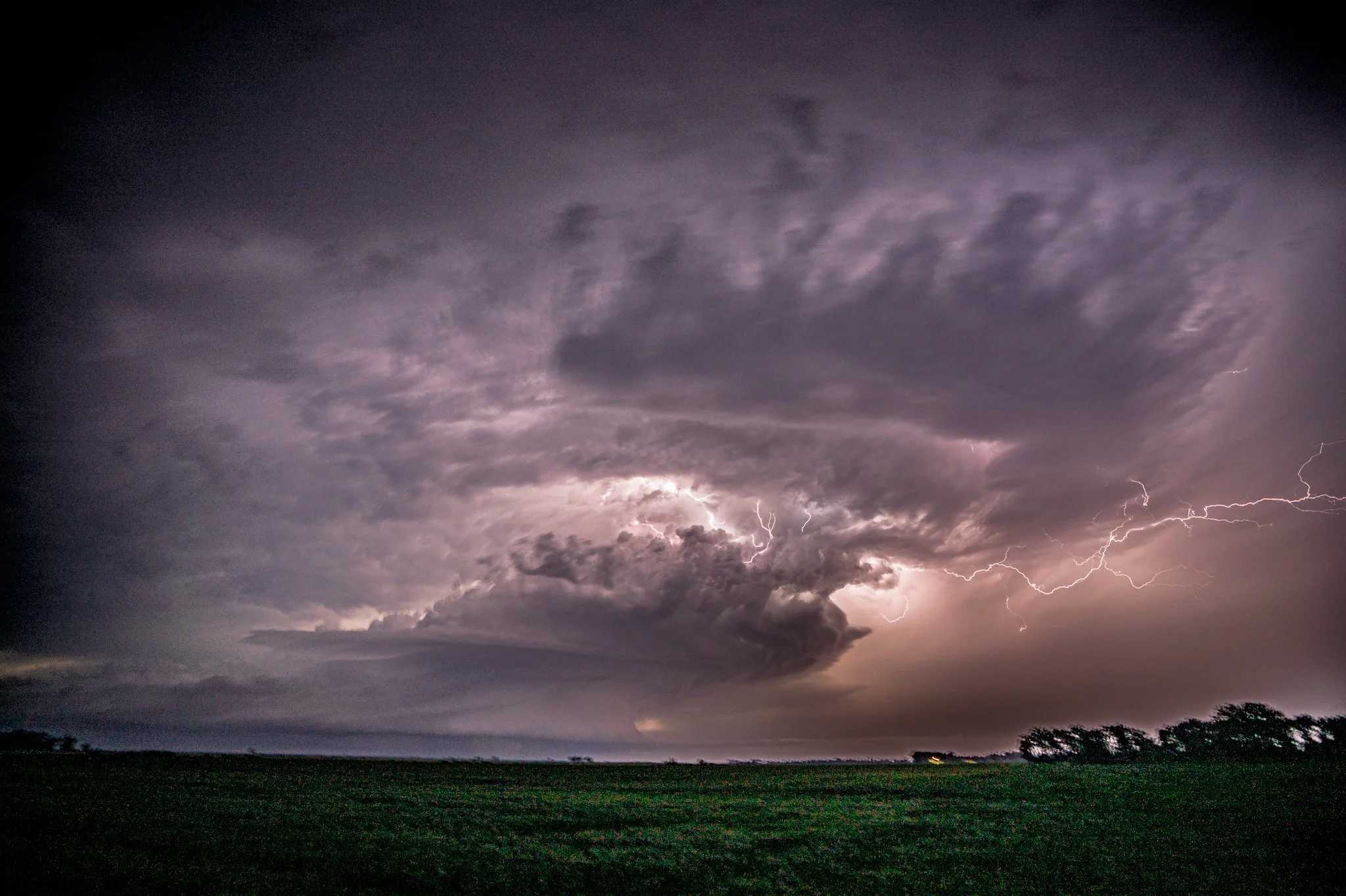
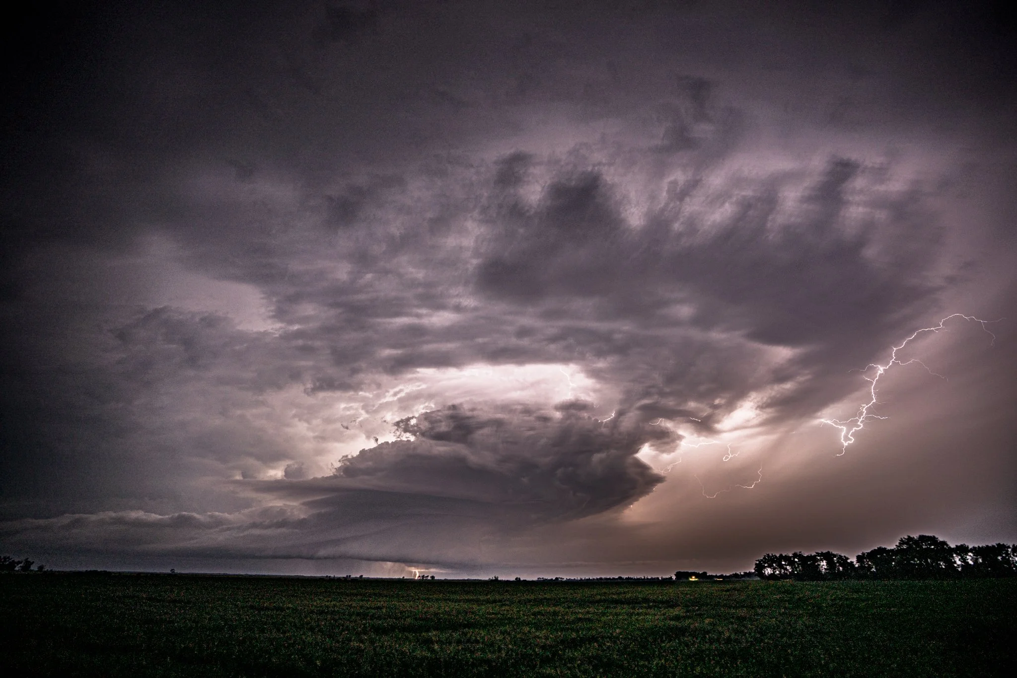
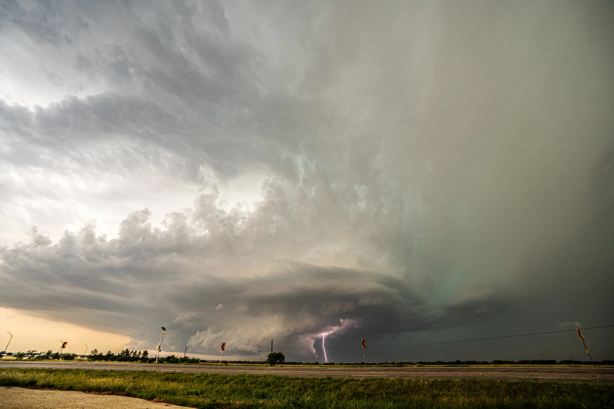
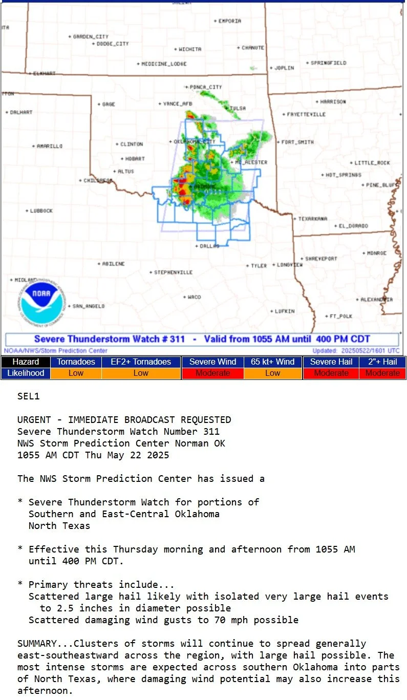
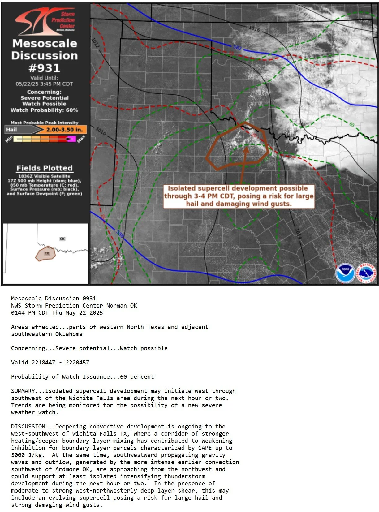
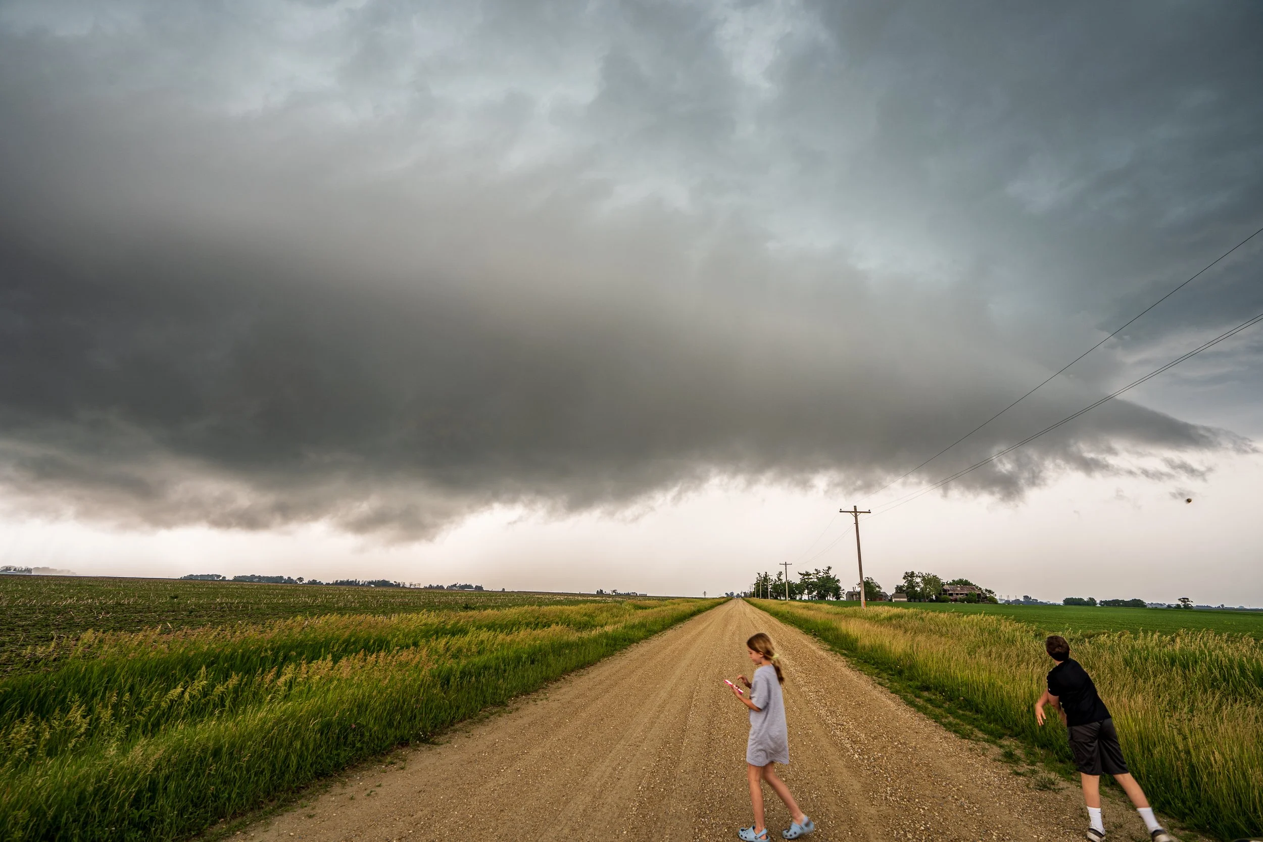
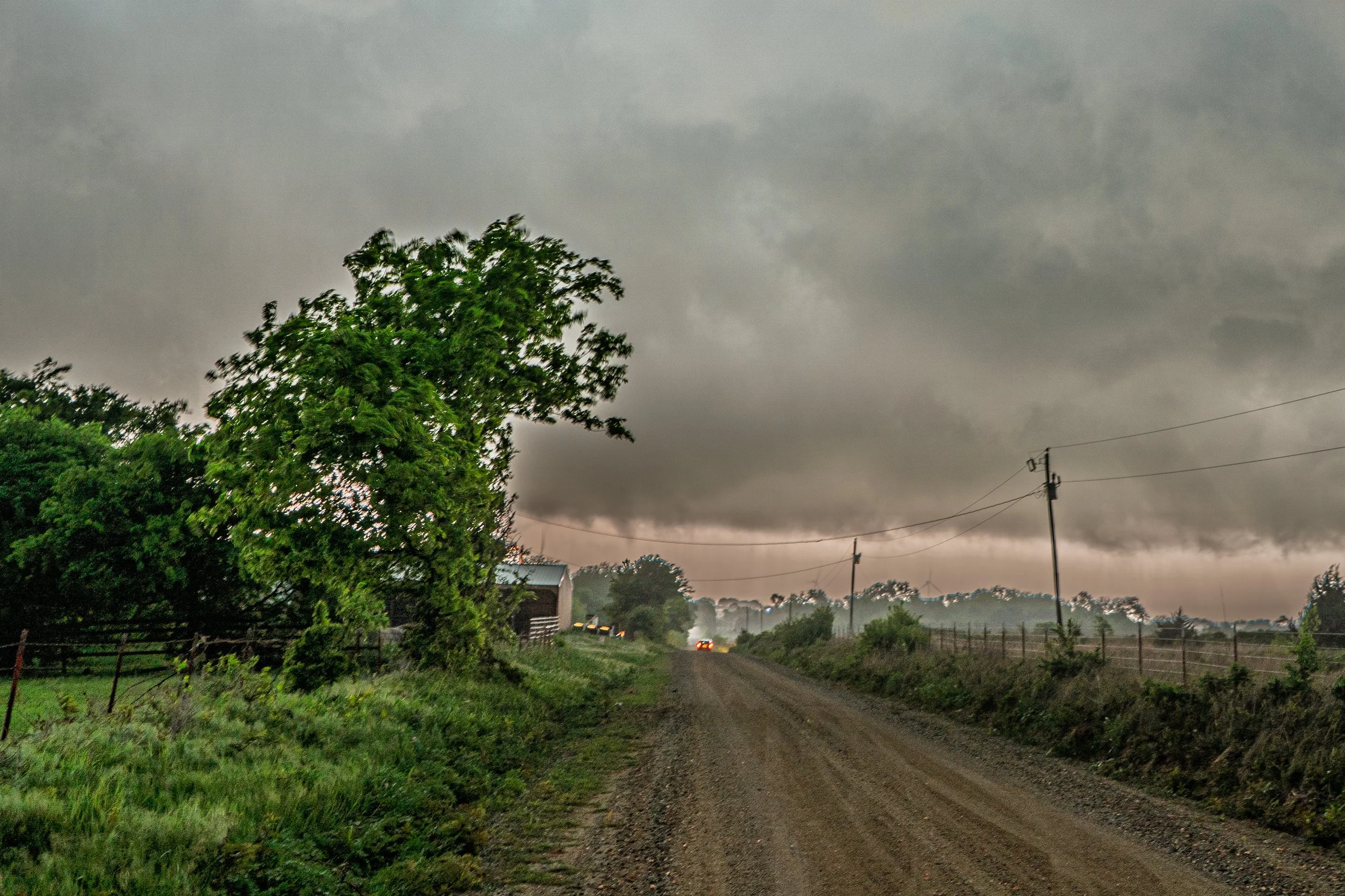
Bailed our initial storm and ended up on another severe warned storm near Katie, Oklahoma after sunset.
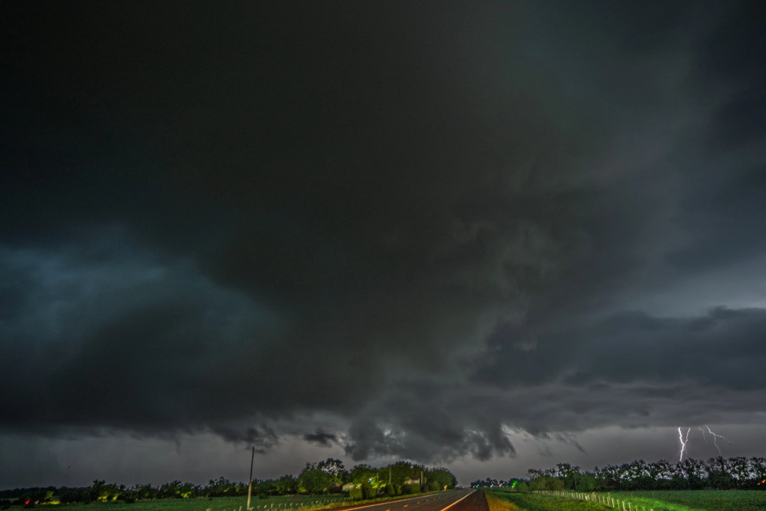
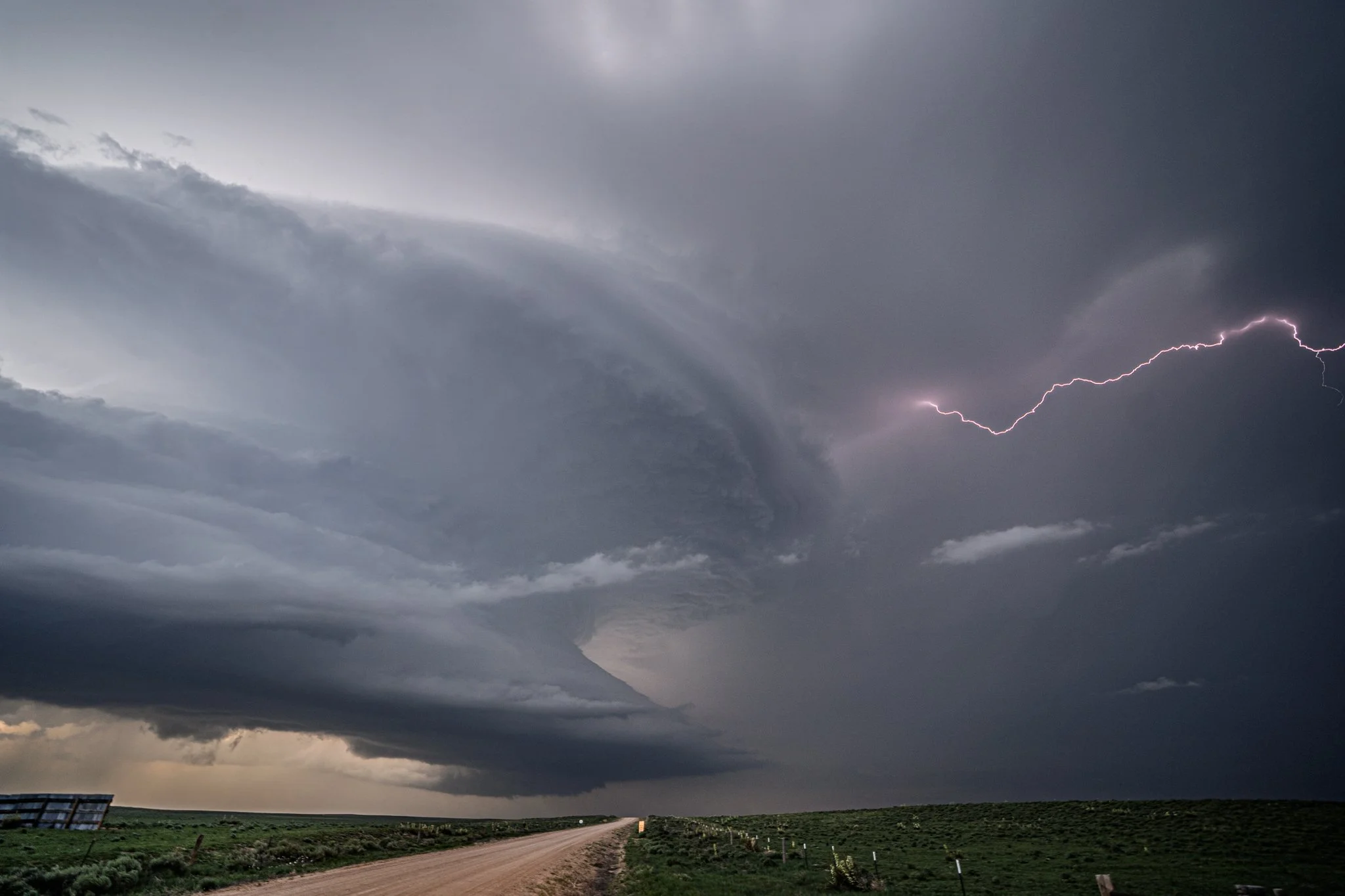
One last shot of the storm with a lightning bolt in the distance near Katie before we called the chase and headed towards Oklahoma City for the night to get ready for the next day.