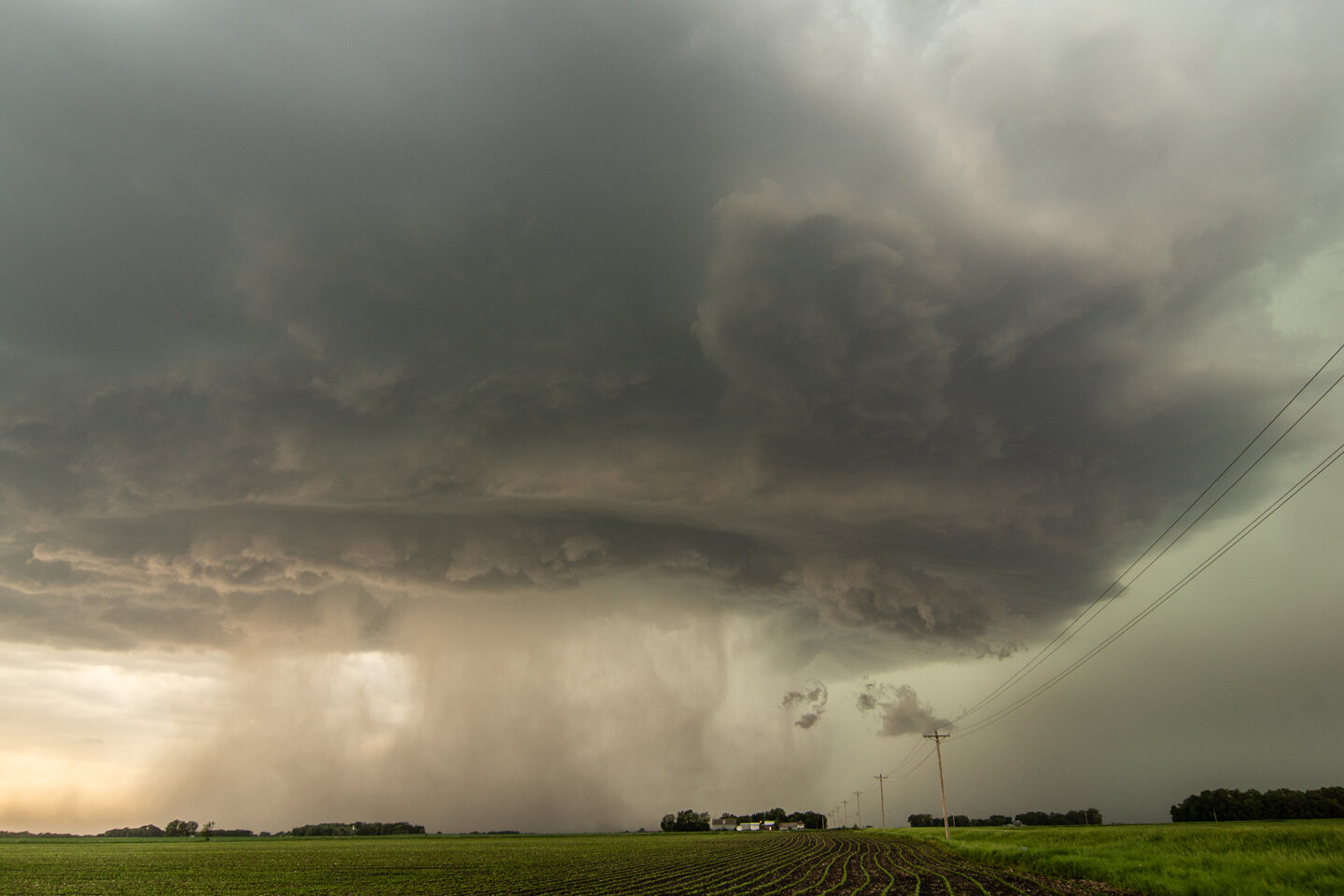
Tornado warned storm near Janesville, Minnesota. Condensation being pulled into the updraft base. Could have easily been mistaken for a funnel cloud.
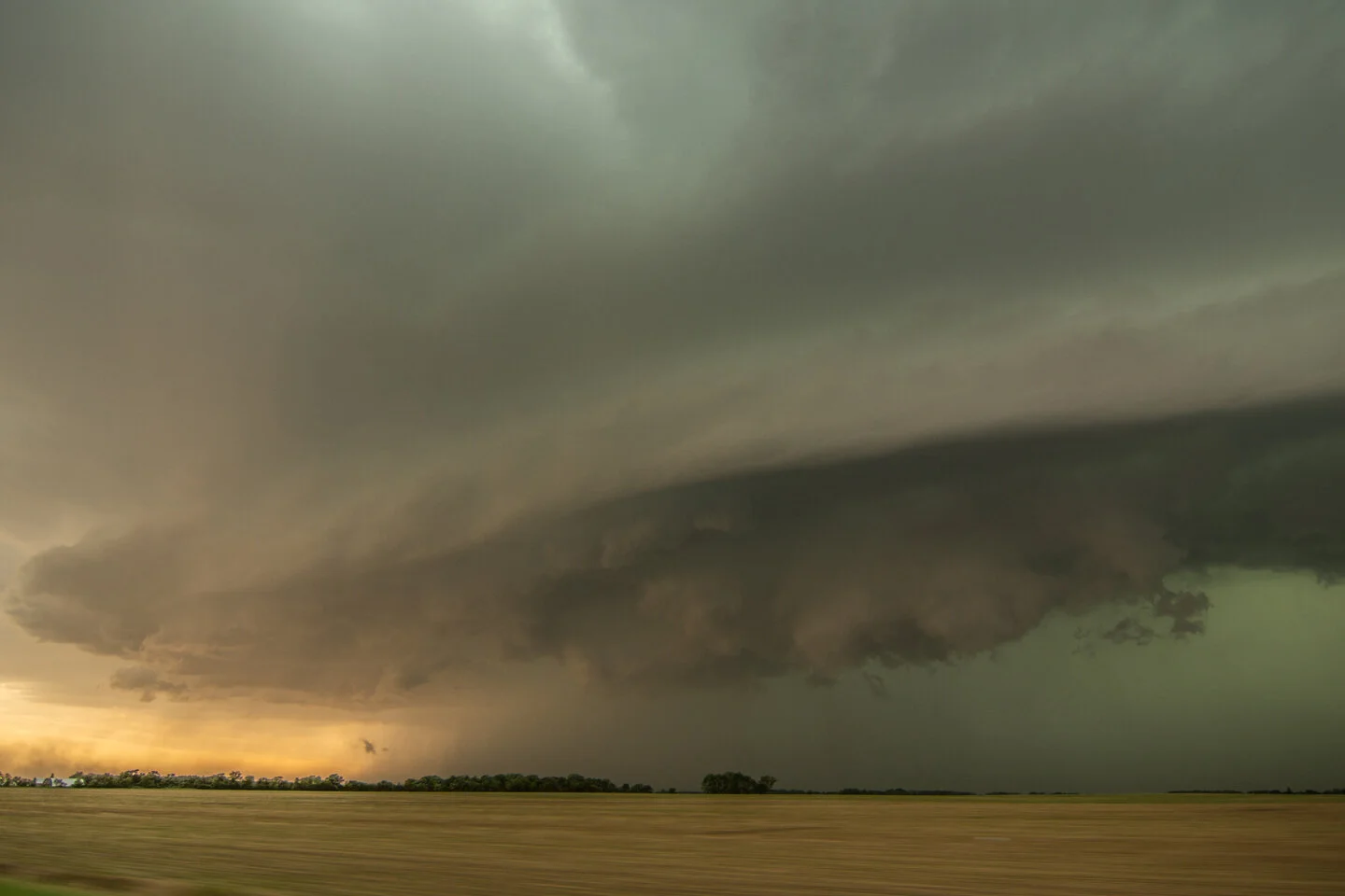
Not too often that you see this kind of awesome structure in Minnesota!
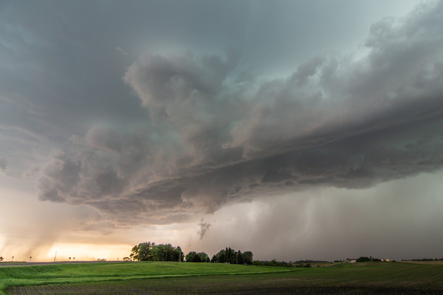
Interesting feature here as there was clear dirt/debris being lofted and a funnel overhead. Tough to tell if this was a tornado or gustnado on the leading edge of the outflow.
Barley dodging an intense hail core!! We blasted ahead to stay out of this core but it was close.
Prolific scud bomb near Ellendale, Minnesota. This was called in as a tornado believe it or not. Definitely not a tornado but ominous looking for sure!
Beautiful end of the day and mammatus near Stewartville, Minnesota.
Mesoscale Discussion issued at 3:52 p.m. CDT detailing the increasing coverage of thunderstorms and risk for hail and damaging winds as a cluster of storms progresses southeast into a higher unstable airmass. https://www.spc.noaa.gov/products/md/2020/md0783.html
Severe thunderstorm watch issued at 4:40 p.m. CDT, valid until 12:00 a.m. CDT. Main threats included significant wind gusts to 75 mph and large hail up to 2” in diameter! https://www.spc.noaa.gov/products/watch/2020/ww0239.html
Mesoscale discussion issued 5:32 p.m. CDT as ongoing severe thunderstorms continue to track southeast along the cold front into the greater instability. Another watch was issued ahead of these storms into southern Wisconsin. https://www.spc.noaa.gov/products/md/2020/md0785.html