Storm developing and rolling off the northern end of the Black Hills of South Dakota near Sturgis.
Shelf cloud approaching very quickly on Highway 34 east of Sturgis. Bear Butte on the right.
Looking northwest towards Bear Butte as the intense squall line and shelf cloud was overtaking it.
Beautiful vertical shelf stretching the skyline over the open prairies of western South Dakota.
Interesting to see all of these notches in the shelf cloud and rotation signatures on radar as the derecho attempted to overtake us.
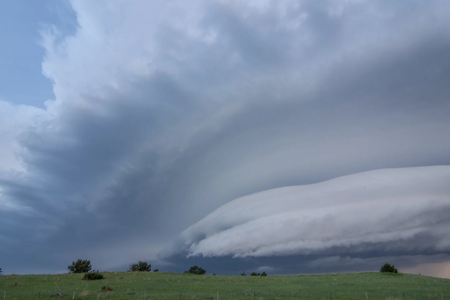
Beautiful shelf still moving on us fast near Union Center, South Dakota.
Interesting feature here where there was strong rotation and a lowering underneath the base to our northwest. Sure looked and felt outflow dominant.
Got ahead of the storm enough to see the updraft above the derecho. Was cool to see these updrafts above the derecho staggered down the line.
Derecho really started to become less linear as it moved into west-central South Dakota and form what looked like mesocyclones with noticeable rotation within each segment along the front on radar.
Enjoying the storm with my beautiful wife, MaryLynn! Looking north into the Cheyenne River Reservation.
Beautiful end to the chase day as we reached Pierre, South Dakota just ahead of the derecho.
Mesoscale Discussion issued at 1:27 PM CDT noting a 95% chance for a severe thunderstorm watch to be issued due to widespread damaging winds with a significant bowing line of storms moving across the region. https://www.spc.noaa.gov/products/md/2020/md0854.html
Mesoscale Discussion issued at 3:33 PM CDT as more isolated supercell storms were possible to form ahead of the derecho moving across Colorado and Wyoming. Storm tried to get going and we even chased one storm from the Black Hills north but it ended up dying due to the capped airmass. https://www.spc.noaa.gov/products/md/2020/md0856.html
New severe thunderstorm watch issued at 5:45 pm CDT until 1:00 am CDT as the derecho was starting to approach western South Dakota. Wind gusts up to 80 mph and large hail events up to 2” in diameter. https://www.spc.noaa.gov/products/watch/2020/ww0264.html
Mesoscale discussion issued at 8:29 pm CDT as a new severe thunderstorm watch needed to be issued ahead of the fast moving derecho. We stayed out ahead and managed to get to Pierre before it hit! https://www.spc.noaa.gov/products/md/2020/md0861.html