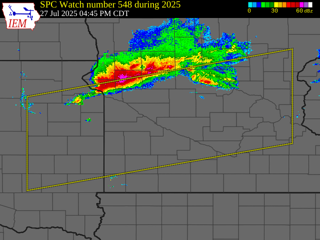
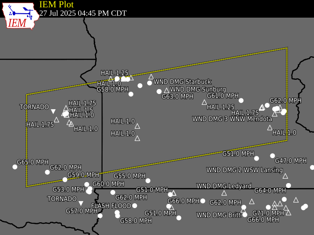
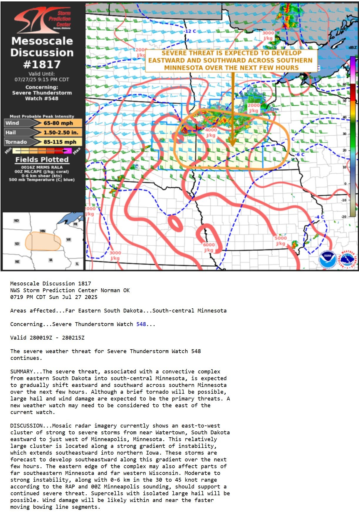
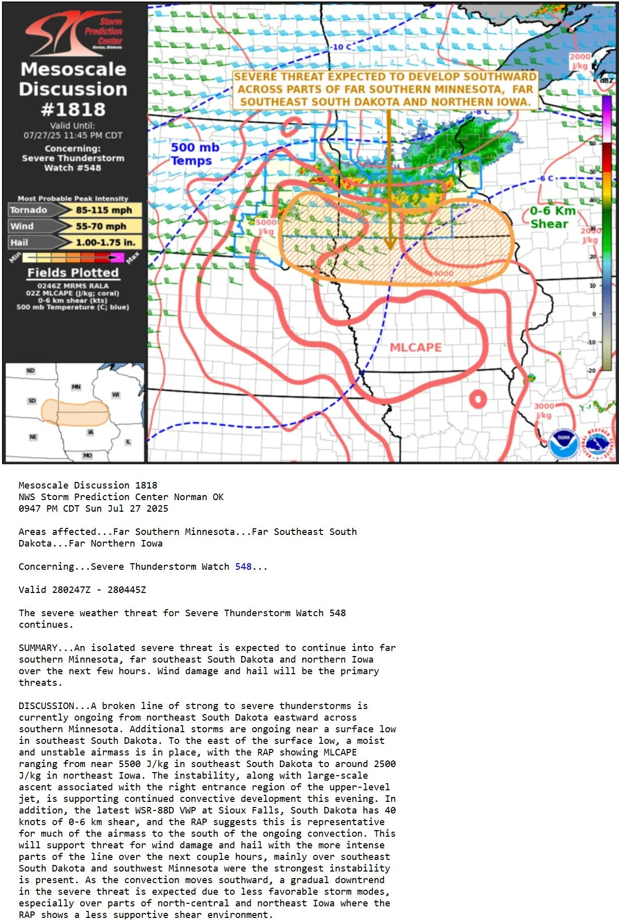
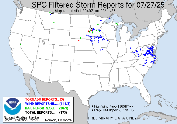
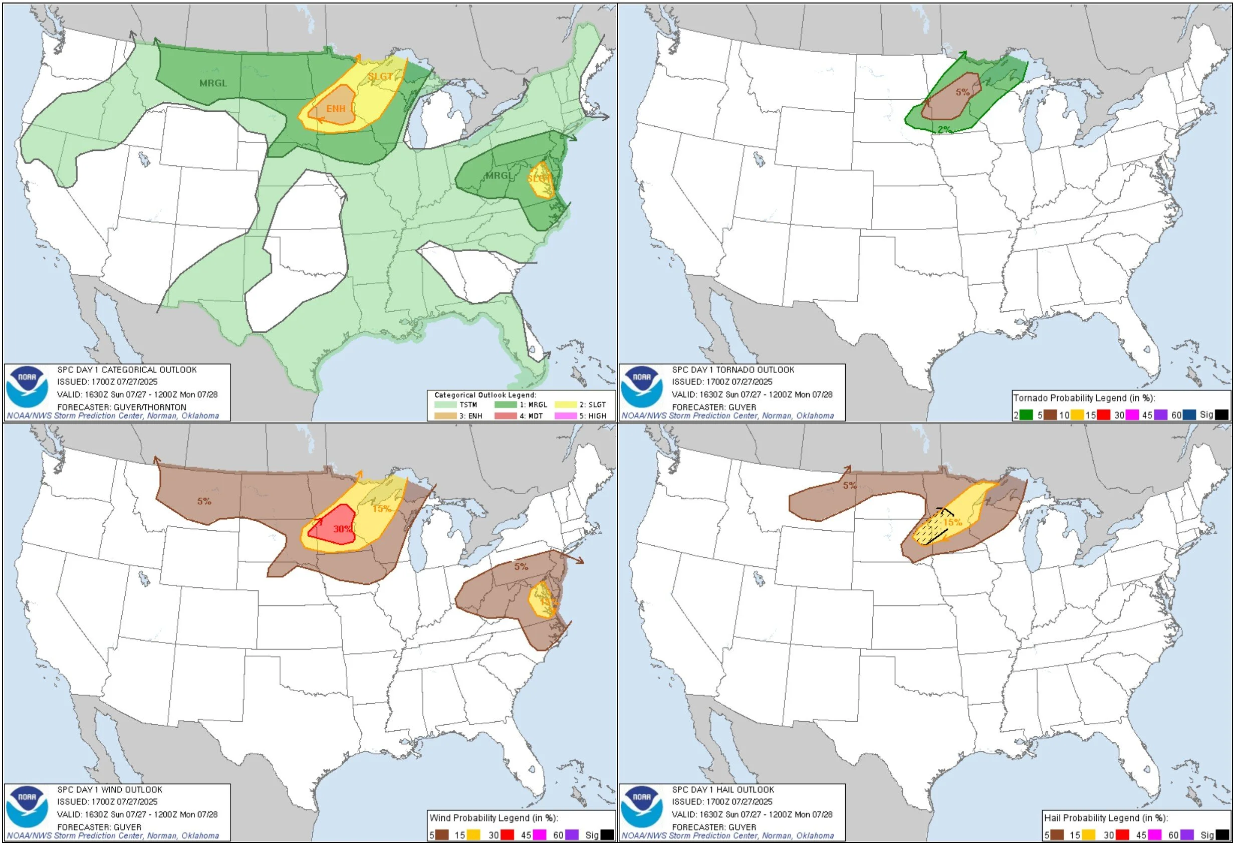
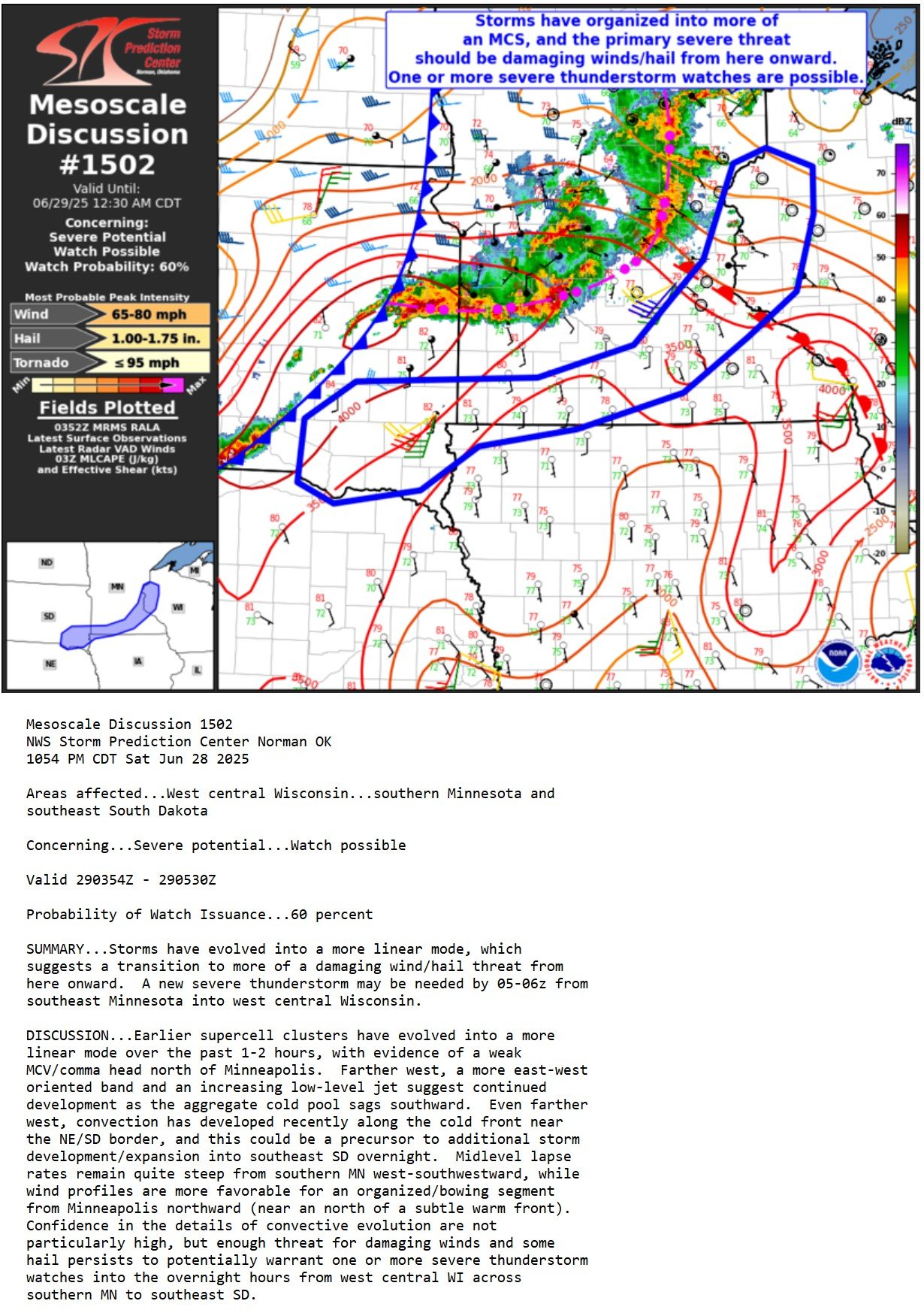
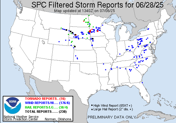
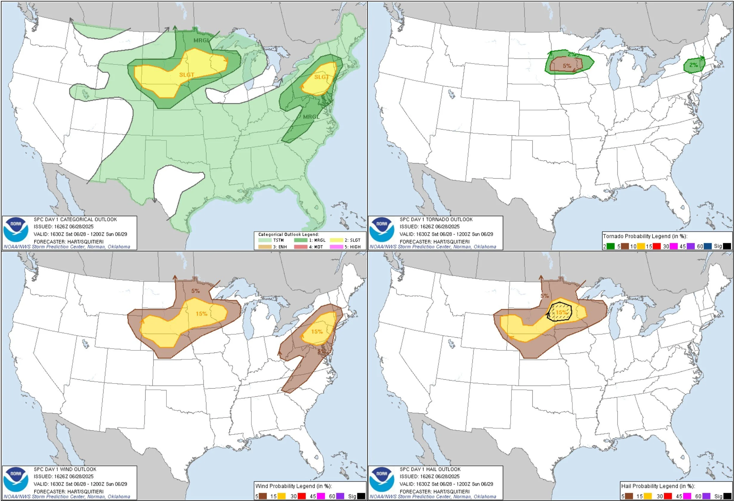
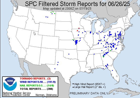
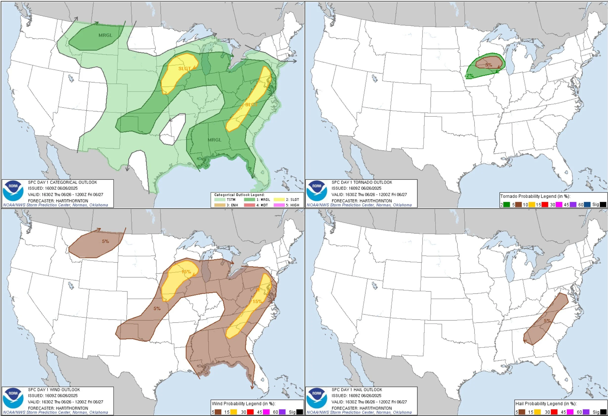
JULY 28, 2025 SOUTH DAKOTA: MOTHERSHIP AND TORNADO
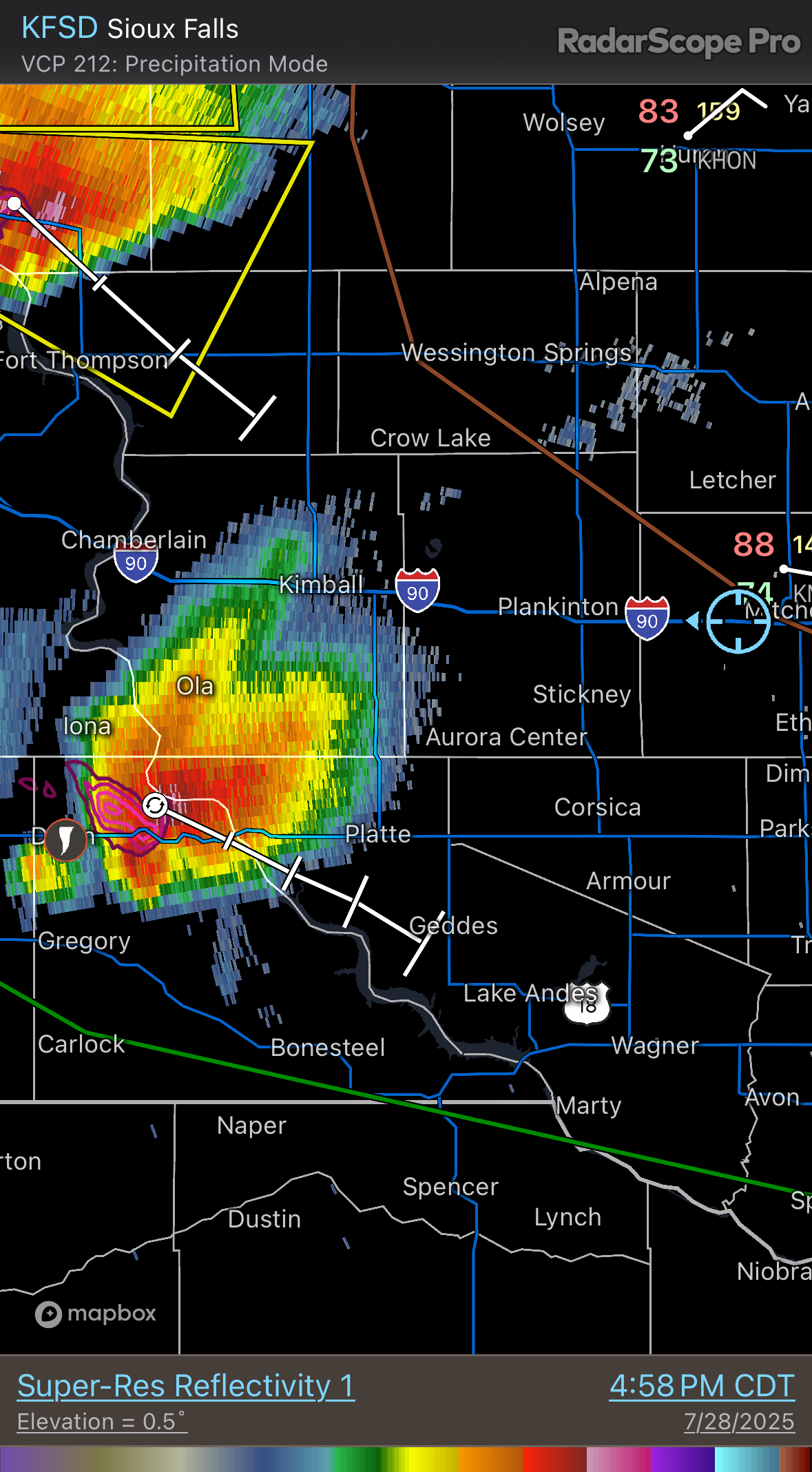
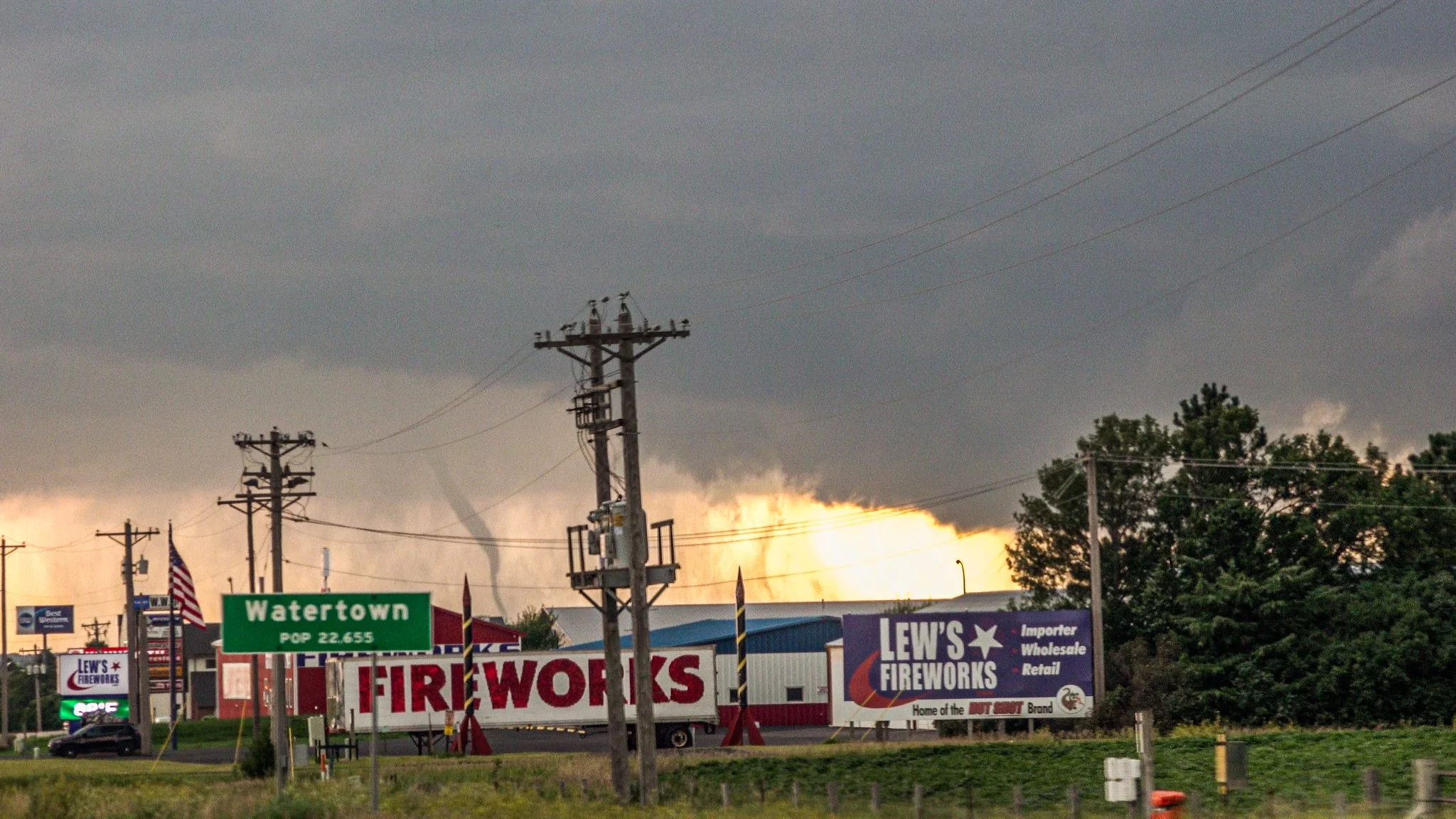
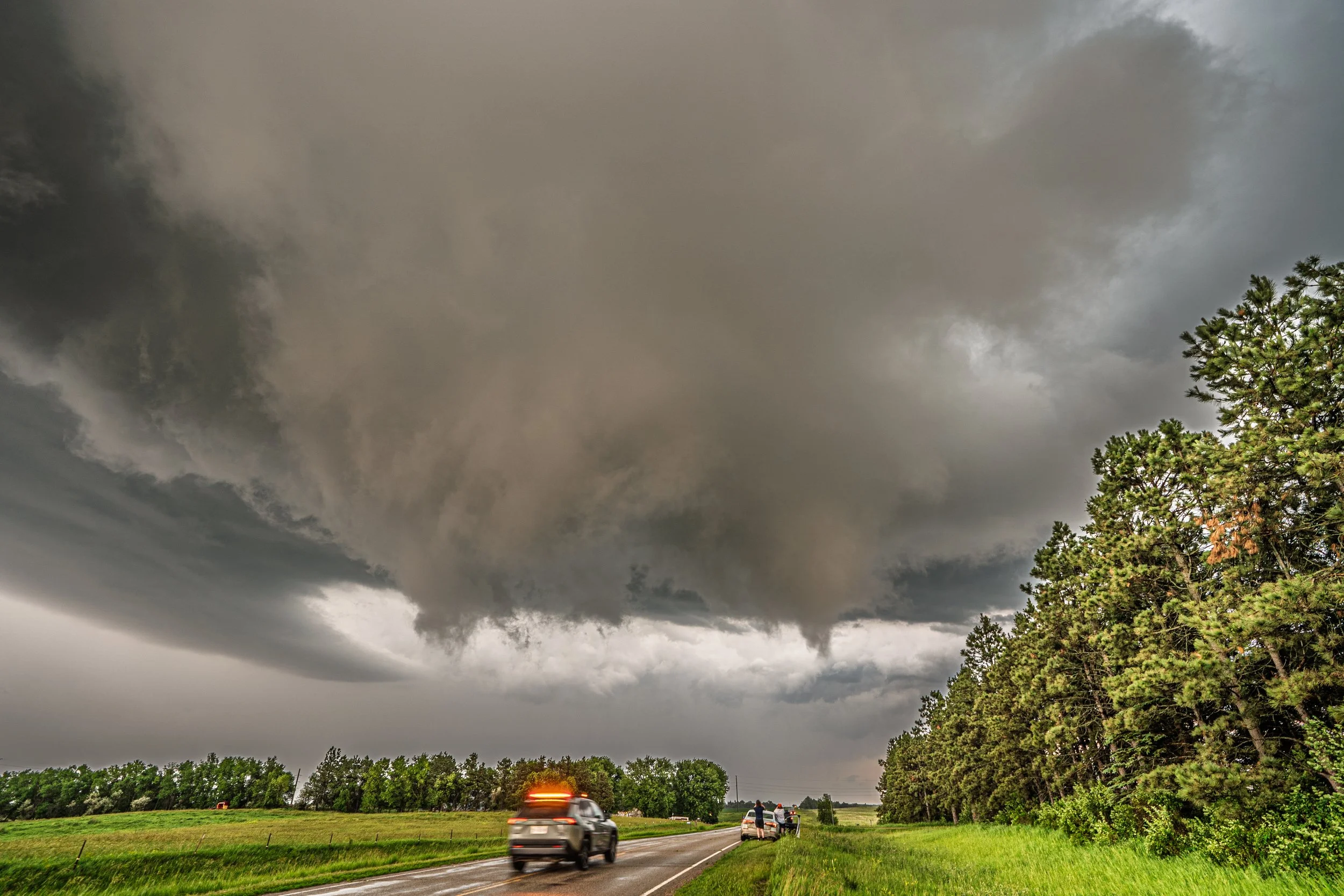
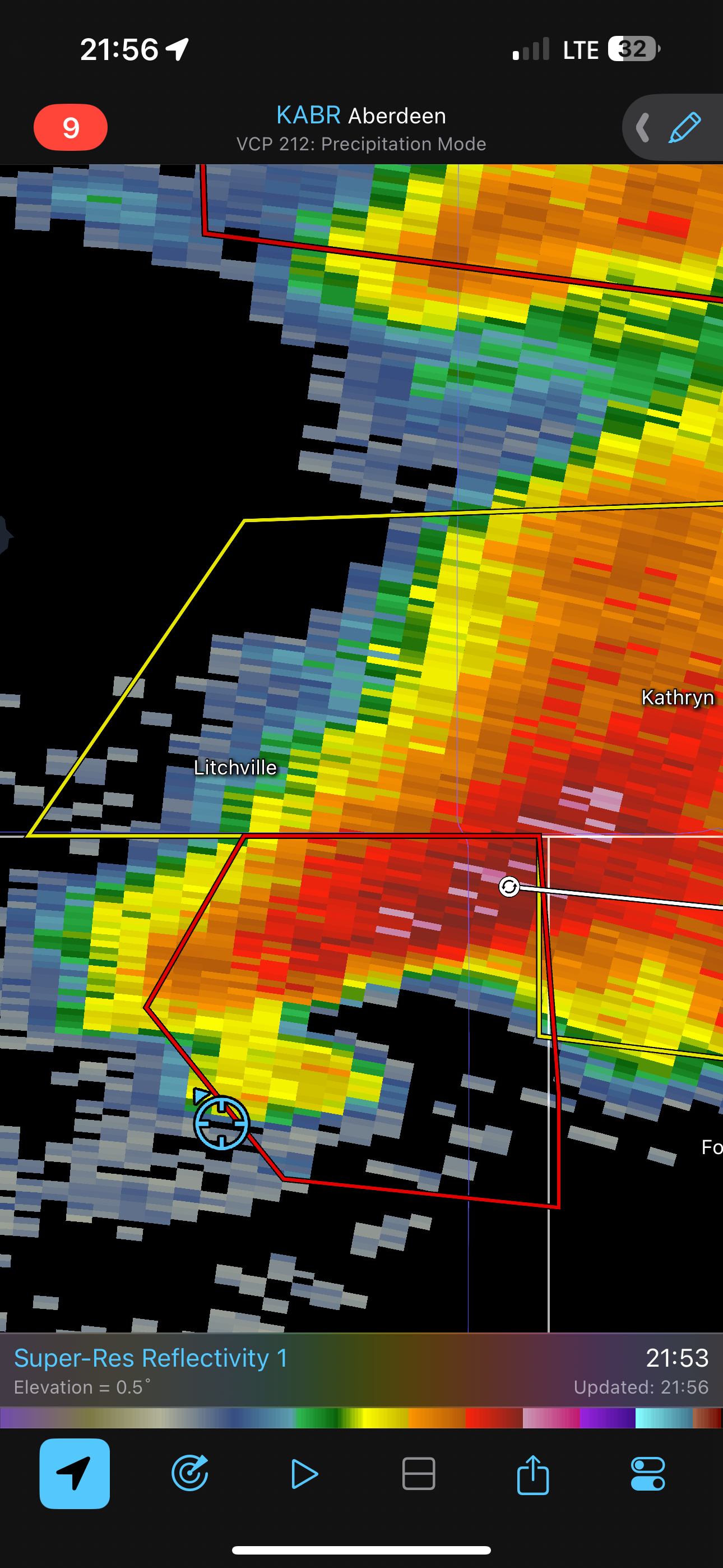
The original plan here was to head back out to Watertown, SD after seeing a tornado in the same area the day before as the setup seemed legit for another round to start as a predicted derecho. However, the cap held and it became more stable, which made me pivot to targeting supercells in southeast SD near the NE border… a lot farther than I was intending to go! I was late to the game here, but ended up getting down to I-90 and blasting west to intercept a tornado warned storm near Gregory, SD.
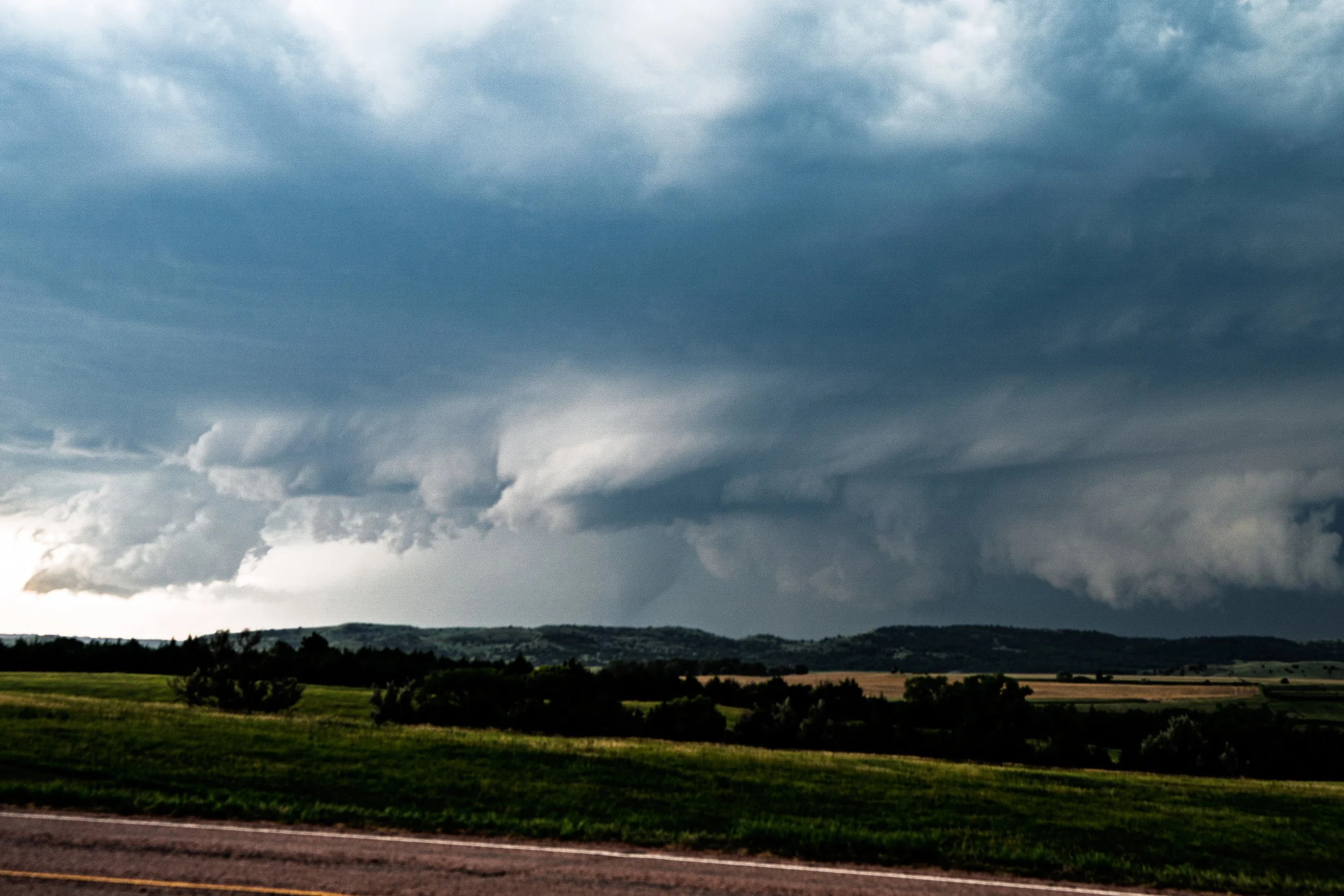
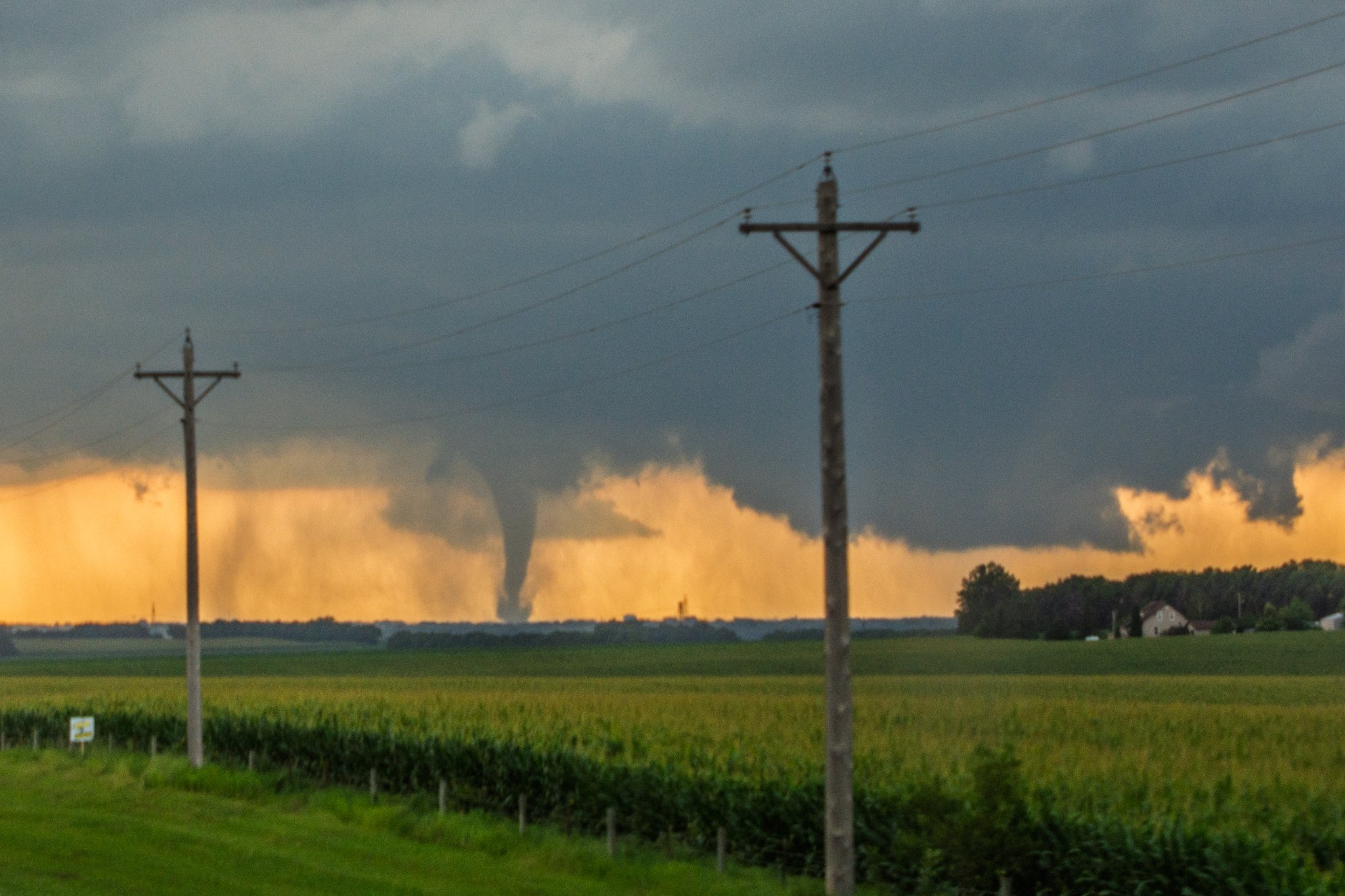
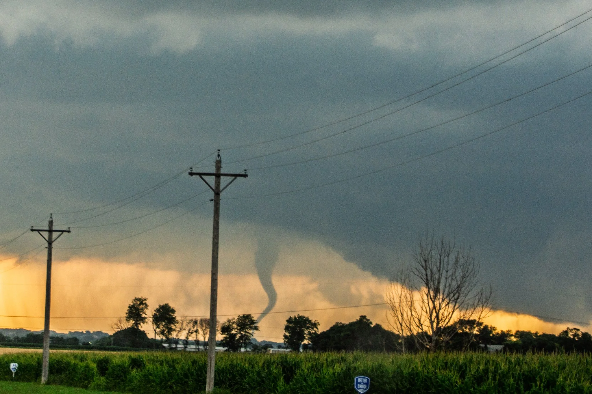
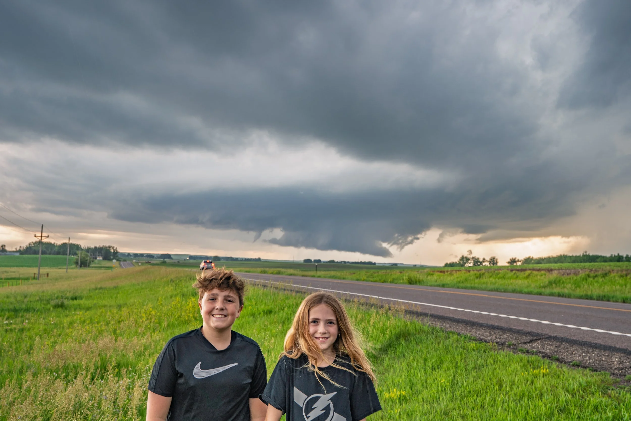
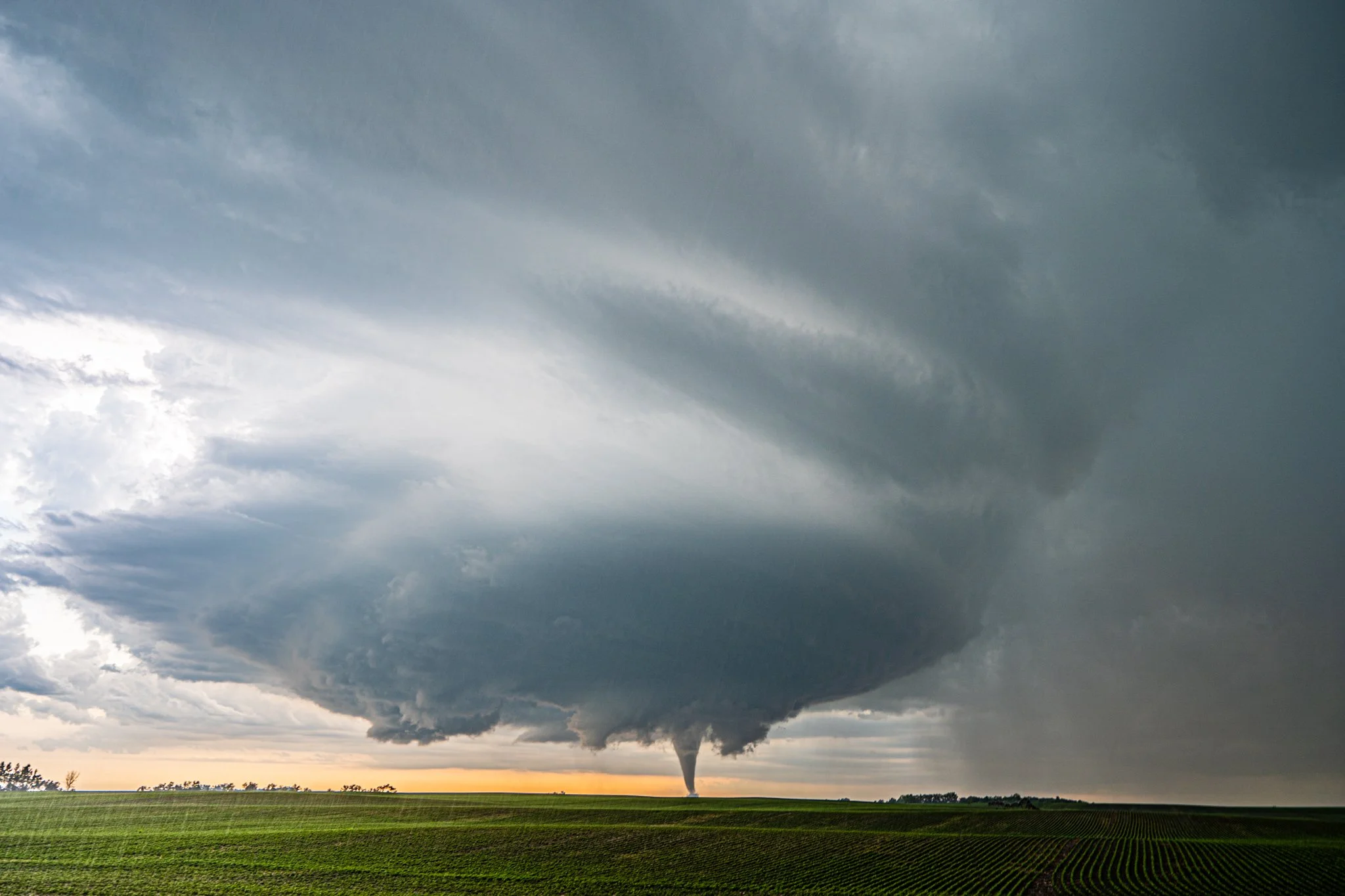
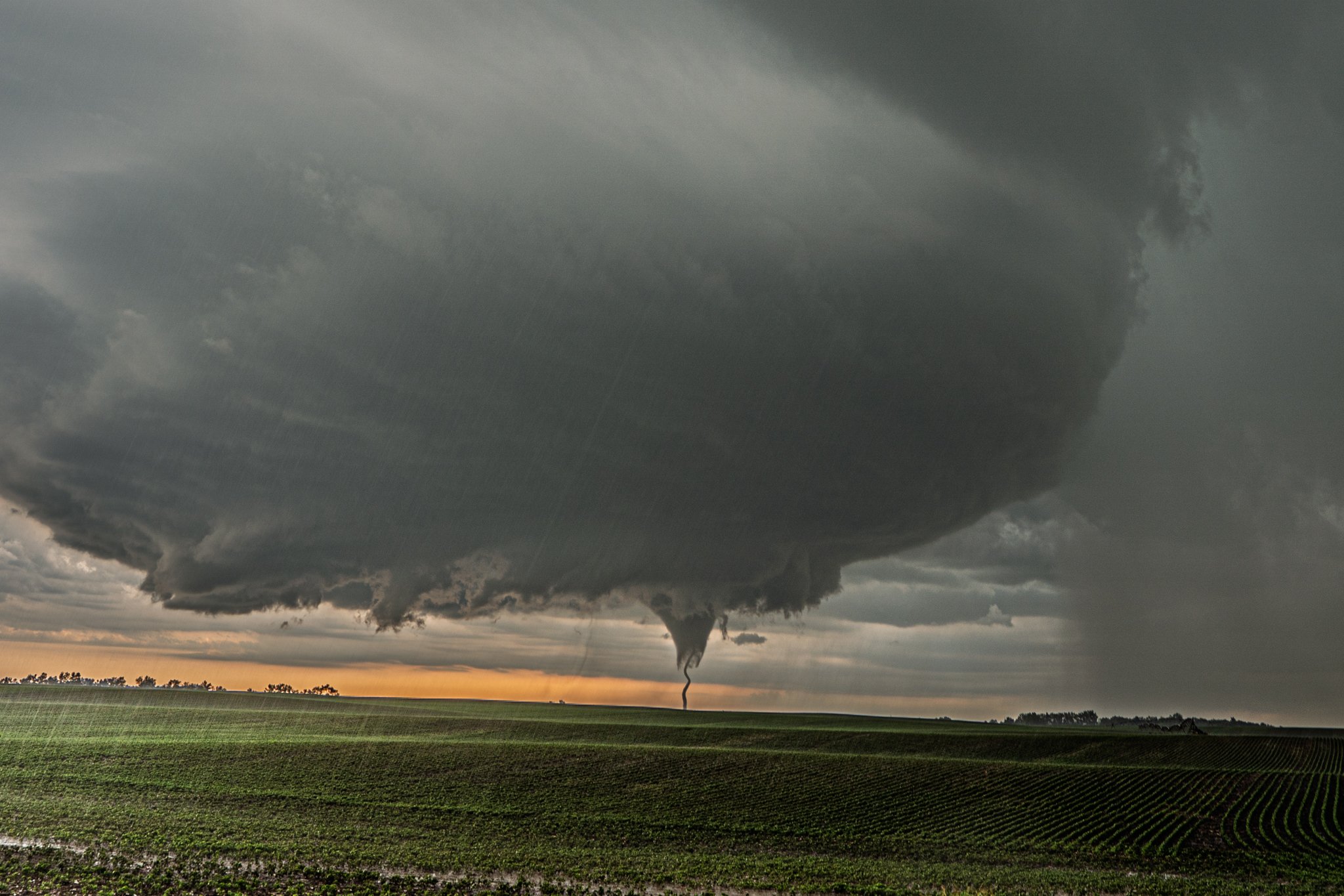
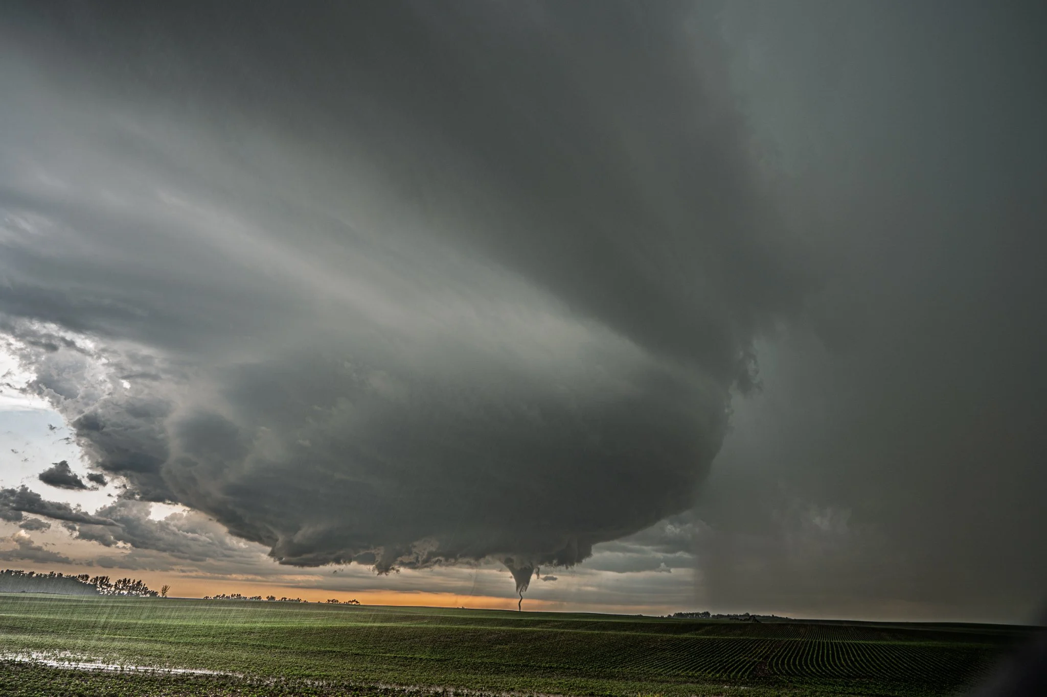
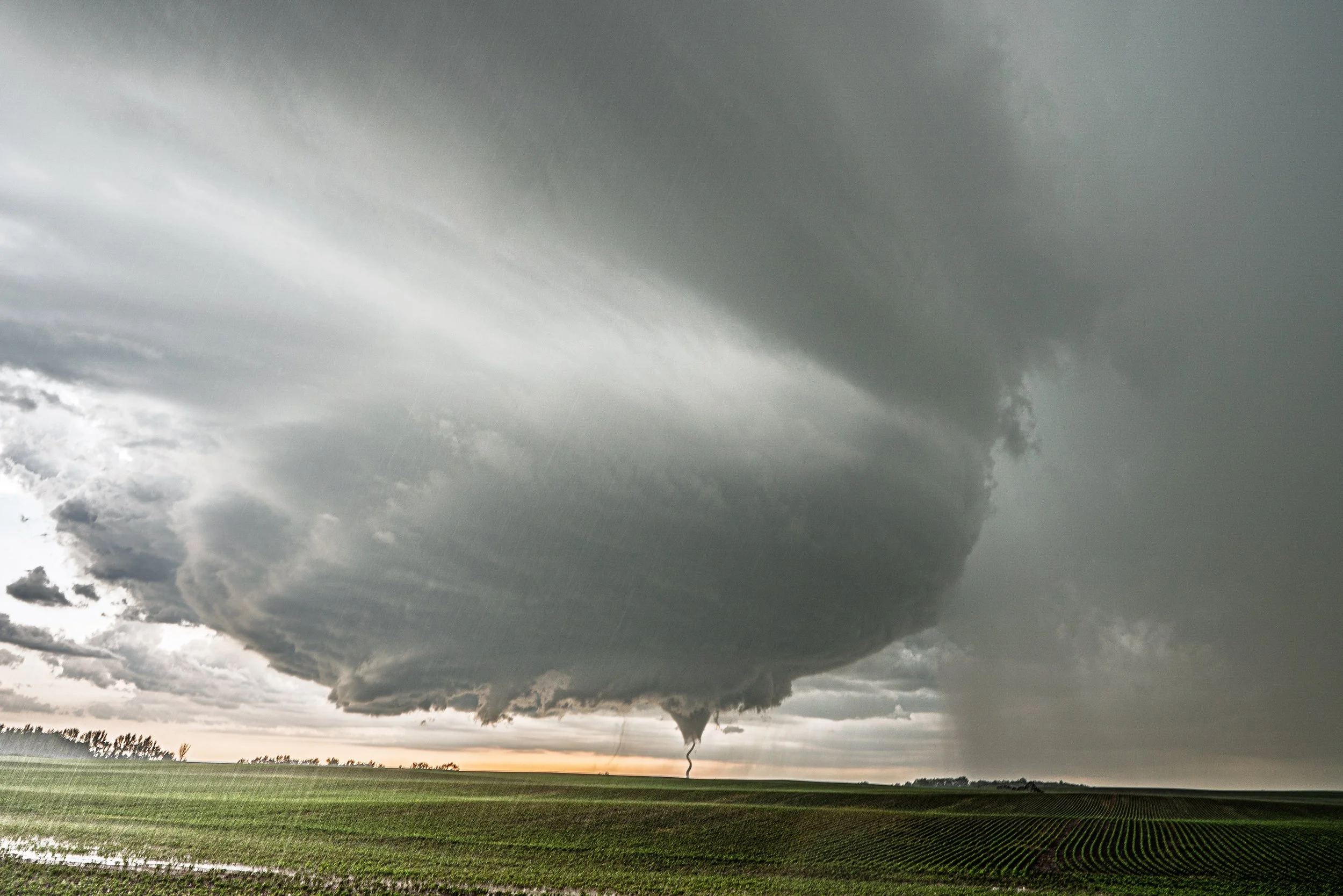
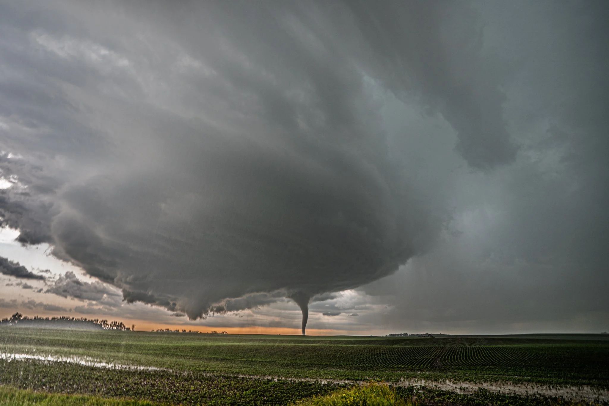
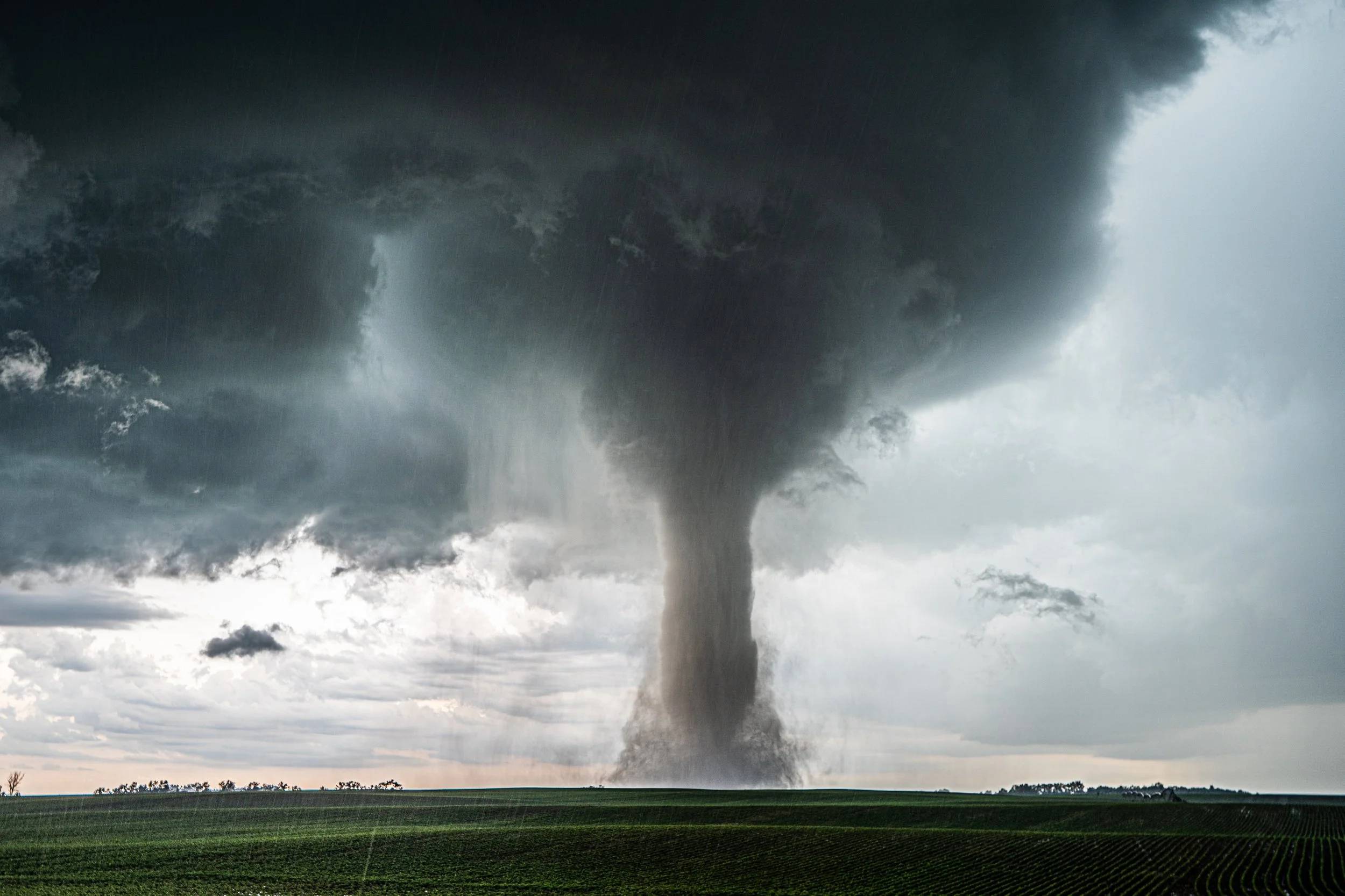
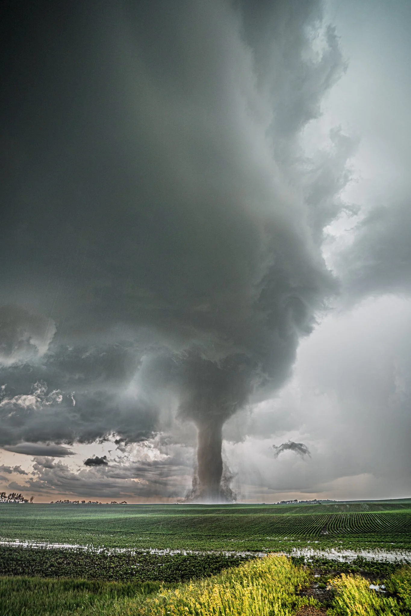
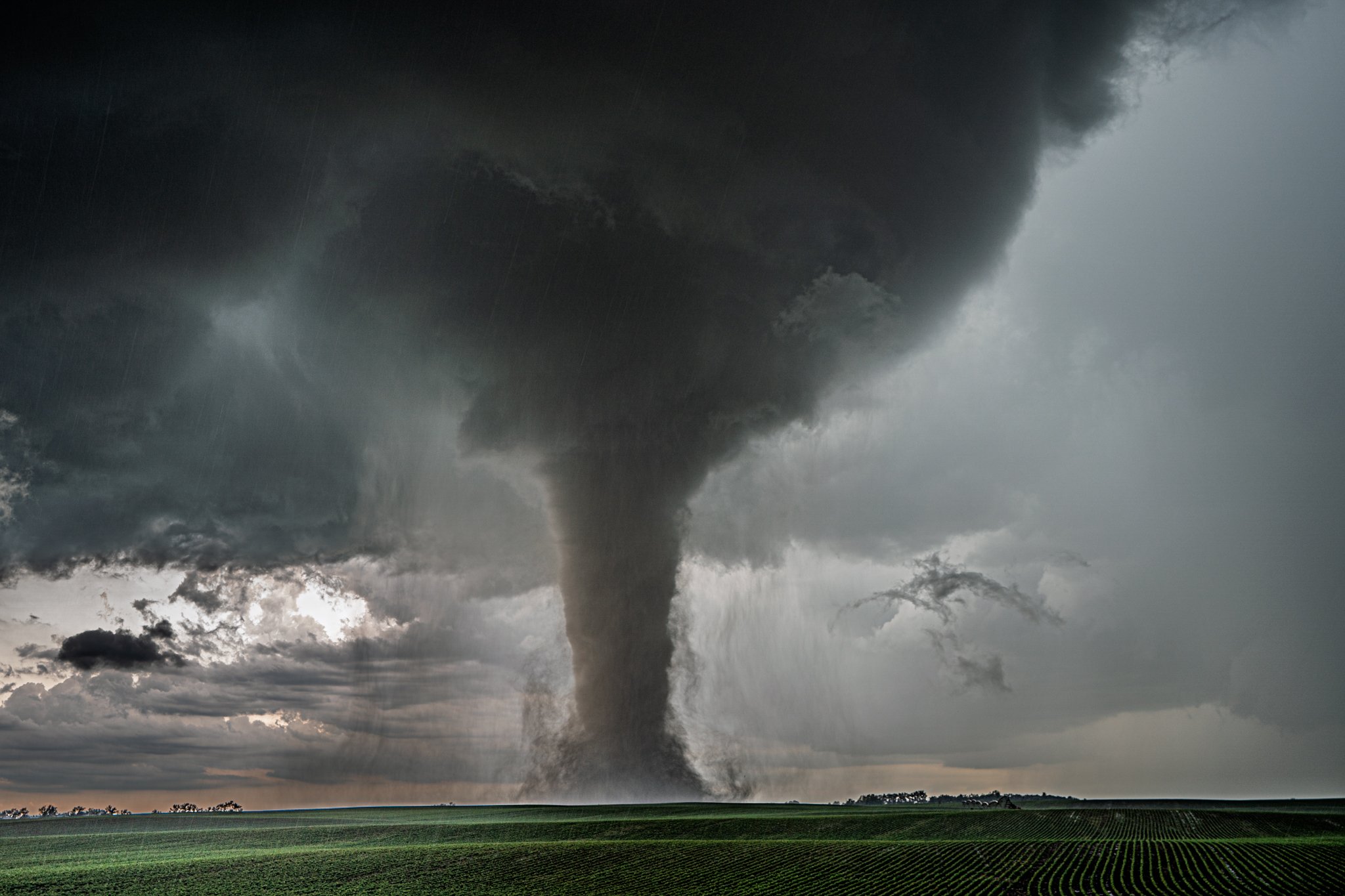
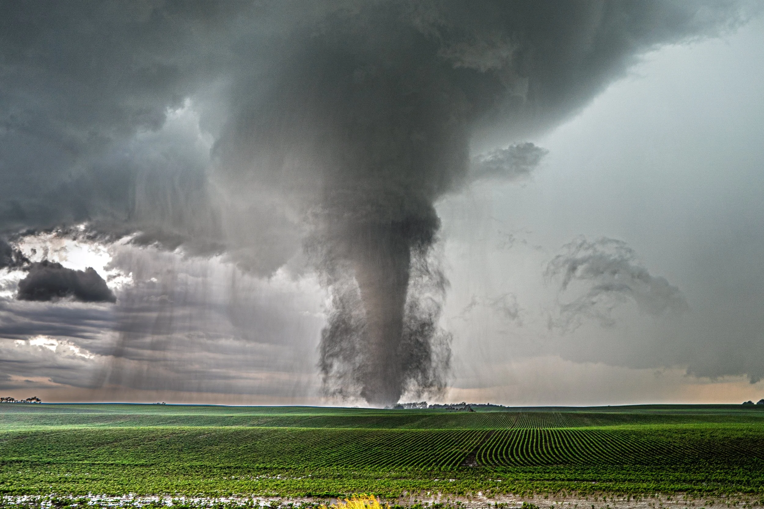
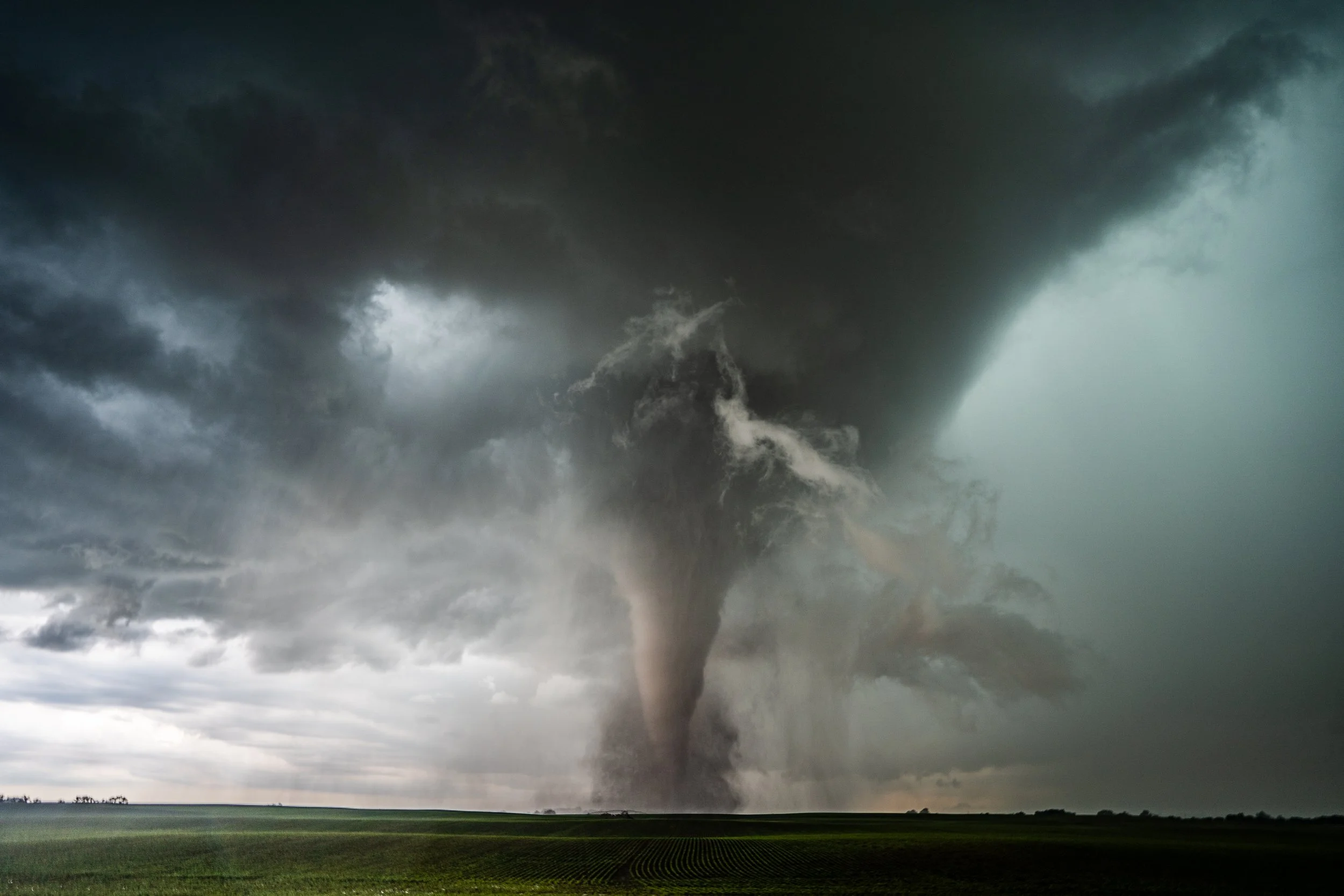
Once arriving on highway 50 south of Geddes, SD and cut off by the Missouri River, I was able to capture the final of 3 tornadoes to the west.
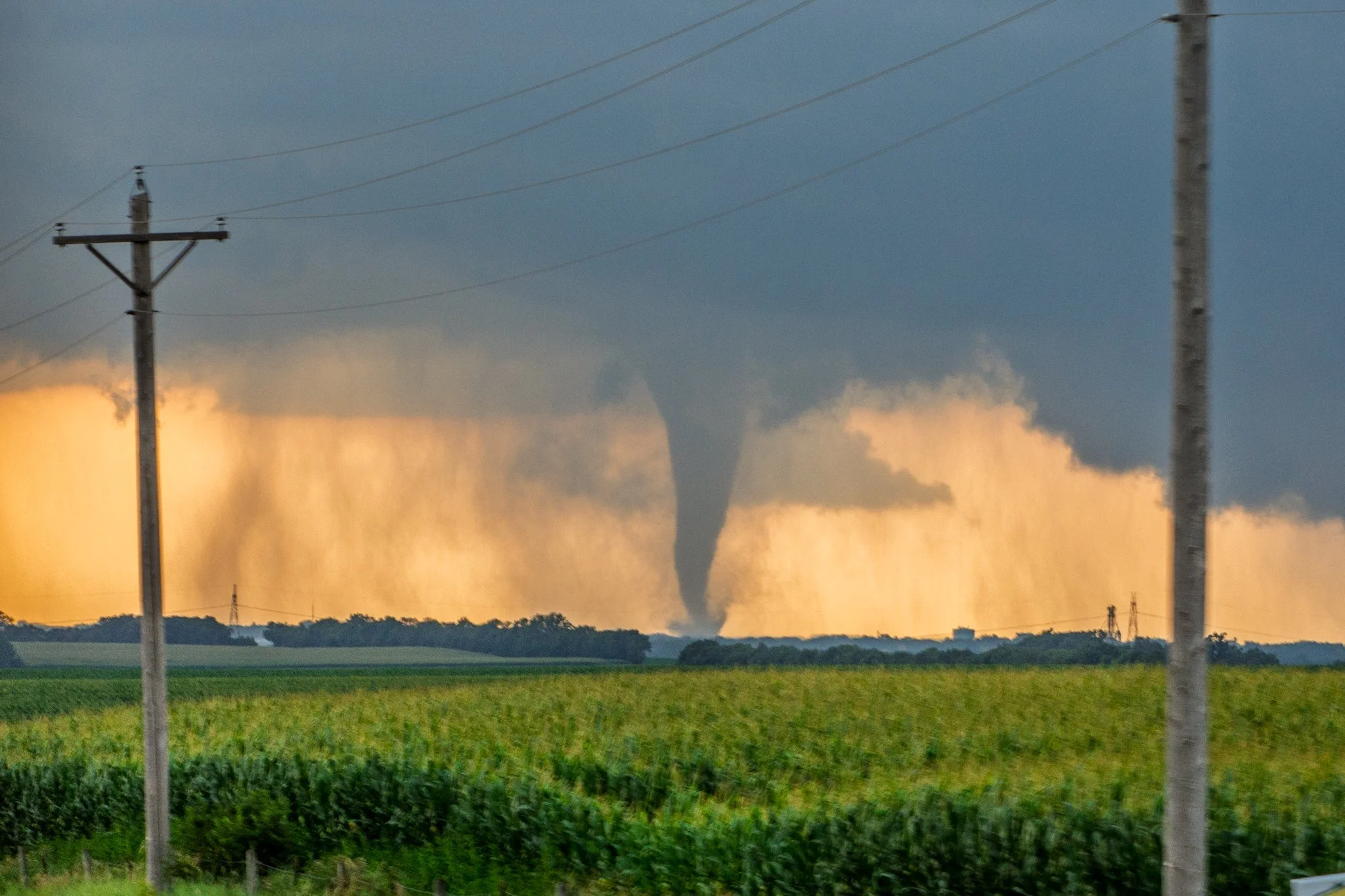
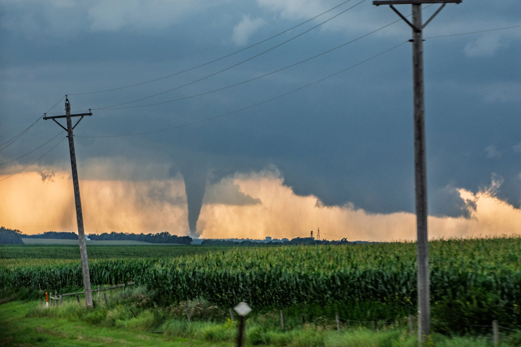
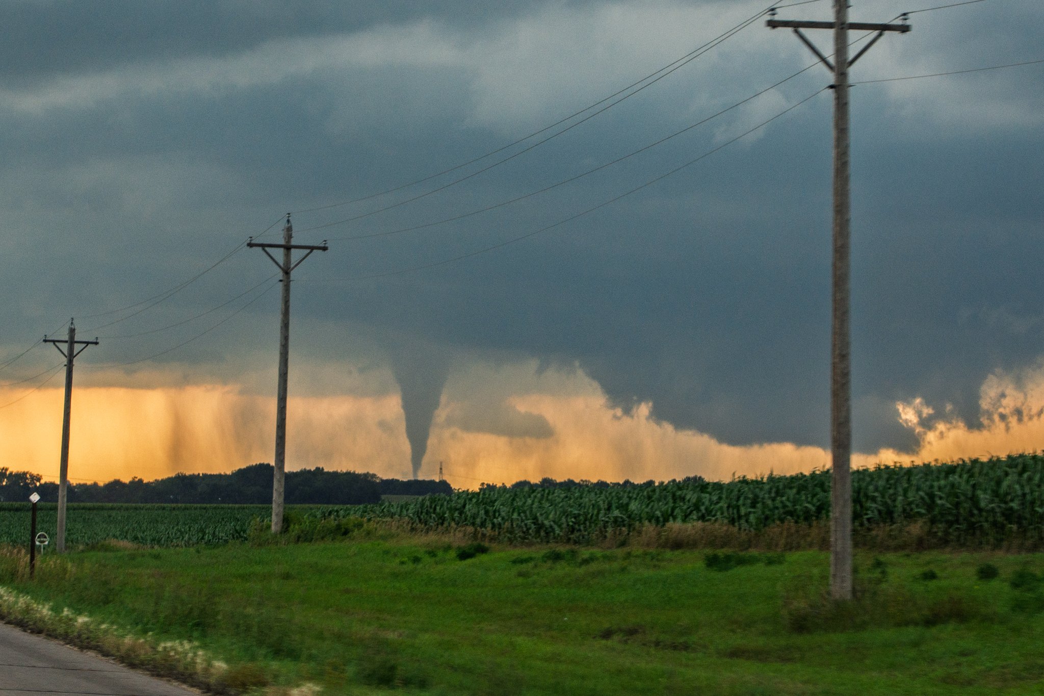
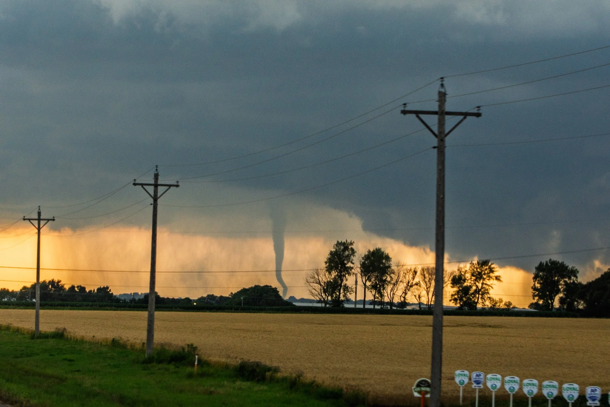
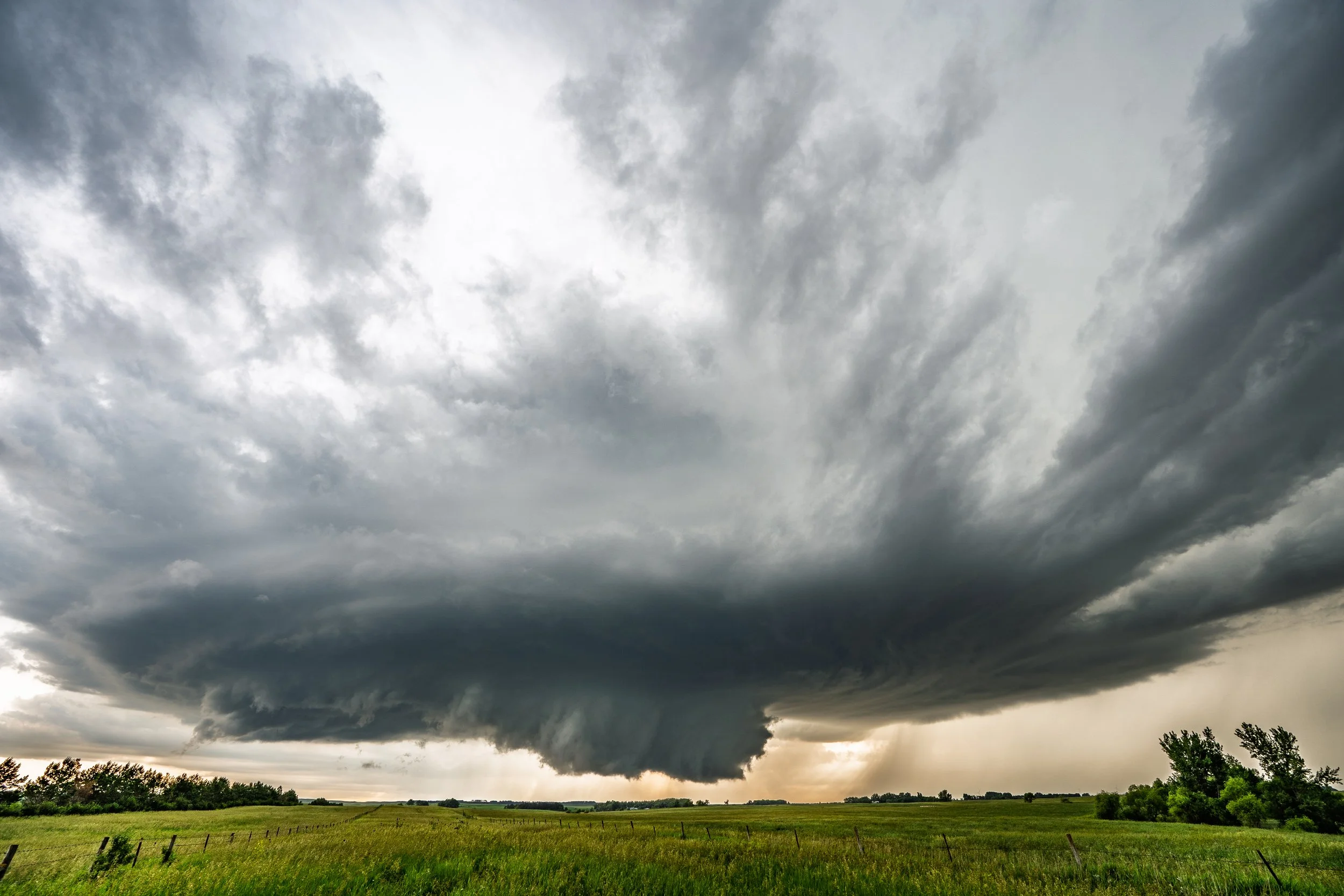
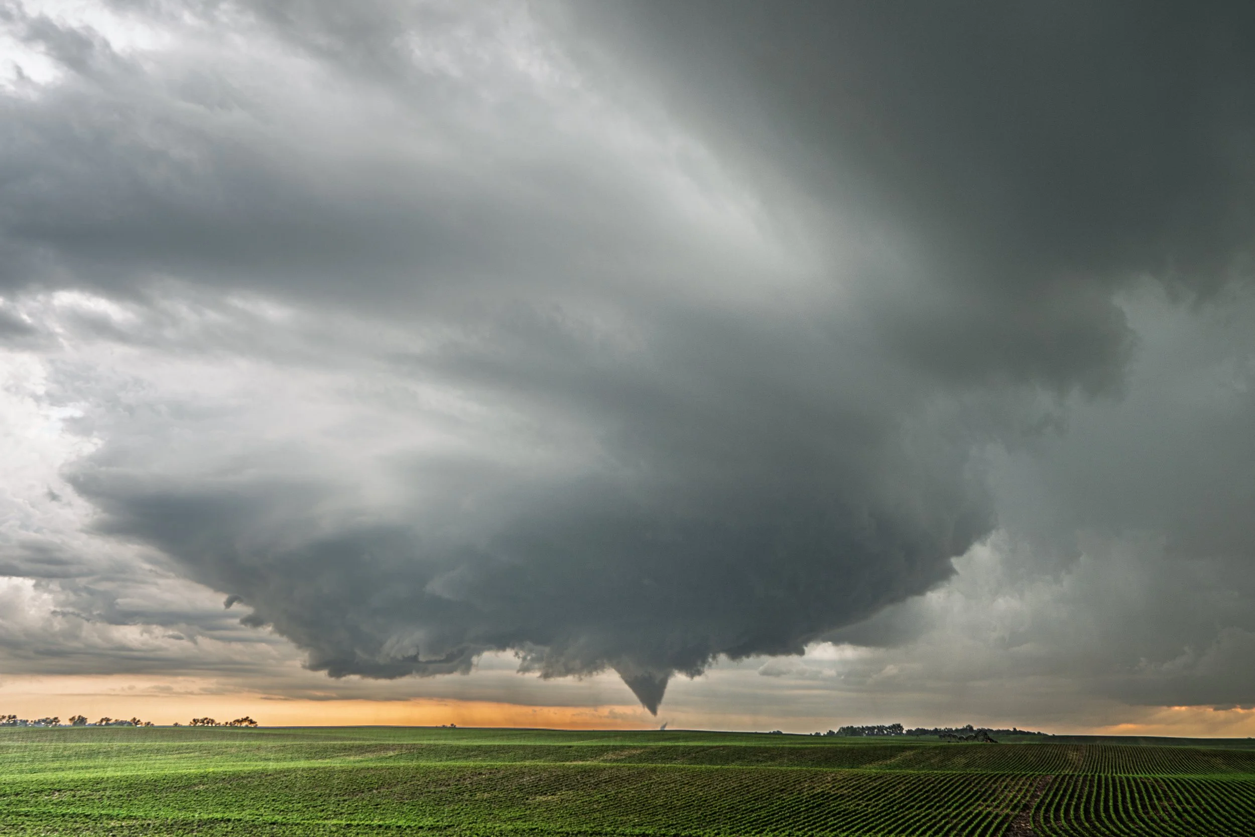
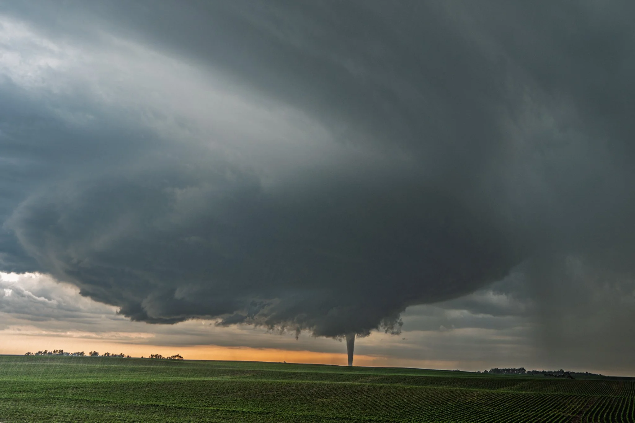
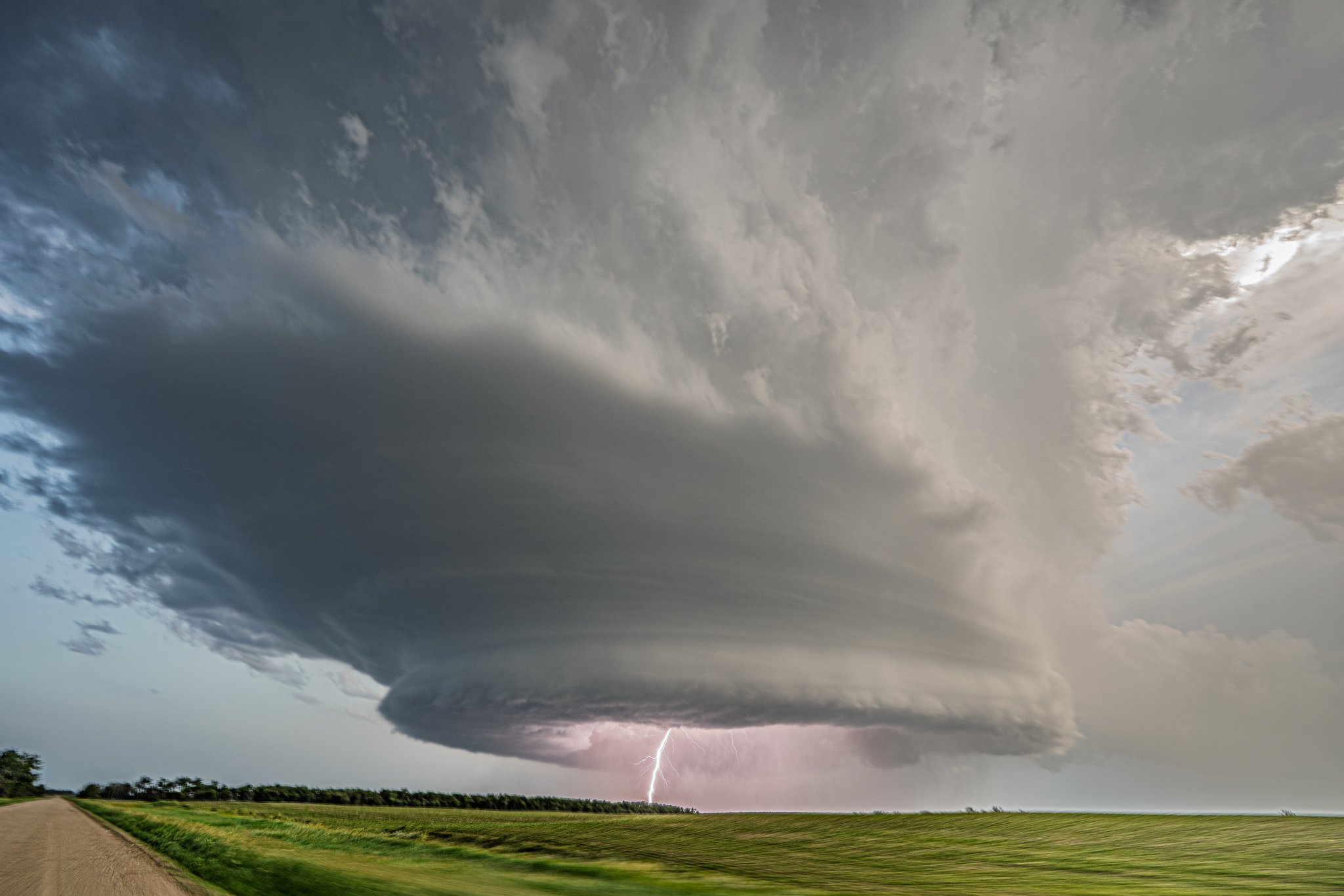
Another shot a minute later of the tornado ongoing and more of the storm structure.
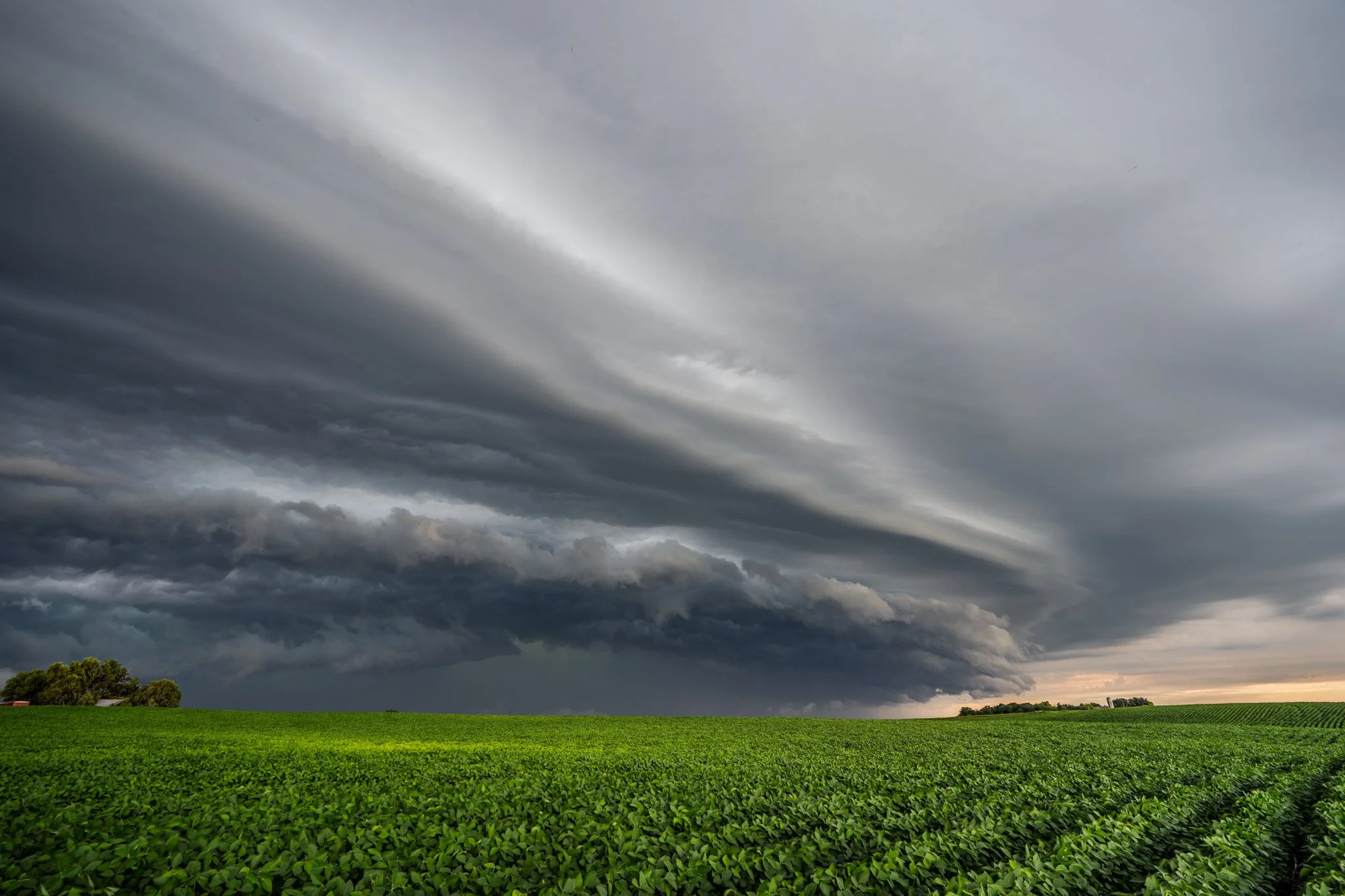
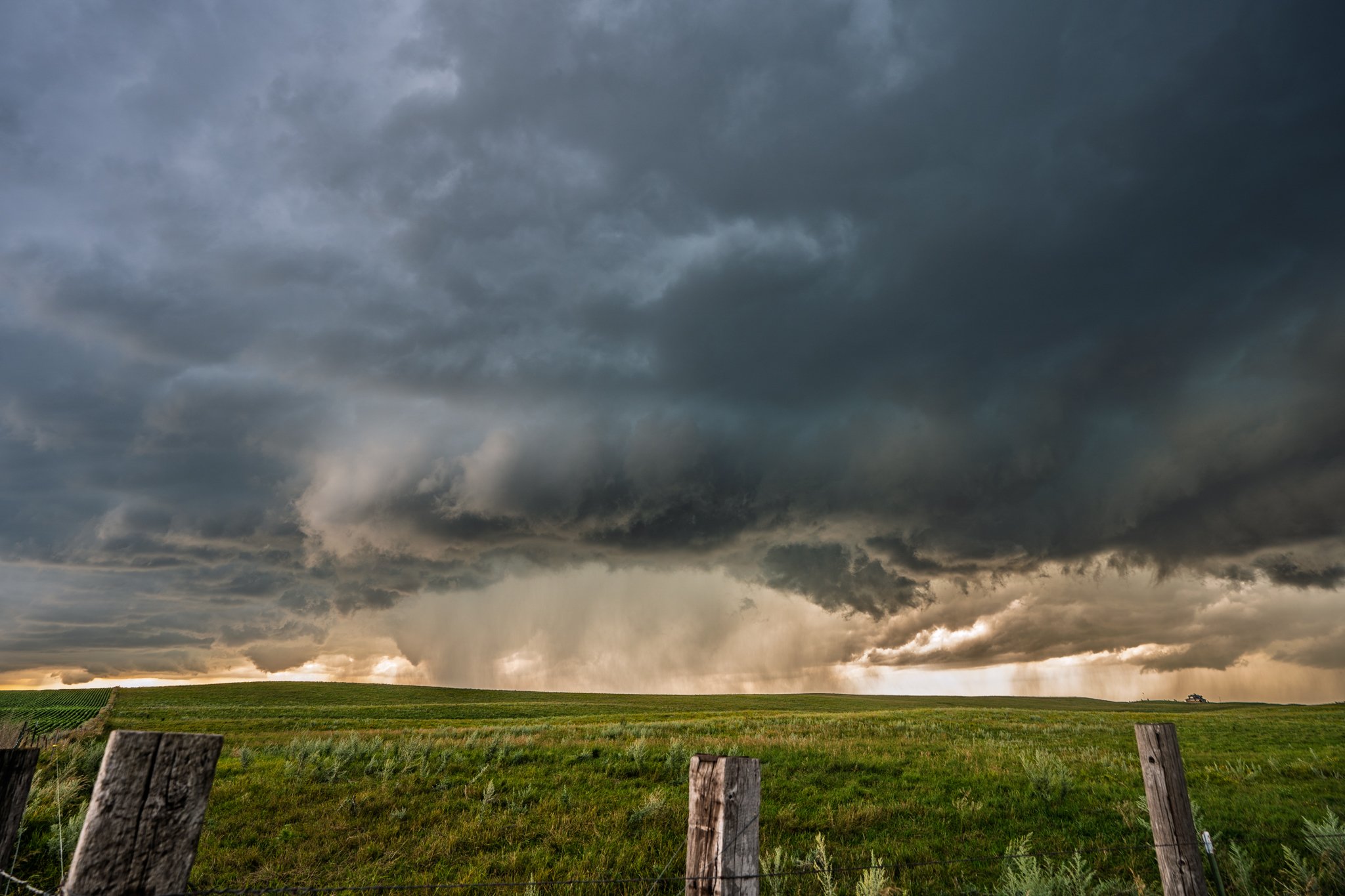
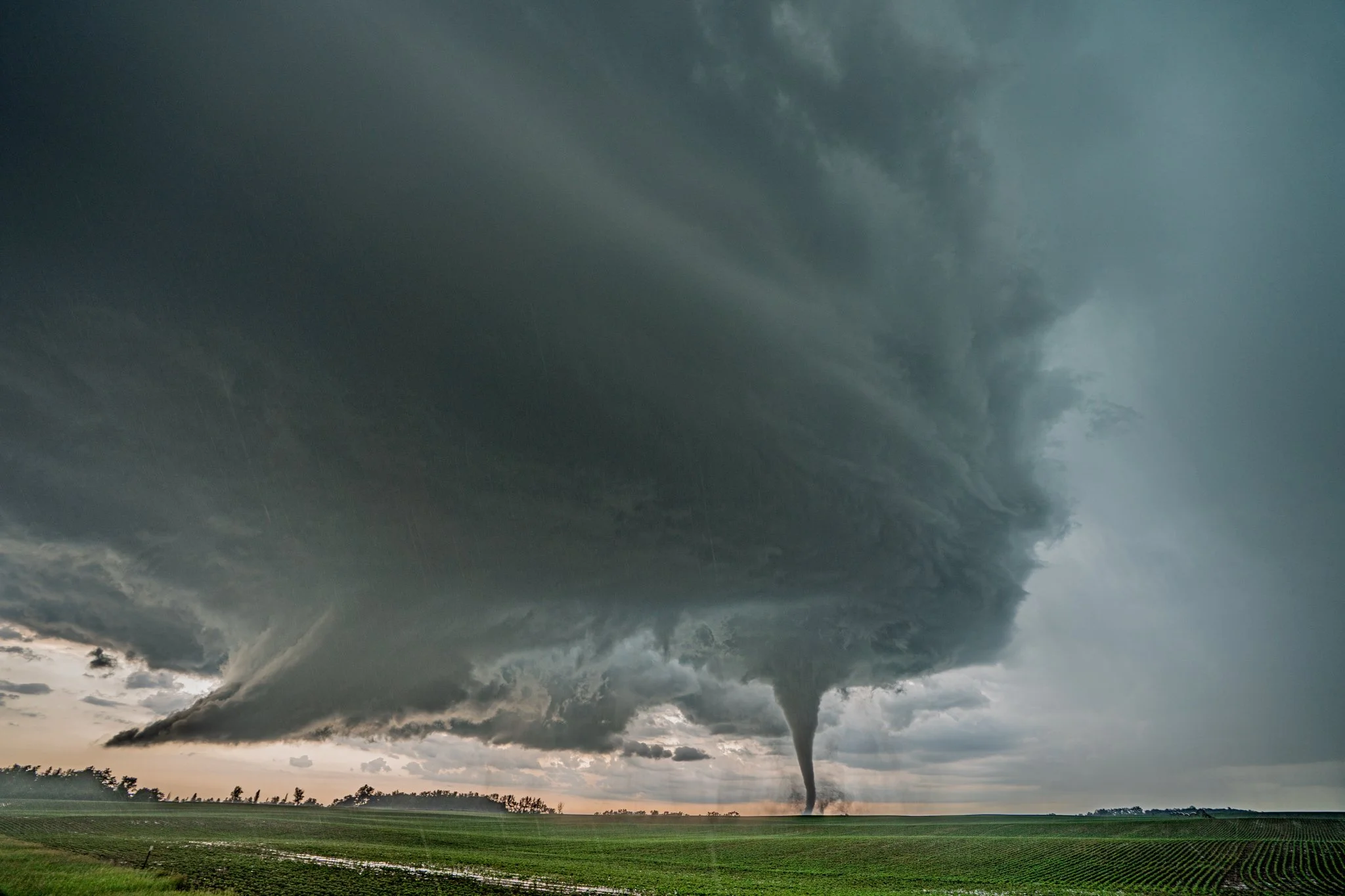
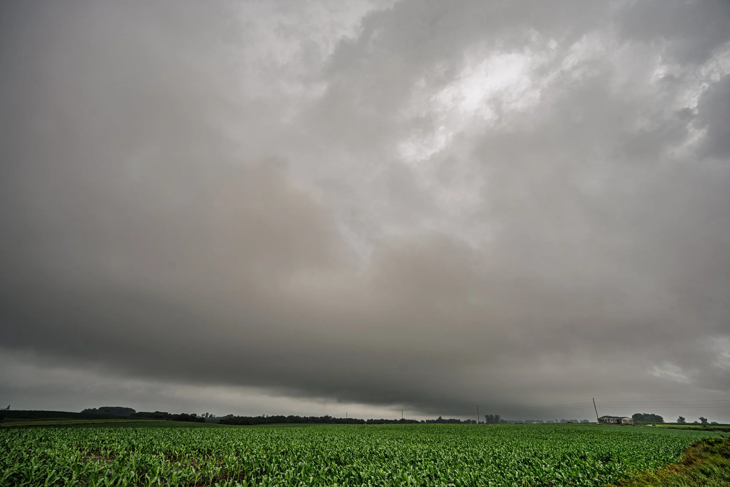
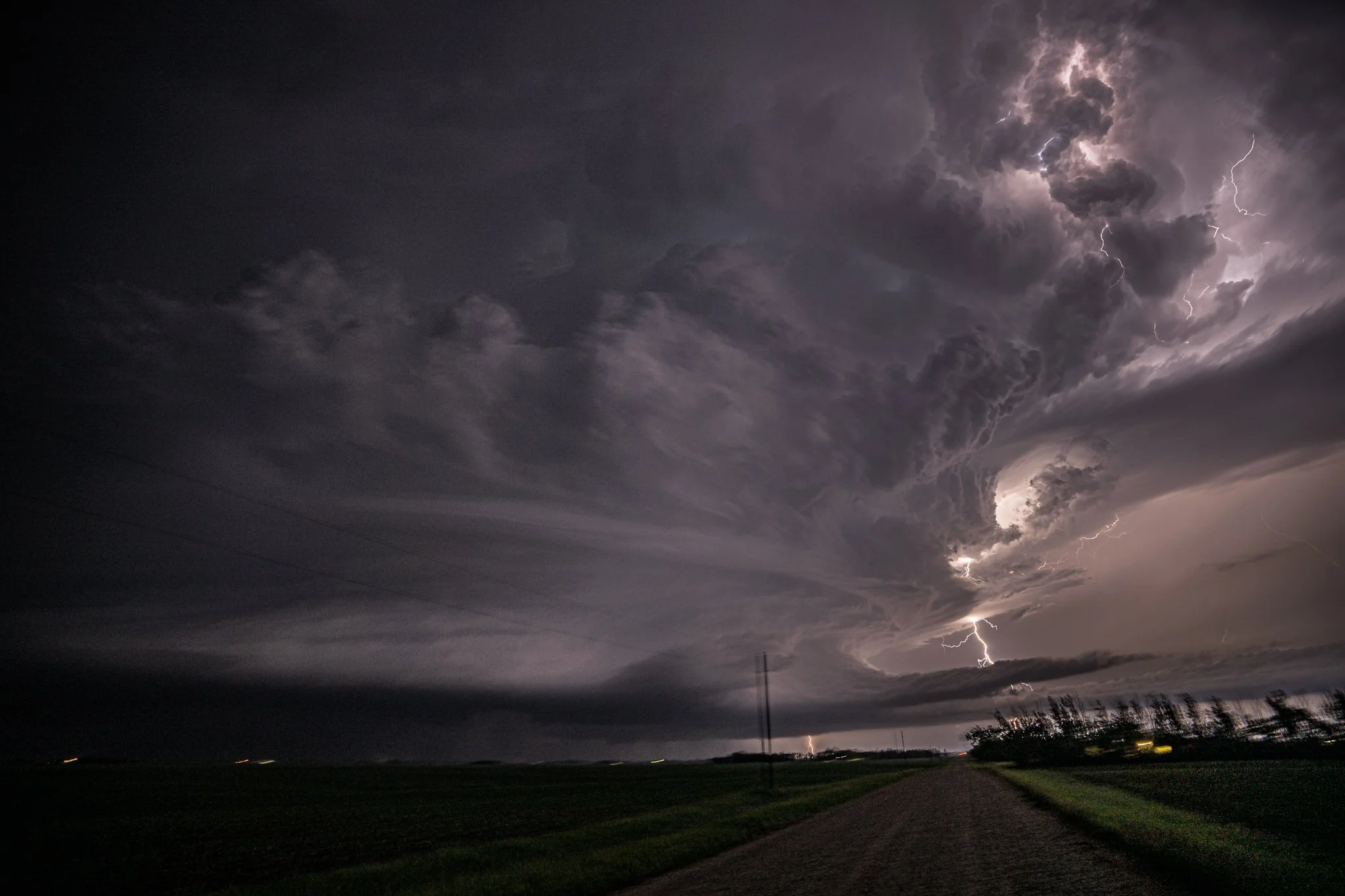
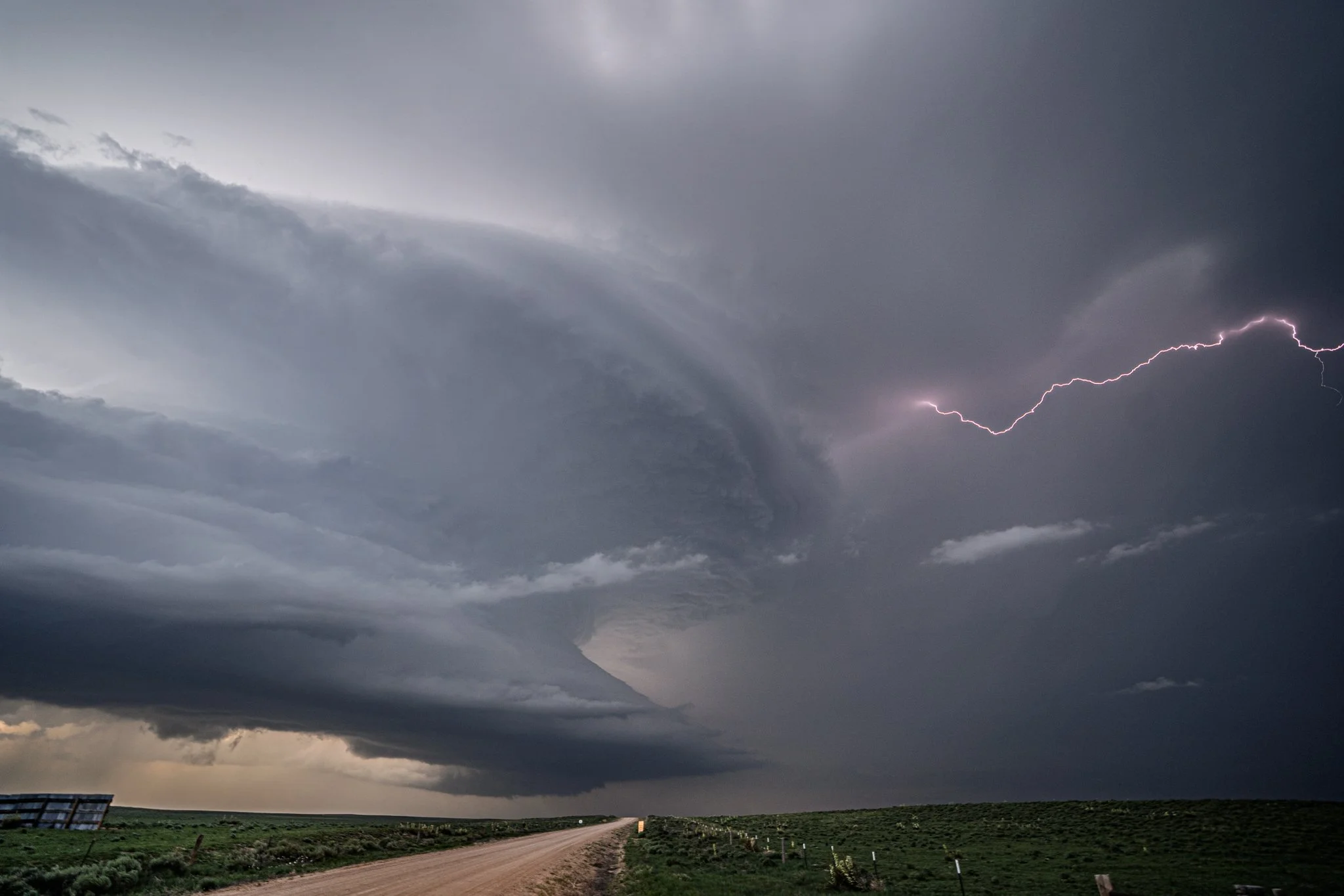
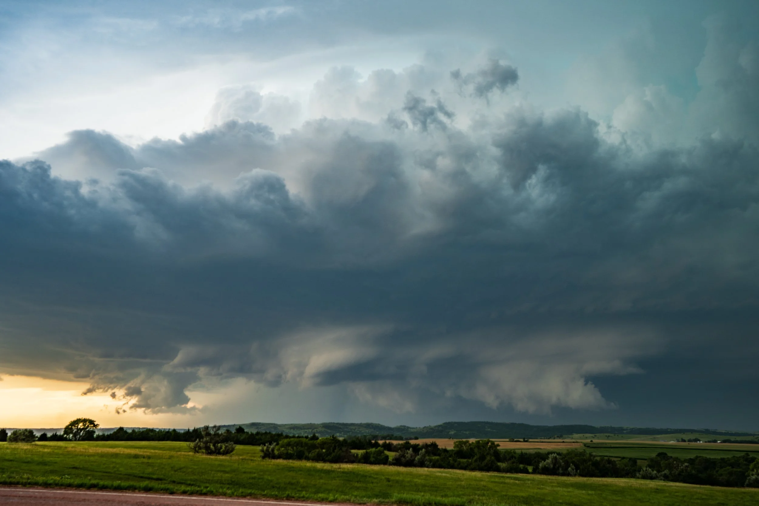
Incredible supercell structure as the tornado dissipated and the occluded wall cloud kept tightening up with another new all cloud right behind it. Inflow streaming in on the right was strong and beautiful!
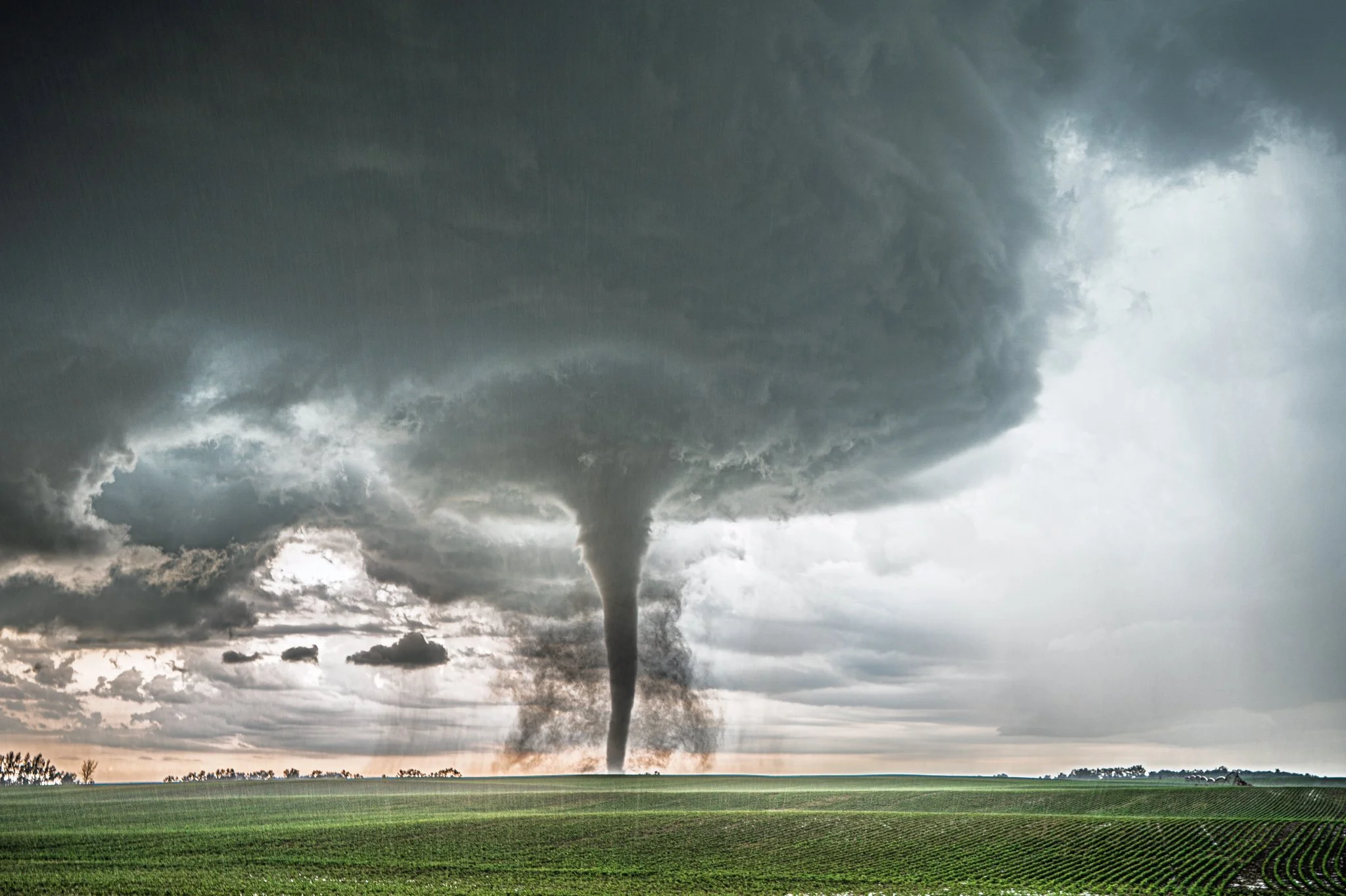
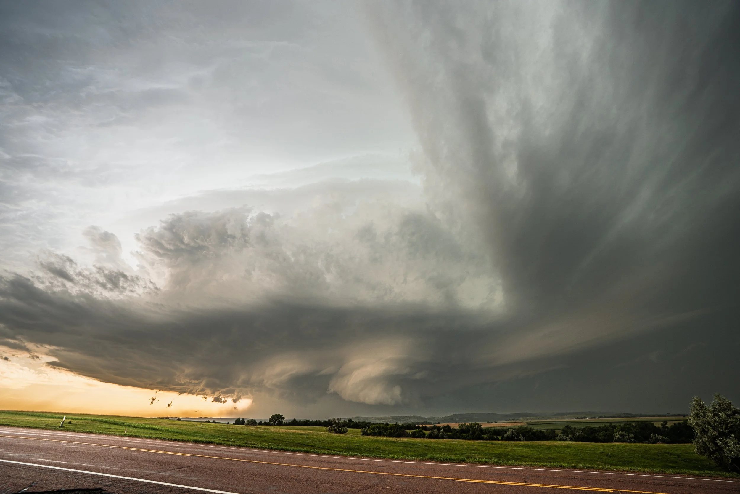
What a mothership!
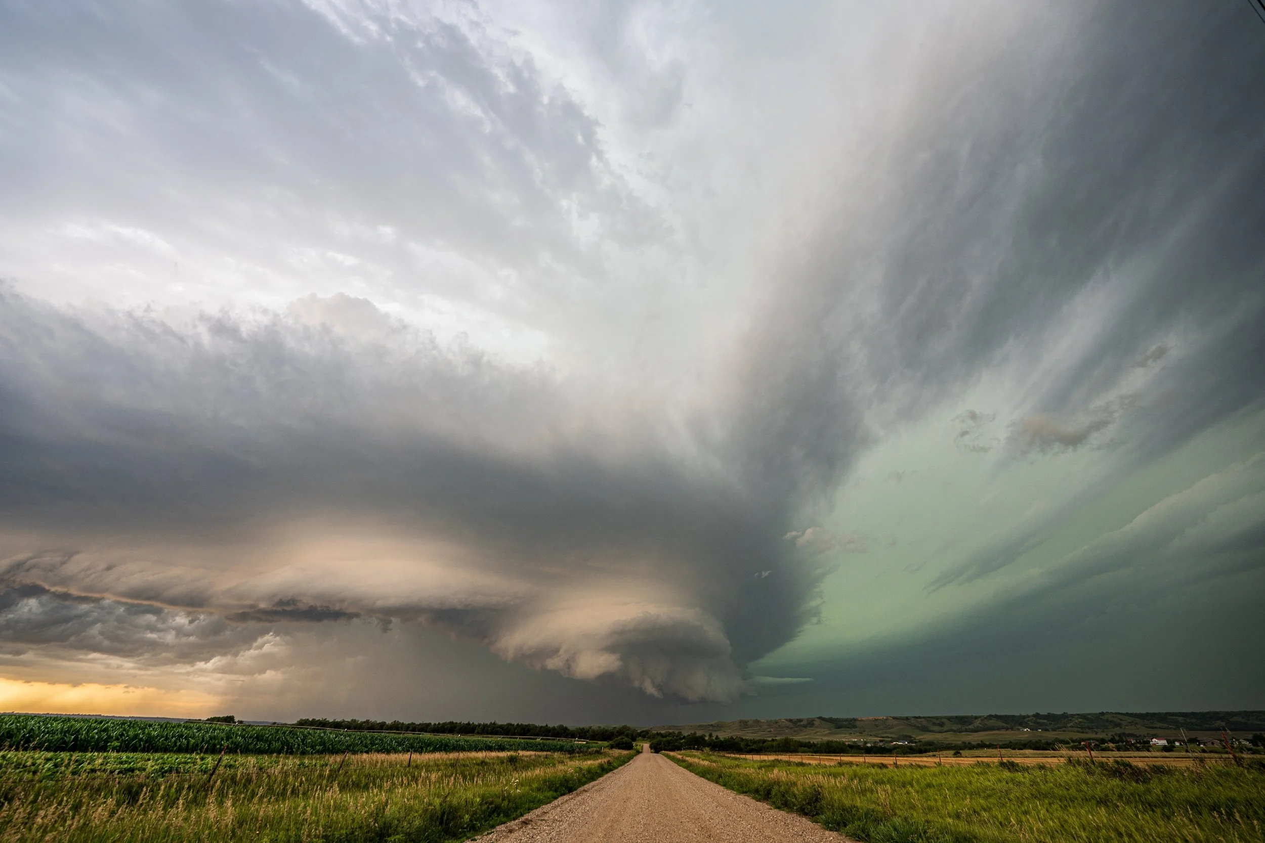
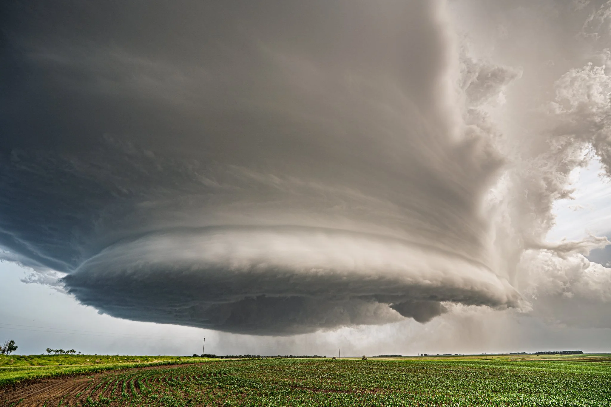
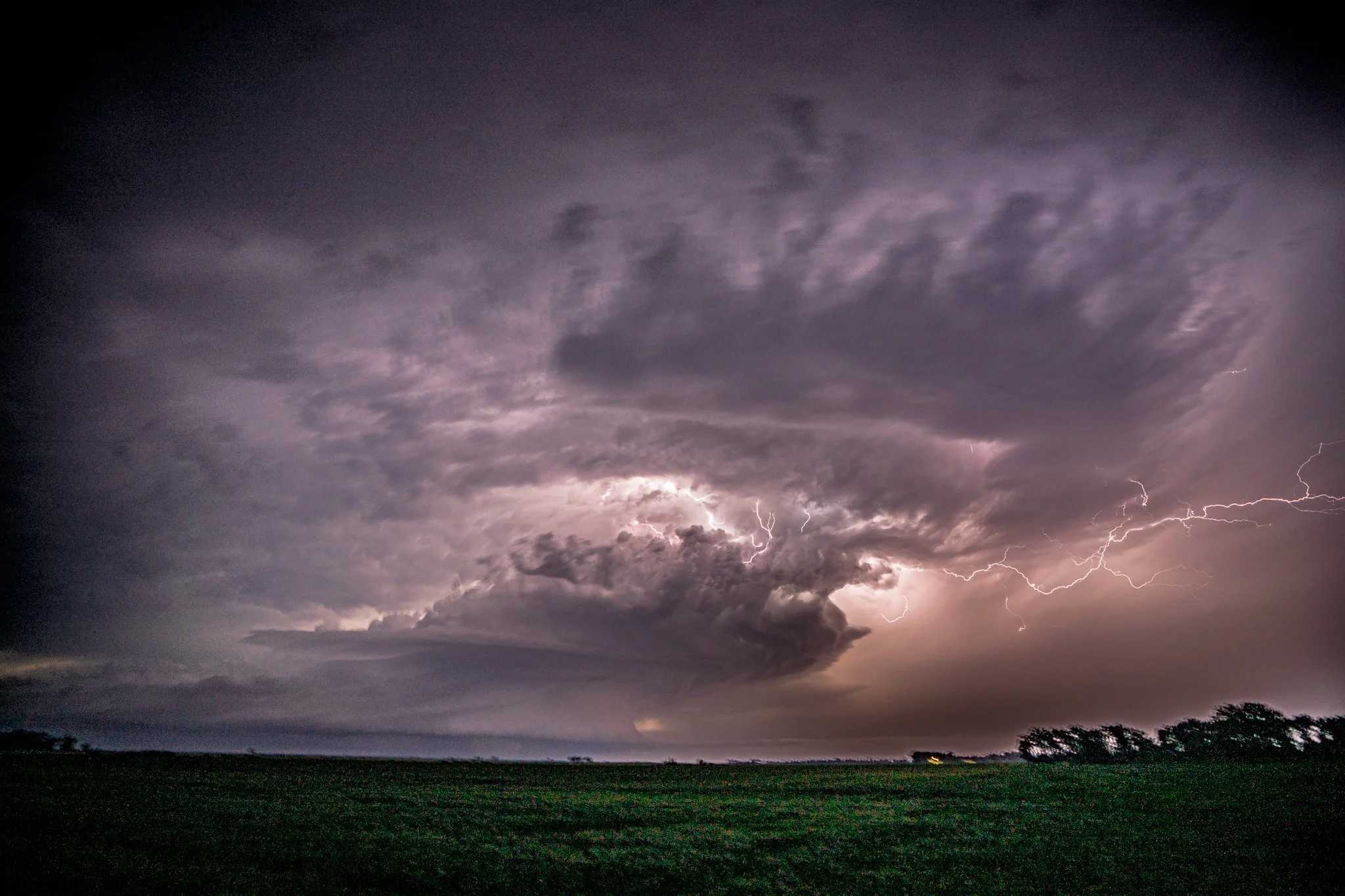
Action area right down the road in front of me. Progressing right to left.
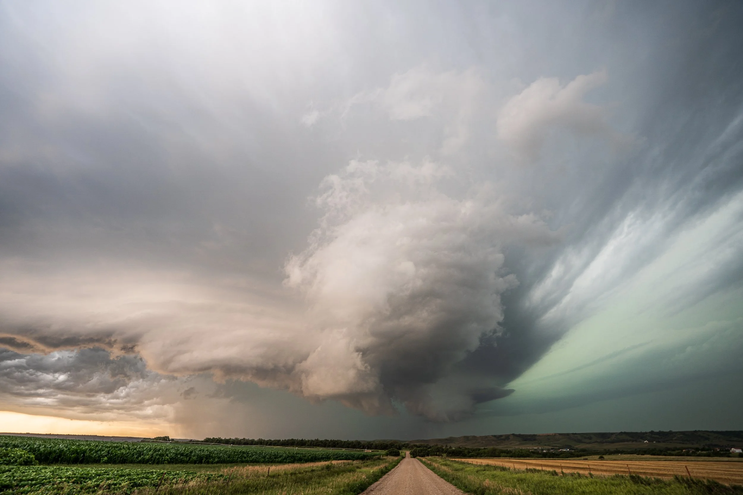
The storm was close to producing another tornado here as the dual wall clouds cranked up on the northeast side of the storm right in the strongest inflow area next to the forward flank core.
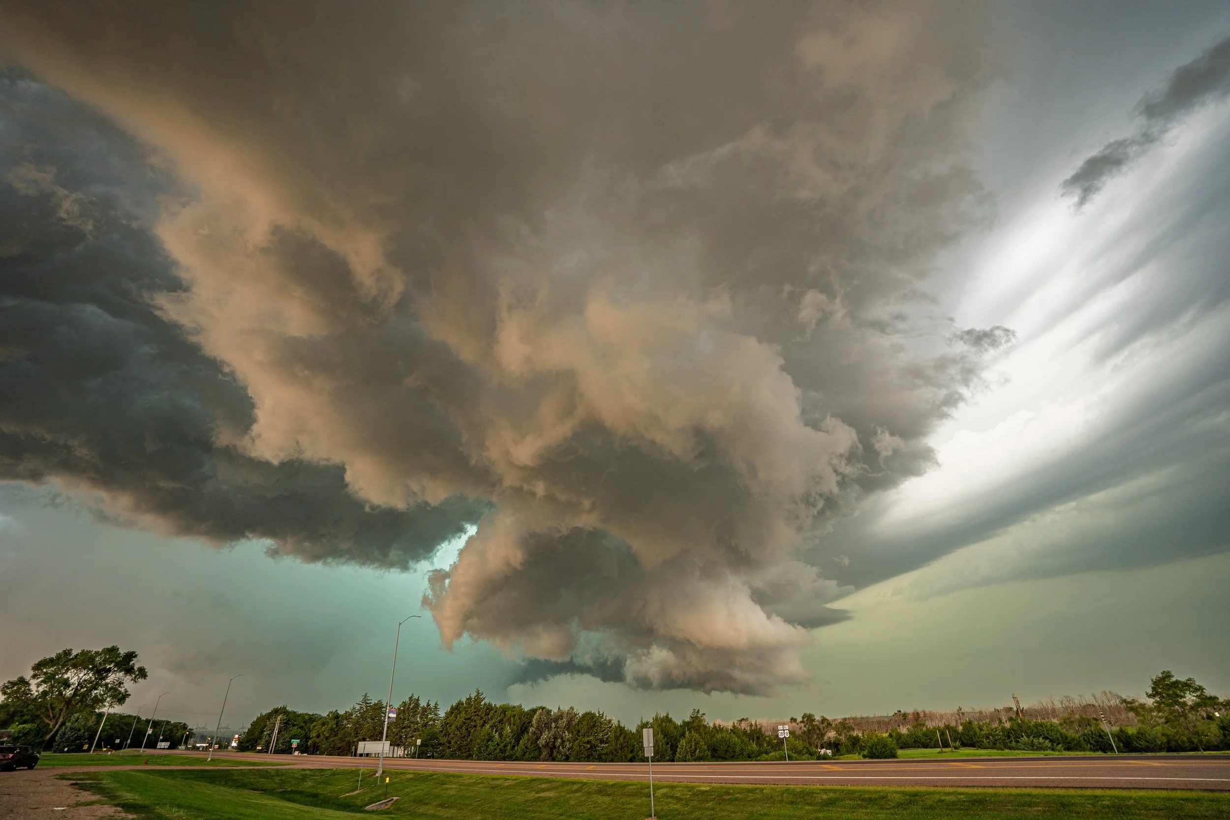
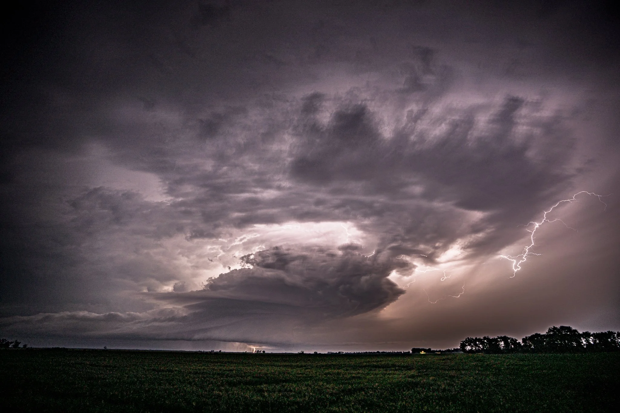
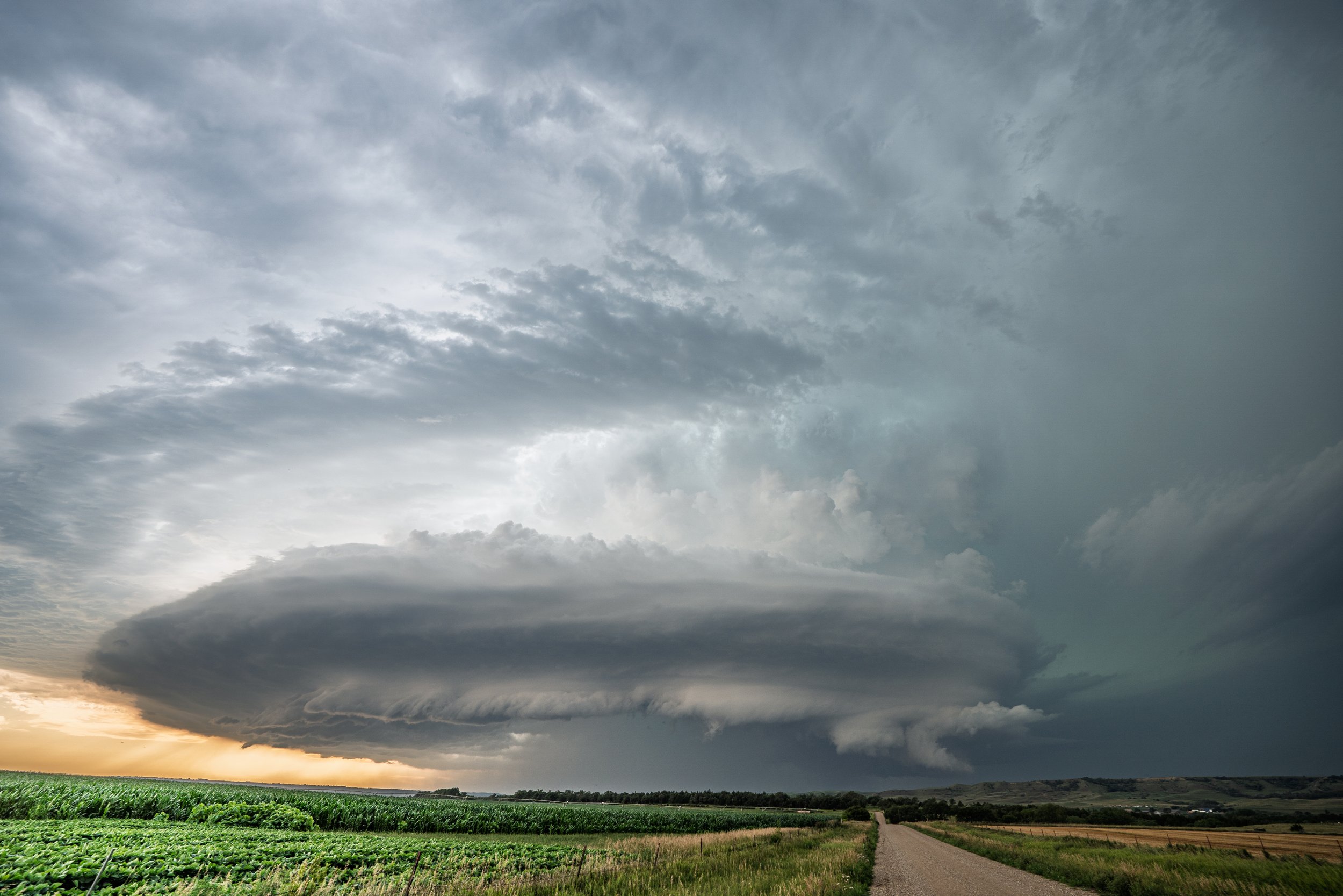
Action area still cranking with a ton of motion going on in Pickstown, SD.
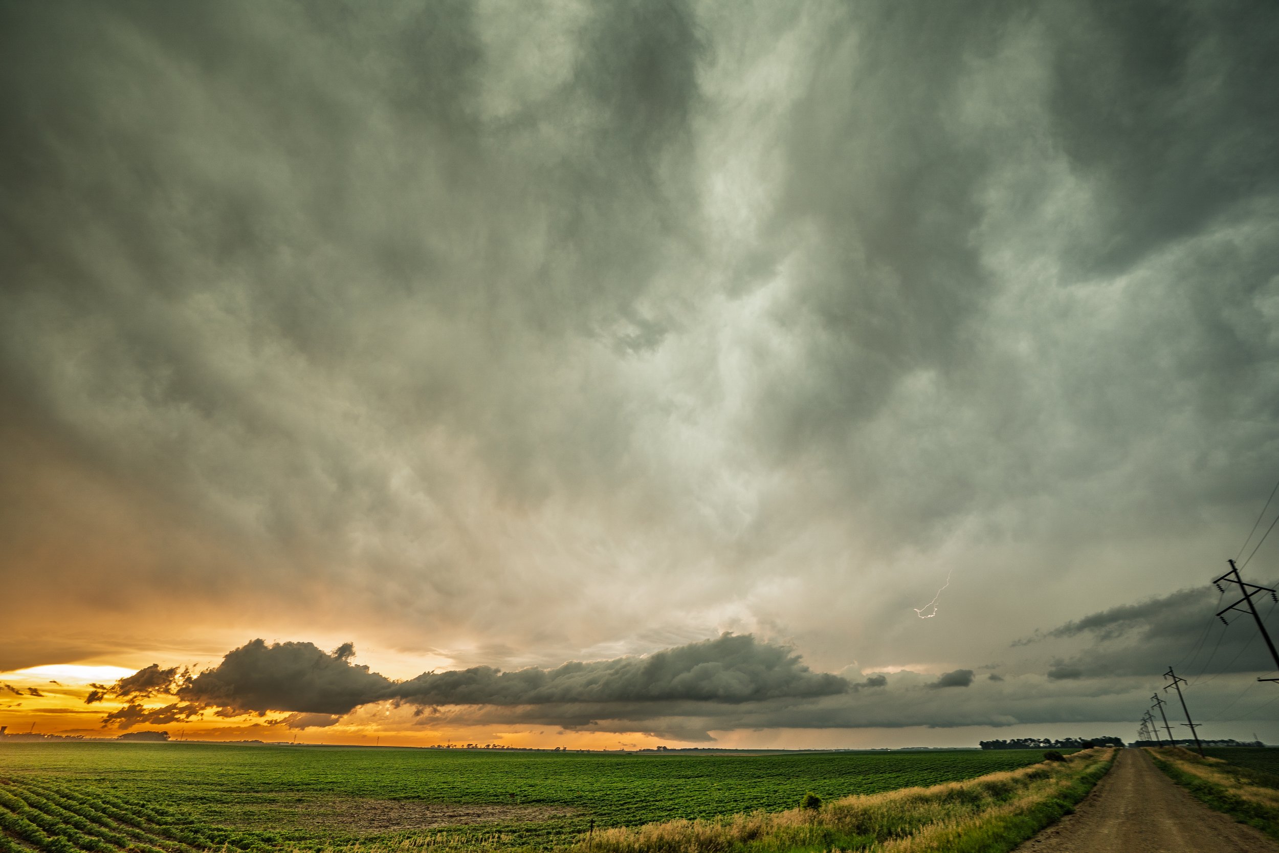
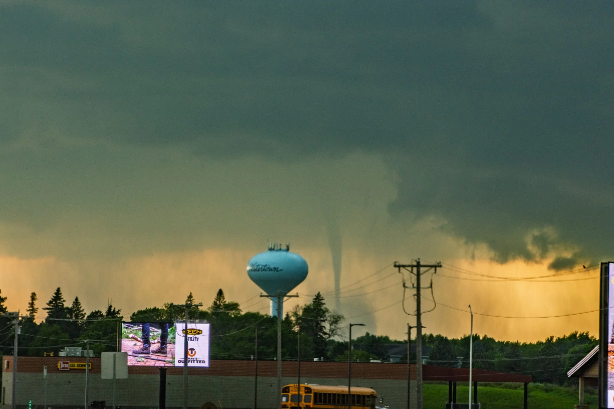
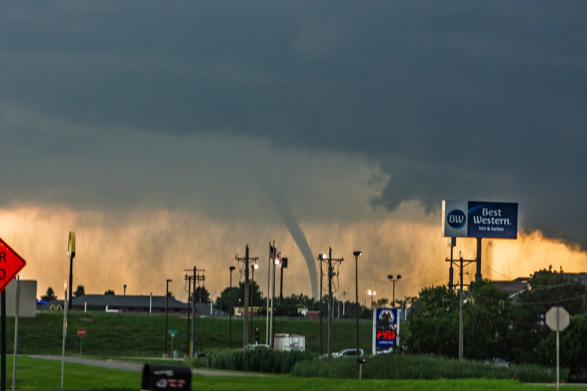
End of the day shot as I left my original storm and intercepted another tornado warned storm near Corsica, SD. Notice what is left of the wall cloud/lowering underneath the updraft direct center. Next was to race home inside and to get ahead of the developing derecho in southeast SD, southern MN, and northwest IA!