JULY 27, 2025 SOUTH DAKOTA: WATERTOWN EF-2 TORNADO

Initial, early day tornado warned storm near Montevideo, Minnesota. This storm was clearly outflow dominant by the time we got there and had a nice shelf cloud. Unfortunately, this is the sucker storm that slowed us down where we nearly missed the tornado later in the day.

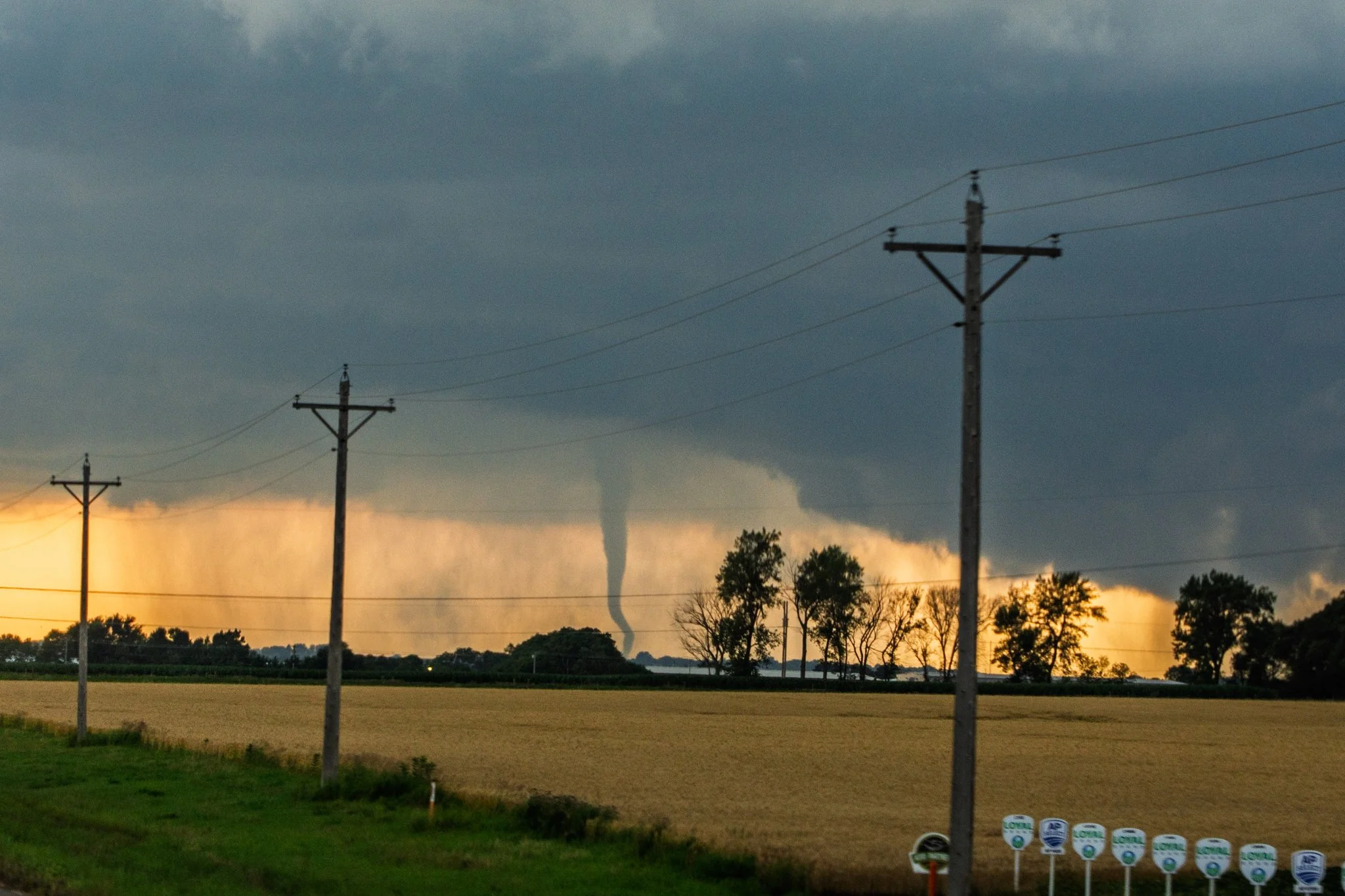
So we decided to bail and head southwest towards Watertown at the triple point where new updrafts kept regenerating and became explosive. This was the view from east of Watertown as we came up over a hill on highway 212 of the ongoing tornado that was northwest of town.

What a cool looking tornado! UGH! Seriously, 15 minutes would have made the difference of us being up close to witness the tornado and this view from 15-20 miles away. Just a bit too late.

Strong tornado here as we started to approach the eastern edge of Watertown, SD.


Clearly starting to weaken and rope out here as we continued to push towards Watertown and get close to the tornado. Felt like it was taking FOREVER.

Tornado still holding strong as we entered the city of Watertown with the water tower in the foreground.


Going through Watertown and frustrated at the time it is taking to get through as the tornado starts to lift west of town.

Progressed southwest of Watertown after the tornado lifted. The supercell was slowly building southeast and held onto a large mesocyclone but clearly lost a lot after producing that tornado. Was going to take a while for it to recycle.