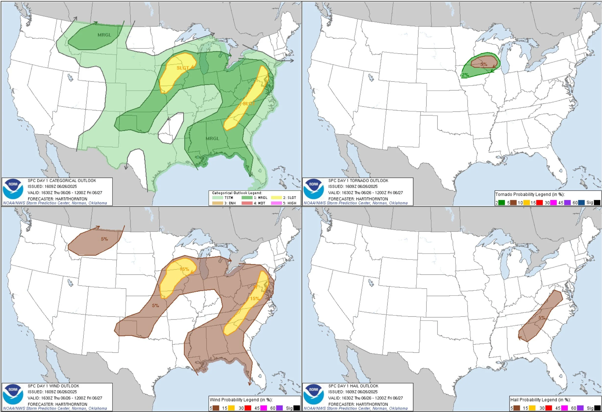
JUNE 28, 2025 SOUTH DAKOTA: THE GARY TORNADO OF THE YEAR
My son Gage’s video when the Gary tornado was at its closest point.
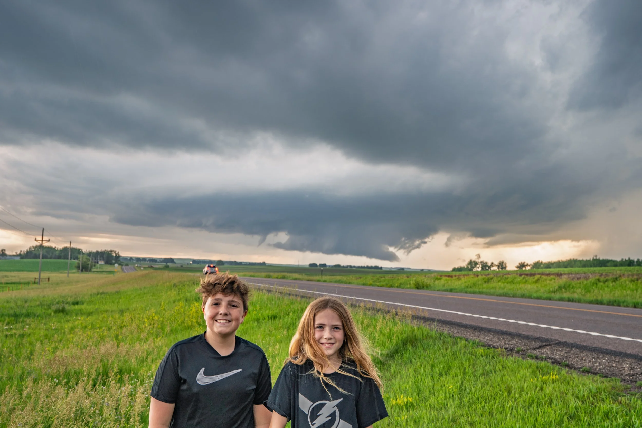
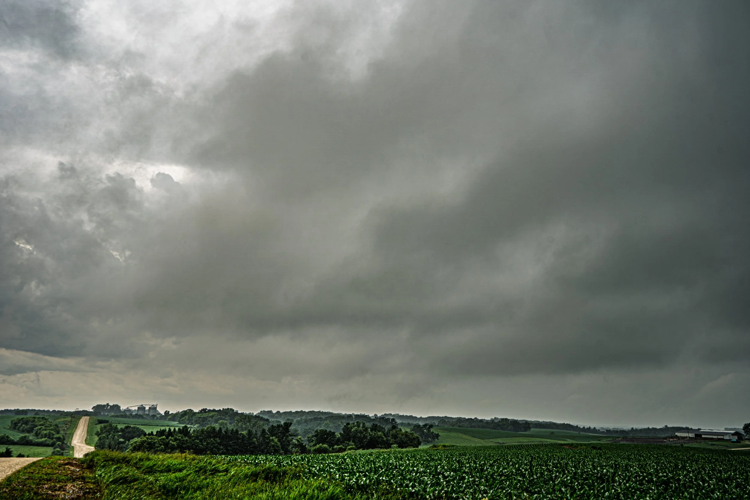
Look at these awesome kids. Jumped out of the car here to snag a photo of the funnel cloud on the left side of the wall cloud near Gary, South Dakota after the Clear Lake tornado. This was a completely different storm than what produced the Gary tornado.
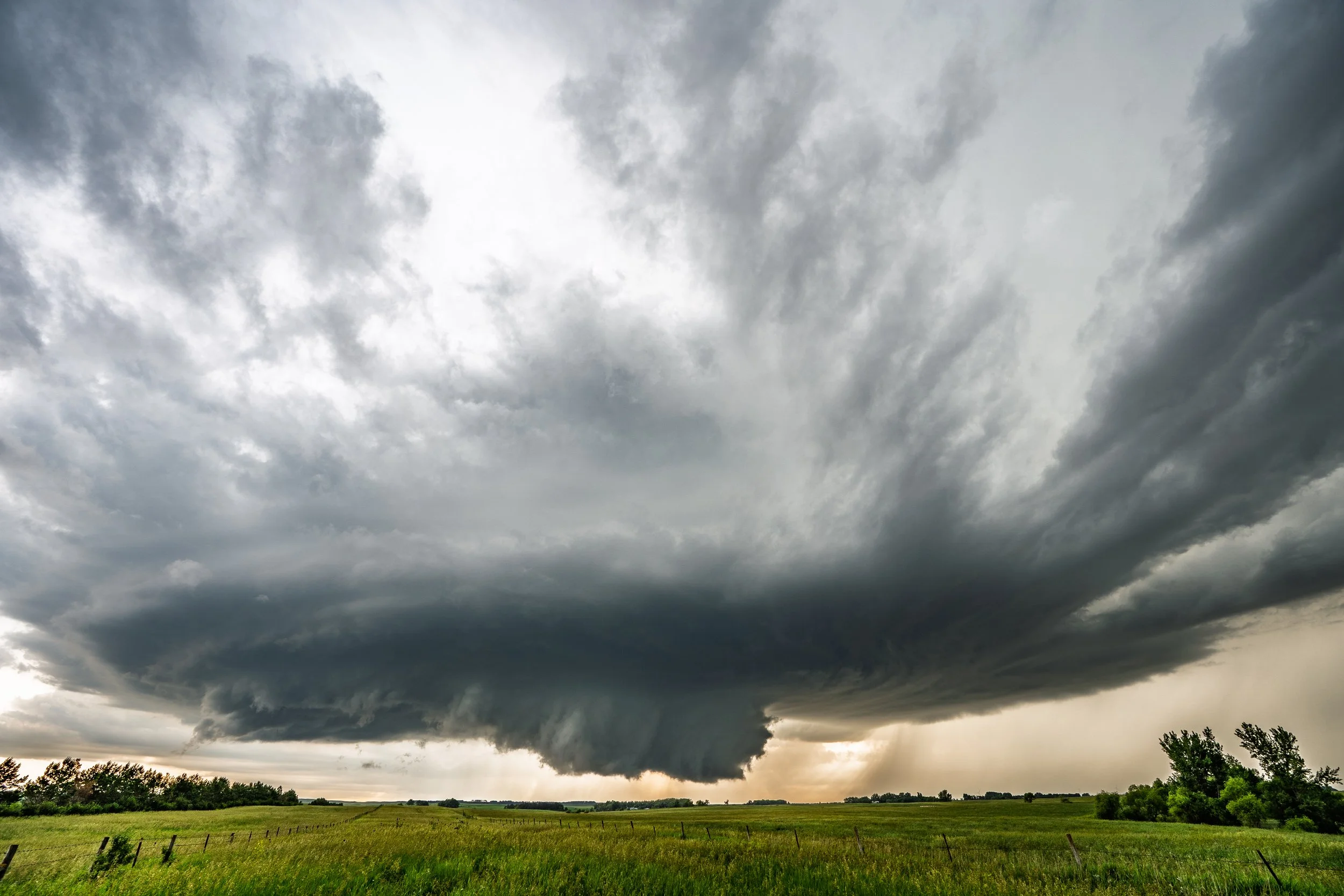
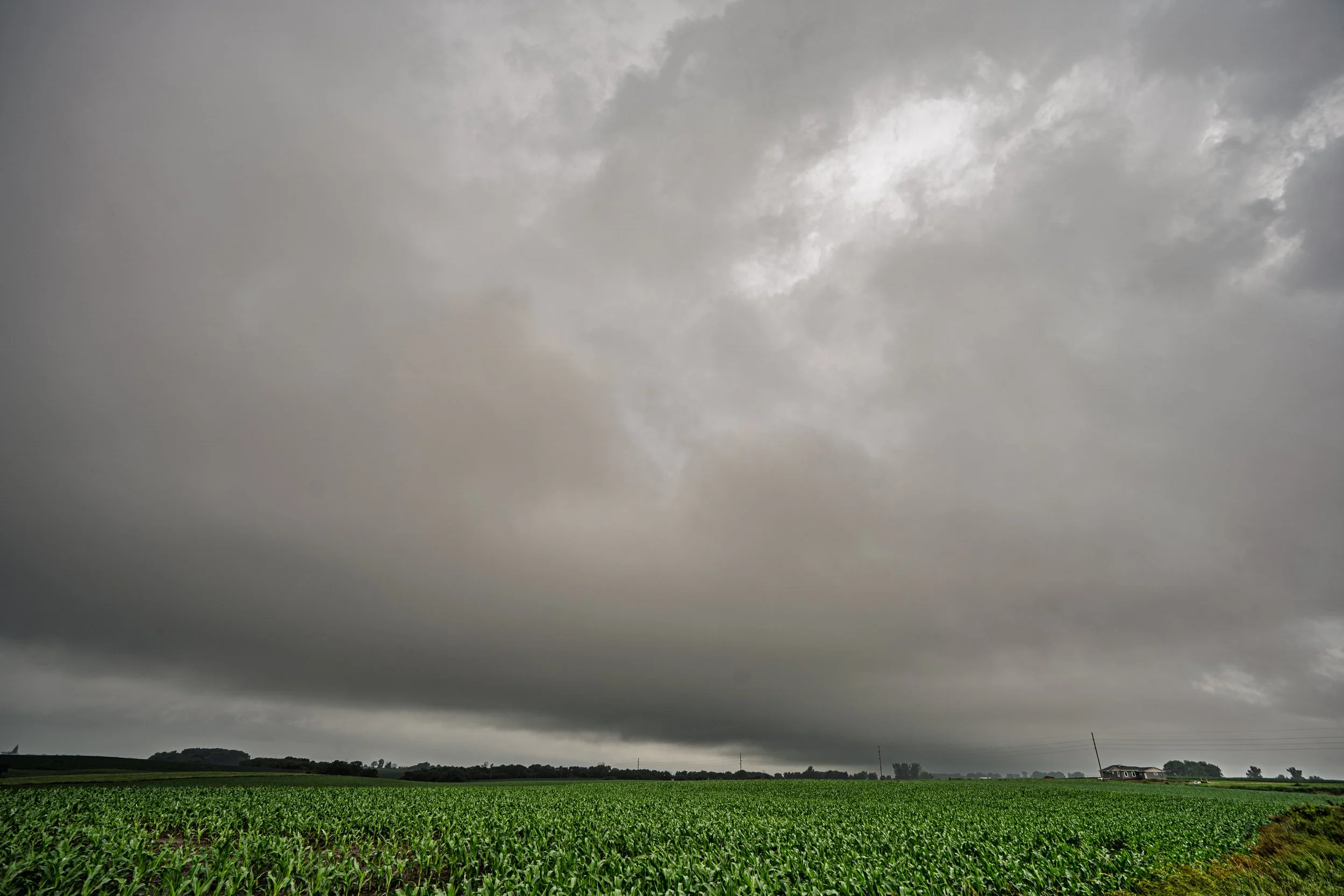
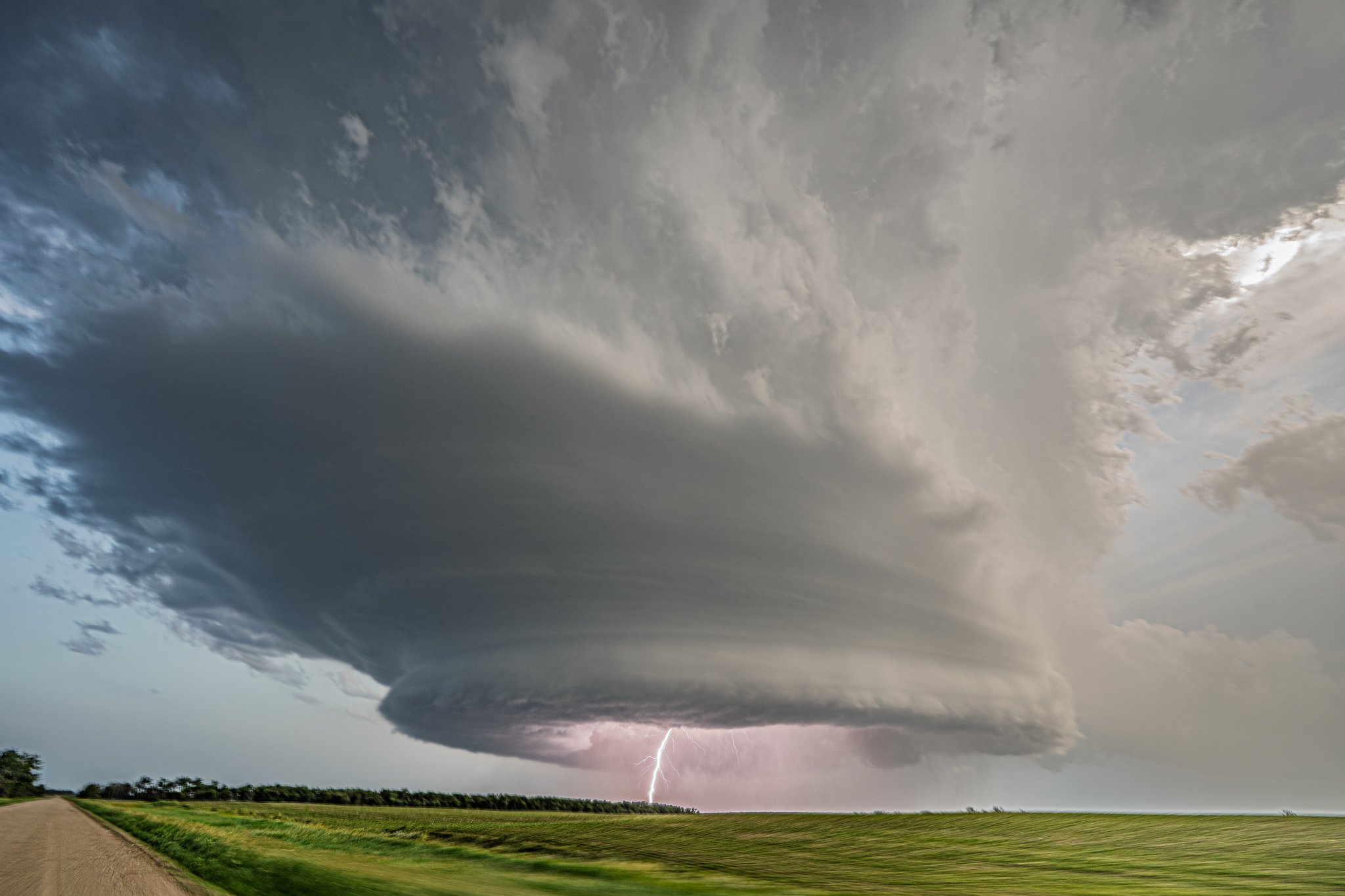
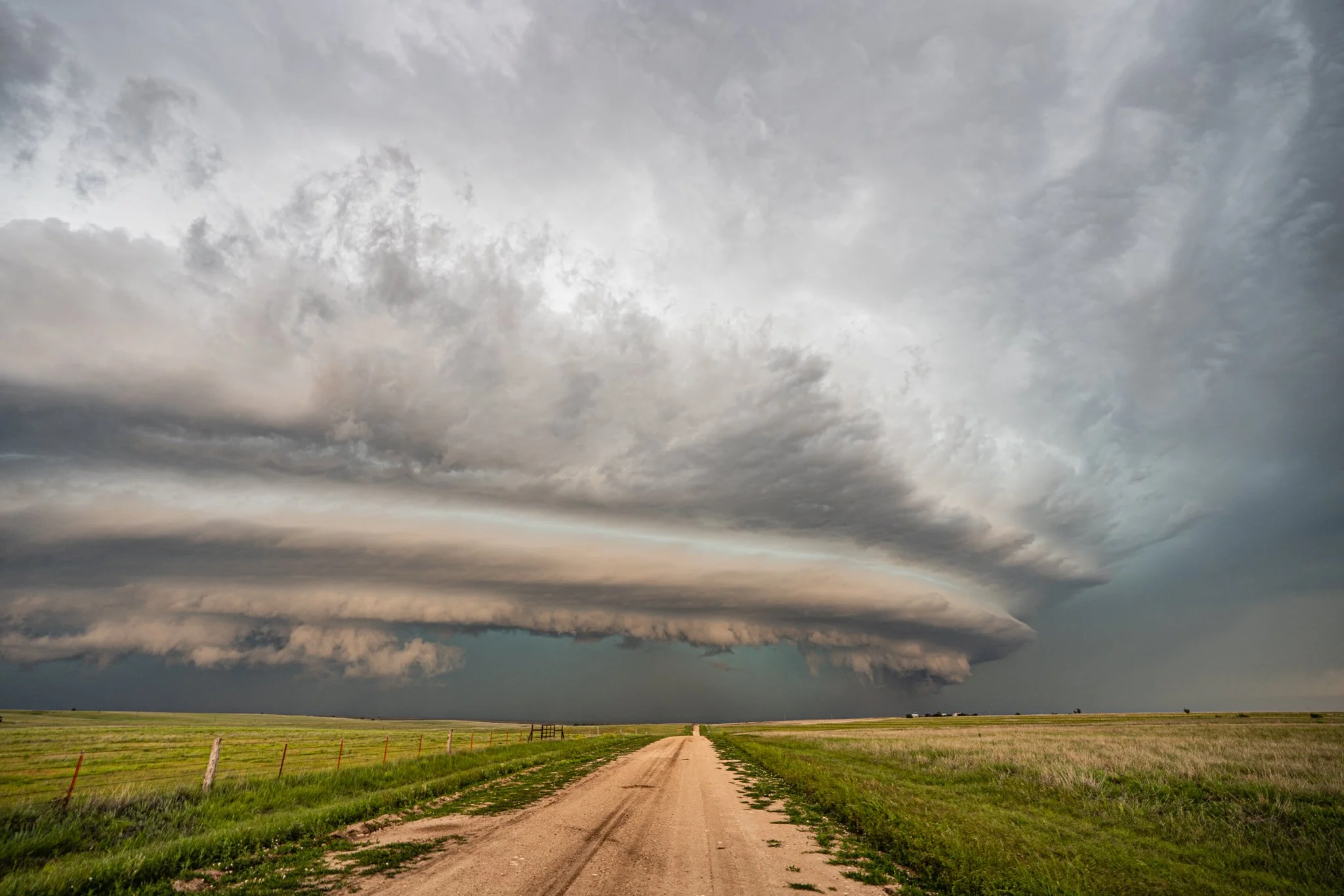
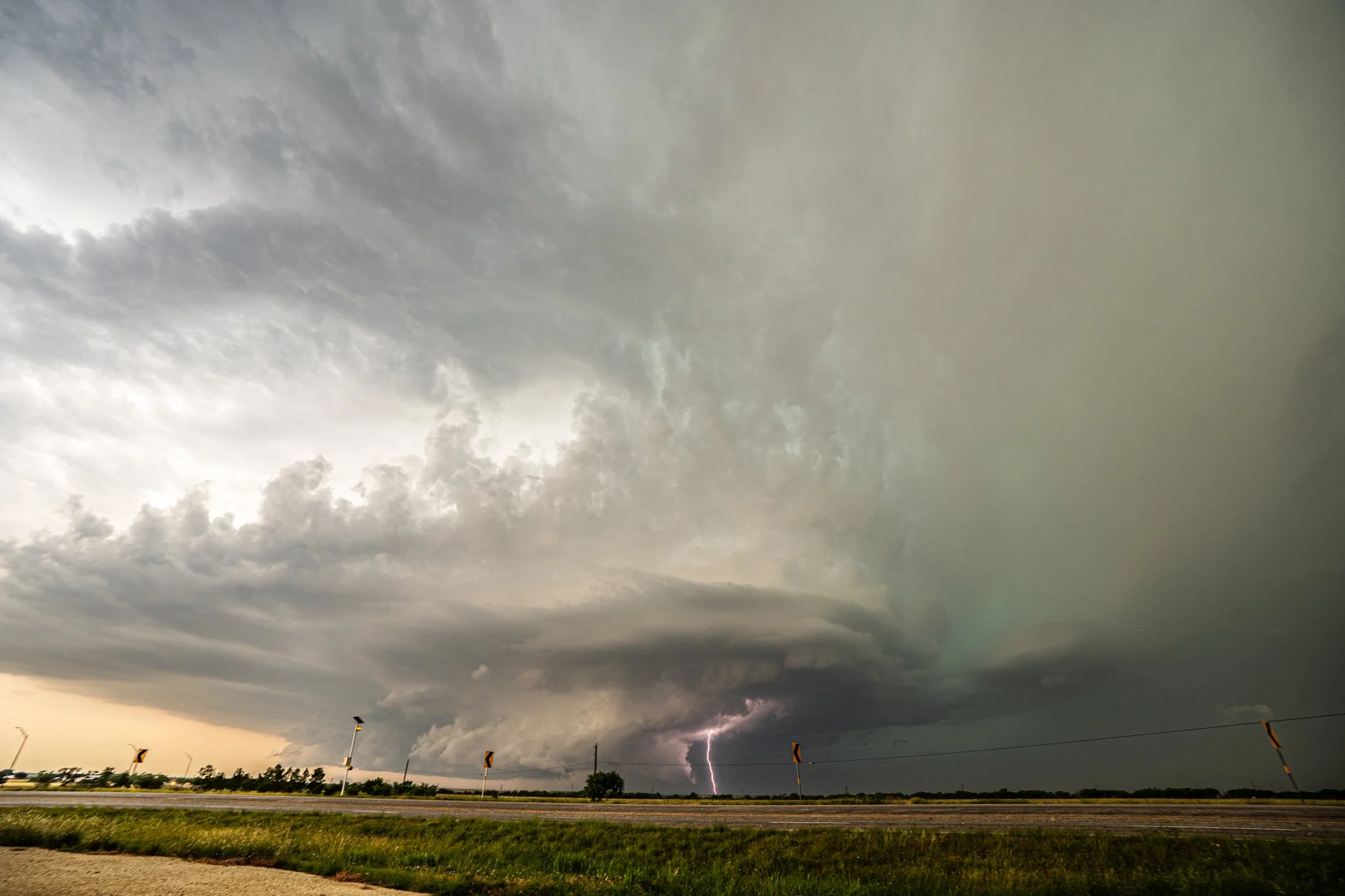
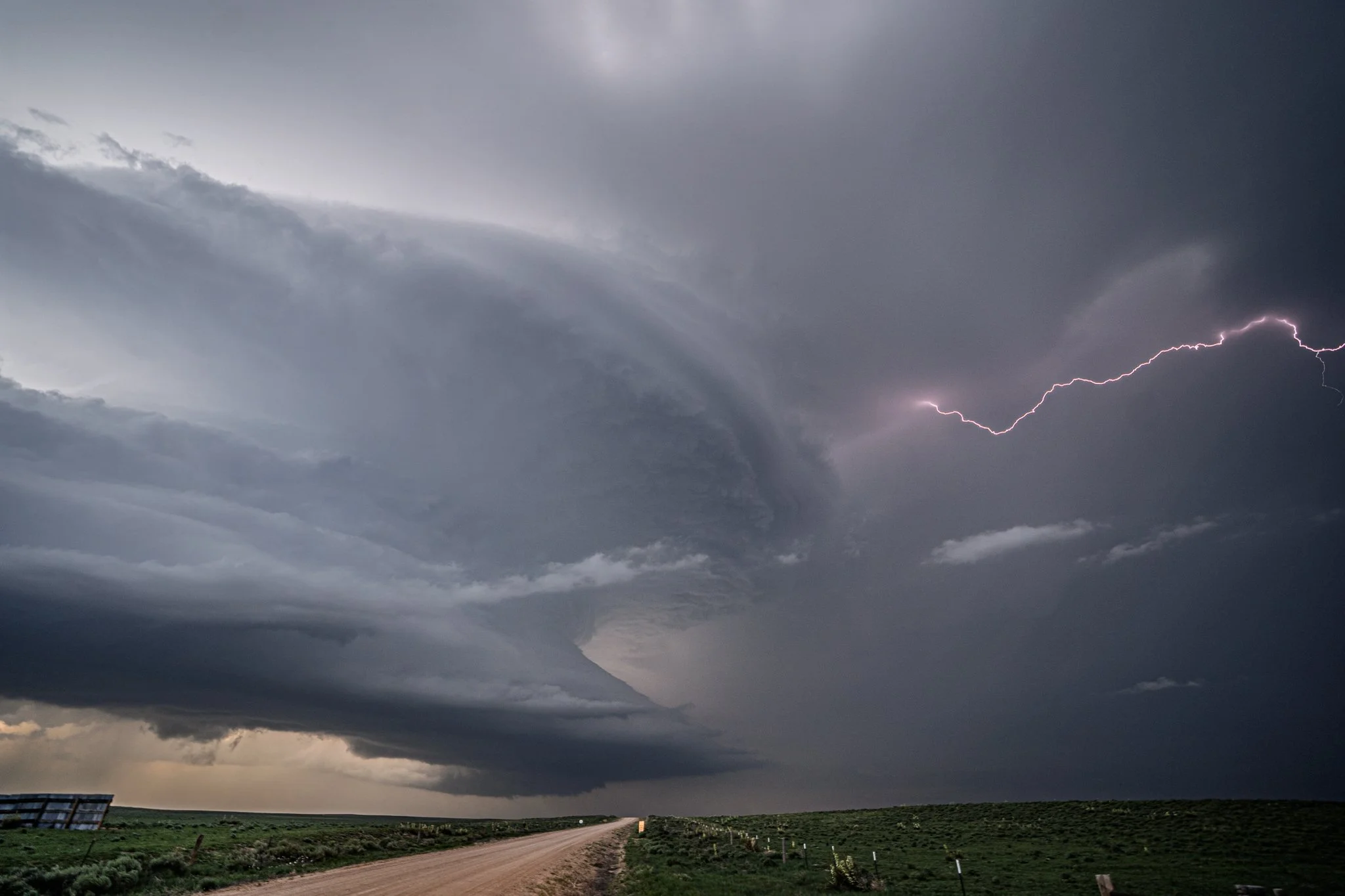
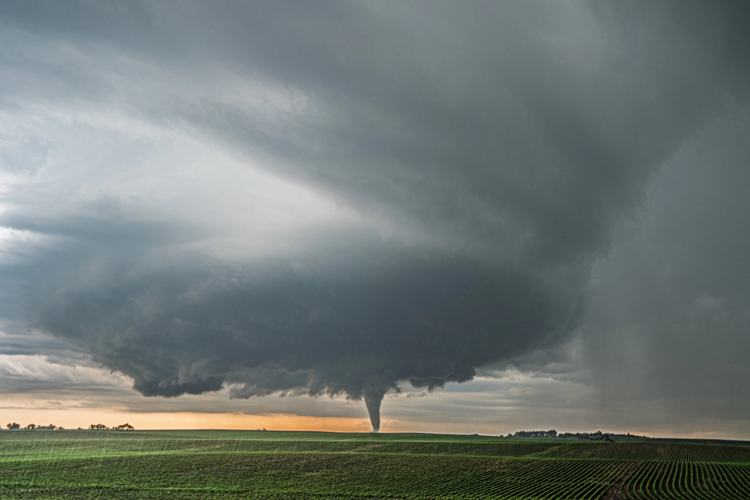
The wall cloud on the storm between the Clear Lake and Gary, South Dakota tornadoes on June 28 of this year was a thing of beauty! This storm did produce a weak, short-lived tornado a short while later.
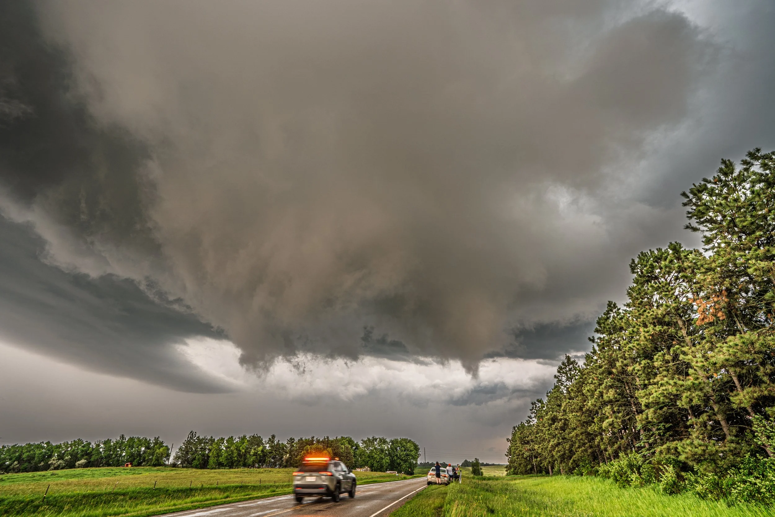
I loved this high intensity moment with the kids. We are in perfect position, following closely behind the rotation wall cloud with condensation fingers and met up on a 4 way stop with a few chaser friends, contemplating our next move. Such a great moment!
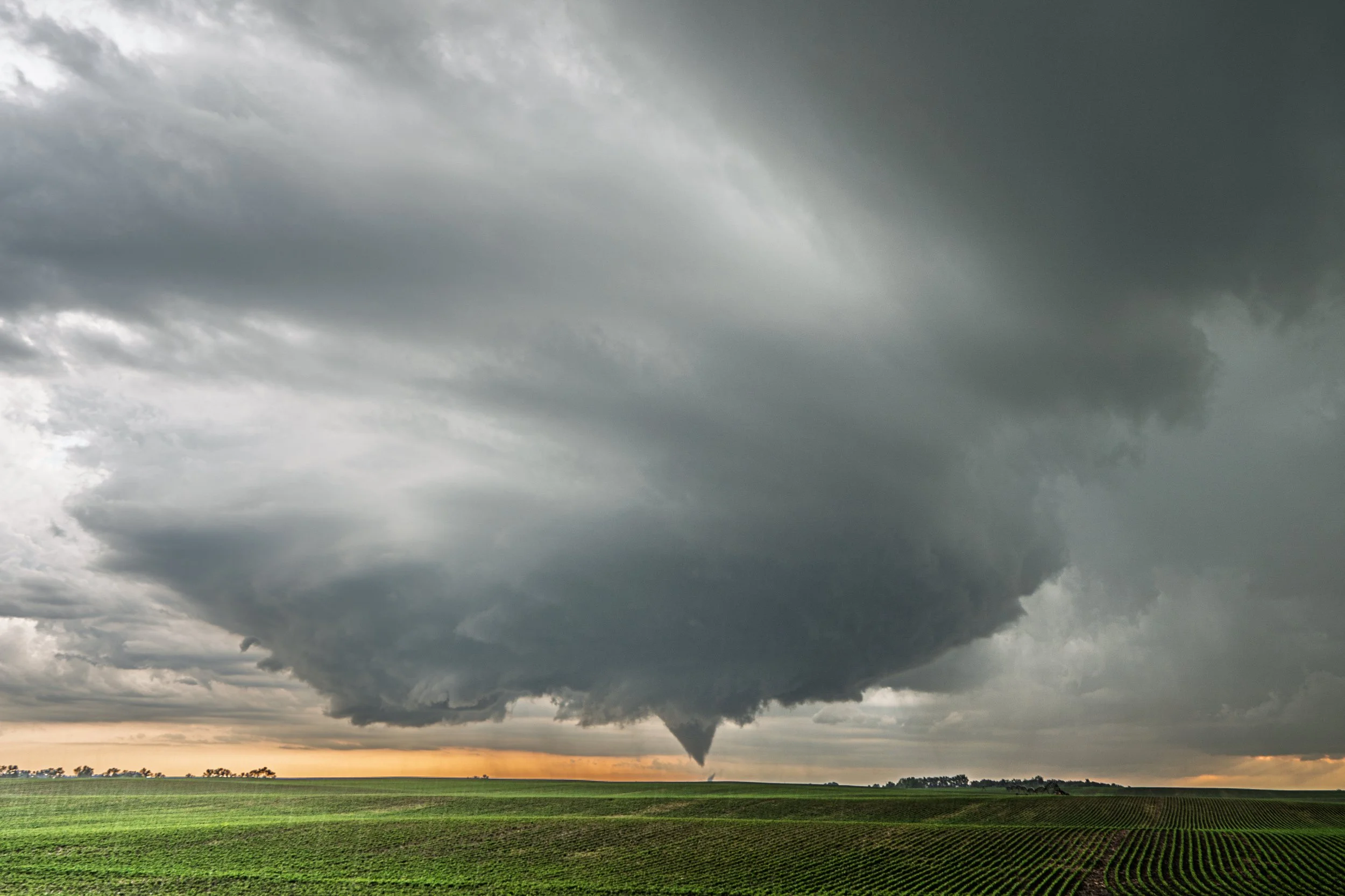
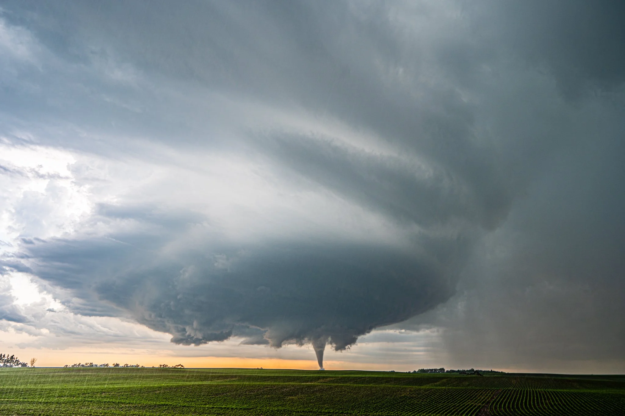
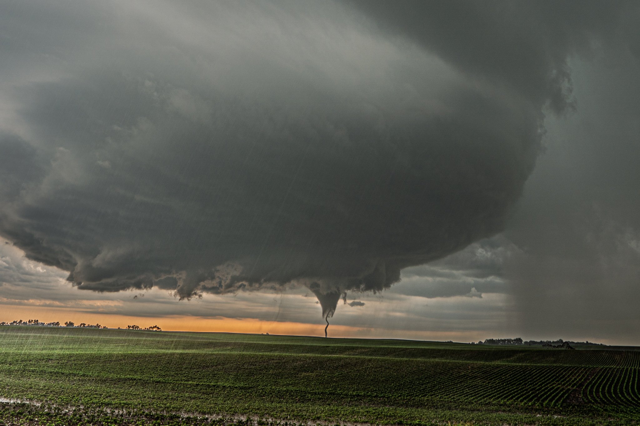
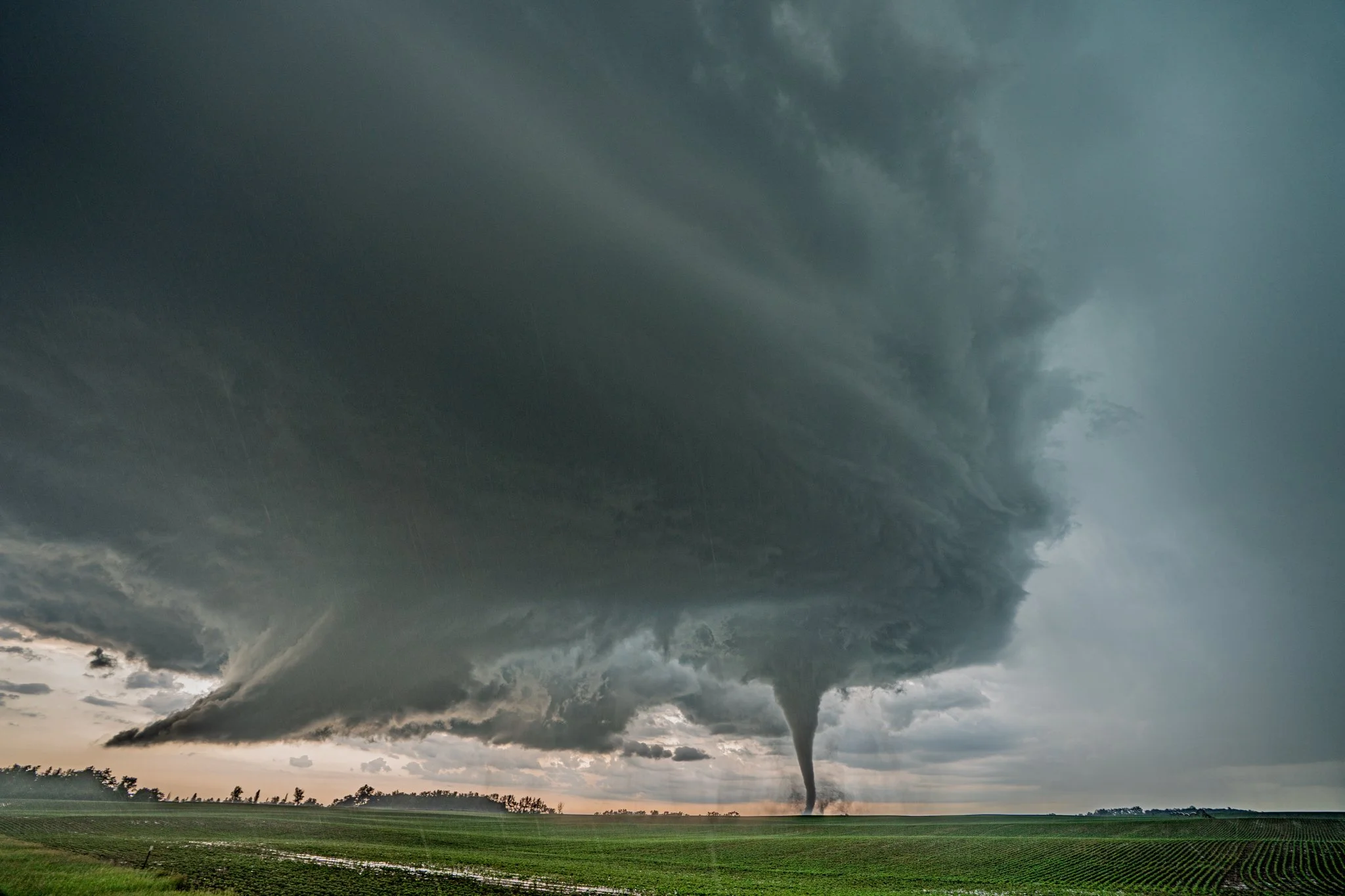
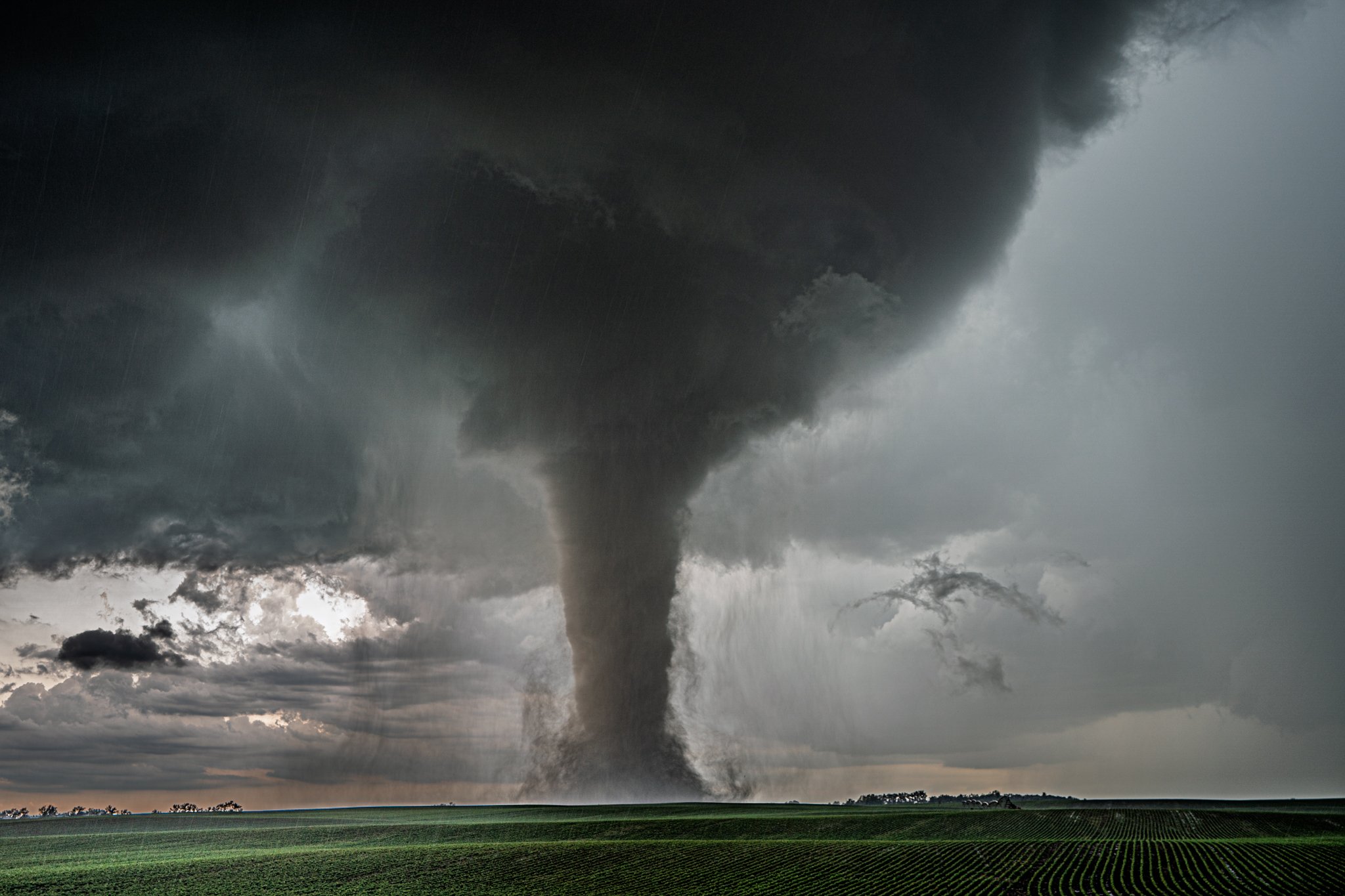
Gary tornado initially touching down was a beauty! The structure was impressive.
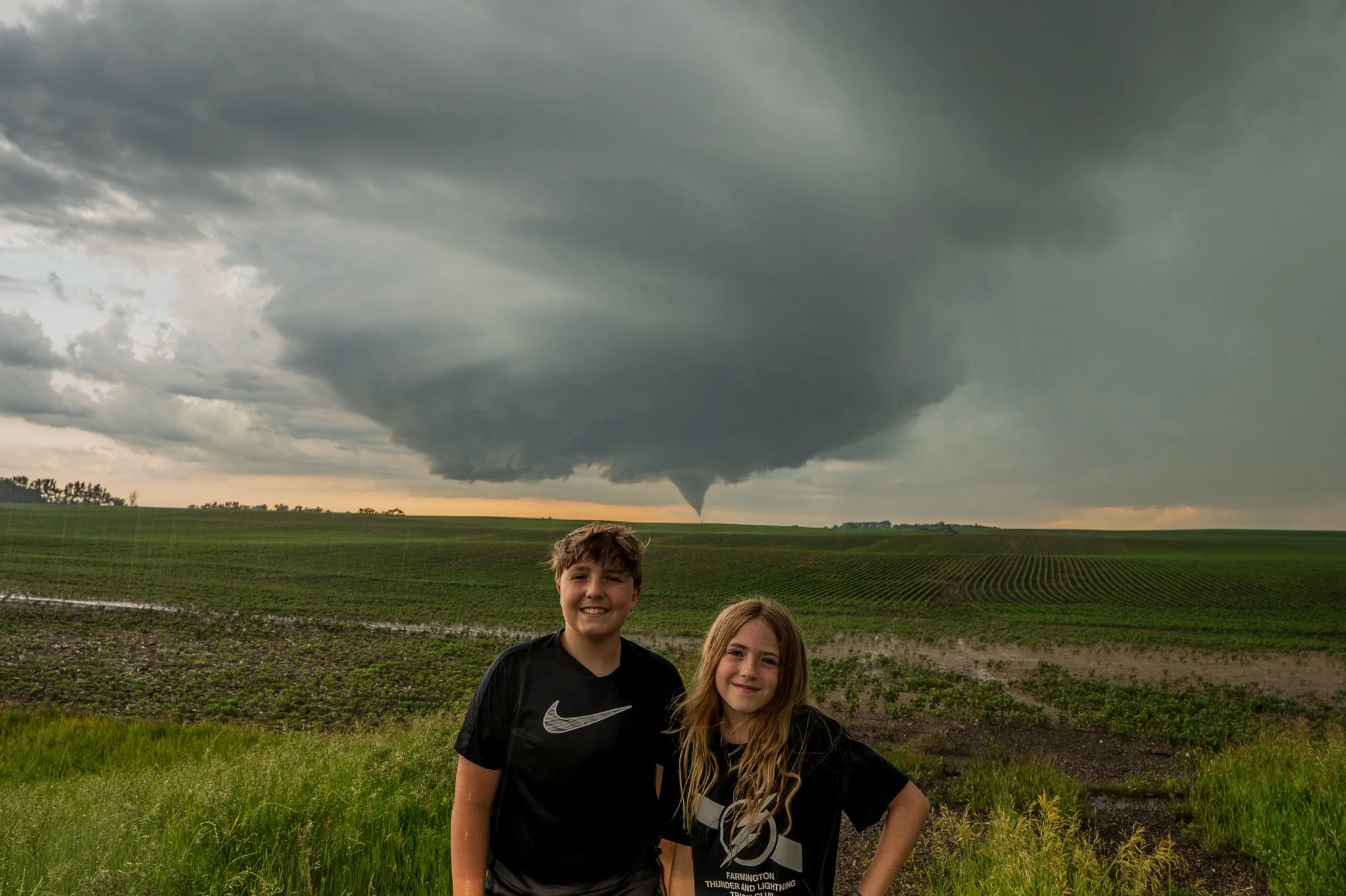
Easily one of my favorite photos I’ve ever taken. To have my kids take in this spectacle is the best ever.
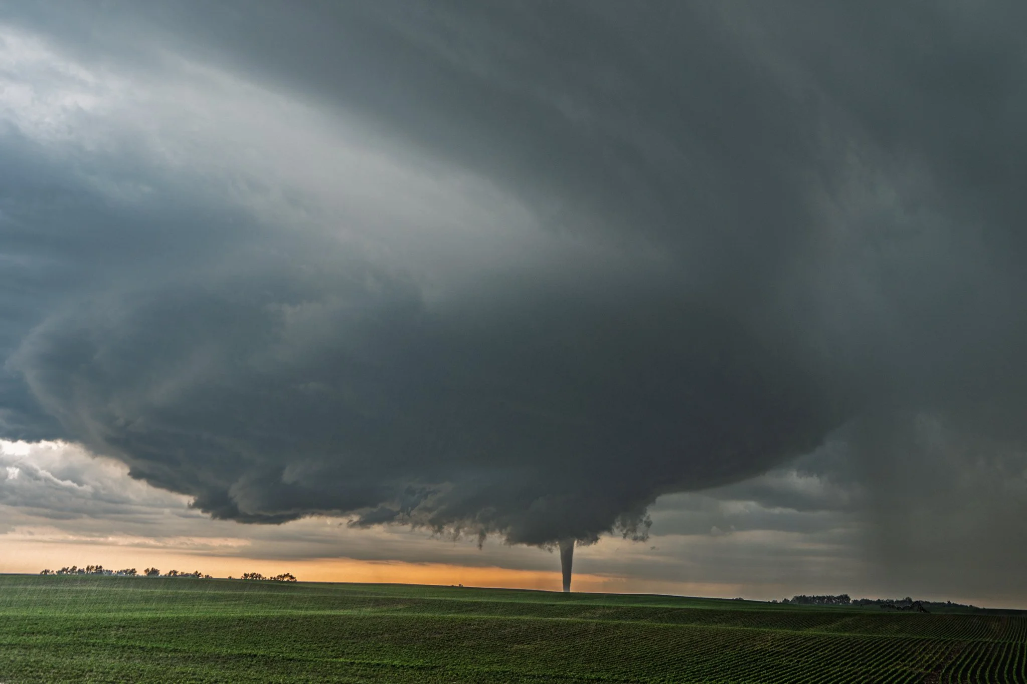
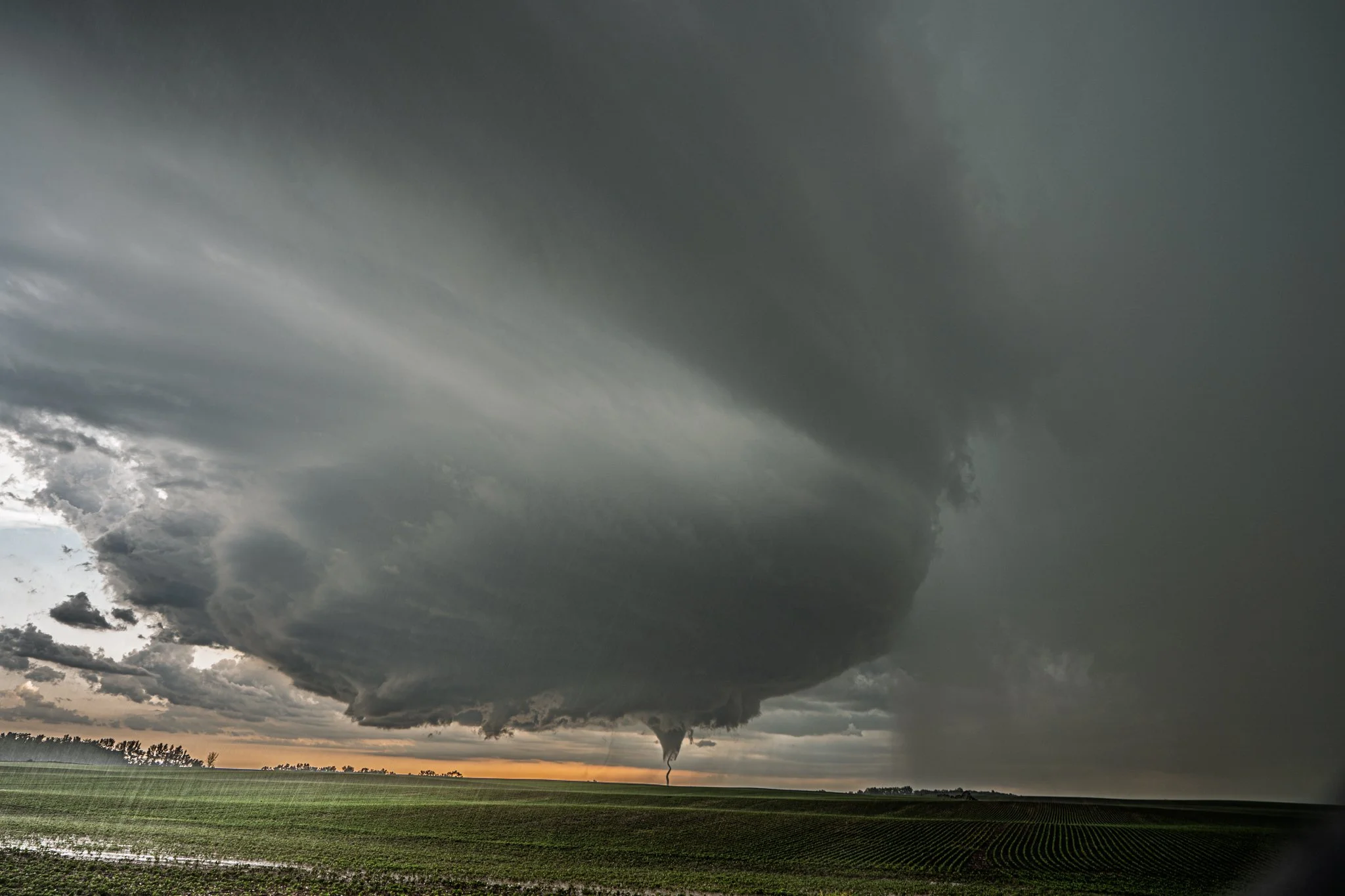
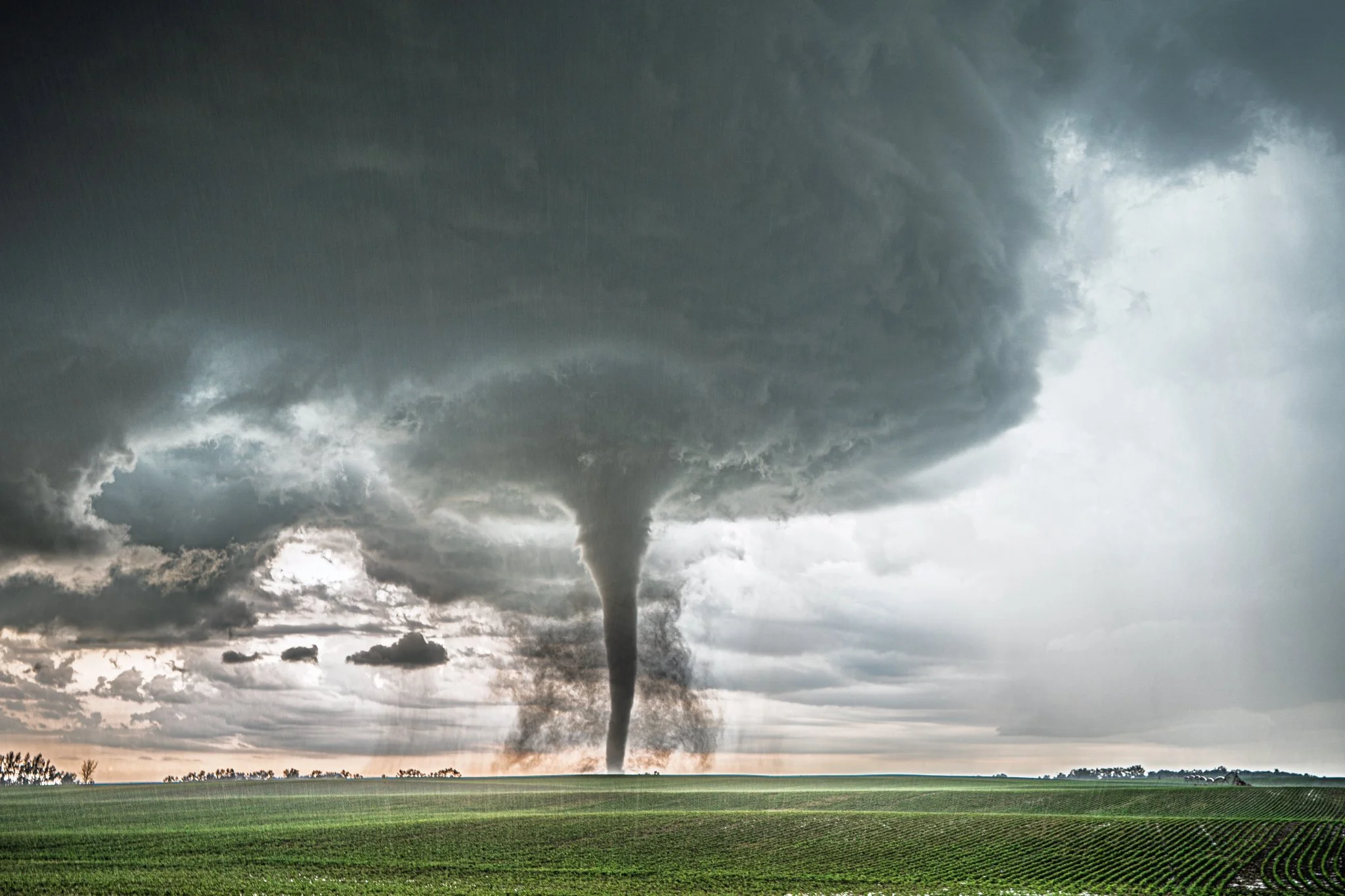
A short while later as the tornado was exhibiting a start to a stovepipe shape.
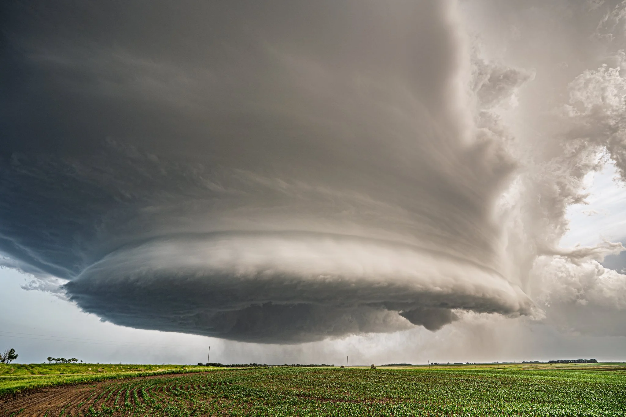
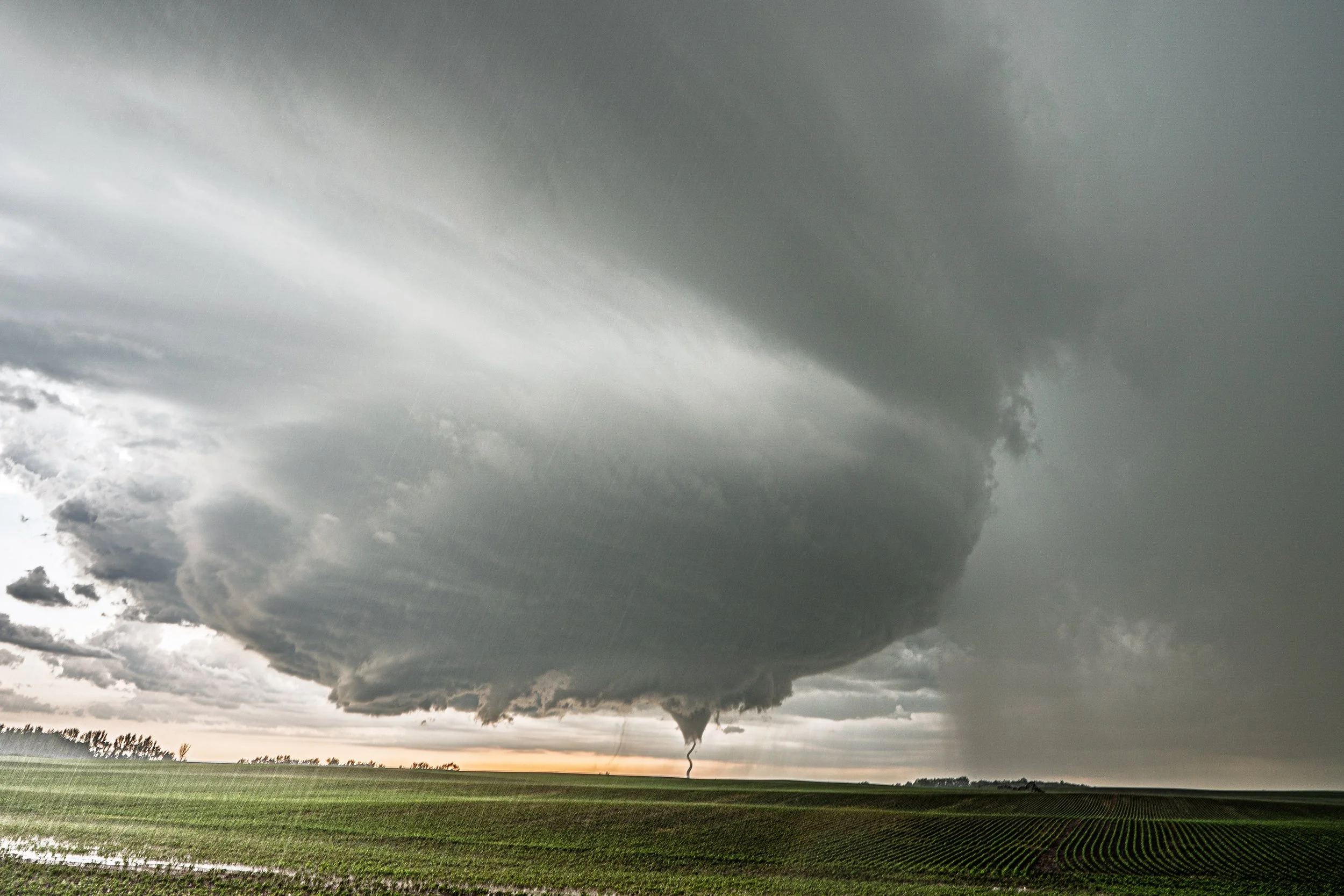
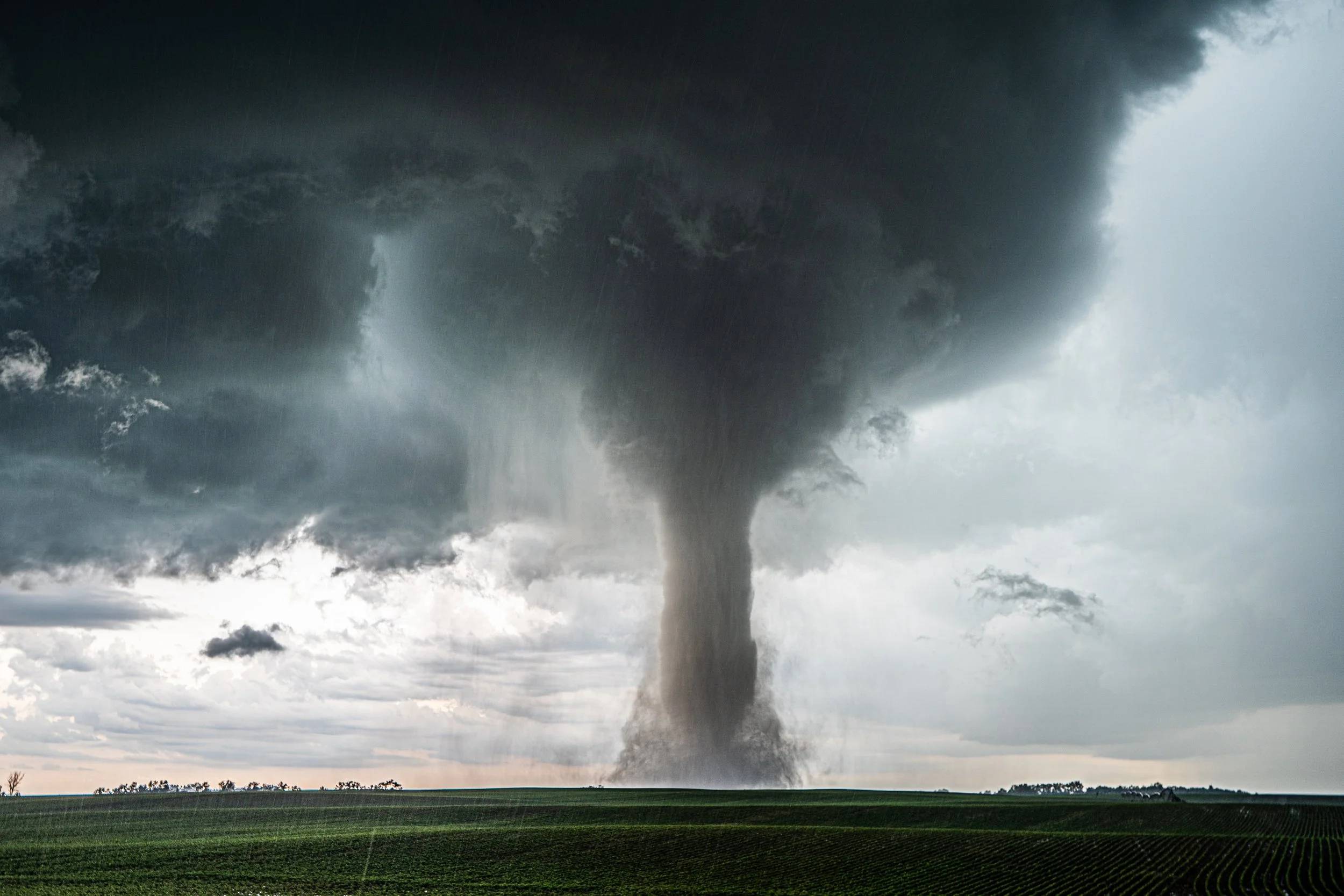
The structure of this thing was seriously mind boggling and incredible. Very impressive.
The infamous squiggle with this tornado. The base of the condensation funnel got pinched off and danced around wildly during the vortex breakdown. Was incredible for those close to experience!
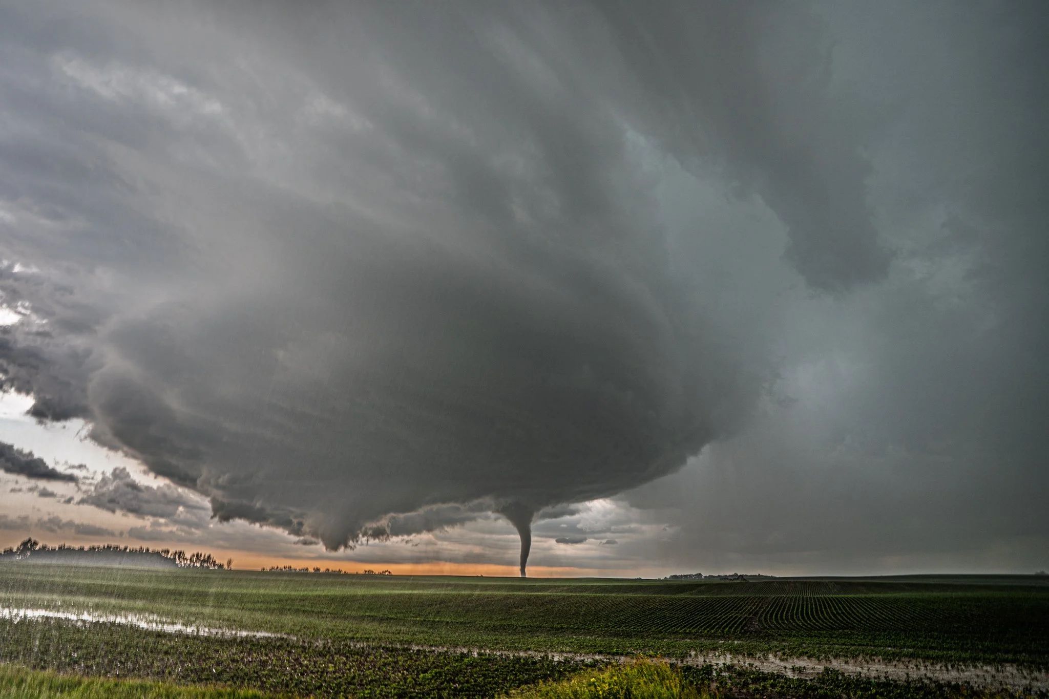
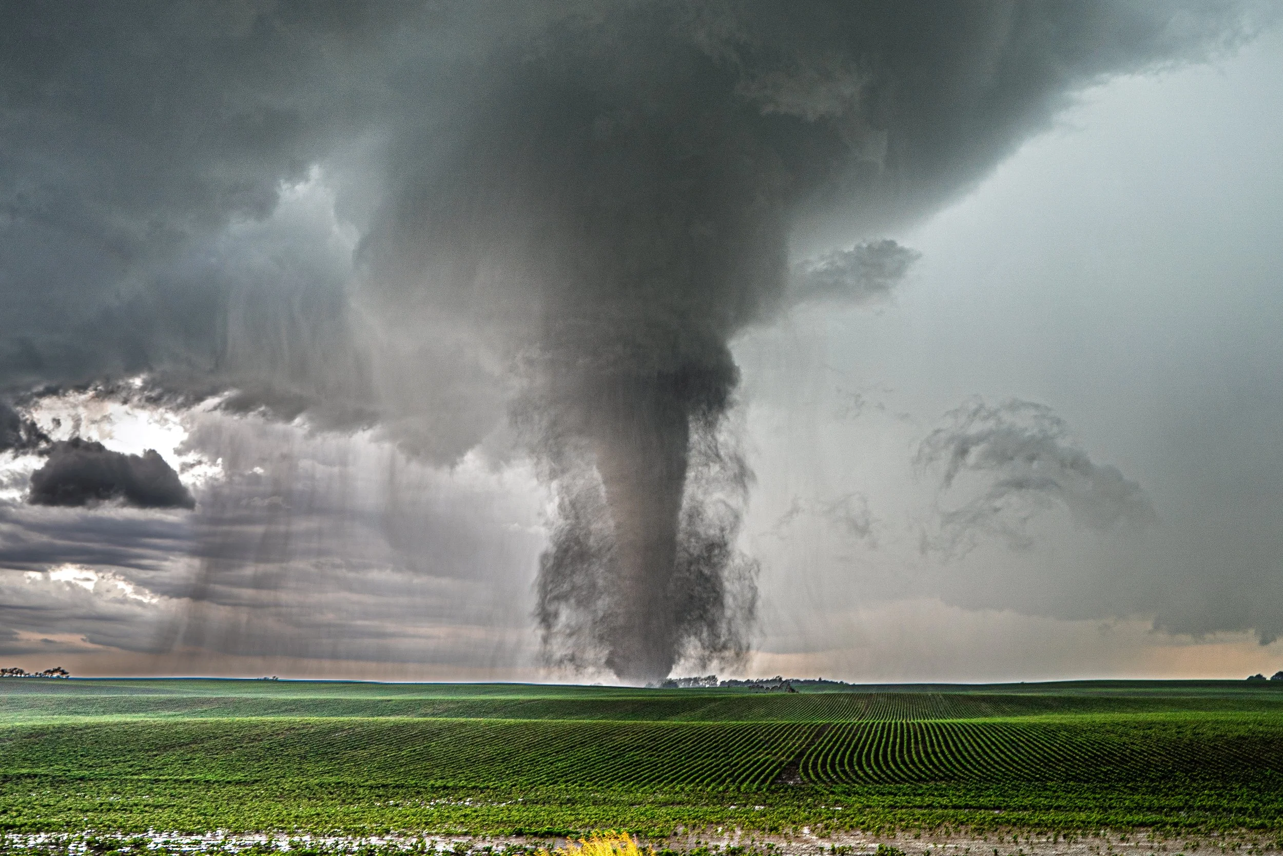
OMG seriously look at this structure and tornado. I am so fortunate to witness this. Just 1/2 mile south of the town of Gary where we have sat in the same spot for nearly 30 minutes.
Stovepipe starting to drill in here. JUST GRINDING
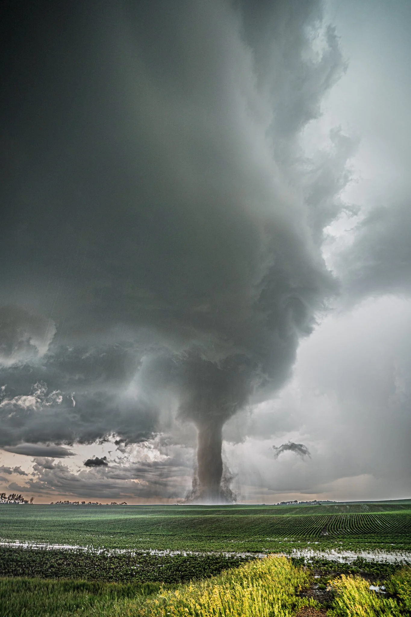
The whole structure is something to be appreciated.
This is a framed shot that I have in my house. Can’t get much better than this.
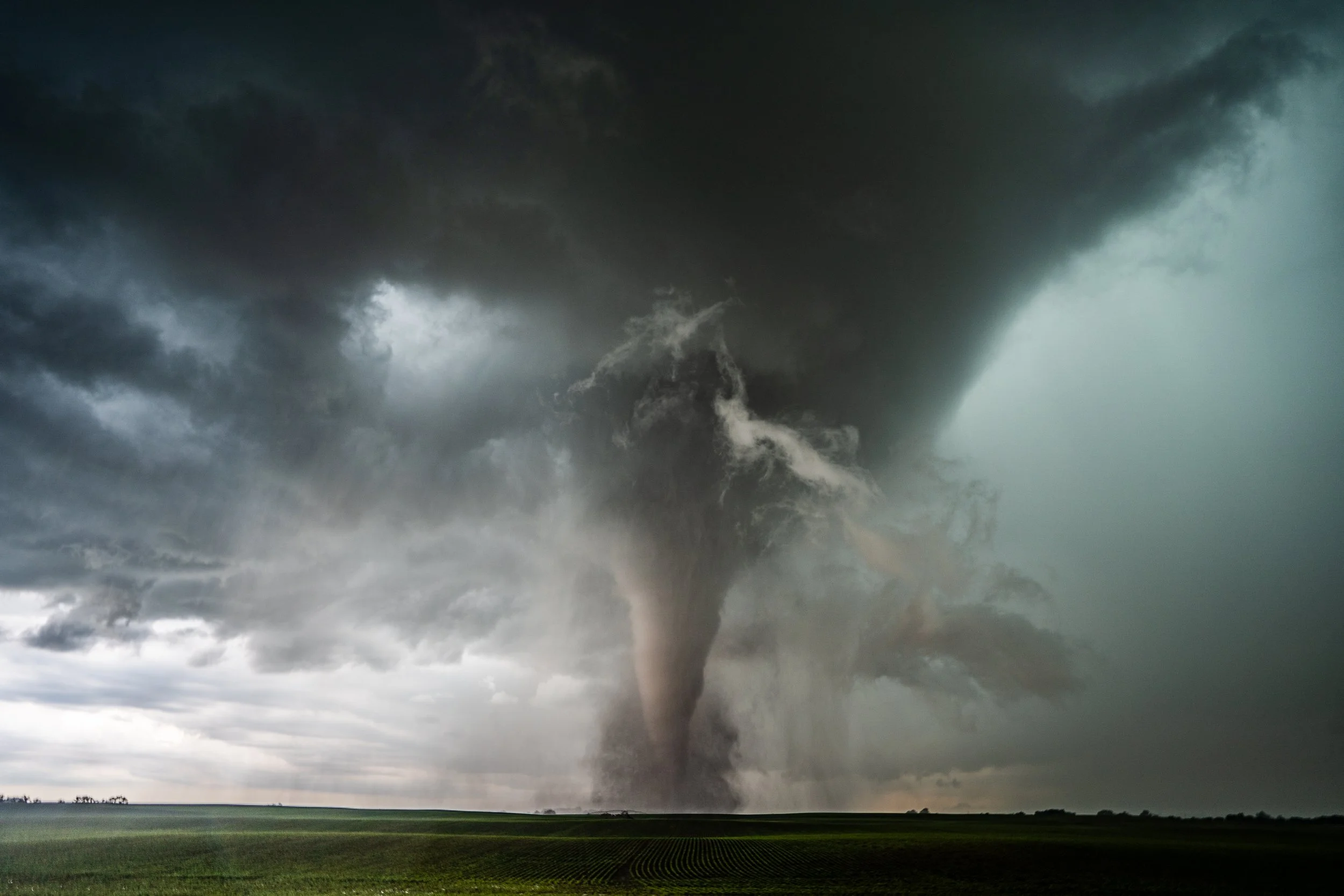
Beast mode as the tornado was entering its demise. Still extremely violent but about to take in the underkill.