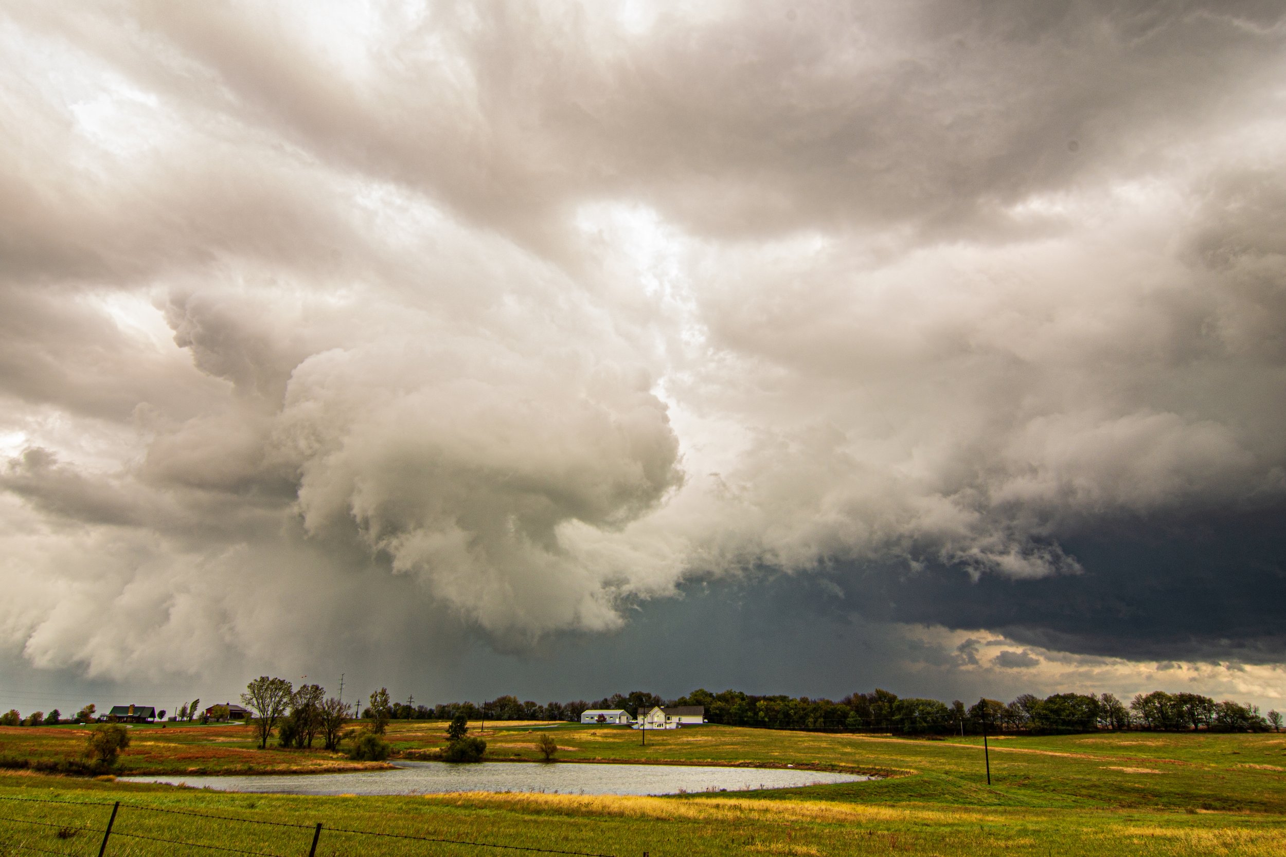
Initial wall cloud on the storm near the Kansas/Missouri border south of St. Joseph, MO. Already a tornado warned storm within an hour of initiation.
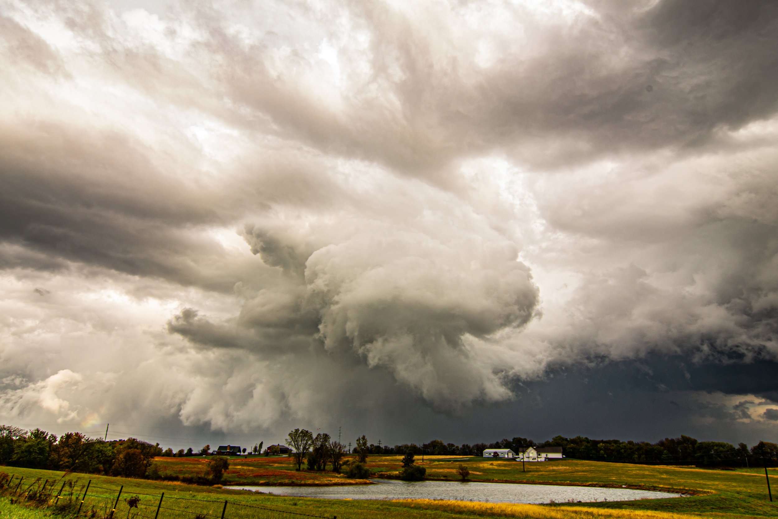
Beautiful wall cloud tightening up and rotating hard with a funnel cloud condensing near Turney, Missouri.
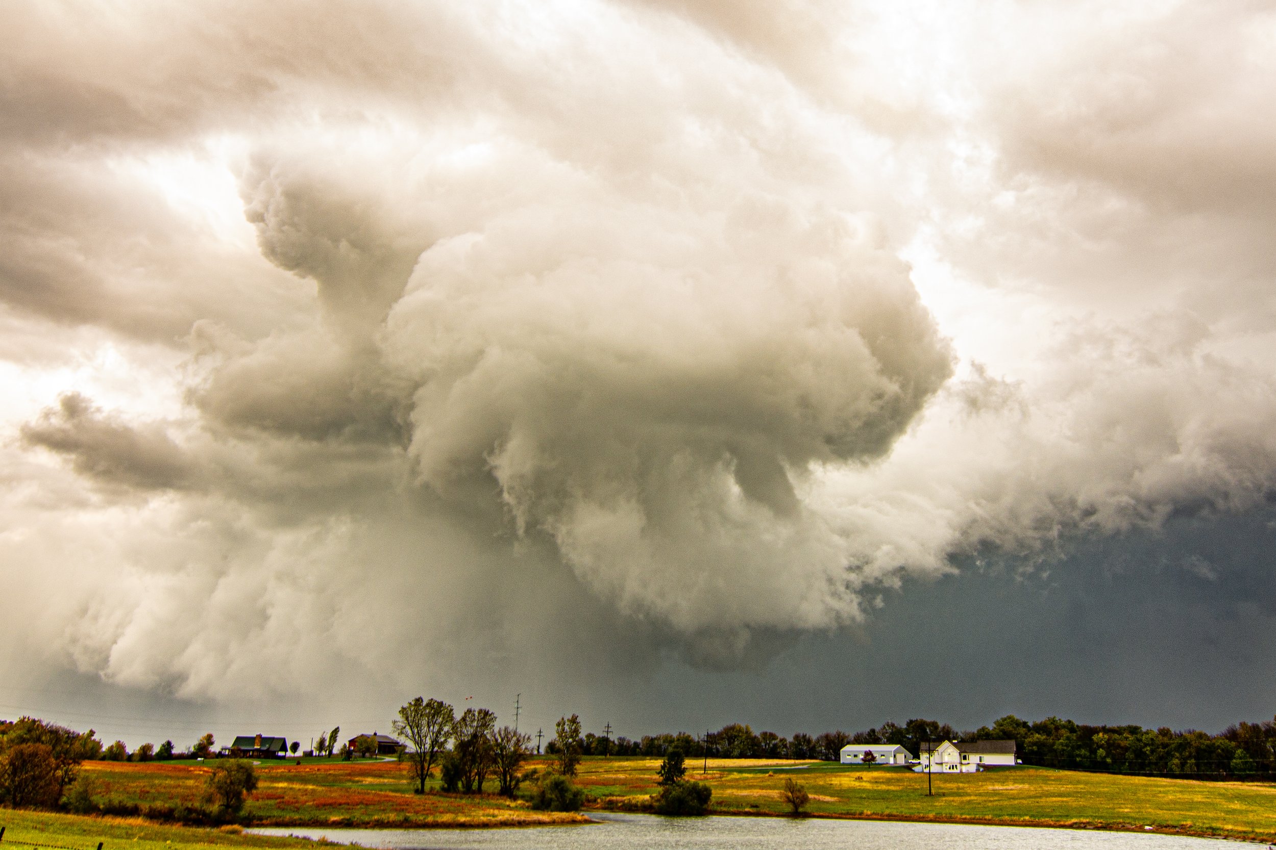
More zoomed out view of the wall cloud twisting up right in front of us.
One more shot of this wall cloud. Thought it was going to drop a tornado right here! Sure came close.
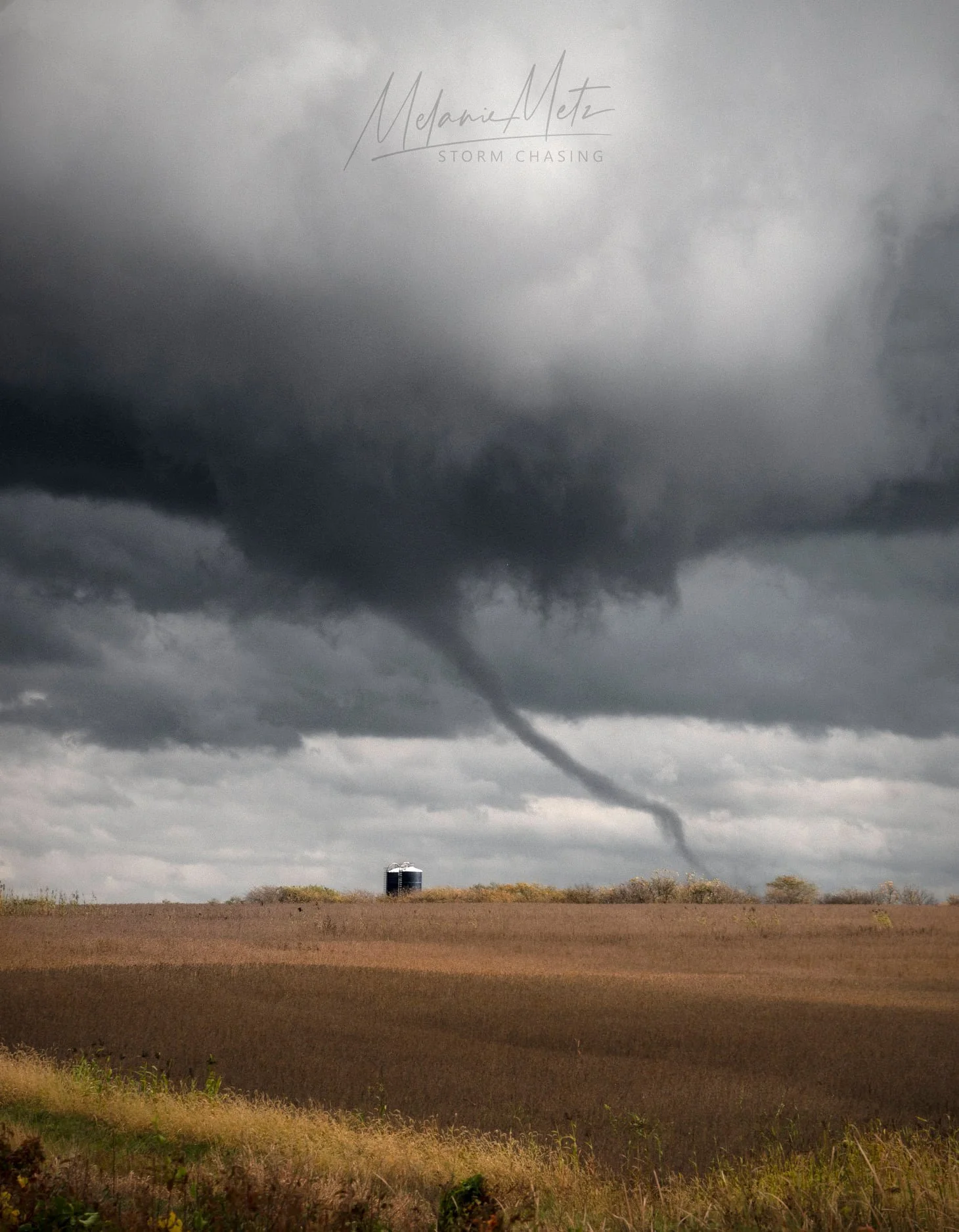
First tornado of the day east of Turney, Missouri! This was taken by my chase partner this day, Melanie Metz, as we were driving and trying to get a better view.
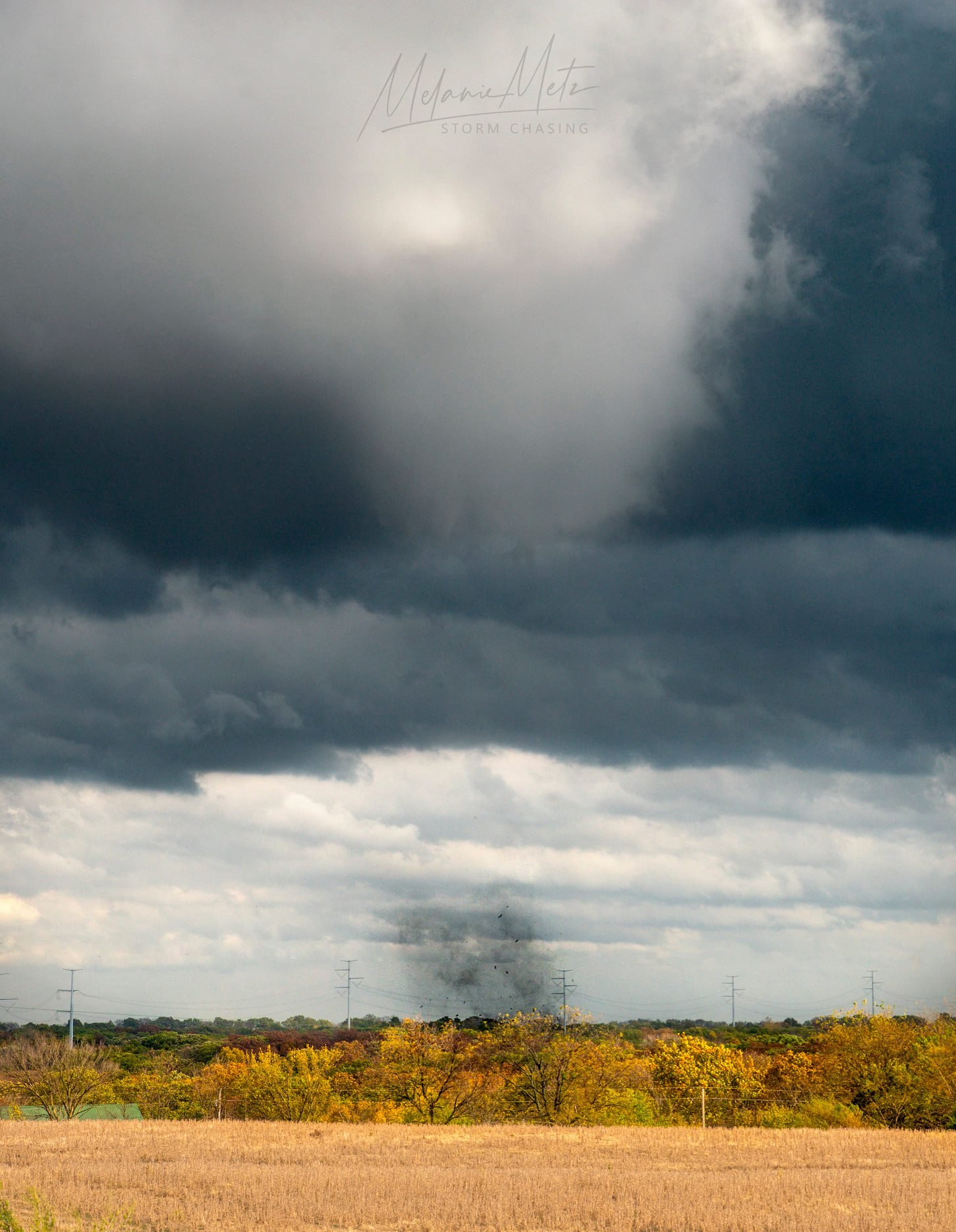
A second tornado with stronger debris cloud between I-35 and Mirabile, Missouri! Taken by Melanie Metz.
Photo by, Melanie Metz, shortly after the 2nd tornado occurred and lifted.
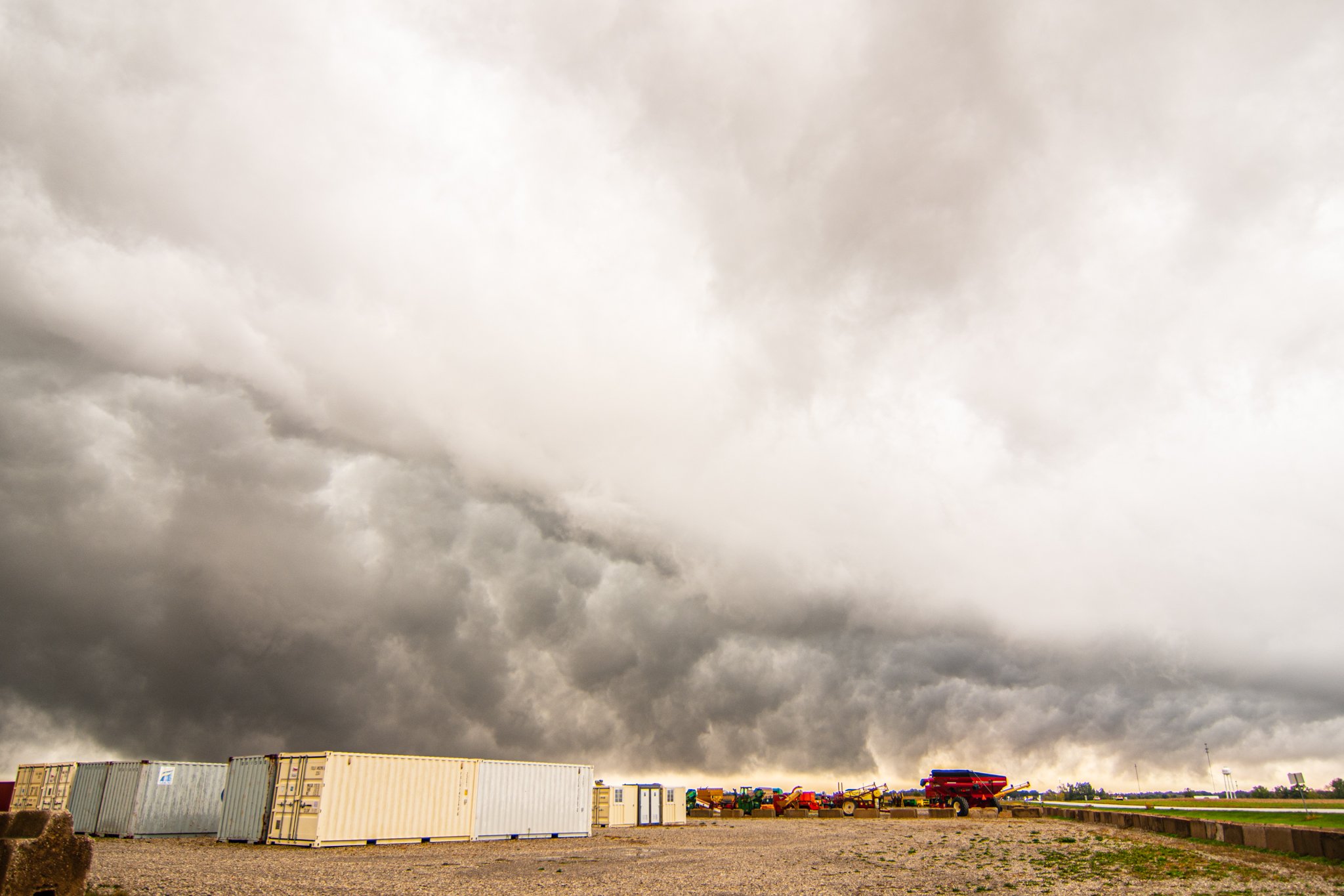
Funnel cloud still holding on as the storm moves just to our east. After a brief stop, we had to quickly get going again to keep up with it.
Melanie taking photos as the continued tornado warned storm approached us with the tornadic circulation passing to our north.
Third tornado of the day, looking north as the storm moved towards Linneus! This matches up with the location and time of the report and sure looks like it in Melanie’s photo. Taken shortly after the previous image in the same spot.
New southern updraft starting to go up on the southern flank of the tornado warned storm near Linneus, Missouri shortly after the 3rd tornado of the day moved to our north.
Another lowering tightening up as we watched to the south and encountered gust RFD winds. This was south of the main circulation on the supercell that went on to produce another tornado near Purdin, Missouri.
Backside of the storms as they passed to our east near LaPlata, Missouri at the end of our great chase day.
Another shot looking to the north of the storms moving to our east as we begin our journey back home to Minnesota.