
MAY 22, 2020 TEXAS: INTENSE SUPERCELL AND 2 BRIEF TORNADOES ALONG THE RED RIVER

Initial updraft of the storm breaking the cap by late afternoon near Haynesville, Texas.

Intensifying storm starting to anvil out, looking above our heads as lightning was becoming more frequent.

Initial wall cloud forming as the storm begins to mature and track east along the Red River between Haynesville and Burkburnett, Texas.

A pair of funnels underneath the updraft.

Tornado warned storm kicking up dirt on the south side of the bowl lowering near Burkburnett, Texas.

Brief tornado underneath bowl funnel. Notice concentrated area of dirt being picked up right in the middle of the picture.
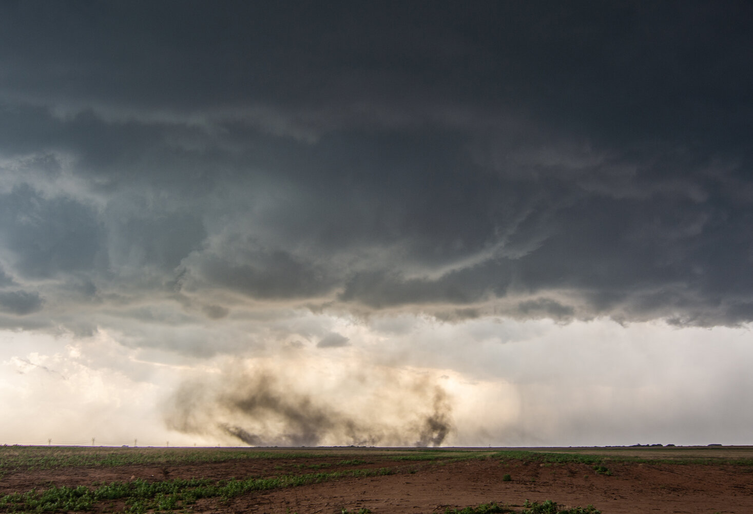
Another shot of the tornado and funnel above that is more noticeable than the previous image. Clear concentrated rotation within this dirt plume.

Concentrated rising scud into the storm base and some structure in this shot, taken near Thornberry, Texas.

Nice structure on this storm as we got further out ahead near Thornberry, Texas.

Another very good structure shot!

Watching this wall cloud attempt to organize near Petrolia, Texas.

Shot of the well organized inflow tails into this storm, right to left, and a wall cloud still intact. Some semblance of a funnel or bowl lowering underneath.

Second brief tornado, noticeable by the debris cloud underneath the funnel and wall cloud near Petrolia, Texas. Lucky to get a view here as this area is hilly with a lot of small trees and brush.

Two wall clouds here, one in the foreground and background. Latter produced the tornado that was shown in the previous photo. Thought the one in front could do the same thing.

One more shot of the matured wall cloud and storm towards the end of the day as it was about to overtake us.

Mesoscale Discussion issued at 12:55 p.m. CDT with expectation of thunderstorm initiation within the next hour. Interestingly enough, thunderstorm initiation occurred much later and closer to 5-6 p.m. as the cap held and initial towers could not sustain.

Mesoscale discussion issued at 1:25 p.m. CDT for developing severe weather threat on northern edge of the highest CAPE axis.

Initial Severe Thunderstorm Watch issued at 1:25 p.m. CDT.

Mesoscale Discussion issued at 6:20 p.m. CDT indicating threat of tornadoes for 1-2 hours with the storm we were on just south of the Red River.

New Severe Thunderstorm Watch issued at 6:55 p.m. CDT.

Mesoscale Discussion issued at 9:26 p.m. CDT for ongoing severe weather threat. We were forced to go east to I-35 and head back north to Oklahoma City to get past the more intense supercells.

Mesoscale Discussion issued at 11:56 p.m. CDT.

