
MAY 21, 2020 KANSAS: STORM STRUCTURE OF THE YEAR!

Wall cloud starting to organize on the first storm of the day in Holly, Colorado. Soon after became tornado warned.

Storm chasing 2020 COVID-19 style! Wall cloud and funnel look-alike inflow tail in Holly, Colorado. Storm is tornado warned at this point and the sirens were blaring.

Another view of the wall cloud on the tornado warned storm over the southern part of Holly, Colorado.

Nice structure on the storm as it was moving over Holly, Colorado and threatening to overtake us.

The second supercell was even better! Stacked plates and broad meso on the storm near Ulysses, Kansas.

Another shot of the supercell near Ulysses, Kansas.


It just gets better and better! 3rd supercell of the day near Satanta, Kansas. Incredible structure!

Just awesome. Epic storm structure and popping cloud to ground lightning near Satanta, Kansas. What an experience!
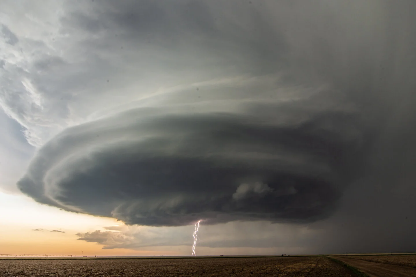
Double cloud to ground lightning strikes in one shot… yes please.

Incredible storm continues to amaze.

Mammatus and stacked plates on a mothership over the wide-open Plains of southwest Kansas. Can’t be beat.


Funnel cloud emerging on the tornado warned storm near Satanta, Kansas.

Funnel cloud just to the right of the lightning strike nearly touching down.

Funnel cloud still holding together just above the light from the farmhouse in the distance. What a structurefest of a day!

Mesoscale discussion issued at 2:20 p.m. CDT for development of storms within the next few hours and a risk of large hail and damaging winds.

Severe Thunderstorm Watch issued at 3:15 p.m. CDT.

Severe Thunderstorm Watch issued at 9:50 p.m. CDT ahead of the squall line surging southeast into northwest Oklahoma.

Mesoscale discussion issued at 9:10 p.m. CDT indicating the primary severe weather threat for the next few hours.

Mesoscale discussion issued at 11:28 p.m. for the enhanced severe weather threat with the squall line surging southeast.

