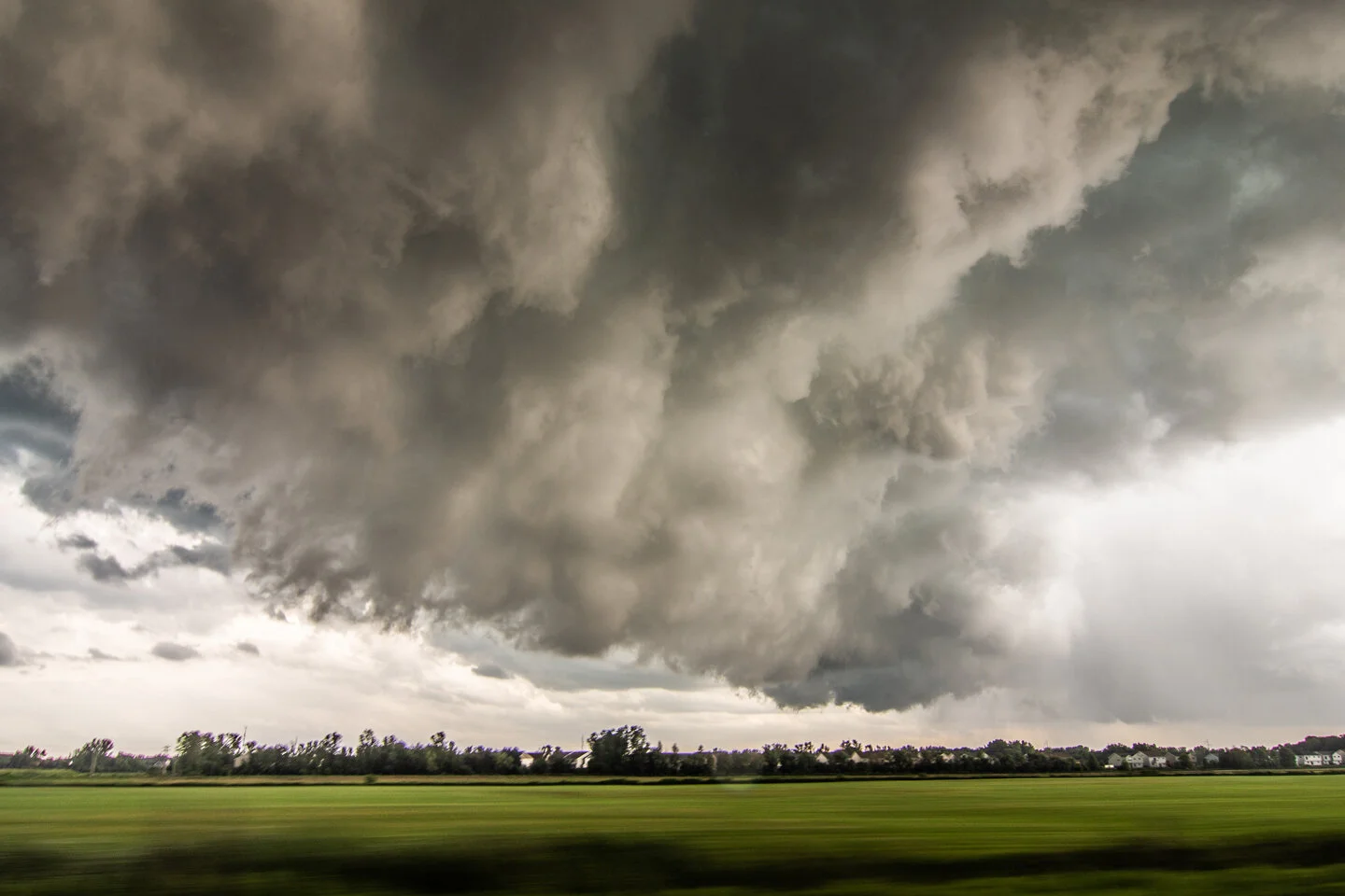
JULY 18, 2020 MINNESOTA: TORNADO WARNED STORM THROUGH NORTHERN TWIN CITIES METRO
Met up with Roger Hill, Rusty Nelson and the Silver Lining Tours crew in Willmar, MN as we waited for storms to initiate. Good to see them and catch up!
Storm developed further east than we were expecting. Had to blast back east towards the Twin Cities. This is the initial storm updraft looking southeast from Annandale, MN towards Brooklyn Park.
A nervous moment as we watched this wall cloud mature, driving on Hwy 14/Main Street from Coon Rapids into Blaine. Inflow right to left into the wall cloud and condensation/rotation with that small dark feature on the right side underneath the wall cloud as it was trying to produce a funnel. Glad it didn't drop a tornado in the northern suburbs!
Wall cloud on what is now a tornado warned storm in Blaine, MN.
Another shot of the wall cloud in Blaine, MN as it was tightening up and becoming better organized.
Turbulent underside of the wall cloud as it overtook us and moved to our southeast. This was as we were approaching White Bear Lake.
East of Hugo, MN the storm became even better organized. Thought it was going to produce a tornado here!
Driving back home after our chase had ended. Beautiful storm erupting at sunset over Eagan, MN.
Taken from my driveway. Love this shot of two storm updrafts approaching Farmington and gap in between!
Shot of the storm to the east of our house, lit by lightning in the evening.
Mesoscale discussion issued at 3:12 PM CDT for central and southern Minnesota into northwest Wisconsin. 95% chance of watch issuance! Strong instability nosing into the southern half of Minnesota. https://www.spc.noaa.gov/products/md/2020/md1264.html
Severe thunderstorm watch issued at 3:55 PM CDT. https://www.spc.noaa.gov/products/watch/2020/ww0382.html
The next mesoscale discussion issued at 6:15 PM CDT as one lone tornado warned storm was trucking through the northern Twin Cities metro (which we were on), while new storms were developing west and north. https://www.spc.noaa.gov/products/md/2020/md1267.html
Mesoscale discussion issued at 8:36 PM CDT for most of northern Wisconsin and the UP of Michigan. Severe storms moving east into Wisconsin. This was near when we called off the chase north of Hudson, WI and let the storms go. https://www.spc.noaa.gov/products/md/2020/md1268.html
Severe thunderstorm watch issued at 9:40 PM CDT ahead of the developing broken squall line now across western Wisconsin. https://www.spc.noaa.gov/products/watch/2020/ww0383.html


