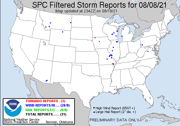
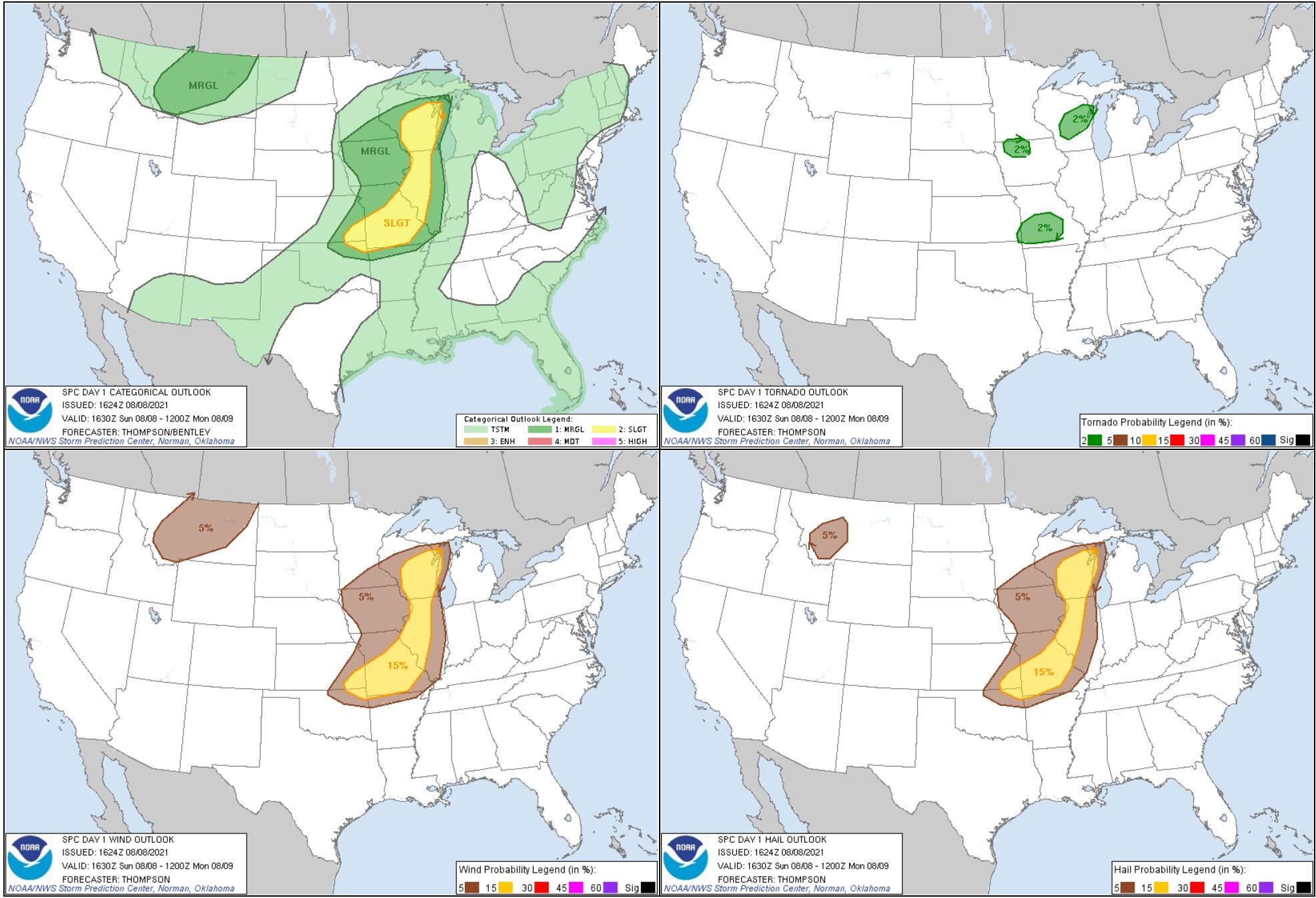
First storm of the day near Edgerton, Minnesota. Can see a lowering trying to wrap up in there to the left-center of the image. We got on this storm just after it already produced a brief tornado further north.
This was a short while later as the lowering tightened up and produced a funnel cloud that we could tell was clearly spinning on the left side of the image here.
Two action areas on the broad mesocyclone near Worthington, Minnesota.
Wall cloud on the tornado warned storm near Worthington, Minnesota.
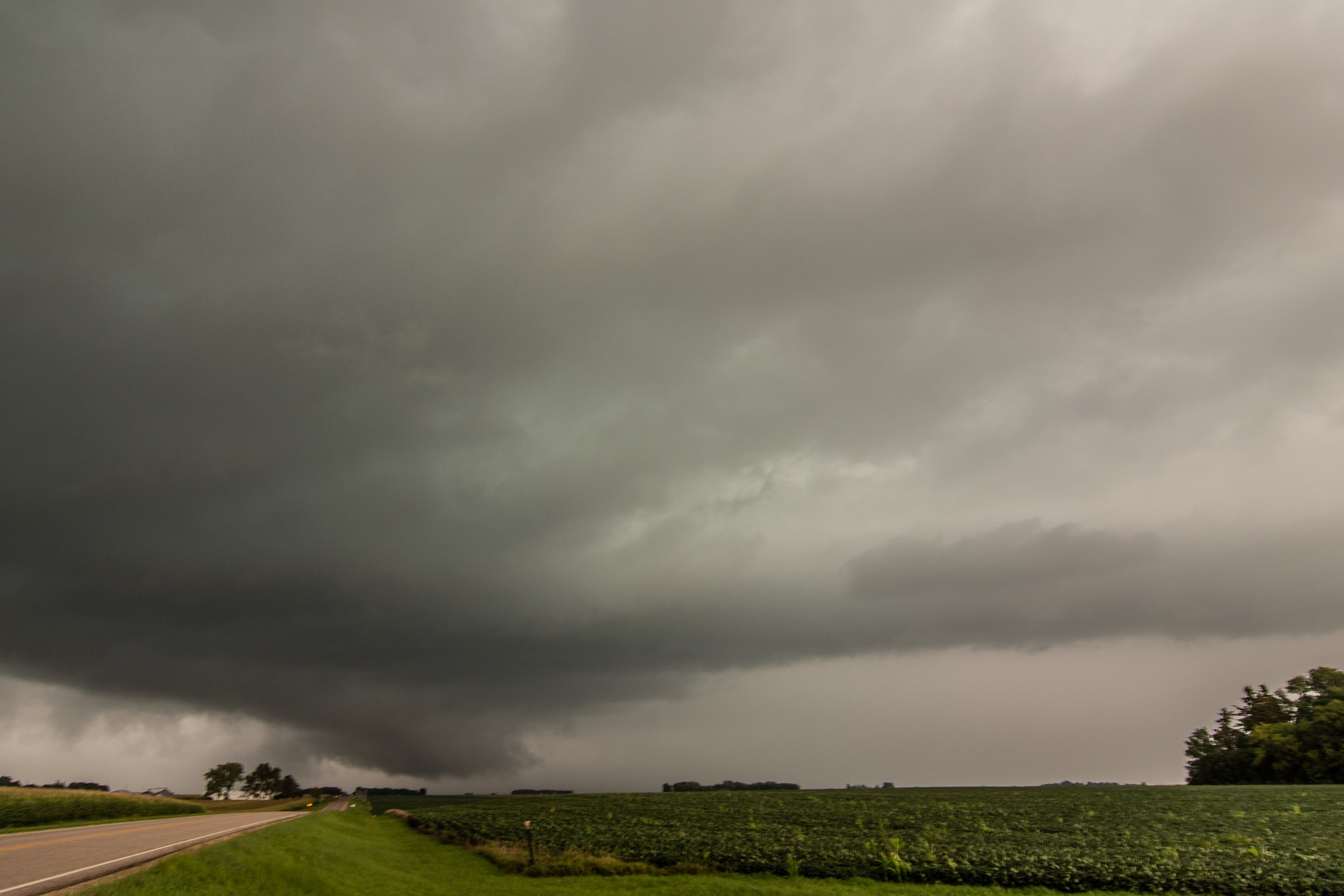
A pair of wall clouds on the storm as it was crossing the border into Iowa.
A wall cloud on the storm near May City, Iowa.
Wall cloud and brief funnel cloud near Everly, Iowa.
Inflow tail right to left into the wall cloud that was twisting and turning here.
Wall cloud with fast condensing inflow scud fingers on the storm near Everly, Iowa.
Beautiful wall cloud trying to tighten up.
Looking out the window at a funnel cloud forming as we were driving and trying to get ahead of the storm.
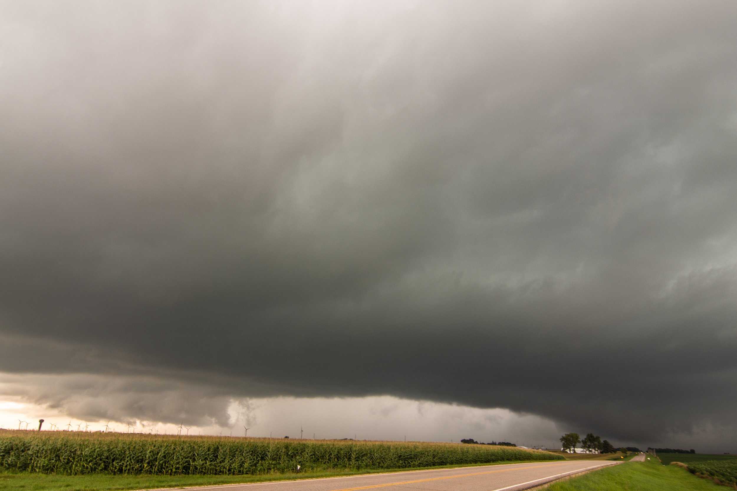
The cloud bases are so low here you cannot even see the tops of the windmills!
Just an awesome supercell that just keeps trucking along and cycling repeatedly.
Yet another wall cloud near Sioux Rapids, Iowa.
ANOTHER wall cloud with a brief funnel forming.
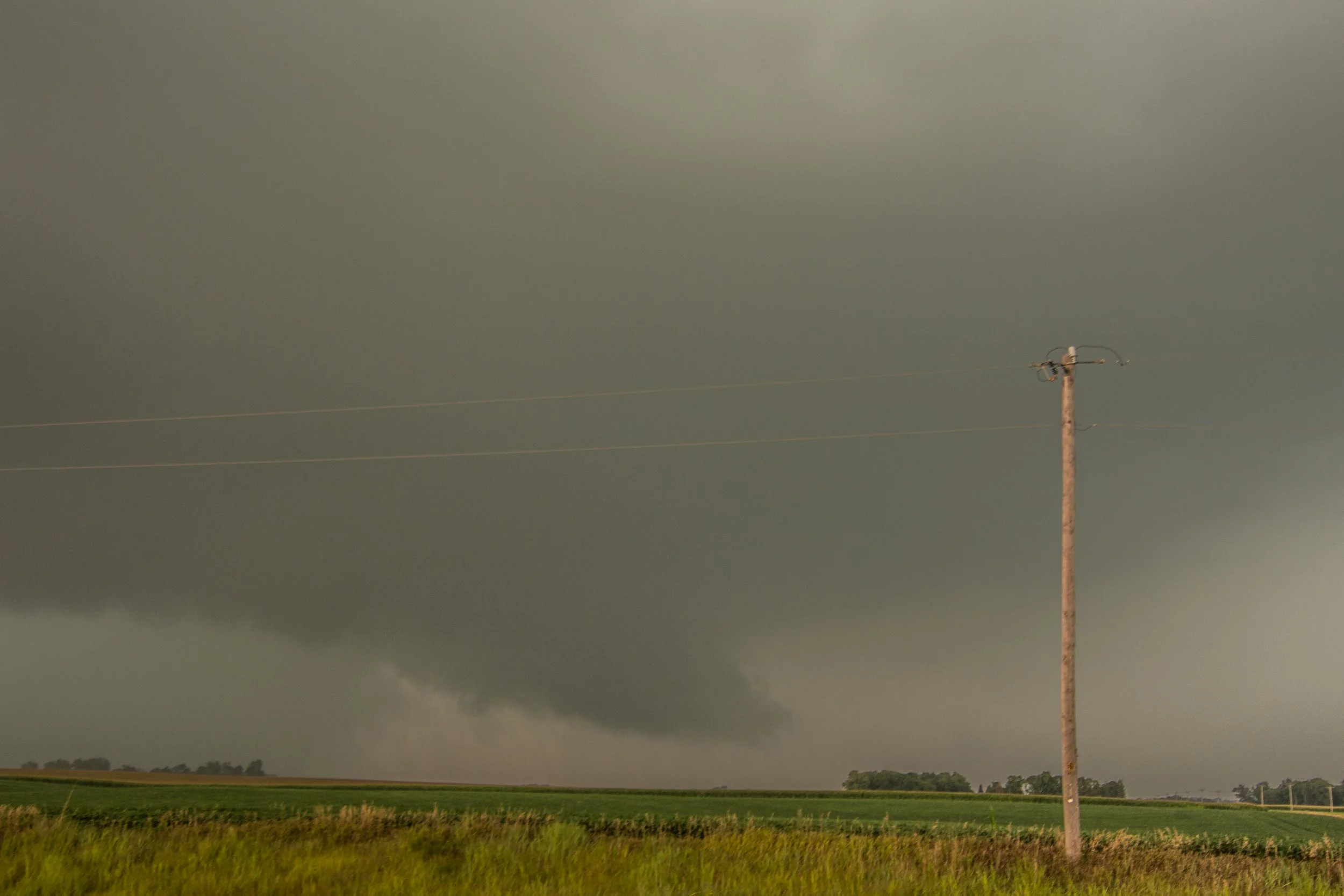
Blocky lowering tucked in near the core that could have easily touched down a tornado near Albert City, Iowa. No confirmation that it did touch down though.