SEPTEMBER 20, 2018 MINNESOTA: ESCAPING THE FARIBAULT QLCS TORNADO

This became an interesting chase day to stay the least. A potent trough was ejecting out of the Plains into the Upper Midwest with a significant speed max through all levels moving into Minnesota during the afternoon and evening. Models were indicating the potential for a broken line of strongly rotating supercells to break out ahead of the triple point and along a northward surging warm front into southern Minnesota by later in the afternoon. My thoughts were to get to southwest Minnesota to get on the initial storms and follow as they matured moving east-northeast towards the south metro of the Twin Cities.

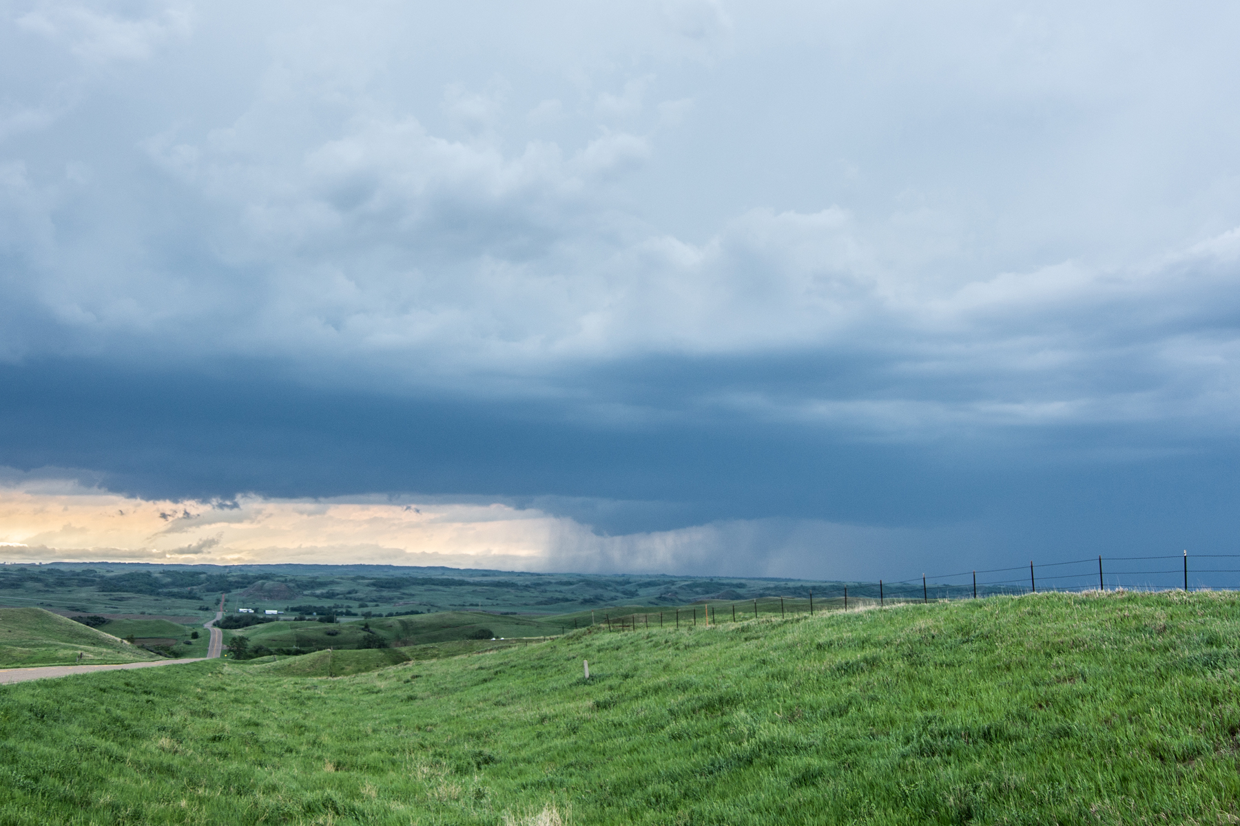
After leaving work at 2 PM, our team consisting of myself, Allan and Allison Persons, and Kyle Magnuson drove down Hwy 169 towards Mankato and then southwest on Hwy 60 towards St. James. Storms had already developed and were surprisingly congealing rather quickly to our west and starting to pick up some speed. We went south on Hwy 4 towards Trimont, Minnesota and waited here for storms to approach. A short while later, we realized the storms were moving at a really fast clip of 40-50 mph and not looking all that interesting, in fact forming more of a line than individual storms. One cell caught our eye to the east by Minnesota Lake that was ahead of all the other storms. We decided to blast east towards this cell to see if we could catch up as the storm intensified and to also stay ahead of the line quickly approaching to our west. We steadily progressed back up Hwy 60 towards Mankato to west of Faribault as the lead storm died and our line to the west started to show signs of rotation within individual inflow notches. We went north and stopped by the northern end of Roberds Lake to watch a mature mesocylone pass to our northwest. This area was later struck by a tornado that led to extreme tree damage and some structural damage to homes/cabins.

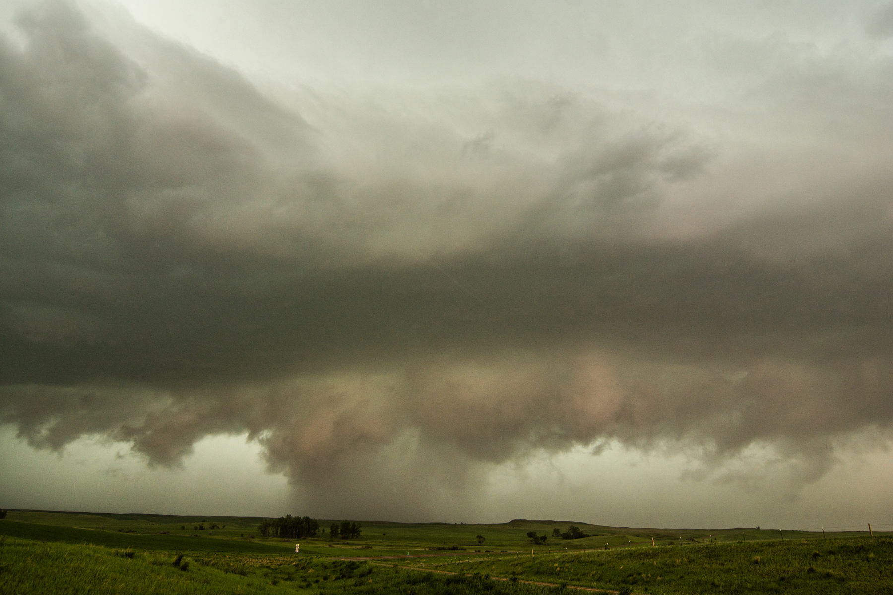
The tornado warned part of our storm was quickly approaching at nearly 70 mph, so we did our best to get a few photos and then head down Hwy 21 towards I-35. As we got past the Faribault airport, we encountered very heavy rain and a couple of very strong wind gusts that led to power poles swaying. We slowly crept down to the Hwy 21/I-35 intersection as we became inundated with 80-100 mph winds and blinding rain, so we were forced to stop at this point. Little did we know that a tornado was moving less than 1/2 mile behind us to our north and hitting the Faribault airport which we just drove past! I thought we were being hit by extreme rear-flank-downdraft (RFD) winds but it would have easily been the southern portion of a large tornadic circulation. Obviously we did not want to be in this situation, but it was very difficult to determine which parts of the QLCS line would have tornadic circulations. In fact, the tornadic circulation behind us showed up in a matter of only 2 radar scans after we already left our original spot near Roberds Lake. After waiting this out, we progressed up I-35 only to find out that it was closed due to damage. We then went up Hwy 3 north of Faribault to get home, passing by severe tree damage, some on homes, and lots of power poles and lines down. Near the Hwy 3 and Hwy 29 intersection around 4.5 miles north-northeast of Faribault, there was just under a mile wide path of trees that had bark stripped and looked clearly to be tornado damage. Here is the link to the National Weather Service damage survey for additional information: https://www.weather.gov/mpx/Sep20Tornadoes

DSC_1265.jpg

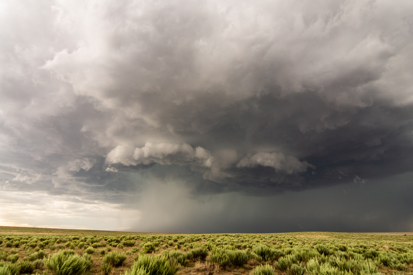
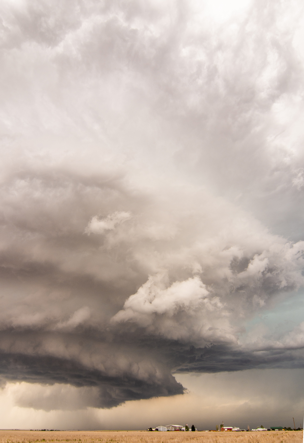
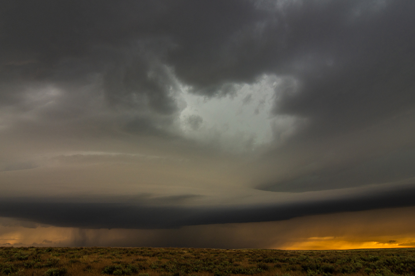
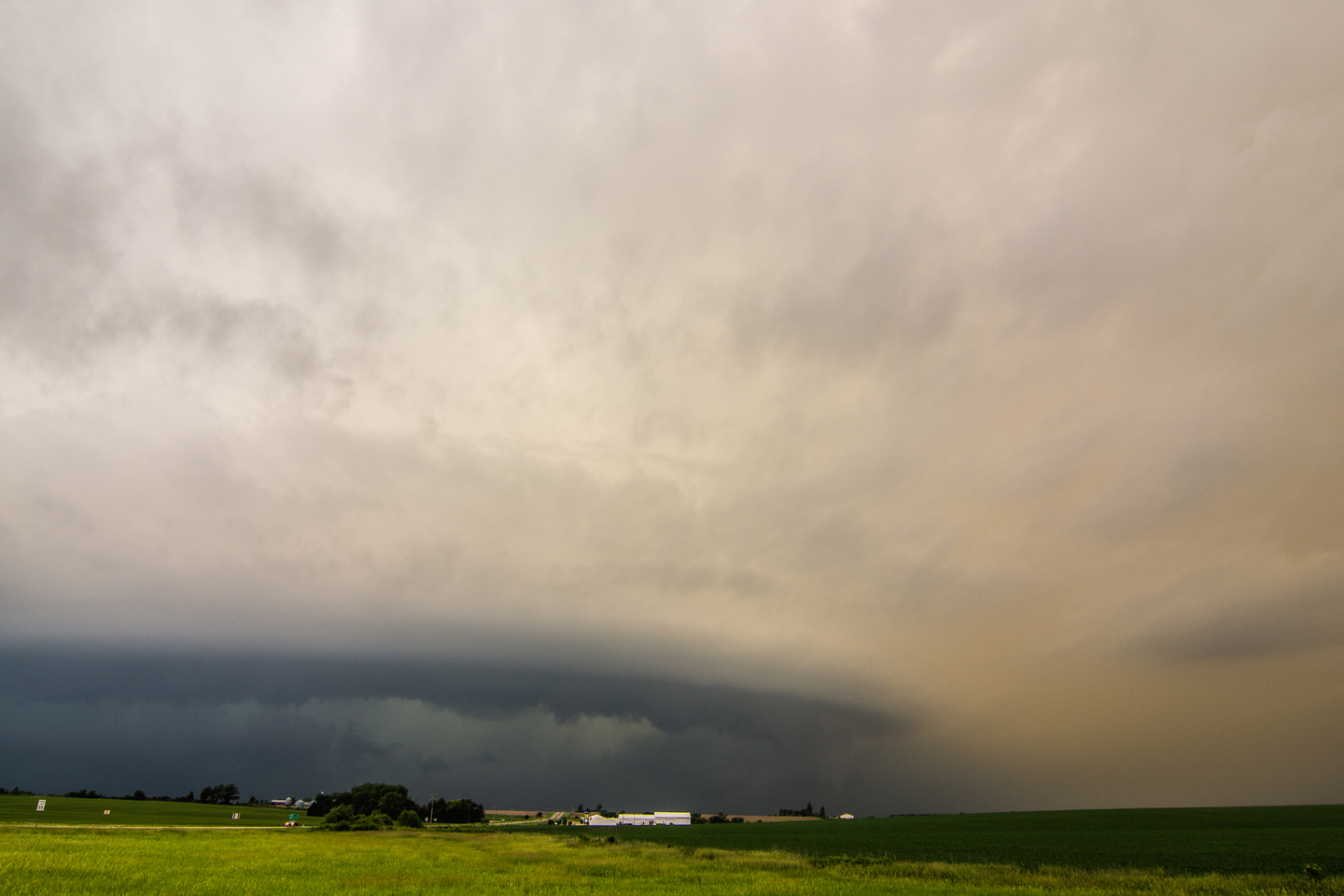
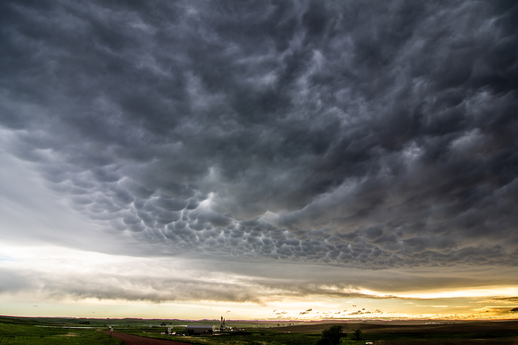
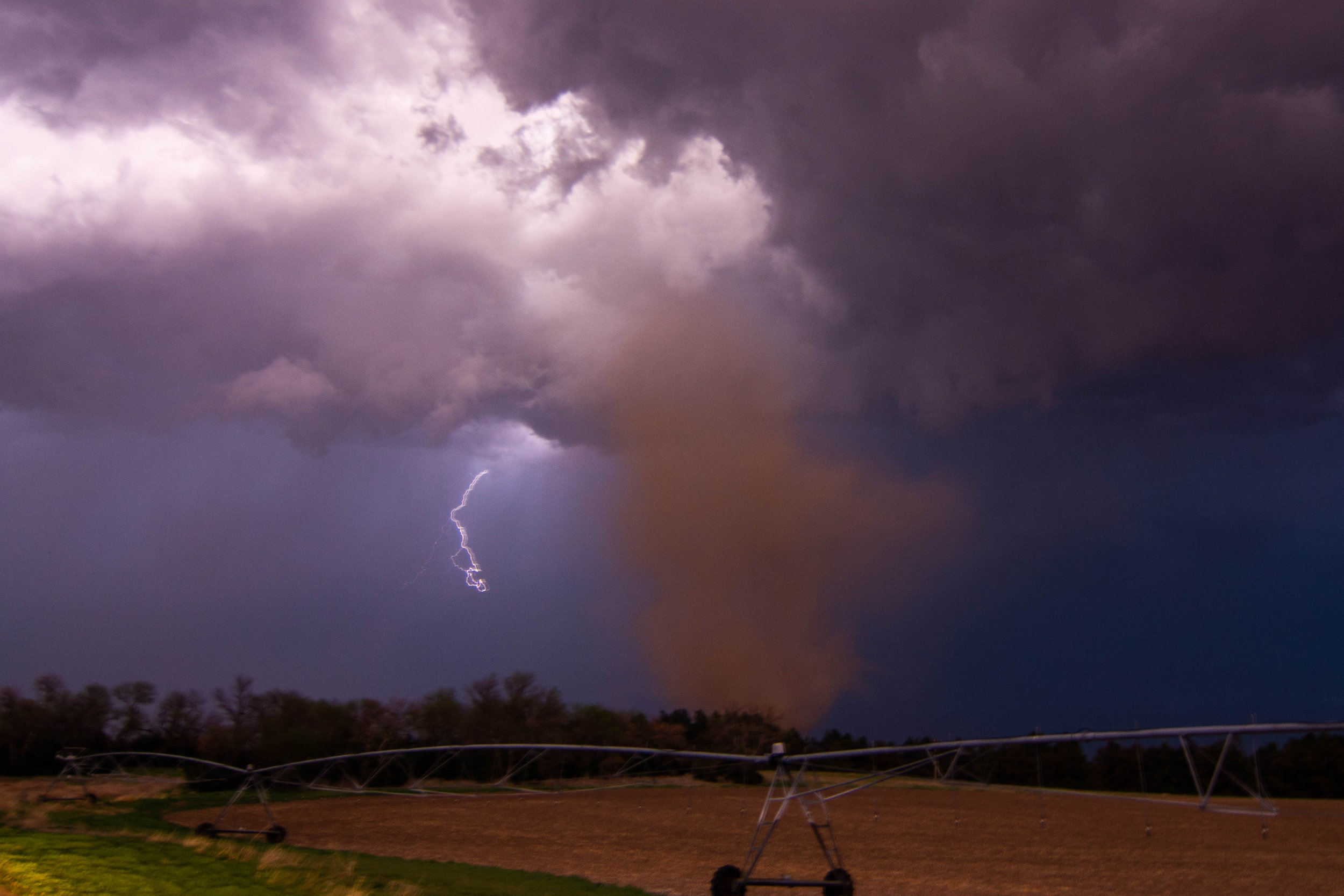
What I think was a large and mature mesocyclone looking west-northwest from the intersection of highways 68 and 69 near the northern end of Roberds Lake near Faribault, MN.

DSC_1270.jpg

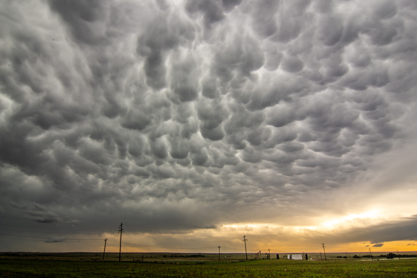
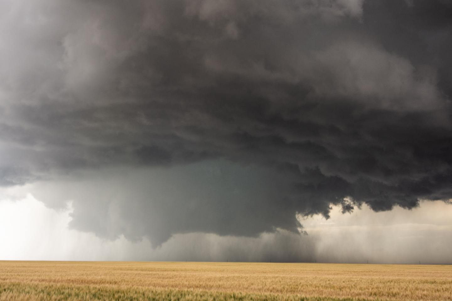
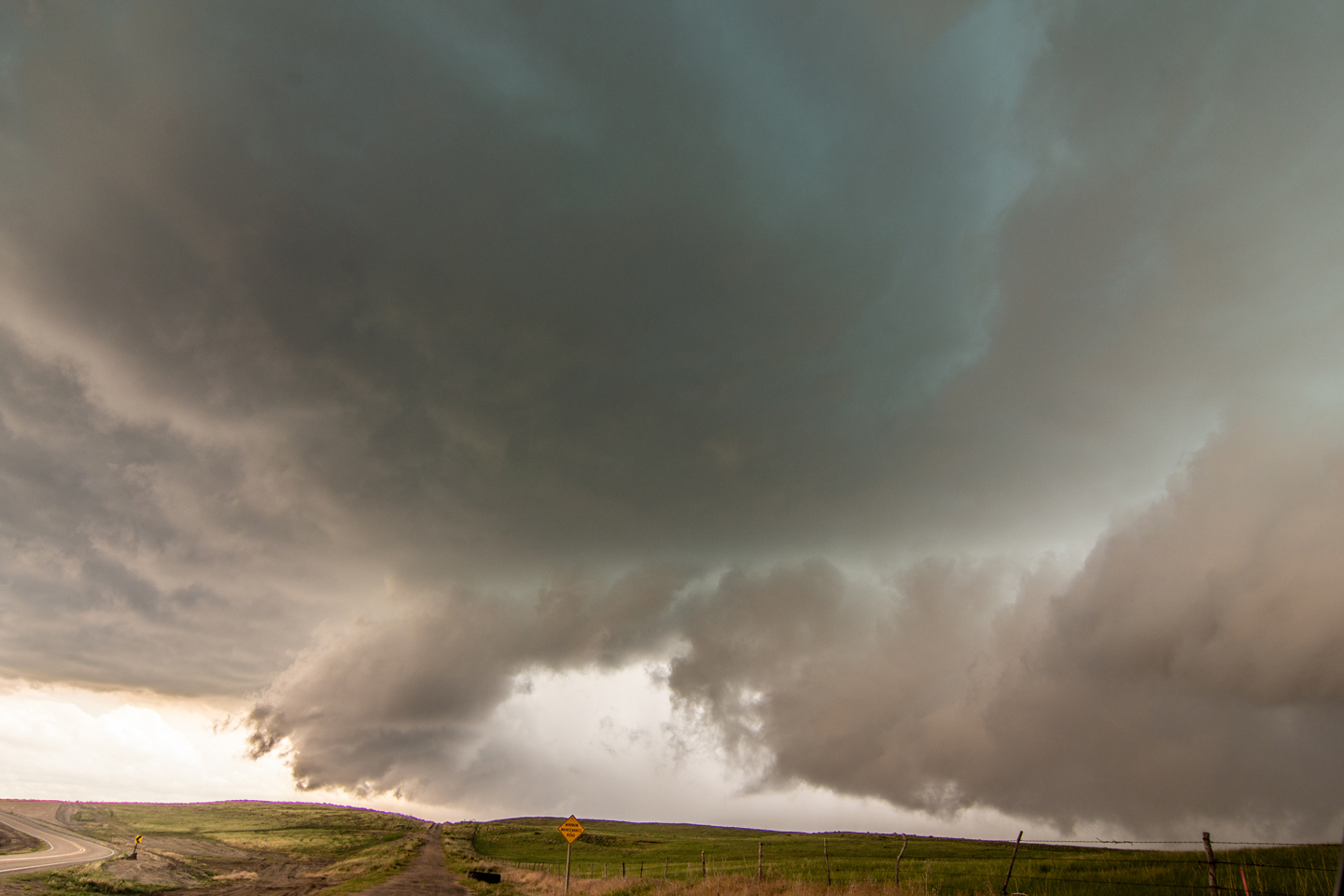
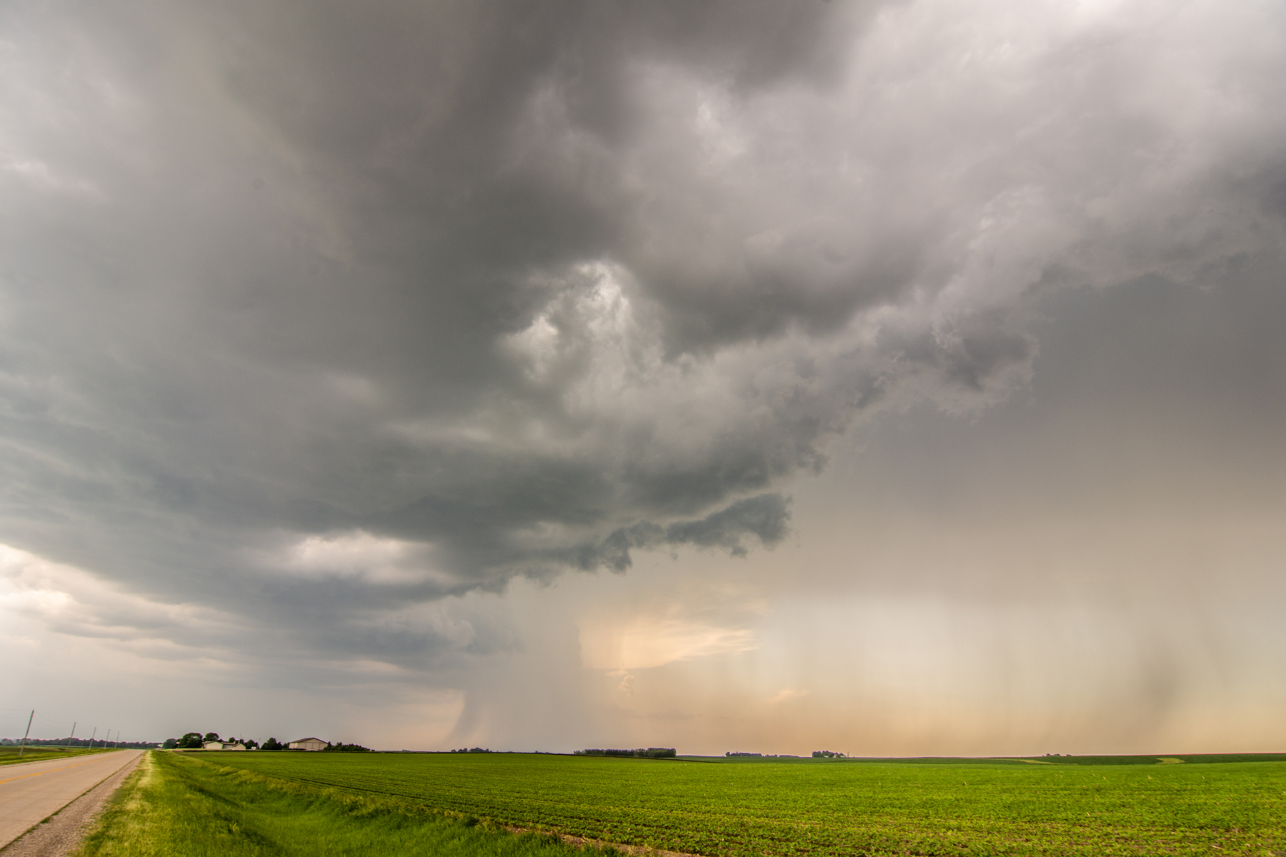
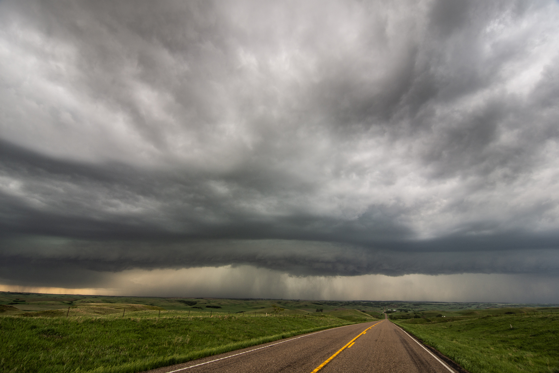
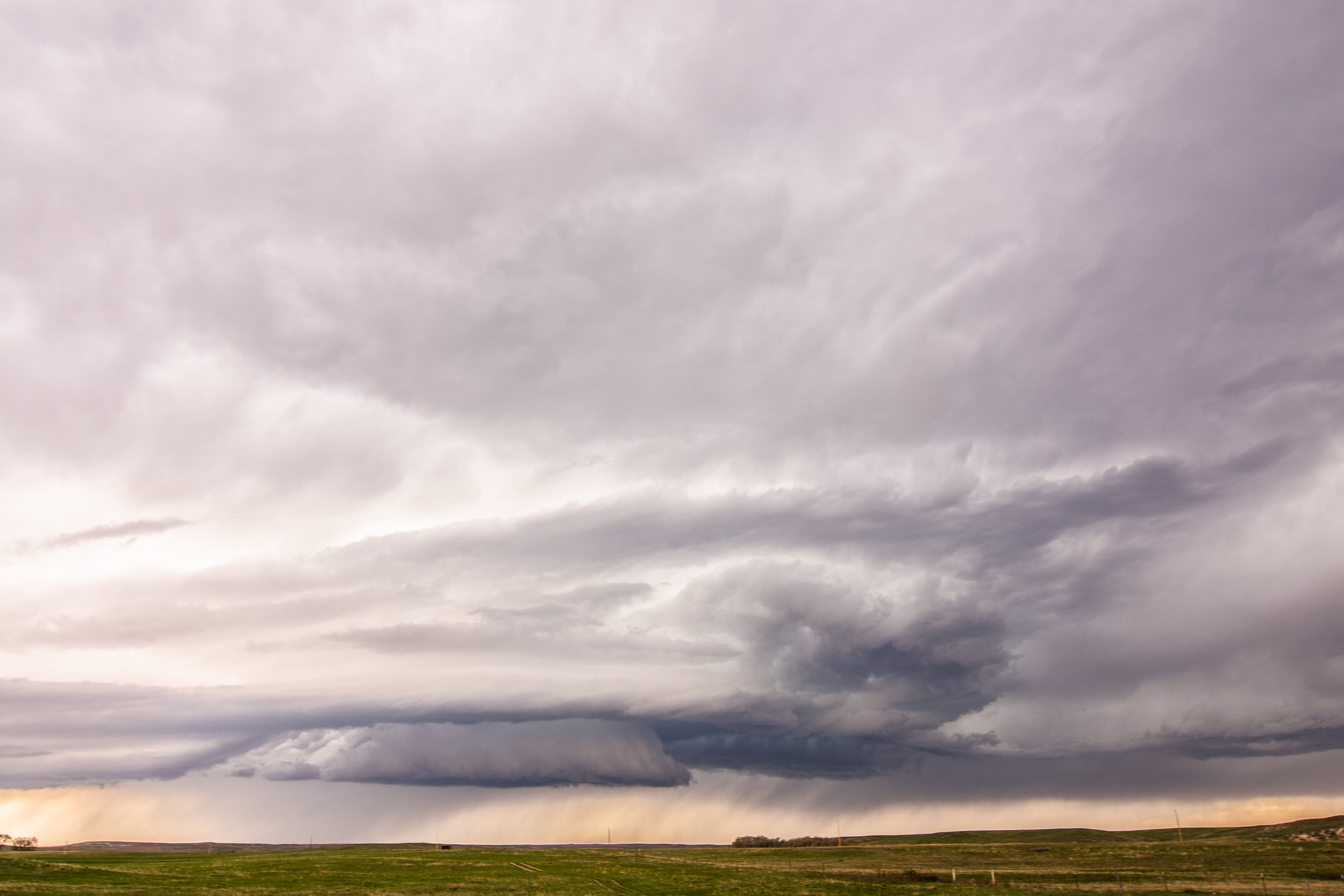
Another view of what I believe was a mesocyclone to our northwest within the notch of the storm. Would make sense based on radar imagery. I could not tell if this was rotating. Could have been an intense downburst?

IMG_1187.PNG

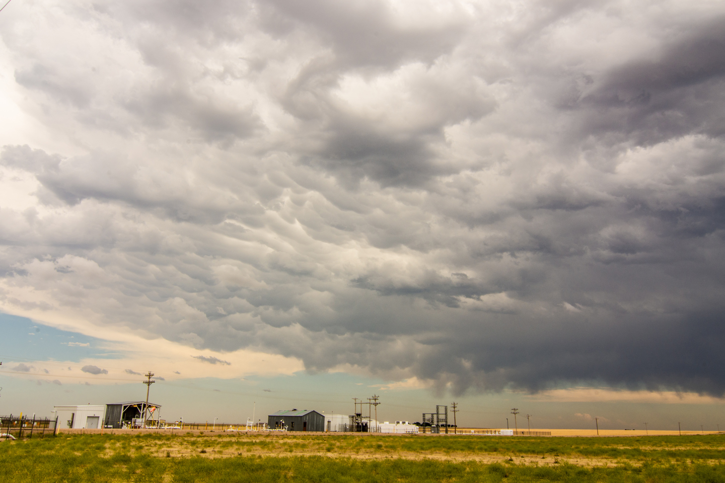
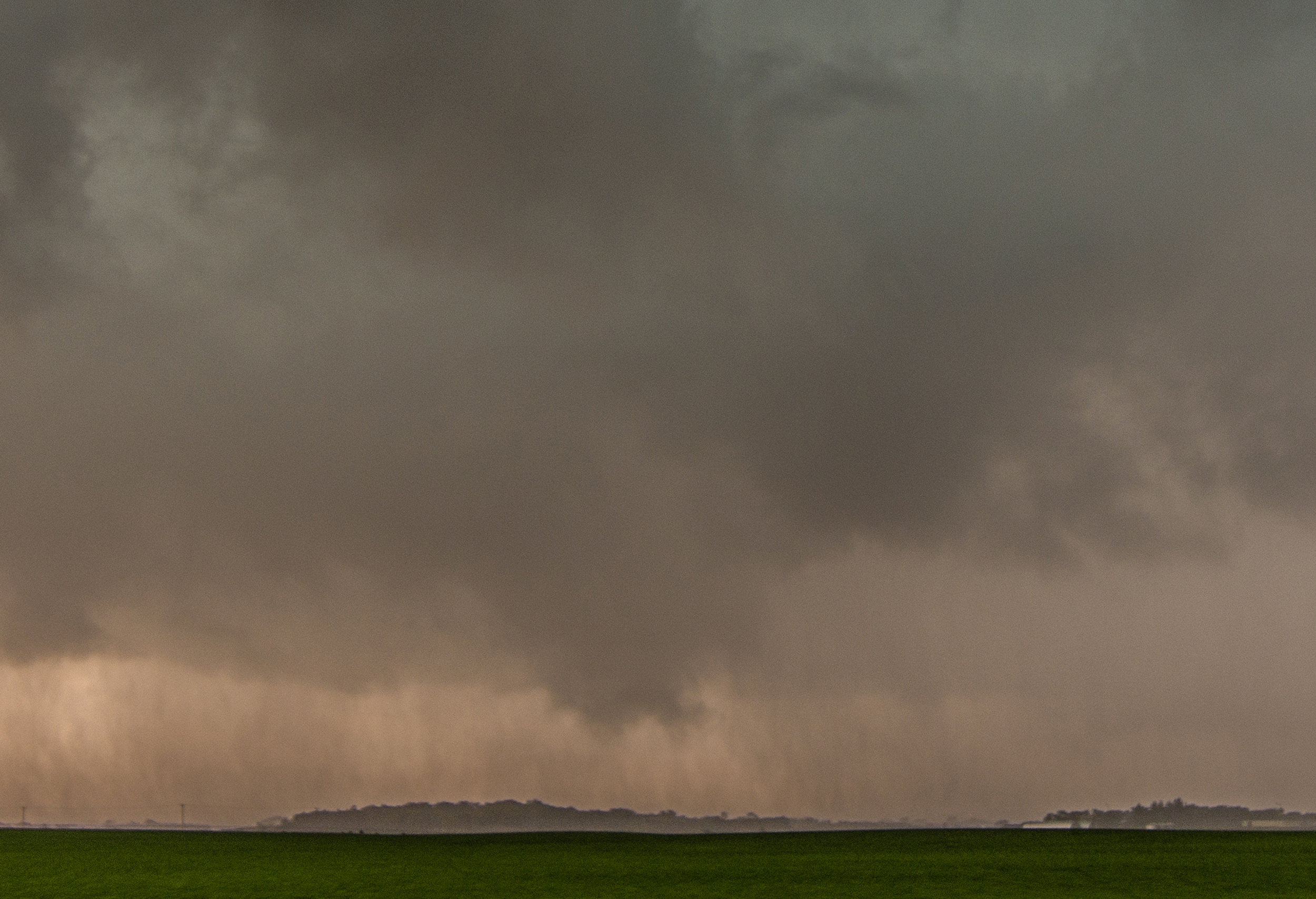
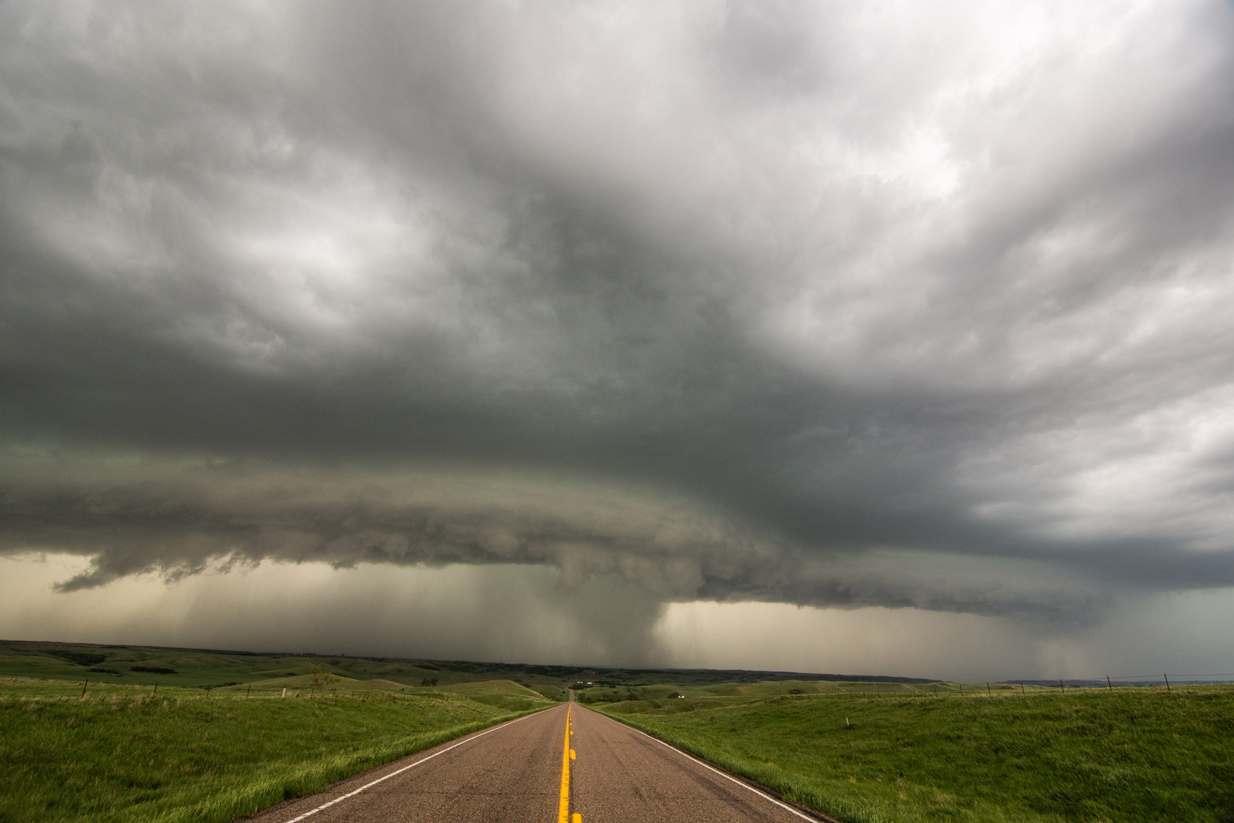
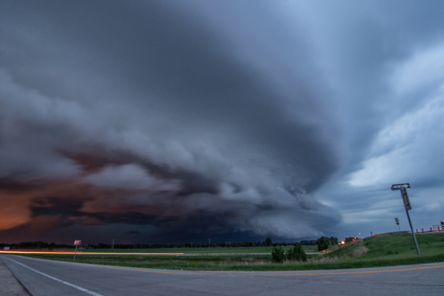
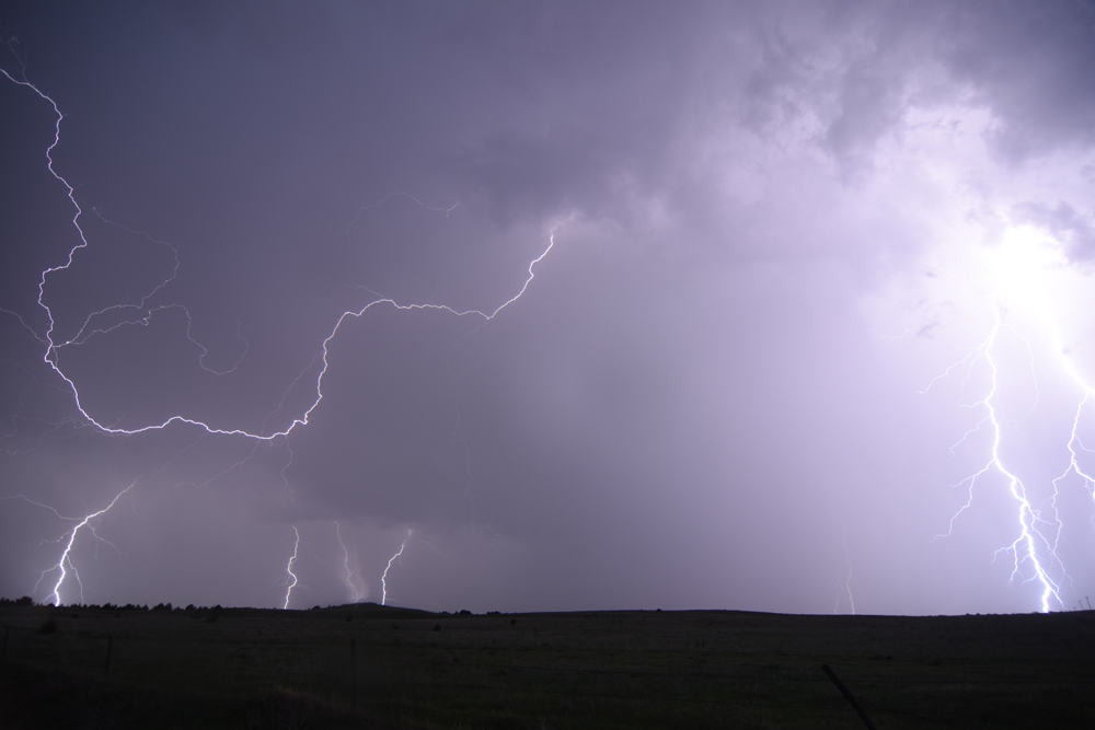
When we were re-positioning on Hwy 21 by the Faribault airport. Got slammed by intense winds ahead of an EF-2 tornado.

IMG_1182.PNG

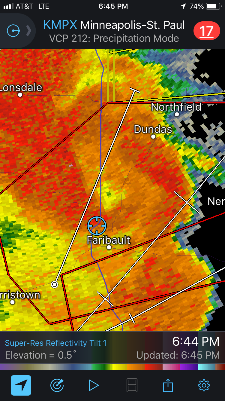
Closed in donut hole just north of our location as we had to stop near the intersection of Hwy 21 and I-35. Strongly indicative of a rain-wrapped tornado that passed just to our north through the Faribault airport.

IMG_1183.PNG

Broad couplet less than 1 mile north of our location and another down by Medford. Circled in black are the likely tornadoes occurring at this point.

Couplet as the tornado was passing to our northeast, just north of Dennison, MN.

Radar.jpg

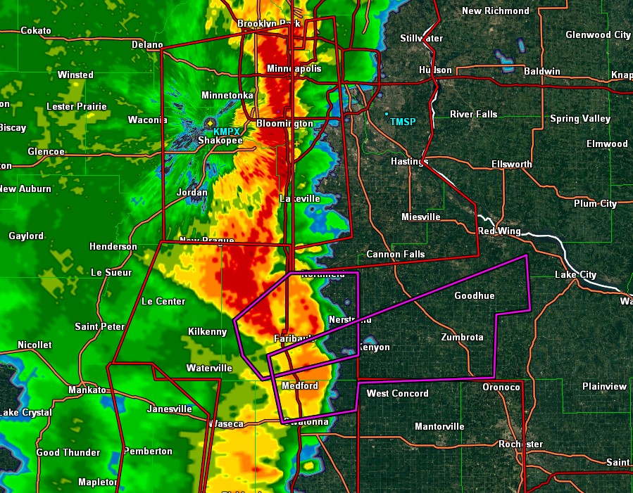
Zoomed out view of the quasi-linear convective system that spawned the 16 tornadoes across southeast Minnesota.

STORM REPORTS:

180920_rpts_filtered.gif

STORM PREDICTION CENTER OUTLOOKS:

Untitled.png

JUNE 23, 2018 COLORADO: GOOD STRUCTURED STORMS ON FINAL CHASE DAY OF TRIP

  This was Day 7 and last chase day of Silver Lining Tours (http://www.silverliningtours.com/) Tour 8.  After chasing some decent storms in the Oklahoma Panhandle the day before, we made our way up to eastern Colorado towards the base city of Denver.  There was not a lot of expectations this day due to a low-moderate instability and dewpoints only in the upper 50's to lower 60's, but deep layer shear was around 45 knots.  But the models continued to break out storms east and southeast of the Palmer Divide and also off the Raton Mesa in northeast New Mexico.  Since we had to be back in Denver that night, we proceeded to chase the northern target but, again, with limited expectations.  To our surprise, a few storms developed along a remnant outflow boundary from the night before and this provided the lift and focus necessary for the storms to intensify and move southeast into better air.  After stopping to take photos of a really cool abandoned farm house between Limon and Hugo, Colorado, we got on the first storm just south of Hugo and chased it south to east of Punkin Center.  The storm actually had some pretty good structure for a while before congealing with other storms.  Nice to have a better than expected chase day to wrap up the tour!

DSC_1136.jpg

  Creepy abandoned farm house between Limon and Hugo, Colorado.  The dead trees surrounding the house really give it a spooky look.  Thought a guy with a chainsaw was going to come flying out of this place at any moment.

DSC_1148.jpg

  The storm getting its act together south of Hugo, Colorado.  

DSC_1149.jpg

  Mammatus clouds on the developing supercell.

DSC_1162.jpg

  Storm starting to take on some good structure and a solid base!  Storm was high based so was not really expecting much tornado potential.  2 separate cores opening up in the distance.

DSC_1166.jpg

  Some of the best structure of the day on this severe warned supercell.  Intense rain foot and hail core down the road.

DSC_1170.jpg

  Storm still exhibiting some good structure east of Punkin Center, Colorado.  Almost looked like a high based wall cloud trying to form here.

  Another shot of the storm east of Punkin Center towards Aroya, Colorado.

DSC_1179.jpg

  Final shot of the day of the storms well defined updraft base.  Storm still had really good inflow but soon lost a lot of the good structure.

136pm MD.gif

  Mesoscale discussion issued at 1:36 PM MDT.  Storms expected to produce large hail and damaging winds on northern end of the instability axis.  Around 45 knots of bulk shear into the area, but not a lot of CAPE.

Watch 220pm.JPG

  Severe thunderstorm watch issued for the area at 2:20 PM MDT.

537pm MD.gif

  This mesoscale discussion was issued at 5:37 PM MDT, shortly after we stopped chasing and headed to Denver.  Line of severe storms with damaging winds was expected to continue southeast into the evening.

STORM REPORTS

180623_rpts_filtered.gif

STORM PREDICTION CENTER OUTLOOKS

Outlooks.jpg

JUNE 22, 2018 OKLAHOMA: SUPERCELL STORM IN THE PANHANDLE

  Day 6 of chasing as a guide with Silver Lining Tours (http://www.silverliningtours.com/) took us to the Oklahoma Panhandle.  There was a stalled front in place reinforced by an outflow boundary from overnight storms.  There was southeast flow at the surface, leading to upslope flow into the Raton Mesa.  Instability built to 2,000-3,000 j/kg into this area during the afternoon with middle 60's dewpoints and bulk shear of 55-60 knots.  A surface low also developed on the Raton Mesa on the tail end of the front.  We initially positioned ourselves near Andrix, Colorado.  It took a while, but cumulus towers kept forming right on the low and on the Raton mesa, while a smaller cumulus field was located to the east along the front.  3 storms finally broke through the cap from Andrix to Springfield, Colorado, while another storm rolled off the Raton Mesa to our south, weakened, and then intensified west of Boise City, Oklahoma.  We chose this southern storm and headed down Hwy 385 to just north of Boise City, just as the storm produced a wall cloud and became tornado warned.  Another storm came up from the south and interfered with our storm, effectively choking off the wall cloud just as it was getting interesting.  I really think this storm would have produced a tornado if the southern storm had not interfered.  We chased the storm east towards Guymon and eventually to Balko where a tornado was reported.  We could not confirm at this point near Balko that it did produce and I seriously question the report as we had a good view of the action area the whole time.  Either way, it was a nice storm but turned into a raging mesoscale convective system (MCS) shortly after Balko as storms congealed and got messy. 

DSC_1091.jpg

  Mammatus under the anvil of the storm to our south near Utleyville, Colorado.  We eventually went south and chased this storm.

DSC_1093-1.jpg

  Cool shear funnel out the back of the developing storm near Utleyville, Colorado.

DSC_1094.jpg

  Thunderstorms erupting to our northwest as we watched near Utleyville, Colorado.  The furthest west storm had an echo top that exploded over 50,000 feet very quickly.

DSC_1100.jpg

  Got down to the storm near Boise City, Oklahoma, and this beauty of a wall cloud was there to treat us.  Raging hail core to the right (north) side.

  The storm became tornado warned at this point as the wall cloud began rotating and pulling up focused scud tails into the base.  Rear flank downdraft winds coming around the south side that you can notice by the dirt on to the southwest side of the wall cloud as we look due west.

DSC_1109.jpg

  Nicely structured wall cloud that continued to have rotation near Boise City, Oklahoma.  This was shortly before the storm to the south came up and interfered.

DSC_1113.jpg

  View of the storm near Balko.  At first glance, this may look like a shelf cloud and an outflow dominant storm, but there was still inflow into the storm here and it became tornado-warned once again due to signs of rotation on radar.  Focused area of scud rising into the base on the left side of this image.

  Mammatus clouds on the back of the storm near Hardesty, Oklahoma.

mcd0825.gif

  Mesoscale discussion issued at 2:52 PM CDT

Watch.JPG

  Severe thunderstorm watch issued at 3:30 PM CDT.  Big threat for severe wind due to the expectations of a severe MCS to develop and track east along the front.

mcd0828.gif

  Mesoscale discussion issued at 5:14 PM CDT.  Bullseye of CAPE increasing to 3,000 j/kg iwth 55-60 knots of bulk shear across the area.

mcd0830.gif

  Mesoscale discussion issued at 7:12 PM CDT as storms were congealing and forming a severe MCS.

STORM REPORTS

180622_rpts_filtered.gif

STORM PREDICTION CENTER OUTLOOKS

Outlooks.jpg

JUNE 19, 2018 COLORADO: THE PROSPECT VALLEY TORNADO

  The 3rd day chasing as a guide for Silver Lining Tours (http://www.silverliningtours.com/) was a great one!  We initially thought that storms would form off the Palmer Divide southeast of Denver and intensify further east towards Last Chance.  Cumulus towers went up and down several times on the Palmer Divide but never could quite get going.  However, storms developed just west and northwest of Denver on the mountains in the upslope flow region of the Denver Cyclone (DCVZ).  3 separate supercells developed and moved off at relatively the same time.  We chose the middle storm as it looked the most intense, and this storm soon became tornado warned very early, shortly after 1:30 PM MDT!  We chased the storm from near Fort Lupton over to Keenesburg where it produced an extremely photogenic tornado in Prospect Valley, Colorado.  After the tornado lifted, the storm cycled a few more times but never could put down another tornado.  We ended up finally leaving this storm and heading south to the tail end storm near Deer Trail.  This storm also became tornado warned and quickly a high precipitation supercell with some impressive structure.  We ended up chasing this storm down to Limon before letting it go as it became outflow dominant.  An awesome chase day!

DSC_0824.jpg

  Wall cloud on the storm near Fort Lupton as it soon becomes tornado warned shortly after 1:30 PM MDT!  Storm had just moved off the foothills and intensified quickly.

DSC_0845.jpg

  Massive wall cloud on this storm now just east of Fort Lupton.

DSC_0857.jpg

  Terrific structure!  The entire storm was rotating.  Backwards C in the wall cloud indicates rear flank downdraft cutting into the back side.  

DSC_0859.jpg

  A wider view of the storm.

DSC_0868.jpg

  Wall cloud becomes better organized and the first funnel cloud forms in the middle.  Rain curtains wrapping around the entire wall cloud.

DSC_0871.jpg

  Wider view of the funnel, wall cloud and the storm.  I love the scenery and how far you can see in eastern Colorado!

DSC_0891-1.jpg

  Tornado!  Initially obscured by the rain but it eventually came out for us to get a great view.

DSC_0896.jpg

  Amazing tornado and structure to the storm!  Near Prospect Valley, Colorado close to Keenesburg.

DSC_0903.jpg

  Another incredible view of the storm and the tornado as it changes shape.

DSC_0908-2 (2).jpg

  Incredible twisting and turning elephant trunk tornado!  This was from around 2-3 miles away (estimated).

DSC_0912.jpg

  After producing the tornado, the storm continued to cycle more ragged wall clouds for another few hours.

DSC_0924.jpg

  This was right when we got on the southern, tail end severe storm down by Deer Trail, Colorado.  The storm was still a bit high based but had great structure.

DSC_0928.jpg

  A bit more outflowish here, but the storm still had great structure and lighting near Agate, Colorado.

DSC_0940.jpg

  Loosely organized wall cloud to our north near Agate, Colorado.

DSC_0947.jpg

  Beast of a tornado-warned, high precipitation supercell near Limon, Colorado.  

  Shelf cloud on the storm as it rages towards us east of Limon.

DSC_0972.jpg

  View of the shelf cloud, looking northwest.

IMG_0889 (1).jpg

  iPhone pano of the storm and shelf cloud.

mcd0791.gif

  Mesoscale discussion issued at 11:48 PM MDT, mentioning the threat for a few tornadoes.  Solid 50-55 knots of bulk shear across the area with 1500-2000 j/kg of MLCAPE already.  

Watch.JPG

  Tornado watch issued at 12:25 PM MDT.

mcd0793.gif

  Mesoscale discussion issued at 1:54 PM MDT.

STORM REPORTS

180619_rpts_filtered.gif

STORM PREDICTION CENTER OUTLOOKS

JUNE 18, 2018 COLORADO: SENSATIONAL STORM STRUCTURE

  Day 2 chasing as a guide for Silver Lining Tours: http://www.silverliningtours.com/  We stayed in northeast Colorado as supercell thunderstorms developed on the mountains and then rolled off just north of Denver.  We ended up staying close to I-76 and chasing these storms from Fort Lupton to Fort Morgan.  The storms exhibited terrific structure throughout their life cycles!

DSC_0763.jpg

  Supercell rolling off the mountains northwest of Denver near Erie, Colorado.  This is looking up at the updraft.  We drove through quarter size hail upon having to punch through the core from the north.

DSC_0775.jpg

  Non-rotating wall cloud on the storm near Erie, Colorado.

DSC_0784.jpg

  Terrific structure of the storm with wall cloud underneath in Hudson, Colorado.

DSC_0794.jpg

  Terrific looking storm near Keenesburg, Colorado.

  Incredible storm structure!

DSC_0802.jpg

  Looking at the south side of the storm with a well defined inflow tail.

DSC_0810.jpg

  Wall cloud on the storm as we approach Wiggins, Colorado.

DSC_0814.jpg

  The wall cloud takes on an even better shape a short time later.

mcd0783.gif

  Mesoscale discussion issued at 3:06 PM MDT highlighting the area expected to have severe thunderstorms into the afternoon and evening.  Modest instability at this point but decent bulk shear of 45 knots.  Instability did increase through the afternoon.

Watch.JPG

  Small severe thunderstorm watch issued at 6:35 PM MDT.  Storms were not moving very fast and were not expected to hold together very well further east.  Ended up having some flooding rain along I-76 as a result of training thunderstorms into the evening.

STORM REPORTS

180618_rpts_filtered.gif

STORM PREDICTION CENTER OUTLOOKS

Outlooks.jpg

JUNE 17, 2018 NEBRASKA: TWO TORNADOES AND A WICKED SHELF CLOUD

  Day 1 of storm chasing as a guide with Silver Lining Tours (http://www.silverliningtours.com/)!  We chased a couple of supercells from near Julesburg, Colorado to north of Ogallalla, Nebraska.  Along the way, we saw two tornadoes.  The first was a dirt obscured tornado near Julesburg and the second was near Big Springs, Nebraska and was from a longer distance away.  We did briefly see a third tornado near Ogallalla but did not get a decent shot of it since we were re-positioning ahead of the storm.

DSC_0692.jpg

  Wall cloud forming on the storm near Julesburg, Colorado.  

DSC_0699.jpg

  Large wall cloud on the storm near Julesburg, Colorado.  Not rotating at this point but certainly starting to look interesting!

DSC_0702.jpg

  Wall cloud starting to tighten up as rear flank downdraft comes around the south side of the storm.  Strong inflow winds at this point.

DSC_0717.jpg

  Rotating wall cloud really tightening up now with strong rear flank downdraft kicking up dirt.

  There's a tornado in there!  That dark area underneath the wall cloud was a confirmed tornado.  Obscured from all of the dirt being blown around here.

  A large, rain-wrapped funnel cloud between Julesburg, Colorado and Big Springs, Nebraska.  Did not know that I captured this until going through the photos later.

  Confirmed tornado in the distance near Big Springs, Nebraska.  Wish we would have been closer to this thing, but we were caught getting out ahead of the storm to avoid being cut off.

DSC_0729.jpg

  Storm starting to gust out and form a shelf cloud north of Ogallala, Nebraska.

DSC_0748.jpg

  Terrific structure on this storm as it is transitioning from being a tornado produce, to outflow dominant wind and hail machine.  Still tornado warned at this point with visible mesocyclone on the right side of this image.

DSC_0751.jpg

  Tour guests enjoying the storm.

  Awesome shelf cloud on the storm, looking south from the previous image.

mcd0767.gif

  Mesoscale discussion issued at 1:05 PM MDT shortly before storms initiated.  Area of low pressure slowly moving northeast along a stalled boundary.  Effective bulk shear of 55 knots into the area.

Watch.JPG

  Tornado watch issued at 1:35 PM MDT as storms have already initiated.

mcd0771.gif

  Mesoscale discussion issued at 3:53 PM MDT as severe thunderstorms are set to intensify and continue.  Lower 70's dewpoints now starting to advect into the area with east to southeast winds.

mcd0775.gif

  Another mesoscale discussion issued at 5:47 PM MDT.

mcd0777.gif

  Final mesoscale discussion for the area, issued at 8:27 PM MDT as severe weather threat is starting to decrease.

STORM REPORTS

180617_rpts_filtered.gif

STORM PREDICTION CENTER OUTLOOKS

Outlooks.jpg

JUNE 9, 2018 IOWA: LEAVING VACATION FOR TWO TORNADOES!

  Well, this was certainly unexpected.  After chasing a few days before, it was time for family vacation.  I had a great time on Friday and woke up on Saturday, June 9 to enjoy the day at a cabin, do some fishing, and spend time with family.  However, after looking over the observations and models Saturday morning, it soon became apparent that I had to get out northern Iowa to chase a mesoscale low pressure and warm front setup!  I met Wes and Debby Hyduke in Rochester and we went on our way to a target near Mason City.  The HRRR model completely nailed a tornadic storm that occurred in northern Iowa, just northwest of Clear Lake and Mason City.  It was one of the easiest targets that I can remember.  Basically had to find the triple point and park right in front of it.  A storm went up near Forest City, Iowa and produced a tornado just east of town, while another tornado occurred on this storm south of Fertile.  Just south of Fertile, there was a rapidly spinning mesocyclone on a separate wall cloud than the one that produced the tornado soon after.  The storm continued to be tornado warned southeast of Mason City but became a high precipitation supercell and eventually more outflow dominant.  It was a great spur-of-the-moment chase!

DSC_0509-2.jpg

  Wall cloud on the storm near Forest City, Iowa.

IMG_0279.JPG
DSC_0531.jpg

  Tornado occurring off the right side of the wall cloud with visible debris cloud at the ground.  

DSC_0531-2.jpg

  Closer view of the wall cloud and tornado.

DSC_0554.jpg

  Wall cloud forming on the storm just south of Fertile, Iowa.

DSC_0578.jpg

  Rapidly rotating wall cloud tightening up and attempting to produce a tornado.  Large condensed inflow tail screaming right to left and around this wall cloud at this point.

DSC_0587.jpg

  Around the time of the tornado reported southeast of Fertile, Iowa and northwest of Clear Lake.  Could not confirm that it was touching down at this point due to trees, but it was reported so I'm counting it as tornado #2.

DSC_0597-2.jpg

  Area of rotation, possible funnel cloud, near Mason City, Iowa.  Storm still tornado warned.

DSC_0610.jpg

  Severe thunderstorm approaching Charles City, Iowa.  Storm still has a visible wall cloud on the right side, but soon lost this as it became more outflow dominant.

DSC_0616.jpg

  Another shot of the storm approaching Charles City, Iowa at the end of our chase.

mcd0682.gif

  Mesoscale discussion issued at 1:46 PM CDT.  Area of low pressure moving southeast along the warm front.  Isolated supercells expected to develop just ahead of the low.

Tor Watch.JPG

  Tornado watch issued at 2:25 PM CDT as storms are erupting right on the triple point.

mcd0685.gif

  Mesoscale discussion issued at 3:52 PM CDT, highlighting the continued risk for tornadoes with storms in northeast Iowa.

mcd0687.gif

  Mesoscale discussion issued at 6:30 PM CDT indicating a new watch will likely be issued southeast of tornadic storms in northeast Iowa.

Severe Watch.JPG

  Severe thunderstorm watch issued at 7:45 PM CDT as storms move downstream and evolve into severe wind and hail producers.

STORM REPORTS

180609_rpts_filtered.gif

STORM PREDICTION CENTER OUTLOOKS

Outlooks.jpg

JUNE 6, 2018 IOWA: SEVERE THUNDERSTORMS ALONG A STALLED BOUNDARY

  Took a few days to chase with Rich Hamel, who flew in from Boston.  After a bust in North Dakota the day before, we moved south to Iowa to chase storms along a stalled, outflow enhanced boundary that had dropped to just north of I-80.  There were not a lot of expectations on this day due to weak low and deep layer shear, but there was enough instability of 4,000 j/kg of MLCAPE to lead to severe thunderstorms producing damaging winds and large hail.  We caught the first severe storm just south of Ames, Iowa and then moved back west towards Guthrie Center as new storms developed.  Overall, the chase ended up near expectations considering the environment storms were going up in.

DSC_0417.jpg

  A old one room schoolhouse that was still in good shape near Slater, Iowa.  New flanking towers of our initial storm are going up behind the schoolhouse to the west.  We ended up chasing back west to these new storms.

DSC_0424.jpg

  2nd severe storm of the day near Panora, Iowa.  Core moving right to left in this image and new hail core opening up in the distance.

DSC_0426.jpg

  Closer view of the new hail core opening up near Panora, Iowa.

DSC_0431.jpg

  View of the updraft and vault region of our storm, about to move overhead.

DSC_0432.jpg

  Dark, high-based storm approaching us from the north with heavy rain and hail curtain.

  Rich Hamel in his element!

  Severe thunderstorm about to overtake us.  Dark, rolling shelf cloud on the leading edge of the storm.

mcd0652.gif

  Mesoscale Discussion issued at 2:22 PM CDT, highlighting the area that will most likely need a severe thunderstorm watch in 1-2 hours.

Watch Box.JPG

  Severe thunderstorm watch issued at 3:20 PM CDT.  Notice the High Likelihood for severe wind and hail.

mcd0655.gif

  Mesoscale Discussion issued at 6:20 PM CDT as severe thunderstorms are ongoing.  We were on the western end of that line of storms in central Iowa at this point.

mcd0657.gif

   Final Mesoscale Discussion issued at 8:45 PM CDT as thunderstorms are beginning to weaken.

STORM REPORTS

180606_rpts_filtered.gif

STORM PREDICTION CENTER OUTLOOKS

JUNE 1, 2018 NORTH DAKOTA: SEVERAL TORNADO WARNED SUPERCELLS AND A DISTANT TORNADO

  There were two targets today, one in Nebraska and another in North Dakota.  Decided on the northern target and took the long drive with Wes Hyduke out to western North Dakota to chase a triple point setup that offered decent tornado potential.  Shear and instability were maximized right on the triple point and warm front, so we had an initial target in the vicinity of New Town to Makoti.  Unfortunately, this was right on the north side of large reservoir Lake Sakakawea.  The front ended up not lifting as fast as forecast, so we set up shop on I-94 near Glen Ullin, watching towers go up and down during the mid-afternoon hours.  Storms finally went up right on the low and triple point along Hwy 85 to your northwest.  We headed up Hwy 8 towards Halliday as the storm became tornado warned, and ended up seeing a confirmed tornado from 19 miles away that was near the town of Medicine Hole.  Since the storms were moving northeast, we could not get across the reservoir due to being cut off, so proceeded up towards Two Buttes on a hill with a great view off Hwy 22.  Here is where we saw 4 separate tornado warned storms, each with wall clouds moving south to north right in front of us.  A few of these wall clouds had solid rotation and attempted to wrap up, but these eventually occluded before dropping a tornado.  After about 1 good hour of chasing, the storms became a severe cluster of storms producing wind and hail.

DSC_0319.jpg

  Looking to the southwest of Glen Ullin, North Dakota as updrafts were attempting to break the cap on the warm front as it was lifting north.  This area later had a storm that produced a brief tornado, close to where we were at this point!

DSC_0328-1.jpg

  Tornado from 19 miles away that was near Medicine Hole, North Dakota.  We were viewing from north of Halliday and trying to stair step northwest to get ahead of the storm at this point.

DSC_0328-2.jpg

  Closer view of the tornado near Medicine Hole, taken from a distance.

DSC_0336.jpg

  Set up shop east of Two Buttes on a large hill that had a great view to our west.  We could see 3 supercells at once from this spot, all that were tornado warned at some point.  Here is the 2nd supercell in the line coming up from the south with a visible wall cloud under the updraft.

DSC_0338.jpg

  Visible rotating wall cloud on a tornado warned storm looking to our west-northwest.

DSC_0341.jpg

  Wall cloud still present on the storm as it continued to slide off to the north.

DSC_0351.jpg

  The 3rd storm in the line that came up from the south.  Another lowering on this storm as well.

DSC_0355.jpg

  A 4th supercell getting its act together and moving up from the south.  I was just blown away by the view from this location.

DSC_0360.jpg

  Storm becomes tornado warned as a wall cloud forms on the northeast side of the base.  

DSC_0366.jpg

  Wall cloud becomes better organized here, with upward condensating motion into it.  Visible rotation at this time as well.

DSC_0367.jpg

  Closer shot of the wall cloud from the previous photo.

DSC_0372.jpg

  The closest that this storm came to producing a tornado.  Could not tell if there was a big cone funnel or tornado tucked away back there, surrounded by heavy rain and hail. 

DSC_0373.jpg

  Twin mesocyclones northeast of Two Buttes, North Dakota.  Great structure and foreground.

DSC_0380.jpg

  The 4th tornado warned storm of the day occurred as we headed east on Hwy 22 to keep ahead of the storms.  This was the last wall cloud we saw as the storms were really congealing into a severe cluster at this point.  

DSC_0385.jpg

  Closer shot of our last wall cloud of the day.  This one was on the messy side but was still tornado warned with some slower rotation.

DSC_0393.jpg

  Nice mammatus display covering the sky on the back side of the storms as we got back down to I-94 near Glen Ullin, North Dakota.

DSC_0394.jpg

  Punched through the squall line through North Dakota and got ahead near Jamestown.  It was completely dark at this point, but I caught a decent view of the storm with an 8 second shutter speed.

DSC_0396.jpg

  Looking to the south at the shelf cloud overtaking Jamestown, North Dakota.  The chase vehicle G6 is on the left with Wes in the passenger seat.

mcd0608.gif

  Mesoscale discussion issued at 2:13 PM CDT highlighting the severe weather potential with all hazards possible.  3,000 j/kg of MUCAPE nosing up into the area with 50 kts of effective bulk shear.

ww0146_radar_init_resize.gif

  Tornado watch issued at 3:20 PM CDT!

mcd0615.gif

  Another mesoscale discussion issued at 6:02 PM CDT, highlighting the greatest short term risk for tornadoes.  The tornado threat was quickly diminishing at this point as storms congealed, even in the presence of strong deep layer shear and moderate instability.

mcd0619.gif

  Yet another mesoscale discussion issued at 8:30 PM CDT highlighting the area of greatest severe weather risk.  This was as we were core punching through the storm to get ahead near Jamestown.

STORM REPORTS:

180601_rpts.gif

STORM PREDICTION CENTER 1630Z OUTLOOKS:

Outlooks.jpg

MAY 10, 2018 WYOMING & NEBRASKA STORM CHASE: SUPERCELLS, LANDSPOUT TORNADO, HAIL AND LIGHTNING SHOW

  Had a somewhat surprisingly good chase out to eastern Wyoming and western Nebraska.  2018 has been a big time down year for good storms and tornadoes, but we managed to get everything from great structure, big hail, a landspout tornado and a heck of a lightning show this day.  I probably would not have chased if my friends Kevin and Kate were not out on their chasecation and I could meet up with them in Wyoming.  I left the day before and drove out to Rapid City, South Dakota, then down to the target area near Cheyenne, Wyoming the next day.  We watched a short-lived supercell with terrific structure go up on the Laramie Range north of Cheyenne, but this storm quickly went outflow dominant with a surging boundary and cold front undercutting all the storms.  This was obviously the end to any decent thunderstorm threat that we had, so the decision was made to book it to the east towards storms developing in northeast Colorado and moving up towards Sydney, Nebraska.  Storms went to the north into an area of bad roads and into more stable air, but one storm caught our eye southwest of Ogallala, Nebraska.  We got ahead of this storm and almost decided to bail and head north to get on a storm approaching Arthur, Nebraska, but the storm to our southwest strengthened and started to look much better as it got into higher dewpoints and better CAPE.  Ended up chasing this storm from Ogallala to Wallace, Nebraska, seeing some good structure, a wall cloud, funnel, rainbow with lightning, a landspout tornado and an incredible lightning show to end the day.  Definitely worth the 1800+ miles that I drove on this trip, even for 1 day!  Drove back home the day after as the setup for the next few days did not look appealing to chase.

DSC_0086.jpg

  Beautiful supercell with foot shaped lowering and great structure moving off the Laramie Range to the north of Cheyenne, Wyoming.

DSC_0084.jpg

  Wide angle, zoomed out view of the entire rotating supercell moving off the Laramie Range into the high plains of Wyoming.  You can really see the inflow being pulled in with the bands from left to right and rising, corkscrew motion into the storm updraft.

DSC_0100.jpg

  Caught a photo of a train going by while watching the storm east of Ogallala, Nebraska.  Thought it was kind of a cool photo, especially since you can see the storm in the background through the train.  

DSC_0130.jpg

  Kevin and Kate enjoying the chase and watching the mesocyclone directly ahead of us north of Madrid, Nebraska.

DSC_0134-1.jpg

  Short lived funnel cloud on the storm north of Elsie, Nebraska.  

DSC_0148.jpg

  Wall cloud north of Elsie, Nebraska.  View from the east as the mesocyclone was moving towards us down the road.

DSC_0154.jpg

  Got into some big hail north of Elsie, Nebraska!  This was after 15 minutes of melting.  Around golf ball size hail initially.

DSC_0156-1.jpg

  Awesome shot of a rainbow and lightning in nearly the same orientation northwest of Wallace, Nebraska!  This was looking to the east at the back side of the storm.

DSC_0183-1.jpg

  Landspout tornado!  We came around a bend in the road and saw a large dirt plume.  No condensation funnel above but was rapidly rotating and swirling with dirt directly underneath the mesocyclone.  Very cool site to an already good chase day.

DSC_0189-1.jpg

  Another shot of the landspout tornado with lightning.  Lots of dirt being kicked up at this point.  Last moments of daylight here, or we would have never been able to see it clearly.

DSC_0199.jpg

  Time for lightning shots.  I really like how these bolts took on a similar shape, north of Wallace, Nebraska.

DSC_0201.jpg

  Bolts, bolts, bolts, everywhere!  This was on a 30 second exposure.  Lots of cloud to ground lightning as the storm remained severe.

DSC_0211.jpg

  Lightning snaking across the sky.

mcd0375.gif

  Mesoscale discussion issued at 12:56 PM MDT, highlighting the need for a watch box to be issued soon.  Storms expected to develop quickly in an environment characterized by 40 knots of effective bulk shear and 1,000 j/kg of MUCAPE.

Watch.JPG

  Severe thunderstorm watch issued at 1:40 PM MDT by SPC for southeast Wyoming and western Nebraska, mainly for the risk of large hail and damaging winds.

mcd0379.gif

  A new mesoscale discussion issued at 5:10 PM MDT, highlighting the continued severe weather threat.  Effective bulk shear has now increased to around 50 knots with 2,000 j/kg of MUCAPE into western Nebraska.

mcd0383.gif

  Mesoscale discussion issued at 7:39 PM CDT highlighting the need for another watch box soon, especially for damaging winds.  Effective bulk shear continues to increase to 55-65 knots into the area.

Watch2.JPG

  New severe thunderstorm watch issued at 8:00 PM CDT for severe storms with damaging wind potential into the evening.

STORM REPORTS:

180510_rpts.gif

STORM PREDICTION CENTER OUTLOOKS:

Untitled.jpg