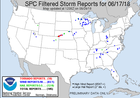
JUNE 17, 2018 NEBRASKA: TWO TORNADOES AND A WICKED SHELF CLOUD
Day 1 of storm chasing as a guide with Silver Lining Tours (http://www.silverliningtours.com/)! We chased a couple of supercells from near Julesburg, Colorado to north of Ogallalla, Nebraska. Along the way, we saw two tornadoes. The first was a dirt obscured tornado near Julesburg and the second was near Big Springs, Nebraska and was from a longer distance away. We did briefly see a third tornado near Ogallalla but did not get a decent shot of it since we were re-positioning ahead of the storm.

Wall cloud forming on the storm near Julesburg, Colorado.

Large wall cloud on the storm near Julesburg, Colorado. Not rotating at this point but certainly starting to look interesting!

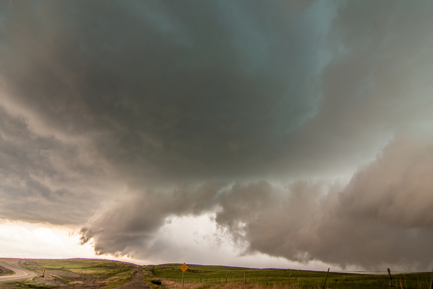
Wall cloud starting to tighten up as rear flank downdraft comes around the south side of the storm. Strong inflow winds at this point.

Rotating wall cloud really tightening up now with strong rear flank downdraft kicking up dirt.

There's a tornado in there! That dark area underneath the wall cloud was a confirmed tornado. Obscured from all of the dirt being blown around here.

A large, rain-wrapped funnel cloud between Julesburg, Colorado and Big Springs, Nebraska. Did not know that I captured this until going through the photos later.

Confirmed tornado in the distance near Big Springs, Nebraska. Wish we would have been closer to this thing, but we were caught getting out ahead of the storm to avoid being cut off.
Storm starting to gust out and form a shelf cloud north of Ogallala, Nebraska.

Terrific structure on this storm as it is transitioning from being a tornado produce, to outflow dominant wind and hail machine. Still tornado warned at this point with visible mesocyclone on the right side of this image.

Tour guests enjoying the storm.

Awesome shelf cloud on the storm, looking south from the previous image.

Mesoscale discussion issued at 1:05 PM MDT shortly before storms initiated. Area of low pressure slowly moving northeast along a stalled boundary. Effective bulk shear of 55 knots into the area.

Tornado watch issued at 1:35 PM MDT as storms have already initiated.

Mesoscale discussion issued at 3:53 PM MDT as severe thunderstorms are set to intensify and continue. Lower 70's dewpoints now starting to advect into the area with east to southeast winds.

Another mesoscale discussion issued at 5:47 PM MDT.

Final mesoscale discussion for the area, issued at 8:27 PM MDT as severe weather threat is starting to decrease.