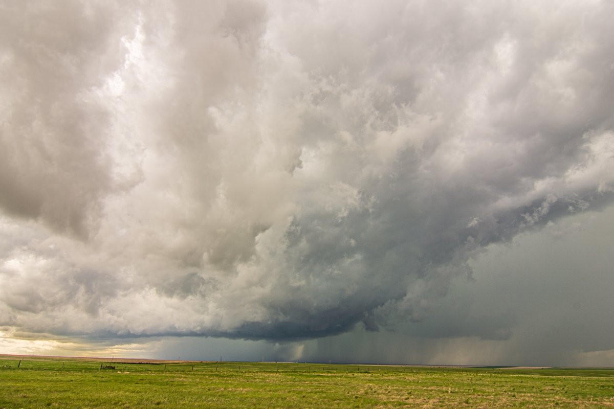
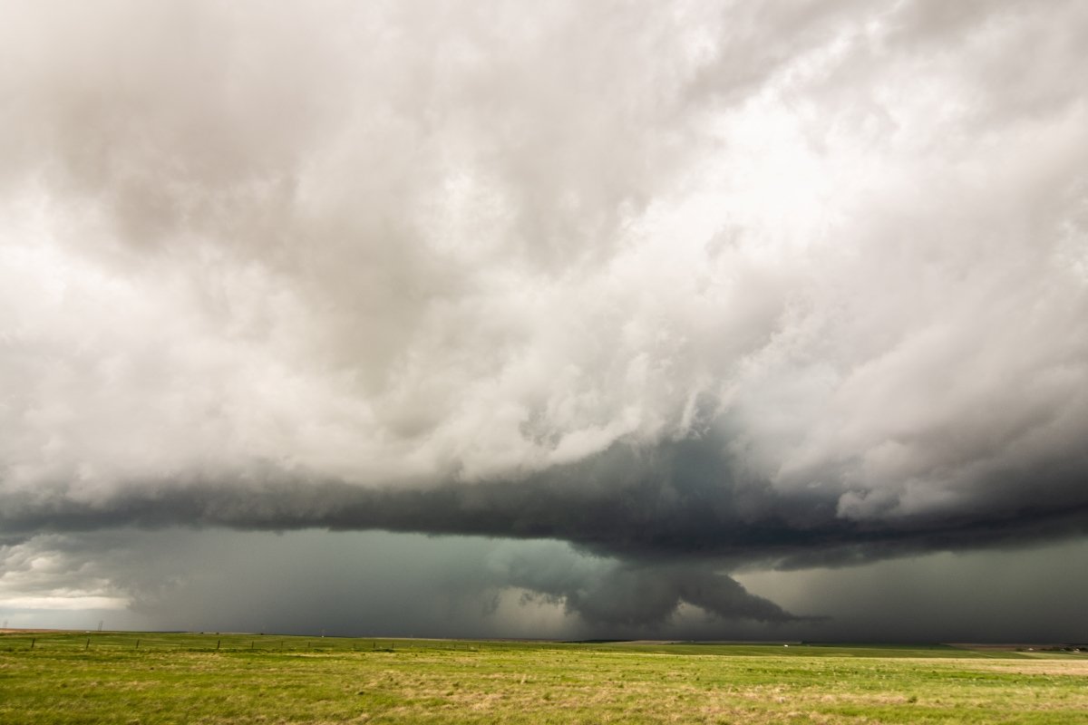
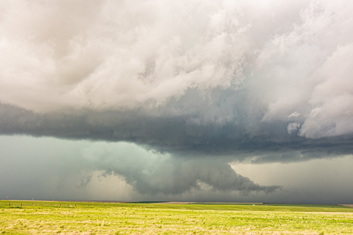
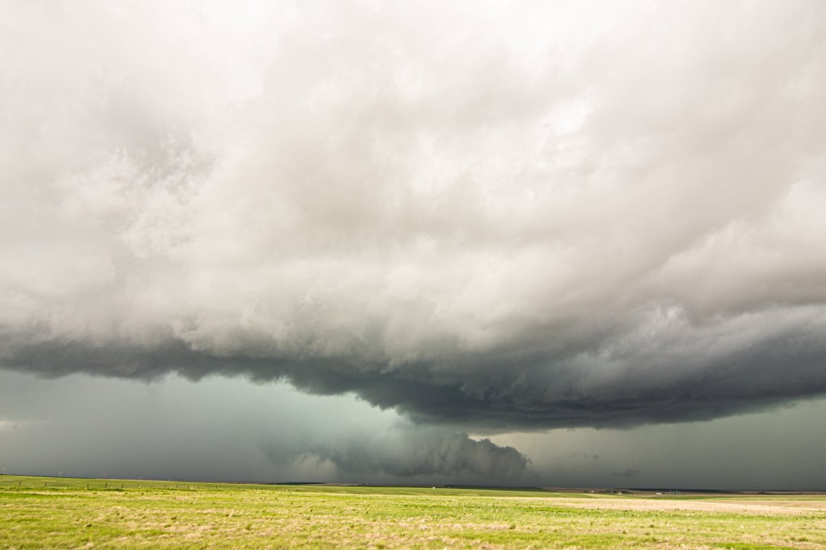
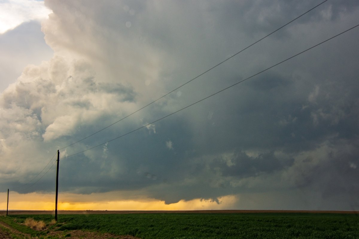
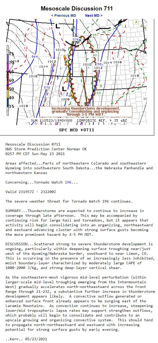
MAY 23, 2021 COLORADO: PHOTOGENIC AND TORNADO WARNED SUPERCELL STORMS December 03, 2021 by Brad in 2021 First storm of the day near Rush, Colorado. Already a nice, flat, dark base and intense core on this storm. Shortly after the previous image was taken, a wall cloud begins to develop on the rotating storm. AHHHH… this is where it really got interesting as the wall cloud was near ground with strong inflow right to left as noted by the tail. A closer shot of the wall cloud and inflow tail on the tornado warned storm near Rush, Colorado. Funnel cloud on the left edge of the wall cloud and just right of the core as the wall cloud began to mature. Closer view of the funnel cloud and inflow tail with strong right to left inflow at the time. Storm updraft on a new supercell near Siebert, Colorado. Funnel cloud starting to form underneath a strong updraft south of Burlington, Colorado. A new storm we were watching south of Burlington off the dryline. A new rotating storm we intercepted near Cheyenne Wells, Colorado. Really nice storm we intercepted after the first one! Storm forming a solid base as it approached the wind farm in front of us. Storm moving to our north with continued great structure near Cheyenne Wells, Colorado. STORM REPORTS: STORM PREDICTION CENTER OUTLOOKS: