
JUNE 8, 2020 NEBRASKA: MEAN TORNADO WARNED SUPERCELL AT DUSK

Mammatus on the northern storm as we were approaching after crossing the dam at the Missouri River near Pickstown, SD.

Approaching from the northeast on the farthest north severe thunderstorm in a broken line through east-central Nebraska. Can see a lowering here where the mature wall cloud is wrapping into the mesocyclone.

Severe warned supercell near Dustin, NE as we were driving south to chase a stronger storm. Terrific structure!

Approaching the stronger supercell to the south near Atkinson, NE. This storm soon becomes tornado warned.

Wall cloud in the notch of this storm on the northern side of the storm base where the mature mesocylone was occluding.

Dual mesocyclones looking to our south towards Atkinson, NE

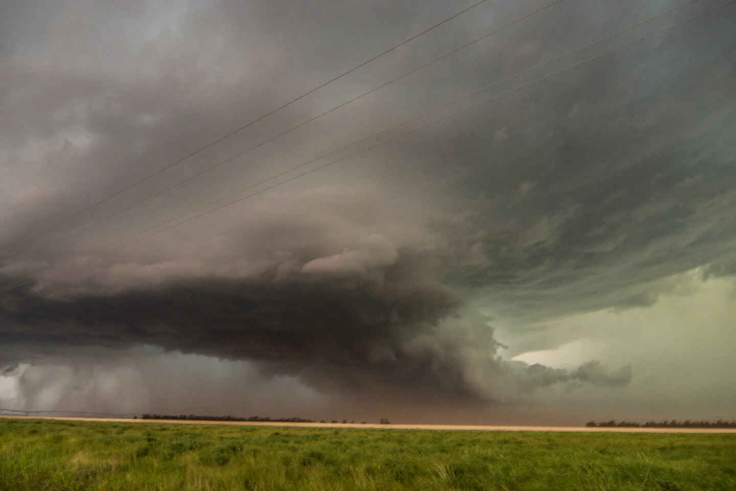
Another view of the wall cloud trying to tighten up. Inflow tail and fast right to left condensation into the storm at this point. Hard to tell if there’s anything that is touching down in there due to all of the dirt and generally low visibility.

Screaming inflow to our backs into this wall cloud at this time. This is when it looked the most interesting in regards to potentially producing a tornado. Was still tornado warned at this point.

Very interesting. Rapid inflow right to left into this rotating wall cloud. Still can’t see what’s going on in there.

Lots of dirt being pulled into this storm with screaming fast inflow from our backs.

End of the chase during the evening as a strong and intense line of heavy rain and hail as approaching. Looking northwest from near Bristow, NE.

Mesoscale discussion issued at 3:16 PM CDT. 80% chance of watch issuance along and ahead of the stalled boundary from eastern South Dakota into central Nebraska. We were positioned in Mitchell, SD on the northern end of where thunderstorms were expected to develop. https://www.spc.noaa.gov/products/md/2020/md0882.html


Mesoscale discussion issued at 7:16 PM CDT for central Nebraska where a localized tornado threat existed. https://www.spc.noaa.gov/products/md/2020/md0885.html

Mesoscale discussion issued at 9:13 PM CDT as severe storms were moving north along the front into South Dakota. https://www.spc.noaa.gov/products/md/2020/md0887.html


