
June 17th Southern Minnesota Storm Chase - Austin EF2 Tornado
06-17-09 CHASE LOG: MN
I chased with Twister Sister Peggy Willenberg today and we ended up targeting near the Mankato/New Ulm, Minnesota area for initiation.An intense supercell that later spawned the Austin, MN tornado quickly developed 25 miles southeast of Mankato and we were quickly on this storm near Geneva, MN.There was a large wall cloud on the storm that was being shielded somewhat from the intense hail core but we could see the edge upon following the storm to the east to Highway 218.Upon briefly getting cored with some nickel sized hail, we emerged very close to the meso, which was violently rotating on the northwest side of Austin and very low to ground.Under the meso, there was no condensation funnel at that time, but there was debris underneath the meso, so this was indeed the first touchdown of the tornado at that time.We then progressed south towards I-90 and came upon damage to structures, trees and downed power lines as well as snapped power poles.After getting through Austin and emerging on the southeast side of town, a newly developed mesocyclone let to a second touchdown, and much stronger, about 2 miles east-southeast of Austin.This tornado was much larger and had multiple vortices as shown by the video.This was quite the incredible but sobering experience at this point as the tornado sat over a farmstead and large wooded grove of trees for around 4-5 minutes about ¼ mile to our south-southeast.There was large structural damage done here as well as numerous power flashes with this tornado upon meandering slowly to the northeast.We also got into some golf ball sized hail at this point that did put a crack in the windshield.The tornado eventually diminished but soon cycled, with a third touchdown of the tornado as we traveled southeast on Highway 56 near Rose Creek, MN. This tornado was a nice cone structure with a needle towards the ground and intense rotation about ½-1 mile away from us at that point.It did not appear that this third touchdown led to much in the way of damage, thankfully.Thereafter, we followed the storm further southeast towards Adams and Leroy, MN, witnessing a pair of horizontal funnels (very cool looking I might add) as well as an organized and rotating wall cloud that did not put down a tornado before we lost daylight, although it very much looked like it would at a few points in its cycle.All in all, a terrific chase day for us, close to home, and actually too close to home for me considering I grew up in this area and knew a lot of the areas that were hardest hit by these tornadoes.

Image of the supercell taken near Amboy, Minnesota.
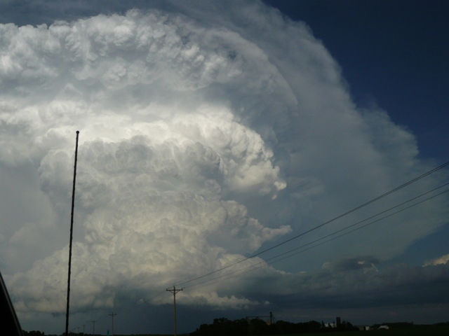
Updraft
Strong thunderstorm updraft taken near New Richland, Minnesota.

Austin Tornado 1
Tornado 1/2 mile to the east of the Austin Municipal Airport. This tornado went over a farmstead and caused considerable damage to that area.

Austin Tornado 2
Tornado 1/2 mile to the east of the Austin Municipal Airport. Condensation finally reaching the ground here.
Tornado 1/2 mile east of the Austin Municipal Airport. Police on the scene at the farmstead to the right of the tornado.

Austin Tornado 4
Tornado east of Austin, Minnesota. Large wall cloud over the tornado as well.

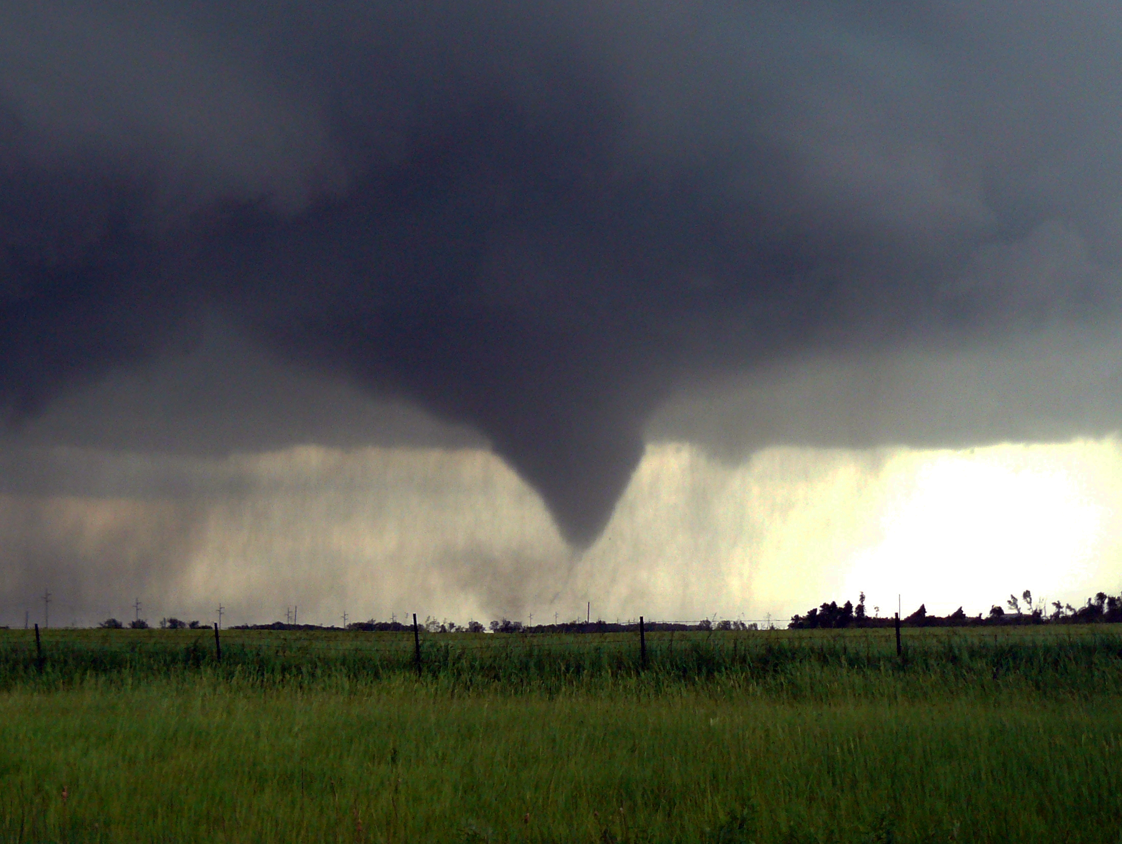
Austin Tornado 5
Tornado 1 mile to the south of Rose Creek, Minnesota. Final tornado of the day with this amazing storm.
More photos from this day can be found here: http://www.flickr.com/photos/39991047@N02/sets/72157621793443334/
National Weather Service Event Summary: https://www.weather.gov/arx/jun1709
Storm Reports:

090617_rpts