AUGUST 5, 2023 SOUTH DAKOTA/NEBRASKA/IOWA: BRIEF TORNADO


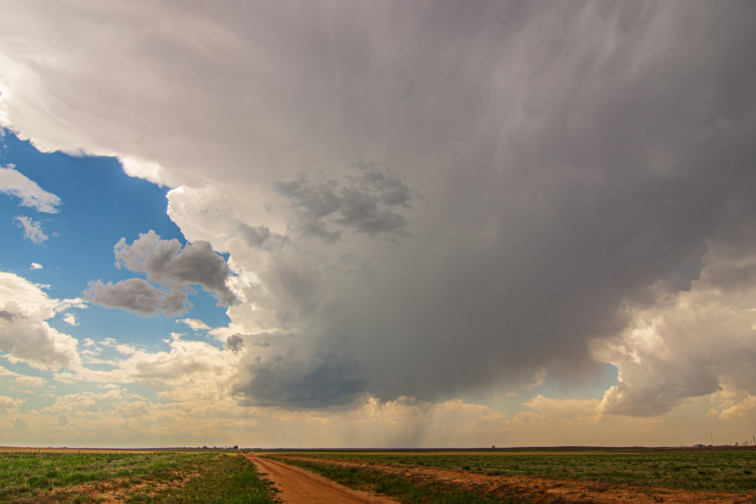
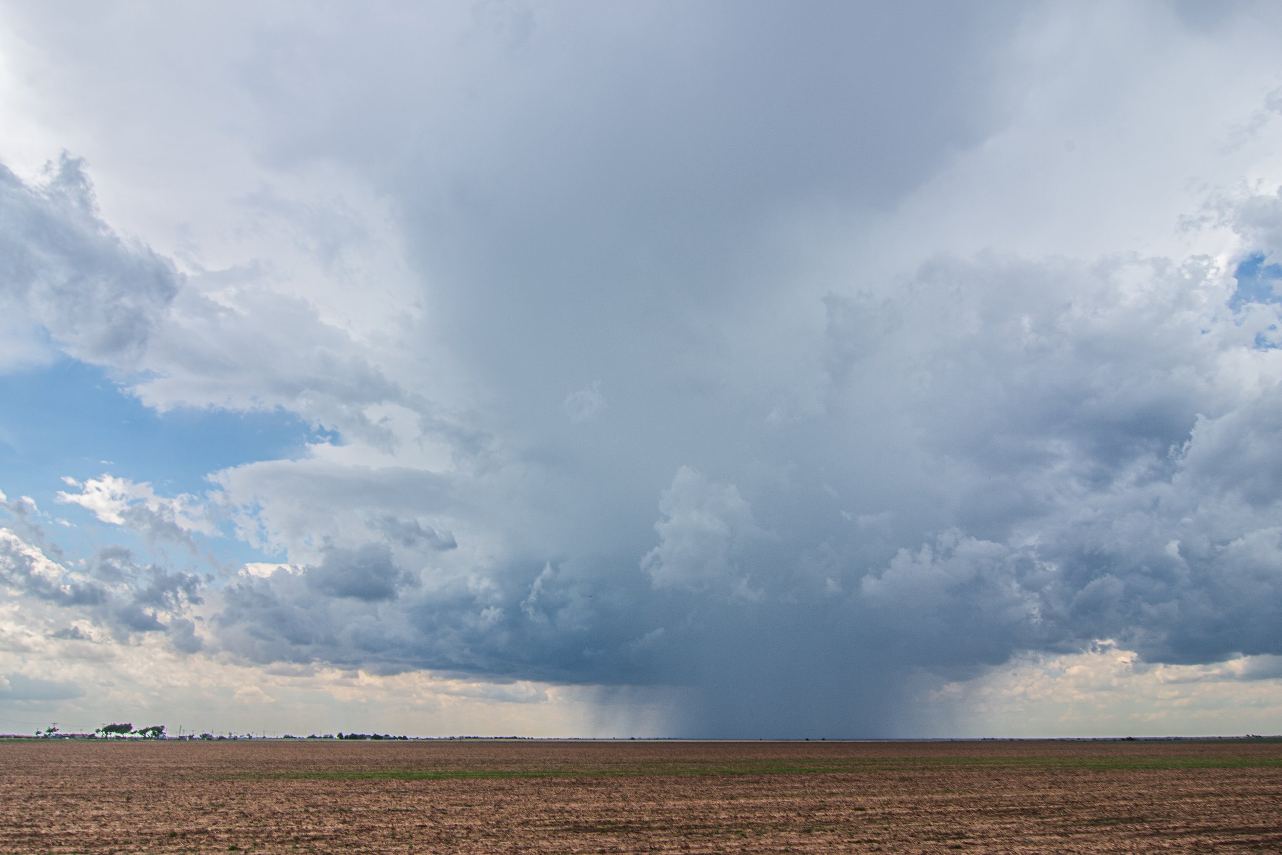
Towering cumolonimbus in southeast South Dakota.

Focused condensating scud into the cloud base. This storm had potential for sure.

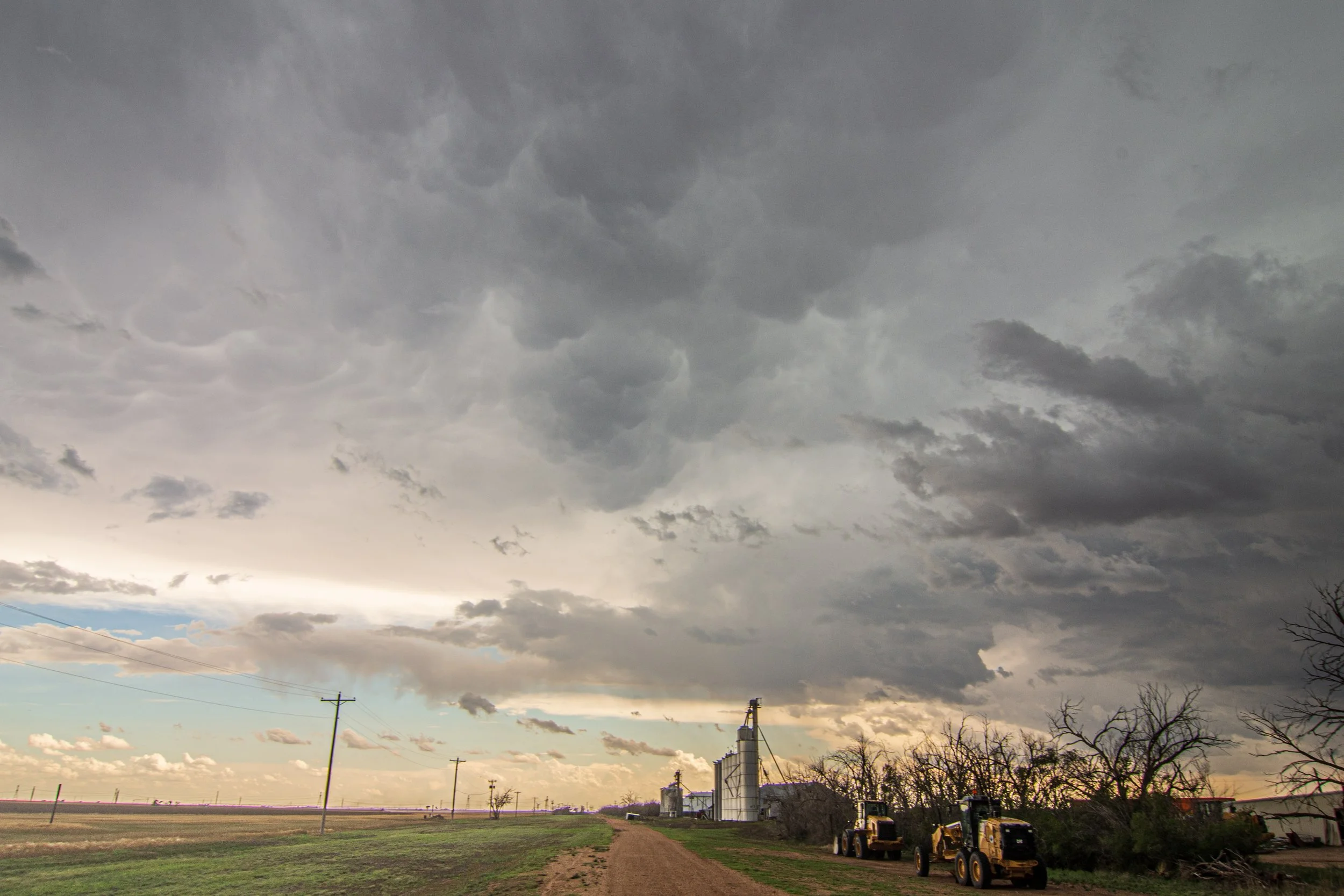
Great storm base here. Not rotating or focusing very well but was good structure for a bit.

A couple of decent action areas of slow rotation.

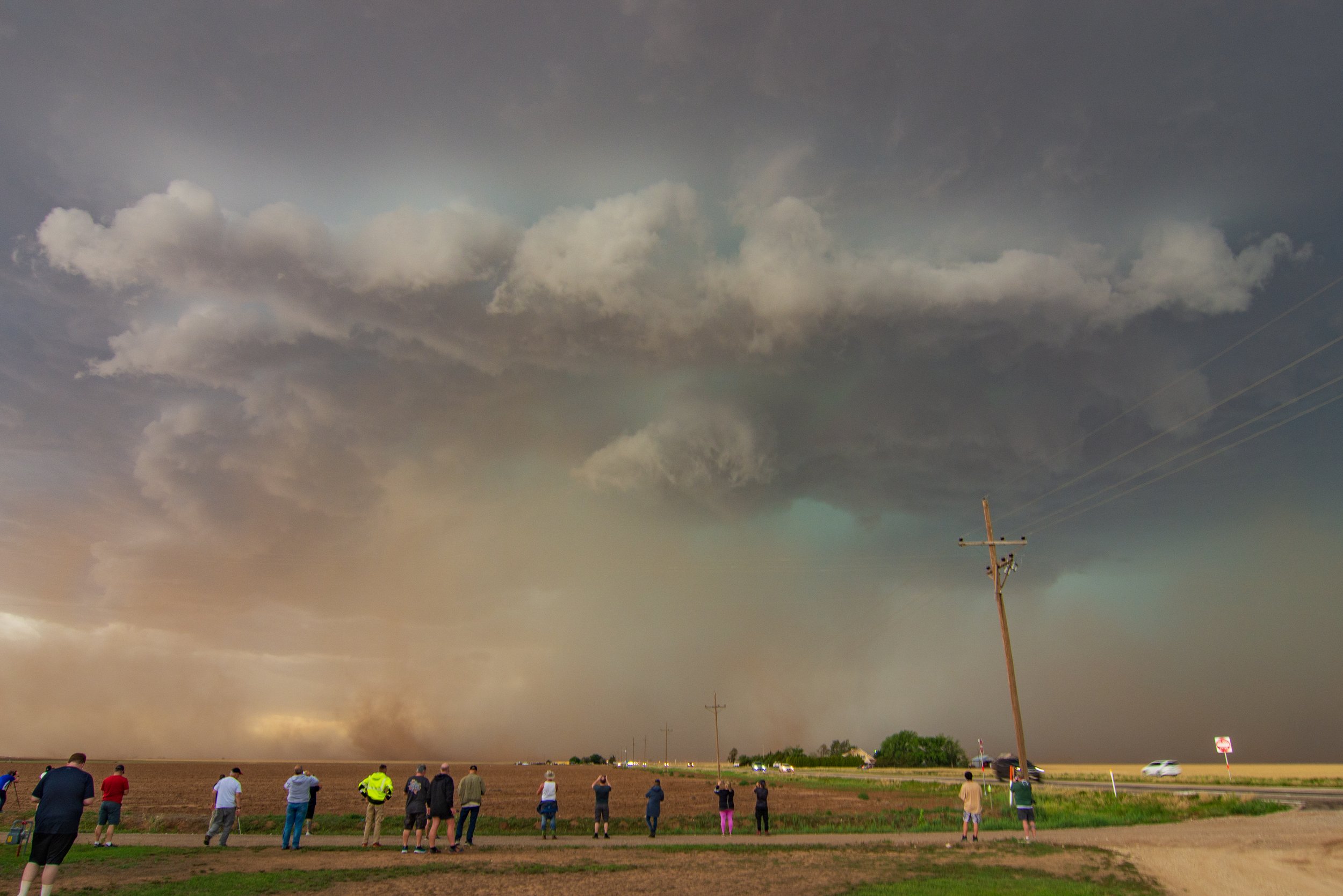
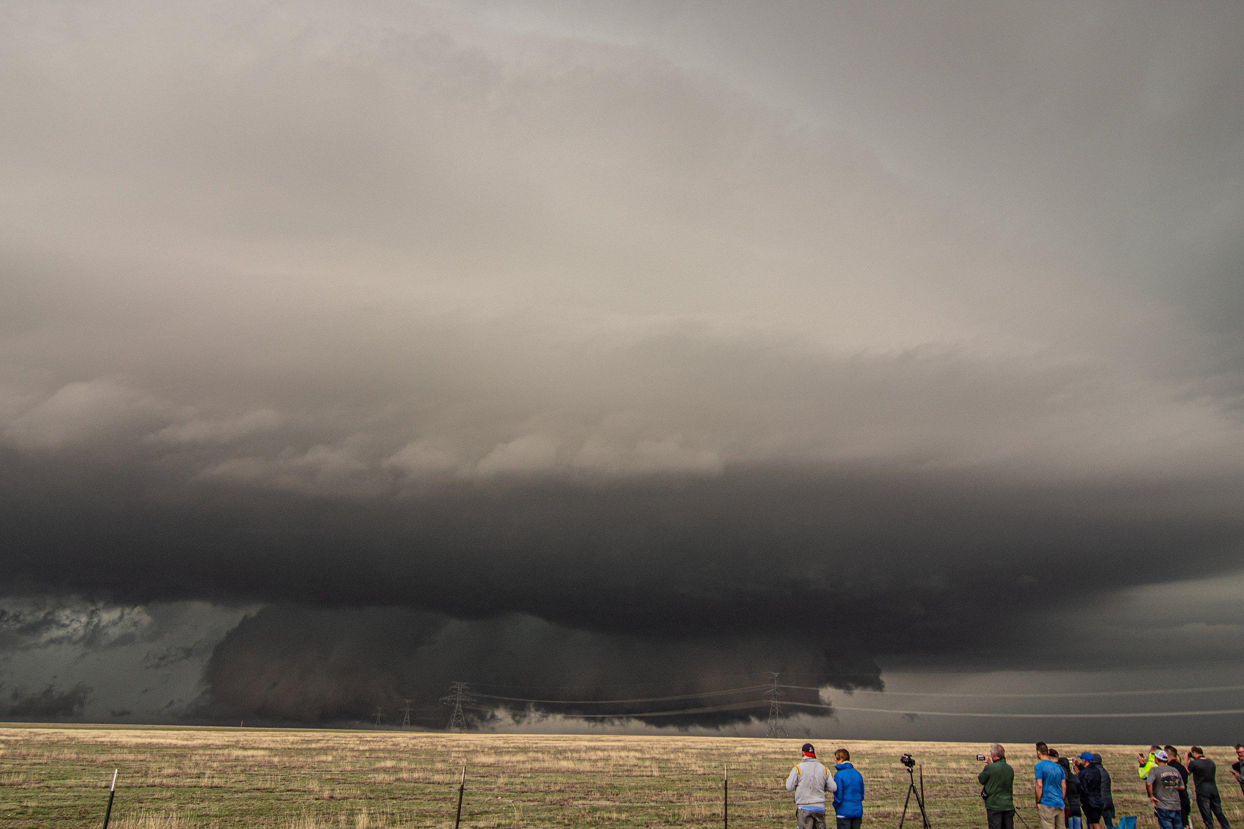
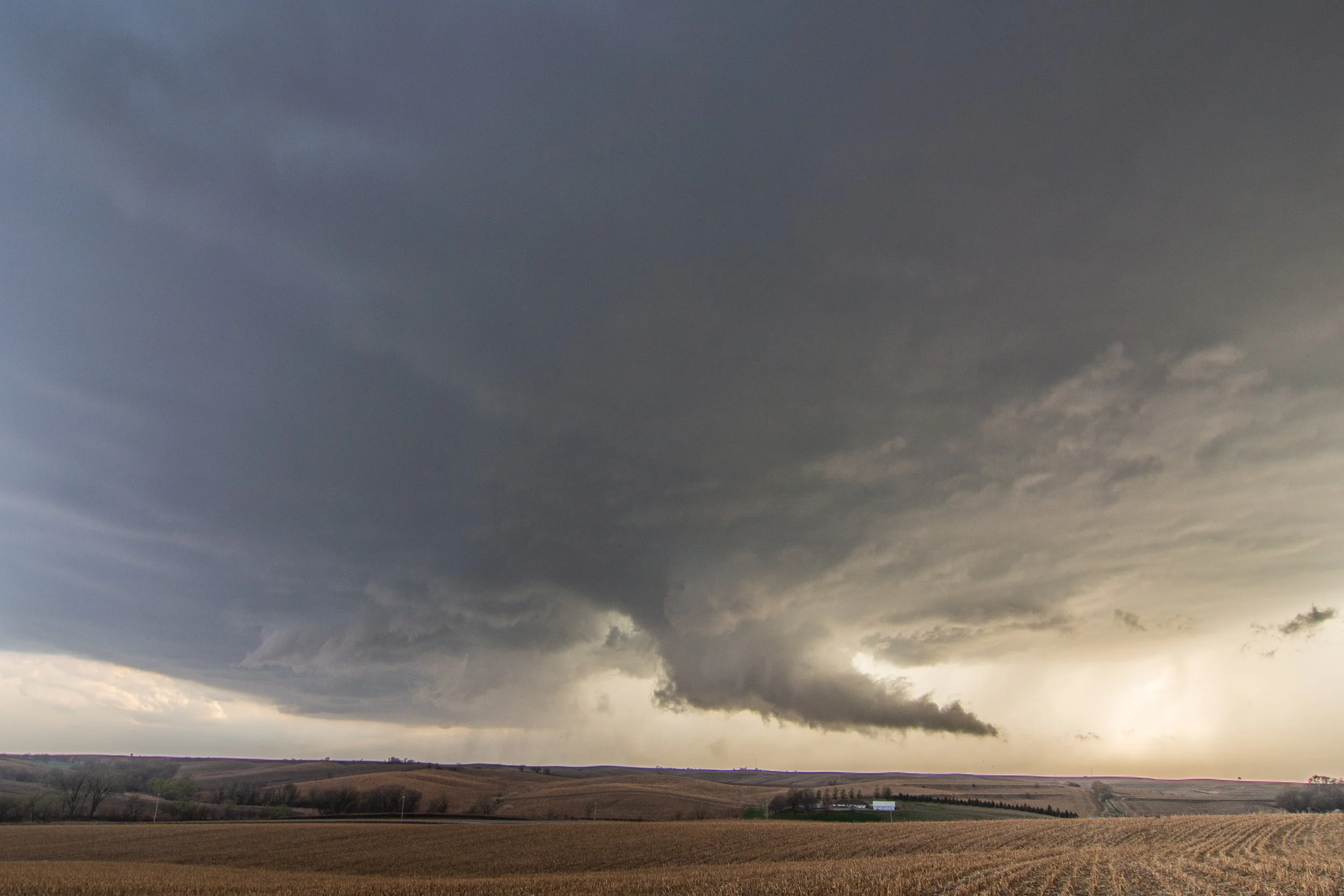
Very weak tornado occurring here behind the tree. Condensation funnel to the ground and all.

Love this shot. Action area to the left, hail/rain core to the right. Time to escape!

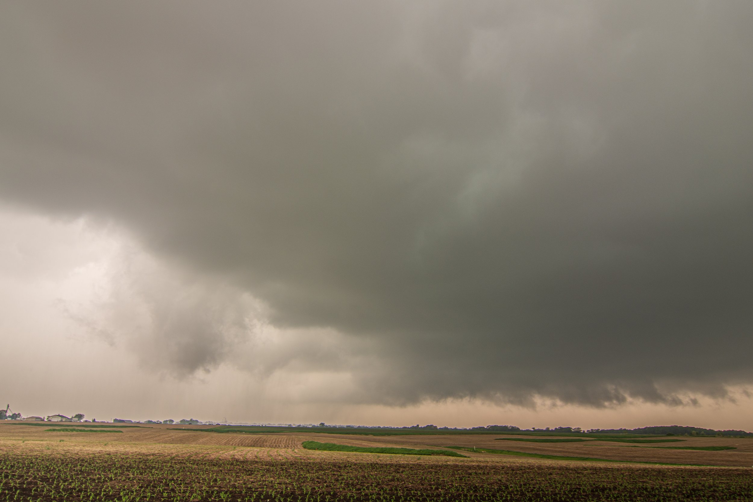
Shelf cloud coming in fast!

Beautiful storm moving over the corn fields of northwest Iowa.

Tornado warned storm about to overtake Le Mars, Iowa.

STORM REPORTS:

STORM PREDICTION CENTER OUTLOOKS:

JULY 27, 2023 MINNESOTA: MUCH NEEDED MID SUMMER SEVERE STORM


Really pleased with how this day went considering the blah storm season we had in Minnesota in 2023. I originally was going to blast north towards the true boundary near St. Cloud, but stopped halfway through the Twin Cities metro as a storm broke the cap west of New Ulm. I had been eyeing that area all day so quickly got down there and intercepted the storm just north of Franklin, MN and sat in nearly the same spot for 2 hours watching this thing. It was great and definitely something I needed! The storm had some decent structure at times and was surprisingly photogenic. Constant thunder from this storm and could hear the hail roar from above at times. Really cool to get out there and watch this supercell as new updrafts kept forming on some kind of pinch point on the tail end of the boundary, possibly right on a weak surface low that was stationary.

Stopped to take a quick photo as I approached the severe thunderstorm near Winthrop, Minnesota.

Goofy high based lowerings on this storm when I first got on it. Interesting features though.

Western updraft starting to take over with action areas near the core on the right side of the image.

Skinny updraft pumping away and starting to produce a strong rain/hail core here. Love all the features of the storm in this shot, especially the couple weird looking bases.

Heavy rain and hail core opening up north of Franklin, Minnesota.

Decent storm base here with scud rising up into it.

I was surprised to see this bowl lowering form on the new western storm rather quickly as it was taking over the show. VERY slow rotation but it was rotating and condensating for about a minute.

The death of a storm right here. Might be my favorite shot of the day thought. Skinny updraft and almost an LP look to it with an eroding base. Time to head home!

New updraft to my west as the storm as I was on died and I was heading back home.

Couple of towers still trying to hold on at sunset.

STORM REPORTS:

STORM PREDICTION CENTER OUTLOOKS:

JULY 24, 2023 MINNESOTA: STORM CHASE FROM MY BACK YARD


Severe thunderstorm with hail sliding right by my house in Farmington, Minnesota. Taken literally from my back yard.

Most interesting part of the short chase. This circulation was trying to wrap up and was rotating but quickly dissipated.

Area of circulation rotating around in this C shape on this severe warned storm.

Storm wasn’t doing all that much so I decided to head home, but stopped one last time to get a shot of the updraft near Northfield, Minnesota.

Radar loop of the storm as it dove straight south through southeast Minnesota.

STORM REPORTS:

STORM PREDICTION CENTER OUTLOOKS:

MAY 27, 2023 COLORADO: HIGH BASED FUNNEL AND GREAT SHELF CLOUD


Supercell exploding just southwest of Greeley, Colorado and coming my way.

Storm approaching Greeley with a ragged looking base, looking like it is starting to gust out already with a shelf cloud.

Storm starting to look a little better here as the base becomes better organized with a clear slot developing behind it.

Headed east of Greeley on highway 34 towards Wiggins, Colorado to watch a couple new developing storms that were out on their own with good, clean inflow and better instability.

High based funnel cloud starting to form after a while as the storm was slowly headed towards me.

Funnel cloud on the left trying its best to condense and reach towards the ground. Never really got all that close though.

Another funnel cloud right in the bottom middle of the image as I headed north to try and stay ahead of the intense core. This was looking southwest off highway 89 north of Orchard, Colorado.

Battled getting back ahead of this storm, but managed to do so near Stoneham, Colorado as it was creating a nice shelf cloud.

Beautiful whale’s mouth underneath the shelf as it was about to overtake me. Time to leave!

Gustnado on the leading edge of the shelf cloud. Can see it on the bottom middle of the image.

Fully underneath the whale’s mouth here.

Awesome shelf cloud structure as I got back out ahead of the storm.

Final pano shot from my iPhone as I ended the chase after nearly two weeks of being on the road.

STORM REPORTS:

STORM PREDICTION CENTER OUTLOOKS:

MAY 26, 2023 NEW MEXICO: ANOTHER AMAZING STORM IN THE SOUTHERN HIGH PLAINS


Finally getting to the severe warned storm (previously produced a tornado) near Vaughn, New Mexico.

Kept blasting west to intercept the storm near Encino, New Mexico.

Amazing storm as we were getting pelted by golf ball hail to the south of Encino.

This structure is top notch.

Brief funnel cloud forming underneath the right side of the storm base.

Big time hail core raging and heading right towards Encino. Forced us to go around the long way and not go back the way we came.

Stopped to look back at the storm with the setting sun east of Vaughn, New Mexico.

Last shot of the day as we headed back east at the end of the chase.

STORM REPORTS:

STORM PREDICTION CENTER OUTLOOKS:

MAY 24, 2023 NEW MEXICO: BEST STORM OF THE YEAR!


Really enjoy the thrill of the tour guests watching an intense storm develop near San Jon, New Mexico. Had a nice spot to line up and enjoy the view!

New updraft going up quickly on a southern storm as we pursue.

The beginning of what will become the great storm of the day and one of the storms of the year.

Made it up the ridge on Hwy 469 to view the developing storm north of Wheatland, New Mexico.

This was a reported tornado near Wheatland, New Mexico. The white lowering that is right in the middle of the image.

Rear flank downdraft wrapping around what was a tornado that may have still been down.

Big time supercell churning away and becoming outflow dominant.

Here it comes!

Incredible storm after sunset near Farwell, Texas.

My favorite shot of the day. This supercell structure is absolutely top notch and some of the best I have ever seen!

Another awesome one!

STORM REPORTS:

STORM PREDICTION CENTER OUTLOOKS:

MAY 23, 2023 TEXAS: SPINNING MOTHERSHIP SUPERCELL & FUNNEL CLOUDS


Our initial storm intensifying quickly near Farwell, Texas.

Big, broad mesocyclone now forming on the storm as it begins to mature.

Scud rising into the base of the wall cloud and tightening up in the process.

Two action areas. The old mesocyclone on the right and the new action area on the left becoming organized.

Awesome storm with spinning mesocylone and funnel near Farwell, Texas! Can see the dirt being picked up by the rear flank downdraft coming around the southwest side of the storm.

We blasted east on Hwy 70 to intercept a new storm that was already tornado warned and producing this giant wall cloud near Floydada, Texas. My thought at the beginning of the day is this would be our best storm of the day.

Big lowering and spinning storm rooted right on a boundary!

Wow what a storm with rotating action area and a lot of condensing scud trying to organize under the base.

Awesome wall cloud that was the best attempt of this storm to produce a tornado near Floydada! What a scene.

Great colors at sunset near Ralls, Texas.

STORM REPORTS:

STORM PREDICTION CENTER OUTLOOKS:

MAY 22, 2023 TEXAS: INCREDIBLE STORM STRUCTURE IN WEST TEXAS


First big storm of the day exploding near Tulia, Texas.

Funnel cloud already on the storm just east of Tulia.

Interesting feature on the wall cloud. Not a funnel but certainly a look-alike! This is scud rising into the base underneath the updraft.

Funnel cloud and rapid condensation into the wall cloud on the storm east of Tulia.

Possible funnel cloud being the white feature in the middle of the image. Was rotating and right next to the clear slot punching in behind it.

Blasted south to get to the storm near Cone, Texas. Had a lowering and solid base when we arrived.

Mammatus clouds! Gotta love them.

Intense cores of these severe warned storms! Big time hail in there.

Got to love chasing in the Texas Panhandle. Unobstructed views for days.

What a storm!

A white funnel here as this thing was spinning like crazy and trying to condense while the storm exhibited a TVS signature. Much too high-based to have a tornado touch down here though.

Our awesome tour guests enjoying the beast of a storm coming right at them!

Still good structure on this storm as it rolled over the canyonlands near Dickens, Texas.

Beautiful storm over the canyons.

SPC STORM REPORTS:

STORM PREDICTION CENTER OUTLOOKS:

MAY 18, 2023 TEXAS: SLOW MOVING, TORNADO WARNED STORM SPINNING AWAY NEAR AMARILLO


First look at the storm looking west off Hwy 136 towards Gluck, Texas.

Supercell taking shape and inching closer as a wall cloud starts to form.

Caught this bolt with my iPhone. Hence the reason that top part of the image is blown out, but still a cool shot!

Nice wall cloud taking shape here. Really starting to look interesting! Storm is now tornado warned and we haven’t moved at all as it continues to slowly crawl right towards our position.

What a beautiful, intense storm! The structure is incredible and love that twisting inflow tail on the right side of the mesocyclone.

Really interesting lowering/wall cloud on the middle-right side under the meso and tucked away back there. Could have easily touched down as a tornado here.

Just awesome supercell structure! An absolute beauty of a storm.

The Silver Lining Tours guests are sure enjoying that inflow tail and reforming wall cloud now.

Insane ground scraping wall cloud right in our faces. Such a surreal moment watching this storm. A tornado was reported on this storm but we could never see if anything touched down from our vantage point through the life cycle.

STORM REPORTS:

STORM PREDICTION CENTER OUTLOOKS:

MAY 17, 2023 TEXAS: QUALITY STORMS NEAR PAMPA


First storm of the day starting to crank up near Pampa, Texas.

Beginnings of a supercell as it becomes better organized with a dark, flat base and a mesocyclone forming as noted by the striated look to the tilted updraft.

Storm still morphing and intensifying while other storms just to the north started catching our eye.

Wall cloud now fully developed on a new storm in the area. This ended up being our storm of the day that we followed into the evening.

Beautiful storm twisted up as sunset was upon us. Starting to crank out some lightning!

Love the lightning and storm structure in this shot.

STORM REPORTS:

STORM PREDICTION CENTER OUTLOOKS:

MAY 13, 2023 IOWA: SUPERCELLS AND TORNADO CHASE WITH FAMILY


Heading south on the Hwy 14 bridge over Lake Red Rock to intercept the initial tornado warned storm south of Monroe, Iowa.

Got west towards Pleasantville, Iowa to view the hook echo and action area. The mesocyclone was slowly rotating here.

Wall cloud near Knoxville, Iowa that was rotating pretty well here!

First funnel cloud on the left that really tried coming down and condensing near Knoxville.

Another weak funnel that developed as we were bailing back east and back across the river to near Pella.

Really thought we were going to have a decent tornado here with the big lowering/wall cloud on the right looking stout near Harvey, Iowa.

Great shot of the kids in front of the rotating wall cloud! They had a really good time on this chase.

Nice funnel near Harvey that was reported as a tornado. We could not confirm ground contact but would not be surprised at all if it produced.

Rain curtains whipping underneath this lowering, possible funnel near Harvey, Iowa. Video will be nice to look at from this point.

Very suspicious shot here of a possible tornado west of Harvey, Iowa as it became rain-wrapped on the tornado warned storm. Best hook echo of the day and we drove south on Hwy T17 just after it passed and saw a lot of tree debris and other things that were blown around. Can see chasers bailing out of there heading back north from this thing.

STORM REPORTS:

STORM PREDICTION CENTER OUTLOOKS:

APRIL 19, 2023 IOWA: TORNADO AND FIRST CHASE OF THE YEAR


Initial severe warned supercell starting to crank up near Blencoe, Iowa. Already have a nice lowering in place underneath the stout updraft.

Storm approaching our position, coming directly at us as we stay put just northeast of Blencoe, Iowa off of Hwy E54.

Our position northeast of the developing supercell as indicated by the crosshairs.

Beautiful looking storm as we stand our ground. Nice inflow streamers into the updraft and core.

Core moving closer but main portion looks to move just to our north as we are directly in the primary low level inflow region next to the forward flank core. Hail about to commence!

Primarily quarter size hail on the storm with some bigger stones mixed in here and there.

Storm now a bit disorganized here but is trying to get its act together with a slowly rotating mesocyclone right in front of us near Ute, Iowa.

Here we go. Beginnings of a real wall cloud starting to form with condensation tail cloud on the backside and wrapping around the new mesocycline.

Funnel cloud here on the left side of the maturing wall cloud. Storm taking on great structure at this point.

Funnel wrapping up here in the middle and not able to condense further to the ground. This whole area was rotating and you can see this in the video.

New wall cloud trying to form after the first attempt at a tornado. This did not hold on very long as it quickly became undercut.

Storm holding on nicely with an action area still present and capturing our attention near Charter Oak, Iowa.

Funnel cloud near Deloit, Iowa trying to condensate to the ground. Keep coming down buddy!

We have a tornado! Faint debris cloud underneath at this point. Can see it better in the video.

Definitely a noticeable debris cloud under the tornado at this point!

And that’s all she wrote with this one as the short-lived tornado lifted.

Beautiful structure of the storm after sunset and sparking like crazy east of Deloit as we progressed towards the Boyer and Breda areas.

Funnel cloud look-alike as organized scud was being pulled into the base on the left side of the image.

STORM REPORTS:

STORM PREDICTION CENTER OUTLOOKS: