JUNE 19TH MINNESOTA: TORNADO WARNED SUPERCELL

 
DSC_0381
DSC_0381

Intercepting a tornado warned supercell west of Lake Shore at the intersection of Cty Rd 1 and 88th St.  Nicely structured storm with inflow streamers, large base and wall cloud.  The lowering/wall cloud was tough to make out until the storm got closer due to being shielded by rain.

DSC_0382
DSC_0382

Looking a bit to the right of the base and updraft at the intense core that went on to produce baseball size hail near Nisswa.

DSC_0385
DSC_0385

A closer view of the wall cloud west of Lake Shore, Minnesota. There was clear rotation at this point and fairly fast condensation into the base.

DSC_0387
DSC_0387

Wall cloud started to become more ragged as it approached my location but still evident tucked in right by the core and underneath the base.

DSC_0389
DSC_0389

Wall cloud forming over North Long Lake to my east.  This is where I came across a vehicle that was down in the ditch and backwards, close to the lake.  I checked on him and the guy was ok and had already called for help.

DSC_0392
DSC_0392

Wall cloud becoming better organized east of North Long Lake as I watched to the west.  Attempted to catch up with the storm right after this but got slowed going through Brainerd.

DSC_0398
DSC_0398

View of the strong and still tornado warned high precipitation (HP) supercell moving north of Mille Lacs Lake. This was taken in Garrison looking northeast.

DSC_0399
DSC_0399

Double rainbow north of Ogilvie, Minnesota.  WHOA, A DOUBLE RAINBOW!!

DSC_0410
DSC_0410

Base of the former tornado warned storm, and lightning, near Big Lake, Minnesota at the end of the day.

MESOSCALE DISCUSSION:

MN MD
MN MD

SEVERE THUNDERSTORM WATCH:

ww0273_radar_init
ww0273_radar_init

STORM REPORTS:

160619_rpts_filtered

SPC OUTLOOKS:

day1otlk_20160619_1630_prt
day1probotlk_20160619_1630_hail_prt
day1probotlk_20160619_1630_torn_prt
day1probotlk_20160619_1630_wind_prt

JUNE 14TH MINNESOTA: NUMEROUS FUNNEL CLOUDS & 2 TORNADOES


Longer version featuring highlights from the entire chase:

DSC_0227
DSC_0227

Wall cloud lowering on the first storm near Arco, Minnesota.  This cell did not look like much on radar but was spinning like mad and had solid inflow!

DSC_0231
DSC_0231

First funnel cloud of the day on the storm near Arco, Minnesota.  This storm produced several more funnels.

DSC_0254
DSC_0254

Another funnel that was rapidly rotating and condensing near Porter, Minnesota.  This funnel was 3/4 of the way to the ground but we cannot confirm there was any touchdown in the field right in front of us.  I believe we were on Highway 7 to the south of Porter at this time.

DSC_0263
DSC_0263

Another view as the storm moved just to our north and the wall cloud was really tightening up with a continuous funnel cloud.  The wall cloud occluded soon after this as the funnel dissipated.

DSC_0268
DSC_0268

Took a little while but we eventually got on the next storm after the first one died.  This wall cloud was forming with apparent inflow scud fingers near Big Stone Lake on the Minnesota/South Dakota border.

DSC_0273
DSC_0273

Another wall cloud quickly forming on the storm southeast of Beardsley, Minnesota.

DSC_0283
DSC_0283

Another funnel cloud quickly formed and dissipated on the storm.  Very high sheared air feeding these storms at this point but not a lot of instability.

DSC_0293
DSC_0293

The most pronounced and lowest funnel cloud of the day that did not produce a tornado.  Never could see if this touched down but it had to be close.

DSC_0311
DSC_0311

Hard spinning storm updraft and developing funnel cloud southeast of Beardsley and southwest of Barry, Minnesota.  Strong inflow occurring at this point.

DSC_0333
DSC_0333

Funnel cloud forming out of the hard spinning and tightening wall cloud shortly after the previous photo.  A textbook scenario of fast inflow to the right wrapping into the notch and rear flank downdraft winds cutting around the backside of wall cloud/updraft to eventually produce a beautiful tornado.

DSC_0355
DSC_0355

Rope funnel cloud starting to condense to the ground as the storm was moving north of our location.

Beardsley MN Tornado

Video still of tornado and white debris cloud.

Beardsley MN Tornado 2

Another video still showing stretching vorticity in action!  Long, white rope tornado.

Beardsley MN Tornado 3

Another video still of the long tube.

MESOSCALE DISCUSSION:

MN MD
MN MD

TORNADO WATCH:

ww0255_radar_init
ww0255_radar_init

STORM REPORTS:

160614_rpts_filtered

SPC Outlooks

Outlooks
Outlooks
 

MAY 8TH OKLAHOMA: TORNADO WARNED SUPERCELL & ROTATING WALL CLOUDS

 
DSC_0056
DSC_0056

Developing storm in the foreground with beautiful crepuscular rays coming through the clouds.

DSC_0060
DSC_0060

First developing storm north of Woodward, Oklahoma.

DSC_0065
DSC_0065

Wall cloud/lowering on the storm as it was starting to get its act together near Freedom, Oklahoma.

DSC_0067
DSC_0067

Rotating wall cloud underneath the updraft of the storm west of Alva, Oklahoma.

DSC_0068
DSC_0068

Another view of the condensing, rotating wall cloud.

DSC_0072
DSC_0072

Strong updraft as the storm reaches its strongest point.

DSC_0073
DSC_0073

New wall cloud forming after the old one weakened and occluded.

IMG_3986
IMG_3986

iPhone shot of the wall cloud west of Alva, Oklahoma.

DSC_0077
DSC_0077

Doppler on Wheels (DOW) heading down the road to re position as the wall cloud we were watching weakened and dissipated.

DSC_0080
DSC_0080

Strongest rotation of the day on this wall cloud that was tightening up near Alva, Oklahoma.  This likely would have produced a tornado at this point if the dewpoints were higher than the lower to middle 60s.

DSC_0085
DSC_0085

Condensing lowering on the wall cloud, possibly funnel.  Very tilted updraft from left to right on this storm.

IMG_3987
IMG_3987

My position (blue crosshairs) relative to the hook echo north of Alva, Oklahoma.

MESOSCALE DISCUSSIONS:

OK MD
OK MD
OK MD 2
OK MD 2

TORNADO WATCH:

ww0149_radar_init
ww0149_radar_init

STORM REPORTS:

160508_rpts
160508_rpts

SPC OUTLOOKS:

day1otlk_20160508_1630_prt
day1probotlk_20160508_1630_hail_prt
day1probotlk_20160508_1630_torn_prt
day1probotlk_20160508_1630_wind_prt

MAY 7TH COLORADO: SUPERCELL & FUNNEL

 
DSC_0040
DSC_0040

Supercell storm intensifying and still south of the warm front near Abarr, Colorado.

DSC_0041
DSC_0041

Wall cloud developing on the storm.  Notice clear slot behind the wall cloud where the rear flank downdraft cut was occurring.

DSC_0043
DSC_0043

Another shot of the storm as it was getting closer.  Sharp, flat base to the supercell at this point.  Dissipating wall cloud on the far right.

DSC_0047
DSC_0047

Silver Lining Tour guests and crew enjoying the show underneath the mammatus clouds.

DSC_0050
DSC_0050

Large storm base really taking on a C shape as the RFD cut became larger.

DSC_0054
DSC_0054

The storm near Vernon, Colorado as we began departing for Oklahoma City.  This storm went on to produce several tornadoes that we missed due to having to be back in Oklahoma City that night.

MESOSCALE DISCUSSION:

CO MD
CO MD

TORNADO WATCH:

ww0143_radar_init
ww0143_radar_init

STORM REPORTS:

160507_rpts
160507_rpts

SPC OUTLOOKS:

day1otlk_20160507_1630_prt
day1probotlk_20160507_1630_hail_prt
day1probotlk_20160507_1630_torn_prt
day1probotlk_20160507_1630_wind_prt

May 6TH WYOMING: SUPERCELL TIME LAPSE

 
DSC_0008
DSC_0008

Supercell storm rolling off the Laramie Range near Chugwater, Wyoming.  You can see the feeder bands from all directions into this storm.  Pulling in all the moisture that it can, considering dewpoints were only in the middle 40s.

DSC_0020
DSC_0020

Nicely structured mothership supercell over the foothills of the Laramie Range in Wyoming.  You can see how this storm is rotating with the clouds twisting into the updraft.

DSC_0025
DSC_0025

Another shot of the supercell as it was starting to move out over the flatter Plains near and east of Chugwater.  Storm starting to weaken some at this point.

DSC_0031
DSC_0031

Storm weakening but holding onto some good structure with well defined high-based inflow bands and storm base.

DSC_0033
DSC_0033

View of the storm as another core was starting to open up right in front of us.  Was popping some cg lightning with this new core but could not capture any of the lightning in a photo.

STORM REPORTS:

160506_rpts
160506_rpts

SPC OUTLOOKS:

day1otlk_20160506_1630_prt
day1probotlk_20160506_1630_hail_prt
day1probotlk_20160506_1630_torn_prt
day1probotlk_20160506_1630_wind_prt

April 26TH KANSAS: SUPERCELL & ROTATING, TIGHT WALL CLOUD

 
DSC_0788
DSC_0788

Initial wall cloud on the first tornado warned storm near Caldwell, Kansas.

DSC_0794
DSC_0794

Funnel on the first tornado warned storm just to the north of Caldwell, Kansas near the Oklahoma border.  This funnel persisted for a few minutes before dissipating.

DSC_0814
DSC_0814

Rotating wall cloud tightening up into a funnel near Mayfield, Kansas.  Nearly produced a tornado at this point!

DSC_0815
DSC_0815

Zoomed out view of the tightened up rotating wall cloud and funnel near Mayfield, Kansas.  This area of focused rotation dissipated after the occlusion.

DSC_0823
DSC_0823

This scared dog jumped in the through the passenger door and into the driver's seat when we weren't looking, ha ha!!  Poor guy...felt bad kicking him out in the rain but couldn't take him with.

DSC_0839
DSC_0839

Severe thunderstorm over the wheat fields of southern Kansas.   Storm starting to become outflow dominant and form a shelf cloud at this point.

DSC_0866
DSC_0866

Shelf cloud and storm about to overtake us and a train near Wellington, Kansas.

DSC_0871
DSC_0871

Looking at the underside of the shelf cloud, whale's mouth, as it passed over near Wellington, Kansas.  Visually striking blue/green/aqua colors under this shelf.

IMG_3218
IMG_3218

Wes Hyduke's panorama of the underside of the shelf cloud at the end of the day near Wellington, Kansas.

MESOSCALE DISCUSSIONS:

ks MD
ks MD
OK MD
OK MD

TORNADO WATCHES:  

ww0108_radar_init
ww0108_radar_init
ww0109_radar_init
ww0109_radar_init

STORM REPORTS:

160426_rpts_filtered

SPC OUTLOOKS:

day1otlk_20160426_1630_prt
day1probotlk_20160426_1630_hail_prt
day1probotlk_20160426_1630_torn_prt
day1probotlk_20160426_1630_wind_prt

MARCH 23RD MISSOURI & IOWA: SEVERE THUNDERSTORMS

 
DSC_0726-2
DSC_0726-2

Inflow tail into the storm near Westboro, MO.

DSC_0731-2
DSC_0731-2

Caught a lightning strike in the intensifying storms near Westboro, MO.

DSC_0737-2
DSC_0737-2

Storm from above, now severe warned, dumping a hail core.

DSC_0741-2
DSC_0741-2

Ragged lowering at the base of the storm at the Hwy C and 59 intersection.

DSC_0744-2
DSC_0744-2

Rain/hail cores on severe warned storms east of Westboro, MO.

DSC_0746-2
DSC_0746-2

Storms becoming more organized and showing several feeder bands near Blanchard, IA.

DSC_0754-2
DSC_0754-2

Another shot of the severe warned storms just south of Blanchard, IA.

DSC_0756-2
DSC_0756-2

The southern storm in the line coming up at me with high base forming on the southeast side.

mcd0252
mcd0252

Mesoscale discussion issued during the early afternoon.  Hilarious they put a 'wedge-shaped area' in the discussion!

ww0051_radar
ww0051_radar

Tornado watch issued at 3 PM for the area.

SPC OUTLOOKS:

day1otlk_20160323_1630_prt
day1probotlk_20160323_1630_torn_prt
day1probotlk_20160323_1630_hail_prt
day1probotlk_20160323_1630_wind_prt

STORM REPORTS:

160323_rpts_filtered

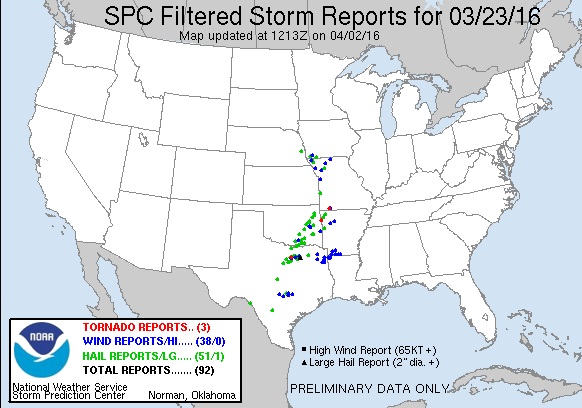
MARCH 23, 2016 CHASE LOG: MISSOURI & IOWA

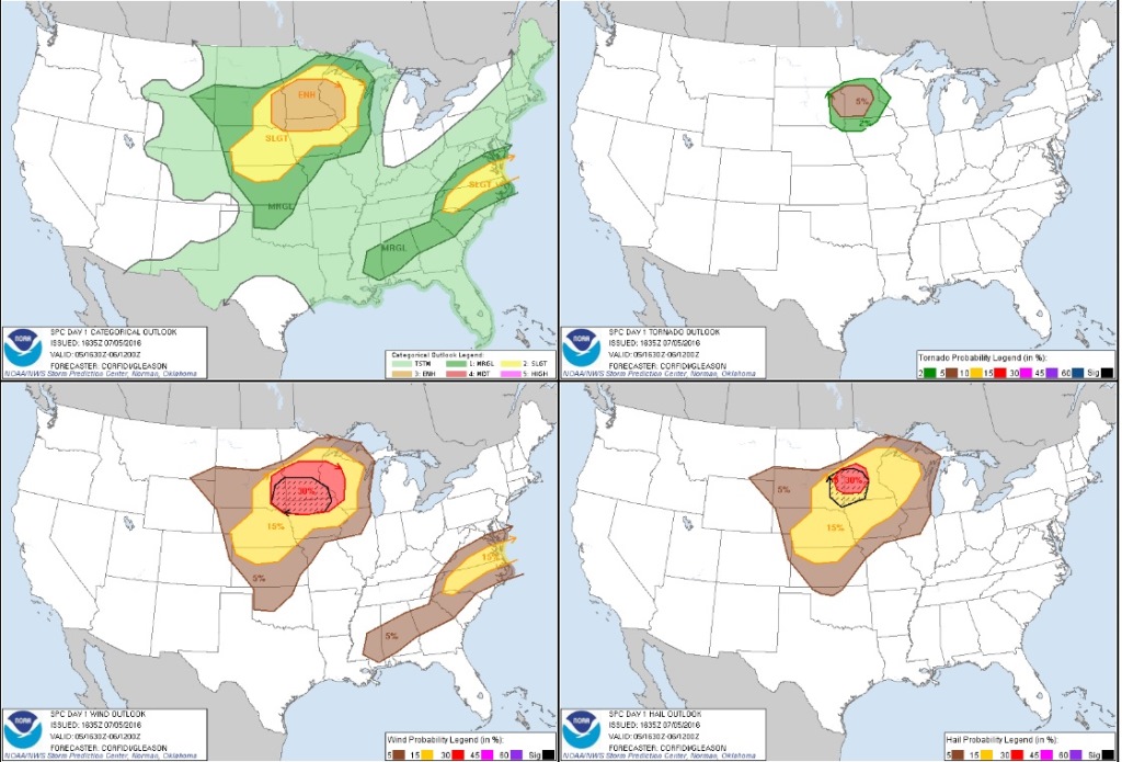
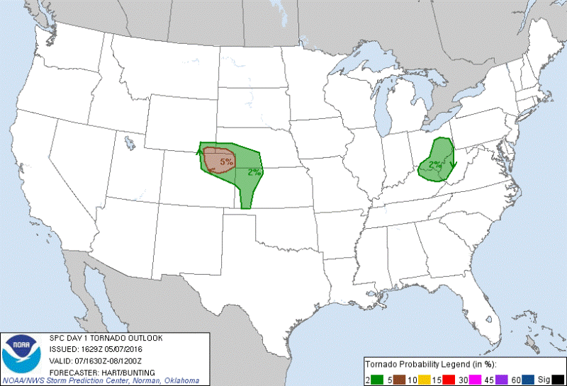
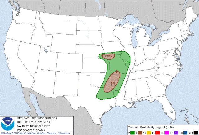
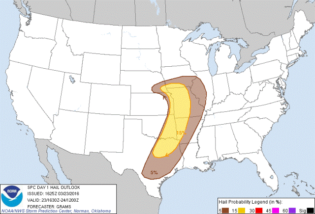
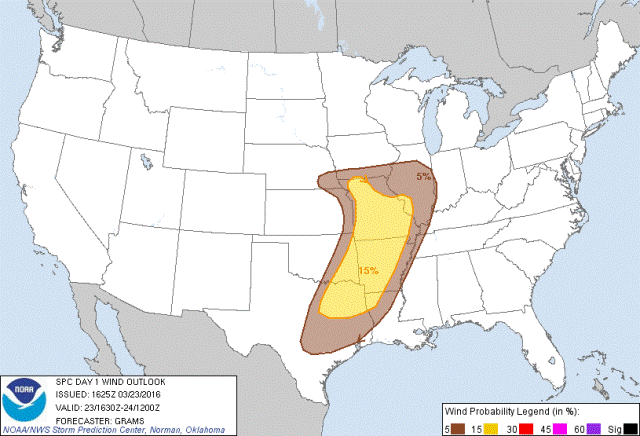
  I decided to chase this day, mainly to kick off the rust from my last chase on July 12, 2015 and to see some decent thunderstorms after the long winter season.  The set-up included a strong upper level trough going positive to negative tilt by later in the day, a 100 kt 500mb jet streak from Kansas into Iowa, and effective shear of 40-50 kts.  At the surface, a surface low moved from near north-central Kansas to southeast Nebraska with a trailing dryline to the south and a near stationary warm front through the southern tier of counties in Iowa.  The plan was to target storms that were expected to develop near and just south of the triple point by 21Z (4pm).  The main concerns for the day were the dewpoints only projected to get into the 52-55F range and be relatively confined to a shallow layer with dry air aloft, and the other concern having to drive back through a blizzard on the northern end of this system in northern Iowa and southern Minnesota.

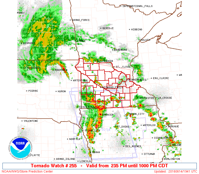
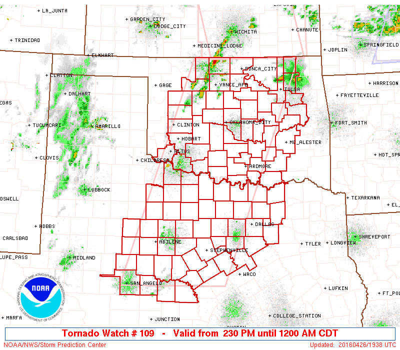
I left that morning and headed south on I-35 to I-80 west, then south on Hwy 148 to Corning and eventually making my way down Hwy 71 to Clarinda.  I stopped here to take a look at the data and grab a bite to eat.  Realizing that storms were likely to first fire in southeast Nebraska and build to the southeast, I headed further west to Shenandoah to wait for initiation, as the town was right on the boundary and wobbling between temperatures from near 60F to lower 70s.  A tornado watch was issued at 3pm for the area, valid until 10pm that evening.  I was honestly a bit surprised with the tornado watch being issues as I had thought a severe thunderstorm watch would be issued instead due the moisture quality issues into the area.

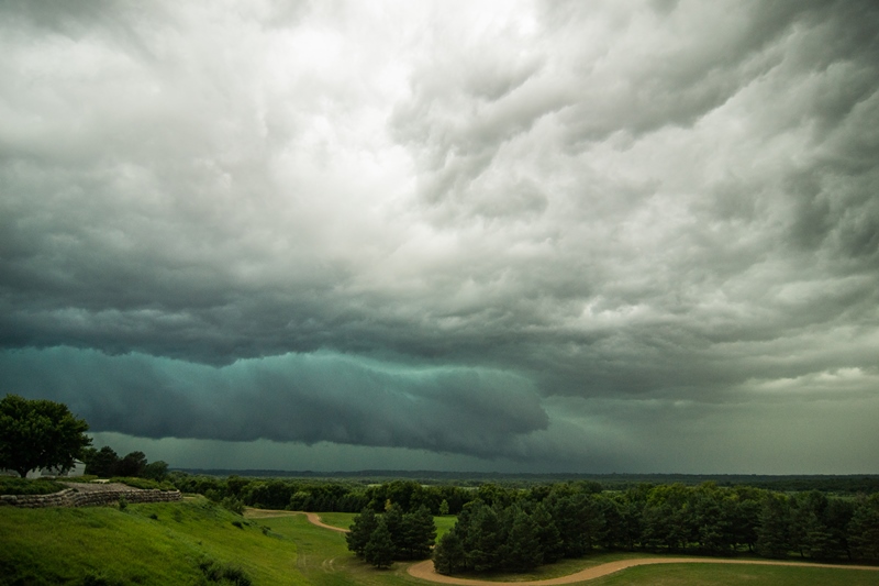
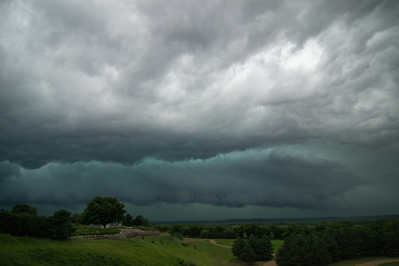
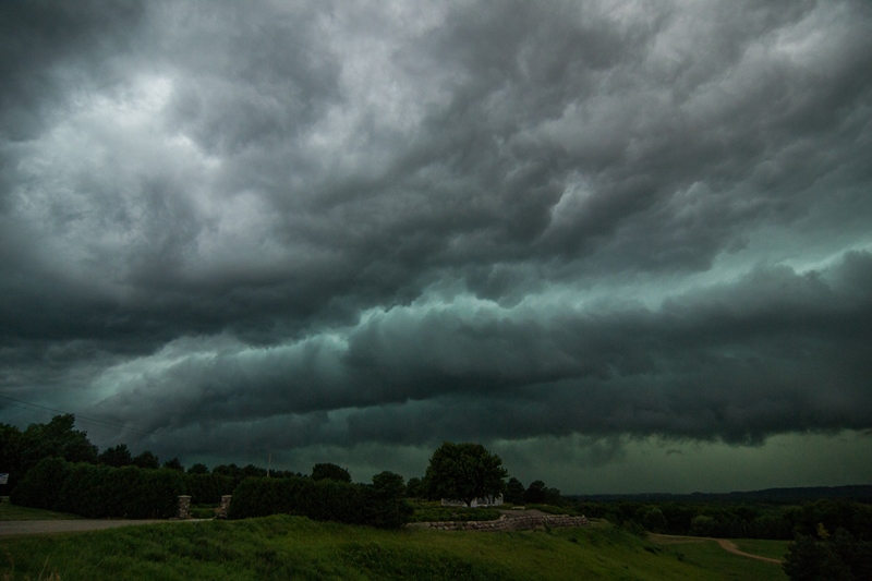
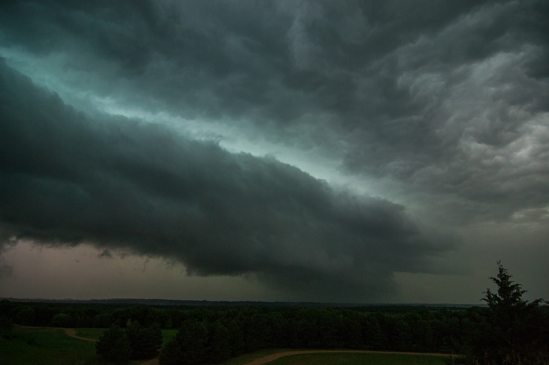
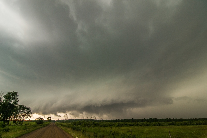
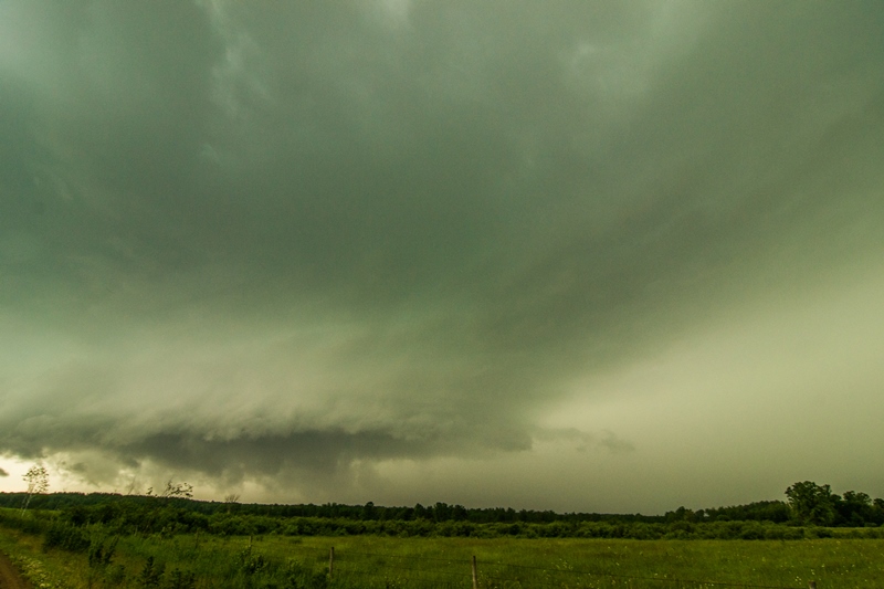
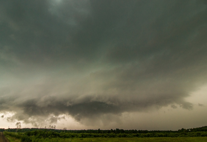
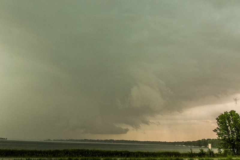
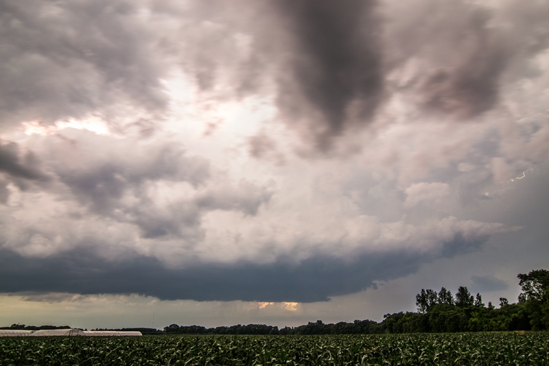
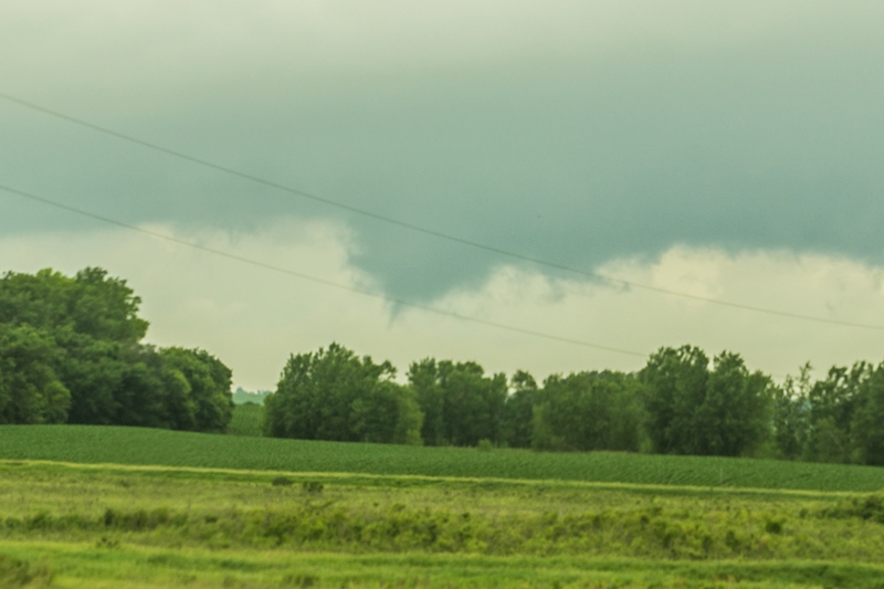
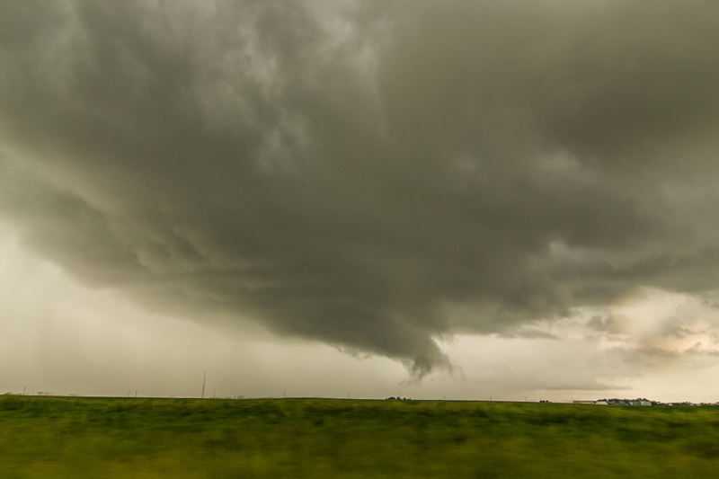
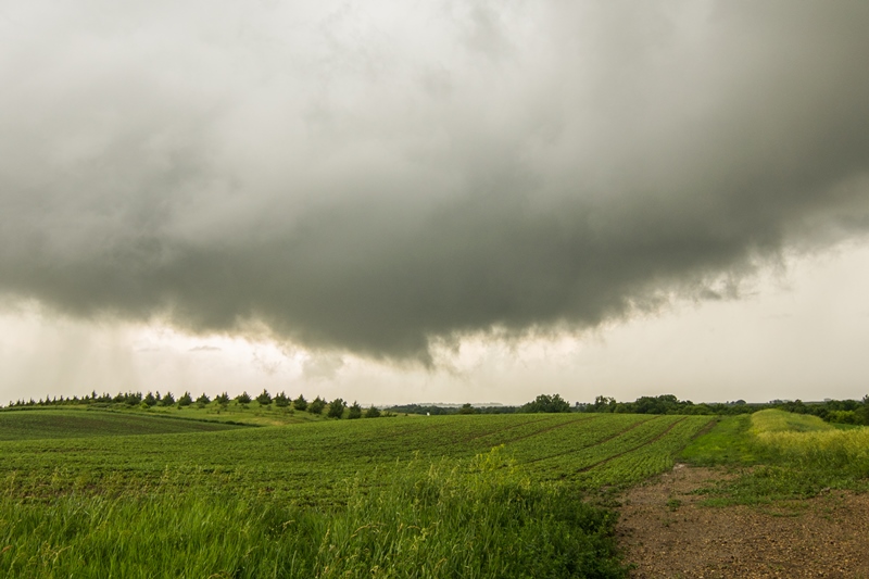
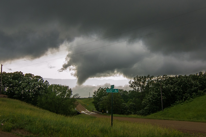
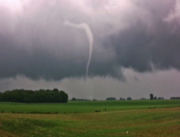
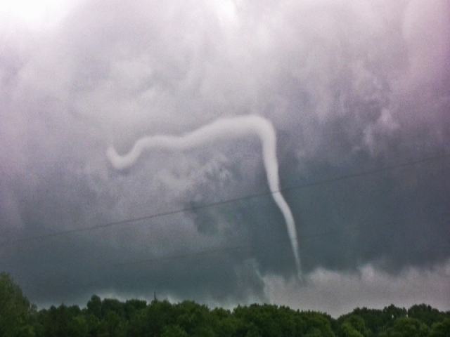
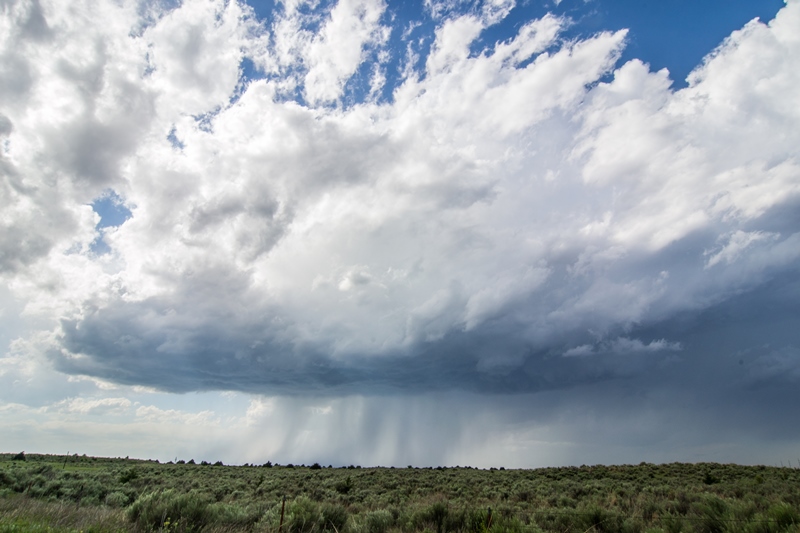
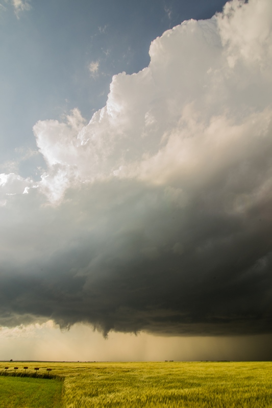
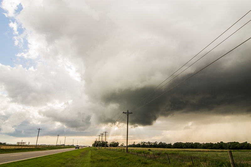
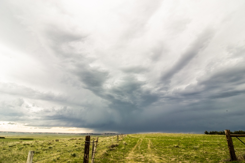
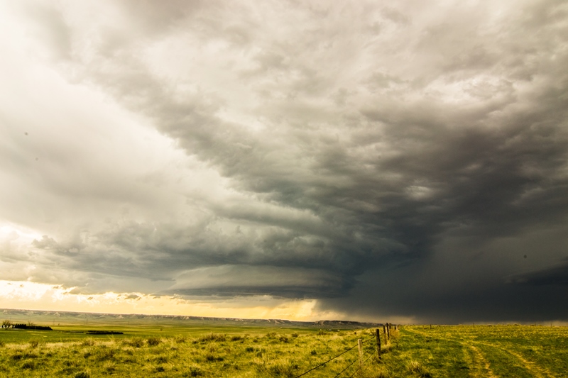
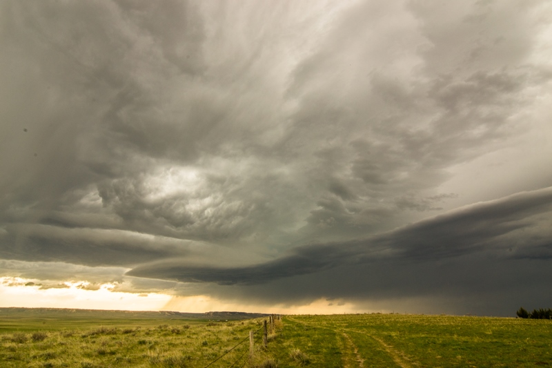
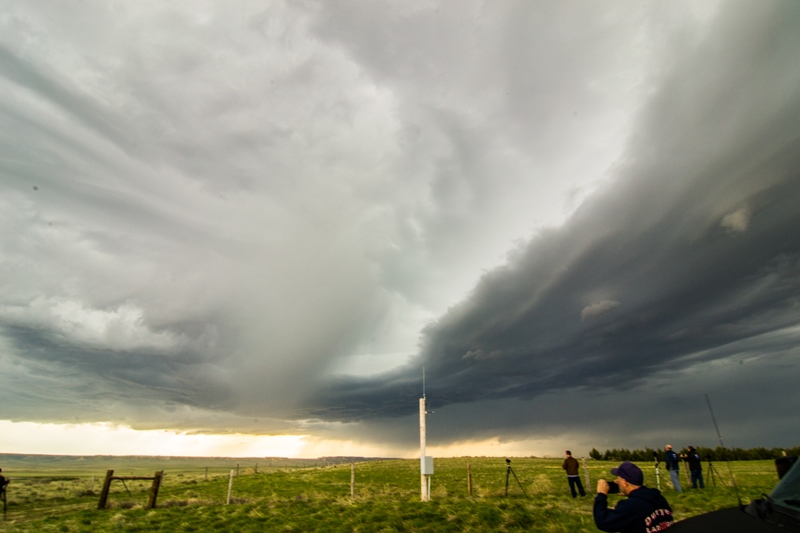
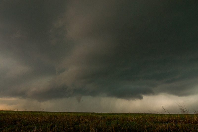
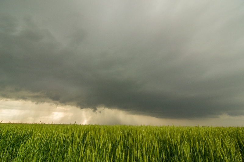
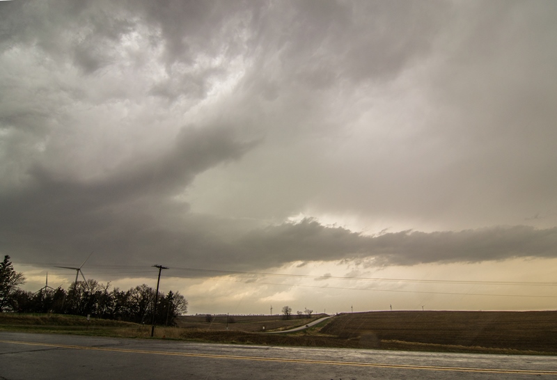
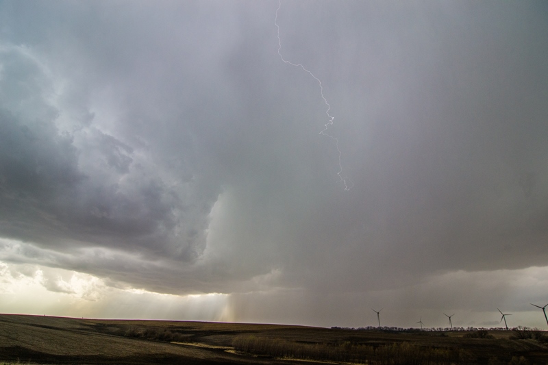
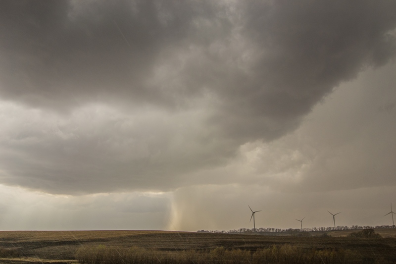
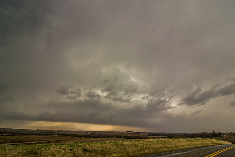
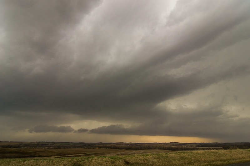
Storms first fired to the west right on the north and east side of the low.  I waited for additional storms to begin forming to my south and, sure enough, cumulus towers started building about 30 minutes after the initial storms to my west.  I traveled south on Hwy 59 and intercepted storms near the intersection of this road and Hwy C, just across the border near Westboro, Missouri.  The storm updrafts were fairly chunky/fluffy going up and did not have that classic, hard look to them, but each storm developed a flat, smooth base and opened up some intense rain and hail cores.  I intercepted 4 separate storms in this area over the next few hours, 3 of which became severe thunderstorm warned for mainly large hail but also damaging winds.  Some of the storms did form some ragged lowerings and had some inflow feeder tails into them with some decent structure but, overall, I did not witness any areas of organized rotation and none ever came close to having any tornado potential.  One particular storm that I followed from east of Westboro north towards Blanchard, Iowa had the best structure of the day with a couple inflow tails and intense cores.  These storms congealed and moved north of the front, so I traveled east to stay out ahead of other storms coming up from the south.  I intercepted one of these storms in Hopkins, Missouri where small hail was coming down so heavy that it was running down the streets in rivers with intense rainfall as well.  Thereafter, I tried to get back out ahead of the storms, traveling east to I-35 and north through Des Moines and home, but managed to stay in the intense rainfall much of the way.  Near Dows, Iowa the heavy rain began transitioning to thundersleet and freezing rain where numerous vehicles were in the ditch, including big rigs.  After 10 miles of treacherous/slow driving, precipitation transitioned to very heavy snow and near white-out conditions.  I slowly made my way north to Mason City and the roads did get a little better to the north of town as the plows had been out.  I ended up eventually making it back to my parents place in southern Minnesota after hours of white knuckle driving.  What a crazy day going from severe thunderstorms to a blizzard, and lower 70s air to upper 20s air!