
MAY 16, 2019 NEBRASKA: SUPERCELL AND TERRIFIC LIGHTNING DISPLAY
Storm developing in front of us with initially elevated base near Grant, Nebraska.
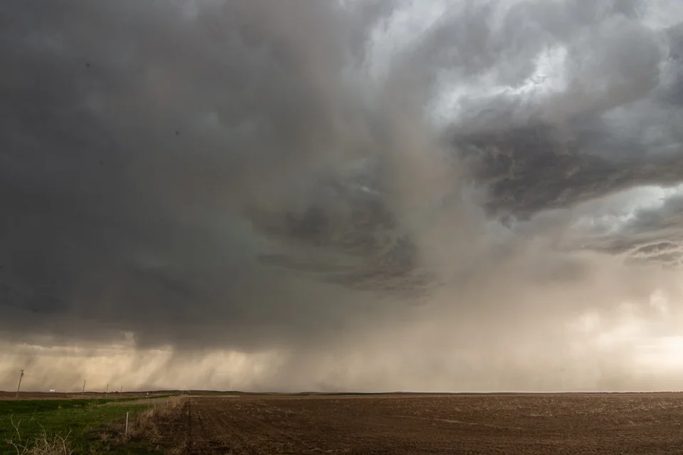
Storm continuing to develop near Grant, Nebraska. Rain and hail curtains becoming more prevalent.
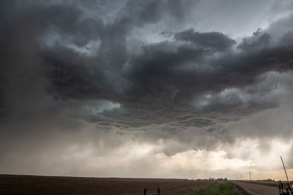
Wall cloud starting to develop near Madrid, Nebraska.

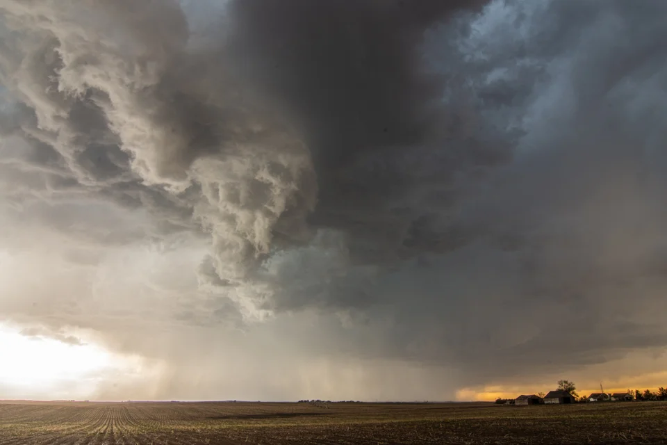
Awesome structure and shelf cloud near Paxton, Nebraska!

Another shot of the storm’s shelf cloud near Paxton, Nebraska.

The first in a series of great lightning shots from near Brady, Nebraska! Several to follow below:
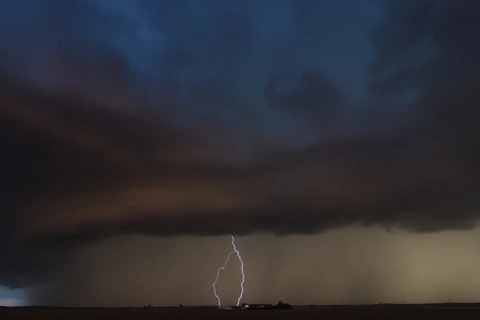


Stopped near an irrigation system near Brady, Nebraska to catch some additional lightning shots.
STORM PREDICTION CENTER OUTLOOKS:

STORM REPORTS:

CHASE LOG, PROVIDED BY RICH HAMEL:
A day that looked like not much was going to happen turned into a fun chase day! Starting in Oklahoma City, we targeted a sagging front in Nebraska, knowing that the target area would be where we wanted to be for the upcoming triple point the next day and we had to get up there anyway. With low expectations because of a lack of sheer and modest dewpoints, we traveled all the way from OKC to Ogallala, NE before stopping to decide what to do. When we got there, there was a severe, anchored storm about two hours to the north near Alliance which was the original plan to target, but as the storm was pulsing down and a new group of storms was forming to our south from Julesburg, CO to Imperial, NE, we waited a bit longer and then proceeded straight south toward a storm that was just getting to Imperial. We headed down Rt. 61 through and to the east of Grant and stopped to observe the first storm coming towards us. The results however were not impressive as the storm had very little lightning and nothing else to offer. We continued farther south, about half way to Imperial, and watched the storm to our south get a little more intense, and the storm to our west was showing signs of life as well. As the first storm got to us, we headed back east and out onto the dirt county roads north of Madrid. We stopped again as the storm to our west took over the show, with much more lightning and some motion under the updraft. Soon the rain was encroaching on our position and since we were on a dirt road, we had to run to keep from getting stuck in the mud.
As we stair-stepped north and east trying to get to pavement, we observed a good deal of blowing dust from the gust front and outflow, and later as we made it to pavement and headed up the road north to Paxton, observed a gustnado to our east that looked like it could have been a landspout, but had no visible connection to cloud base or funnel.
Up near Paxton, we stopped and watched the now linear storms come at us and produce a really cool shelf cloud, rolling and roiling towards us. We observed the great structure and intensifying lightning for a about 10 minutes before heading east to get to the tail end of the line, blasting down I-80 until we got to Hershey then heading south on Rt. 56C. Now the shelf cloud had taken on an orange tint and was massively electrified as the whoile line was now severe warned. As the cell directly to our south got closer, the storm intensified and soon had maxed out VIL’s, meaning big hail, coming straight at us. We blasted east just in time, catching a little hail but no damage. We continued east on I-80 all the way to Brady, stopping there to watch lightning in all directions, from little popcorn storms north of us, and the more robust line to out south. After about 15 minutes, we called it a day and made the easy trek to North Platte and the hotel.
Miles for the day were 773.1 for a trip total of 853.9