
MAY 11TH NEBRASKA: EF3 AND EF2 TORNADOES, HP SUPERCELL, & LIGHTNING
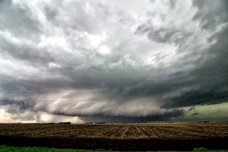
Enhanced shot of the supercell with large EF3 tornado in progress, looking west off Hwy 15 towards Beaver Crossing, NE.

Another shot of the supercell with tornado underneath. Can see left edge of the tornado fairly well in this shot.
Short while later as the tornado begins to become more rain-wrapped and storm really takes on high precipitation nature.

Different color scheme here as the tornado is now completely rain-wrapped. Low, well defined inflow tail into the storm on right.

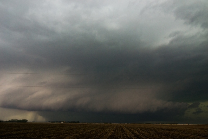
Storm getting closer as beaver tail (inflow tail) continues to scrape the ground. This was north of I-80 near Seward.

Interesting features at this point near Malcolm, NE. A couple areas of rotation on leading edge of RFD that appeared to be funnels.

Funnel cloud attempting to form here, moving left to right. Also near Malcolm.

Video capture of the Raymond EF2 tornado, estimated at 300 yards wide. Taken off Hwy 77 looking west.
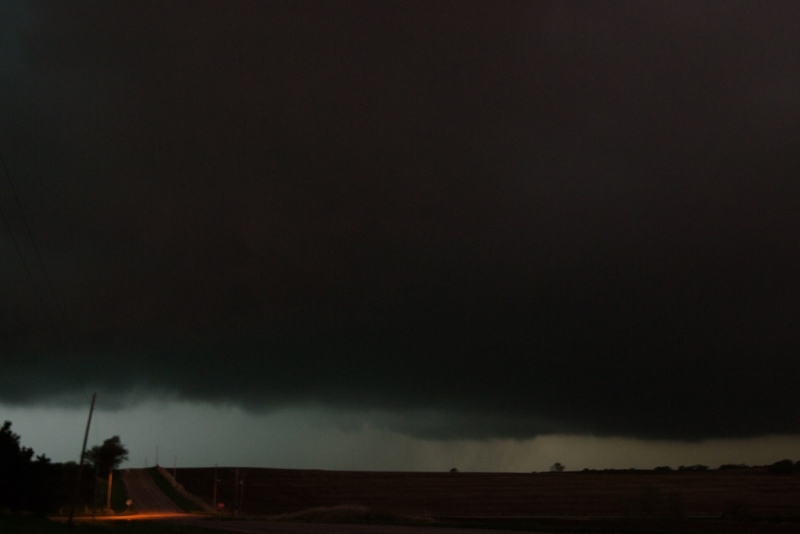
Very low LCL's at this point when the storm was extremely hp. Notice lowering near the center of the image in the background. This was a new action area that formed on the storm east of Ceresco.
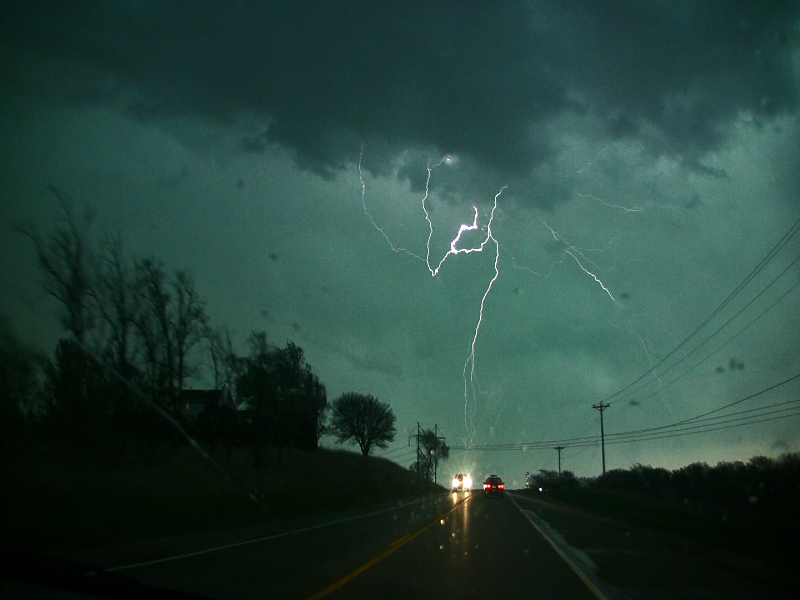
Video capture of lightning when a large amount of cg's were taking place as the storm was approaching west Omaha.
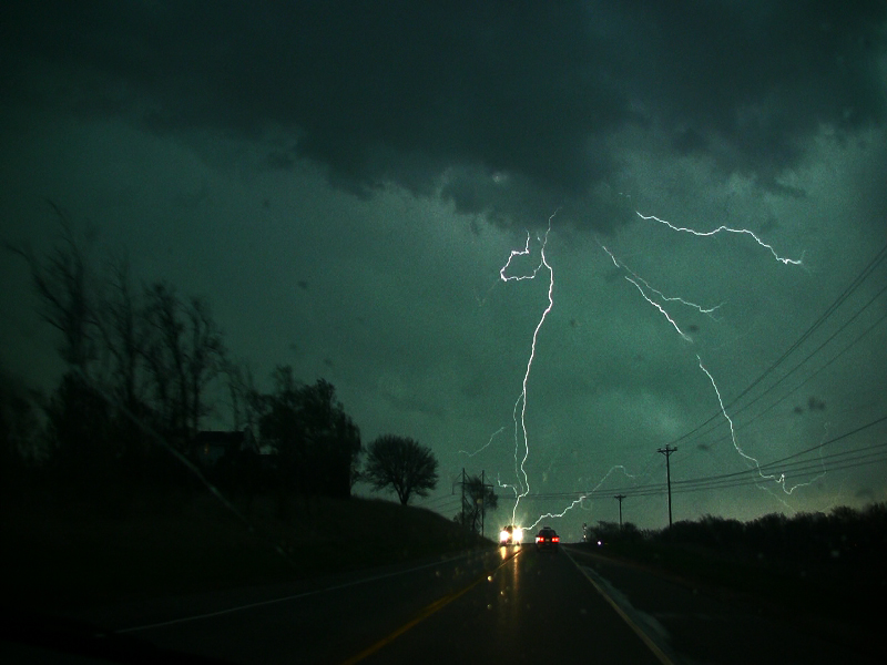
Another video capture of the awesome lightning display.
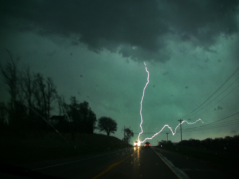
Yet another capture!
STORM REPORTS:

STORM PREDICTION CENTER OUTLOOKS:

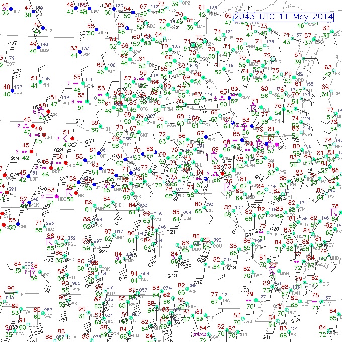
Surface observations at 3:43 PM CDT. Notice backed surface winds into southeast Nebraska with dewpoints pooling in the upper 60s to 70F along and south of the warm front. Terrific low level shear and ample moisture for supercells, while west-southwest to east-northeast orientation of the warm front was perfect for this storm to root and track along the boundary.

Enhanced Storm Relative Helicity per mesoanalysis at 3 PM CDT. High sheared environment as storm develops near Hastings, NE.

Incredible Significant Tornado Parameter numbers in southeast Nebraska ahead of the developing tornadic supercell. Also high along the front into Iowa but this area never fired with storms after the morning/early afternoon convection.
May 11, 2014 CHASE LOG: NEBRASKA
I was rather undecided in regards to chasing on this day since I was leaving on a plane for work the next morning and knew that the best target area would be in eastern NE, making for a long haul back home and not much sleep. However, after reviewing the setup and seeing a warm front draped across IA and within 3-4 hours from home, Wes Hyduke and I decided to make a trip down towards Des Moines to chase storms that we expected to fire on the warm front during the late afternoon. We left Burnsville, MN at 11am. The atmosphere had another plan though as the warm front never fired after the morning convection laid down an outflow boundary that appeared to wash out where the warm front actually was. In addition, there may have been some subsidence and not enough time to destabilize behind the morning rain and storms as cloud cover stuck around just to the north of the remnant outflow boundary. There was also ridging in the mid levels of the atmosphere behind this initial wave. After dropping south to near Des Moines, we knew the play was going to be to blast west towards the NE target. Most of the computer models, especially the HRRR, were blowing up a massive beast of a storm right on the intersection of the warm and cold front in the vicinity of Hastings, NE and moving this storm right along the warm front where it could continue to ingest the warm, humid, unstable air south of the boundary and low level shear maintenance. This area was also under incredible Effective Storm Relative Helicity (ESRH) values of 400-600 m2/s2 and 2,000-3,000 j/kg of Mixed Layer CAPE with Bulk Shear values of 55-70 kts per mesoanalysis. Surface and 850mb winds were also backed from the southeast ahead of the storm and along/south of the warm front making for very high low level wind shear and strongly curved hodographs. Dewpoints were pooling in the upper 60s to near 70F in southeast NE where the storm would be ingesting its inflow air.
THE storm blew up on the boundary intersection near Hastings, NE between 19-20Z (2-3pm). The SPC upgraded the percent chance for a tornado within 25 miles to 15% at the 20Z outlook along a narrow corridor that this storm would track in along the boundary (see outlook image). Within an hour this storm was already producing tornadoes as we were still in western IA and approaching Omaha. We continued on I-80 west to exit 379 and dropped south on Hwy 15 or 280th St. After going south for 1.5 miles, we pulled off to watch an incredibly powerful supercell to our west. At this point, it was producing a large tornado to the south of York, NE and near Beaver Crossing, NE. I was not sure if we saw a tornado buried in the rain underneath this storm, but taking a look at the photos, it appears that the left edge of the tornado is shown before it became rain-wrapped upon approaching I-80. This is at the same time the reports of a large tornado were showing up from other spotters and chasers closer to the storm. As the storm neared, we followed north and back east on I-80 to exit 382 and then north on Hwy 238. The storm at this point was really starting to become high precipitation (HP) and dangerous to stay ahead of at a close distance. Upon getting on Hwy 34 and heading east, we stopped near Malcolm to take some photos and happened to notice the storm forming a wall cloud, which was hard to really get a glimpse of due to the hills and trees. Our path took us north on Hwy 79 and after 4 miles the view opened up to the west where we witnessed a large tornado to our west. This was near the small town of Raymond. We moved east on W Raymond Rd and zig-zagged up Hwy 77 towards Ceresco where the storm continued to produce a large tornado, as seen by other chaser photos and videos at that time. Even though there were still a few hours until sunset, it was pitch black at this time and street lights were on. We continued east on some gravel roads towards the western outskirts of Omaha, having to turn around at one point due to coming up on a muddy road with water running over it. This is where we were close to the storm and got into some strong winds, heavier rain, and small hail due to having to backtrack around these roads. Thankfully we had given ourselves plenty of time to get ahead of the storm and were not in immediate danger of being hit by the rain-wrapped tornado. Plus we did not want to get stuck on a muddy road in the middle of nowhere with a large tornado buried in the rain behind us! Upon reaching Ashland, we had to cross the Platte River on Hwy 6 and then jumped on I-80 to get ahead of the storm, but staying southeast, as we got towards Omaha. The storm started to gust out upon reaching Omaha after the fear that a large tornado would go through the city. They still had some very strong, damaging winds go through the city as the storm gusted out and became outflow dominant with and embedded circulation. The storm structure was amazing as we moved up I-80 through southwest Omaha! We had a good view of the massive supercell mesocylone as we got further ahead from the storm. The lightning was absolutely constant at this time. We got ahead of the storm on I-29 north and then east on I-680. The storm was starting to really bow out upon moving across the NE/IA border so we headed home to beat the storm close to sunset. We made it back home to Burnsville by 12:30pm and I was on a plane by 9am the next morning, heading to South Carolina. Certainly a long 48 hours with little sleep but definitely worth it!