MAY 27TH KANSAS - SEVERE STORMS, ALMOST A TORNADO

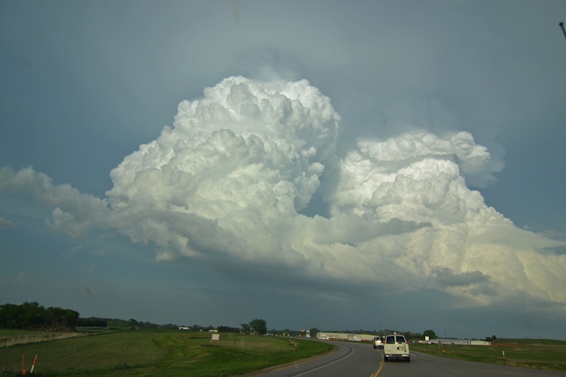
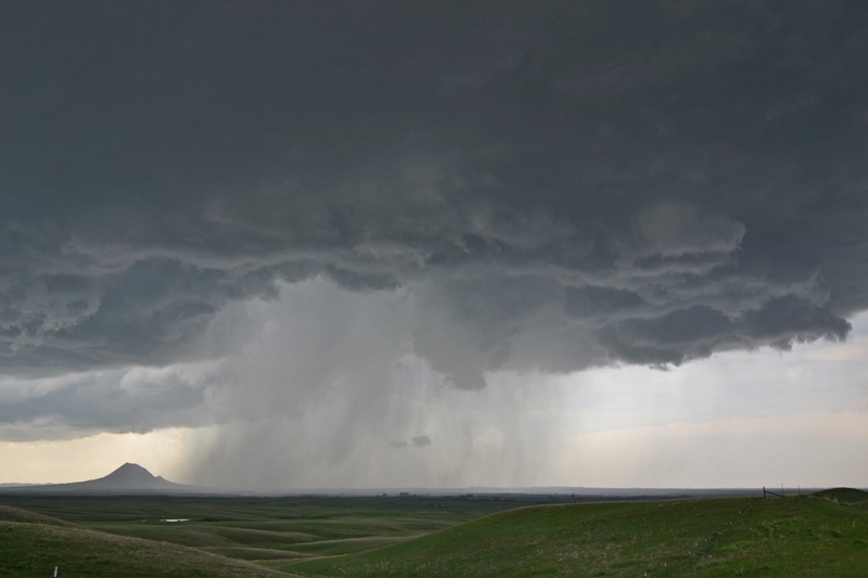
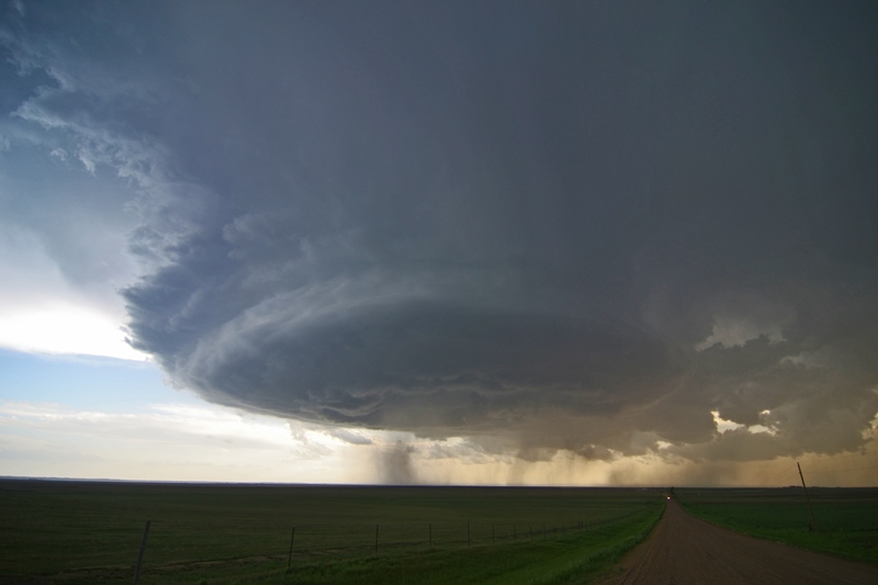
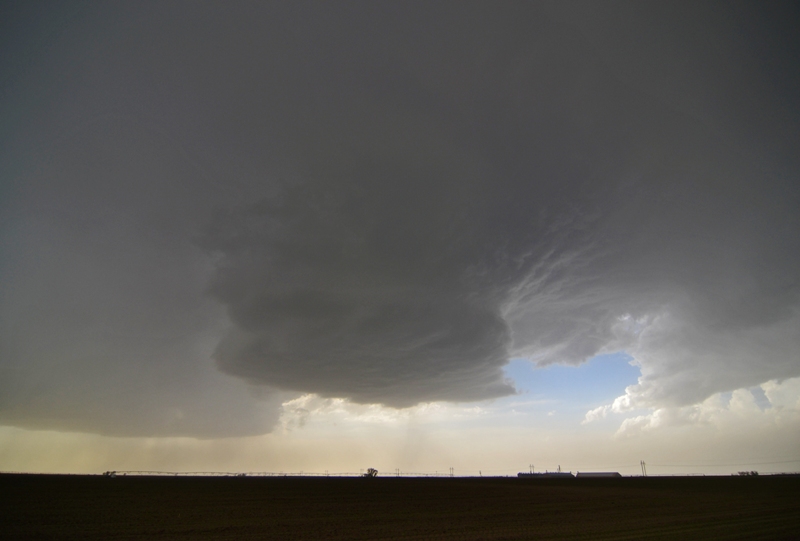
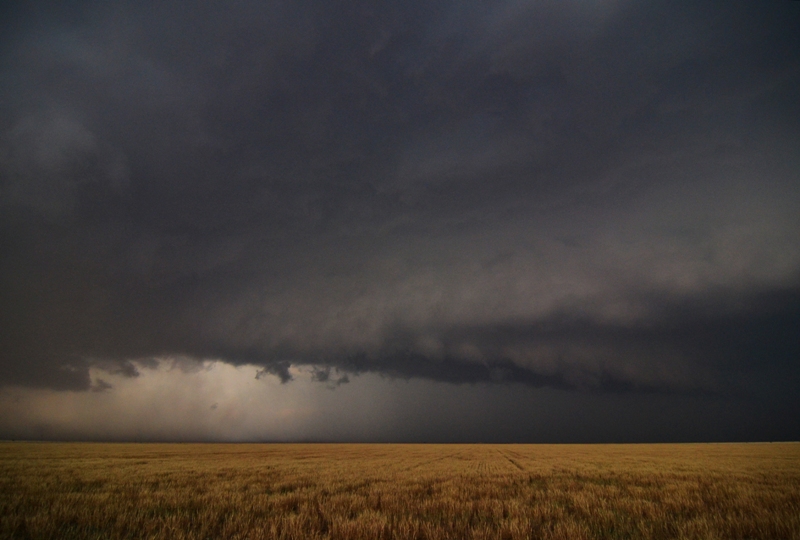
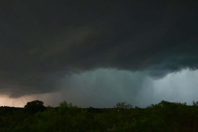
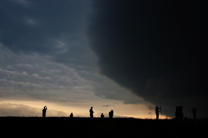
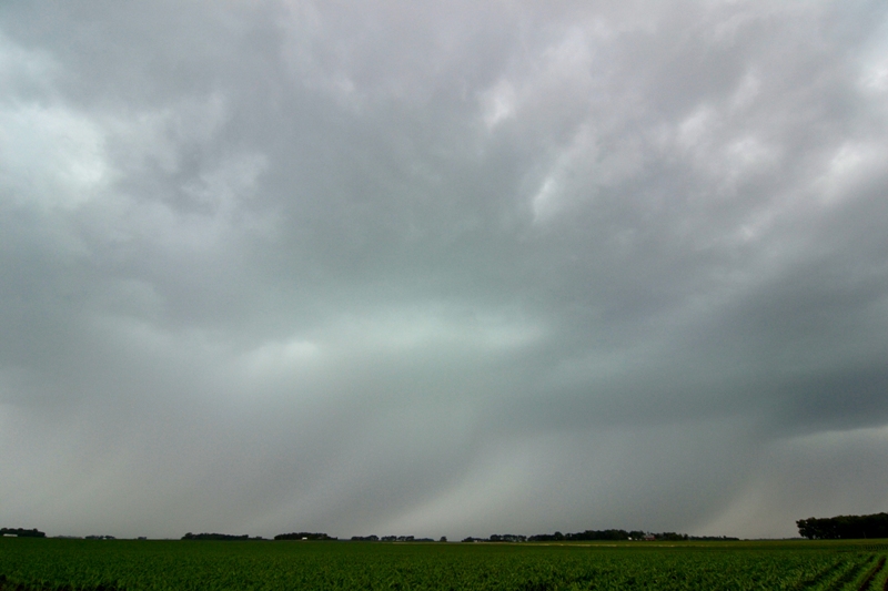
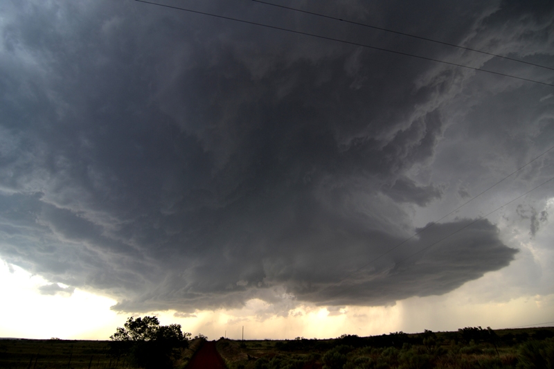
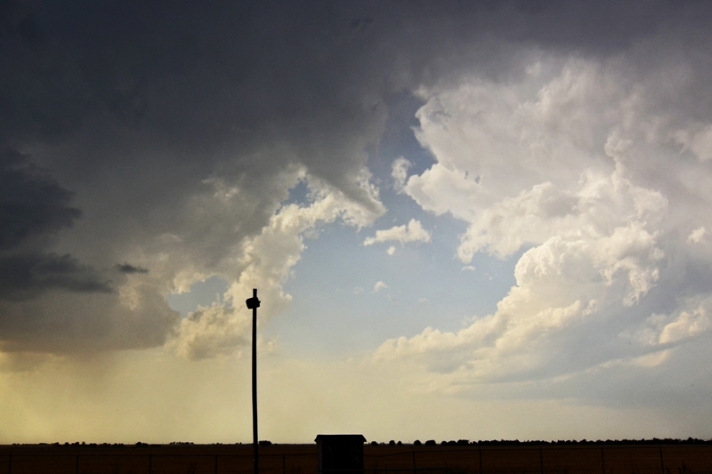
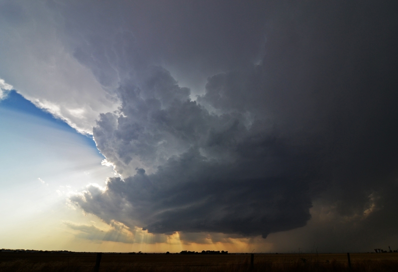
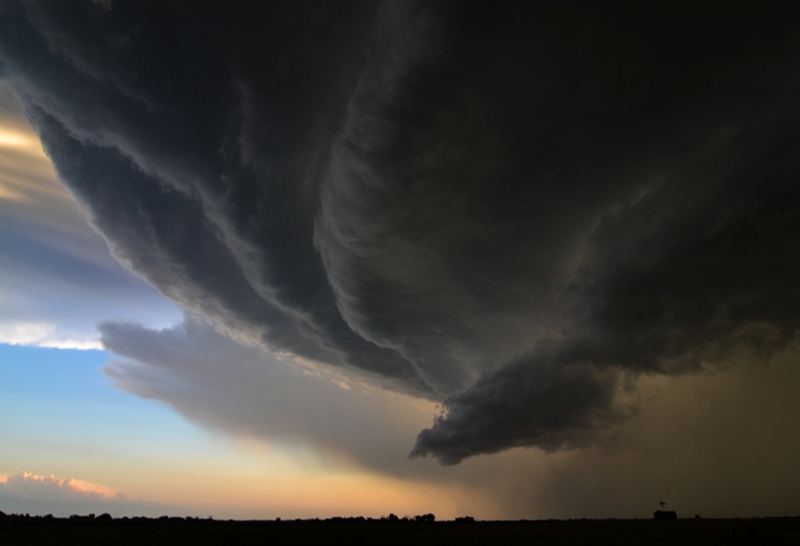
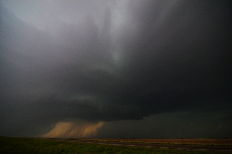
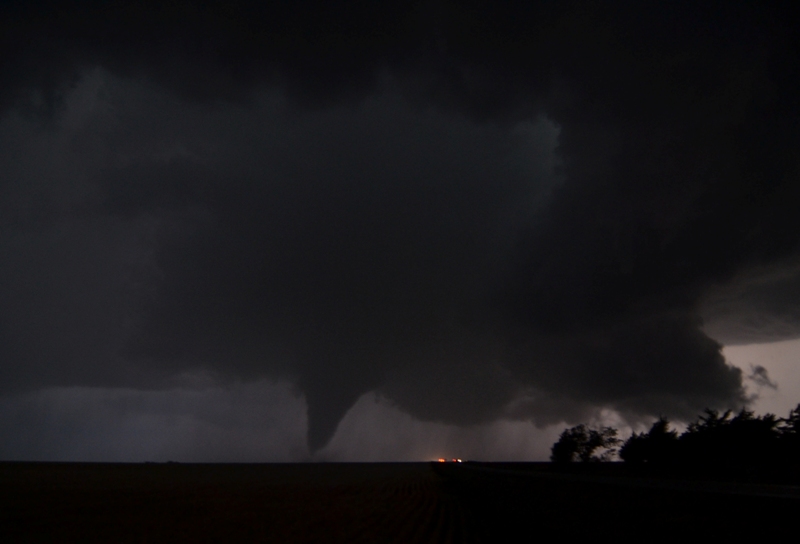
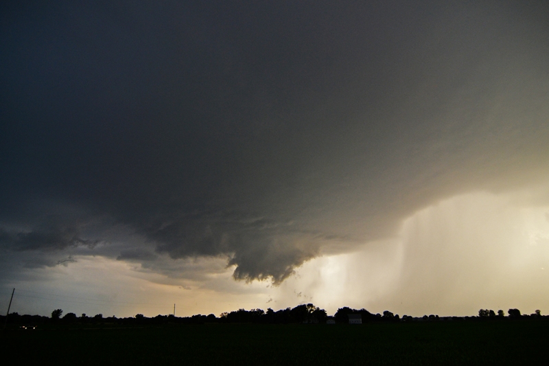
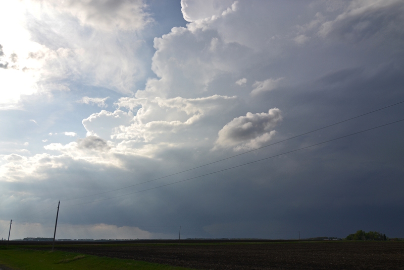
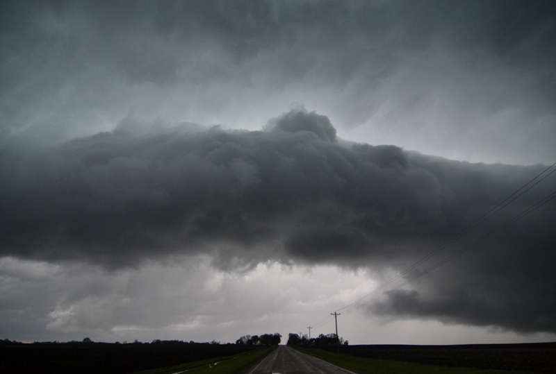
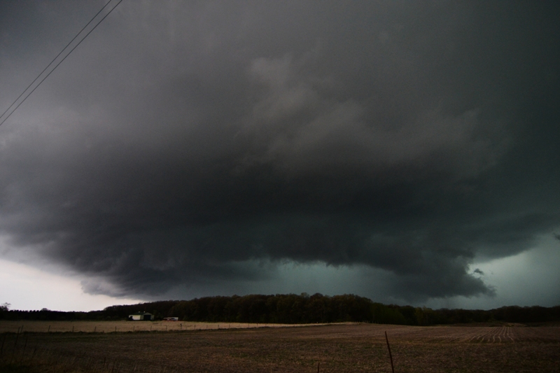
Severe storm just getting going near Kensington, KS. Nice flat base and strong vertical updraft.

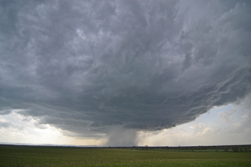
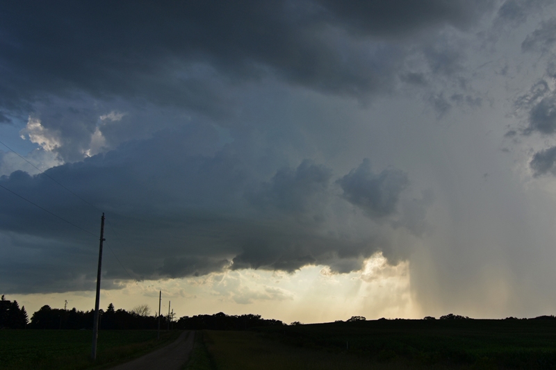
Strong inflow into the storm from left to right. Intense rain and hail core in the center of the image underneath the updraft.
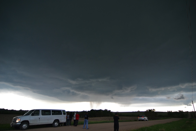
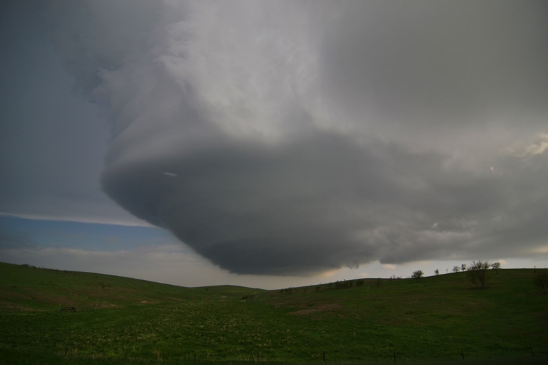
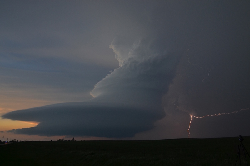
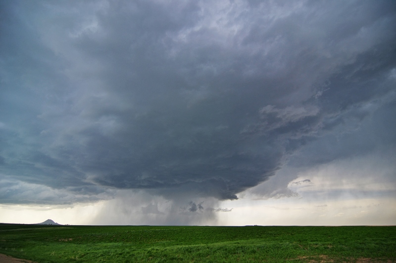
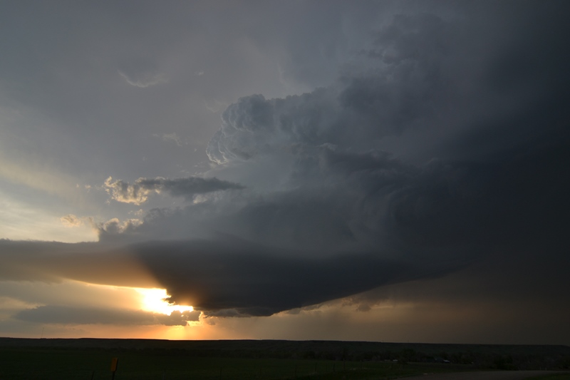
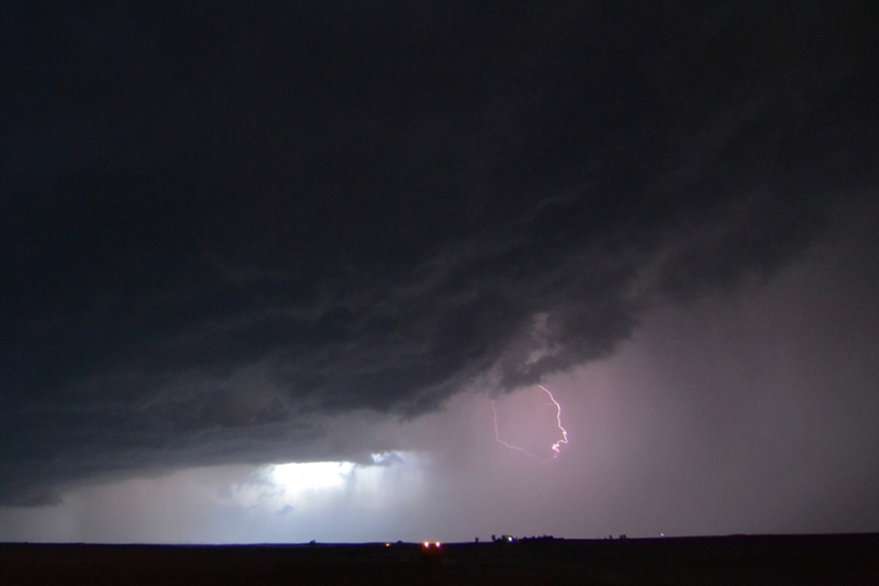
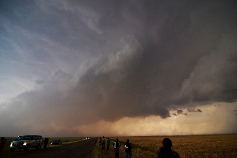
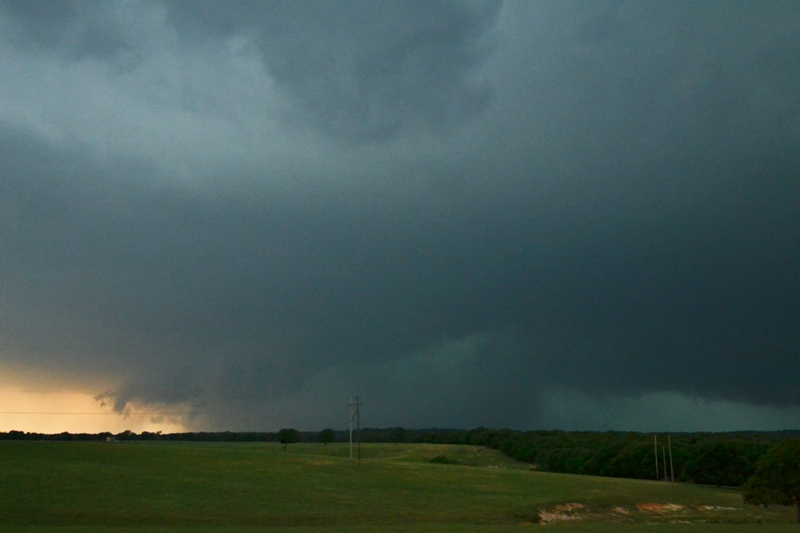
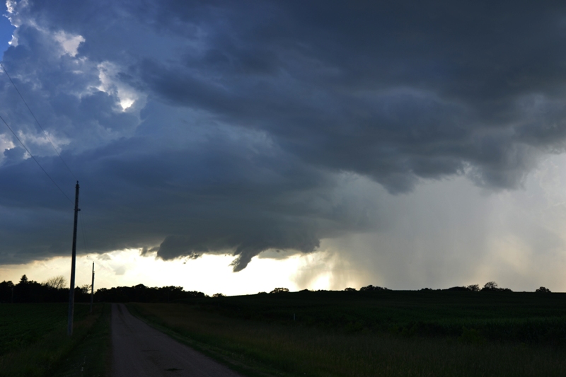
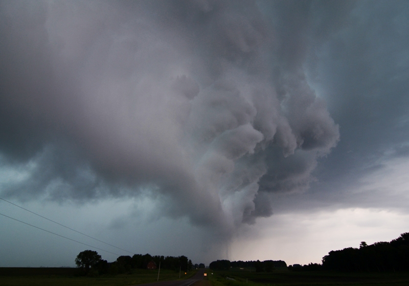
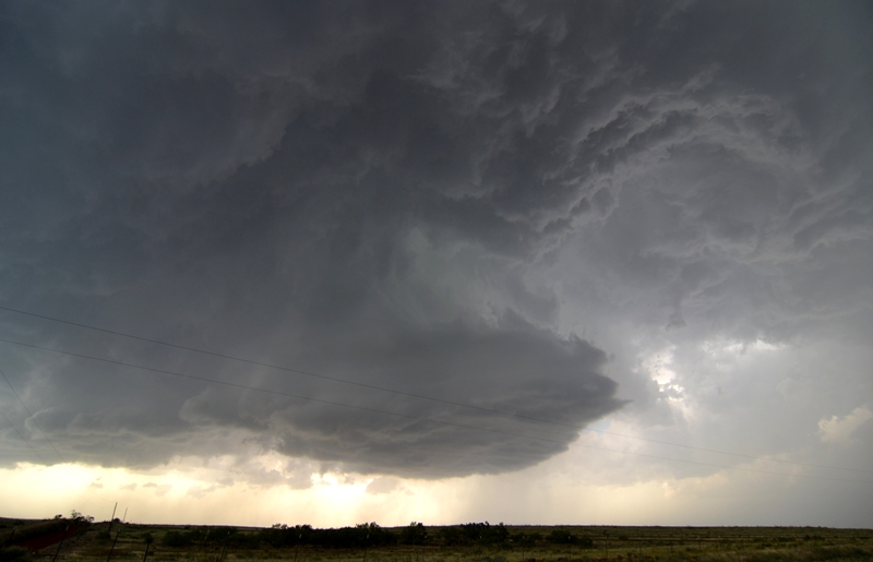
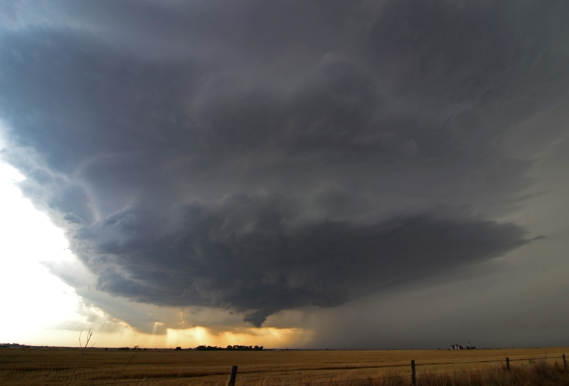
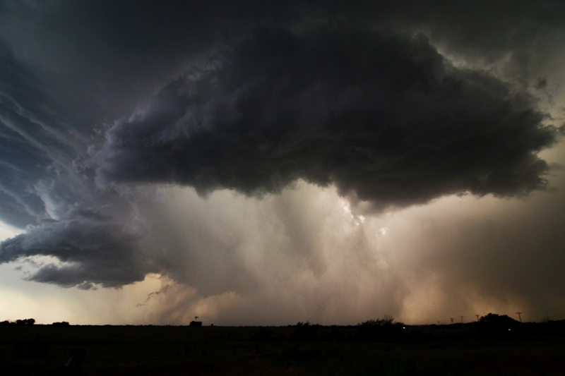
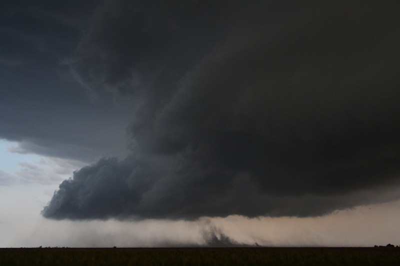
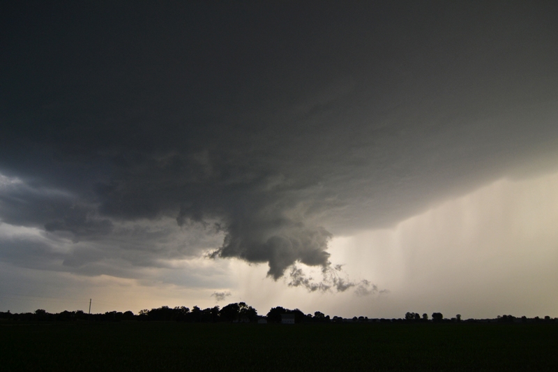
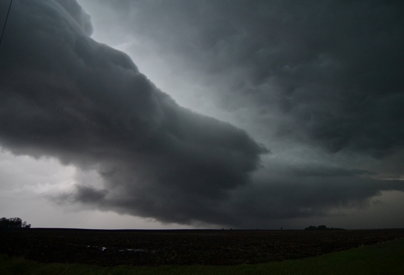
Rotation noted with this lowering and an attempt to produce a tornado here. Just could not get it done, but it had that "look" to it.

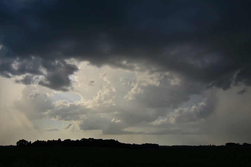
Broad, circular mesocylcone underneath the storm base with rain/hail core middle.

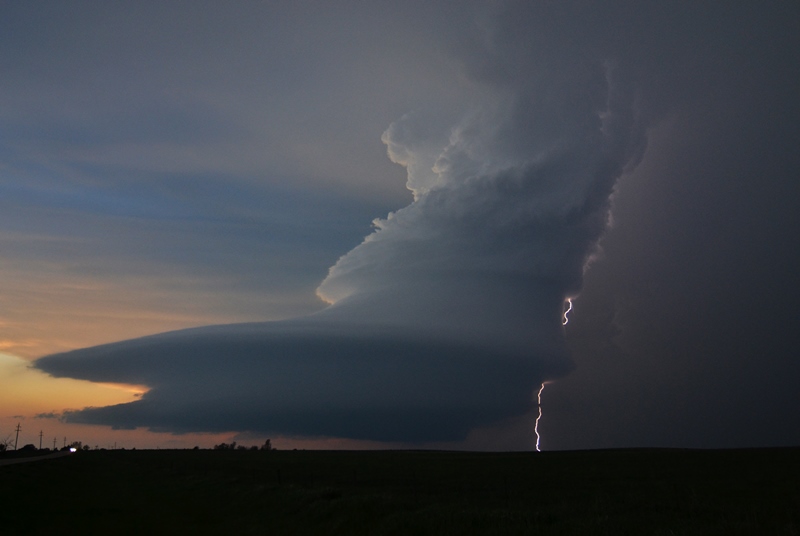
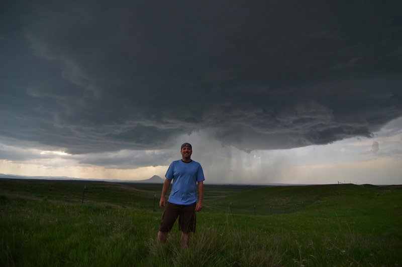
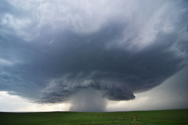
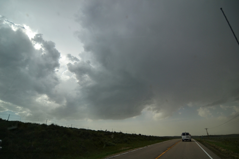
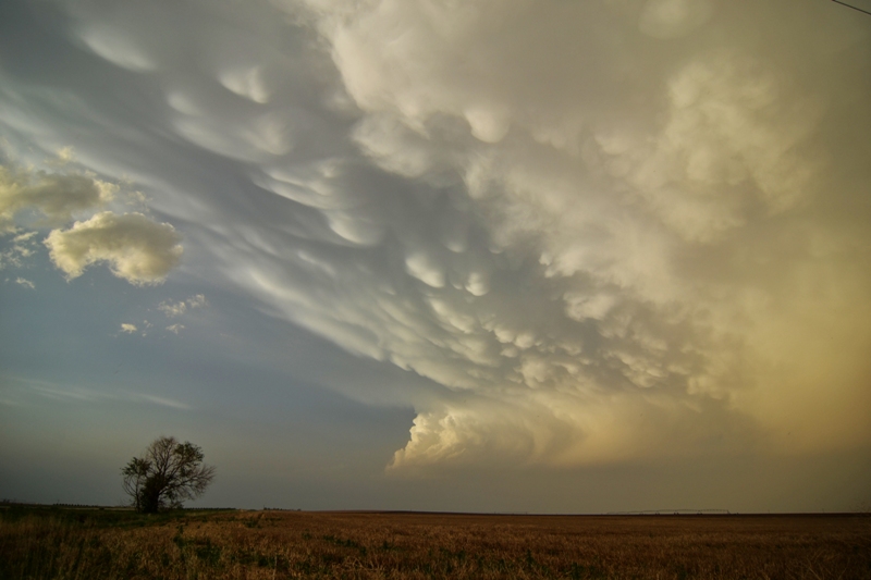
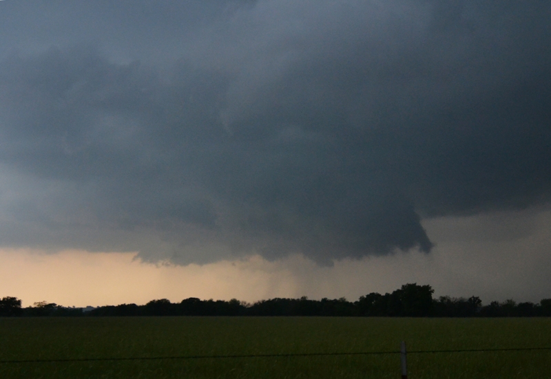
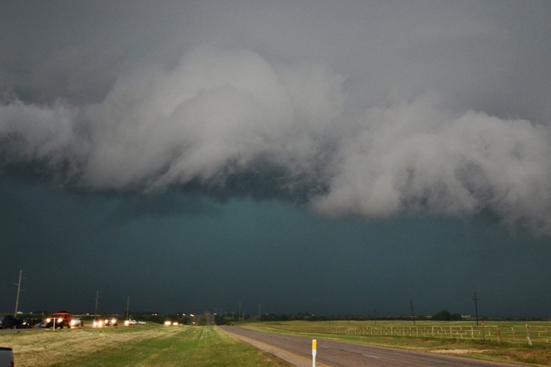
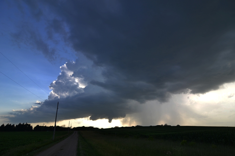
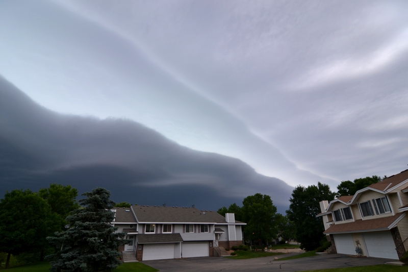
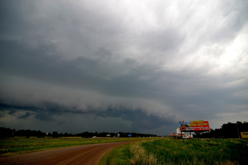
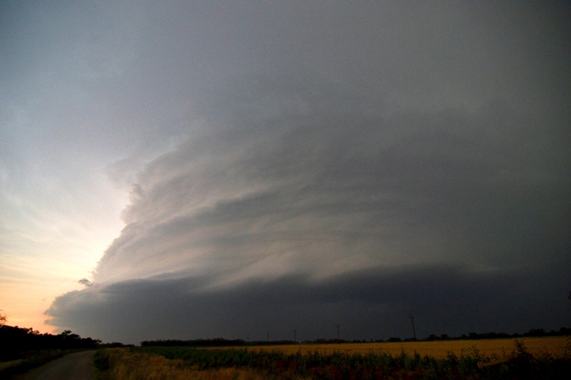
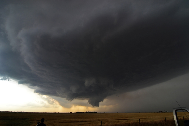
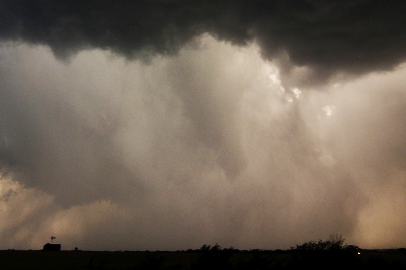
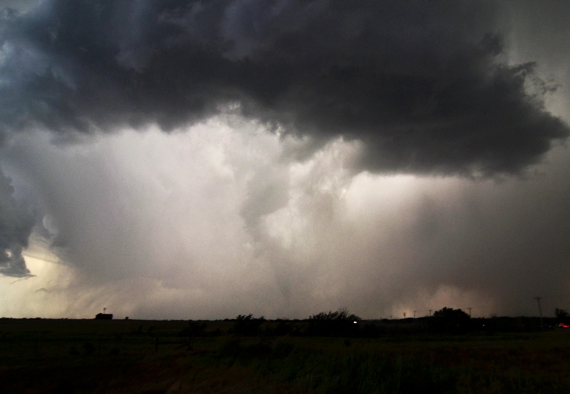
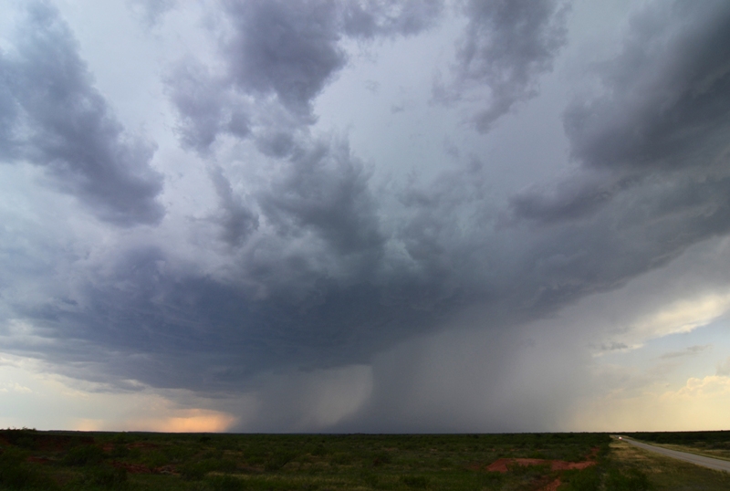
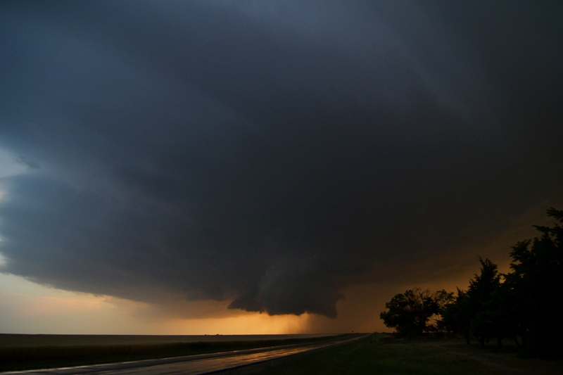
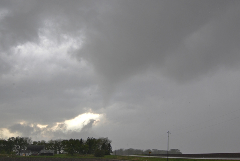
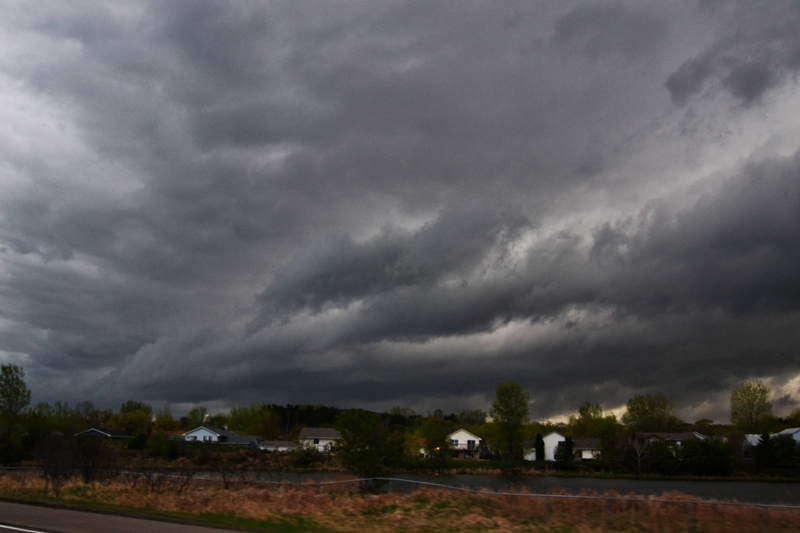
Storm starting to become HP near Smith Center, KS. Solid core to the right. Nice cylindrical shape to the base of the storm.

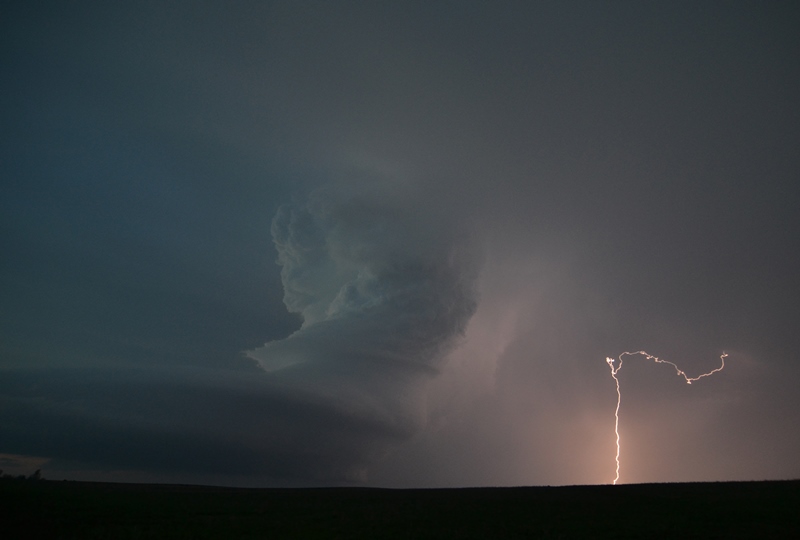
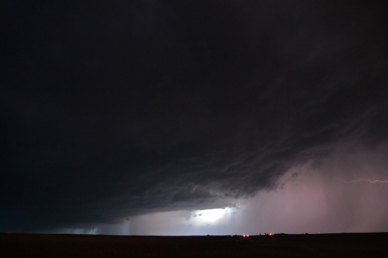
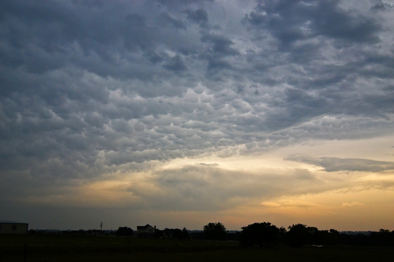
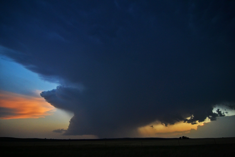
Caught a bolt at the end of the chase on another storm near Ellsworth, KS.
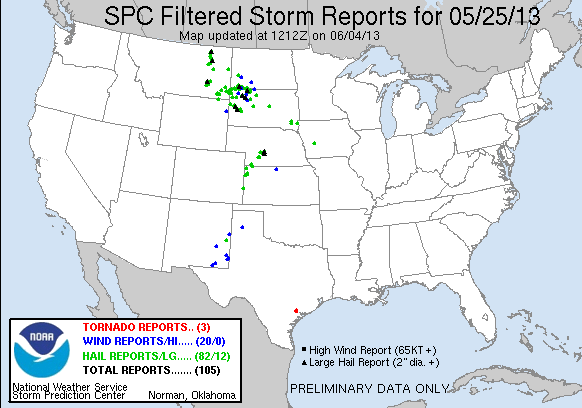
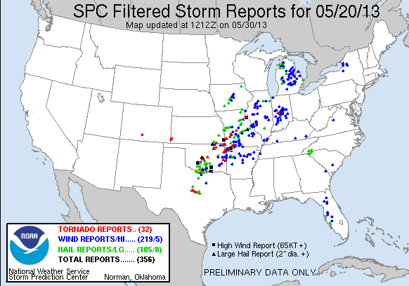
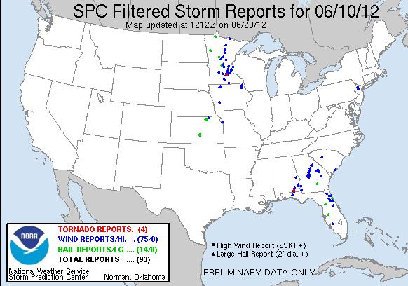
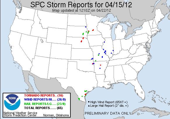
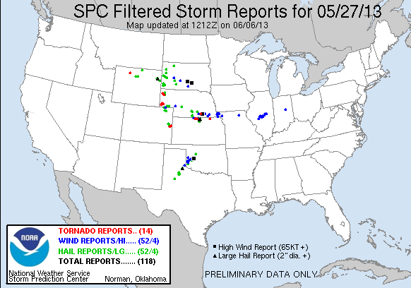
STORM REPORTS:
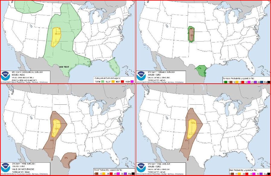
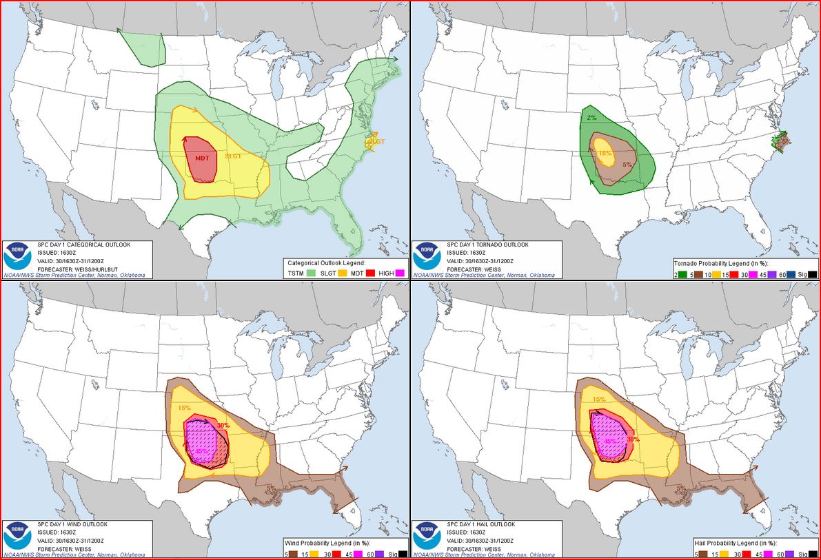
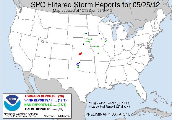
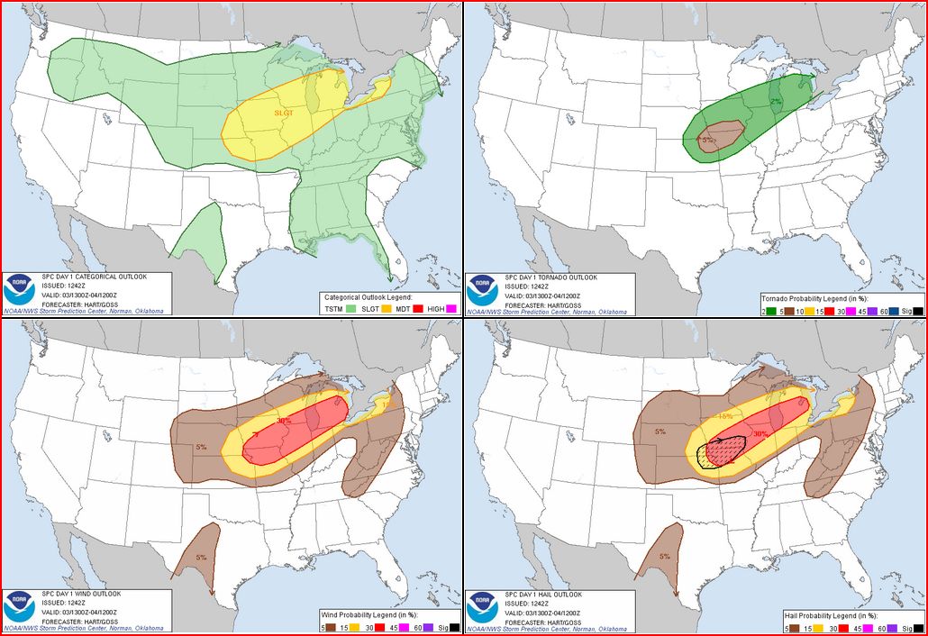
STORM PREDICTION CENTER OUTLOOKS:

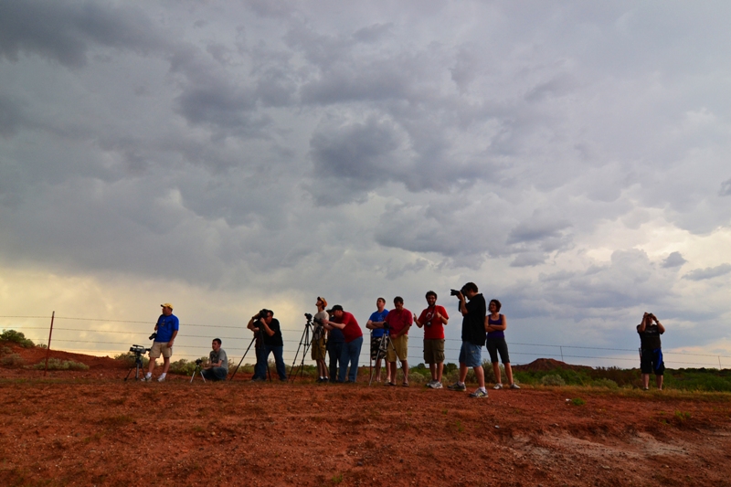
MAY 27, 2013 CHASE LOG: KANSAS
Written by Rich Hamel (http://www.bostonstormchaser.com/)
This was a promising chase day with an extremely easy forecast: surface low in western Kansas, sagging cold front along the Kansas/Nebraska border, and dryline equaled triple point play in north-central Kansas. Because the forecast was so easy though, it meant that ALL the chasers would be there, and this turned out to be true. We left North Platte then headed east on I-80 then south down Rt. 183, crossing into Kansas then stopping for lunch in Stockton, KS. Since the atmosphere was not yet ready for initiation, we found a nice park and hung out there for an hour or two waiting for things to get going. There were storms happening in eastern Colorado, and some suggestion that the only place the cap was going to break was on the dry line near Hutchison, but we still felt that the area we were in could be the “sweet spot” for the day. We considered heading down to I-70 to make it easier to play all 3 options but then storms started firing to our north after finally breaking the cap.
While the storm to our north was strengthening rapidly, it was already moving north towards the frontal boundary, and we knew that if the cell crossed into the cold air it wouldn’t last long. Luckily, additional cells were firing down the flank of the first storm south, so all we needed was for one of the tail end storms to turn right and stay south of the front rather than crossing it. We got our wish north of Phillipsburg, and soon were off onto the dirt roads to the east of Rt. 183.
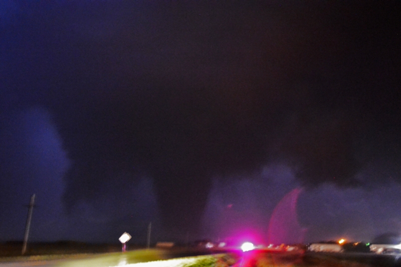
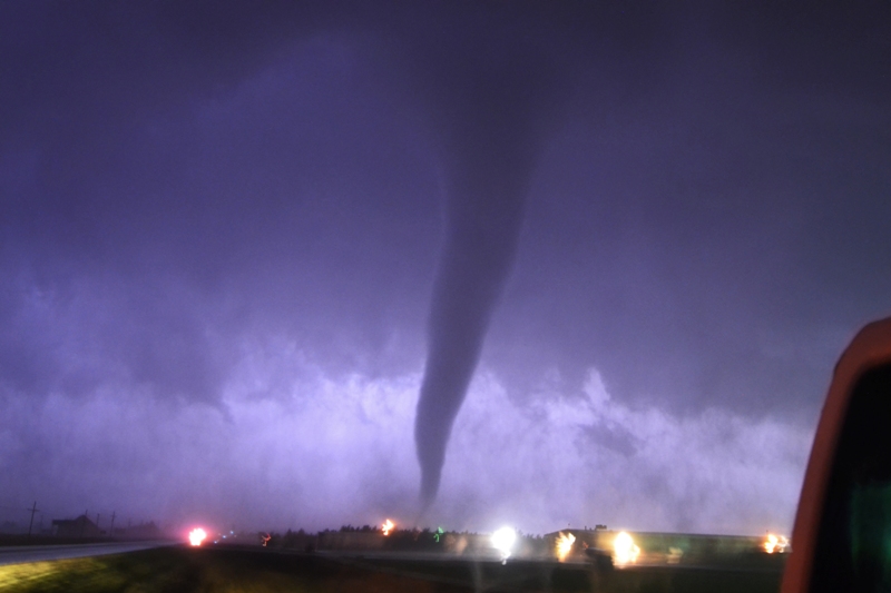
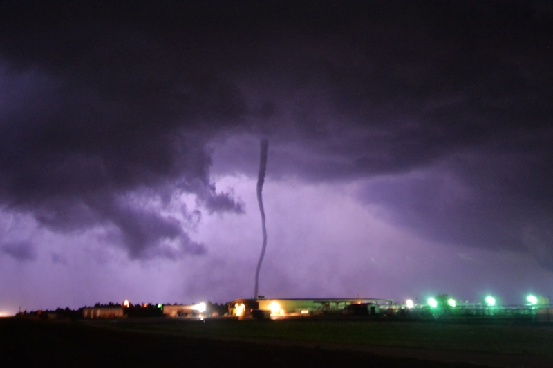
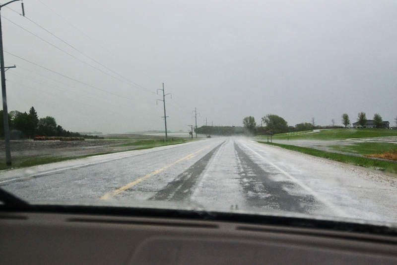
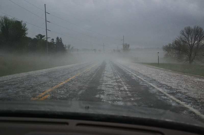
The southern-most storm on our line immediately took over the show and turned straight east right towards us, showing rotation on radar and soon developing a big hook echo. The hook echo was clearly visible with low level stratus being ingested into the storm and the long hook extending from our right to the northeast all the way around and coming back towards us from the southwest. The storm looked like it was getting ready to tornado but it was also still expanding south, and soon, rain and hail was falling around us and threatened to swamp us on the roads if they became muddy, so we bolted east then south on dirt roads north of Kensington to get away, while still keeping in contact with the hook echo region of the storm. We kept proceeding east and south on dirt roads just ahead of the hook, trying to keep out of the rain and stopping every time the storm tried to spin up. At one point, north of Smith Center, there was a notable dust swirl that persisted for a minute or two that was reported as a tornado, but we’re not sure so we won’t count it. Heading towards Esbon the storm looked ready to tornado several times and at one point generated what looked to be a “scud stovepipe” that might have tricked some people, but it wasn’t rotating. Unfortunately, just to the east of that location the storm WAS generating what looked to be a truncated cone tornado based on pictures another chaser showed us, but that area was obscured from our vision by trees. At Esbon we hit pavement and, because we have 2-wheel drive 12 passenger vans, we had to head south to get off the dirt before we got stuck. Those with 4-wheel drive who headed north into the notch ended up seeing a wedge tornado buried in there! With the storm looking more and more HP and additional cells firing to the south, we broke off the northern storm and headed down the line. Even though the severe indices for the environment we were going into were off the charts, the storms died one after another as we passed one core near Beloit, another near Lincoln, and then finally the last two near I-70 and Ellsworth. By the time we’d finished a gas break in Ellsworth, the show was completely over and we headed to Salina for the evening.