July 30th, 2011 Minnesota Storm Chase - Supercell With Several Wall Clouds

 
5995664731_39a0cd8b83_b.jpg

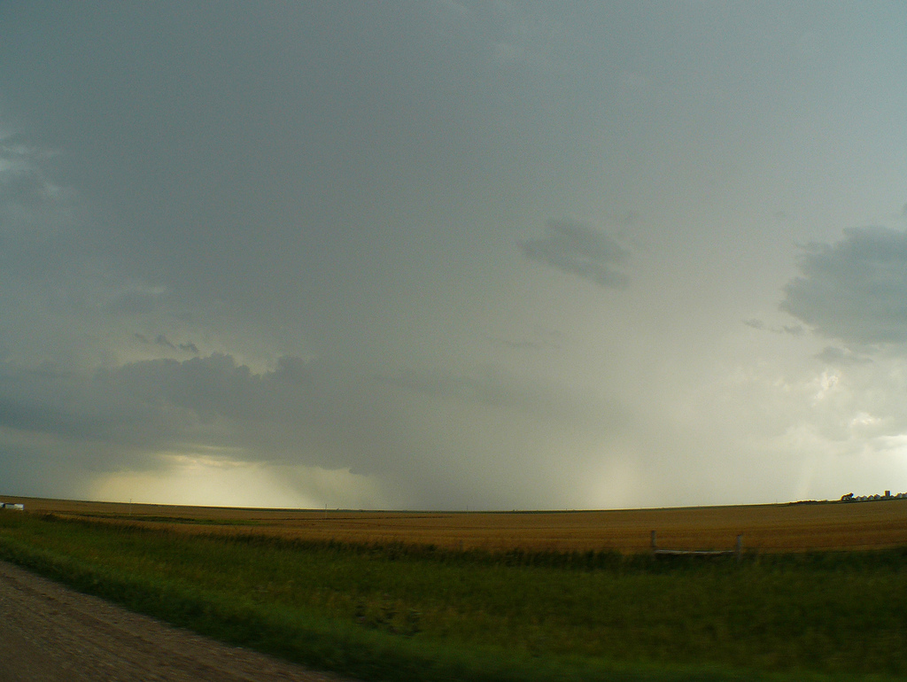
Fast condensation into a developing wall cloud east of Parkers Prairie, MN on Highway 46.  This is the first wall cloud seen in the time lapse at the beginning of the video.

5995743397_f33d36d861_b.jpg

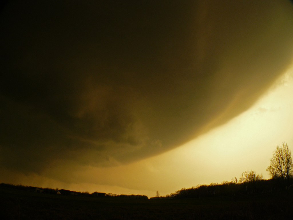
Wall cloud tightening up, I believe north of Rose City, MN on County Road 71.  Notice the clear slot cutting in on the left side!

5995772415_6a541ff93e_b.jpg

Shortly after the picture above.  Condensating inflow tail into the wall cloud with nice bowl shape underneath.

5995818565_c3d8b0f6ff_b.jpg

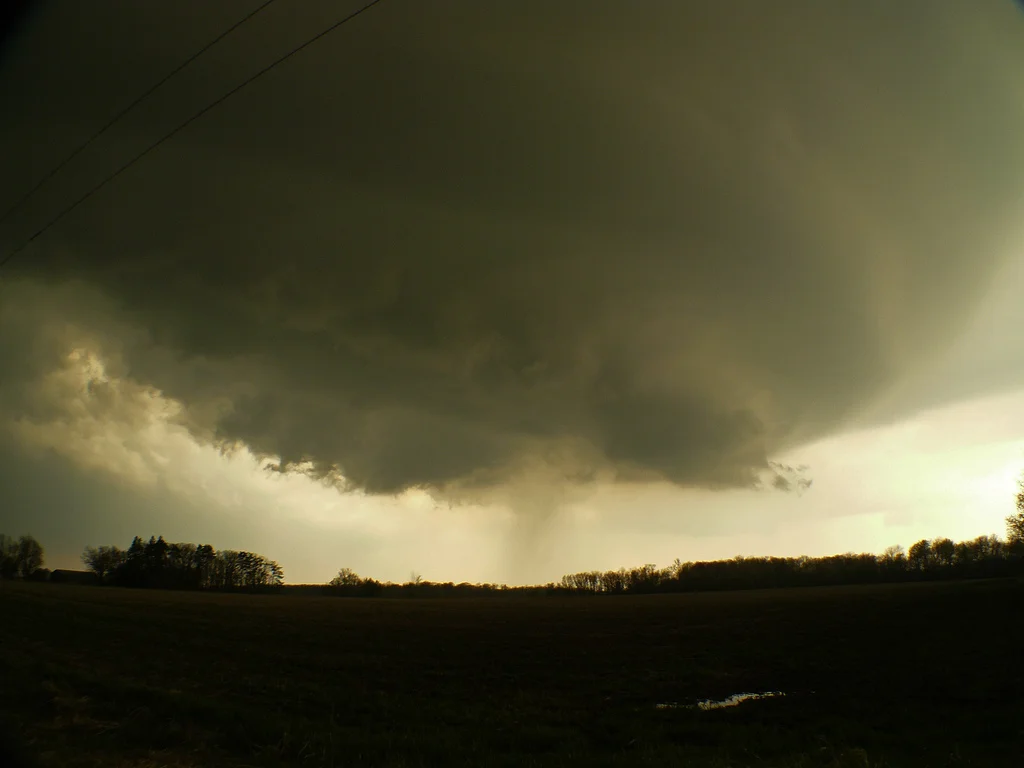
Rapidly rotating and condensating wall cloud at this point near Gutches Grove, MN on Highway 11.

5996390128_1d0586f0ce_b.jpg

Another view of the wall cloud and associated inflow tail near Gutches Grove.

5995987431_99c1682cff_b.jpg

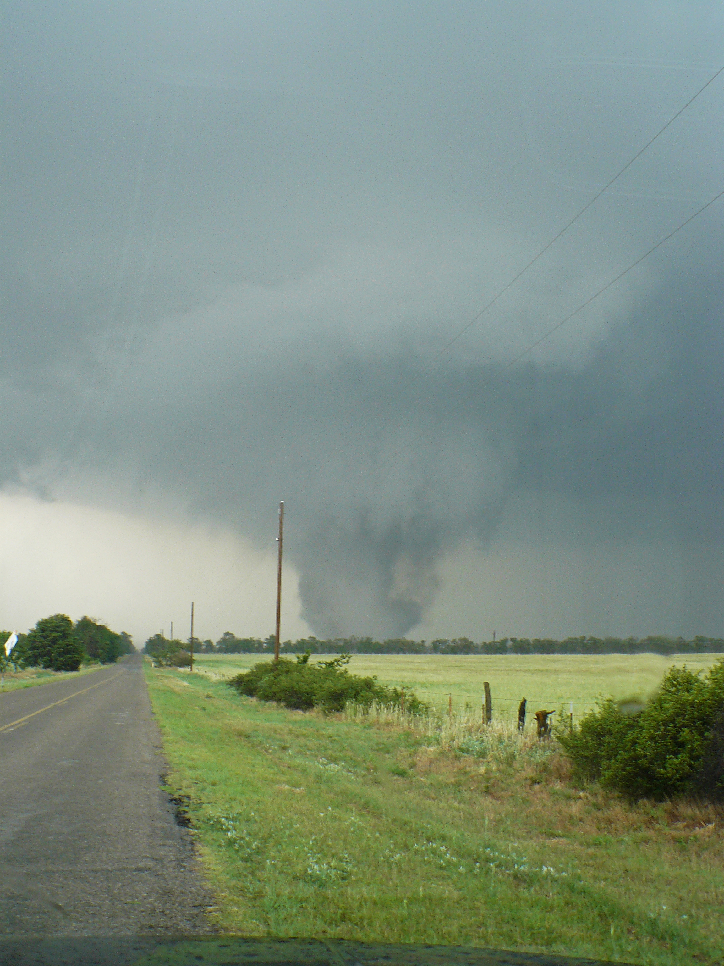
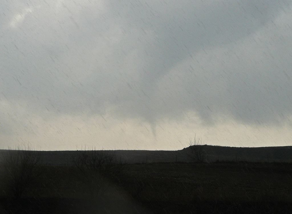
Had to really crank up the contrast here, but I am 75% sure that there is an elephant trunk funnel in the front center.  This was at the point of the fastest condensation into a wall cloud that I had seen all day, and the area became tight, defined, and was rapidly rotating for about 10 seconds.  This was southwest of Long Prairie on County Road 10.  Video captured this much better.

5996562482_032a15fa76_b.jpg

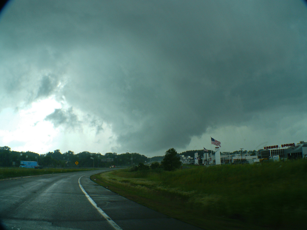
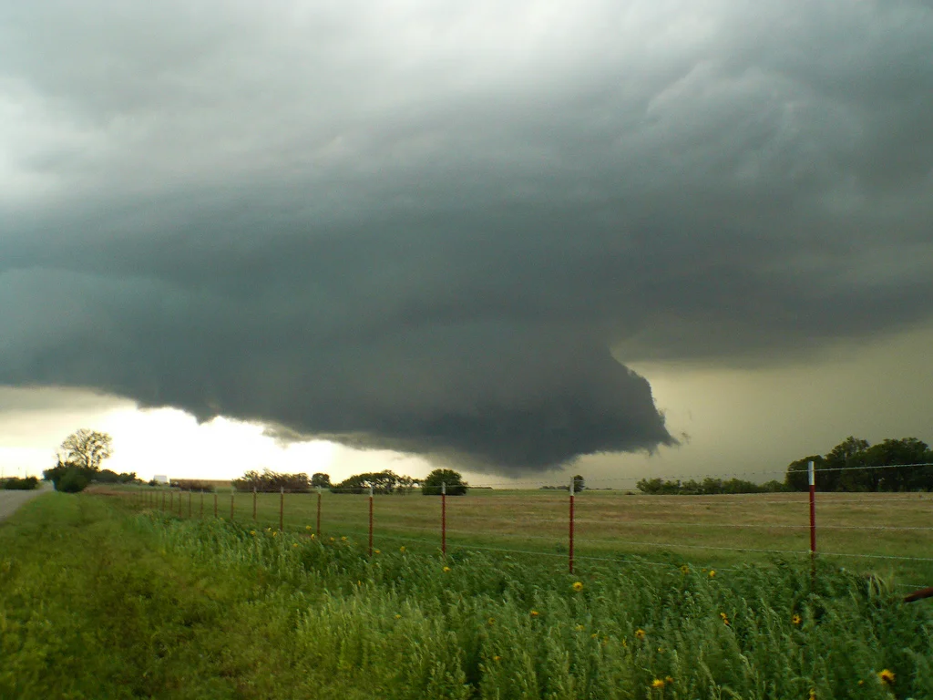
Storm gusting out with a shelf cloud forming near Grey Eagle, MN.

Turbulent undulations on the cloud base in Sauk Centre, MN.

5995940309_32716cfe91_b.jpg

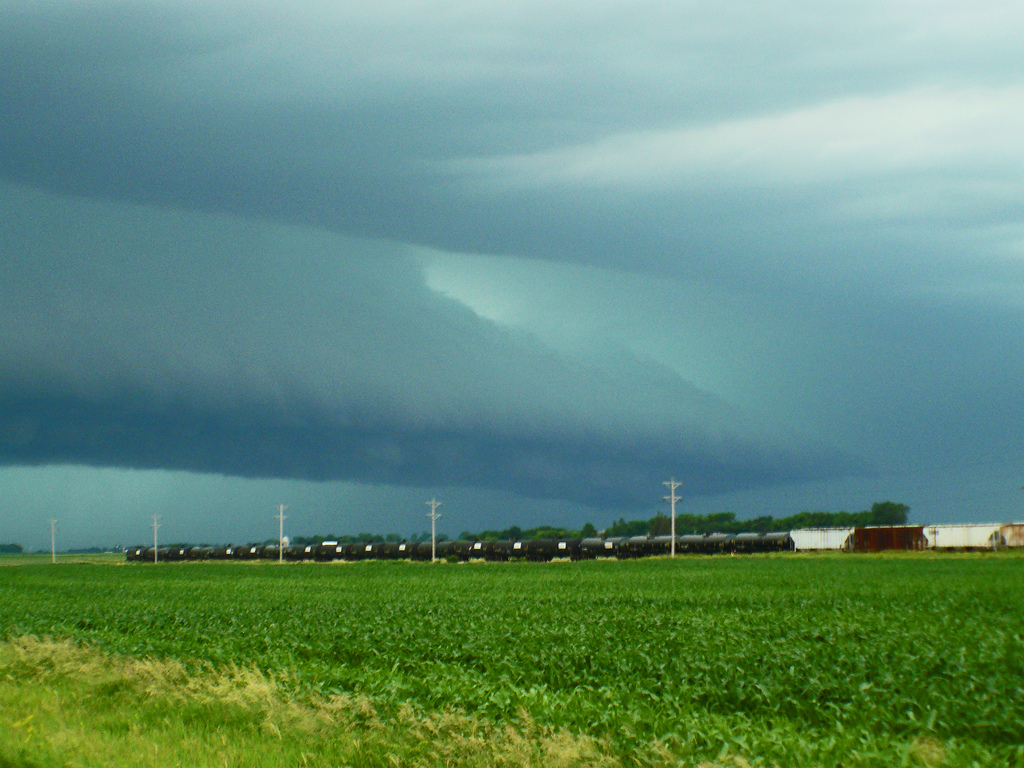
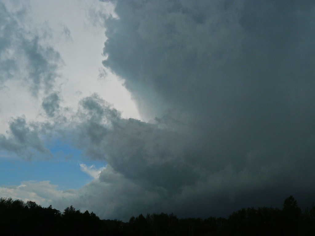
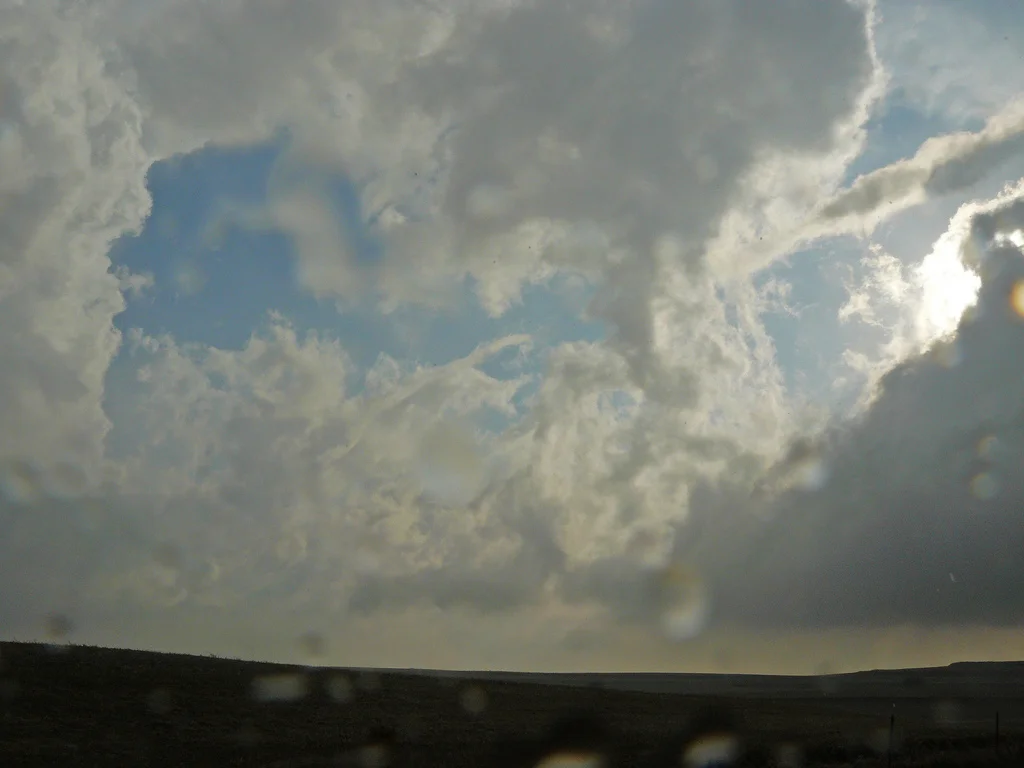
Some good structure on this storm to end the day!
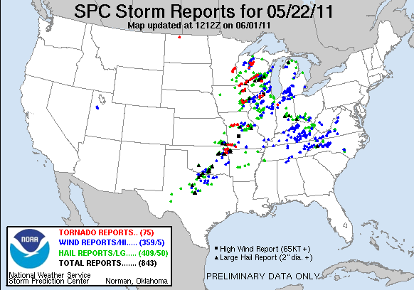
Storm Reports:

110730_rpts.gif

07-30-11 CHASE LOG:  MINNESOTA   This turned out to be a fantastic day that many, including myself, were thinking would be more of a straight line wind and hail threat and not worth the bother to chase.  However, morning storms moved through central MN into WI by early afternoon and laid an outflow boundary right through central MN in the vicinity of Hwy 212.  SPC issued a Severe Thunderstorm Watch along this outflow boundary at 1:30pm CT, while a supercell developed across western SD and was crossing over the border into western MN.  The thinking was that more storms, along with this initial cell, would develop along the boundary.  Well, low and behold, the supercell evaporated into thin air, likely due to the presence of strong capping along the boundary into MN.

  The aforementioned watch box was soon cancelled, while additional development was forecast along and ahead of a cold front entering the eastern Dakotas into northwest MN later in the afternoon, and possibly along the remnant outflow boundary that was rapidly receding north towards the I-94 corridor.  The airmass ahead of the cold front and along the outflow was characterized by dewpoints in the 70’s, MLCAPE of 2500-4500 J/KG, and 45 kts of Effective Shear.  The one concern was the southwest surface winds that were developing, but considering the winds aloft were out of the northwest, there actually was favorable low level shear in place for supercells and low-end tornado threat.

  Our course took us from Hutchinson northward on Hwy 22 and then west on Hwy 55 at Eden Valley.  Storms began to develop along and ahead of the cold front to our northwest near the Fergus Falls area and were strengthening quickly upon moving east southeast, so we continued northwest towards the cells on Hwy 55.  A new Severe Thunderstorm Watch was issued at 5:35pm CT that included all of central MN.  As we approached Hwy 29 near Glenwood, we had to make a decision to keep going west on the storm near Elbow Lake, or continue north to the storm near Wadena.  We chose the storm near Wadena as it looked like it was better organized and had a higher echo top compared to the western storm and appeared to be in just as good of an environment.  Later we find out that the western storm produced a beautiful rope tornado near Collis, MN.

  Upon reaching the storm near Parkers Prairie, we went east of town on Cty Rd 46 and set up the tripod to film a developing all cloud.  This wall cloud looked very good for while with fairly rapid condensation, but you can see in the sped up video how the RFD comes around and the wall cloud occludes and eventually gusts out.  We continued to follow on Cty Rd 71 and then south on Cty Rd 16 towards Rose City.  Here the storm cycled with another wall cloud and came very close to producing a tornado.  This wall cloud eventually wrapped up and we continued to follow on Cty Rd 1 and then east on Cty Rd 36 towards Long Prairie.  Traveling south on Cty Rd 11 and east on Cty Rd 10, another tight wall cloud with rapid condensation formed with a strong RFD surge.  Yet another opportunity for the storm to produce a tornado but it failed to do so.  To the east of Gutches Grove on Cty Rd 10, I’m 75% sure we had an elephant trunk funnel that stuck around for only 10 seconds or so as the wall cloud was producing the most rapid condensation I had seen all day.  Thereafter, the storm became outflow dominant with a photogenic shelf cloud as we traveled down towards Sauk Centre and eventually towards Belgrade where we called it a day after experiencing winds near 50 mph from the gust front.

JULY 26TH 2011 SOUTH DAKOTA STORM CHASE - PAIR OF SUPERCELLS & INTENSE LIGHTNING

 
5986300893_53b7397e36_b.jpg

First severe t-storm warned cell of the day near Gettysburg, SD.  Hail/rain core in the  middle and lowering starting to form to the left of the core.

5986864560_9ec947f0bf_b.jpg

Base starting to become lower and try to form a wall cloud on the supercell near Seneca, SD.

5986869390_55d3e74540_b.jpg

Ragged base of storm during a cell merger.  Appeared to be trying to wrap up after this but never could get its act together.

Heading northwest near Seneca, SD towards a beautifully structured, tornado warned supercell

5986876920_70c17104cf_b.jpg

Tornado warned storm starting to develop a shelf cloud as the outflow boundary gusts out ahead.

5986320915_6109f4e669_b.jpg

Awesome looking shelf cloud and turbulent underbelly west of Aberdeen, SD.

5986884862_f659b8e610_b.jpg

Another view of the shelf cloud as some impressive "sharks teeth" form on the leading edge.  Lots of rotation right on the leading edge of this shelf cloud as it approached Aberdeen!

5986889616_662feef94b_b.jpg

Incredible lit up base as the sun was setting to our back.  This was shortly after the storm had produced a funnel near Groton, SD.

More photos from the day can be found here:  http://www.flickr.com/photos/39991047@N02/sets/72157627305833176/

Storm Reports:

110726_rpts.gif

07-26-11 CHASE LOG:  SOUTH DAKOTA Really was not sure if I was going to be chasing this day as I had worked the overnight shift the night before and did not have a chase partner, so this ended up being a spur of the moment chase. However, I convinced my wife, MaryLynn to take off work by later in the morning and we left Burnsville around 10:30am, targeting central SD near Selby. SPC had issued a 10% hatched tornado risk for portions of the central and eastern Dakotas within a Slight Risk for severe weather. An upper trough was giving a glancing blow to the area from the north, while decent upper level support was in place, along with impressive summer-time low level and bulk shear, along with moderate instability forecast to be 2-3k J/KG of SB Cape. I was particularly impressed with the forecast triple point and warm front to the east that storms were supposed to be moving along with the forecast storm motion, while a dryline moved south of the low. Forecast hodographs and soundings looking pretty good leading up to this day.

We traveled west on Hwy 12 through SD and all the way to Ipswich where we had to go south on Hwy 45 and west on Hwy 20 due to the road being closed near Roscoe as water had washed out the roadway around a week before. This was a re-occurring problem that we noticed through the day with damaged roads and some that were impassable due to water over the roadway. There is incredible flooding across central and eastern SD this year. We gassed up in Hoven (which later had a brief tornado occur near town), and traveled south to near Gettysburg, SD where we watched a developing supercell just to the south of the triple point. This cell did look good for a while and had a couple of cell mergers with weak, ragged wall clouds wrapping up and condensing after both mergers. But this cell could never really get its act together and weakened. We were near Faulkton when I decided to bail on this cell and travel northeast towards the cell near Hoven. Not more than 5 minutes into our drive towards this cell did it become tornado warned and then produced a tornado a short time later near Hoven. We approached from the south and thought we could see a funnel as we looked northwest near the Cty Rd 3 and Hwy 20 intersection. We followed to the east and up to Ipswich again and watched a beautiful shelf cloud on the leading edge as the storm approached Aberdeen, SD. There was a ton of rotation on the leading edge with this shelf and it became very picturesque. Upon reaching Aberdeen, we went to the northeast of town and got caught on a road that was impassable due to water. We turned around and got south in time to see a funnel near Groton, but never got any footage of it due to going in and of cornfields as we drove south. Thereafter, I got took some lightning video near Bristol and then traveled home through MN in a deluge of heavy thunderstorms.

I really thought there would be more tornadoes on this day, and this could have been due to a number of factors such as too much forcing in this time of year with impressive CAPE nearly each day, storms traveling more east-southeast into the warm sector and not directly interacting with the warm front (although one of these did and produced a tornado in northeast SD), or the fact that the surface winds actually seemed to die off some after initiation for some reason. Even though we did not see a tornado, I cannot complain too much as it ended up being an enjoyable chase day!

July 1st Minnesota Supercells and Shelf Clouds

 
5895464983_23fa8ce6b6_b.jpg

Intense HP (high precipitation) supercell with shelf cloud north of Franklin, MN.

5895468843_47edff3f94_b.jpg

HP supercell catching us even though we are driving 60-70 mph to the east.  Storm gusting out a lot at this point.

5896044390_d7a49a510f_b.jpg

What I believe to be a gustnado at the leading edge of the outflow  south of Hector, MN.  Notice the strong debris cloud with tighter "finger" funnel overhead.  Not sure if this is indeed a gustnado, but it sure appeared like one from what I know.  The debris cloud kicked up extremely fast and that is how I first noticed.

5895479129_602208c186_b.jpg

View shortly after the picture above of what I think was a gustnado at the leading edge of the shelf cloud.

5895482497_10da4c7371_b.jpg

Tons of dirt being kicked up due to the intense outflow winds from this storm.

5895487229_1a1d263d39_b.jpg

Shelf cloud approaching us as we waited east of Winthrop, MN.

5895491545_27760efc51_b.jpg

Really neat photo of a train passing ahead of the shelf cloud that was rapidly approaching our location.

5896071810_131b0ebce6_b.jpg

Incredible shelf cloud!

5896077148_afe6332a5c_b.jpg

Another view of the awesome shelf.

More photos from this day can be found here:  http://www.flickr.com/photos/39991047@N02/sets/72157626977879903/

Our relative position compared to the intense supercell northeast of Redwood Falls.

5896072288_290b32e175_o.jpg

Our relative position where we viewed the shelf cloud east of Winthrop, MN.

Storm Reports: 

110701_rpts.gif

07-01-11 CHASE LOG:  MN Computer models had slowed down the progression of a system that was expected to originally blast through MN the night of 6/30, but the days leading up to 7/1 led to increasing confidence that a severe weather event was going to take place.  Temperatures across MN both on 6/30 and 7/1 had risen into the 90’s with portions of MN into the mid and upper 90’s (MSP hitting 99 on 7/1) ahead of a strong cold front that was expected to ignite severe weather across the state.  Dewpoints soared well into the low and mid 70’s as well.  Directional wind shear was less than adequate with primarily unidirectional winds forecast through the lower levels, although very strong deep layer shear was in place for supercells.  The main player in the development of intense severe storms was extremely high instability as MLCAPE values exceeded 4000 j/kg and a corridor of 5000+ j/kg nosed ahead of the cold front in MN that was being driven eastward by a very compact and strong 500 mb vorticity max.  Even though strong capping was in place, the intense forcing ahead of this vorticity center was enough to overcome the cap and sustain intense thunderstorms through eastern SD into MN and northern WI where widespread damaging wind and hail took place.

After getting off work, MaryLynn and I headed west on Hwy 19 to Hwy 169 south.  A very large, beastly supercell had developed in southeast SD and was heading northeast towards our location and the plan was to intercept this cell in the vicinity of Tracy, MN.  As we headed west on Hwy 14 towards Tracy, I realized the storm was heading northeast much too fast and we needed to get north and ahead of this storm ASAP.  We ended up heading north of Springfield, MN on Cty Rd 4 and crossed the MN River near Franklin to get ahead of the beast that was rapidly approaching Redwood Falls.  We traveled north on Hwy 5 and then east on Cty Rd 4 where I videoed the storm as it encroached on us from the west.  We could barely keep up with the storm, even traveling 60-70 mph!  To the southwest of Hector, I believe we witnessed a gustnado as a large and relatively tight debris cloud formed as well as a condensation funnel overhead.  Pictures of this are below, but not completely sure it was a gustnado or intense outflow winds and some sort of “finger” ahead of the developing shelf.  Thereafter, the storm produced intense winds as it overcame us and we saw many large tree branches down further east towards the Stewart area.

Instead of calling off the chase at this point, there were more storms developing to the southwest that would be at our location in an hour, so we stopped in Winthrop at the Eagle’s Landing Bar & Grill and had dinner.  Timing was perfect as we got done with dinner and went east of town where I set up the tripod and video camera and waited for the storm to approach.  This one had a beautiful shelf cloud and I managed to get about 15 minutes of really good video from this storm, as seen below.  After the wall cloud moved over and we got cored, the chase was over as we could not get back out ahead of the shelf at that point as it rolled towards the Twin Cities metro.

June 21st Minnesota Storm Chase - Several Wall Clouds Near Twin Cities

 
5860193551_c590e3058c_b.jpg

Shower with sharp updraft and developing base near Cannon Falls, MN.

5860748840_e03fb1f570_b.jpg

Base of the now tornado warned shower near Hampton, MN.

5860750432_01d0c919dc_b.jpg

Wall cloud forming near Hampton, MN.

Wall cloud weakening but still having rising motion into the base as we traveled on Hwy 50 east of Hampton.

5860198877_841bfae137_b.jpg

Structure shot of shower and base over Vermillion, MN.  Notice inflow tail to the right wrapping into the cell.

Wall cloud becoming much tighter and more pronounced near Inver Grove Heights.

5860755702_492d34561a_b.jpg

Large wall cloud with rotation moving north-northwest of Inver Grove Heights.

More photos from this day can be found here:  http://www.flickr.com/photos/39991047@N02/sets/72157627022778876/

Storm Reports:

110621_rpts.gif

06-21-11 CHASE LOG:  MINNESOTA MaryLynn and I left Burnsville, MN around 12:30pm and headed down Hwy 52 as showers were approaching from the south.  These showers were developing on a northward lifting occluded front and a triple point lifting north along the MS River, while the warm front was further east into WI.  The area along these boundaries was in an environment of high speed shear and some decent turning in the low levels, while instability had increased due to a few hours of heating during the late morning as rain had moved north of the area.  This was all taking place as a deep surface low slowly meandered across southwest MN.

The showers became heavier and more pronounced as we approached Cannon Falls, MN so we decided to wait and see what they would do.  One shower began to take off north of town and a crisp updraft was observed on the low topped shower with a lowering beginning to form.  We followed north on Hwy 52 just as the storm became tornado warned and the shower began to show signs of rotation on radar.  The lowering soon formed a wall cloud near Hampton as we progressed east of the storm on Hwy 50 and then paralleling the storm north on Co Rd 85 towards Vermillion.  The wall cloud weakened near Vermillion and re-formed north of town near Coates.  We traveled west on Hwy 62 and then north again on Hwy 52, getting back underneath the cell as the wall cloud began to grow and the rotation became more pronounced.  Near the Koch Refining Company on the east side of Rosemount is where the strongest rotation of the wall cloud was observed with rapid condensation into the base, strong inflow, coupled with RFD winds that appeared to be dragging the smoke and steam from the refinery back around and into the shower itself.  It was a really cool sight to see but at no time did I see a funnel, although I would not be surprised if there was a spin-up around this time as it was looking rather impressive.

Thereafter, we followed up Hwy 55 and South Robert Trail into Inver Grove Heights as the wall cloud became the largest it had been the entire time.  As we took Hwy 110 west to 35E north, the wall cloud held together upon moving through St Paul but became more ragged upon moving northwest of the city.  The shower continued off to the northwest and we were not able to follow due to the traffic congestion on Hwy 36 and a similar circumstance and crash on I-694 west.  This cell did end up producing an EF-0 tornado in Blaine and Coon Rapids.

The amazing thing with this cell was that there was not any lightning through the duration that we were following, likely due to being low-topped and not high enough above the freezing level to lead to a separation of charges and, therefore, lightning.  It was interesting to witness several wall clouds out of a small shower.

MAY 25TH, 2011 MISSOURI AND ILLINOIS STORM CHASE - NEARLY A ST LOUIS TORNADO

 
P1050582-2.jpg

Driving by Joplin, MO along the Interstate, we noticed major damage, even though Joplin is a few miles north of the road.  Joplin took a direct hit by an EF-5 tornado on May 22nd, 2011 and was completely descimated.

P1050583-2.jpg

More damage as seen along I-44 driving near Joplin, MO.  Makes we wonder if there was a satellite tornado or if it was indeed that massive.

P1050597-2.jpg

Weak wall cloud approaching us in Waynesville, MO.

P1050604.JPG

Horizontal funnel near Doolittle, MO.

P1050610-2.jpg

Intense storm with decent structure and wall cloud as seen on the bottom left near Rolla, MO.

P1050629-2.jpg

Intense supercell and very low wall cloud approaching Concord, MO, the southern suburb of St Louis.

P1050635-2.jpg

Extremely tight wall cloud, possibly large funnel, that was rapidly rotating near Mehlville, MO in the southern St Louis metro.

P1050641-2.jpg

Another view of the vault and wall cloud near Mehlville, MO in the southern St Louis metro.

P1050643-2.jpg

Closer view of the ground-scraping wall cloud near Lakeshire, MO.

P1050688-2.jpg

Shelf cloud about to overtake us in Vandalia, IL.

More photos from this day can be found here:  http://www.flickr.com/photos/39991047@N02/sets/72157626755184785/

Storm Reports:

110525_rpts.jpg

05-25-11 CHASE LOG:  MISSOURI AND ILLINOIS

After seeing 3 tornadoes the day before, MaryLynn and I left Tulsa, OK the morning of the 25th and headed up I-44 towards the St. Louis area.  There was another High Risk in place for severe weather, this time across southeast MO, northeast AR, western TN, western KY, southern IL and southern IN, where a tornado outbreak was expected due to the extreme instability and wind shear.  The set-up included a strong upper low moving east from KS into MO through the day with a surface low into northern MO, a warm front draped east of the low through northeast MO and south-central IL and a strong cold front advancing through AR back into TX.  An intense shortwave and vort max was forecast to round the base of the trough and kick off the severe weather threat and tornado outbreak across the region, in an environment characterized by dewpoints in the upper 60’s and 70’s, over 70 kt mid level winds, 2500-3500 MLCAPE values, and extremely high helicity through much of the lower atmosphere.

The terrain through which much of the High Risk and greatest tornado threat was in, was a very hilly area characterized by winding roads and dangerous chasing conditions.  Our plan was to head towards the northern end of the greatest tornado threat and go for storms more along and just south of the warm front through northeast MO and south-central IL.  We first stopped in Waynesville, MO for lunch and were treated with the first tornado warned storm in the warm sector of the day.  This storm had several weak wall clouds on it as we followed up I-44 and even a horizontal funnel near Doolittle, MO.  Storms began to congeal near St James, MO and we ended up trying to get ahead and through St Louis, MO into IL before storms would reach us.  As we approached St Louis, a supercell rapidly developed ahead of the main line of storms and we witnessed a very low, sharp and rapidly rotating wall cloud enter the southern St Louis suburbs and actually drove through nickel sized hail on I-270.  This wall cloud was the closest thing all day to producing a tornado and could very well have as there was a tornado report out of the St Louis area near the time this storm was going through.  The pictures below detail just how close this storm came to producing a tornado right in the St Louis metro area.  It was a rather scary scenario and thank God the storm did not produce a large tornado as it moved through this heavily populated area.  Towards early evening, the storms got messy and the best looking supercells were well to the south of our location, so we got ahead of the advancing squall line and got cored by a line of storms producing damaging winds and small hail near Mattoon, IL.  Thereafter, we drove through the night and got back to Burnsville, MN very early the next morning.

May 24th Tornado Outbreak - Oklahoma

 
P1050538-2.jpg

Strong updraft on storm as we approached from the west.  Notice the lowered base on the bottom left of the photo.

P1050542-2.jpg

Tornado near Canton, OK.  Actually was stalled out and appeared to be coming back at us down the road at this point!

P1050543-2.jpg

Zoomed out view of the tornado as it crosses Hwy 58A.

P1050544-2.jpg

Another view of the tornado and violently rotating mesocyclone.

P1050546-2.jpg

Violent tornado starting to grow in size!

P1050552-2.jpg

Large cone tornado starting to become extremely violent.

P1050553-2.jpg

Incredible tornado moving to our north-northeast.

P1050556-2.jpg

Very large cone tornado at this point, and also notice the satellite funnel!

P1050570-2.jpg

Beautiful rope tornado near Fairview, OK.

P1050575-2.jpg

Another view of the tornado near Fairview, OK as we watched on Hwy 58, looking northwest.

P1050576-2.jpg

Tornado starting to weaken and rope out at this point.

More photos from this day can be found here:  http://www.flickr.com/photos/39991047@N02/sets/72157626821612302/

Radar image of storm at time of the tornado:

VNX_N0R_1105242020_800x600_KEND__173.jpg

Base Radial Velocity at time of the tornado:

VNX_N0V_1105242020_800x600_KEND__173.jpg

The morning atmospheric sounding from Norman, OK showing the extremely volatile conditions, ripe for severe weather and tornadoes:

Norman Sounding.jpg

Storm Reports:

110524_rpts.gif

05-24-11 CHASE LOG: OKLAHOMA This log details our chase during a High Risk for severe weather with a whopping 45% hatched area for tornadoes! What will later be known as the May 24th Tornado Outbreak. The set-up featured a vigorous upper trough and shortwave ejecting out of the Rockies and becoming negatively tilted in the Southern Plains by the evening. At the surface, an area of low pressure was rapidly deepening through the day and sliding north from the Texas Panhandle into western Kansas, along with an associated warm front. A strong dryline extended south of the low and was forecast to advance through Oklahoma during the day, igniting storms in the rich moisture of upper 60’s and lower 70’s dewpoints with an extremely unstable airmass as MLCAPE values reached 4000-4500 J/KG. With strong south to southeast surface winds gusting 20-30 mph and 6 km winds strengthening to 90 kts by early evening, as well as strong turning with height, the wind shear was incredible as depicted already by the morning sounding out of Norman, OK (shown below).

There were going to be two separate areas to target and I had to make a decision to either go north into KS, ahead of the surface low and play the triple point, or even the warm front that had been enhanced by a morning outflow boundary, or play the dryline further south in the highly unstable and sheared airmass. The decision was made to stay in Enid, OK and wait for initiation along the dryline as it appeared to be sure bet for storms to produce tornadoes, some strong and possibly long-track. Note: The northern target also ended up producing many tornadoes across central and western KS.

Shortly before storms fired, we moved south on Hwy 81 to Kingfisher and then west on Hwy 33 as storms began to fire on the dryline. The first storm that started to look extremely strong with echo tops approaching 50k feet plus was near the Independence/Putnam, OK area. We circled around the storm, staying on Hwy 33 to Hwy 47 west and then north on Hwy 183 to cut the storm off going east on Hwy 51. The entire time we could see a lowering and then rotating wall cloud begin to form, the first signs that this storm was about to drop a tornado. Near the town of Canton, OK it produced a strong tornado that was later rated an EF3, producing winds of 136-165 mph. The damage path from this tornado spread 9 miles in length with a maximum width of ½ mile! We were able to get within ¼ - ½ mile of this tornado and witnessed first-hand the tornado inception and a substantial increase in size as the tornado moved to our north-northeast. We ended up following on Hwy 58, seeing another short-lived tornado in the vicinity of Longdale, OK. Continuing to follow the storm, we saw our third tornado of the day, a beautiful, long, rope tornado near Fairview, OK. Thereafter, the storm weakened as other storms began to interfere with it and disrupt the storms inflow. We decided to get ahead of the storms as numerous tornadic supercells were developing further south along the dryline and were quickly advancing east. Our path took us to Stillwater, OK where a tornado warned storm advanced upon the city. Apparently there were power flashes in the city at the time we saw the storm move through but we could not see if there was indeed a tornado as the storm was completely high precipitation and any tornado would have been rain-wrapped. MaryLynn and I stayed ahead of the storms till near Tulsa, OK before calling off the chase as it was becoming too dangerous to continue at that point. Not a bad day with 3 tornadoes on the first storm we came upon! Unfortunately, there were many other strong tornadoes across the state that did some major damage and sadly there were fatalities from this outbreak.

May 23rd Western Oklahoma Storm Chase - Homestead Tornado

 
5766555706_cabcf63993_b.jpg

One of the many funnels that were spotted shortly after initiation.  This was near Isabella, OK.

Actually have two funnels here at the same time, one in the background and the other in the foreground near Isabella, OK.

Funnel halfway to the ground near Homestead, OK.  Start of the tornado.

5766558694_dc2180687a_b.jpg

Beautiful tornado touching down near Homestead, OK.

5766561870_d3c2151a31_b.jpg

Tornado starting to rope out with debris cloud still present at ground level.

5766032627_07b4365581_b.jpg

Another storm blowing up to our southwest.

5766022935_69a90d40cd_b.jpg

Low precipitation (LP) storm completely tipped over along the dryline near Watonga, OK.

5766572706_5d44346ac3_b.jpg

Awesome looking LP storm with sharp updraft along the dryline near Watonga, OK.

5766029185_4da1ee081f_b.jpg

Low, rotating wall cloud near Kingfisher, OK.

5766584986_ef2dbf1e83_b.jpg

Another view of the wall cloud that almost produced a tornado near Kingfisher, OK.

5766043839_e122bb3281_b.jpg

Heard a few other chasers that also thought this was a funnel cloud near or right over Kingfisher as the action area became rain-wrapped.

More photos from this day can be found here:  http://www.flickr.com/photos/39991047@N02/sets/72157626821241478/

Storm Reports:

110523_rpts.gif

05-23-11 CHASE LOG:  OKLAHOMA This was a Moderate Risk for severe weather and a 10% risk for tornadoes through much of western and northern OK and far southeastern KS.  The set-up included a weak shortwave trough ejecting out of the Rockies into west TX during the morning and reaching our target area of northwest OK by the afternoon.  There was a warm front set up across northern OK that was enhanced by an outflow boundary from a morning MCS that moved through the area.  A dryline was forecast to progress into western OK during the afternoon with discrete supercells breaking out along this boundary by mid afternoon in an environment characterized by upper 60’s to lower 70’s dewpoints and 4000-5000 J/KG, moderate wind shear, and a weak cap.

We left Olathe, KS early in the morning and targeted the vicinity of northwest OK for the afternoon.  We stopped near Tonkawa, OK for lunch and also to re-evaluate as I did not want to underestimate the outflow boundary/warm front and storms developing along this boundary across north-central and northeast OK as they would surely have tornado potential.  The decision was made to head west near the dryline as storms developed between 2-3pm in far southwest and west-central OK.  Our course was to take Hwy 64/412 west towards Enid and then west of that area towards the Ringwood area where we watched storms develop on the dryline.  The storm that caught our attention was further southwest and was clearly the dominant storm on the dryline at the time, so we progressed south on Hwy 8.  As we were looking west, just to the north of Okeene near 3:36pm, the storm produced a tornado near the Longdale/Homestead areas that was rather short lived but absolutely beautiful with how high the LCL’s were.  This was a rope tornado that did not produce any damage from what we could tell.  We followed this storm to the east, and even dropped south on another storm, before moving back north to near Kingfisher where we witnessed a rotation wall cloud just to the north of town.  At this point, it was very close to producing a tornado, but could not completely get its act together and died out before producing.  Shortly after, the storm turned into a mess as we followed east and became very high precipitation (HP).  We ended up heading back to Enid for the night to prepare for the next day’s chase.

May 22nd East Central Minnesota Storm Chase - Forest Lake Tornado

 
5765823529_aa648b39aa_b.jpg

The storm approaching the Forest Lake, MN area with sharp updraft on the south side.

Looking to the west off Hwy 97 just to the west of Cty Rd 15 as the tornado is about to come down.

5766335246_bf745ac695_b.jpg

Tornado touching down just to the south of Hwy 97 to the southeast of Forest Lake, MN.

5765804089_cbc8734d0b_b.jpg

Tornado about to cross Hwy 97 to the east-southeast of Forest Lake, MN.

5766356492_463601923a_b.jpg

Another shot of the tornado about to cross the road with some debris in the air.

5765813161_47343ded71_b.jpg

Tornado crossing the road and starting to throw tree limbs, branches and other foliage into the air.

5766367020_705793ca27_b.jpg

Tornado starting to lift to the north of Hwy 97 a few miles east of Forest Lake, MN.

More photos from this day can be found here:  http://www.flickr.com/photos/39991047@N02/sets/72157626820607856/

Storm Reports:

110522_rpts.gif

05-22-11 CHASE LOG:  MINNESOTA

This was not your typical chase day as I flew in from a work trip and landed at the MSP airport shortly after noon.  MaryLynn and I had planned on leaving for Kansas City to spend the night and chase on Monday, May 23rd, but knowing that there was a Slight Risk for severe weather and a 10% hatched area for tornadoes across southeast MN, just clipping the Twin Cities, I kept an eye on the weather before we left for our trip.  The set-up included a potent upper low across southwest MN that tracked northeast through the day.  A warm and humid airmass overspread the region ahead of a cold front slicing through the area during the early to mid afternoon.  Thunderstorms initiated along this front during the early afternoon and a tornado warning was soon issued for the Minneapolis area.  This storm did produce a damaging tornado in and around the northeast side of the city of Minneapolis and sadly 1 fatality.  We headed up I-35E as this storm continued its track to the north of the metro area.  A new storm developed in the vicinity of Roseville/Arden Hills, while we paralleled the storm to the east and northeast.  This storm soon became tornado warned as Doppler radar was showing signs of rotation.

As the storm approached the Forest Lake, MN area and was still tornado warned, we wanted to get out ahead and take Hwy 97 east as the couplet headed northeast towards our location.  Around a mile to the west of the Hwy 97 and Cty Rd 15 intersection, the storm produced a tornado that touched down for roughly 2 minutes or so.  The tornado did not appear to produce any significant damage, but we could visibly see large tree limbs and branches being thrown into the air.  The tornado was later rated an EF-0, producing winds of 65-85 mph.  Quite the surprising tornado considering that I was not even planning on chasing on this day!

May 10th Central Minnesota Storm Chase - Strong Supercells With Hail

 
5711200925_fc3fe9e8a2_b.jpg

Inflow tail on the left and twisting updraft on storm to the west of Holdingford, MN.

5711762068_4d7d14b3a5_b.jpg

Storm #1 on the right near Holdingford, MN and another intense supercell developing on the left near St. Cloud, MN.

5711198723_6725250ba6_b.jpg

Intense supercell forming an anvil to the southwest of St. Cloud, MN.

5711755856_b6e0e26fd0_b.jpg

Large mesocyclone and clear slot on storm east of Foley, MN.

Mesocyclone really starting to wrap up at this point.  Notice the striations.

5711754622_ba27e75160_b.jpg

Another shot of the meso and turbulence in the bowl.

5711203247_7ef3b46e09_b.jpg

Starting to get underneath the mesocylcone and edge of the action area.

5711764438_b9e6152bcd_b.jpg

Nice color as the sun was setting behind the cell and the base was starting to move overhead.

5711759242_2191c9f08b_b.jpg

Larger view of the base.  Tough to see, but notice the inflow tail into the storm that is in the distance and slight lowering on the left side of the picture.

5711204775_1625a187ae_o.jpg

Possible funnel on now tornado warned storm north of Princeton, MN after dark.

More photos from this day can be found here: http://www.flickr.com/photos/39991047@N02/sets/72157626701212780/

Radar near most intense time of supercell (circled in red):

5711764824_151404e3d8_o.png

MPX 00Z May 11th Observed Sounding:

5711204875_7c1a0f1713_o.gif

Storm Reports:

110510_rpts.gif

05-10-11 STORM CHASE:  MINNESOTA   Going into the day, the main concerns were the capping and if a shortwave would arrive in time for thunderstorms to be able to break this cap, as well as weak mid and upper level winds (even rather weak inflow winds to some degree).  An upper trough and low was well to the west of the area, centered across the western Dakotas while a large ridge was building into the Midwest and Great Lakes region.  Instability was not an issue with MLCAPE values in the 3000-5000 j/kg range nosing into central MN and SBCAPE values of near 6000 j/kg in spots, as noted by the 00Z MPX observed sounding.  Extreme instability was present with dewpoints well into the 60’s and lower 70’s along and south of a warm front that was draped along the I-94 corridor and an impressive dryline/trough that was advancing through western MN.

  Our course of action was to initially target the area between Little Falls and Staples, MN.  We left around midday and went up I-94 to St. Cloud where we waited for things to evolve.  Shortly before 5pm, a few showers and storms began to develop in the vicinity of Alexandria.  As we went up I-94 towards the area, storms really were having a difficult time getting going and thinking was that they were elevated above the cap and could not become surface based for the first 2-3 hours after initiation.  We stopped near Sauk Centre and re-evaluated, whether to continue north to a cell nearing Long Prairie, or head south towards another cell.  We decided to head north towards the cell near Long Prairie, but this cell was not looking as good so we bailed towards the cell moving up from the south.  Upon reaching Holdingford, the cell that we were on was not making much progress, although it did have a nice inflow tail and twisting, albeit skinny, updraft.  Yet another cell was developing to our southeast near St Cloud which was starting to get its act together a little more, right around the time a tornado watch was issued for the area.  We chose to again bail on the cell we were on and travel down Highway 10 towards the cell moving to the Sauk Rapids area.  We got on the cell shortly after it had produced tennis ball size hail in this area, but ended up following the storm east as it slowly moved towards Foley.  The good thing about this day is that, with the weaker steering flow aloft, storms were easy to keep up with.  Between Foley and Princeton, MN is when the storm looked the best.  We stayed on Highway 4 and followed near the base as a large mesocyclone developed with off and on periods of rising motion.  This cell was clearly attempting to make at least a wall cloud and we even had some rapid condensation taking place very close to us at one point, which indicated a possible funnel developing (as seen in the video).  It became too dark to see much of anything between the lightning flashes near Princeton but this was just as the storm became tornado warned.  We followed near the hook signature on radar for a little while longer and noticed a lowering between the flashes off to the east of the intersection of Highway 169 and Highway 4.

  The extreme instability, but with weak vertical wind shear, likely led to supercells that contained a lot of large hail (due to the potent updrafts); with only 1 tornado reported near St. Michael, MN.  This tornado appeared to be an effect from the storm staying rooted on the boundary at the exact right time during the storms maturation and right at the dryline and warm front intersection.

March 22nd Southwest Iowa Storm Chase - Defiance Tornado

 
5553545859_b72d384073_o.jpg

First storm of the day going up as we are looking to the southwest of Nebraska City, NE.

5554130148_3e6817db49_o.jpg

Mammatus forming as the anvil moves overhead.

5554120504_09e690ffcc_b.jpg

A terrific omen as we were traveling north on Highway 57 to intercept a tornado warned storm.

5553544801_04f67f3a7d_b.jpg

Tornado only a few miles to the northeast of Defiance, IA!

5554130424_8f0c35964c_b.jpg

Another view of the tornado as the hail was really starting to fall.

5554131000_a7bd437837_b.jpg

Tornado snaking around as it is starting to rope out.

5554131492_9c3748e8cc_b.jpg

View of the entire portion of the tornado roping out.  Notice the tornado condensation funnel detached in spots but still discernible from top right to bottom left.

5554132498_85d5f03b63_b.jpg

Top portion of the tornado coming out of the back of the storm.  Starting to become detached from the lower portion.

5554131714_b408fc0bb7_o.jpg

Video grab of the tornado from cloud to near ground as it is roping out.

5553538031_c4a2486afa_b.jpg

Ragged wall cloud on the storm north of the warm front near Manila, IA.

5553543505_4507e48450_b.jpg

Extremely low clouds to the north of the warm front and wind turbines hidden from view in spots.

5554134798_4cd7f089d2_o.jpg

Radar image near time of the tornado.  The white circle outlines the storm.

Storm Reports:

Map of 110322_rpts's severe weather reports

03-22-11 CHASE LOG: IOWA This log describes the details of my first March tornado!  Our chase team included Beau, Donya, and Ephram Gjerdingen, Mike Nardozzi and me.  We began the day driving south on I-35 at 8am, heading for a target area of west-central IA.  With a strong, spring system already impacting the region, we were forced to drive through rather treacherous conditions on our way down as accumulation of hail and sleet occurred during the morning hours from Faribault to Owatonna, MN.  Several cars and a semi were seen in the ditch as a result.  Upon clearing the wintry weather, our course took us to I-90 west and then south on Highway 60/75 to Sioux City, IA.  Thereafter, our plan was to take I-29 south to near Council Bluffs, IA to re-evaluate.

The set-up was as follows:  A deepening area of low pressure was parked over northeast NE through the day as a warm front stalled out to the southeast and then into IA along the I-80 corridor.  To the north of this front, low clouds, drizzle, and gusty easterly winds limited temperatures to the 40’s and 50’s, while instability built south of the front as temperatures soared into the 70’s and even low 80’s, with dewpoints rising into the mid and upper 50’s.  There were even a few low 60 dewpoints that I noticed were pooling across southwest IA by mid afternoon, terrific for this time of year.  Further west, a strong cold front and pre-frontal dryline were surging east through NE as an upper level vort max ejected out of southwest CO and was noticeable on water vapor heading towards the target area.  An upper level trough was forecast to go strongly negative tilt through the day, which helped to significantly increase the synoptic lift.  This could be seen by the moistening of the mid levels as seen on water vapor imagery.  With the strong heating, SB Cape values of 500-1000 J/KG were nosing up into southeast NE and southwest IA, more than enough instability with how much wind shear was forecast in the warm sector and along the stationary front.

As we approached Council Bluffs, the Storm Prediction Center (SPC) issued a Mesoscale Discussion (MD) at 1:19pm.  A storm soon began to develop near Concordia, Kansas at 1:30pm.  We decided to head further south and position ourselves near Nebraska City, NE to watch this storm come at us.  Storm motion was at 35-45 mph with a few storms even faster, so the trick was to attempt to stay ahead of the storms as much as possible.  The storm approached us and entered southwest IA with a noticeable lowering as it passed over the river at 4:15pm, as other storms filled in further north along the dryline/cold front.  We followed east on Hwy 2 and the zigzagged to go north on Hwy 59.  The storm was starting to become more HP and was difficult to keep up with, so we were forced to get behind it and travel north to I-80.  At this point, the decision was made to not attempt to stay ahead of that storm, which later produced a tornado near Creston, but to continue heading north and intercept a supercell that was already tornado warned and moving northeast of Omaha, NE.  This was also the time that SPC issued another MD for the area outlying the greatest tornado potential.  The storm appeared to be right on the triple point at this time and interacting with the stationary front.  We intercepted the storm near Defiance, IA and witnessed an incredible anti-cyclonic tornado out the back of the storm and roping out all the way to the ground as we were on 2400th St looking southeast.  This was an incredible scene and the tornado appeared to linger along the ground in an open field, even after the entire middle portion of the tornado appeared to die off and become disconnected.  Thereafter, we followed the storm northeast of the area but it was clear that the cell had now moved well north of the boundary into the cooler, more stable air, and was not going to produce further tornadoes.